
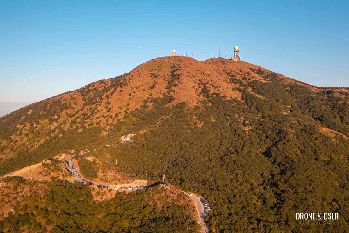
At 957 metres above sea level, Tai Mo Shan is Hong Kong’s tallest peak. Tai Mo Shan (大帽山, literally “Big Hat Mountain”) towers over the city and is visible from almost every part of Hong Kong, as long as it’s not covered in clouds.
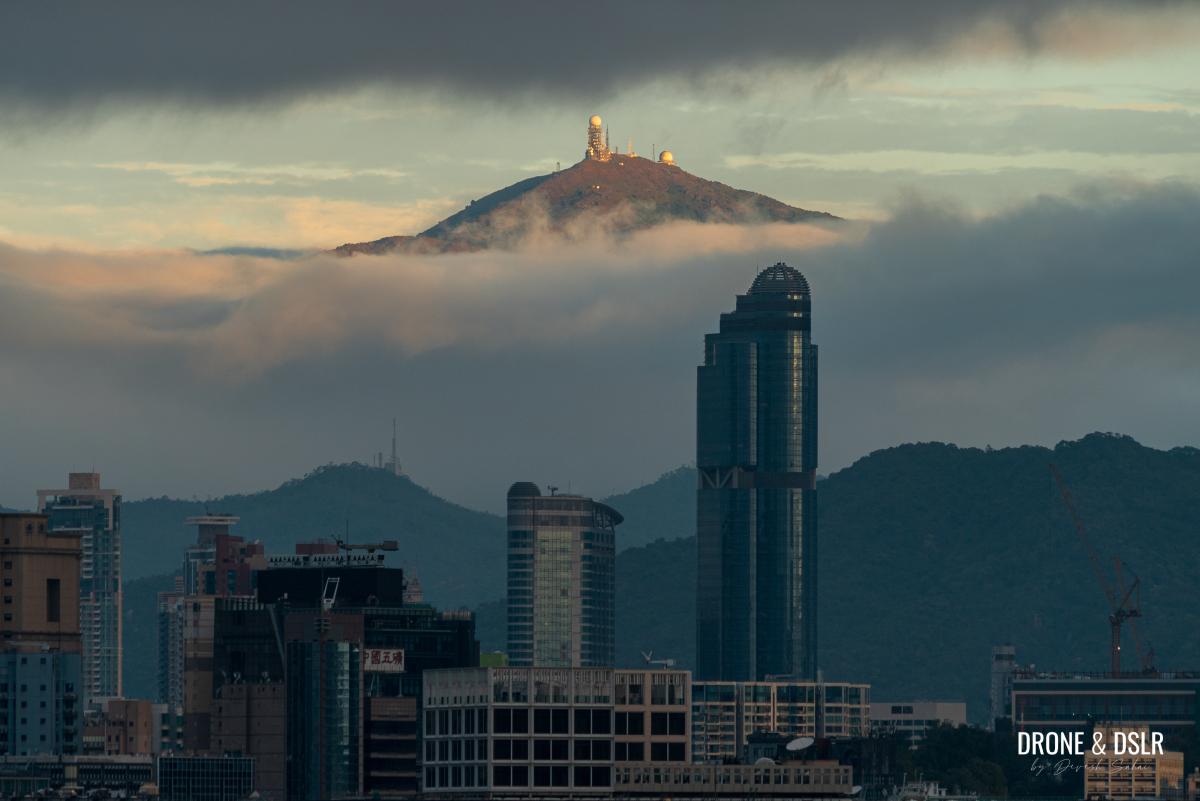
Tai Mo Shan taking a peek through the clouds
Situated in the centre of the New Territories and Tai Mo Shan Country Park, Tai Mo Shan forms part of the Guan Fu Mountain Range with numerous subpeaks surrounding its summit.
And similar to Tate’s Cairn or Mount Parker, Tai Mo Shan’s summit is also occupied by a Hong Kong Observatory weather radar station. This just means that there is a motorable road to its summit.

Tai Mo Shan, aka “Big Hat Mountain”
The access provided by the road makes Tai Mo Shan extremely popular with casual and serious hikers, cyclists, and just about anyone who wants to come here to enjoy the panoramic views of Hong Kong or swim in the clouds!
Tai Mo Shan Hike
Let me preface this section by stating there are numerous hiking trails to the top of Tai Mo Shan. One popular route is via Ng Tung Chai Waterfalls on the north side. If you plan to take this route, just be sure to budget plenty of time to enjoy the views from Tai Mo Shan as well as the four waterfalls along the way.
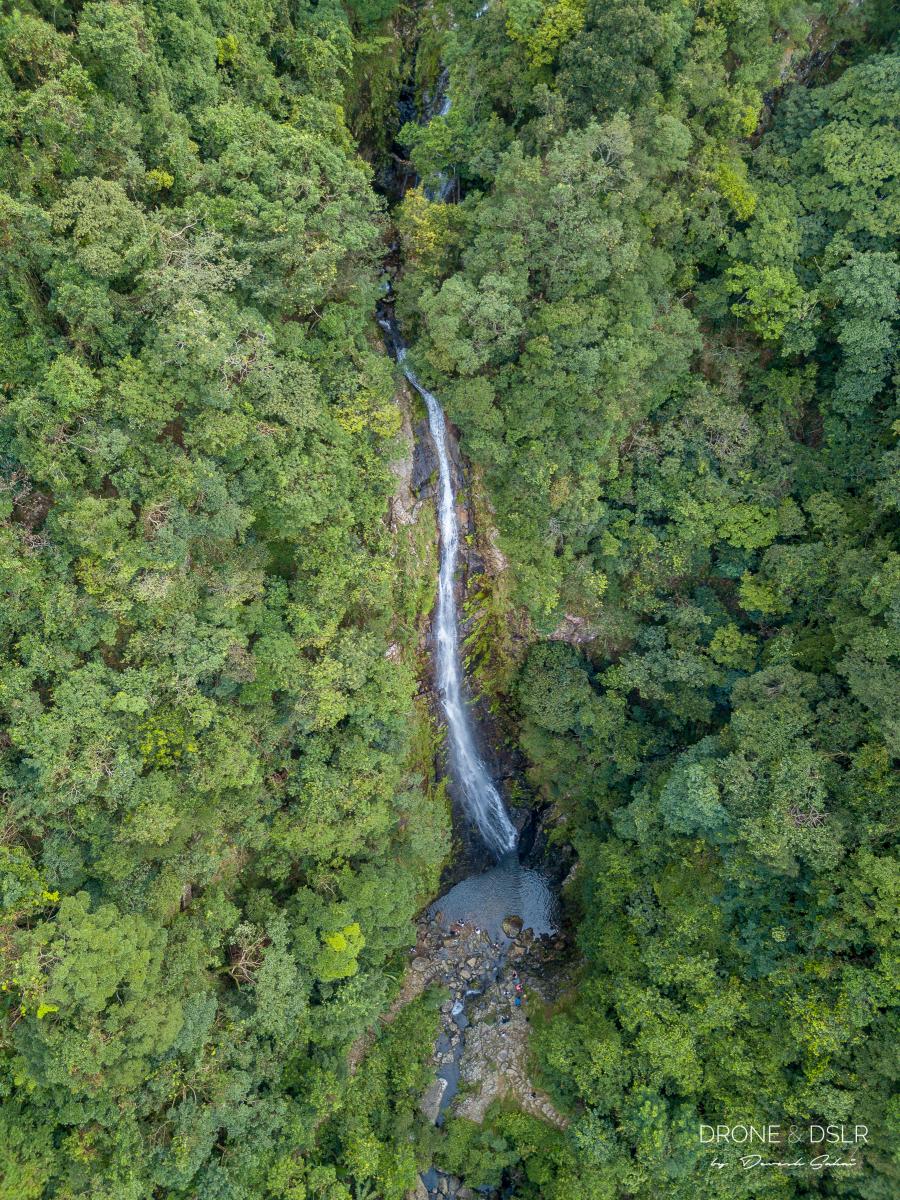
The magnificent Main Fall at Ng Tung Chai Waterfalls
This route is popularly referred to as the Tai Mo Shan Waterfall Hike.
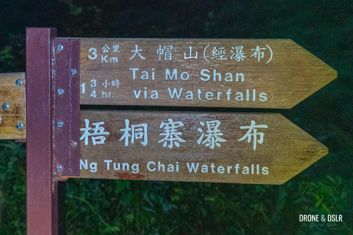
The Tai Mo Shan Hike via Ng Tung Chai Waterfalls
There is another popular route from Chuen Lung Village via the Heung Shek Path and Miu Ko Toi (a subpeak of Tai Mo Shan). There are a few smaller waterfalls on this route too. But the main attraction on this route is the local dumpling restaurants in Chuen Lung Village.
-

- Grab the famous dim sum lunch at Chuen Lung Village before hiking

-
- View of Tai Mo Shan from Chuen Lung Village
Many hikers choose to start or end their hike with some delicious dumplings!
You can also hike to Tai Mo Shan peak from Shing Mun Reservoir’s Pineapple Dam, from Tsuen Wan, or from Tai Po via Lead Mine Pass.
However, the most popular hiking route is from the Tai Mo Shan Visitor’s Centre, next to the Rotary Club Campsite on Route Twisk (Tsuen Kam Au).
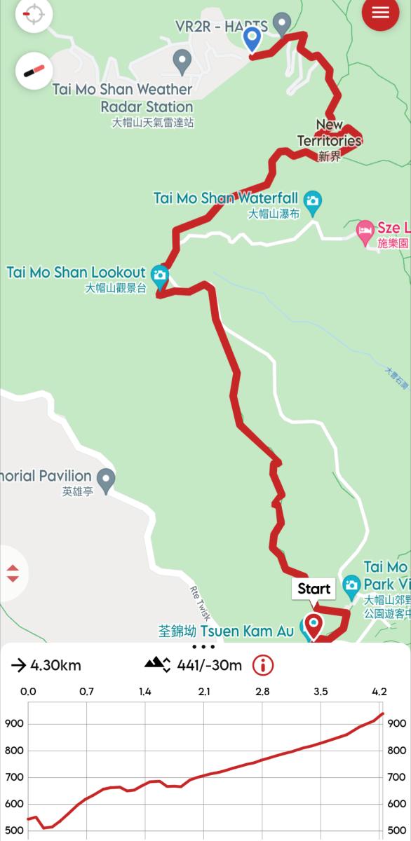
Tai Mo Shan hike and elevation profile
This short hiking route on Maclehose Trail Section 8 is relatively easy, making it a crowd favourite. And this is the route we will focus on in this post.
And here’s a quick highlight reel of the hike.
Subscribe to my YouTube channel
Tai Mo Shan Hike Difficulty
Other than the steps at the start, the hike to Tai Mo Shan from Route Twisk is relatively easy, making it a family-friendly hike. And that’s why it’s our recommended route for anyone who wants to hike to Hong Kong’s tallest peak.
-
- The hike to Tai Mo Shan is simple and short via the Maclehose Trail
-
- This hiking route is popular with everyone
However, there is a shortcut to the weather radar station from the north viewing point that can make this seemingly easy hike challenging! But of course, the shortcut is optional.
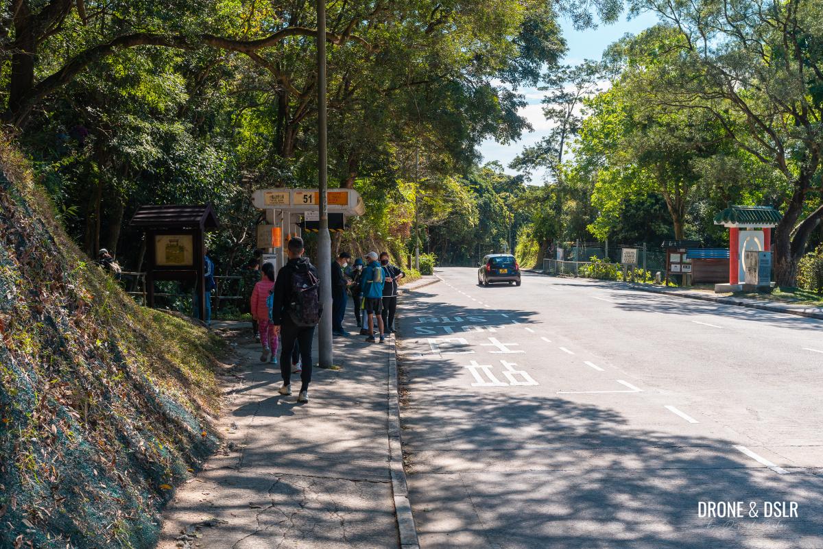
Starting point
The Tai Mo Shan Hike starts from the Tai Mo Shan Country Park bus stop on Route Twisk in Tsuen Kam Au. The starting point is already 470 metres above sea level.
There is only one bus that stops at this bus stop, and that is KMB bus number 51. This bus plies between Nina Tower (Tsuen Wan) and Sheung Tsuen.
It’s easiest to board the bus at the Nina Tower Bus Terminus opposite the Tsuen Wan West MTR Station (Tuen Ma Line) or on Tai Ho Road North outside the Tsuen Wan MTR Station (Tsuen Wan Line).
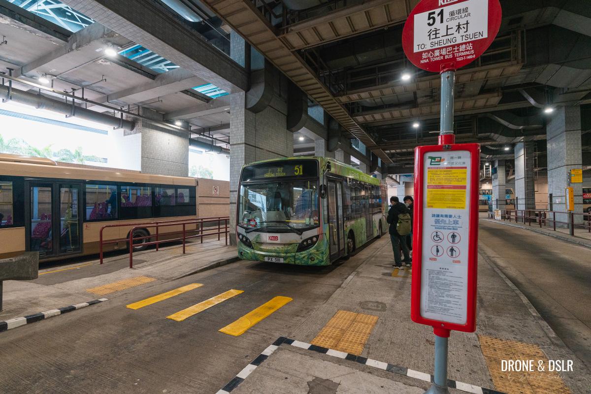
Bus number 51 at the Nina Tower Bus Terminus
Once at the Tai Mo Shan Country Park bus stop, cross the road and find the steps behind the bus stop on the opposite side.
-
- Cross the road to the other side
-
- Maclehose Trail Section 8 starts here

To the Visitor Centre
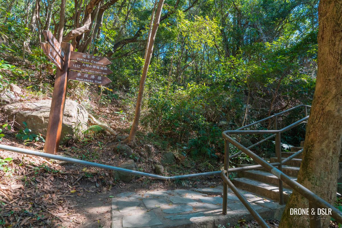
Once on the steps behind the bus stop, simply follow the signs to the “Visitor Centre”.
-
- Follow the signs to the Visitor Centre
-
- Keep following the signs to the Visitor Centre

The Tai Mo Shan Visitor’s Centre is a short 150-metre walk from the bus stop. At the end of the steps is the snacks store at the Visitor Centre.

The snacks store at the Tai Mo Shan Visitor Centre
You can also reach the Tai Mo Shan Visitor Centre by taxi. Technically, you could take a taxi to right below Tai Mo Shan, but then that’s hardly a hike.
If you want to buy some snacks, or drinks, or fill up your water bottle, do it at the snack store. Toilets are also located at the back.
But to continue hiking to Tai Mo Shan, walk through the corridor on the left (towards the toilets) and to the back of the snack store.

Locate the trail behind the snacks store
Locate the sign for the Tai Mo Shan Picnic Site and Maclehose Trail to continue the hike.
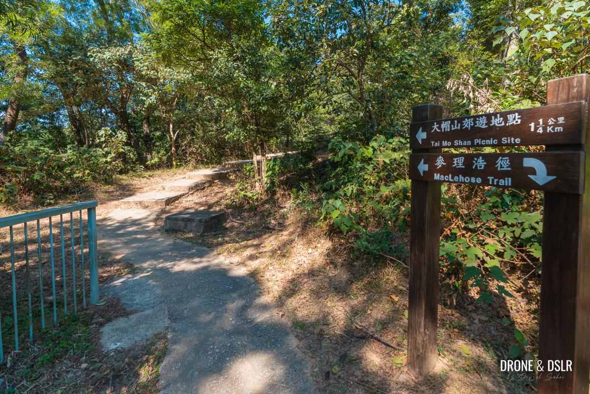
And now follow the trail to the Tai Mo Shan Picnic Site
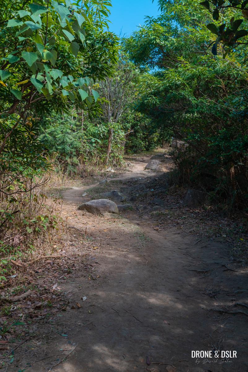
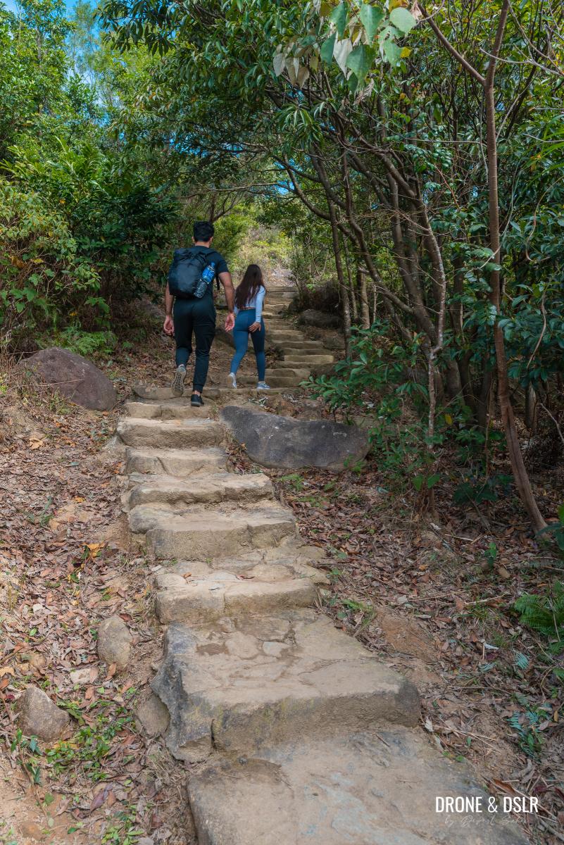
Although the Tai Mo Shan Hike is relatively easy, the section of the Maclehose Trail after the Visitor Centre is the only challenging part of the hike. And if I am being honest, it is the only part that feels like a hike.
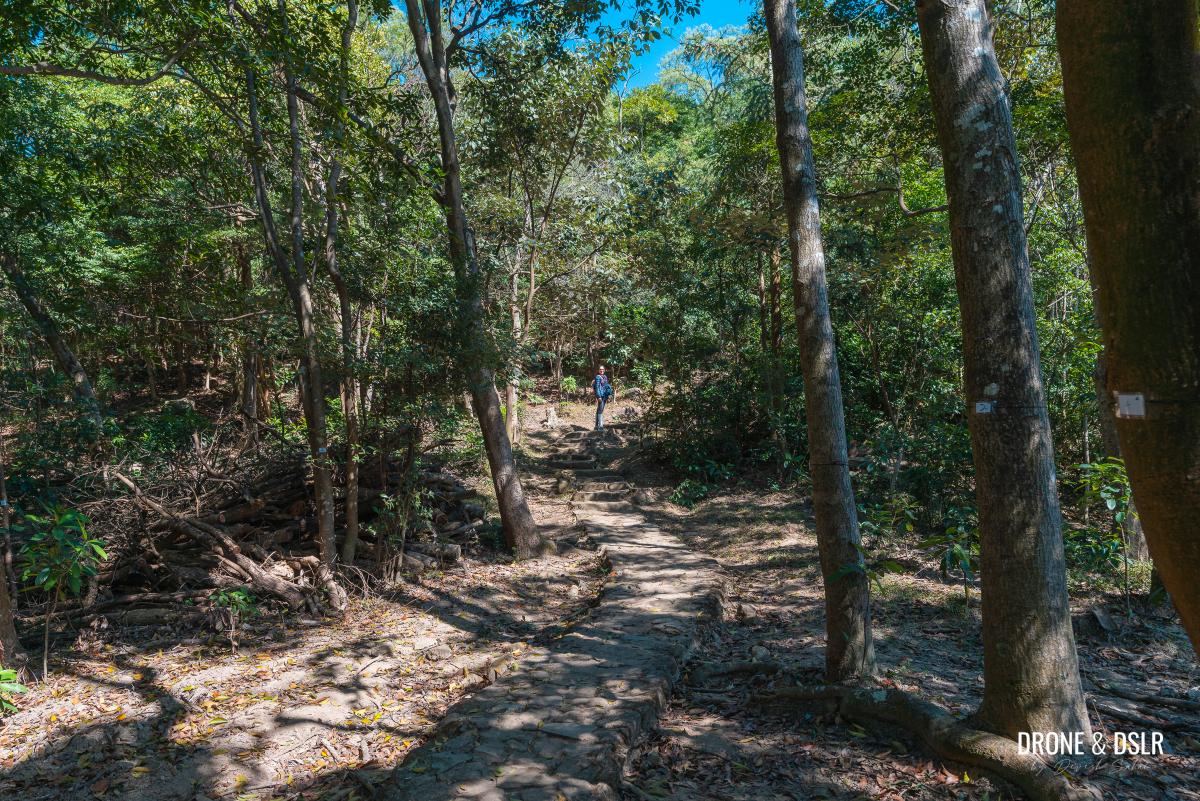
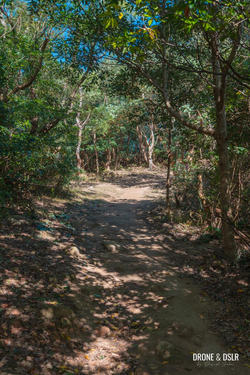
The short trail before the steps
However, if you prefer inclines to steps, you can always walk the Tai Mo Shan Road. Just keep in mind that the road is for vehicles.
The steps on Maclehose Trail
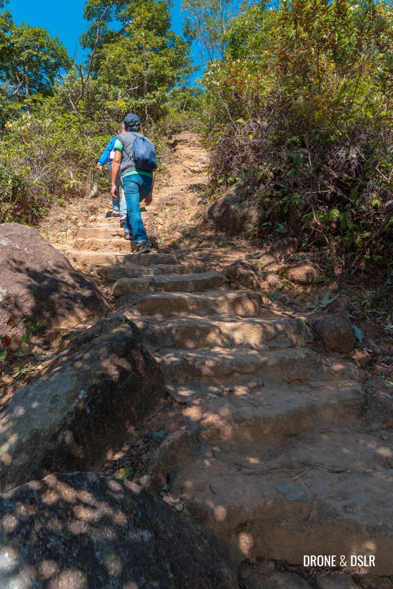
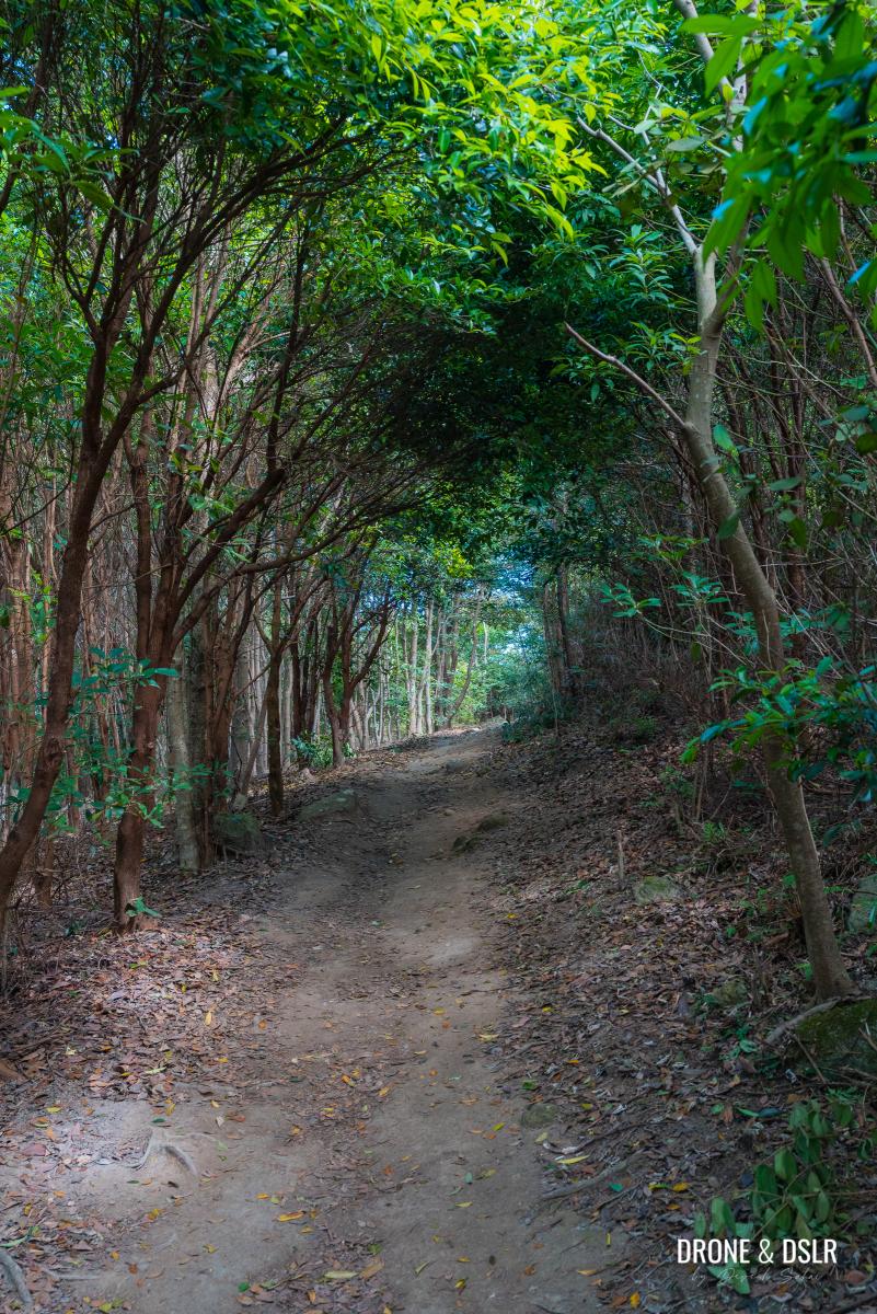
From behind the Tai Mo Shan Visitor Centre, the trail briefly meanders before starting its ascent on steps.

And the steps begin
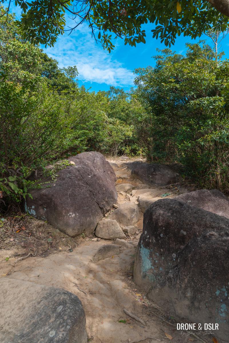
Although the steps are shaded, they can be challenging. The initial section of the steps is relatively steep, so it helps to go slow.

The initial section is relatively steep
The steps become the steepest next to a brief clearing from where you get the first views of Tsuen Wan and Tsing Yi.
-
- The unshaded section of the steps
-
- First views of Tsuen Wan below
Continue on the trail as it briefly flattens before approaching the next flight of steps.
-
- The steps get less intense
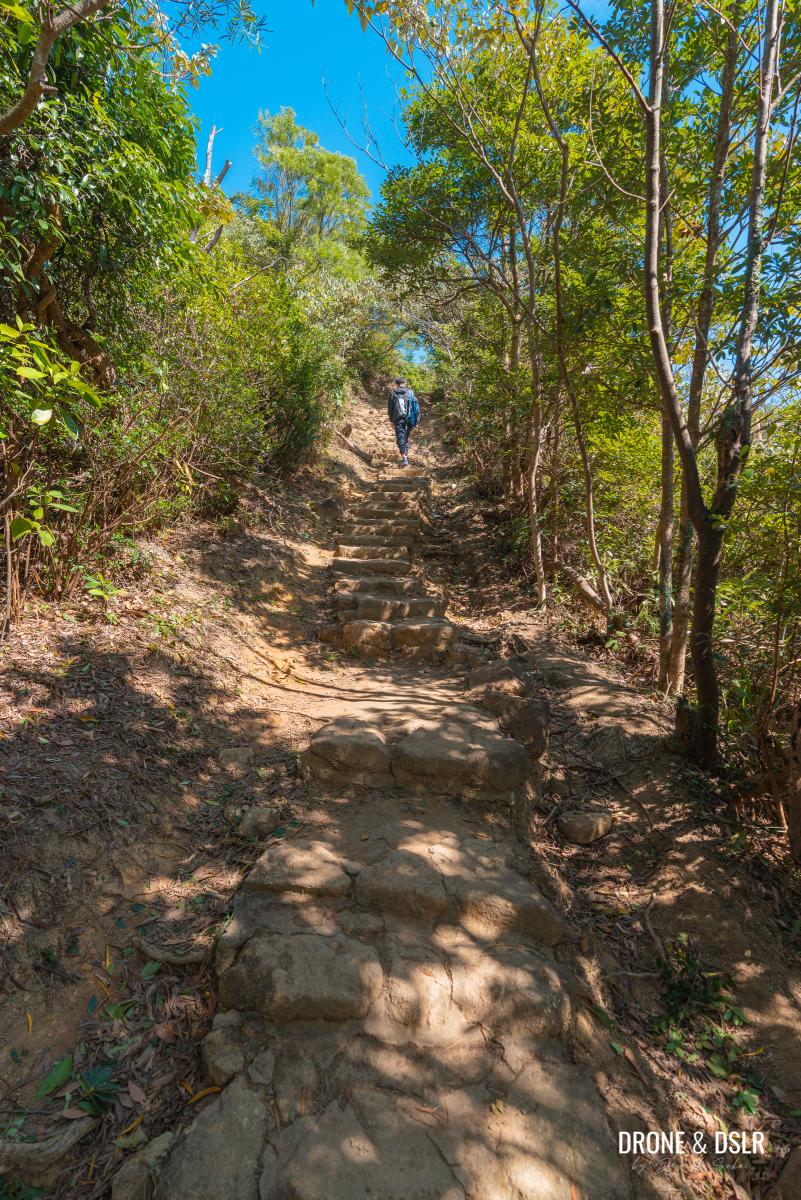
-
- A short break from the steps
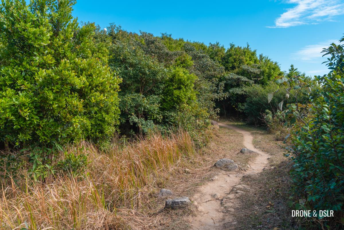
One thing to note on this section of the trail is several hidden clearings on the sides. If you spot one, feel free to check out the views. But remember, there are much better views ahead!
-
- And the steps start again

-
- Slowing approaching our first stop

At the end of the steps and the short incline that follows, there is a small clearing.
-
- And the steps thankfully end
-
- The trail flattens and clears up. Our first views of Tai Mo Shan
Step onto the small cluster of rocks on the left to get your views of Kai Kung Leng, Yuen Long, Shenzhen, and pretty much the entire northeastern New Territories of Hong Kong.
-
- Step onto the rocks on the left for a quick view
-
- First views of Kai Kung Leng, Yuen Long, and Shenzhen
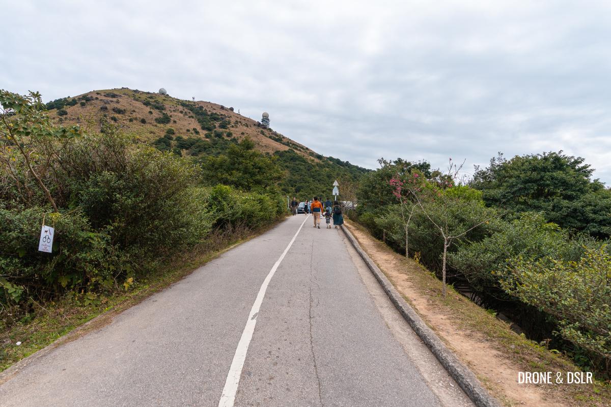
To Tai Mo Shan Picnic Site No. 3
From this clearing, the Tai Mo Shan Hike is nothing short of spectacular, especially on a clear day!
Continue on Maclehose Trail
To start with, the Maclehose Trail becomes more or less flat. And without a canopy of trees, the trail maintains views of Tai Mo Shan at all times.
-
- A scenic section of the trail
-
- Simple trail, lovely views
This section of the trail also has quite a few large rock formations and lookout points. Feel free to climb the rocks, explore the area and enjoy the views.
-
- Views of Tsing Yi and Tsuen Wan below

-
- A short flight of steps, nothing to worry about
-
- Walk between these rocks
-
- The hike gets prettier as it progresses
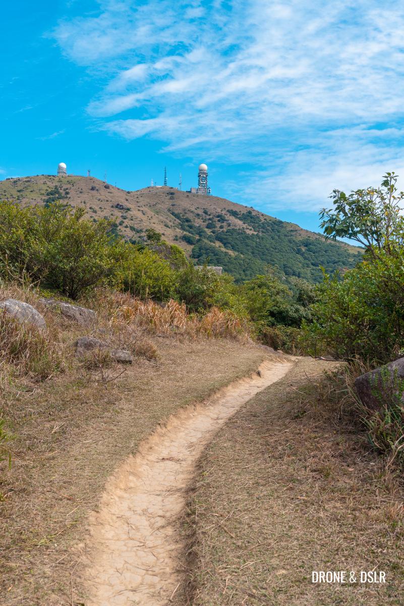
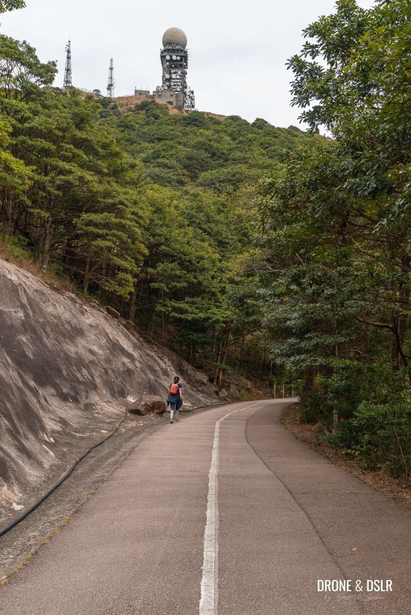
And before you know it, the flat trail ends next to steps going downhill. From these steps, it’s hard not to admire the size of Hong Kong’s tallest mountain right in front.
Taking a break to admire Tai Mo Shan
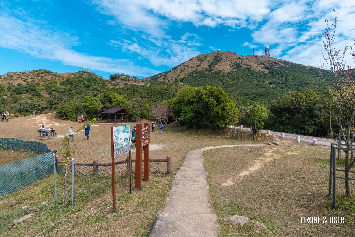
Walk down the steps to reach Tai Mo Shan Picnic Site No. 3. The Maclehose Trail continues through the picnic site. But we recommend continuing the next section of the hike on the Tai Mo Shan Road.
-
- Part of the picnic site
-
- Heading down to Tai Mo Shan Road

-
- Tai Mo Shan Picnic Site 3 and Tai Mo Shan Road
To Wo Tong Kong
As you shift from the trail to the road, watch out for vehicles approaching from both sides.
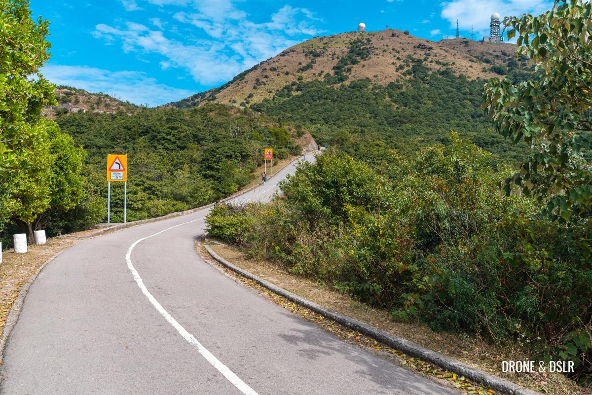
Move onto the Tai Mo Shan Road for some picturesque views
I think the photographer in me found this short stretch of road after the picnic site to be extremely photogenic.
The road that takes you up to Tai Mo Shan
The uphill road leading up to Tai Mo Shan felt like a perfectly framed picture.
The scenic Tai Mo Shan Road
At the end of the incline, Maclehose Trail continues through the trees on the right. However, instead of taking the trail, stay on the road.
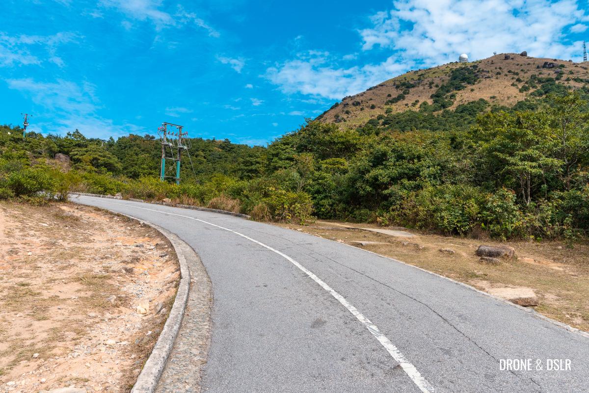
Maclehose Trail splits to the right, but remember to stay on the road
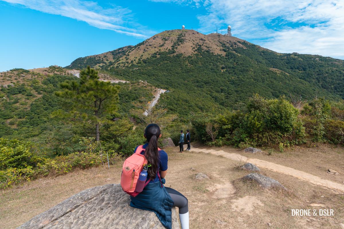
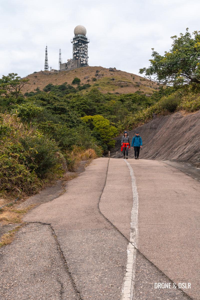
At the next bend is a small mound, which is the summit of Wo Tong Kong, one of the subpeaks of Tai Mo Shan. Climb the mound to reach Tai Mo Shan Country Park Viewing Point (North) and the Tai Mo Shan Picnic Site No. 4.
-
- At the next bend, climb onto that mound
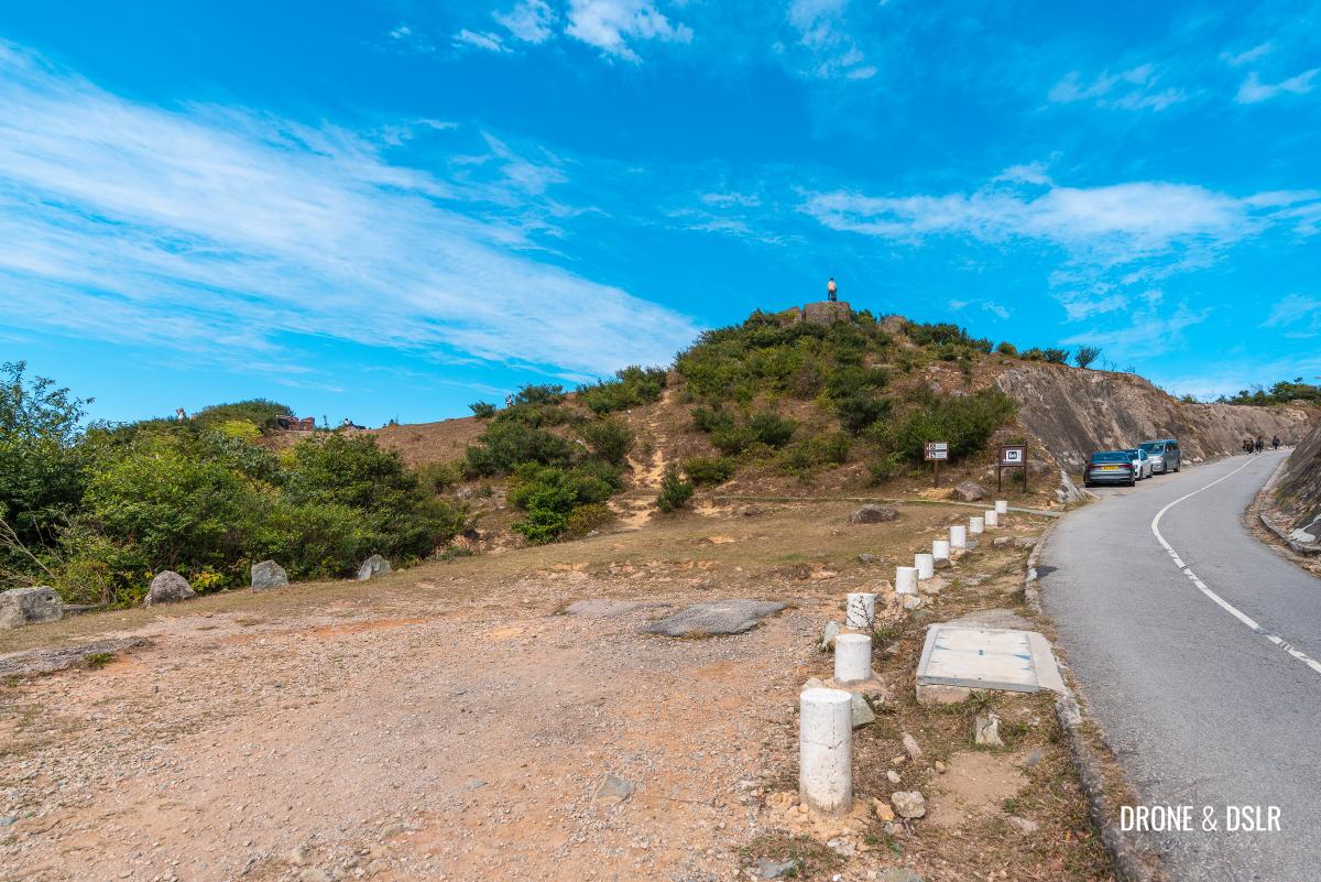
-
- The Tai Mo Shan Country Park Viewing Point

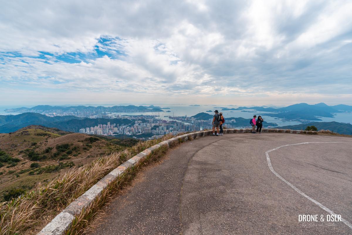
Tai Mo Shan Lookout
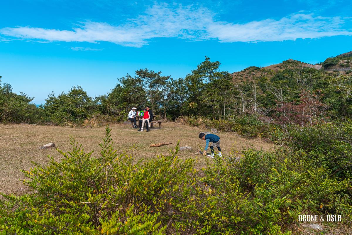
At 702 metres, Wo Tong Kong is the location for the Tai Mo Shan Country Park Viewing Point (North) and the Tai Mo Shan Picnic Site No. 4.

Wo Tong Kong, a subpeak of Tai Mo Shan that is better known as Tai Mo Shan Lookout
This location is also more simply referred to as the Tai Mo Shan Lookout.

The lookout and picnic site is popular for kite flying thanks to the wind
From here you can enjoy sweeping panoramic views from Yuen Long to Tai To Yan, with Shenzhen in the background.
There is another lookout point on the opposite side of the road with views to the west.

Enjoying the views as we sip our coffee
But for me, this lookout offers the most striking view of Kai Kung Leng (Rooster Ridge), the volcanic crest with a velvet texture. Don’t let the hill fool you but Kai Kung Leng Hike is surprisingly challenging!
-
- Beautiful panoramic views from the Tai Mo Shan Lookout

-
- Views of Kai Kung Leng from the Tai Mo Shan Lookout
-
- Views of Tai To Yan from the Tai Mo Shan Lookout
Take a break and enjoy the views from what I would imagine is Hong Kong’s highest and most scenic picnic spot!

A bird’s eye view of the Tai Mo Shan Lookout and the surrounding area
To the barrier gate
From the Tai Mo Shan Lookout return to the Tai Mo Shan Road and continue walking uphill. There’s an abandoned structure behind the lookout that you can peek into.
-
- A look inside the abandoned structure behind the Tai Mo Shan Lookout

-
- Continue on Tai Mo Shan Road
At the last car park, the road splits in two. The road on the right heads down to Sze Lok Yuen and the YHA Sze Lok Yuen Tai Mo Shan Youth Hostel.
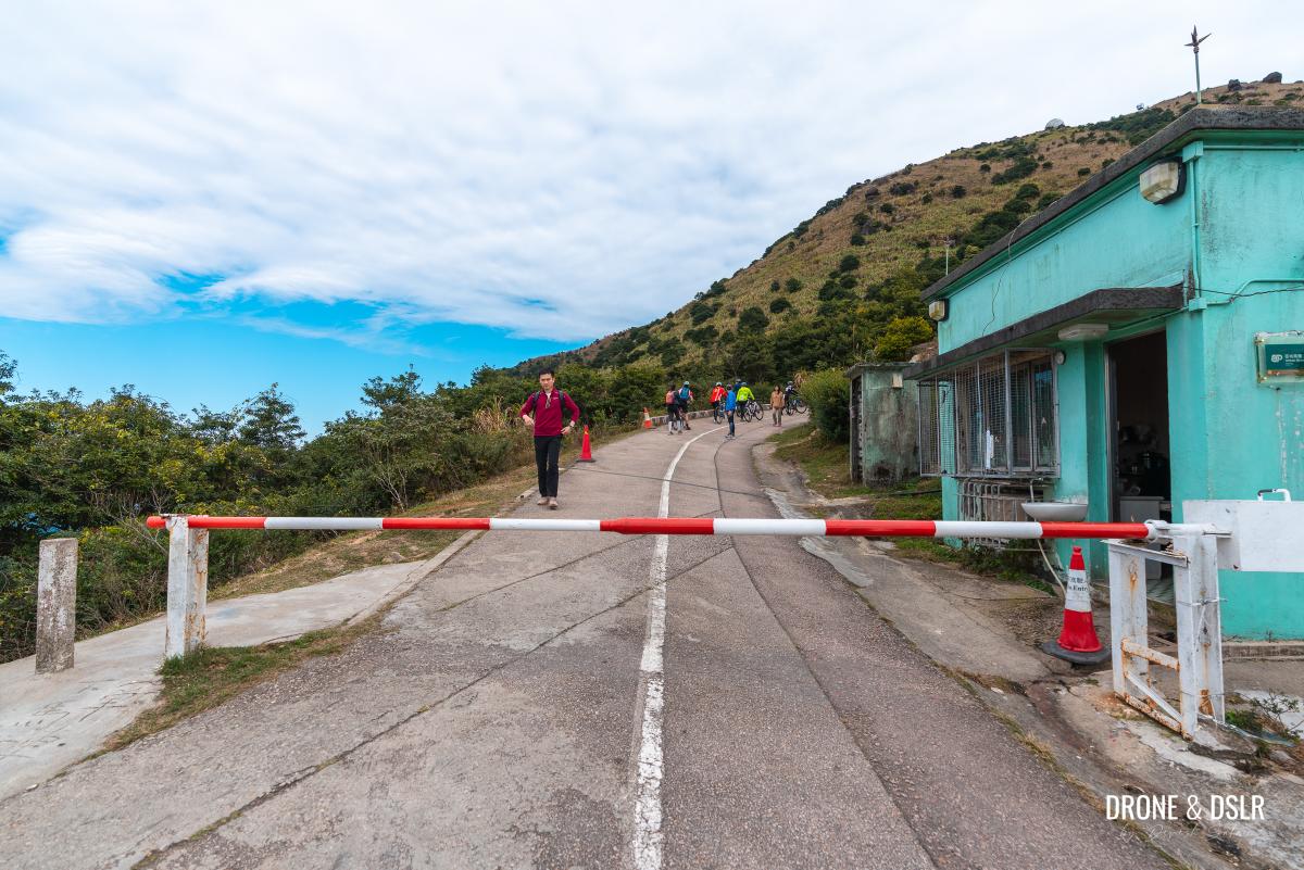
Cross the barrier gate
However, to continue to Tai Mo Shan, turn left and walk past the barrier gate. Only authorized vehicles are allowed beyond this point.
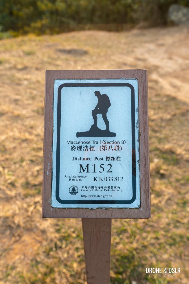
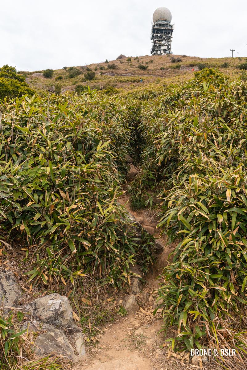
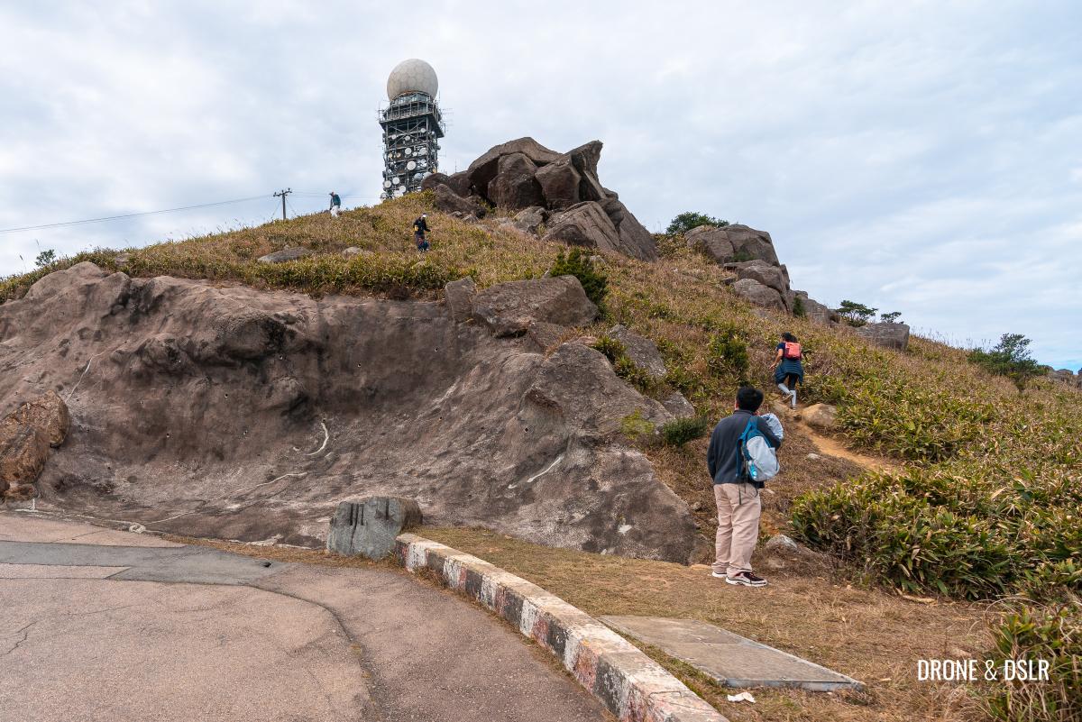
The steep shortcut to the summit (optional)
Just around the corner after the barrier gate, is an unmarked trail to the top of Tai Mo Shan. The easiest way to spot it is to look for the clearing directly opposite the M152 trail marker.
-
- The unmarked shortcut starts here
-
- If you want to take the shortcut, look for the clearing opposite the M152 distance post
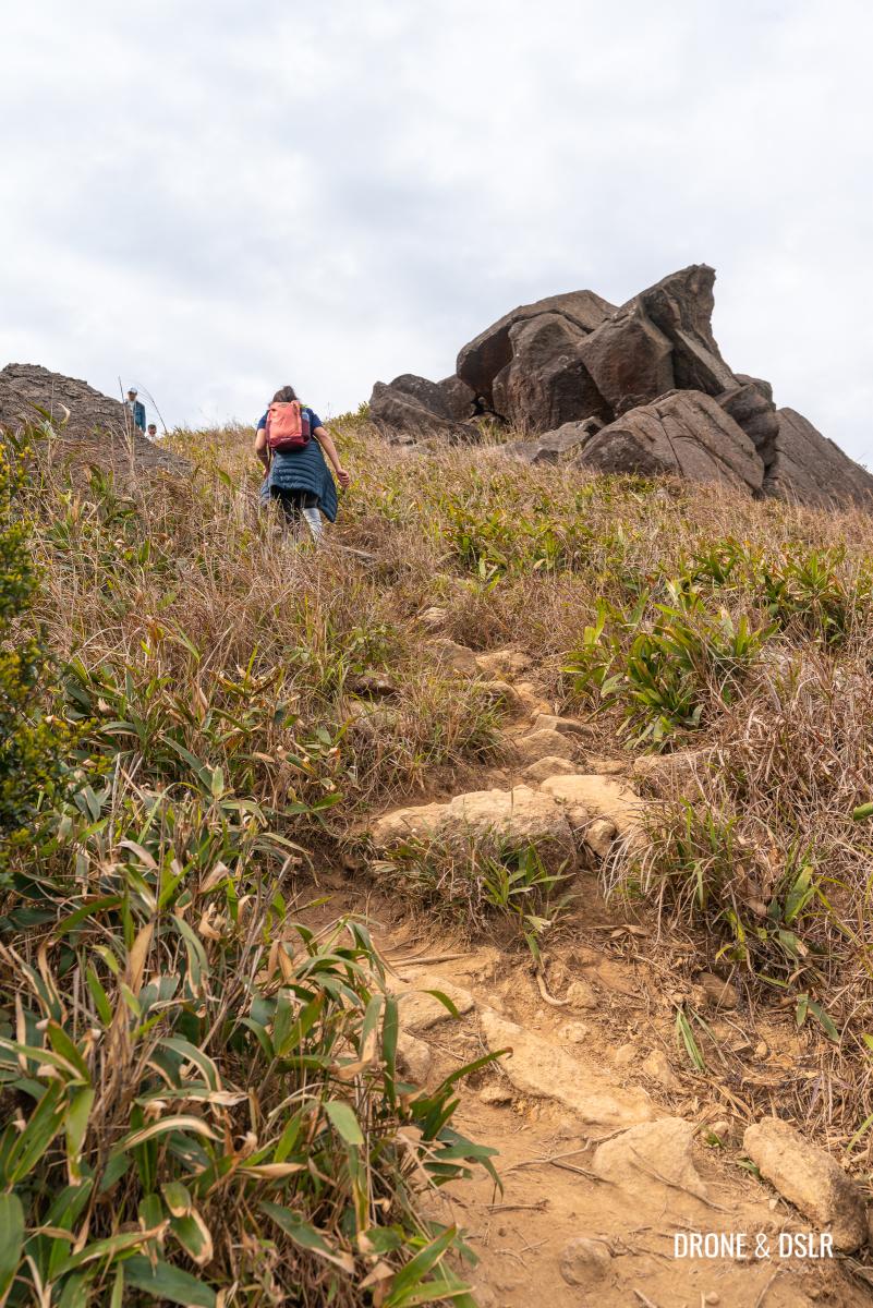
Although the shortcut is relatively easy to follow, it is very steep. It covers a distance of 530 metres as it ascends from 735 metres to 935 metres. And once on the top, it’s another 280 metres to reach the front of Tai Mo Shan.
-
- The shortcut is steep but cuts the distance by half

-
- The Tai Mo Shan Road takes you to the summit but there’s also a shortcut on this side of the hill
-
- This is where the shortcut ends on the summit

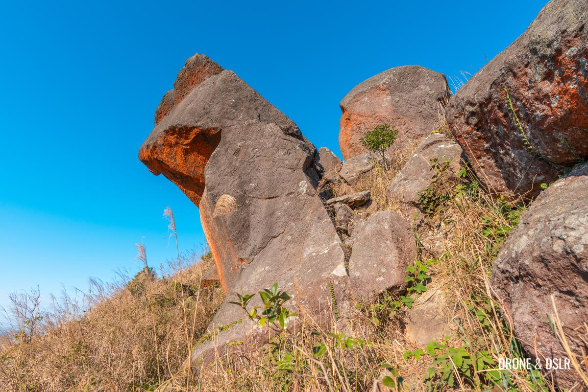
The shortcut is also quite scenic as it passes a few large and colourful rock formations and silver grass along the way.
-
- There are some interesting and colourful rocks on the shortcut
-
- The silver grass added to the beauty of the shortcut

However, if you were to continue walking on Tai Mo Shan Road to the summit, the distance is approximately 1.7 km vs. 820 metres via the shortcut to the same spot.
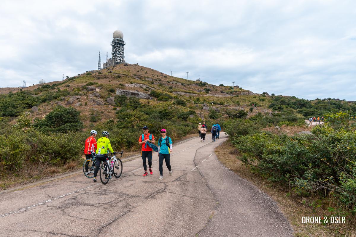
Tai Mo Shan Road
The easy but longer option is to stay on the road. The short but challenging option is to take the shortcut. Or you can mix and match – go up one way and come down the other.
We wouldn’t recommend what we did, which is to ascend via the Tai Mo Shan Road and descend via the shortcut. Because of its steep nature, it’s easier to climb up than to come down via the shortcut.
Tai Mo Shan Road to the summit
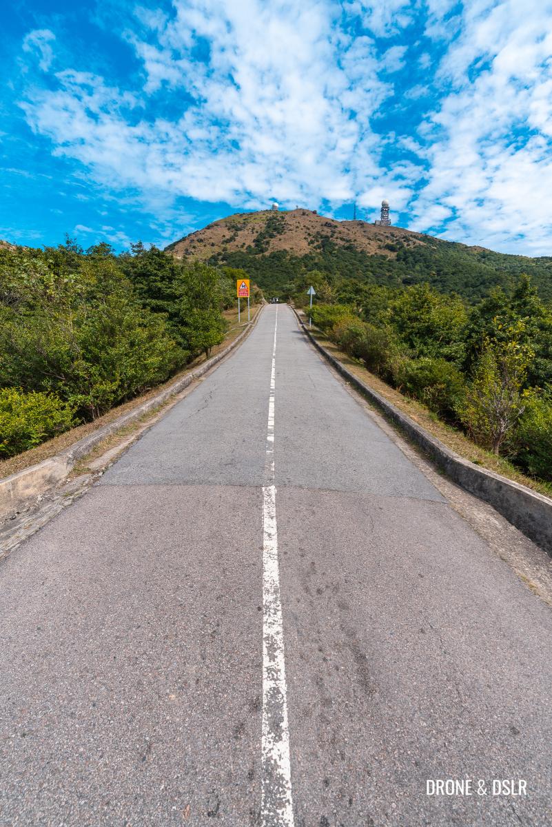
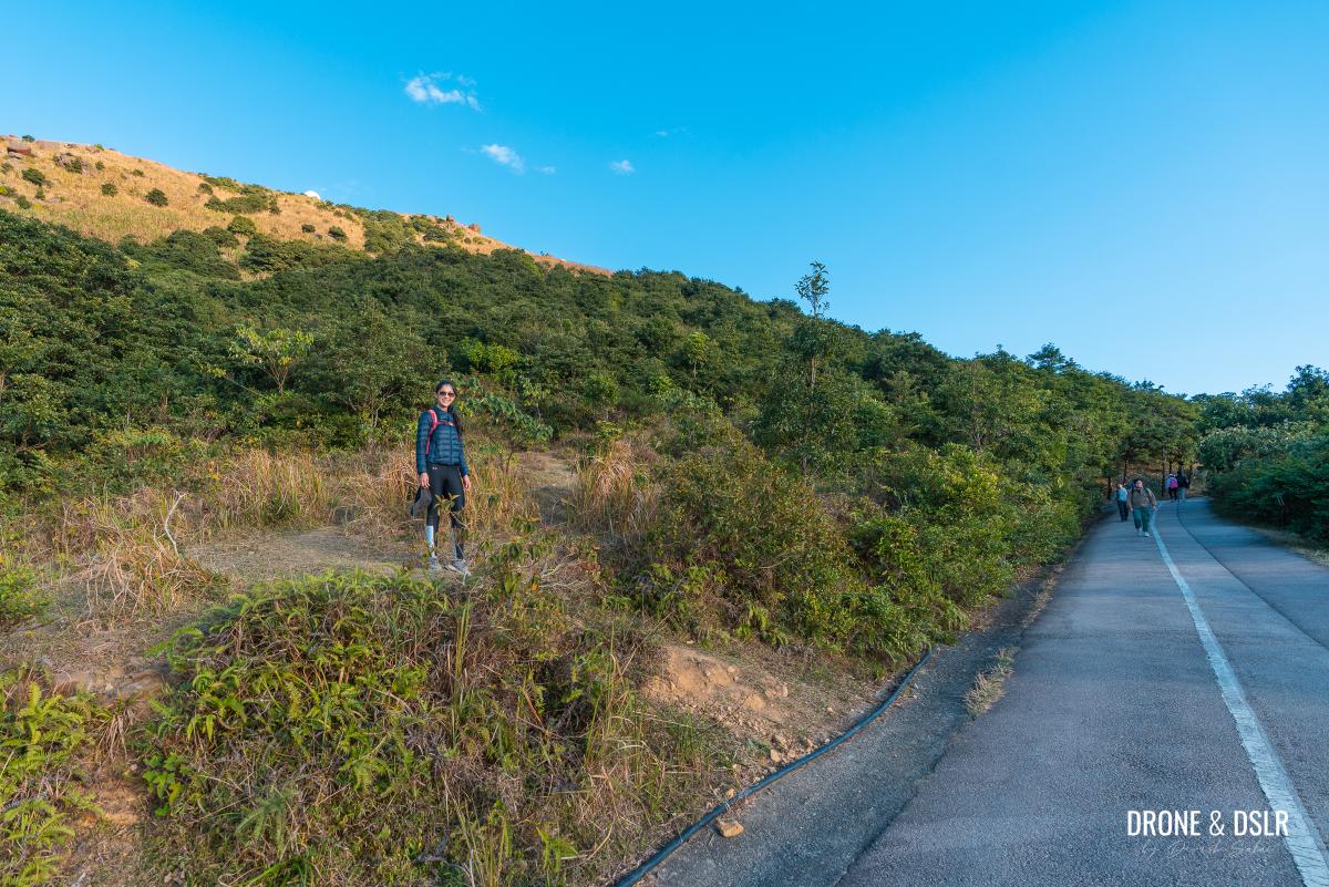
For now, we’ll stay on Tai Mo Shan Road and highlight some shortcuts from here to the summit. And if you prefer keeping this hike as simple as possible, stick to the road.
The gradual incline of the Tai Mo Shan Road
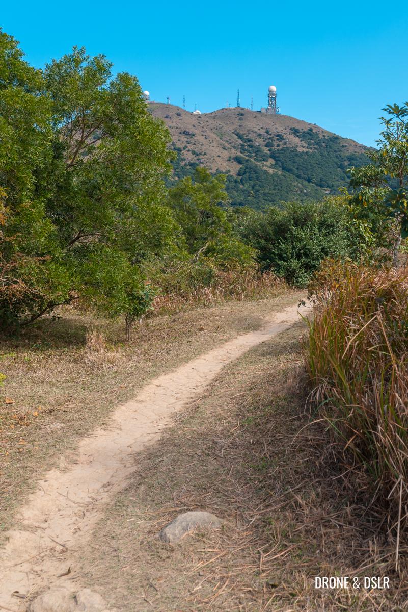
From the barrier gate, the Tai Mo Shan Road ascends at a gentle incline. The initial section has the hill on one side and trees on the other. So, it doesn’t offer much in terms of views.
No views other than the radar station at this point
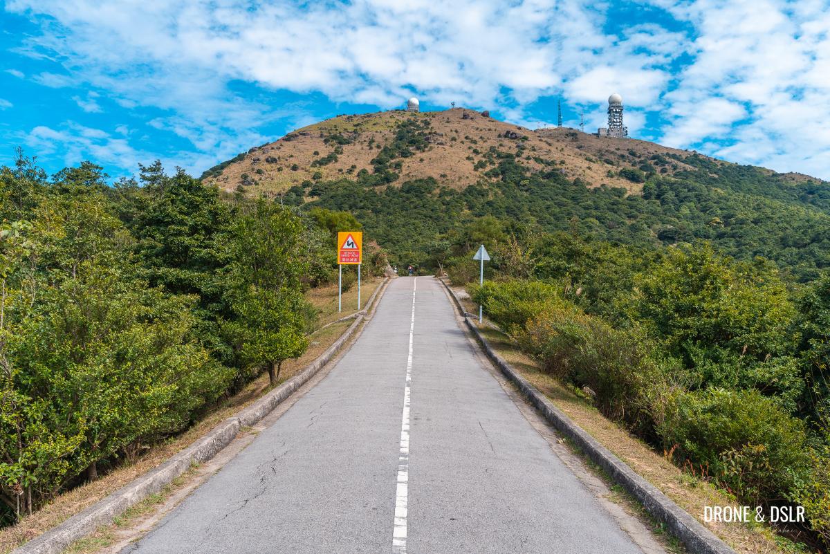
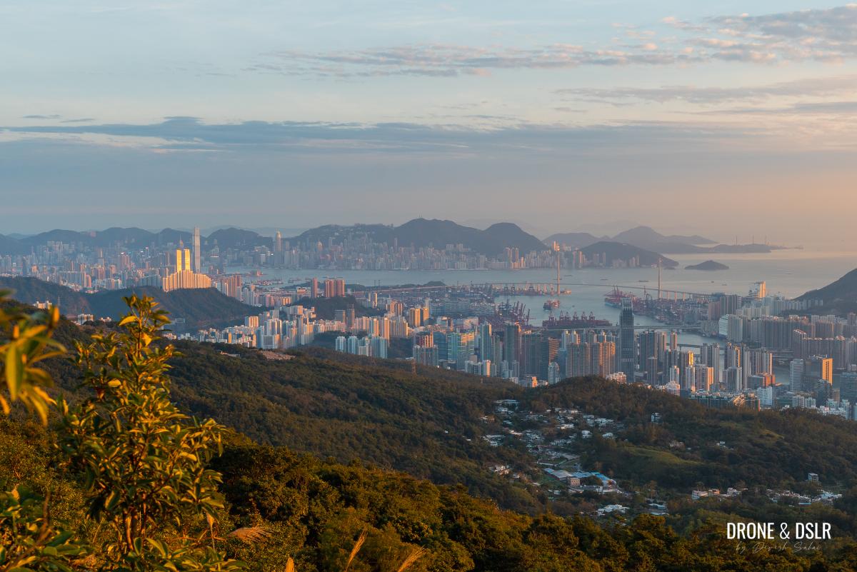
However, after roughly 800 metres into the walk, the views begin! Each bend on the road showcases a different side of Hong Kong.
-
- Coming to the first clearing on the road

-
- From Lantau to Shenzhen

-
- That sharp peak in the distance is Castle Peak
Take your time and appreciate the views as you slowly make your way to the summit.

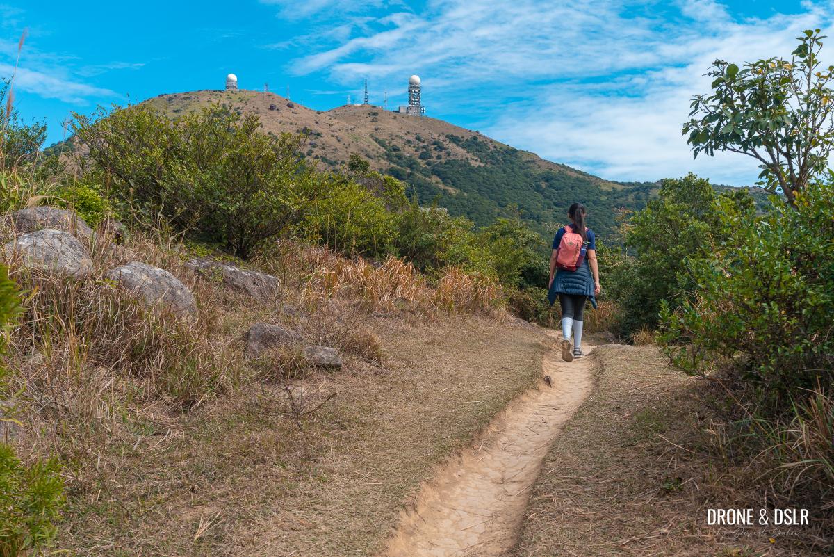
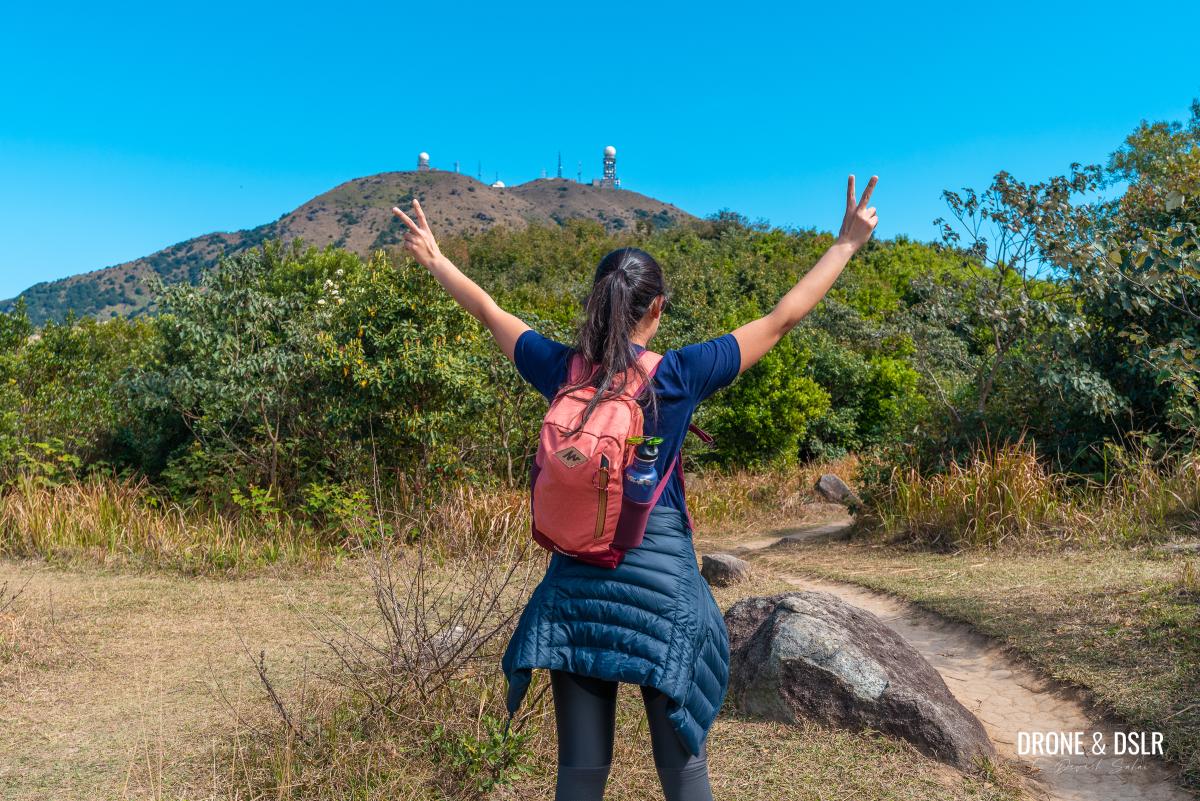
Miu Ko Toi, one of the subpeaks of Tai Mo Shan
Shortcuts on Tai Mo Shan Road
After about 1.4 km of walking on Tai Mo Shan Road, there are a couple of shortcuts that will save you plenty of walking.
-
- Getting close to that summit
-
- First clear views of Hong Kong Island from the hike

The first shortcut I recommend is when the road is directly below the weather radar. There’s a visible clearing through the bushes to the road above.
-
- Spot this shortcut through the bushes below the summit
-
- Climb through the bushes to the road above

-
- We’re pretty high up now
When you reach the road above, look for the rock formation at the next bend. Take the shortcut from next to the rocks to the road above.
-
- At the next bend, take the shortcut on the right, below the rocks
-
- Cut through to the road above
-
- Within touching distance now
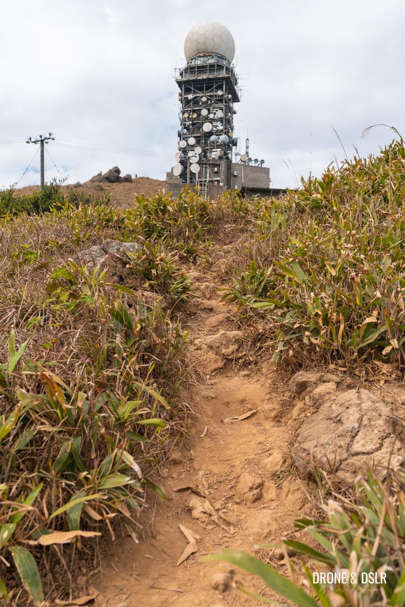
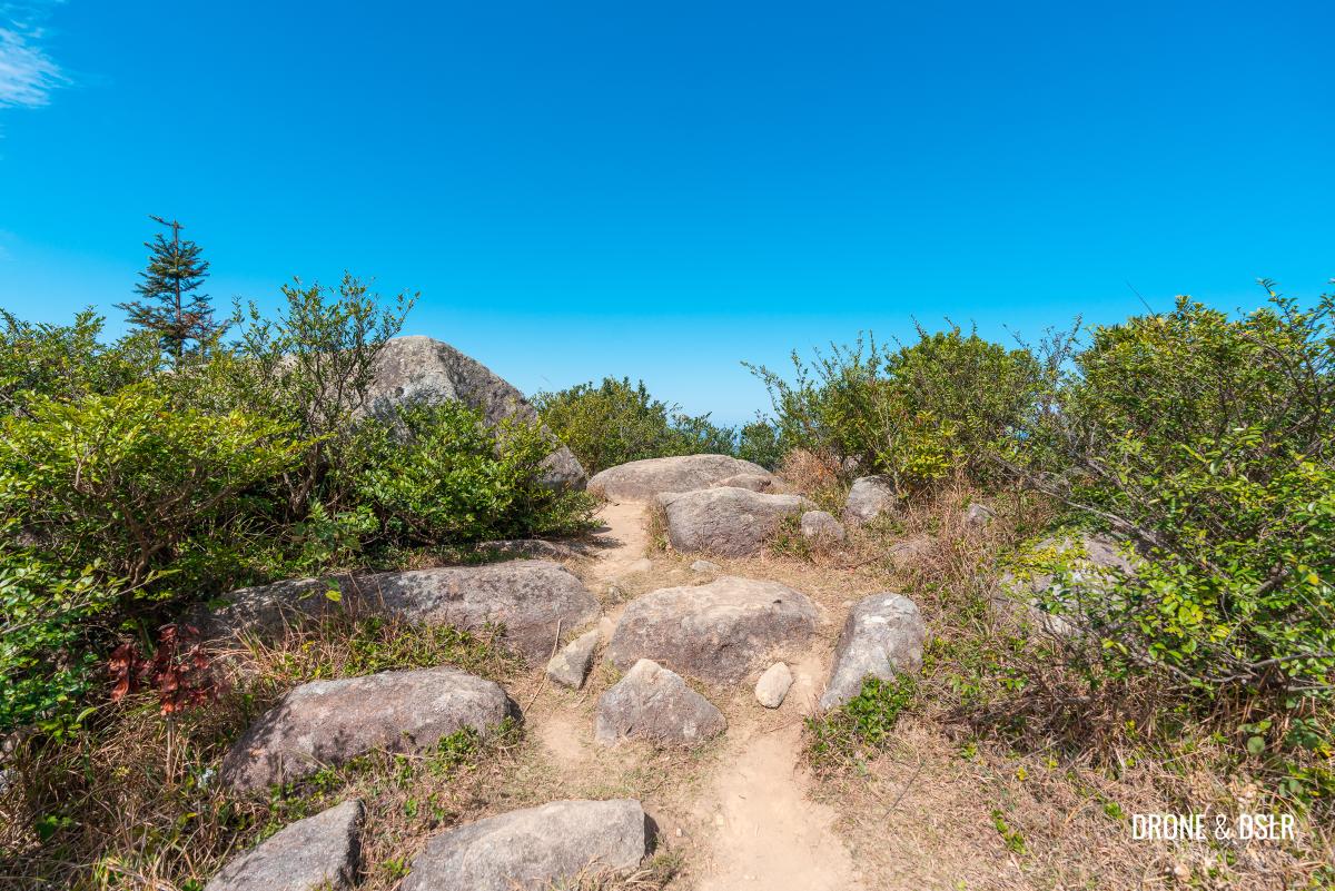
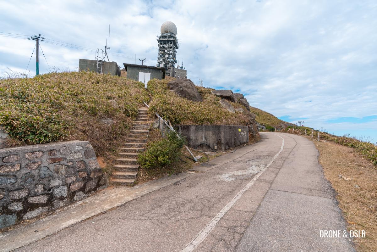
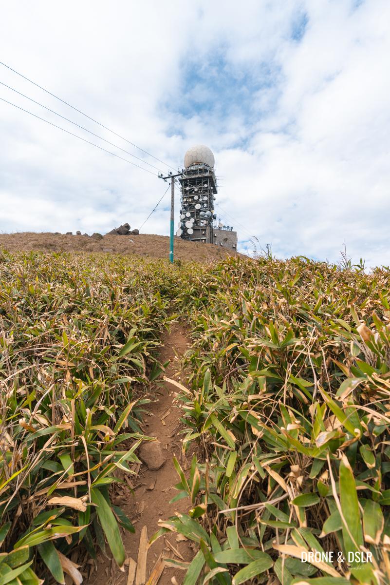
And finally, when there is no more road between you and the peak of Tai Mo Shan, there is a short trail that runs between the two small structures.
Take this trail to the top of Tai Mo Shan!
-
- Take the steps between and then the path between the two structures
-
- The final stretch to Tai Mo Shan’s summit
-
- And we’ve arrived on top of Tai Mo Shan
The importance of good weather at Tai Mo Shan
Due to its height, Tai Mo Shan is Hong Kong’s most misty area and is often covered in clouds. The temperature is also usually lower than that in most parts of the city.

The rocks just below the summit. Check out the views!
Now some may prefer to hike among the clouds, but we waited patiently for a clear day. And I must be honest, it was completely worth it for the views.

The views of Hong Kong before the clouds cleared
Another point to keep in mind is that the weather on the summit can change very quickly. When we hiked up, it was cloudy and cold. And when the sun came out, it became pleasant. But every time the cold wind blew, we froze.

Tai Mo Shan on a clear winter day
And yes, it is normal for temperatures to drop below freezing point at Tai Mo Shan during the winter.
The Tai Mo Shan weather radar station is visible from most parts of the city
A tip from us – if you’re planning to hike to Tai Mo Shan and the weather changes not to your liking, we recommend pivoting to the Kap Lung Ancient Trail and Forest Trail Hike. It shares the same starting point as Tai Mo Shan and doesn’t need good weather to be enjoyed.
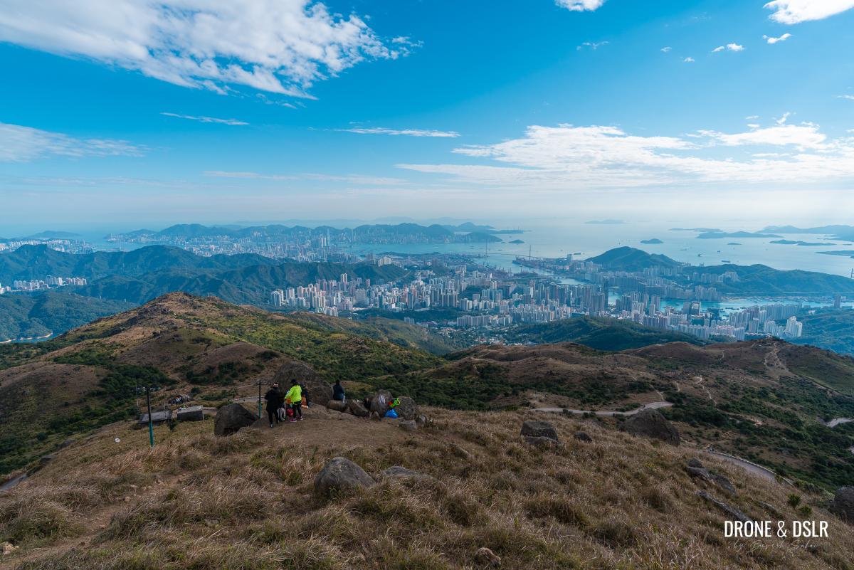
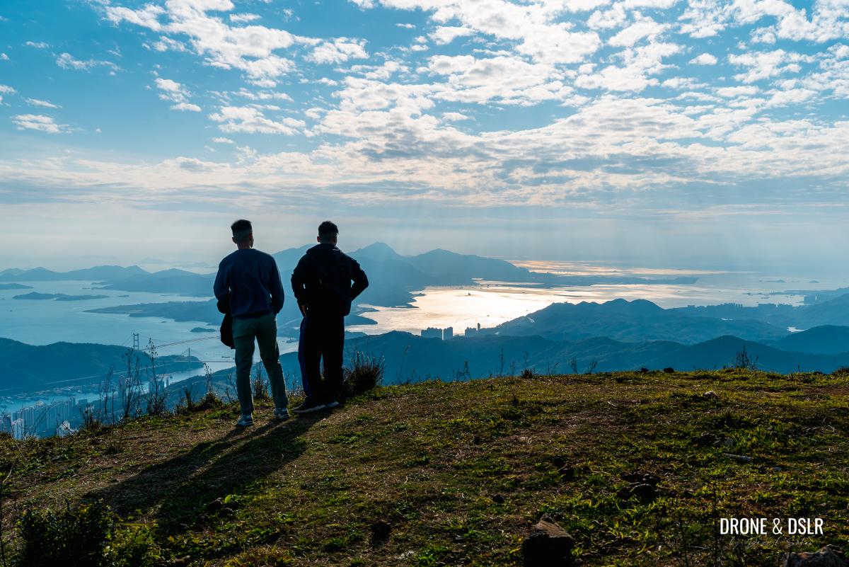
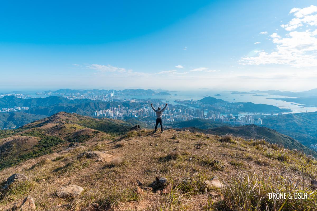
The views from Tai Mo Shan
The joy of Tai Mo Shan isn’t the hike but rather the experience from on top of Hong Kong’s tallest mountain!
The grassy summit with plenty of rocks to sit on to enjoy the views
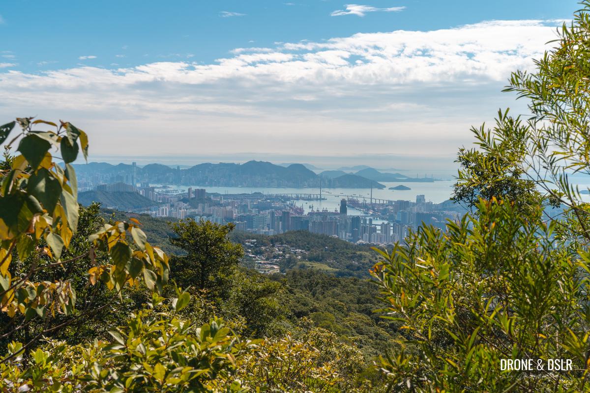
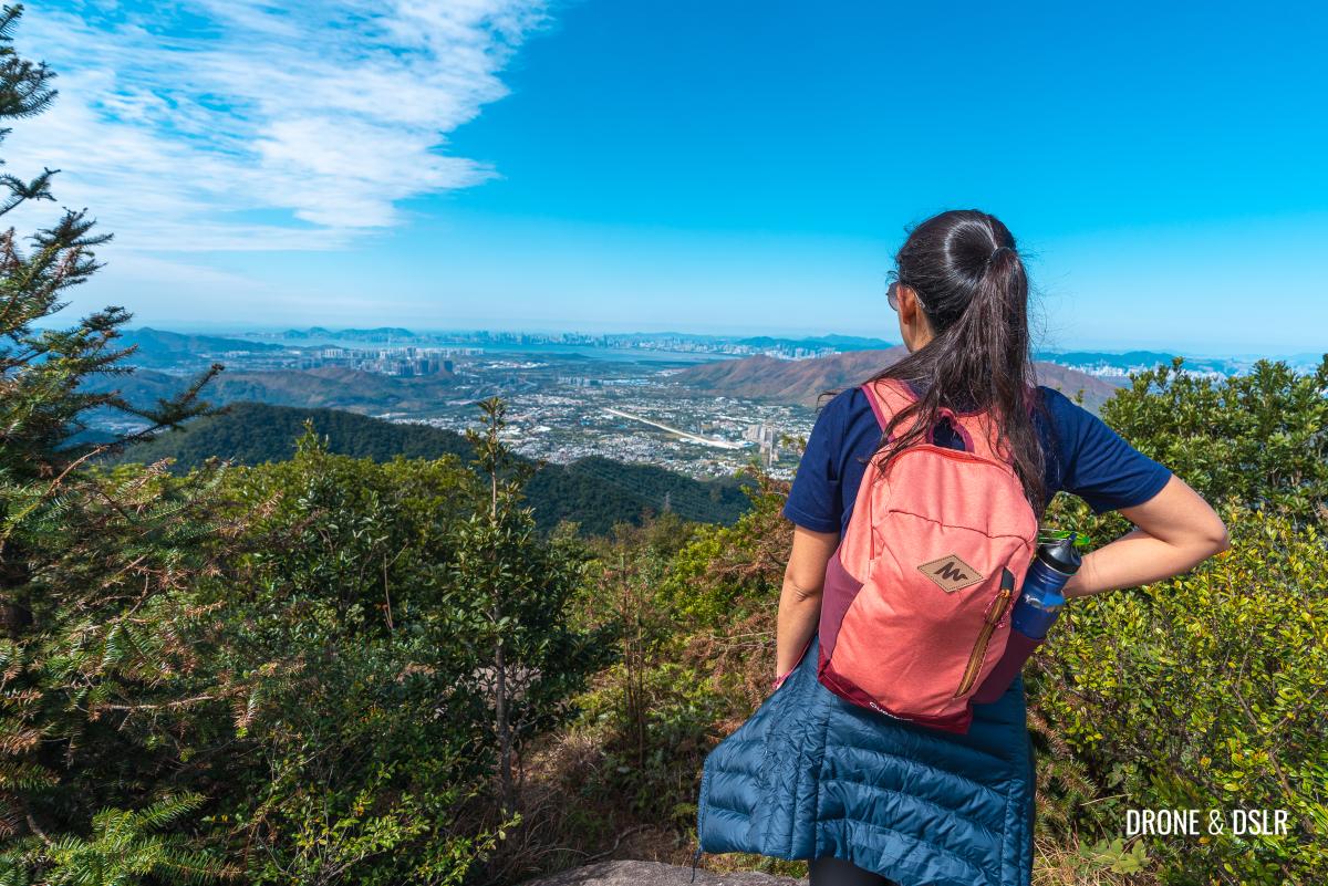
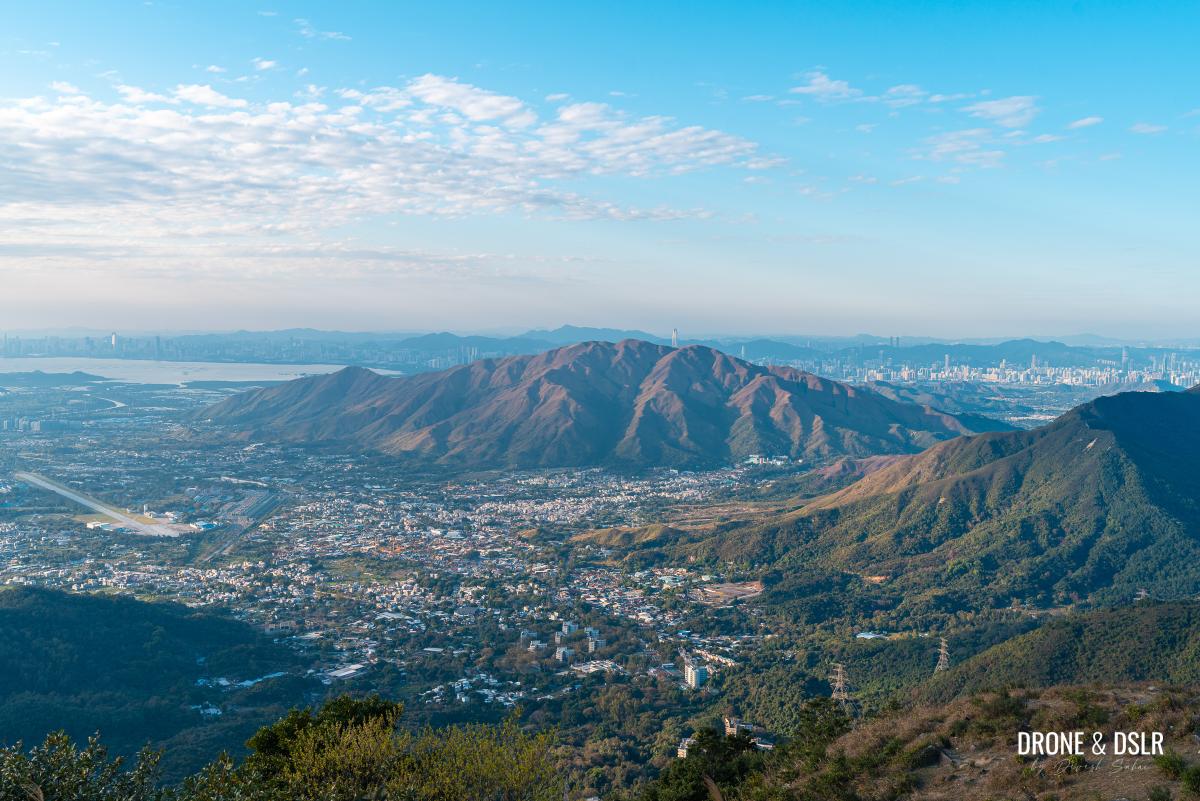
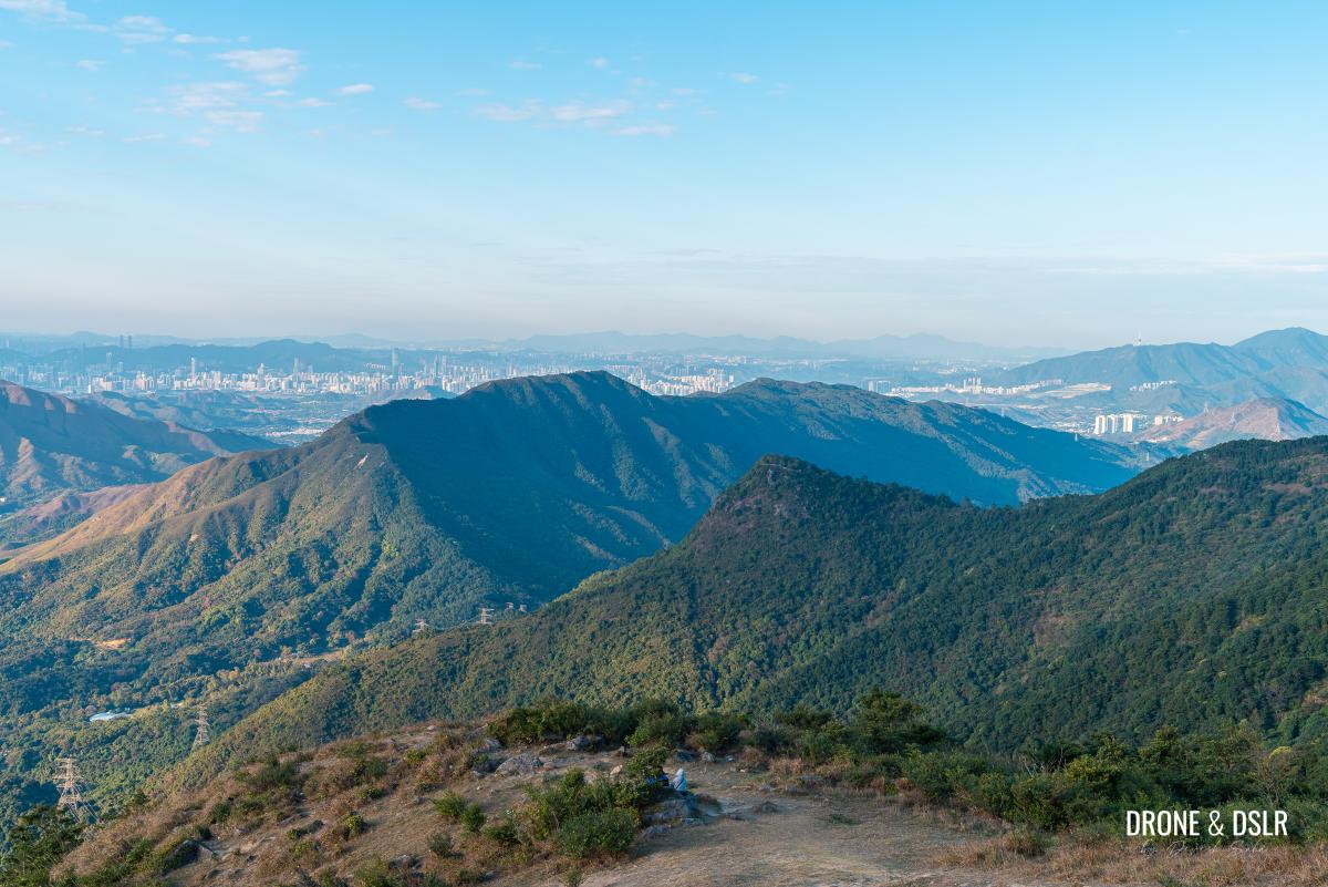
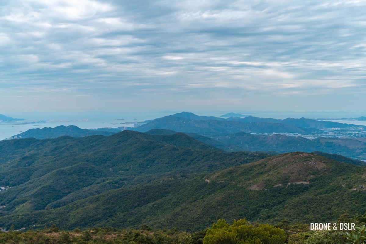
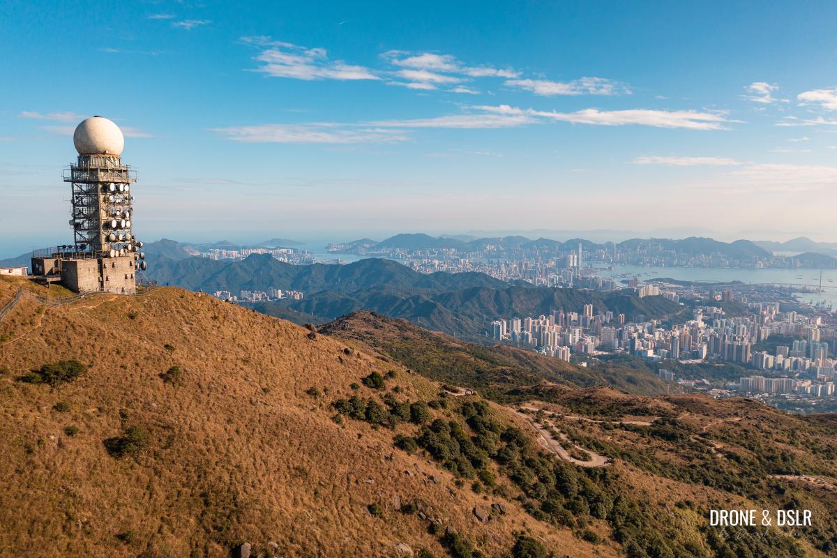
Our patience paid off when we hiked on a cold and clear winter’s day. Because from the top of Tai Mo Shan, we could see every inch of Hong Kong!
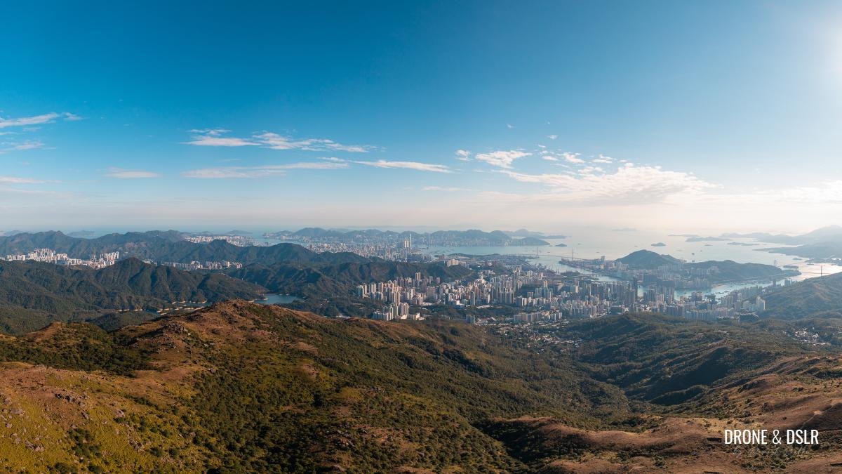
The panoramic views of Hong Kong from Tai Mo Shan
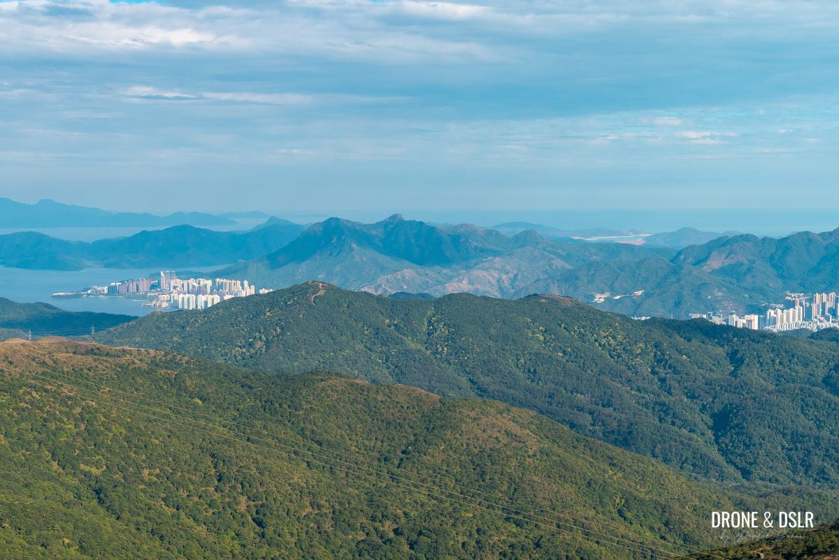
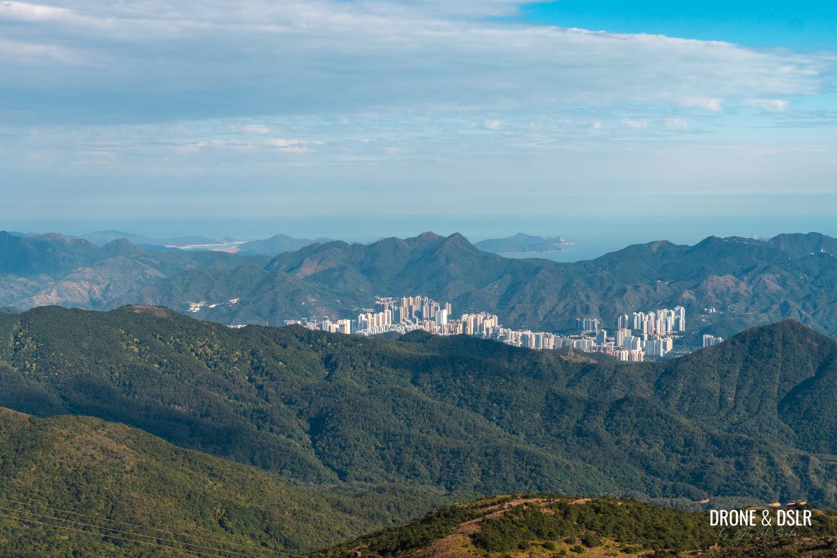
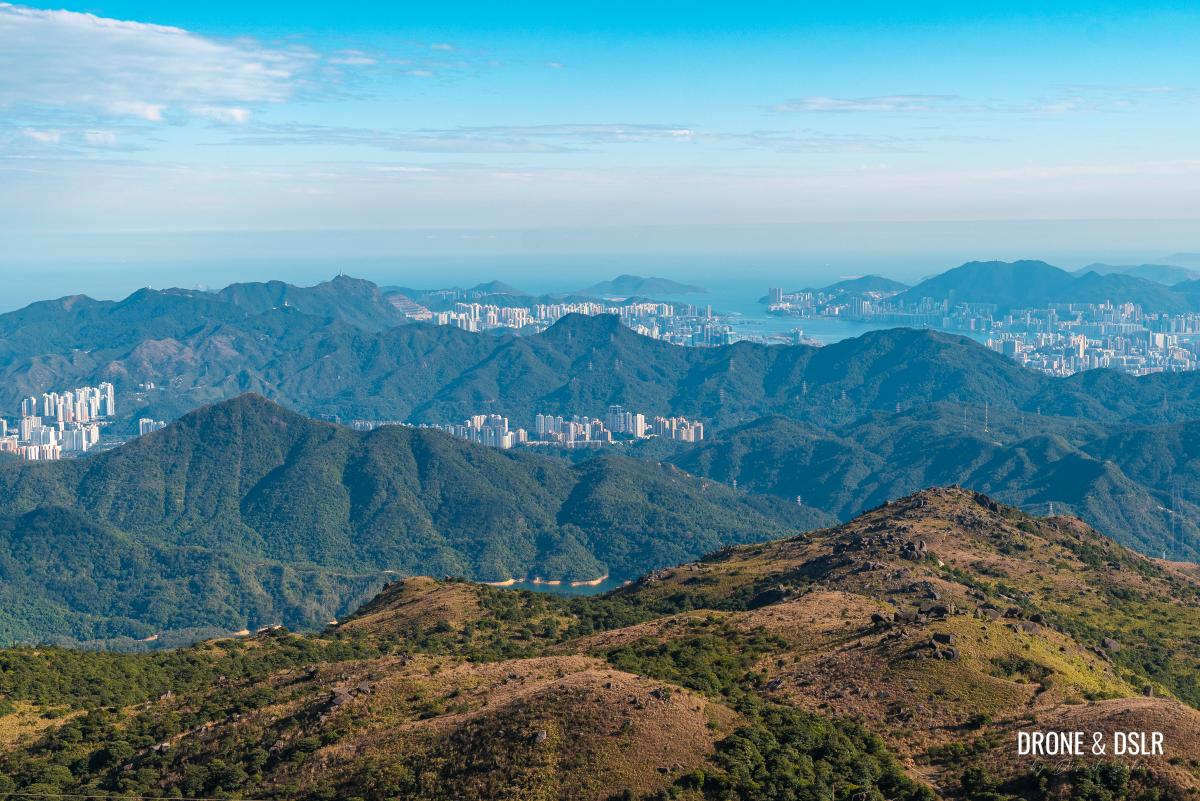
In the east are Grassy Hill, Tai Po, Plover Cove Reservoir, Ma On Shan and Pyramid Hill, and even High Island Reservoir!
-
- Grassy Hill, Tai Mei Tuk, and Plover Cove Reservoir

-
- Ma On Shan, Pyramid Hill, and High Island Reservoir
Slightly below that lies Buffalo Hill, Shatin, Needle Hill, Shing Mun Reservoir, Lion Rock, Kowloon Peak, Tate’s Cairn, and the entire Kam Shan Country Park. We could see as far as Tung Lung Chau!
-
- Shatin and Buffalo Hill
-
- Shing Mun Reservoir, Needle Hill, Lion Rock, Kowloon Peak, and Tung Lung Chau!
Further south we could see the entirety of Hong Kong Island! And behind it, Lamma Island.
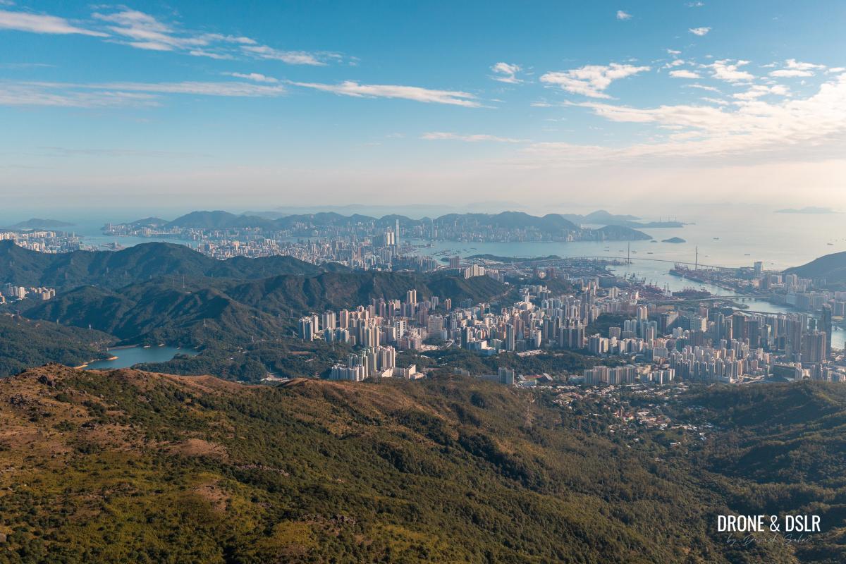
Look how small Hong Kong Island is
Right below Tai Mo Shan are Tsuen Wan and Kwai Chung, and the island of Tsing Yi.

Looking down at Tsuen Wan and Tsing Yi from the summit
Slightly west of that is Lantau Island with Lantau Peak and Sunset Peak, the second and third-highest peaks respectively in Hong Kong.
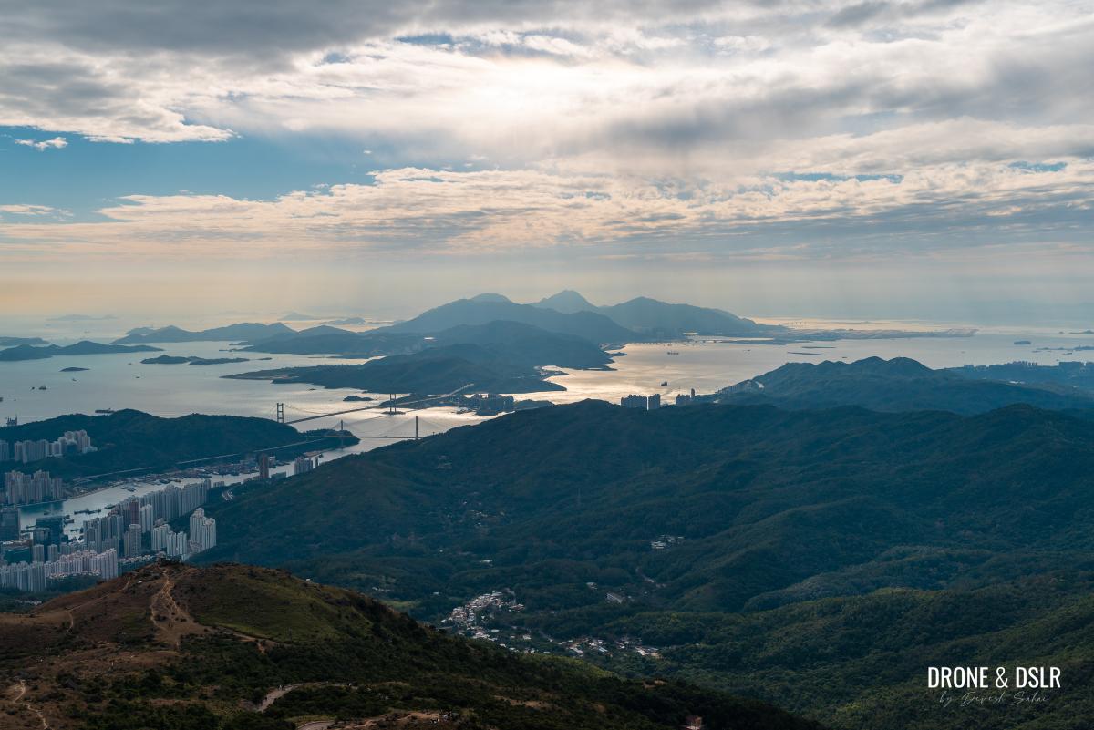
Lantau Island glowing in the distance
To the west lies the massive Tai Lam Country Park, home to the Thousand Islands Lake and Sweet Gum Woods.

Tai Lam Country Park below
And right at the end, we could see the unmistakable summit of Castle Peak!
As we walked around the fence on the summit, we could also see Ho Pui Reservoir below and of course, the entire Shenzhen skyline.
And finally, the north also has beautiful views of Yuen Long, Kai Kung Leng, and Tai To Yan.

Kai Kung Leng and Shek Kong Airfield views from Tai Mo Shan
As I said, the views are stunning, and we had the fortune to see the entire length and breadth of Hong Kong from on top of Tai Mo Shan.
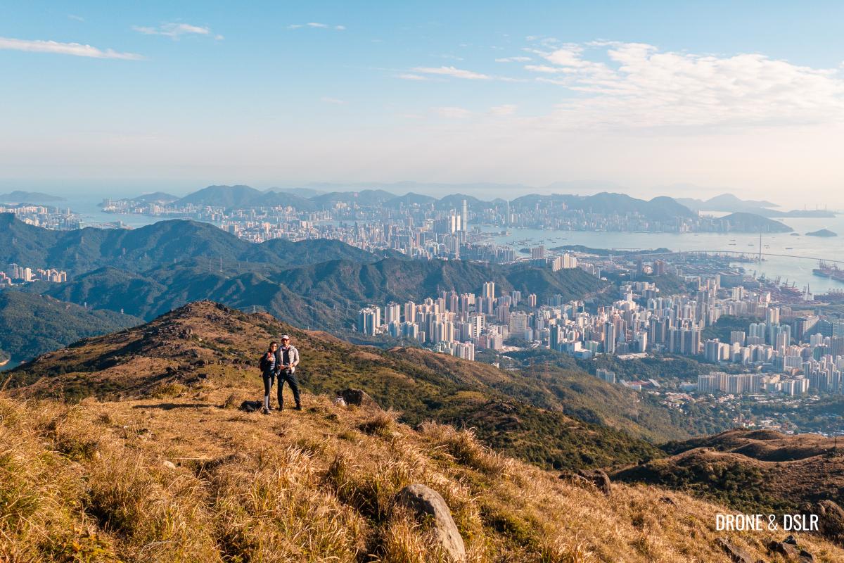
That’s us on top of Tai Mo Shan
Hong Kong’s Highest Peak
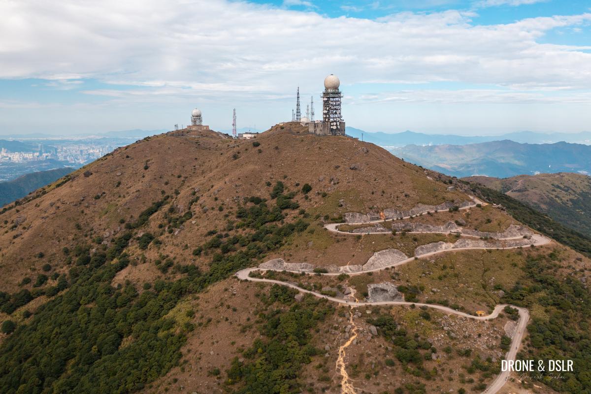
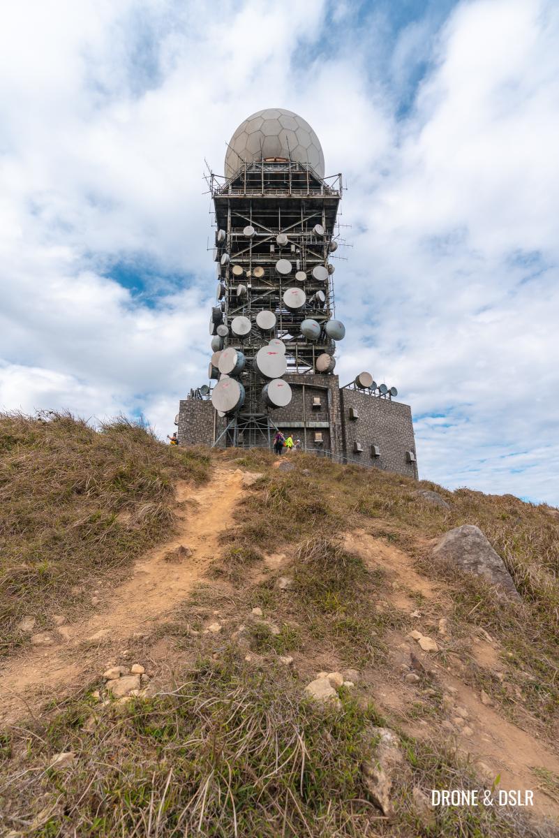
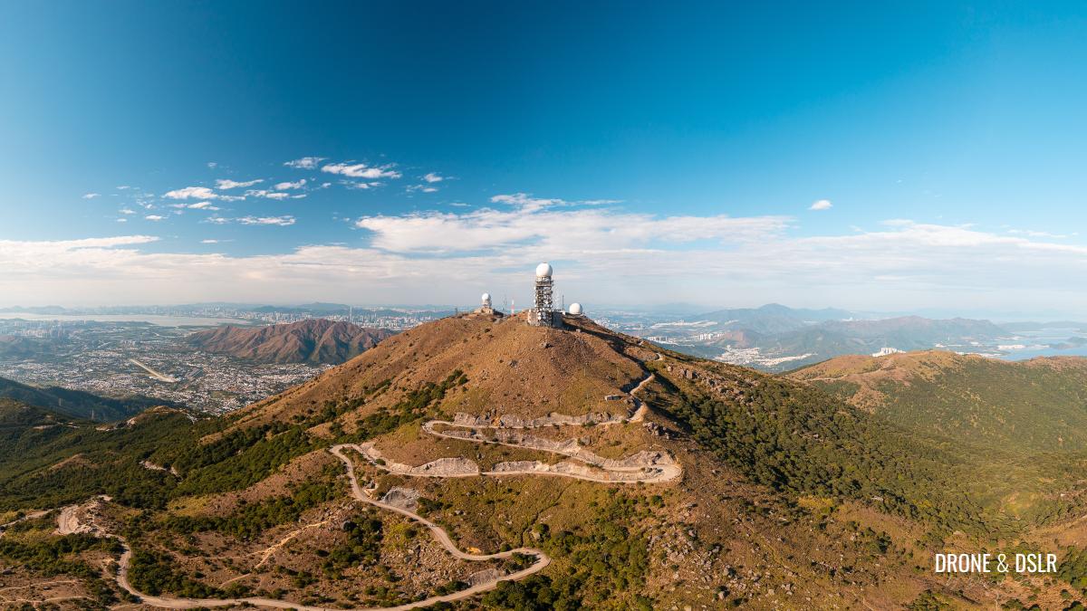
The height of Tai Mo Shan is 957 metres above sea level, but even at the end of the hike, you cannot reach the claimed height. And that’s because the highest point on the hill is located inside the fenced area that belongs to the Hong Kong Observatory.

The Tai Mo Shan Weather Radar Station occupies the summit
So, technically the highest access point for us civilians is limited to approximately 945 metres above sea level.
Fortunately, the area in front of the radar station is grassy with lots of rocks to sit on comfortably while you enjoy the views.
The grassy summit of Tai Mo Shan is very conducive to just relaxing on its summit
Just watch out for all the cow dung!
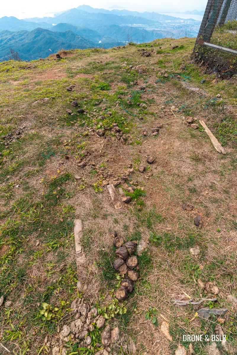
Watch out for the bull crap on the summit
Ways to descend
Because of the numerous hiking routes to the summit, there are plenty of options to descend Tai Mo Shan.
You can continue on Maclehose Trail Section 8 and descend to Tai Po via Lead Mine Pass. Or head down to Ng Tung Chai via the waterfalls.

The Tai Mo Shan Road winding its way past the summit
If you wish to return the way you came up, you can either take the gentle decline of the Tai Mo Shan Road, or the steep shortcut from the west face of the hill.

The trail on the western side of the fence
To reach the shortcut, walk to the northwest end of the fence and locate the start of the trail.

The unmarked shortcut to the barrier gate
We ended up taking the shortcut to the barrier gate. And although it was challenging and very slippery coming down this way, it did save us a lot of walking.

Carefully navigating our way down the shortcut
Best time to hike
Given how easy it is to access Tai Mo Shan, most people choose to visit either the Viewing Point or the summit to catch the sunset or sunrise.

Tai Mo Shan silhouette during a sunset
We decided to stay to catch the golden hour from Tai Mo Shan, and it was glorious! And we also noticed that the crowds started building up just before sunset.
-
- Enjoying the views as golden hour sets in

-
- Golden hour views from Tai Mo Shan

And while we were descending, we weren’t too surprised to see that all the hidden viewing points on the trail back to the Visitor Centre were occupied with those wanting to catch the sunset.
-
- Catching the sunset from Tai Mo Shan

-
- We saw the city bathe in gold as we began as descent
Tai Mo Shan also becomes very crowded during New Year’s Eve and New Year’s Day as hundreds come here to watch the last sunset of the year and the first sunrise of the new year.
On top of Hong Kong
We hope you enjoyed our guide to the Tai Mo Shan Hike from Route Twisk (Tsuen Kam Au). This is honestly the simplest and shortest route to Hong Kong’s tallest peak.
On top of Hong Kong!
You can always try a different route to make the hike more challenging. But for most, the joy of Tai Mo Shan is in the panoramic views from the top. The sunsets and the sunrises. And the knowledge in knowing that you’re on top of Hong Kong!
Tai Mo Shan, Hong Kong’s tallest peak
Feel free to share this post on the social media channel of your choice and drop us a comment below.
If you enjoy our work, come join us on Instagram and YouTube 🙂


You might also like


4 Comments
I enjoyed reading your blog and shared it on my Facebook wall. I’ve read some blogs about Tai Mo Shan but I’ve found this the most accurate one!
A complete package!
Thank you very much! Really appreciate your feedback 🙂
I did this walk a few weeks ago following your directions. It was so beautiful. The weather wasn’t quite as clear as on your hike, but it was still lovely. Considering this is the highest mountain in Hong Kong, the hike wasn’t too bad. Really enjoyed it. Thank you for the info.
Thank you very much, Irene! Yes, I agree that this route makes it so easy to hike Hong Kong’s highest hill. I am sure that even with the slightly hazy weather you were able to get some great views!