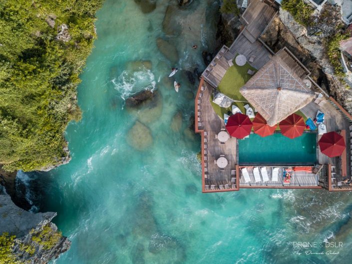
Above The Land Down Under

Aerial Photos from Australia


Australia has to be one of the most diverse countries that we’ve ever been to, and also one of the most beautiful. From pristine unspoilt beaches, to charming towns and cities. No doubt we consider ourselves fortunate to have captured some of these highlights with a drone.

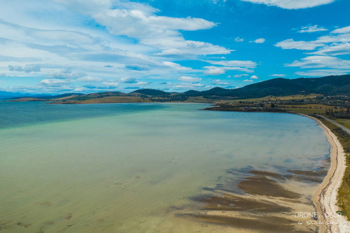
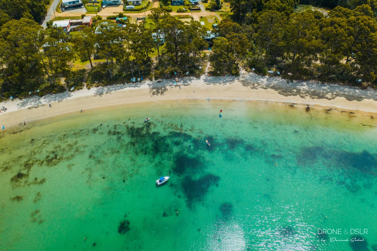
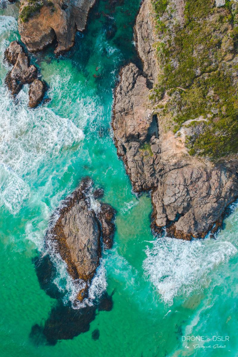
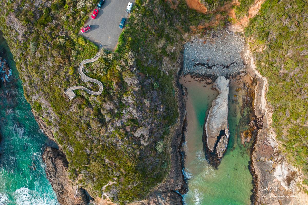
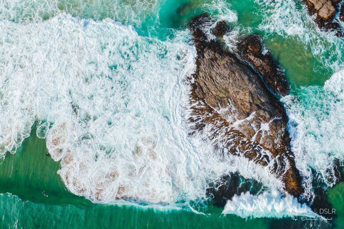
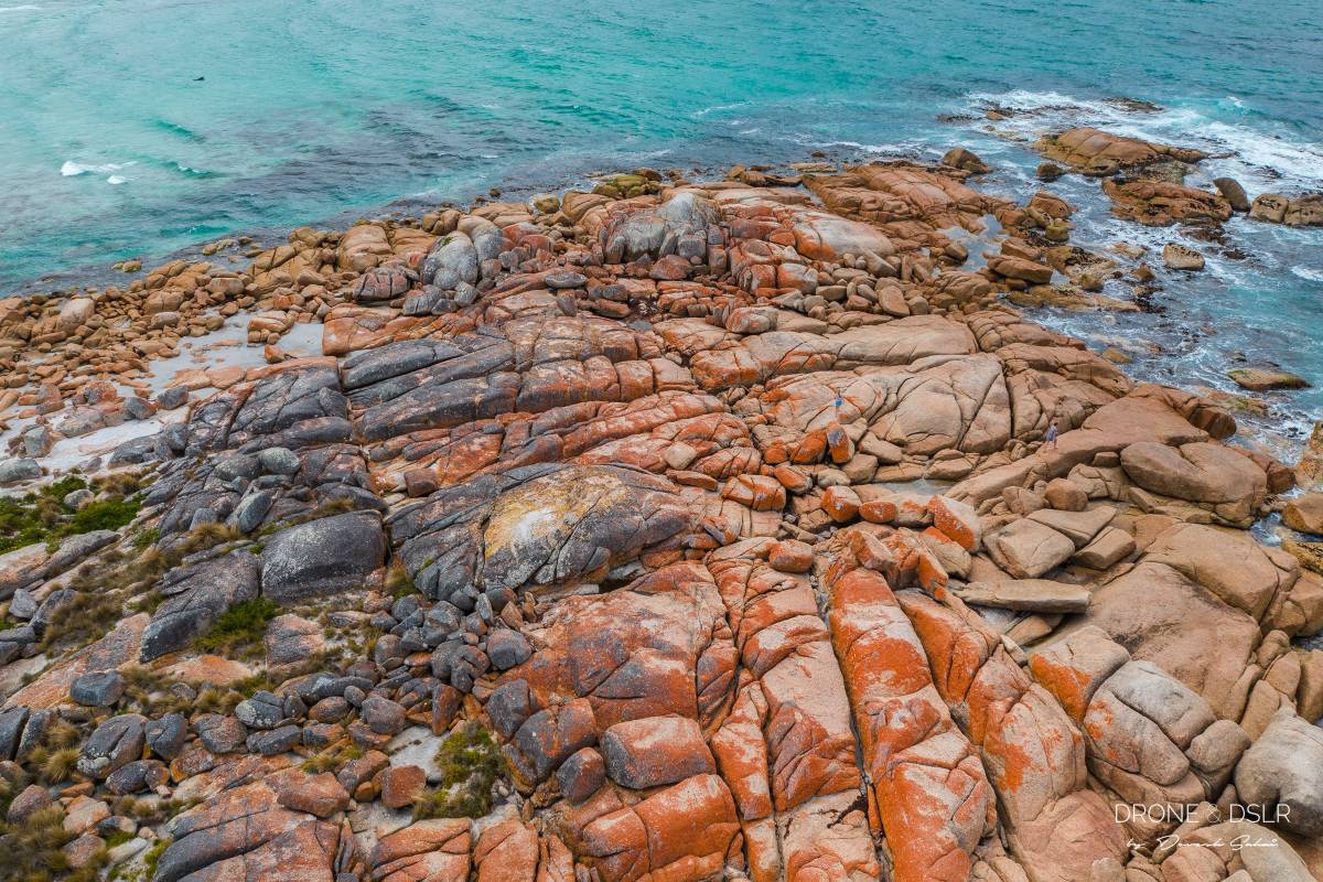
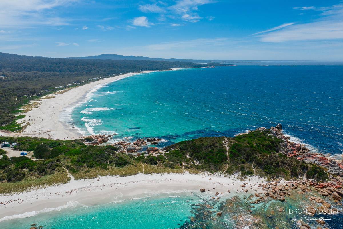
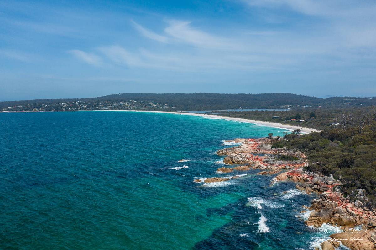
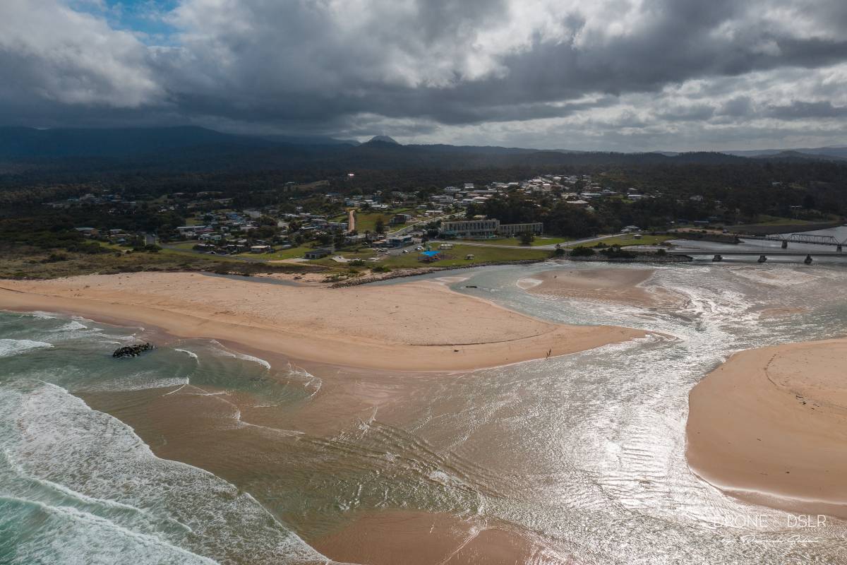
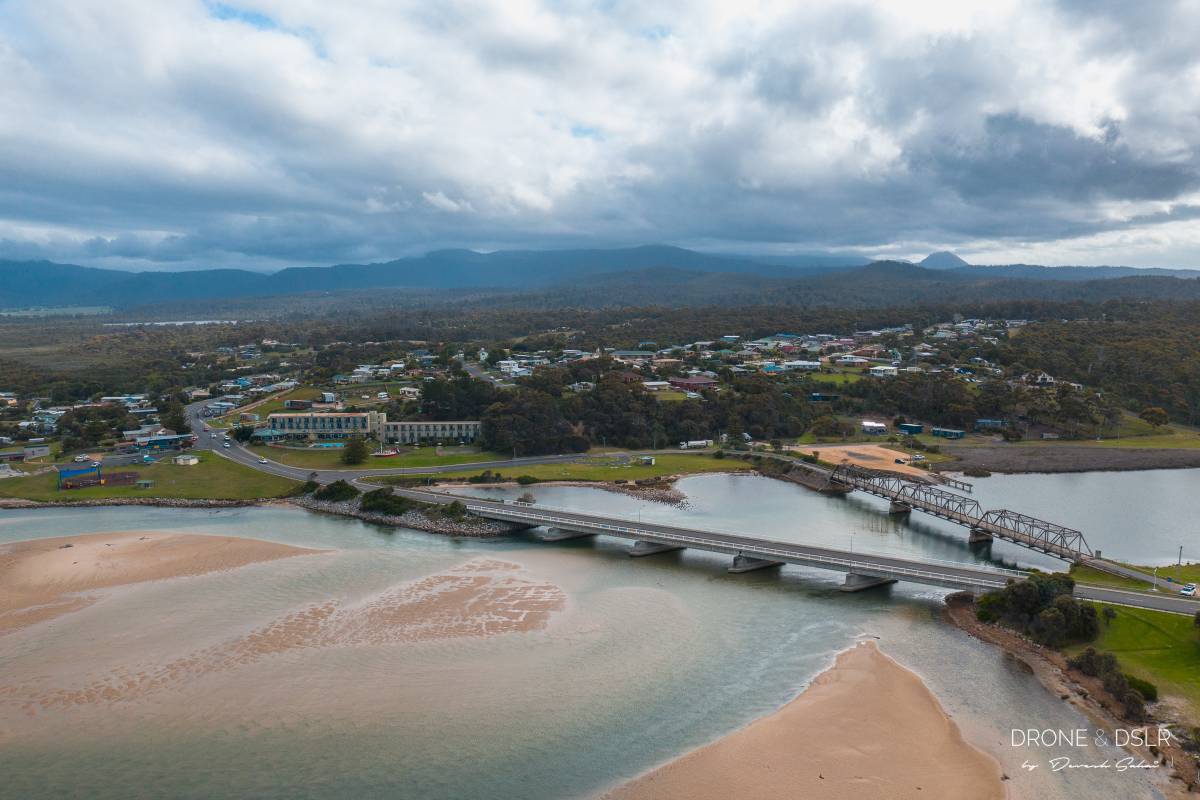
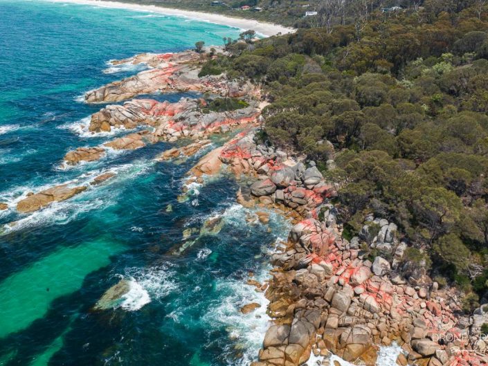
We started our journey in Hobart, Tasmania, and then drove along the Great Eastern Drive all the way to Launceston. Along the gorgeous drive, we stayed at quaint towns and saw some of the most spectacular sights. Our favourite was Binalong Bay and the Bay of Fires. Never have we seen such vivid colours – transparent blue waters and white sand beaches. Not to forget the red streaks on the rocky shores of the Bay of Fires.

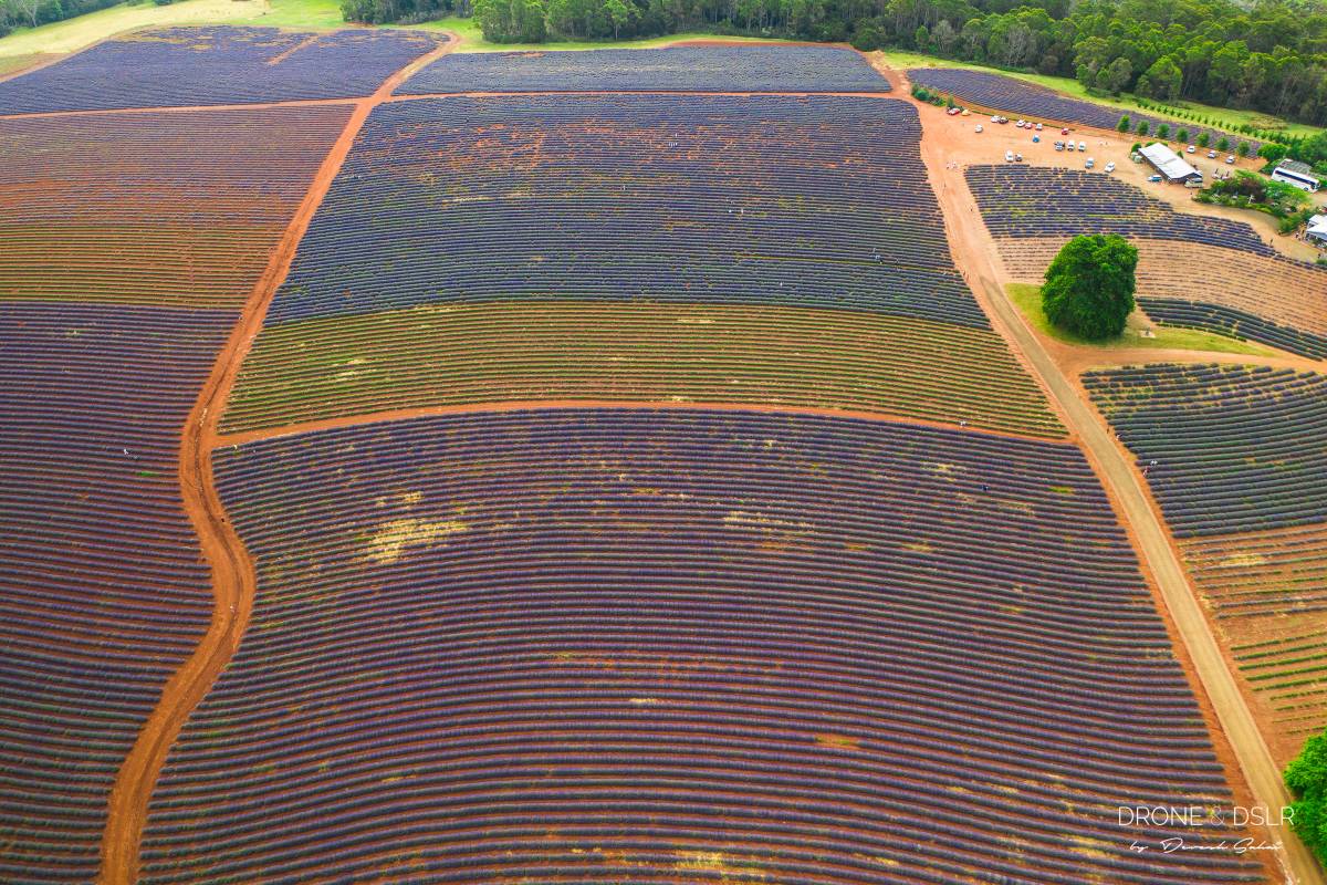
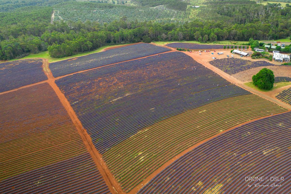
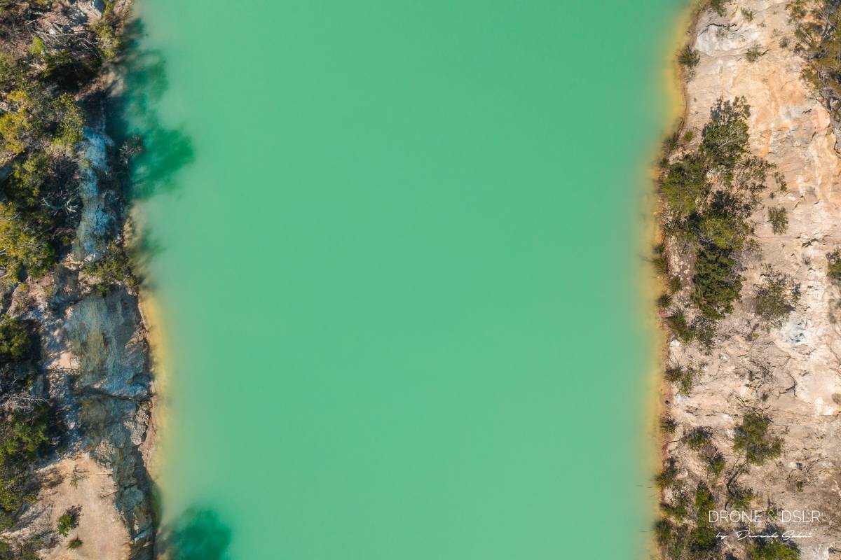
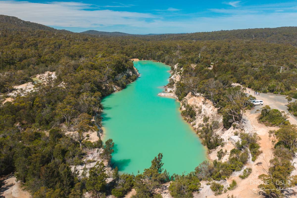
Other great sights were the Bridestowe Lavender Estate and the Little Blue Lake. We were lucky to have a drone to capture these gorgeous attractions from a unique perspective.

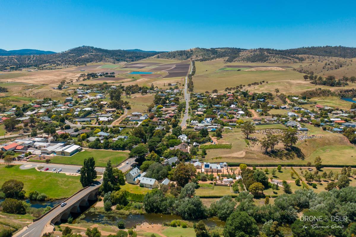
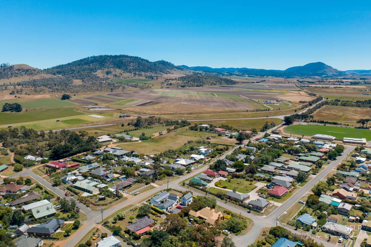
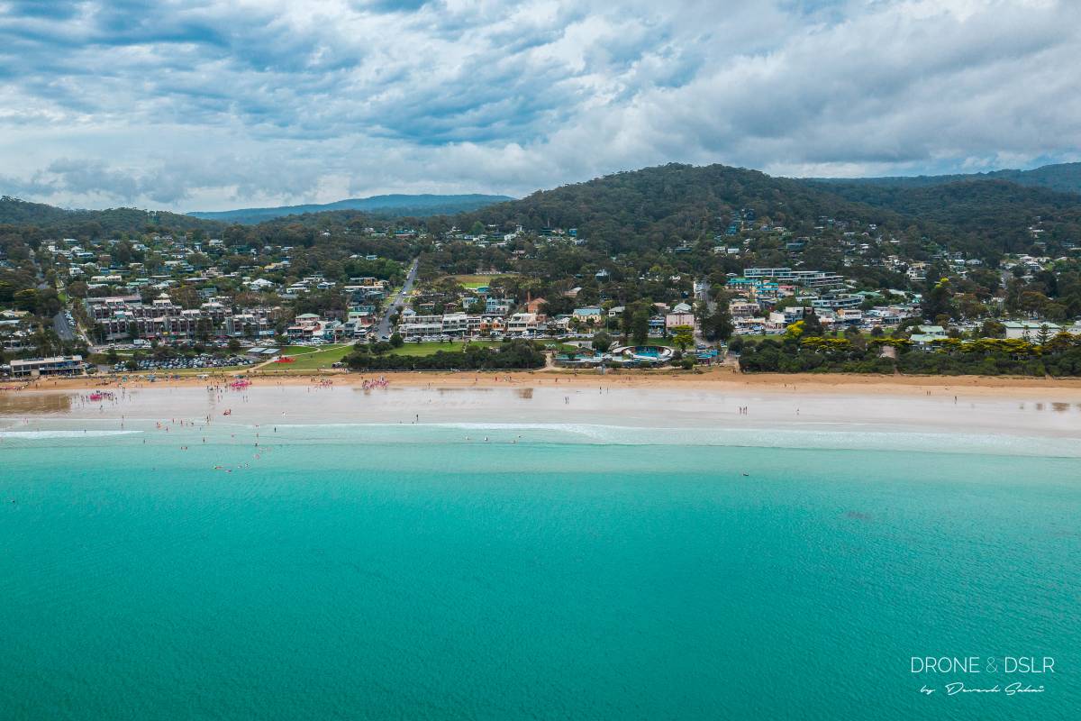
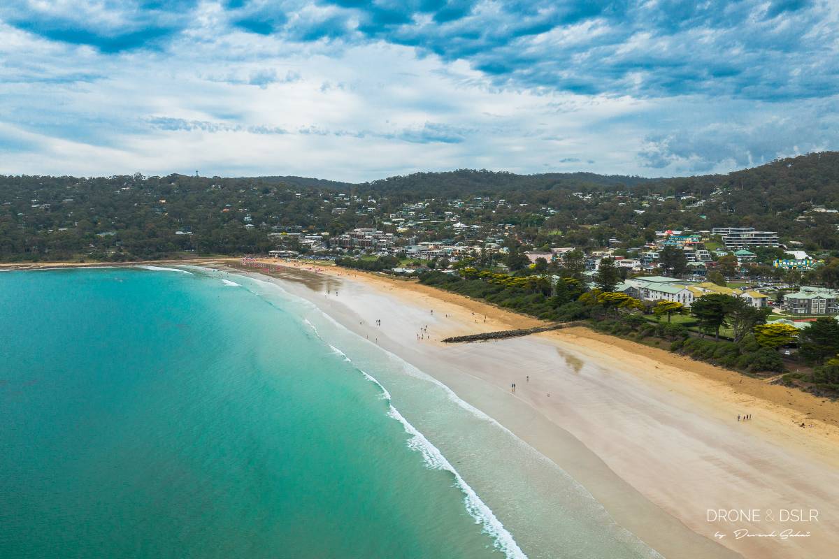
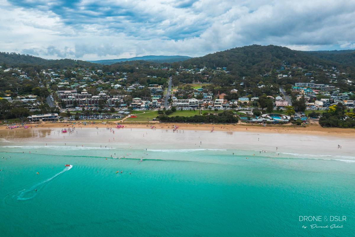
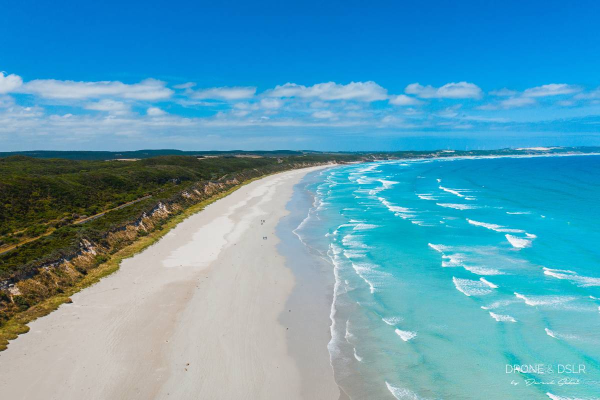
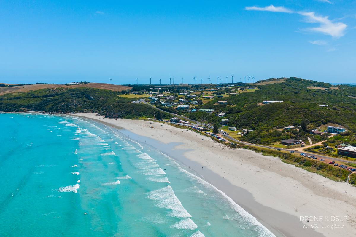
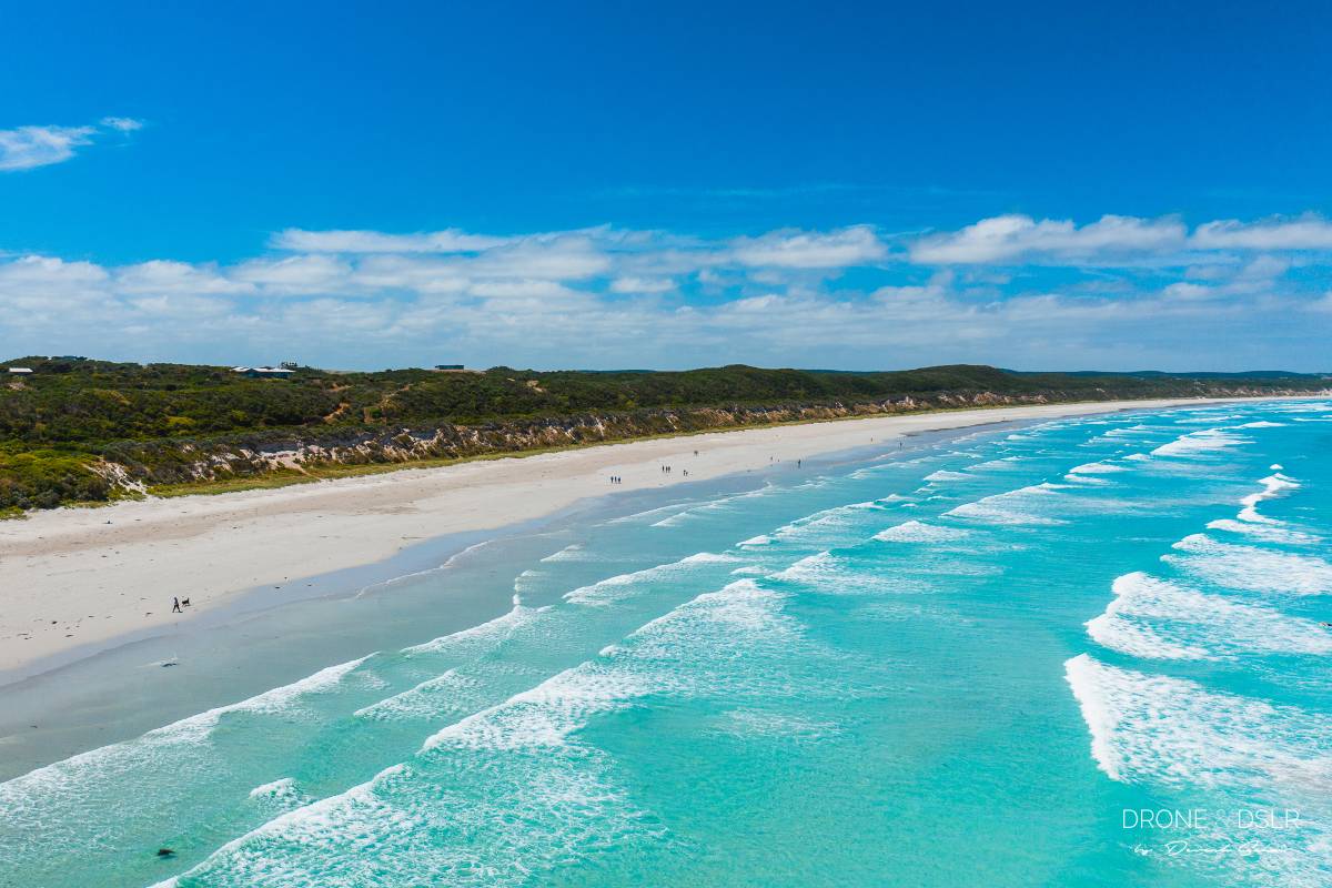
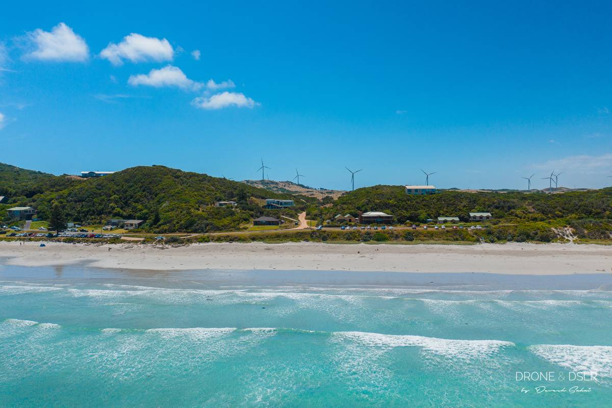
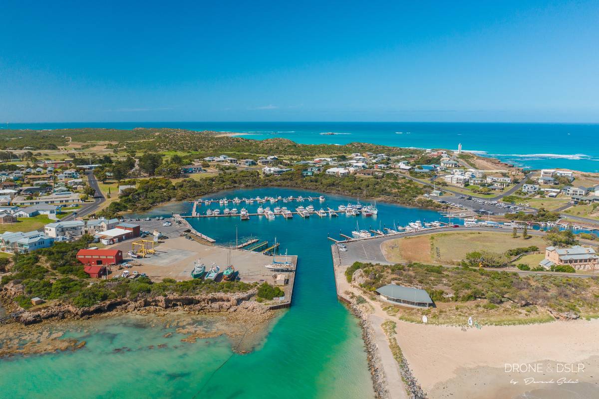
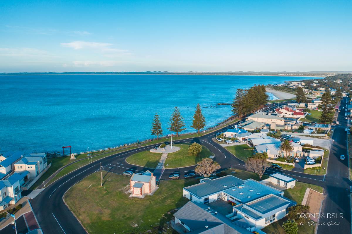
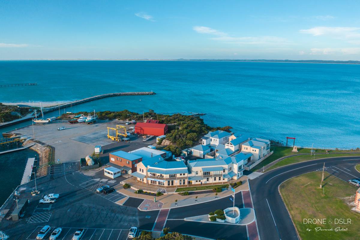
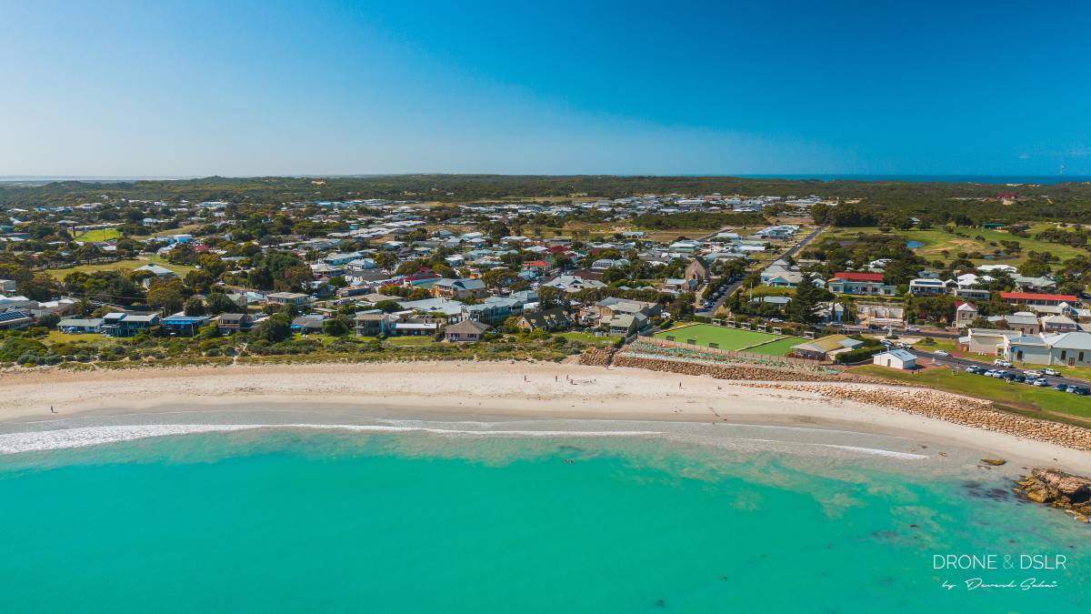
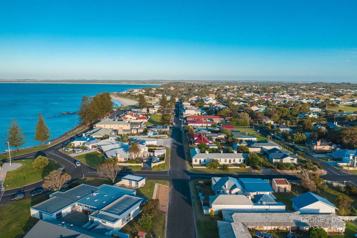
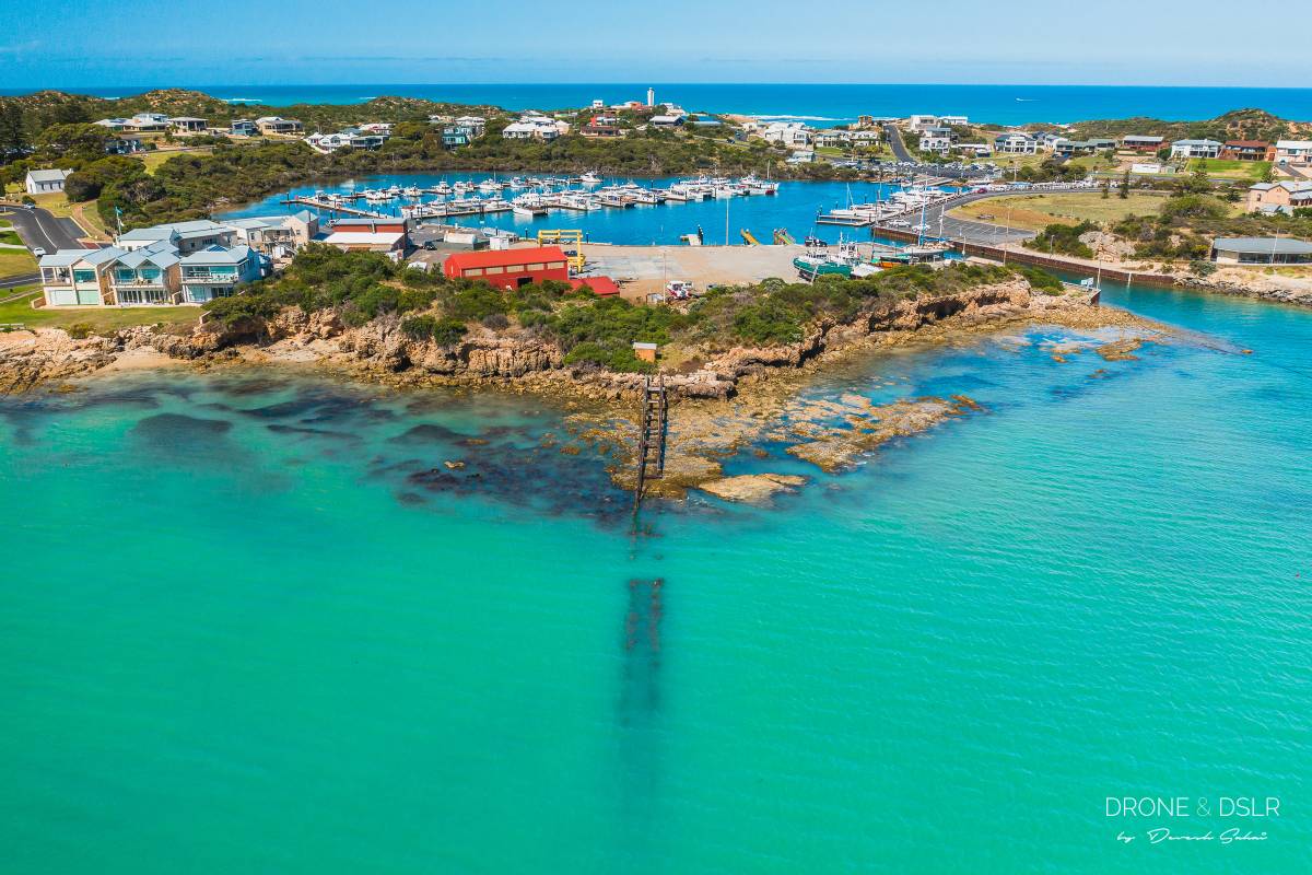
Once we returned to the mainland, we drove along the Great Ocean Road. In fact, we drove all the way from Melbourne to Adelaide! Again, we stopped at charming towns along the southern coast of Australia. Although we were only able to capture the beauty of some of these towns from the air, we were just fortunate to have seen them!

We hope you enjoy these drone aerial photos from our trip to Australia. I know we just scratched the surface but I’m certain we’ll be back for more.

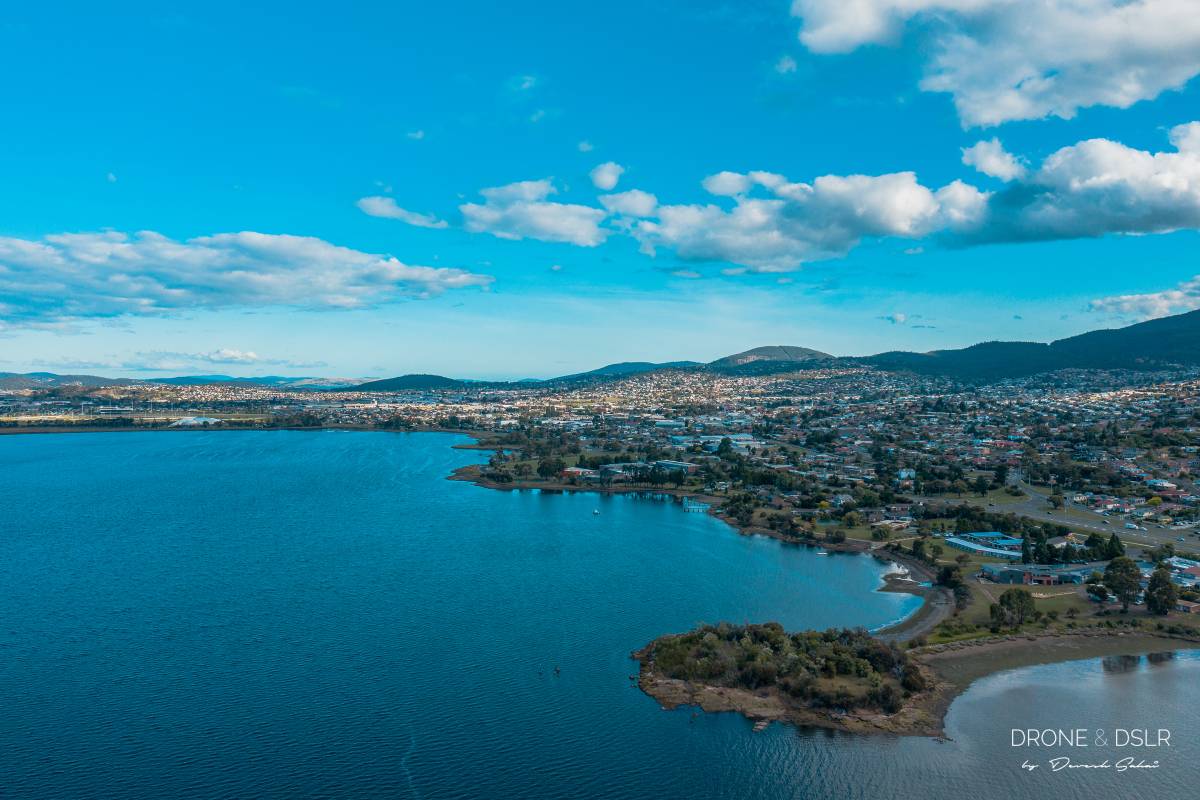
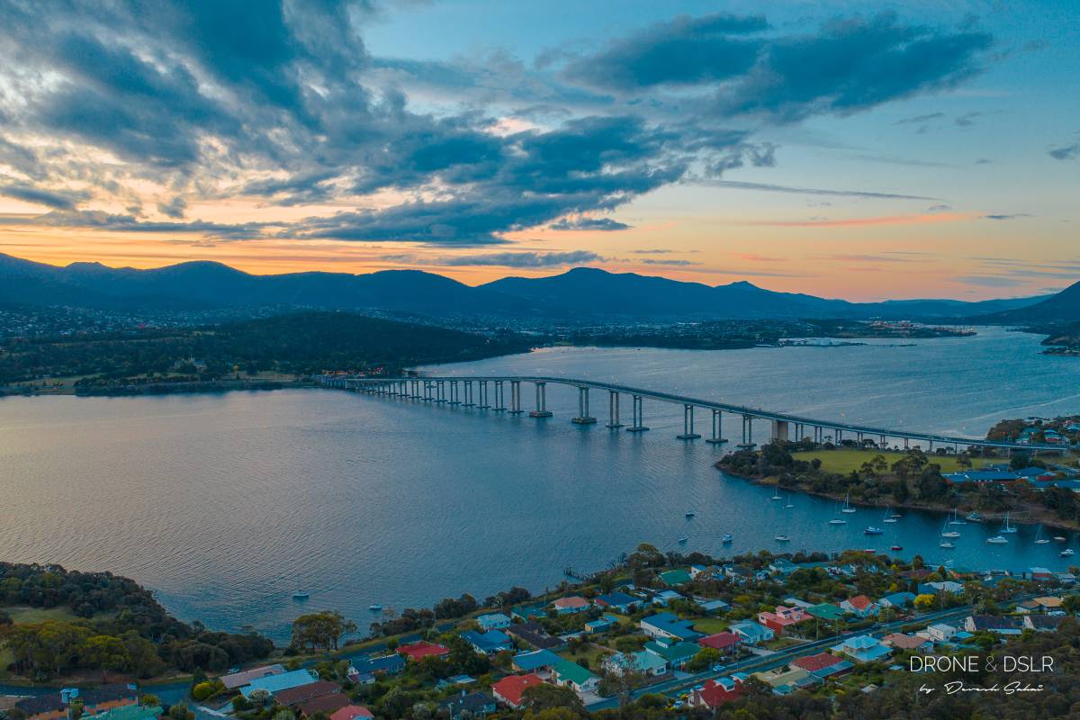
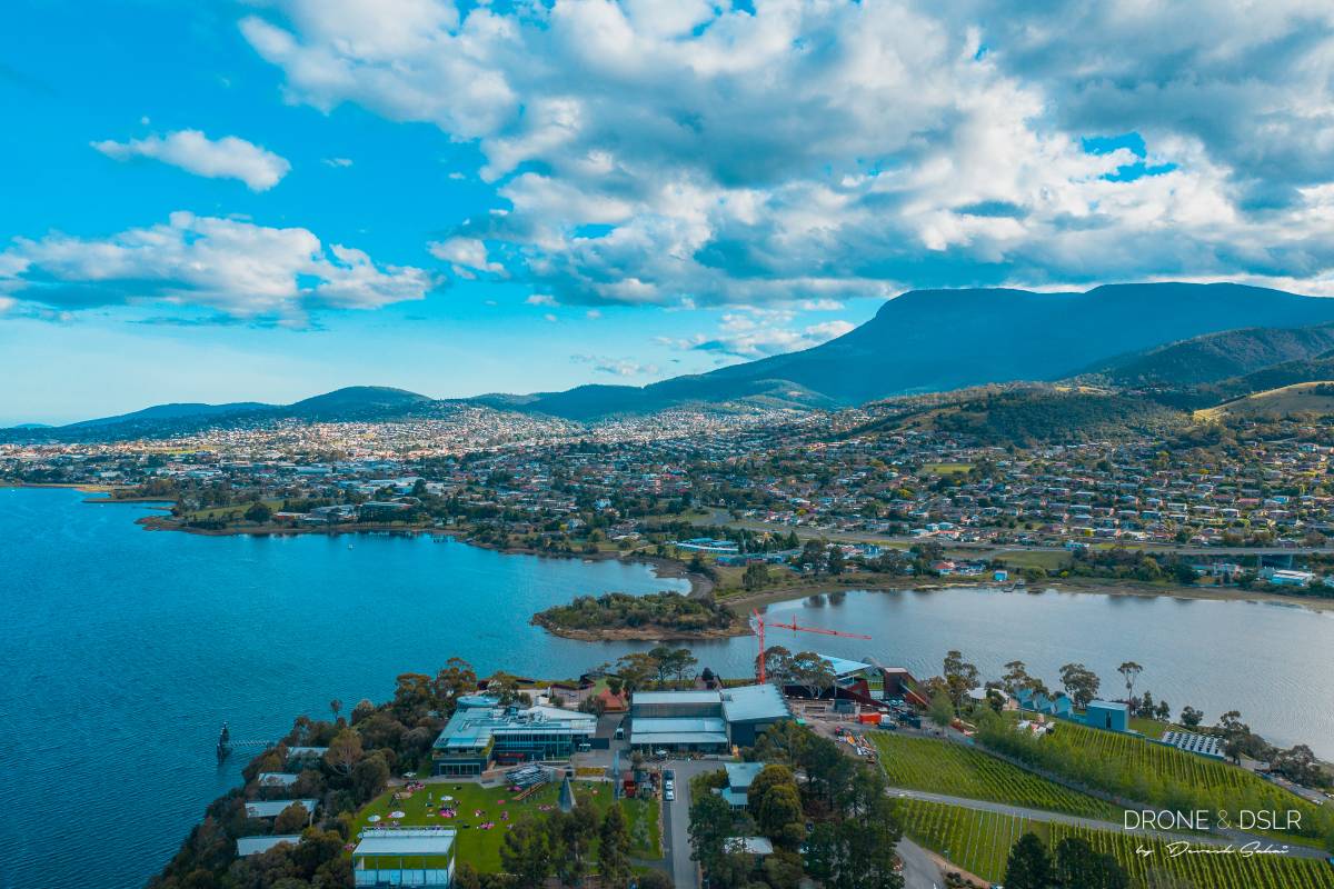
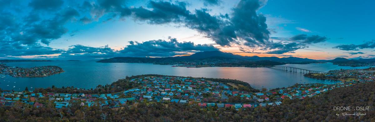
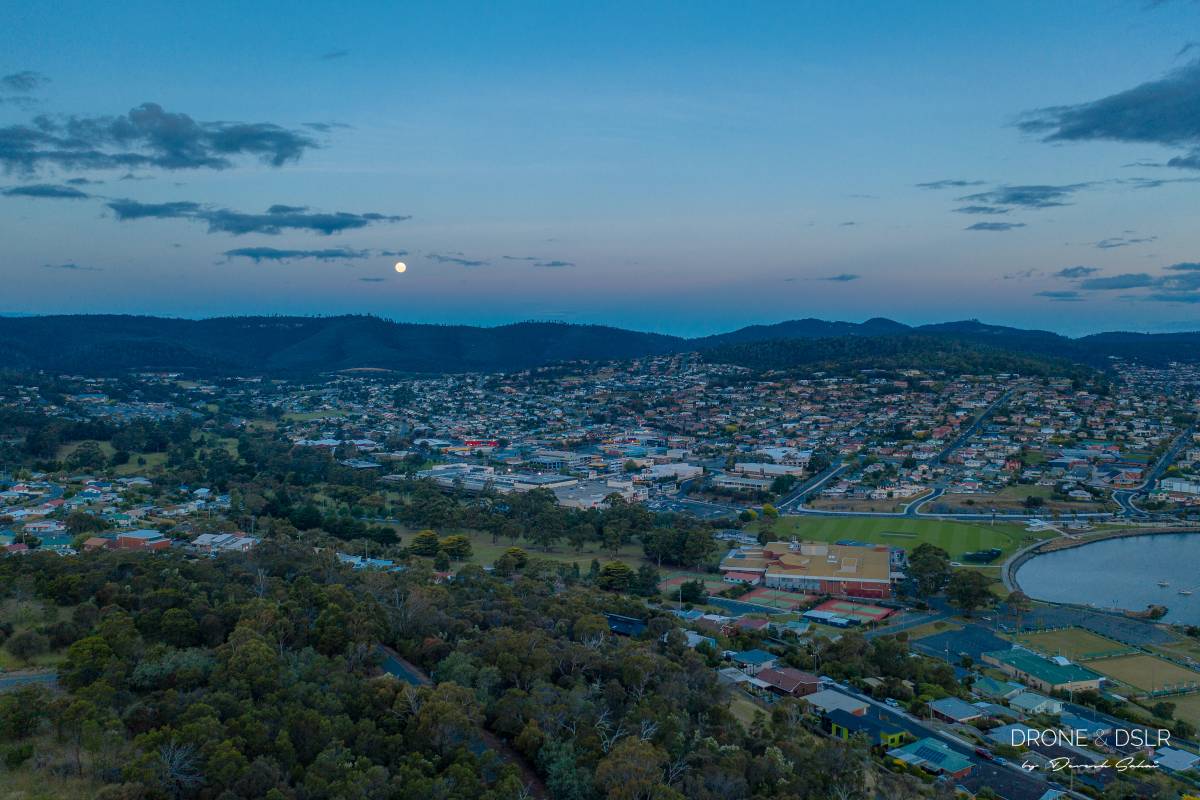
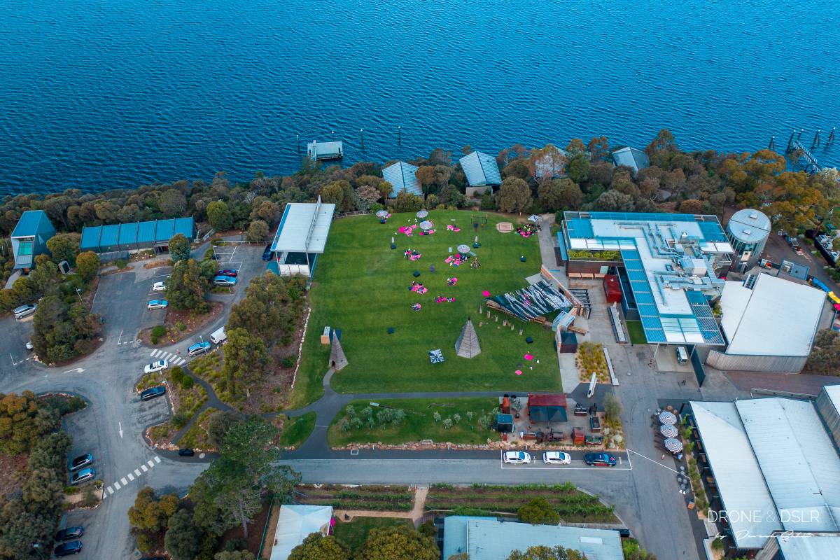
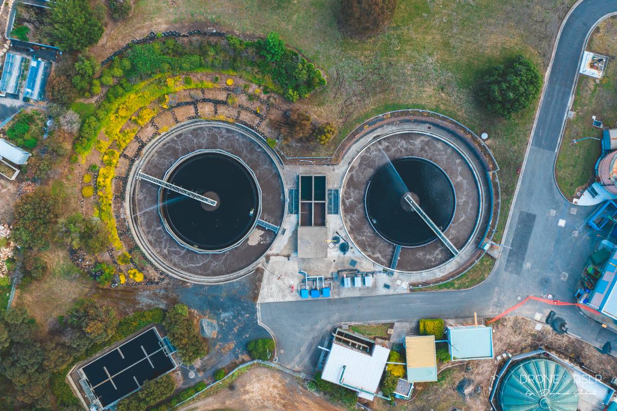
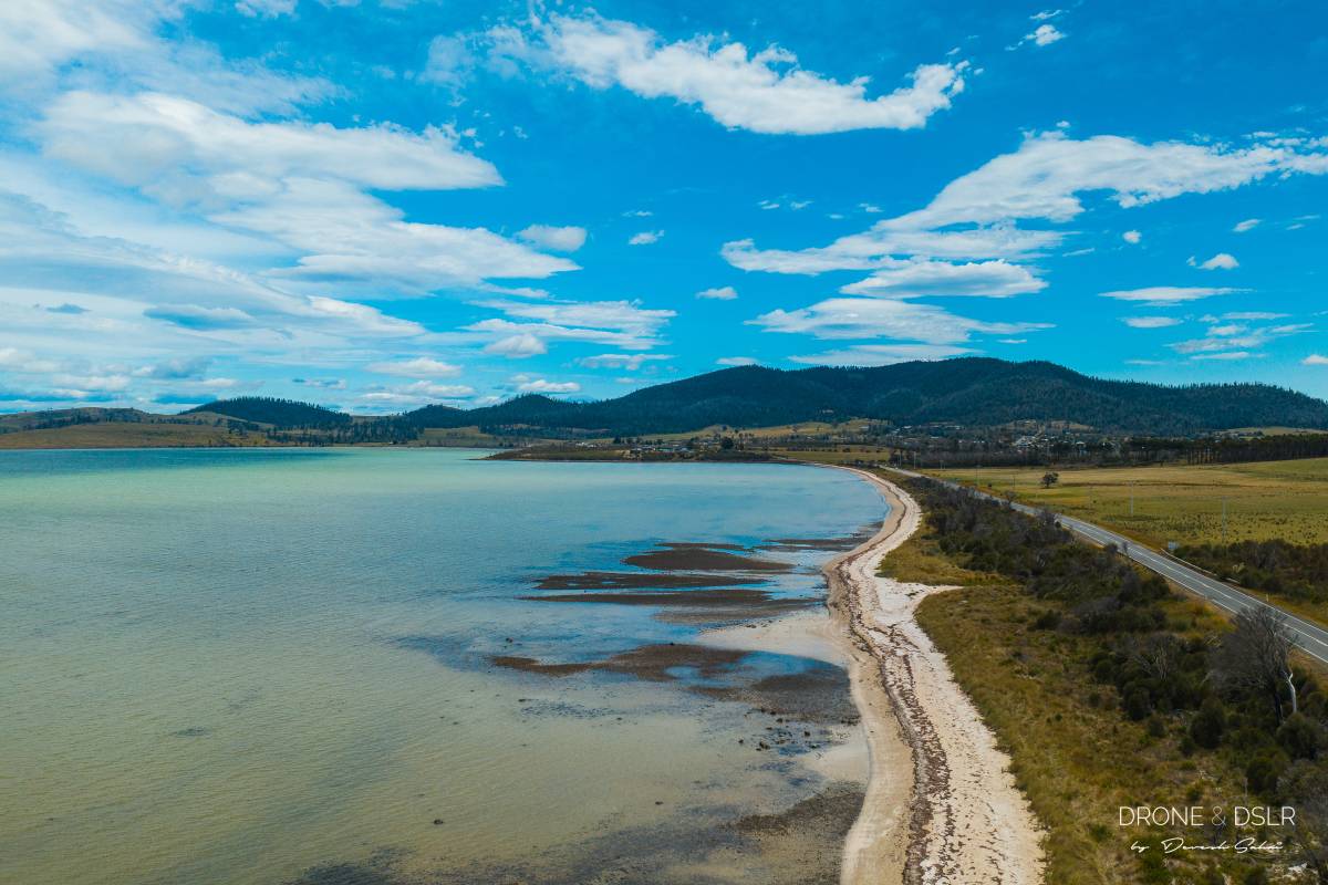
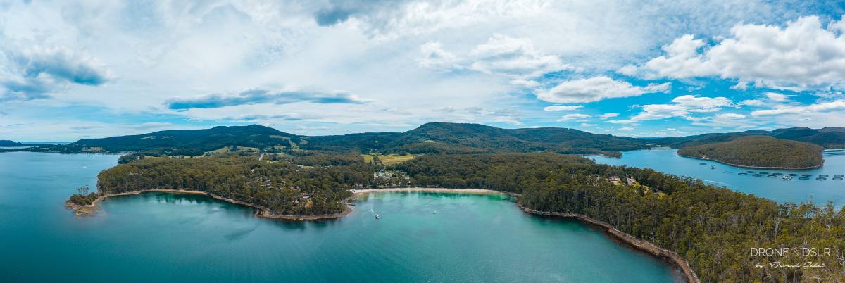
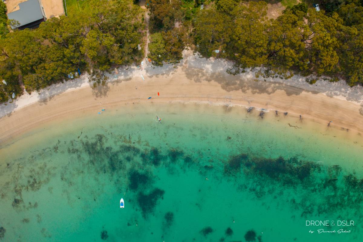
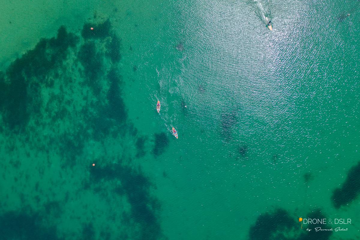
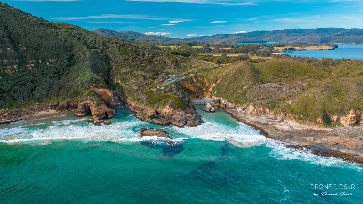
Aerial Photos from Tasmania

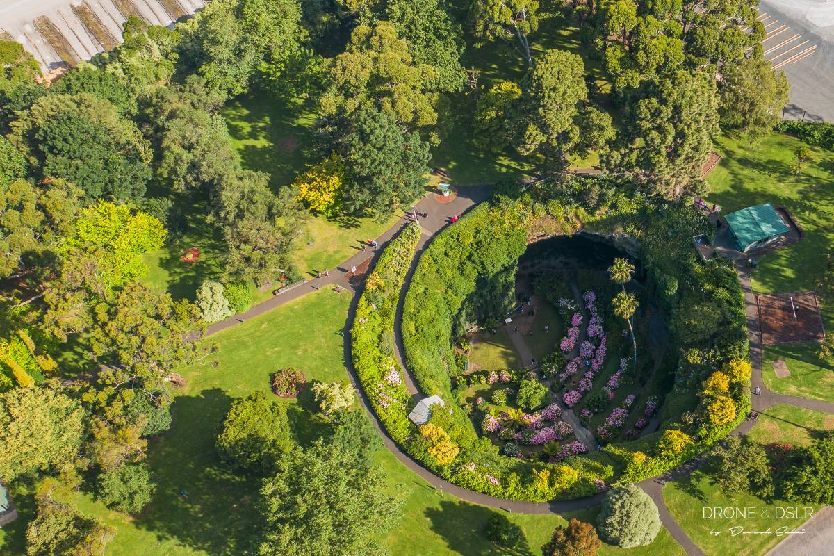
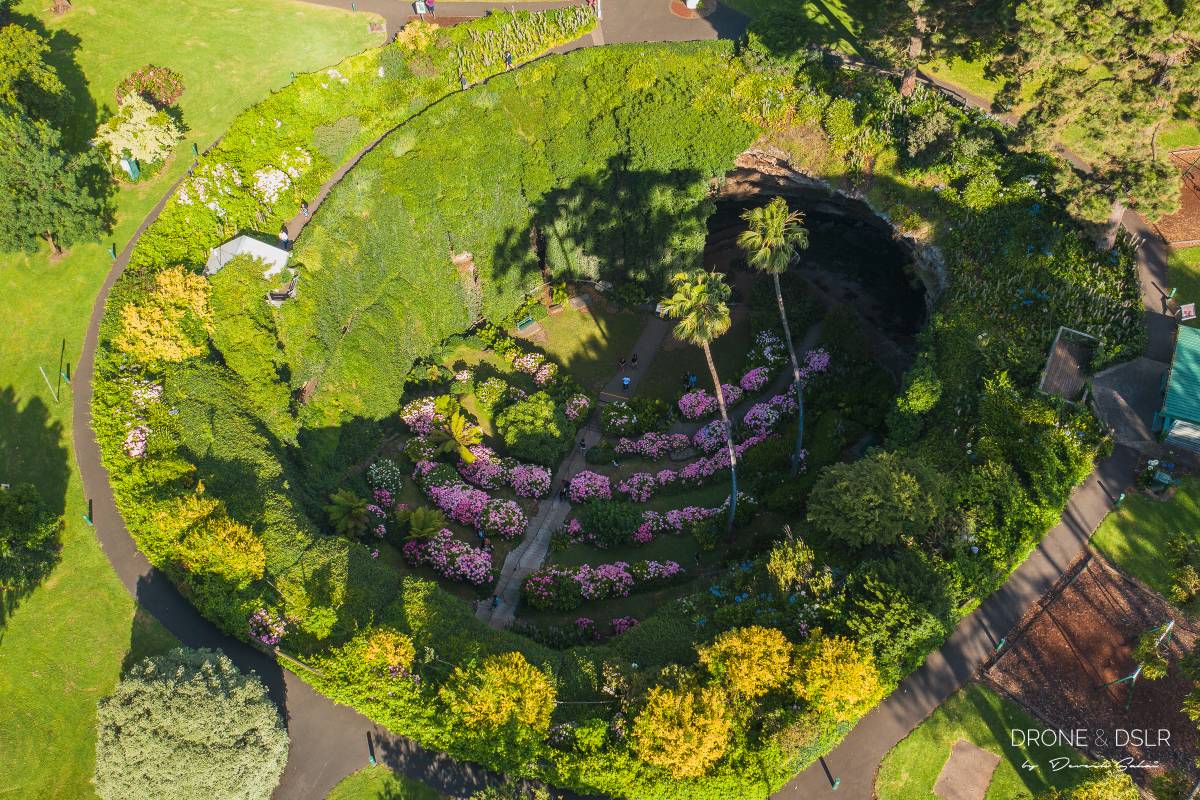
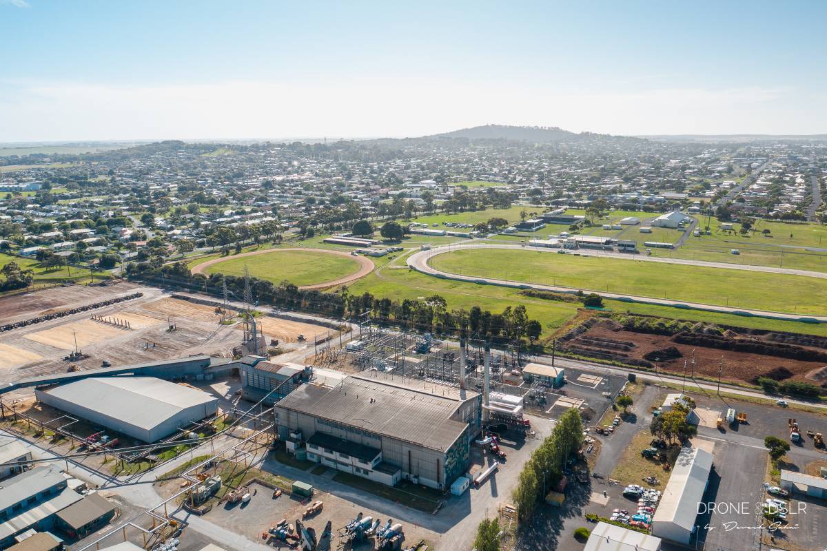
Aerial Photos from Victoria

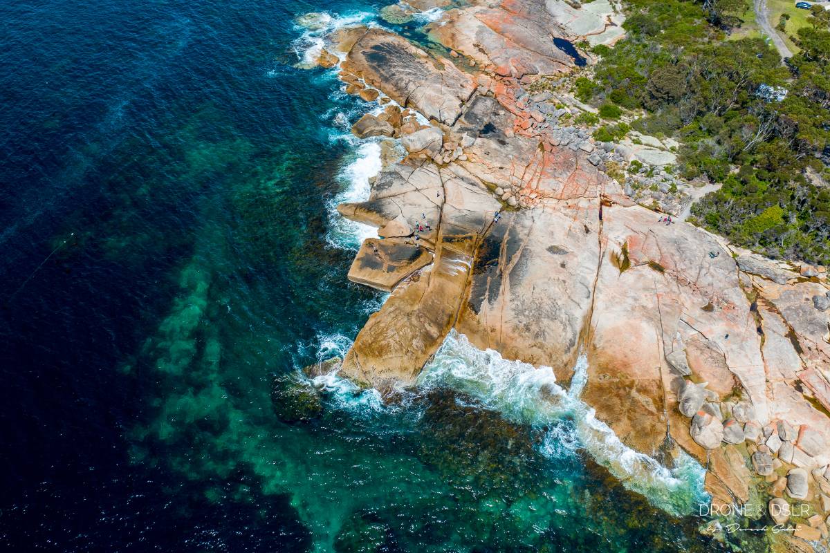
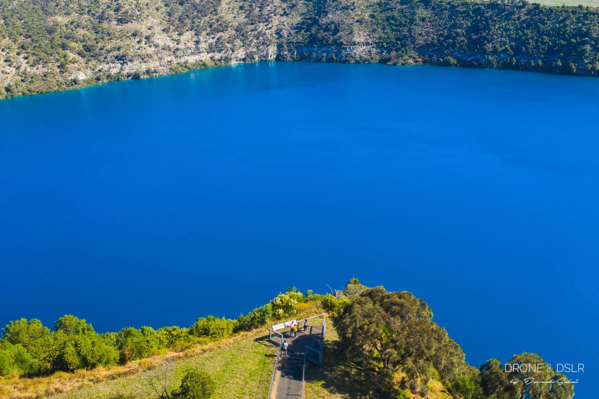
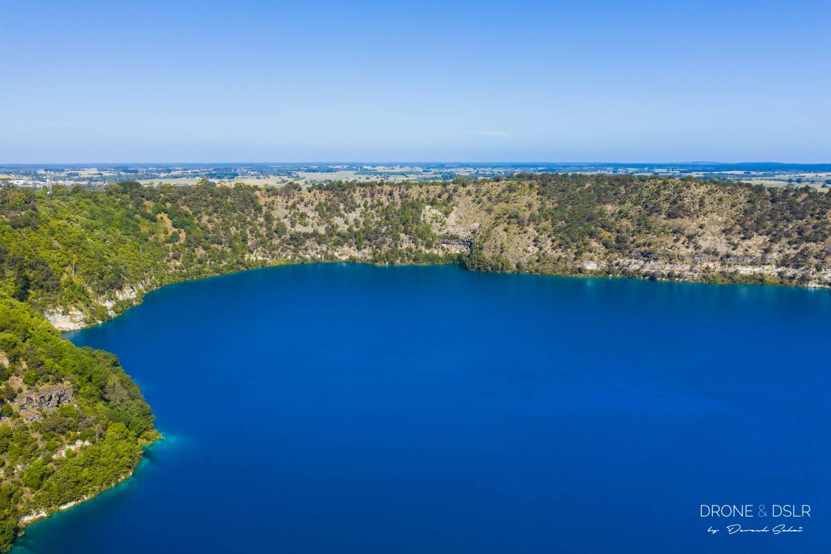
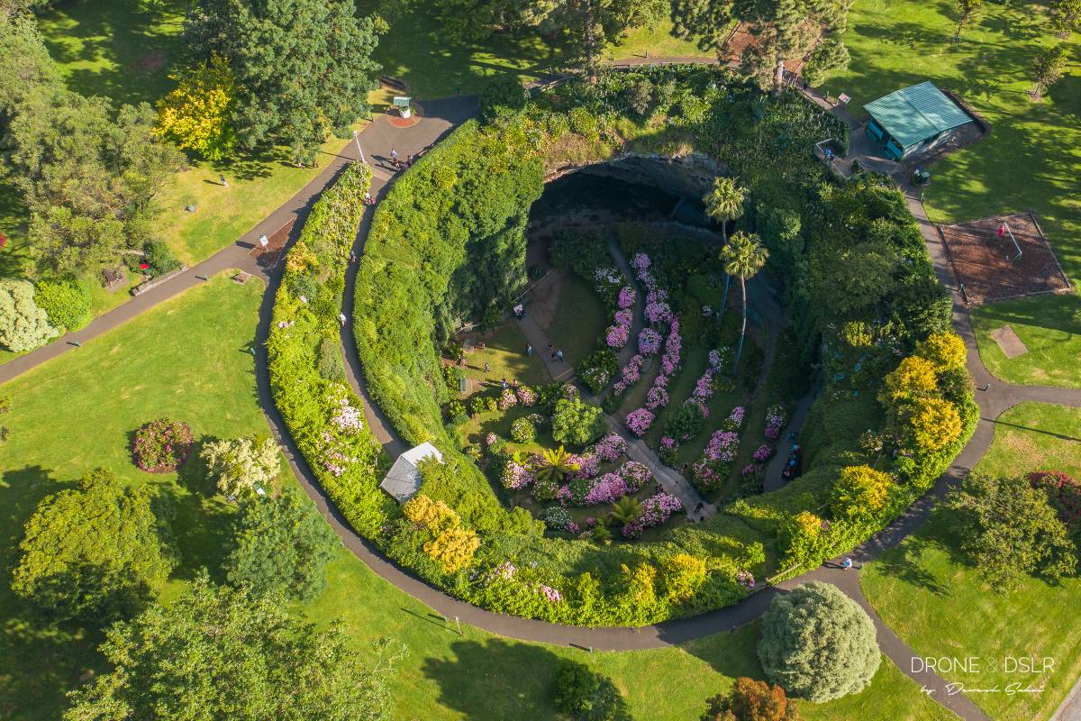
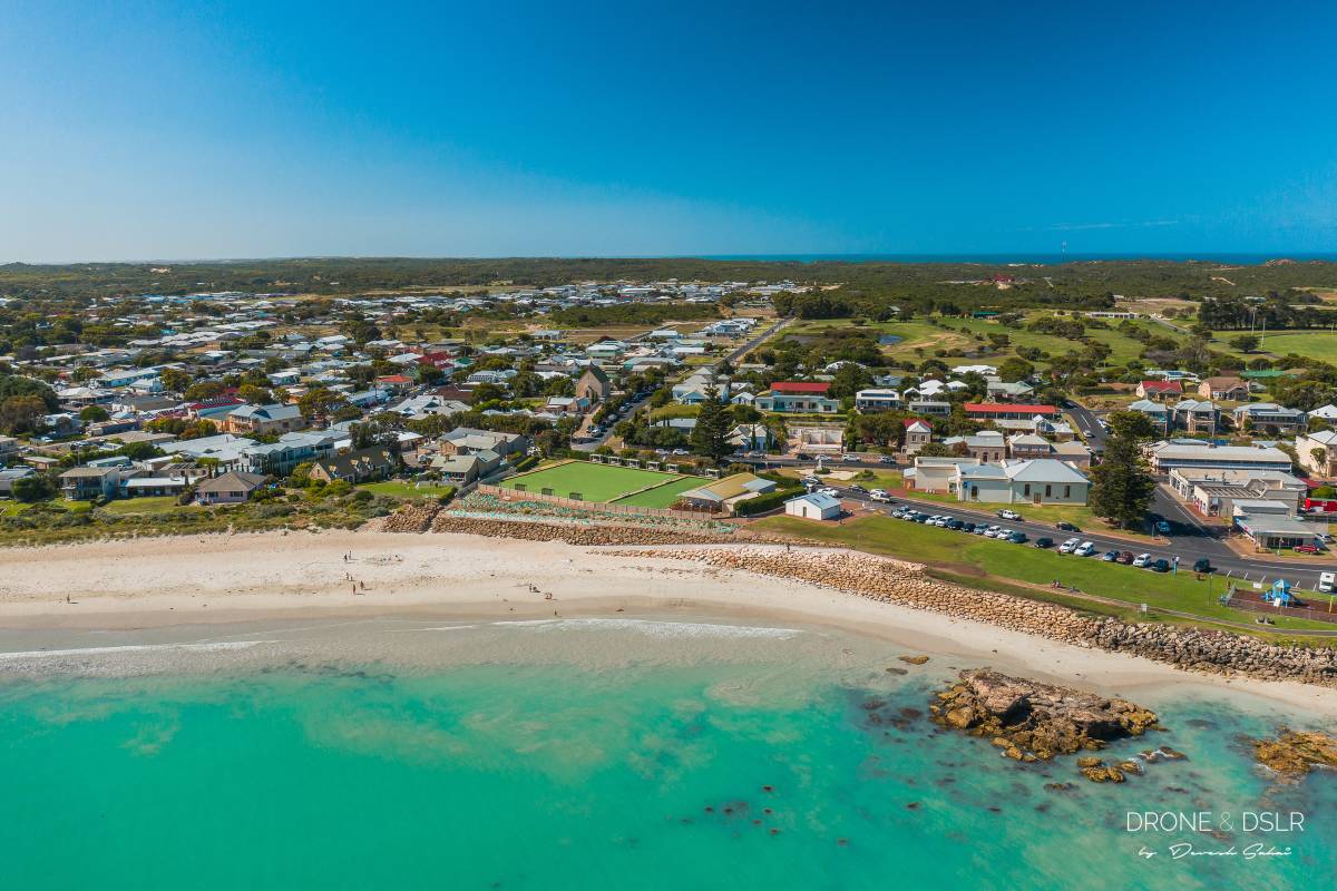
Aerial Photos from South Australia

If you’re planning to travel to this beautiful country with your drone, be sure to read up on Australian drone laws.

Aerial Photos of Tasmania

Aerial Photos Of

Hobart

Hobart is where we began our journey in Tasmania. The very first thing that struck me was just how picturesque the city of Hobart is. With the mountain rolling up on the city’s side, the individually spaced-out houses seem so picture perfect.

Although we weren’t in Hobart for too long, I did have the opportunity to send the drone up to capture some of the beauty of Hobart from the sky. Which included us searching for the perfect spot to catch the sunset.

A bird's eye view of Hobart on a beautiful day
The Tasman Bridge during a gorgeous sunset in Hobart

Hobart as seen from MONA
Aerial view of Rosny in Hobart, Tasmania
Aerial panorama of Hobart, Tasmania
The Moon rising over Hobart
The vineyards of MONA, Hobart

The hotel and grounds at the MONA, Hobart
Something circular at a vineyard, Hobart, Tasmania

Aerial Photos From

Beyond Hobart

Dunalley Bay

On our drive to to Port Arthur we caught a glimpse of the beautiful Dunalley Bay. The way the colour in the bay shifted from a sky blue to a dark blue, with a very visible demarcation, was quite spectacular! Obviously we had to stop to take a few pictures and even fly the drone and get these aerial shots.

The Dunalley Bay’s dual colour scheme captured our attention

Beautiful dual colours of Dunalley Bay
The Dunalley Bay's dual colour scheme captured our attention
Aerial view of Dunalley Bay, Tasmania

Stewarts Bay

Next on our drive to Port Arthur came Stewarts Bay. We decided to take a pit stop here to grab a bite.

We had no idea how beautiful the area would be, with bays within bays, and beautiful views. We stopped by a restaurant called Gabriel’s By The Bay which had outdoor seating to admire the views. These were the aerial views from Stewarts Bay, and Ladies Bay.

Aerial panorama of Stewarts Bay, Tasmania
The smaller Ladies Bay, Tasmania
Looking down on the beach at Ladies Bay, Tasmania

Two kayaks at Stewarts Bay, Tasmania
The beach at Ladies Bay (Stewarts Bay), Tasmania

Maingon Bay Lookout

The last stop on our day-trip to Port Arthur was Maingon Bay Lookout. The point is known for two things – surfing, and the Remarkable Cave. And a rock that looks like a penguin.

With the drone I was only able to capture the massive waves, that the surfers love, and the Penguin Rock. The waves here were no joke. If you look at the images, you can get an idea of how massive the waves were compared to the tiny surfers.

Doesn't look like a penguin from this angle, Maingon Bay Lookout, Tasmania
Aerial view of Maingon Bay Lookout, Tasmania
Slithering paths and Penguin Rocks - Maingon Bay Lookout, Tasmania

Maingon Bay Lookout is a popular surfing location in Tasmania
Can you spot the tiny surfer? - at Maingon Bay Lookout, Tasmania
The size of waves are put into perspective once you notice the surfer - Maingon Bay Lookout, Tasmania
Caught in the waves, Maingon Bay Lookout, Tasmania
The gorgeous Maingon Bay Lookout, Tasmania

Aerial Photos Of

Richmond

Richmond is a small historic town 25 kms from Hobart. We stopped by the town to check out their main attraction – the Richmond Bridge. The bridge was built between 1823 and 1825, during the town’s first settlement, by convicts.

Aerial view of the beautiful historic town of Richmond near Hobart
Richmond Bridge and the road that exits the town

Bridge Street (the main street) in Richmond, Tasmania
Bird's eye view of Richmond, Tasmania
The farms beyond Richmond, Tasmania
Looking down on the town of Richmond, Tasmania
The historical Richmond Bridge

Aerial Photos From

Great Eastern Drive

Bicheno Bay

Bicheno Bay was a beautiful town along the Great Eastern Drive. We stopped at Bicheno to visit a wildlife sanctuary, but end up enjoying the town’s natural beauty more. From its famous blowhole, to beautiful beaches with red rocks.

Above the Bicheno Bay Blowhole
The colourful rocks of Bicheno Bay, Tasmania

Aerial photo of the Bicheno Bay Blowhole
An elevated view of the lichen red rocks of Bicheno Bay, Tasmania

Binalong Bay & Bay of Fires

St Helens was our last stop along the Great Eastern Drive. This small town is the gateway to one of the most beautiful sites in Tasmania – Binalong Bay and the Bay of Fires.

This whole region is known for its pristine waters, and white sand beaches. Honestly, the beaches at Bay of Fires were some of the most spectacular beaches that I’ve ever seen in my entire life!

But the highlight here are the red rocks. These rocks get their red streaks from the lichen, a composite organism.

The red streaks on the rocks are caused by lichen, a composite organism - Bay of Fires, Tasmania
Jeanneret Beach - One of the many beaches along the Bay of Fires. Absolutely gorgeous beach!

Bay of Fires - a stunner for miles!
Aerial view of Binalong Bay, Tasmania

Scamander

Scamander is a small town at the mouth of the Scamander River, between St Helens and St Marys on the north-east coast of Tasmania. The town is a popular holiday destination because of its wide, sandy beaches and views of the ocean.

While driving through Scamander we were instantly drawn to its beautiful, expansive beaches. It didn’t help that it was almost sunset time, and the sun was peaking through the clouds onto the beach. Making it look absolutely spectacular.

A bit of sunshine on the Scamander Beach
Aerial view of Scamander, Tasmania

The town of Scamander, Tasmania
Bridges over the Scamander River

Aerial Photos Of

Bridestowe Lavender Estate

Bridestowe Lavender Estate is a lavender farm located in Nabowla, Tasmania, Australia. The farm is believed to be the largest commercial plantation of Lavandula angustifolia in the world.

Interestingly, drones are only allowed to operate in the estate after 5 PM, and the estate shuts as 6 PM. Giving drone operators exactly one hour to capture all the footage.

Without knowing, we arrived at the estate at 5:05 PM. And the first thing that I saw were at least 20 drones in the sky! Obviously, I wasn’t going to miss this opportunity. Unfortunately, our arrival time also meant that we had only a limited amount of time to actually explore the lavender estate.

A bird's eye view of the Bridestowe Lavender Estate in Tasmania
The lavender field was mid-bloom when we visited - Bridestowe Lavender Estate, Tasmania
Lavender and more lavender - Bridestowe Lavender Estate, Tasmania

Aerial Photos From

The Little Blue Lake

The Little Blue Lake is located off South Mount Cameron, and is quite a long, lonely drive. But once you arrive, you’re greeted by an absolute hidden gem!

Unfortunately, the vivid colour of the lake isn’t natural. In fact, the lake is a relic from the mining days. The turquoise colour in the lake is caused when the white clay exposed in tin mining operations reflects the clear blue of the sky. The water is also very acidic, and unsafe for swimming. It’s best admired from a distance!

An aerial panorama of the Little Blue Lake at Mount Cameron
Top down view of the Little Blue Lake
Aerial shot of the Little Blue Lake, South Mount Cameron

Aerial Photos of Victoria

Aerial Photos Along

The Great Ocean Road

These are but a few aerial photos from along the Great Ocean Road, one of the most iconic drives in the world. We stopped along the highway to fly the drone a couple of times to capture the essence of the drive from a bird’s eye view. I think the real beauty was experienced from inside the vehicle. Driving along a stunning blue ocean on one side, and lush green hills on the other.

We took our time to cross the Great Ocean Road, spending nights in some of the beautiful towns along the way. Aerial photos from those towns follow below. These drone photos are just from along the drive.

Along the Great Ocean Road
A bird's eye view of the Great Ocean Road
Along the Great Ocean Road
The surging sea enroute the Great Ocean Road
A couple of gorgeous houses overlooking the Great Ocean Road near Lorne

Aerial Photos Of

Lorne

Lorne is a beautiful town on the Great Ocean Road in Victoria, Australia. The beach is a popular surfing spot and the town is known for its arts community.

We spent a night in Lorne before carrying on with our journey, and absolutely loved the vibe of the town.

The quaint town of Lorne along the Great Ocean Drive
A cloudy morning in Lorne

An aerial view of Lorne Beach
Lorne Beach

Aerial Photos Of

Cape Bridgewater

Cape Bridgewater lies at the western end of Victoria, and was the last town we visited in before heading to Mount Gambier.

We had originally arrived at Cape Bridgewater to see the seal colony, but were almost instantly in awe once we saw the beauty of this little town. The waves along its shores were fierce and endless. The water was absolutely crystal clear.

When we learned that the seal colony was a 2 hour hike, we had to adjust our plan. As we were headed for Mount Gambier the same day, we had only budget an hour or so at Cape Bridgewater. So, we had no choice but to chuck our seal colony plan. But instead, we just sat in front of the sea, admiring it, for an hour. It really was that pretty! I hope the drone pics can do justice.

Endless waves at Cape Bridgewater, Australia
The beautiful town of Cape Bridgewater, Australia
Surfers in the teal blue, transparent waters of Cape Bridgewater
White sand and transparent waters of Cape Bridgewater, Australia
The windfarm at Cape Bridgewater, Australia

The beach at Cape Bridgewater, Australia
From this angle you can see the windmills behind the beach at Cape Bridgewater

Aerial Photos of South Australia

Aerial Photos Of

Mount Gambier

Mount Gambier is a city in the southeastern corner of South Australia. It’s known for its limestone, volcanic landscape and crater lakes. In particular, there are two major attractions in this city.

One of these is the Blue Lake. The lake turns cobalt blue only during a few months in the summer. It’s absolutely spectacular!

The other attraction is the sunken garden. The Umpherston Sinkhole, or the sunken garden, was created in 1886 inside a limestone cave in which the roof collapsed.

Green and Blue - Mount Gambier's Blue Lake
The stunning cobalt blue colour of the Blue Lake at Mount Gambier
Blue Lake, Mount Gambier
An aerial panorama of the Blue Lake at Mount Gambier
A bird's eye view of the sunken garden inside the Umpherston Sinkhole at Mount Gambier
Umpherston Sinkhole, Mount Gambier
The Sunken Garden inside the Umpherston Sinkhole, Mount Gambier
The sunken garden at Mount Gambier from an interesting angle
Aerial view of Mount Gambier
An industrial facility at Mount Gambier
The town of Mount Gambier, Australia

Aerial Photos Of

Robe

Robe is a beautiful fishing town along the Limestone Coast or South Australia. What was once a busy port has now been transformed into one of southern Australia’s most popular holiday destinations.

We spent new year’s day in Robe and absolutely fell in love with its quaint character. Though, we must admit, it wasn’t all that quaint on the 1st of January.

The Robe Lake Buttler Marina
The beautiful town of Robe in South Australia
Aerial view of the Robe Lake Buttler Marina

An aerial view of the main street of Robe, South Australia
A group of apartments next to the sea at Robe, South Australia
The entrance to the Robe Marina along with Stinger Beach
The gorgeous town of Robe in South Australia
Robe at sunset
Had to take the drone up to capture this sunset at Robe, South Australia
And that's how you get a boat into the sea


2 Comments
Suzanne Pang
29th January 2021 at 01:45
Reply

Hi, lovely photos, especially in Tassie. Did you run into any issues around permits to fly the drone, especially in national parks? I’m heading to Tassie soon and am hoping to do some aerial photography, so it would be most helpful if you could share your experience. Thanks, Suzanne


    Devesh
    29th January 2021 at 08:38
    Reply

    Hi Suzanne,
    Thank you very much!
    There was no permit requirement when we travelled to Tassie, but that might have changed now. From my experience, regulations were pretty strict. In fact, drones aren’t allowed in national parks.
    I’ve written about my experience of flying drones in Aussie and Tassie on this page.
    Enjoy your trip!

Leave a Reply

Your email address will not be published. Required fields are marked *


Recent Portfolios


Make an Appointment