
Dragon’s Back is arguably the most popular hike in Hong Kong. What makes this hike so appealing is its easy accessibility, moderate difficulty, stunning scenery, and the rewarding finish at a beautiful beach. It’s no surprise then it featured on the list of “23 of the world’s best hiking trails” in 2019 by CNN!
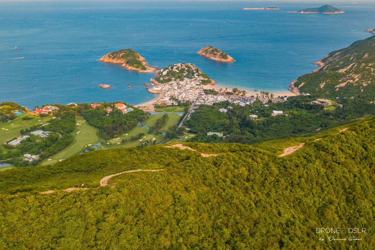
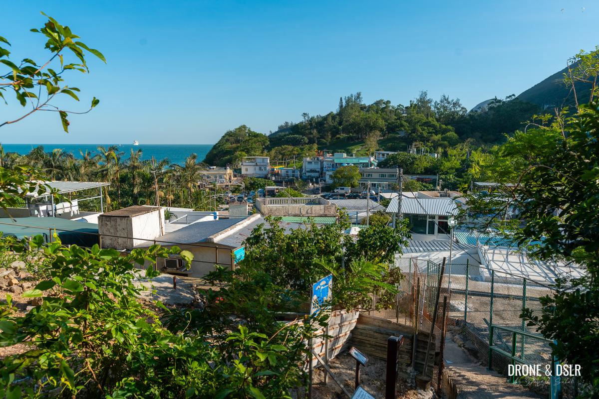
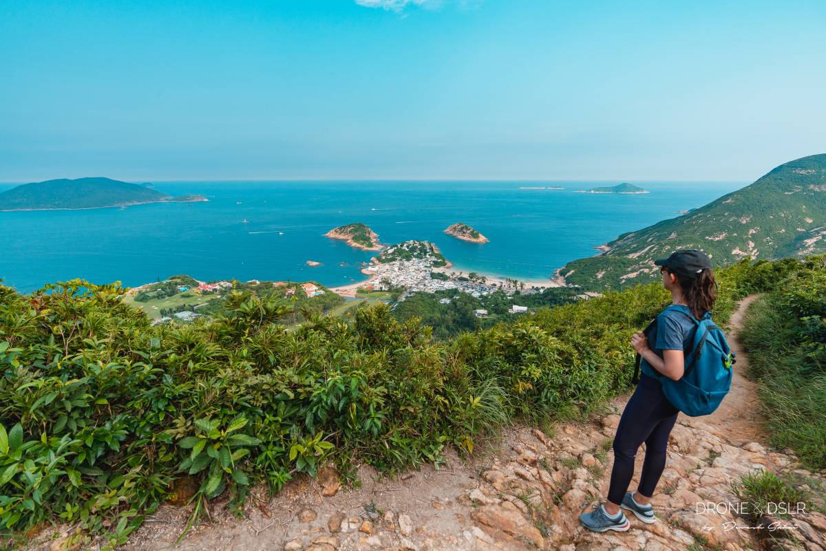
Situated in Shek O Country Park, at the top of the D’Aguilar Peninsula, Dragon’s Back offers hikers beautiful views of Tai Tam Bay on one side, and the South China Sea on the other. Additionally, the southeast coastline offers a bird’s eye view of Shek O, Big Wave Bay, and the Shek O Country Club.
Easy and scenic — no wonder Dragon’s Back Hike is so popular!
For many, the Dragon’s Back Hike is their induction to hiking in Hong Kong. It’s a great way to see Hong Kong’s natural beauty and go beyond the skyline right on Hong Kong Island.
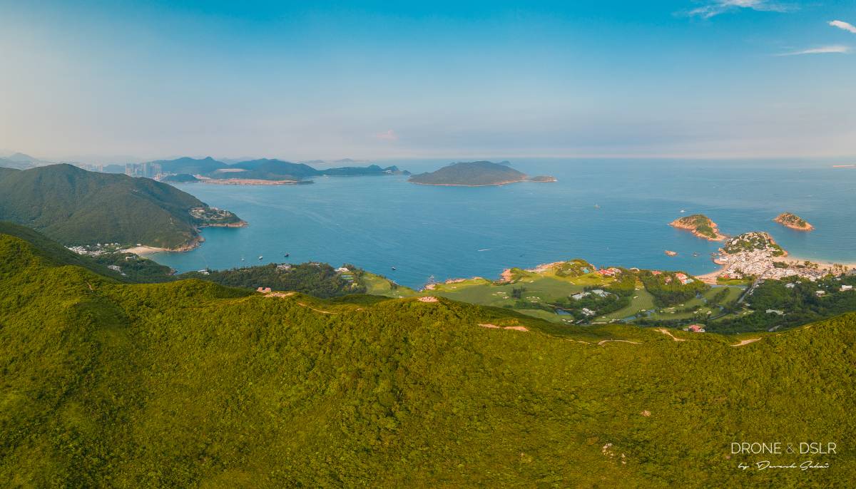
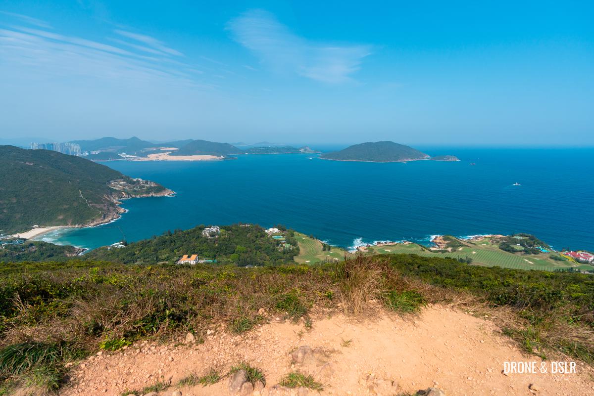
Bird’s eye view of Shek O on the right, and Big Wave Bay on the left with the undulating ridge of the Dragon’s Back in the foreground
So, if with that out of the way, let’s dive into our comprehensive hiking guide to the Dragon’s Back, which includes hiking route options, maps, photos, and all the necessary information to make your hike as enjoyable as possible!
About The Dragon’s Back Hike
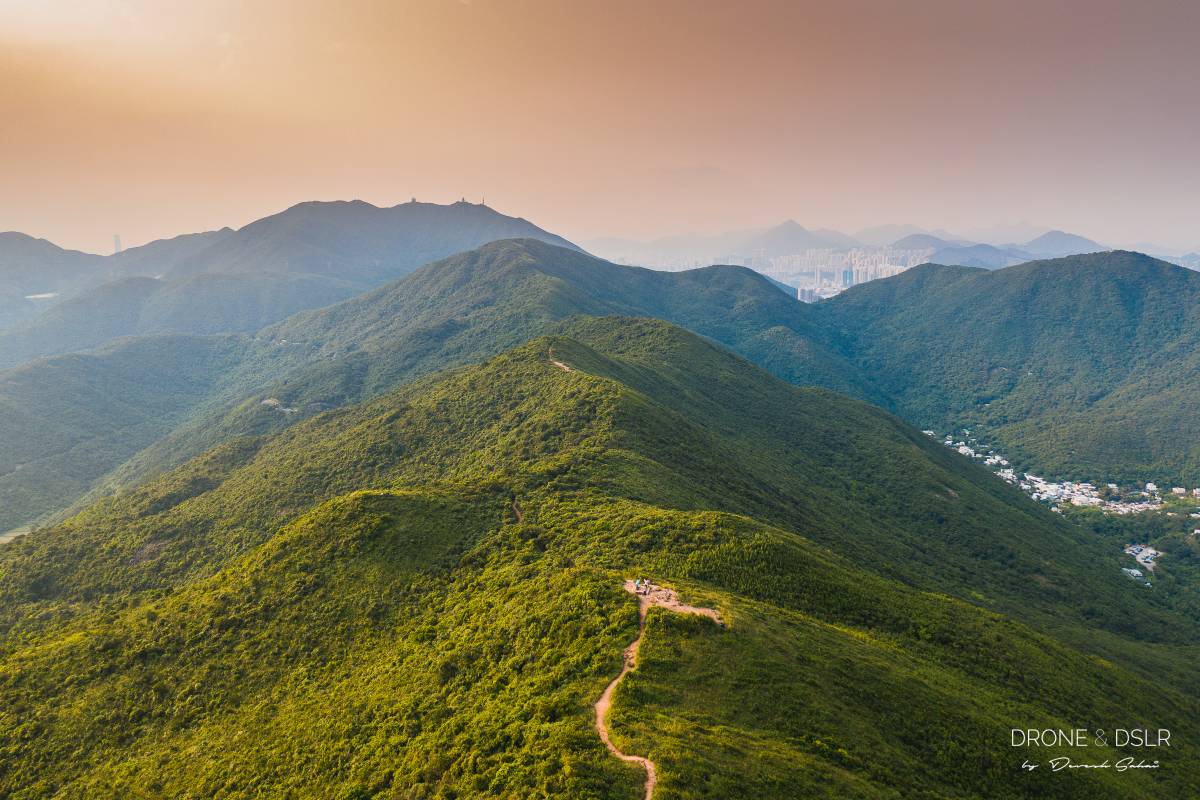
The Dragon’s Back gets its name from the rugged undulating spinal ridge (that resembles a dragon’s back) on which the trail lies. Although the hike is synonymous with Hong Kong Trail Section 8, the ridge only covers a short portion of the entire Section 8 (about 1.5 km of the 7.6 km).

Dragon’s Back is synonymous with Section 8 of the Hong Kong Trail
But this short section is what makes the Dragon’s Back so popular. Along the ridge, hikers are treated to stunning views of natural sights and man-made structures that lie on either side.
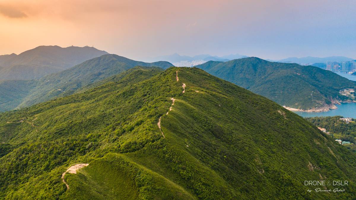
Dragon’s Back Hike running on top of the hill
And here’s a short video that showcases these amazing views.
Subscribe to my YouTube channelNext, let’s answer some other commonly asked questions about the Dragon’s Back.
How difficult is the Dragon’s Back Hike?
For many, the Dragon’s Back is their first hiking experience in Hong Kong, so it’s understandable to want to know how difficult the hike is.
The hike is relatively easy with fairly minimal climbing to reach the ridge. Once on the ridge, the undulating path is relatively straightforward with plenty of viewing points and stunning vistas all around.
The hike is relatively easy
Even getting to Shek O Peak (284 m), the highest point on the Dragon’s Back Hike, shouldn’t pose a challenge.
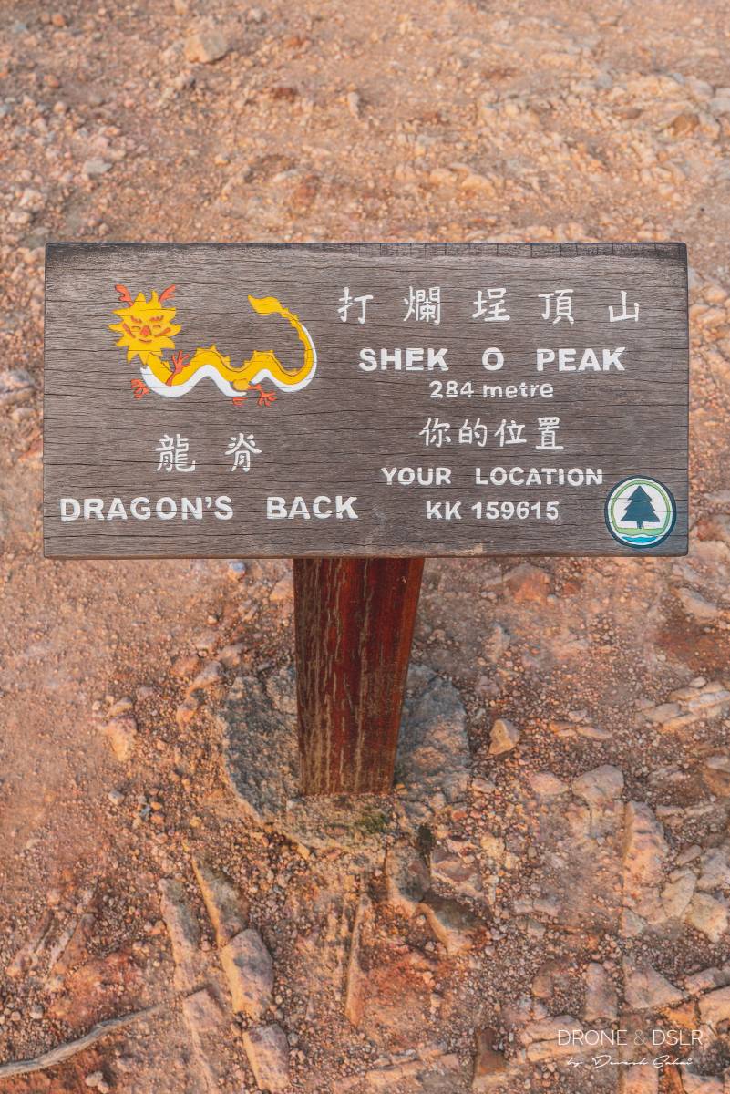
Shek O Peak, the highest point on the Dragon’s Back Hike
What’s the best time for the Dragon’s Back Hike?
The Dragon’s Back can be completed at any time of the day. However, the views are best suited for sunrise, as the ridge over great views to the east.
Alternatively, the views in the evening are equally beautiful as the sun is behind you when you look eastwards.
The sun slowly sets on the Dragon’s Back
However, personally I enjoy completing the hike in the morning and finishing at either one of the beaches in time for lunch.
And speaking of ending the hike, let’s touch upon this topic.
Three Hiking Route Options
Most hikers who choose to hike the Dragon’s Back do not intend to complete the entire Section 8 of the Hong Kong Trail. Fortunately, there are several route options available to enjoy and complete the hike, each offering a unique way to finish while providing the spectacular views the Dragon’s Back is famous for.
In this guide, we will discuss three different route options for the Dragon’s Back Hike. Based on how you plan your day, you can select the best option to conclude your hike.
Exit 1 — Return to the starting point from Shek O Peak (3.2 km)
This option is perfect for those who wish to end their hike at Shek O Beach. Maybe grab a drink and enjoy a meal at one of the many restaurants in the village.
It involves hiking to the Dragon’s Back Viewing Point, and then returning to the starting point to catch a bus to Shek O.
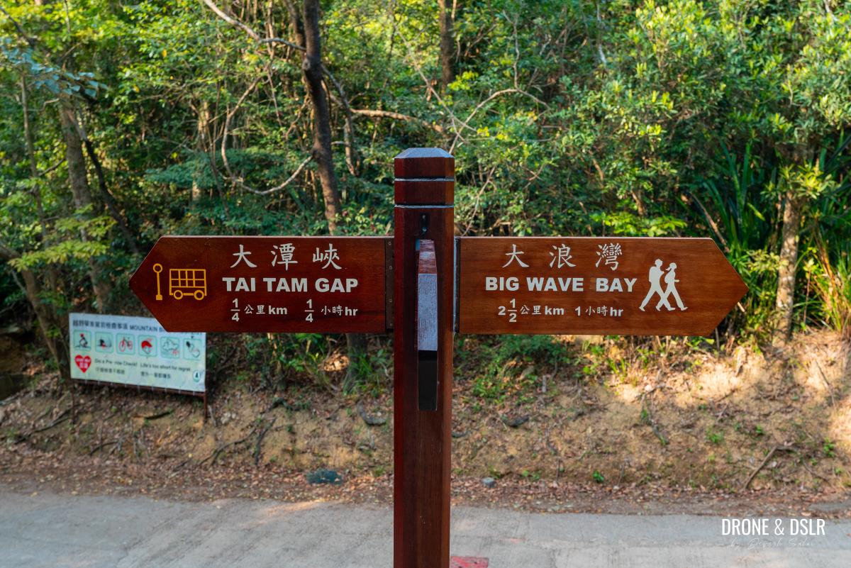
Exit 2 — Finish at Tai Tam Gap (4.9 km)
This option is perfect for those who wish to return to the city after the hike.
It involves completing the entire ridge, and then exiting at Tai Tam Gap.
Exit 3 — Finish at Big Wave Bay (7.6 km)
This is the longest route and also completes Section 8 of the Hong Kong Trail.
It is ideal for those who want to finish the hike at Big Wave Bay instead of Shek O. The path continues from Tai Tam Gap toward the Mount Pottinger Catchwater. From there, the trail descends along Hong Kong Trail Section 8 and terminates at Big Wave Bay.
I will bring these exit options up at the appropriate locations in the guide below, but for now let’s find out where to start your Dragon’s Back Hike.
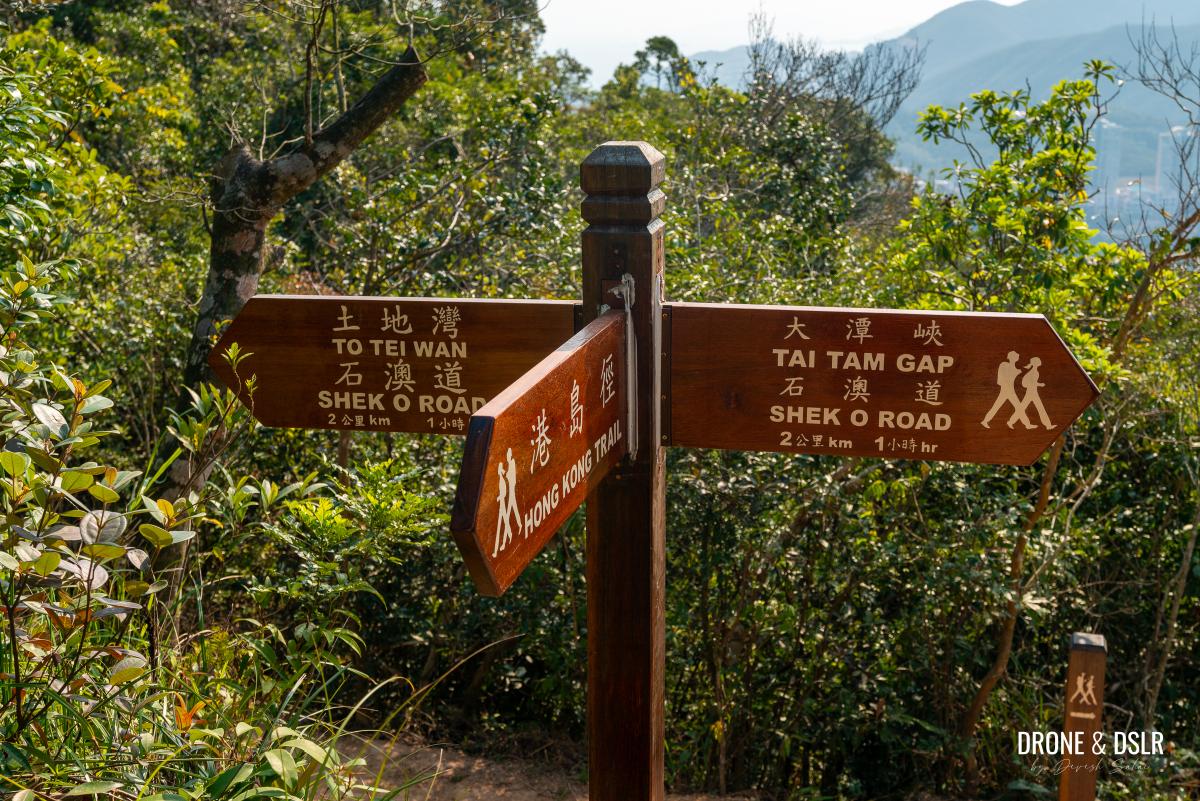
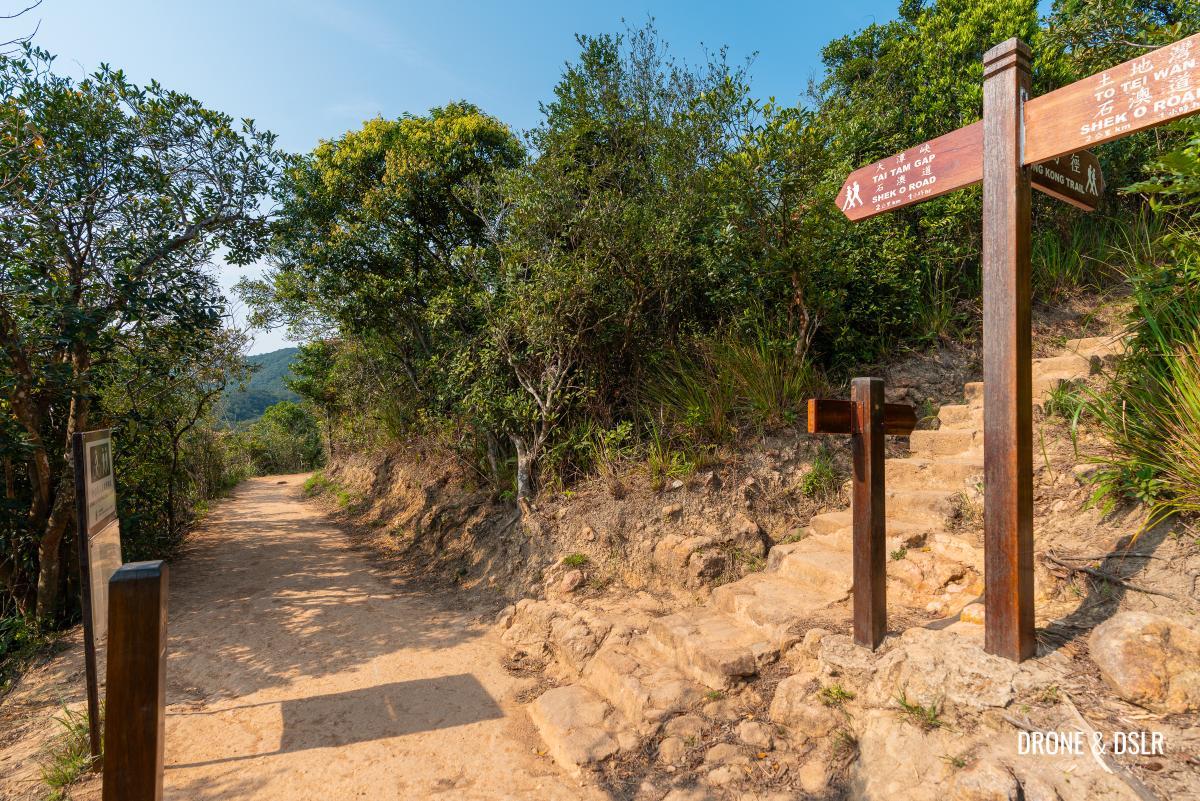
To Tei Wan — The Starting Point for Dragon’s Back Hike
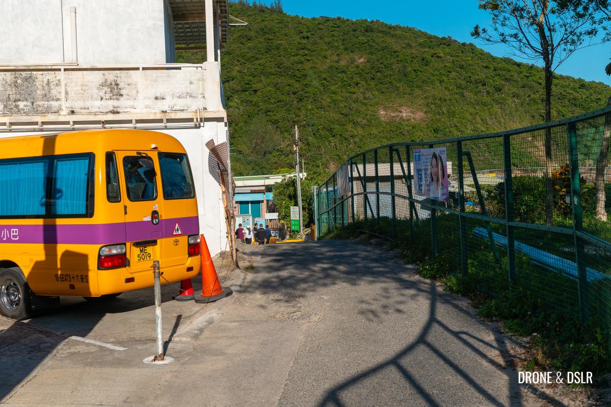
The Dragon’s Back Hike starts from the To Tei Wan bus stop on Shek O Road. This is point where Sections 7 and 8 of the Hong Kong Trail meet, and there are a couple of options to get there.
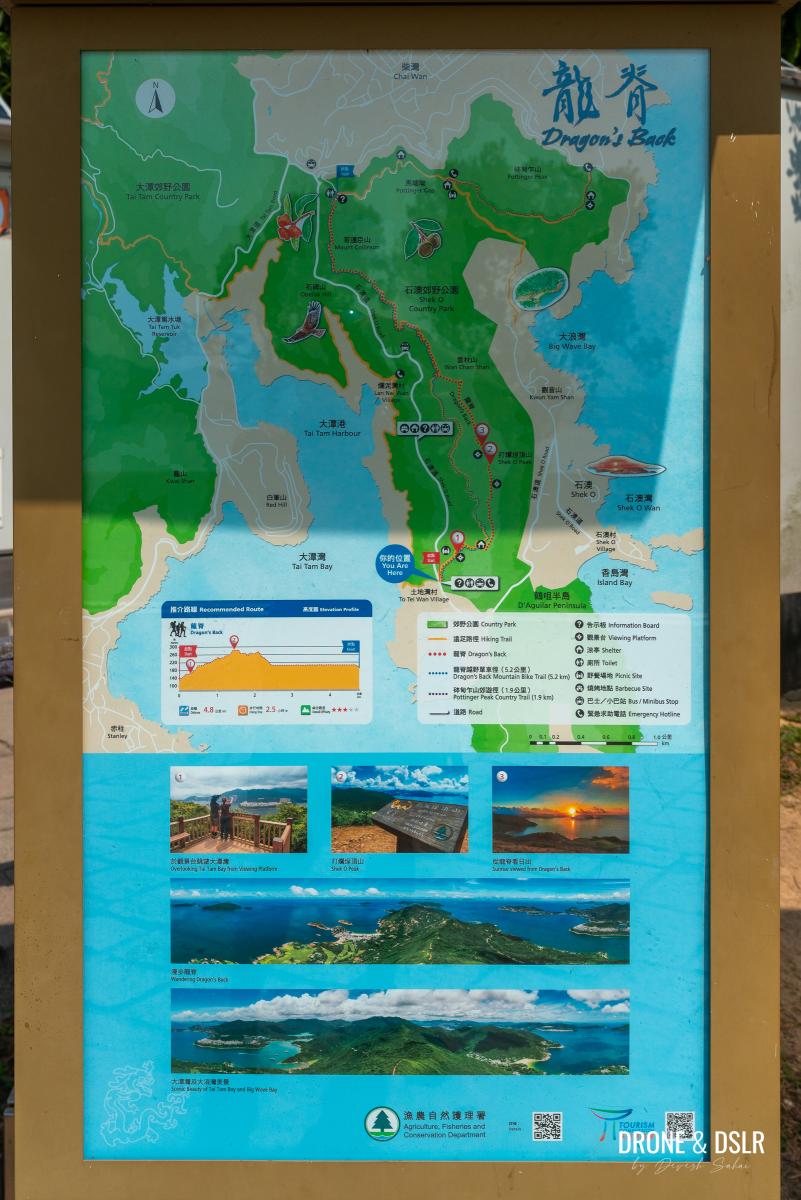
The map of Dragon’s Back and Hong Kong Trail Section 8
The simplest is to take the Island Line to Shau Kei Wan MTR station.
- At the MTR station, take Exit A3 and look for bus number 9 to Shek O at the Shau Kei Wan Bus Terminus.
- Hop onto the bus and wait for your stop “To Tei Wan, Dragon’s Back”, about 11 stops. Keep an eye on the name of the stop in the bus, or watch for other hikers alighting together. Thankfully, the bus added “Dragon’s Back” to the name of the stop.
- Once you alight at To Tei Wan, it’s hard to miss the sign for the Dragon’s Back.
You can alternatively take the red minibus from Exit A2 at Shau Kei Wan MTR station. Make sure you request the driver to stop when To Tei Wan approaches. (If it’s your first time, we recommend taking bus number 9 as it displays the names of the stops).
And of course, it’s always possible to take a taxi to the starting point if you’re in a big group.
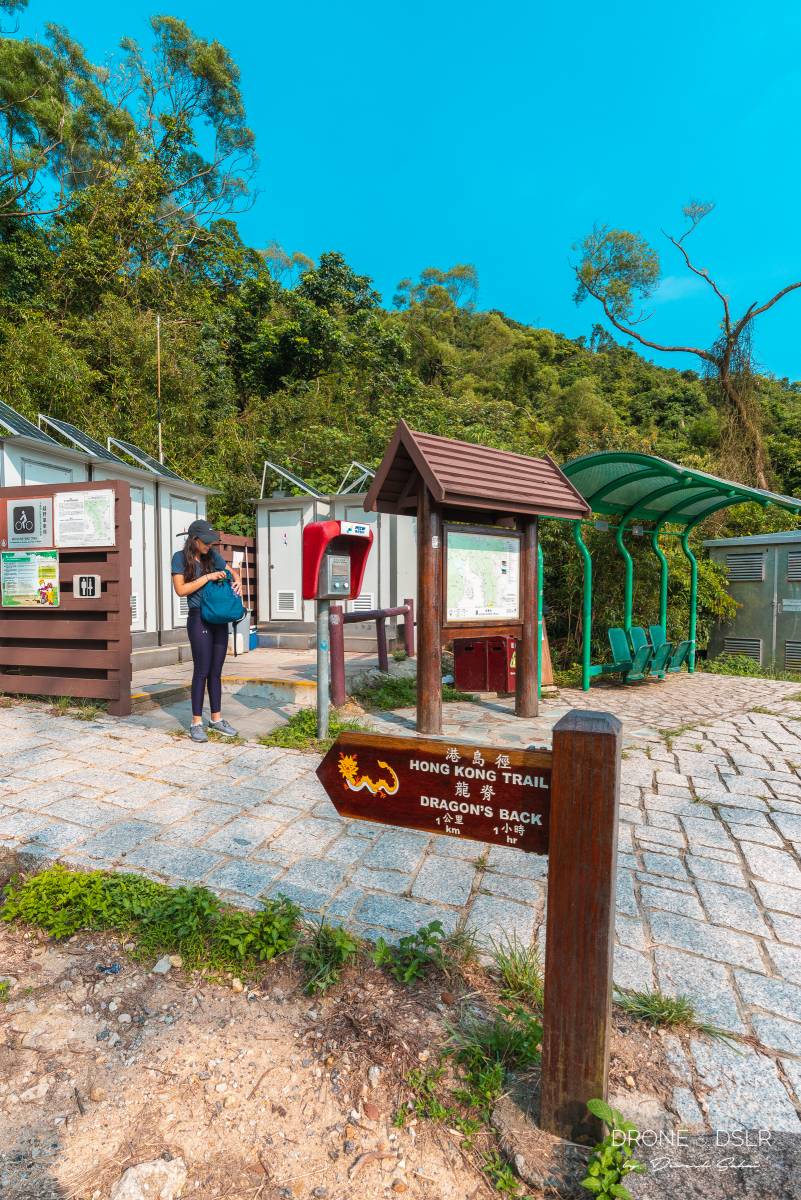
The starting point for the Dragon’s Back Hike at To Tei Wan
Once you arrive at the starting point, it’s time to start hiking the Dragon’s Back.
Starting Point To The Tai Tam Bay Viewing Platform
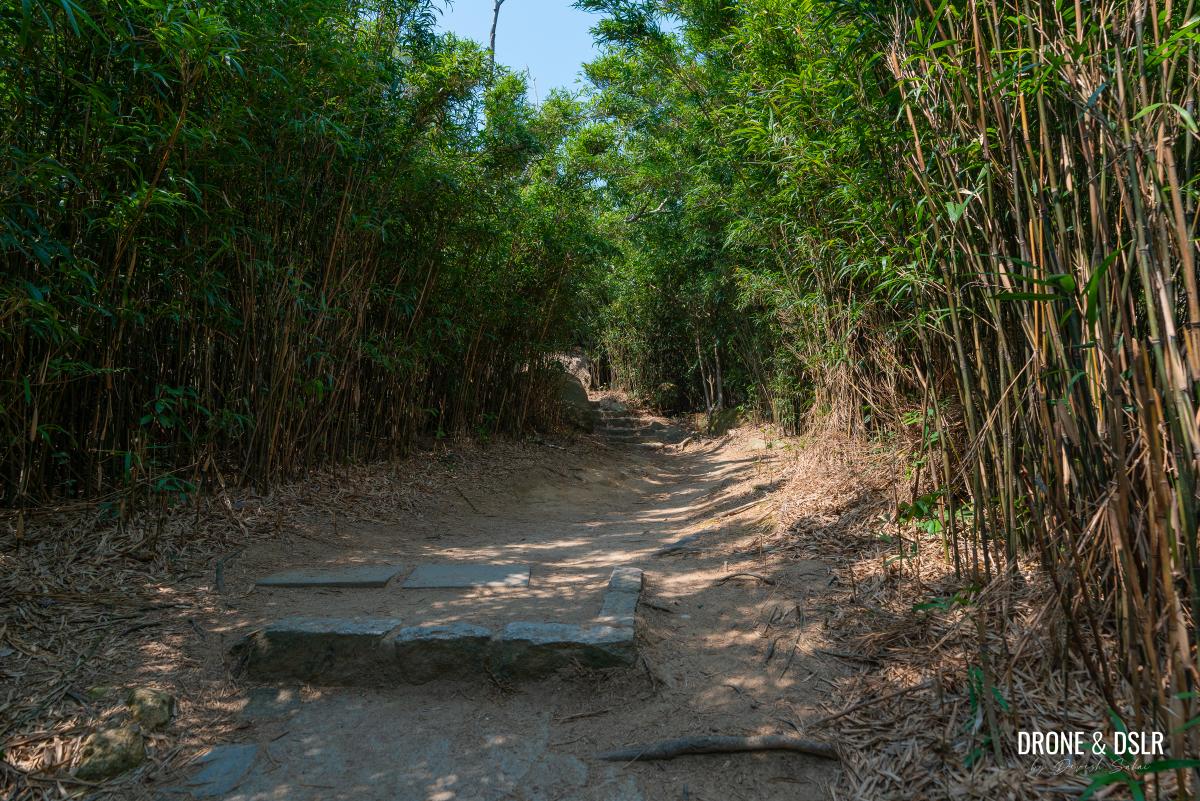
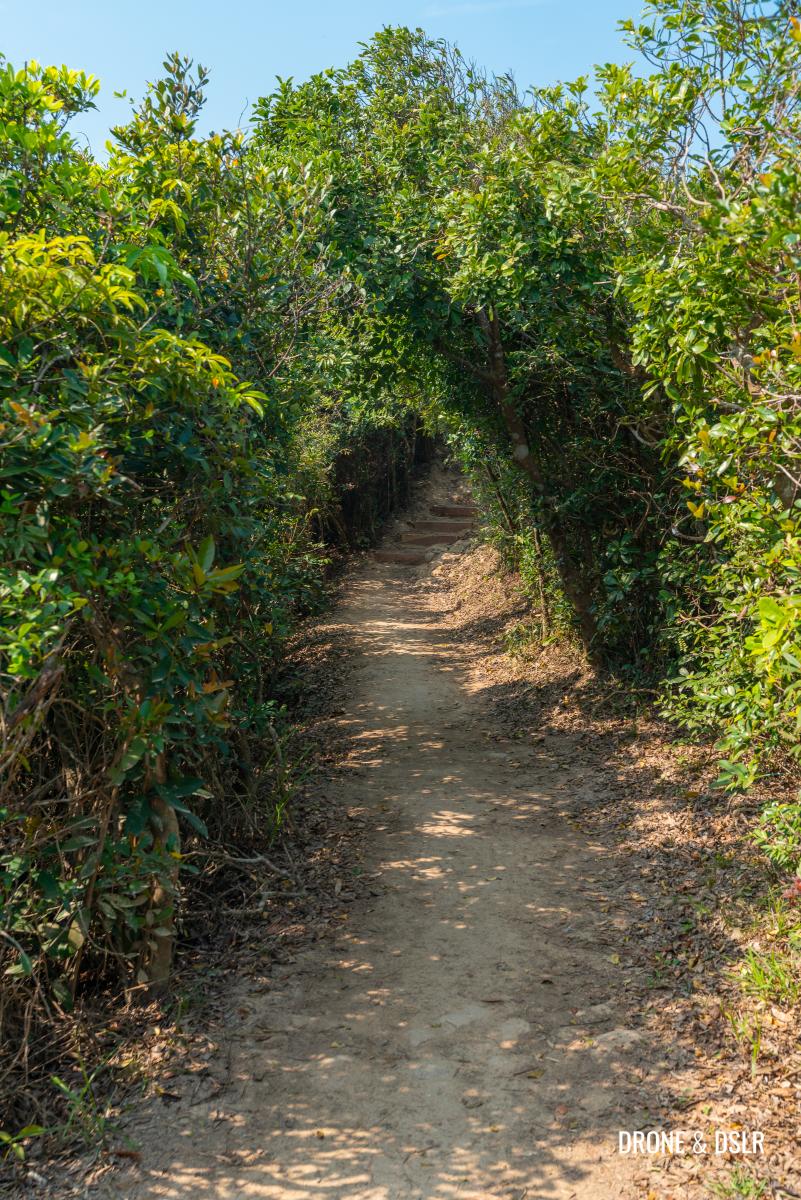
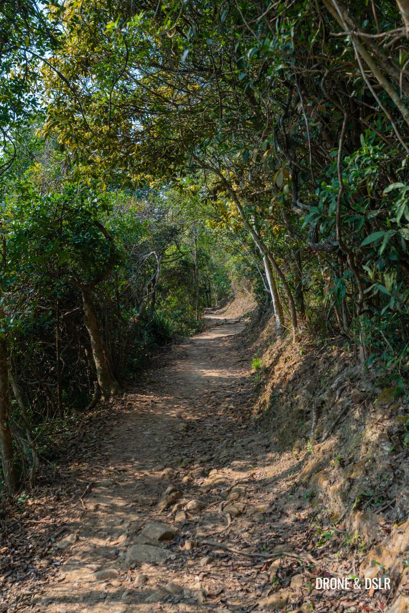
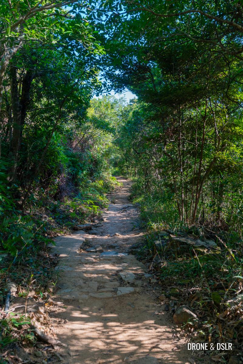
The Dragon’s Back trail begins gently, with a mix of easy steps and mild inclines that will give you a sense of what to expect in terms of difficulty throughout the hike.
-

- The trail starts off gently
-
- Easy steps as you begin the Dragon’s Back Hike
After about 250 metres of hiking, you’ll arrive at a diversion for small picnic site, with views of Tai Tam Bay. I usually skip this spot since there are much better views ahead.
-
- The trail flattens after a short climb
-
- The diversion to the picnic site. My recommendation is to keep going straight
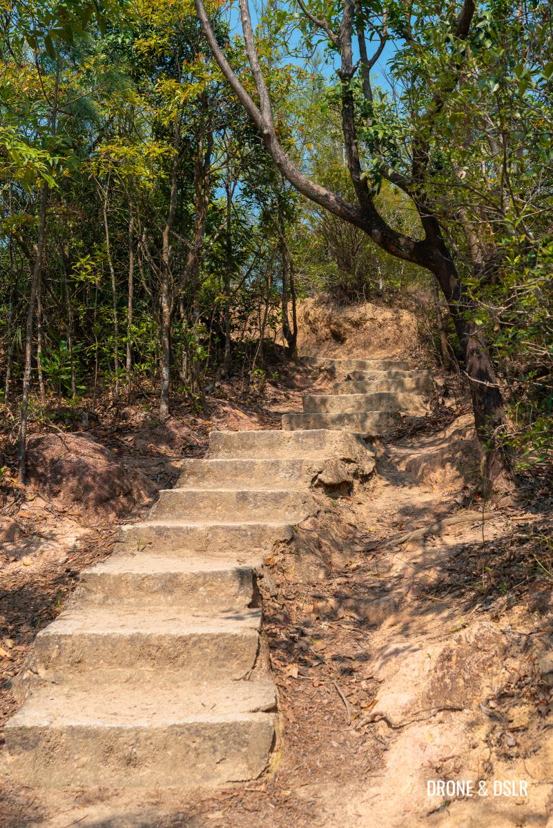
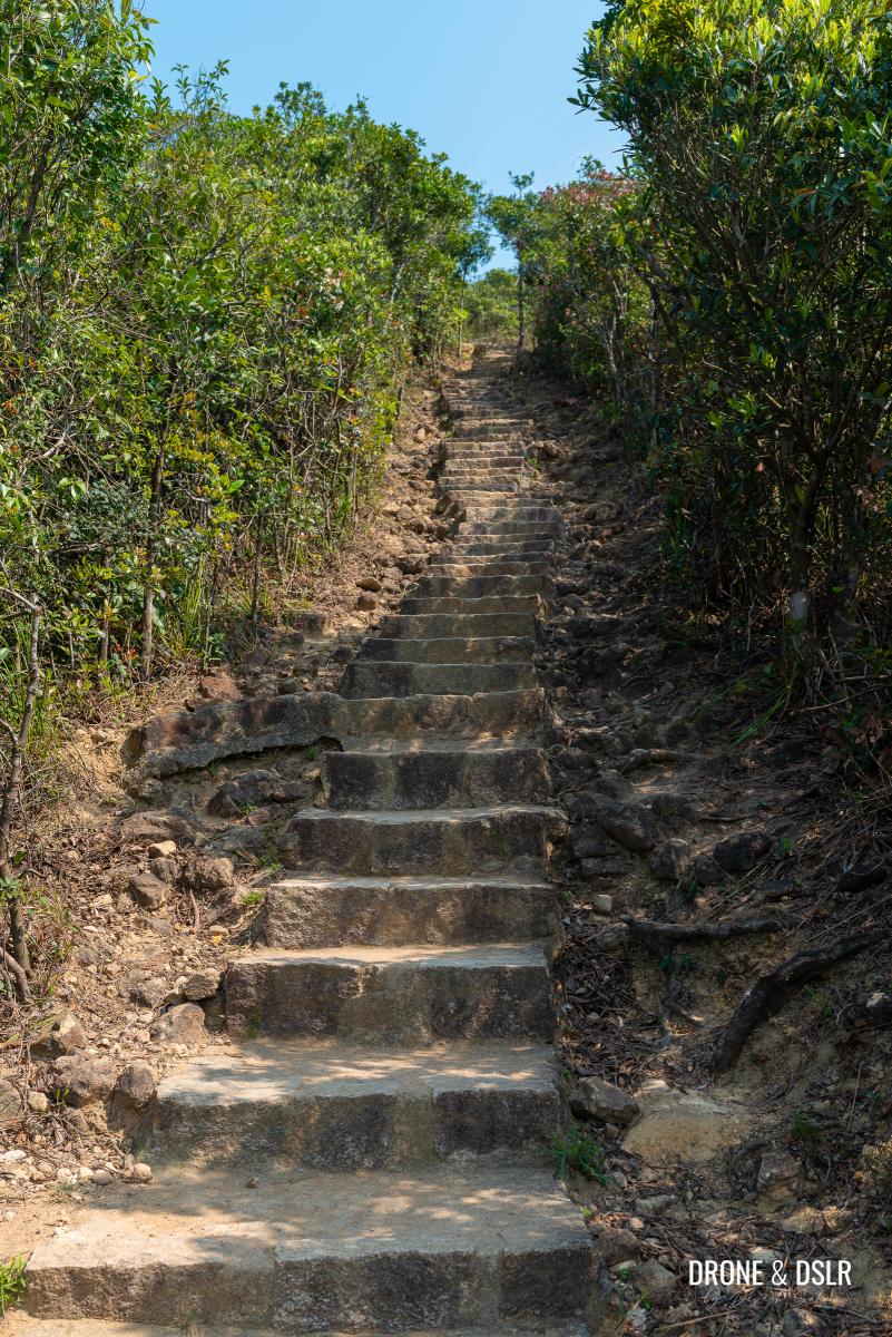
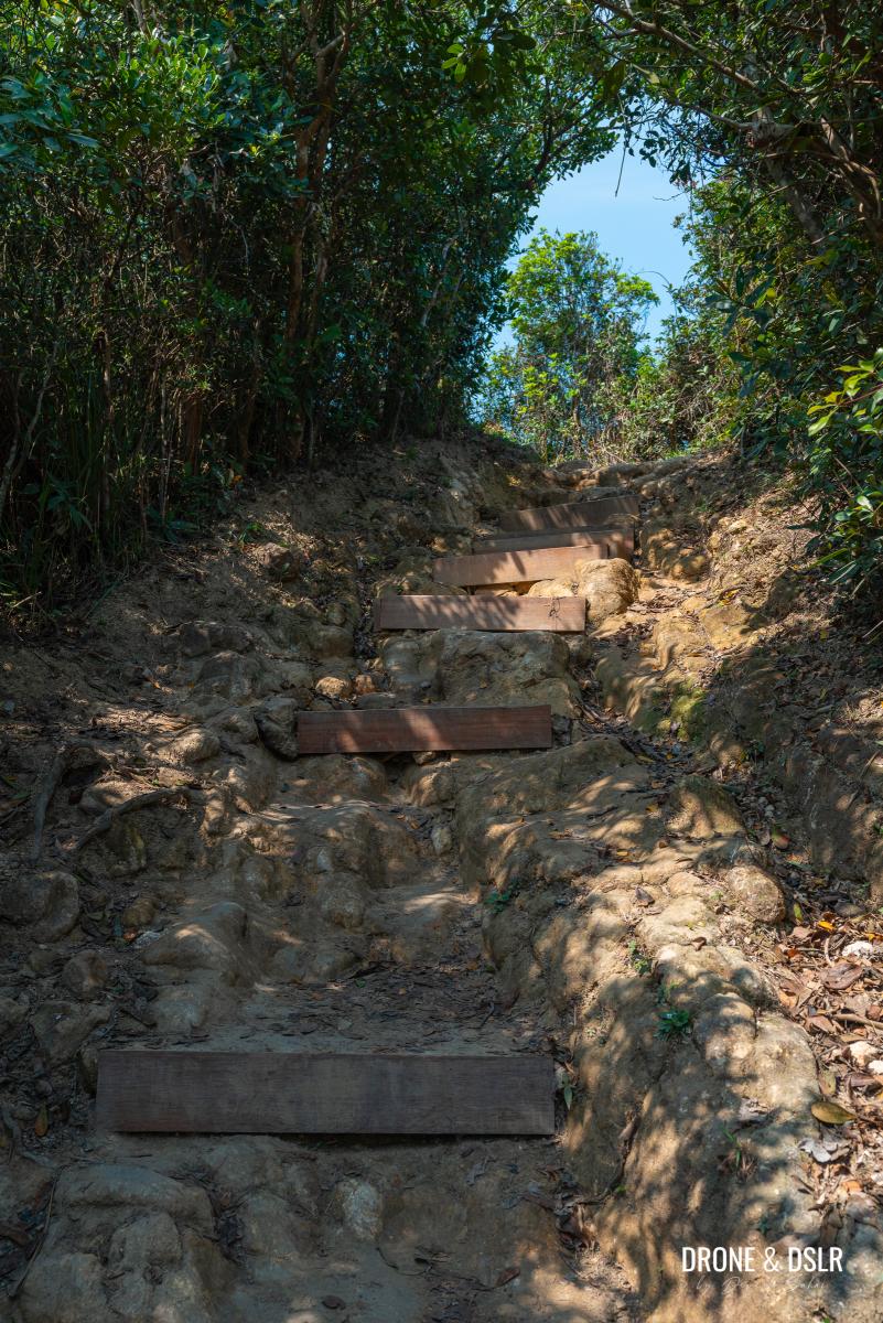
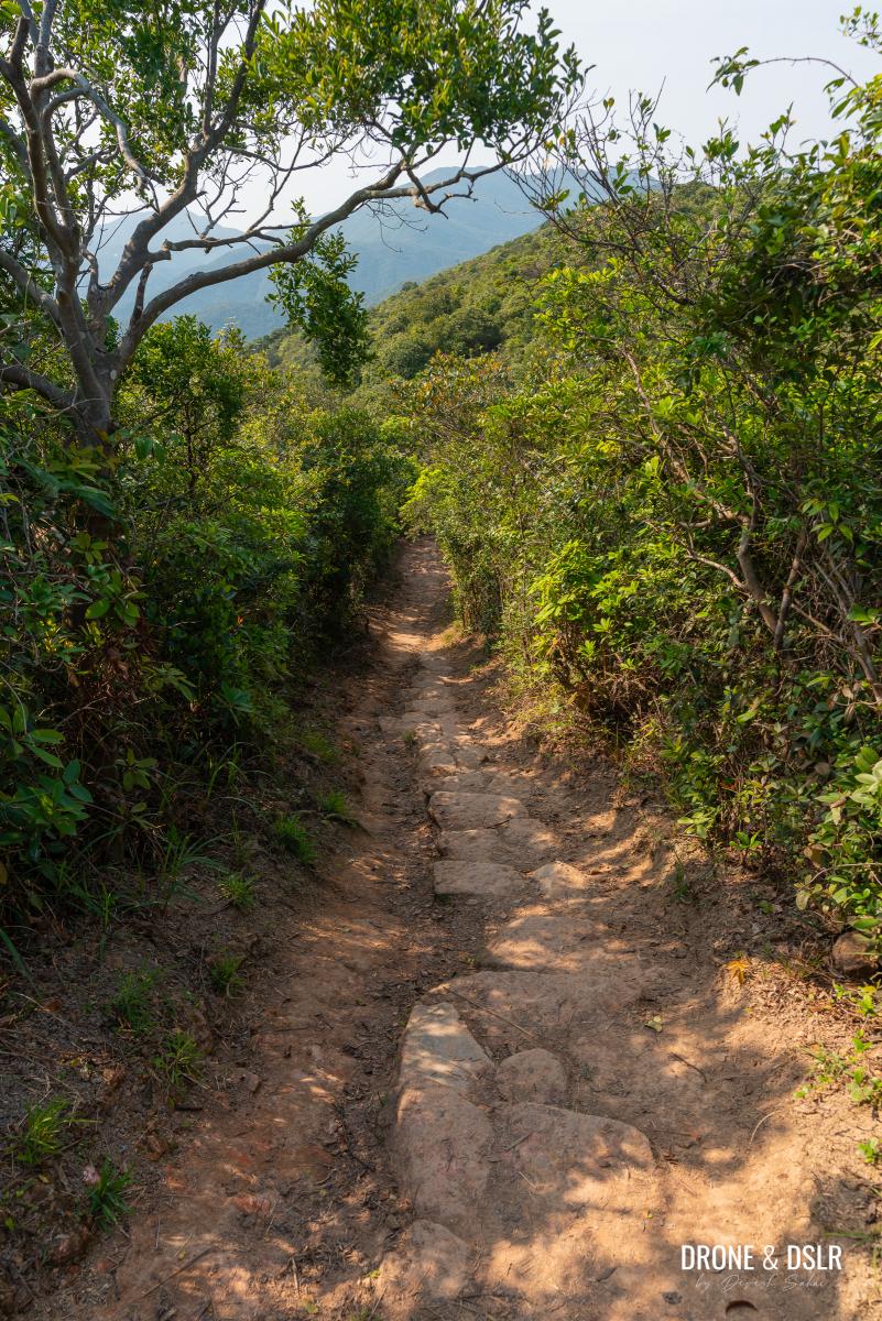
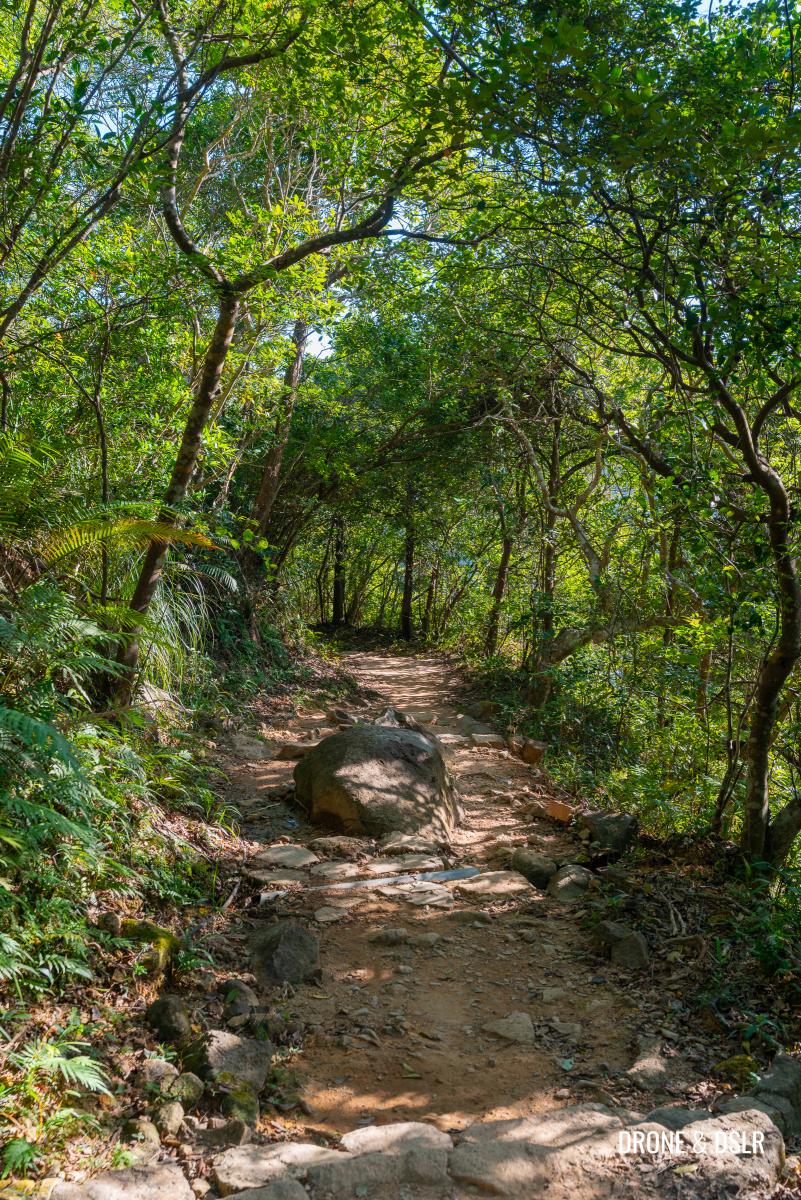
Beyond the diversion, you’ll face your first relatively long flight of steps. After this, the trail flattens out for a short section before another long flight of steps appears.
-
- The first challenging flight of steps
-
- Trail eases out after the steps
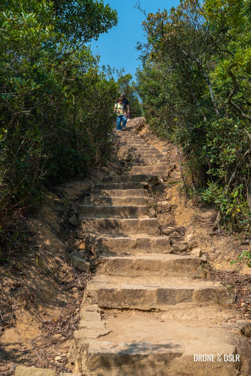
This second set is tougher than the first, and oddly enough, I believe it’s the most challenging part of the Dragon’s Back Hike.
Probably the toughest section on this hike
At the top of steps, the trail continues to the left. However, if you’d like to take a quick break, there’s a viewing platform, overlooking Tai Tam Bay, to the right featuring the name of the hike—definitely a great photo opportunity!
-
- At the top of the steps, turn right for a viewing platform
-
- Views from the Tai Tam Bay Viewing Platform
To The Start Of The Dragon’s Back — Let The Views Begin!
Once you’ve finished admiring the views of Tai Tam, return to the trail and continue walking as it levels out into a gentle stroll.
Return to the Hong Kong Trail after the viewing platform
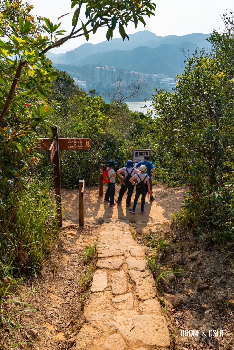
Approximately 150 metres ahead is a pavilion next to which, the trail splits. To stay on the Dragon’s Back Hike, turn right and follow the gentle steps leading uphill.
-
- At this junction, turn right and walk up the steps
-
- Take these easy steps to the start of the Dragon’s Back
The steps emerge at the spinal ridge, the point that marks the trail’s most spectacular section and the start of the Dragon’s Back!
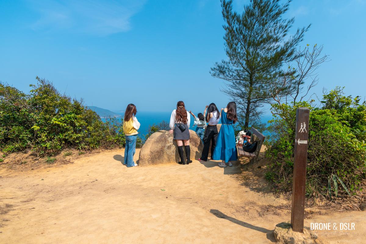
The viewing area at the start of the Dragon’s Back Hike
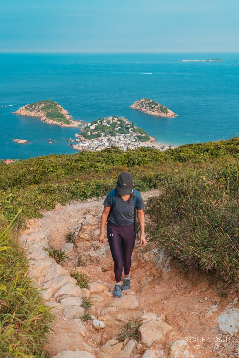
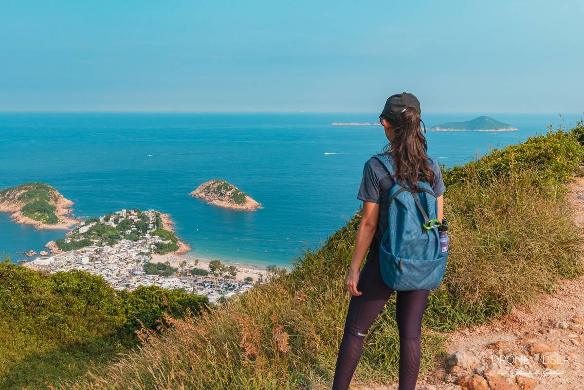
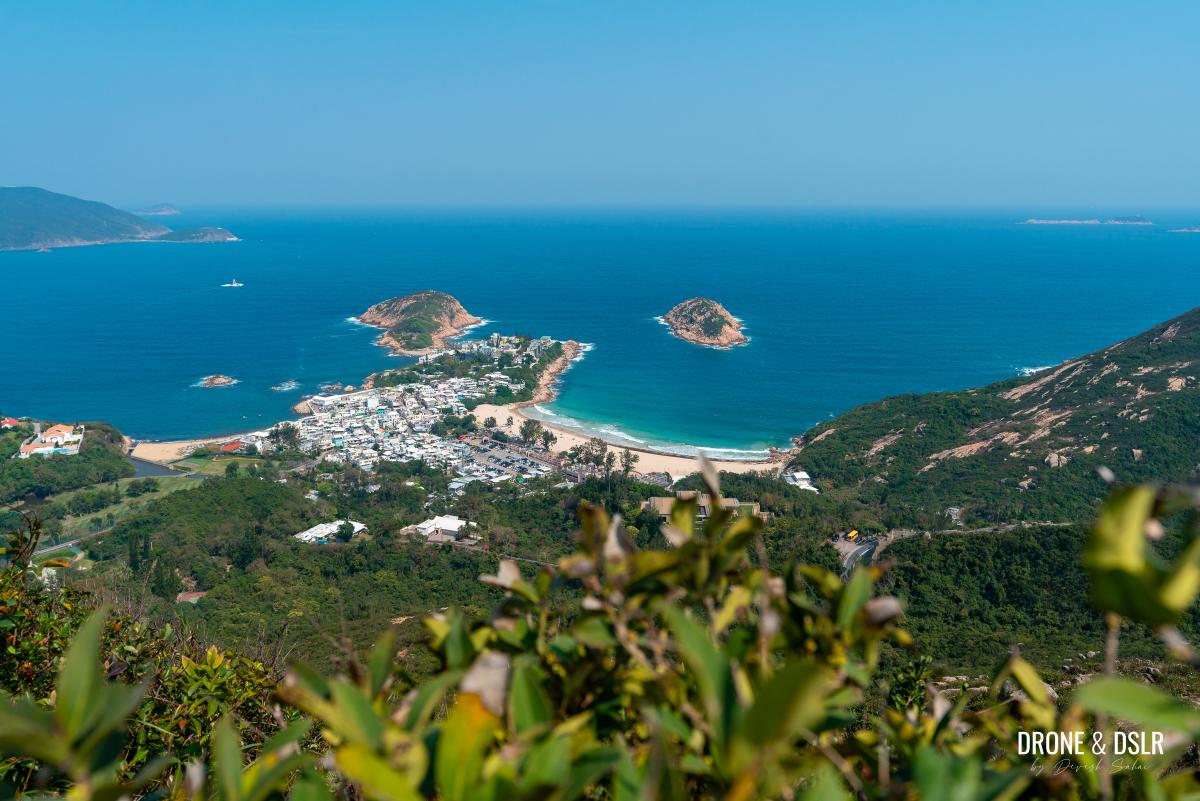
Here, you’ll get your first glimpse of the stunning landscapes below, including Shek O Beach, Shek O Country Club, and the South China Sea. On a clear day, the views are absolutely breathtaking and inviting!
The lookout point at the start of Dragon’s Back Hike
While the trail continues to the left, you’ll notice an area of exposed rocks to the right. If you’re feeling adventurous, you can scramble up this rock face for even better views.
-
- You can climb up this rock face for better views of Shek O
-
- Once you reach the Dragon’s Back ridge, turn right and walk towards the rocky area for a superb view of Shek O Beach
To Shek O Peak
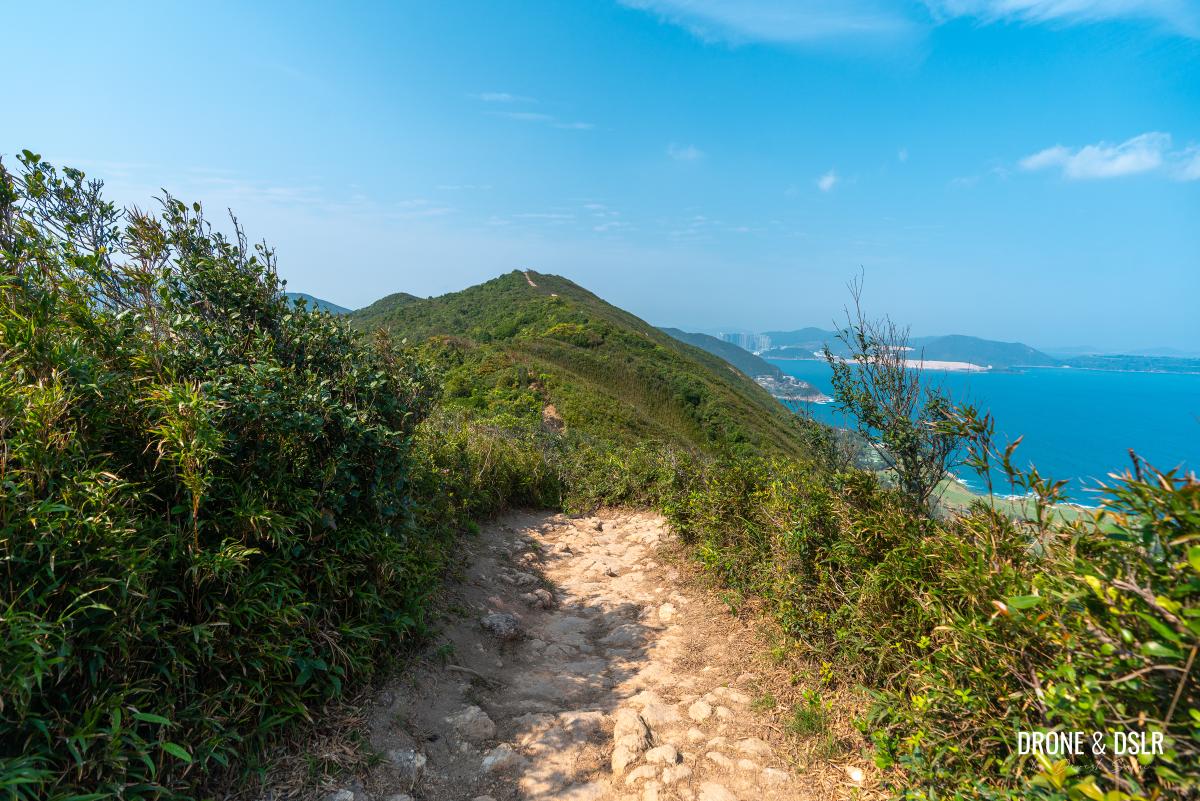
From this point on, the Dragon’s Back Hike truly delivers on its promise of stunning views across an undulating spinal ridge.
-
- Kicking off the Dragon’s Back Hike with these views

-
- The Dragon’s Back trail with Shek O in the background
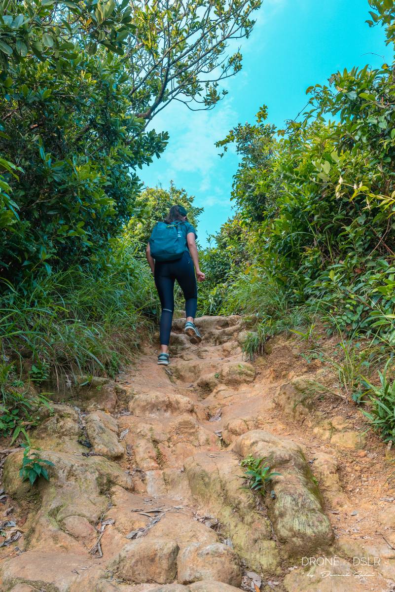
As you hike, it’s hard to resist stopping every few metres to capture the scenery. And while the trail remains easy, it is undulating, with a few bumpy sections that shouldn’t pose any problems.
-
- The views disappear for while
-
- Stop by and enjoy the views along the hike
-
- The trail isn’t always smooth
-
- Views of Shek O and the South China Sea from the Dragon’s Back Hike
As you progress, the trail plays a game of hide-and-seek with the views, frequently concealing them with vegetation before revealing them again.
-
- The undulating ridge does mean some climbing occasionally
-
- Stunning views of the Shek O Country Club from Dragon’s Back Hike
-
- The Dragon’s Back plays hide and seek with the views
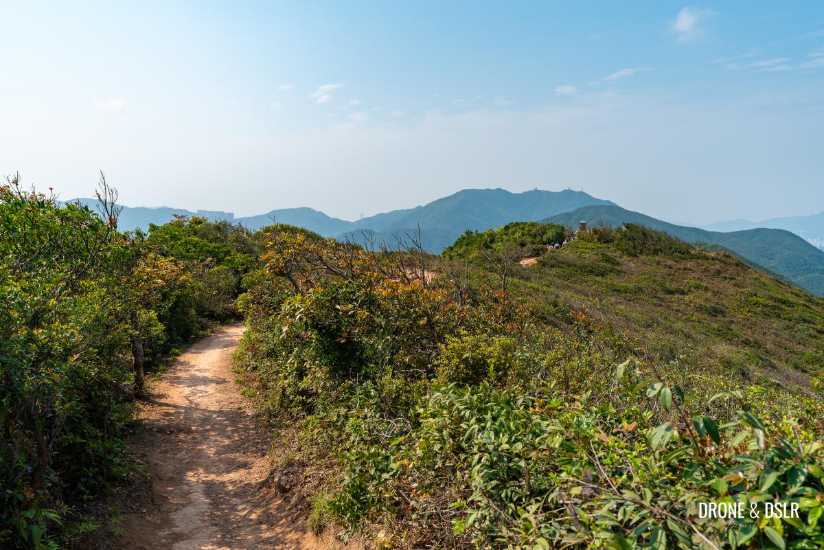
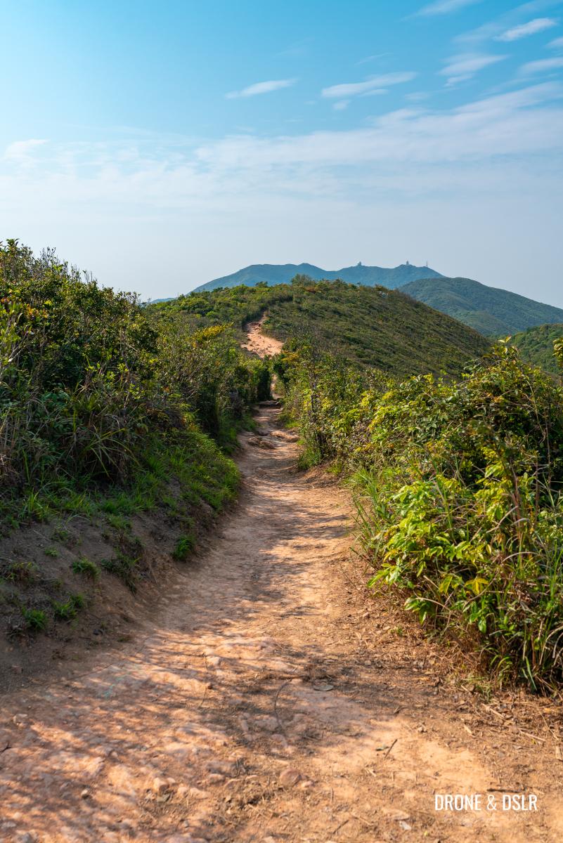
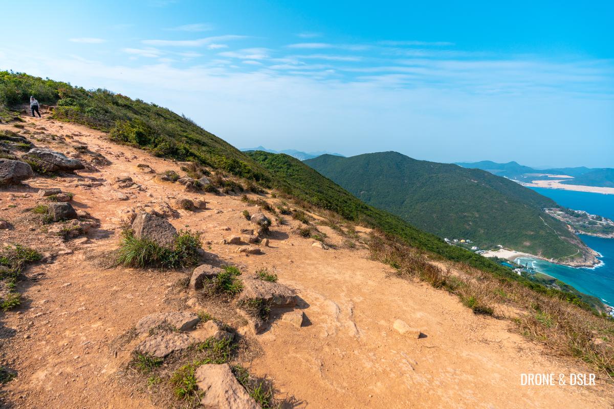
There are spots where you can admire the undulating path framed by lush hills and the sea. Keep an eye out for Shek O Peak, the highest point, visible straight ahead.
-
- Admiring the beautiful Dragon’s Back Hike
-
- A nice open space on the ridgeline
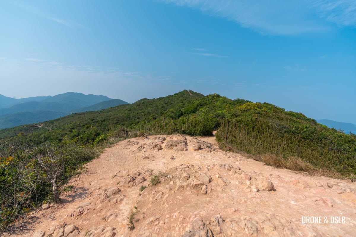
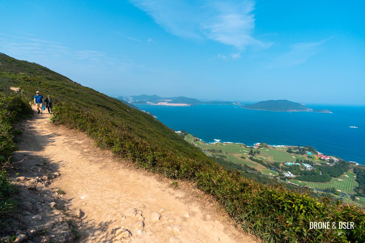
Keep enjoying the views of the sea, beaches, and golf course as you make your way to Shek O Peak.
-
- The views are a good distraction from the trail
-
- The Dragon’s Back Hike offers these stunning views from its undulating ridge
-
- Look out for another viewing platform just before Shek O Peak
Just before the final incline, you’ll find another viewing platform offering breathtaking views of Shek O Village, the beach, and the country club in one stunning frame.
-
- Enter the viewing platform
-
- What incredible views of Shek O below!
After taking in the views, simply follow the steps up the final ascent that leads you to Shek O Peak.
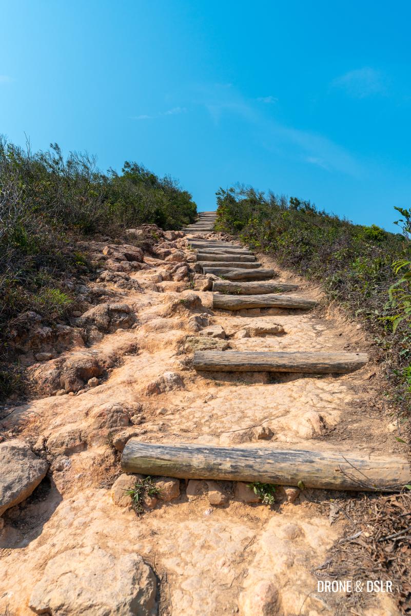
The final ascent to Shek O Peak
The Highest Point On The Dragon’s Back
At 284 metres above sea level, Shek O Peak is the highest point on the Dragon’s Back Hike.
-
- Made it to the highest point on the Dragon’s Back Hike
-
- Shek O Peak (284 m)
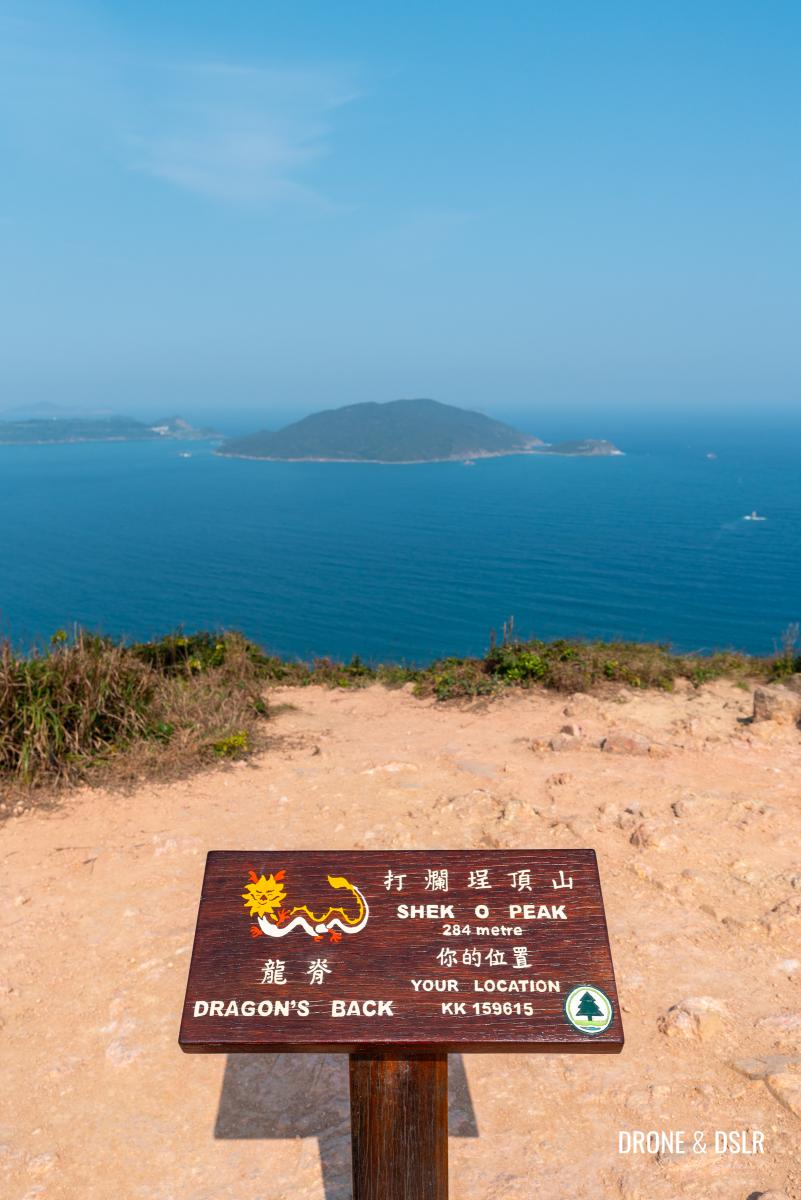
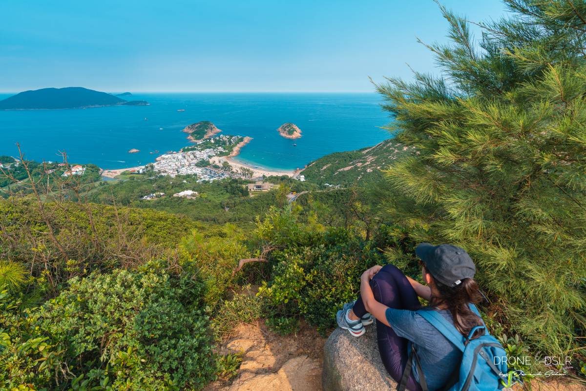
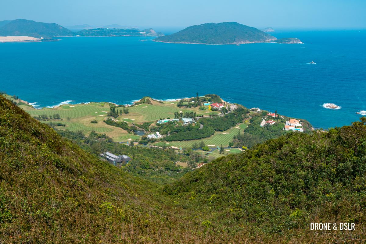
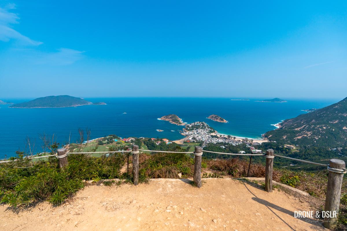
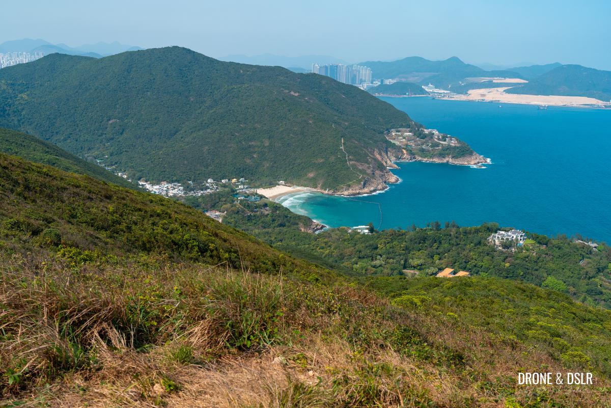
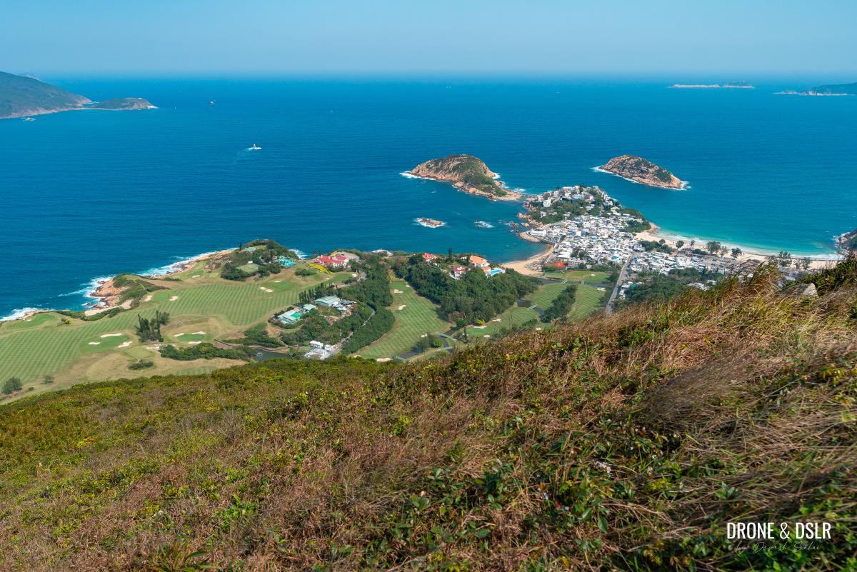
The peak itself is a relatively large, plateaued hilltop that offers panoramic views of Shek O Beach, Shek O Country Club, Big Wave Bay Beach, and beyond.
-
- Views of Big Wave Bay from Shek O Peak
-
- Shek O Peak — The highest point on Dragon’s Back Hike
-
- Views of Shek O from Shek O Peak
As one of the shorter hills in Hong Kong, Shek O Peak offers an impressive effort-to-views ratio, which contributes to the popularity of the Dragon’s Back Hike!

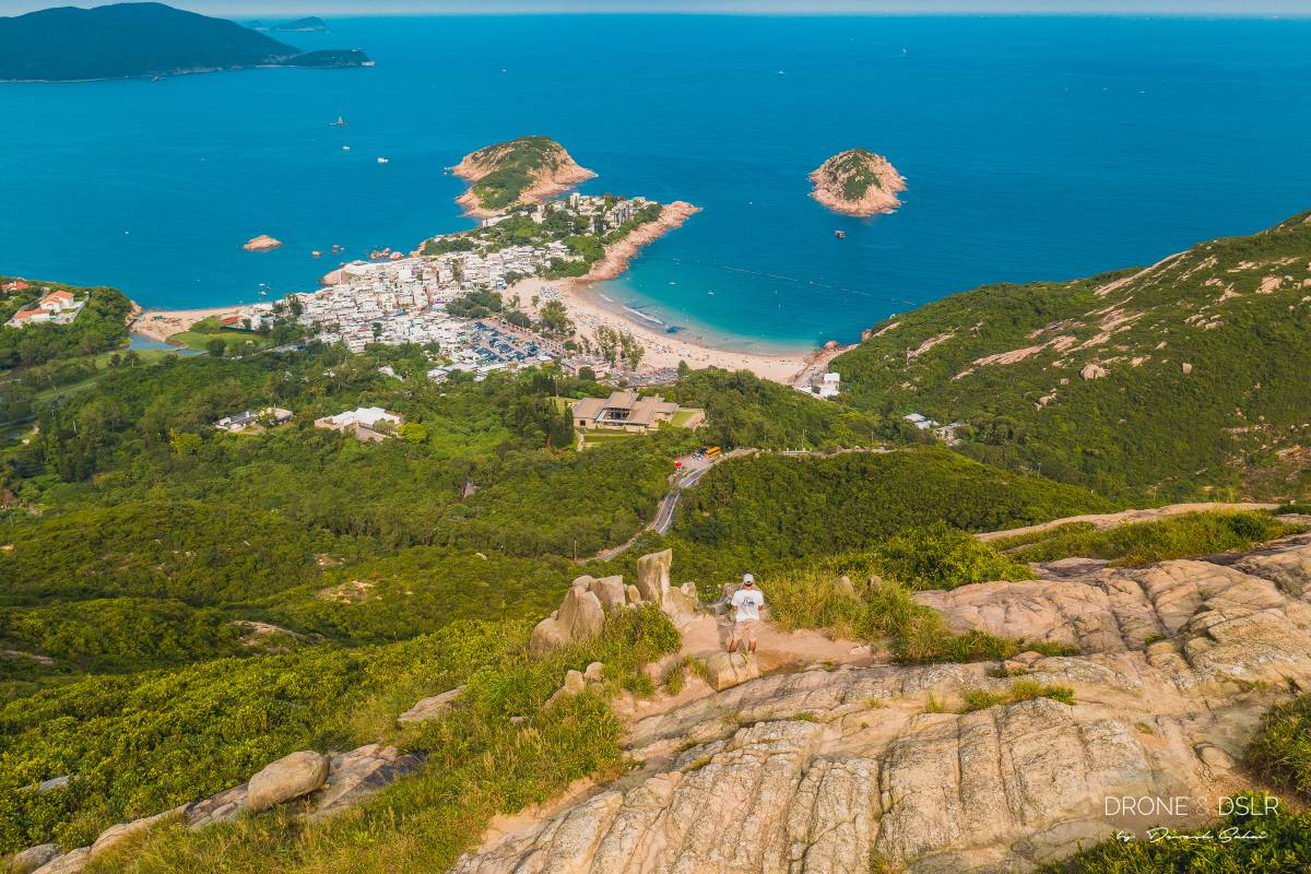
Aerial view of Shek O Peak with Shek O Golf Course below
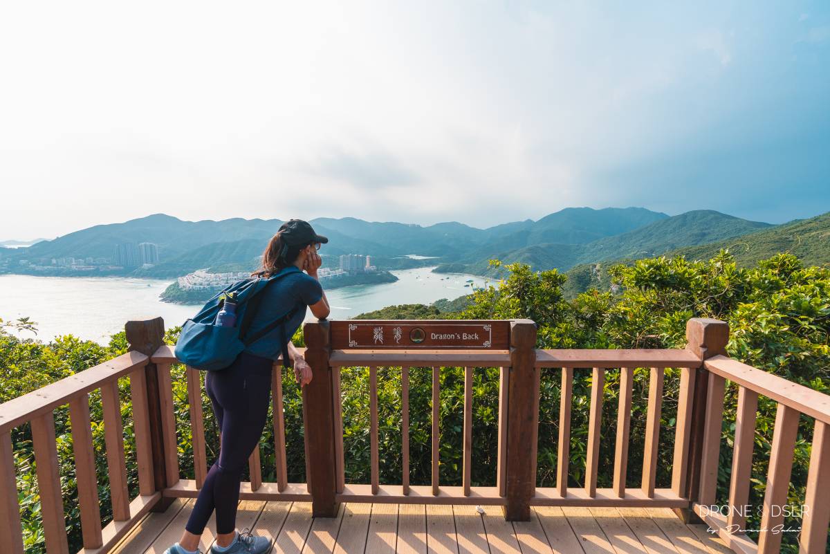
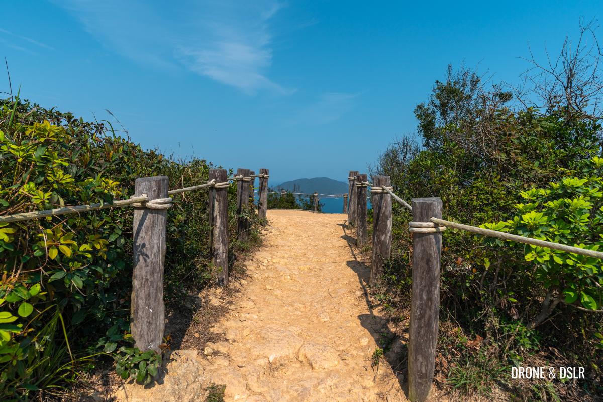
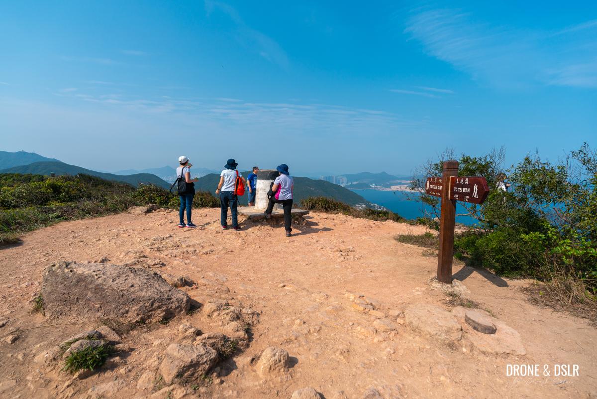
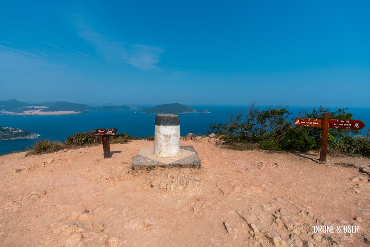
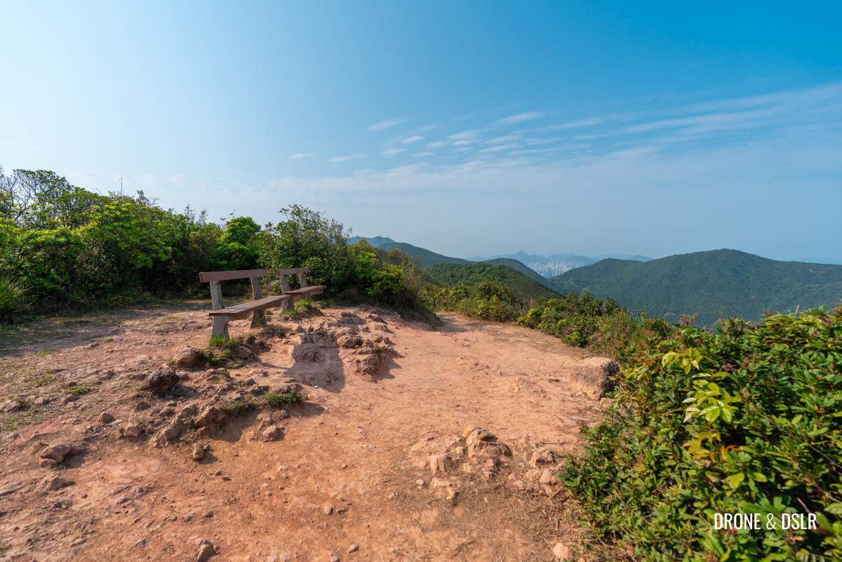
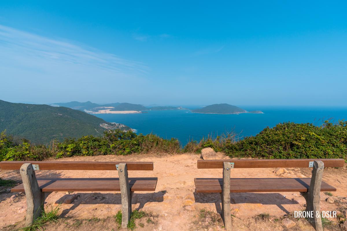
The Dragon’s Back Viewing Point
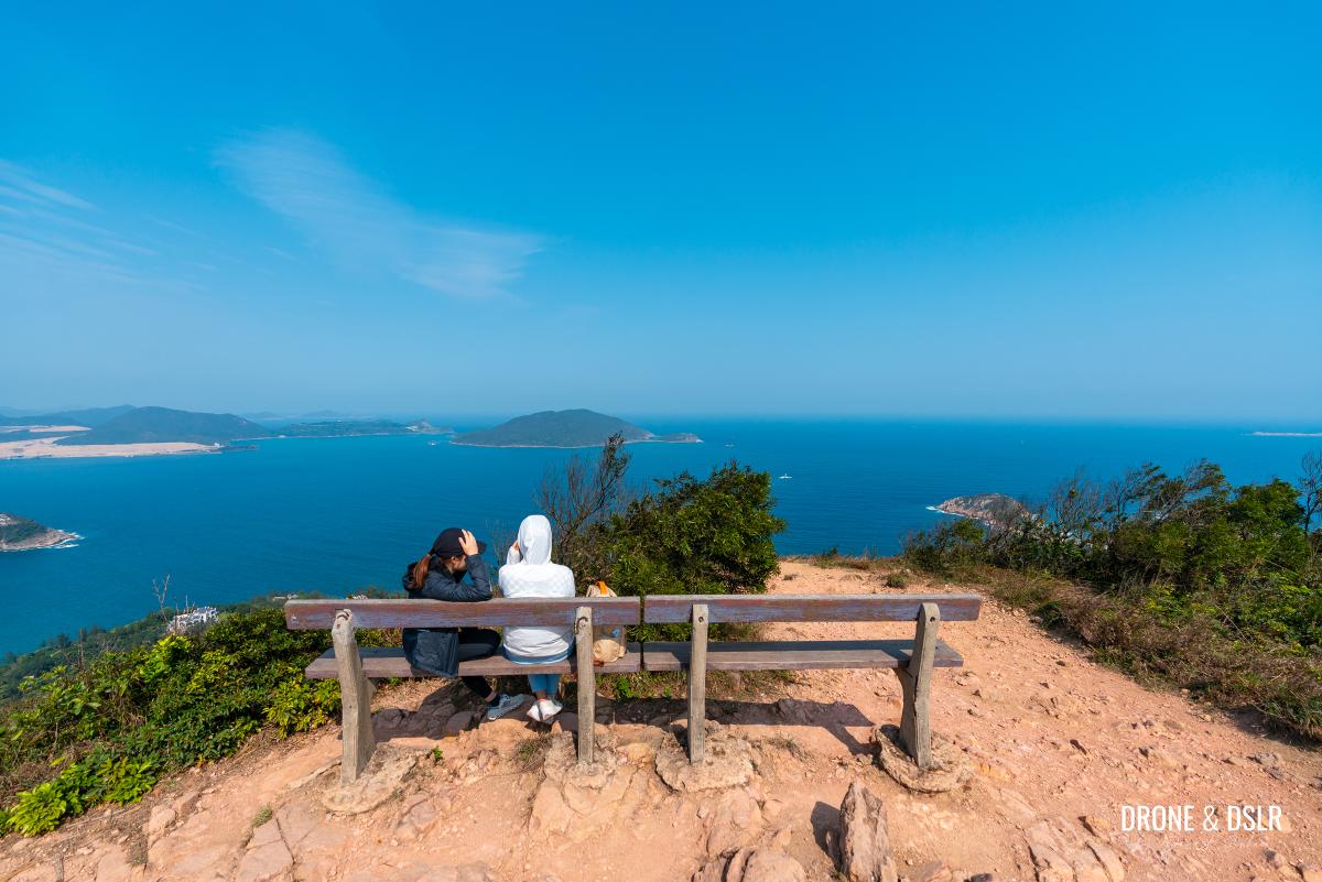
If you want more time to soak up these views, then follow the trail for another 100 metres to The Dragon’s Back Viewing Point.
The Viewing Platform is 100 m ahead of Shek O Peak
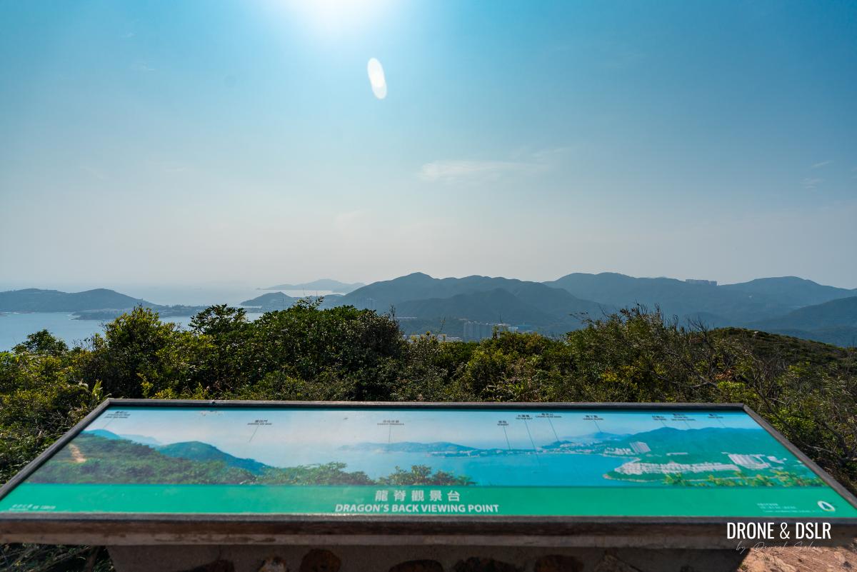
The viewing point offers similar views to the peak, but adds a bench and panoramic informational guide.
-
- A bench on top of Dragon’s Back to let you soak in the views
-
- Views to the west of Dragon’s Back Viewing Point
-
- Views to the east of Dragon’s Back Viewing Point
Exit 1 — For those who want to finish at Shek O
If you’ve been tempted by the beautiful sights of Shek O, and want to end your hike at the beach, return to the starting point from the Dragon’s Back Viewing Point.
At this point, you’ve experienced the best of what the Dragon’s Back has to offer. And the shortest route to Shek O Beach is to trace your steps back to the To Tei Wan bus stop, and catch bus number 9 or any minibus heading to Shek O.
You can read our guide to Shek O to make the most of your visit.
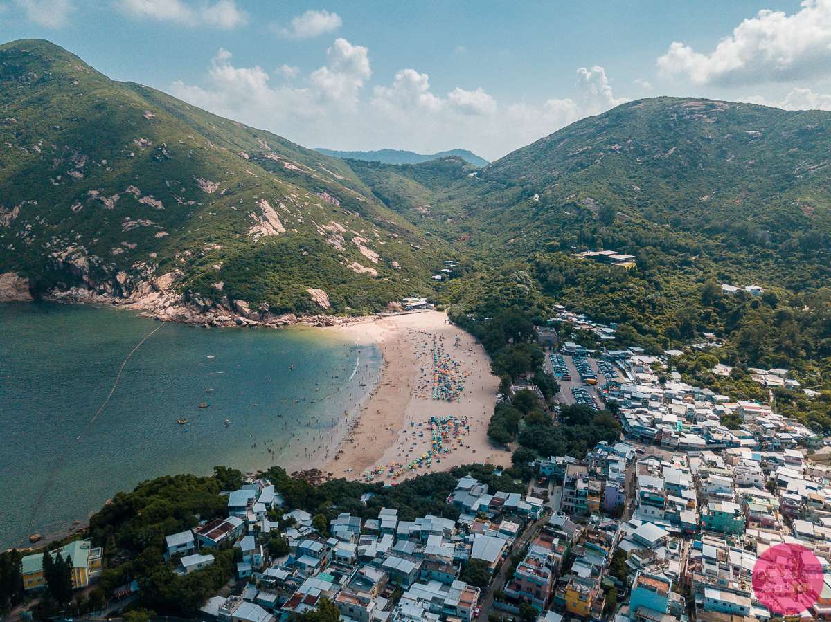
Aerial view of Shek O Beach, Hong Kong
However, if you’d like to continue hiking and exit at Tai Tam Gap or Big Wave Bay, then read on.
To The Next Viewing Point
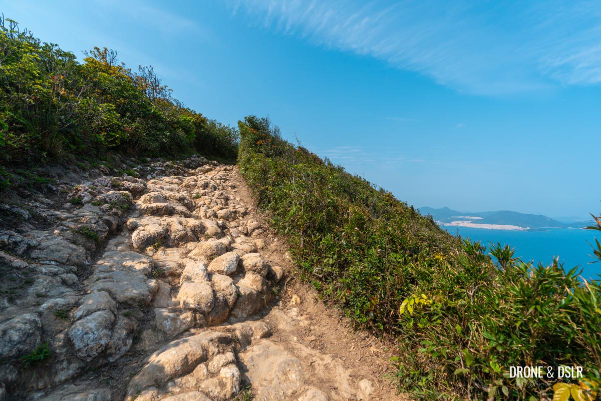
From the Dragon’s Back Viewing Point, you’ll encounter more of what you’ve already experienced, but now the views of Big Wave Bay are closer and more impressive, and that there are fewer hikers around.
The trail continues downhill from the Dragon’s Back Viewing Point
After the viewing point, the Dragon’s Back trail gently descends before levelling out. This flat section eventually leads to a more rocky descent, where the surrounding trees and bushes may obscure your views.
-
- An easy hike
-
- The slope is quite gentle and shaded
However, on a clear day, you can occasionally catch glimpses of East Kowloon straight ahead.
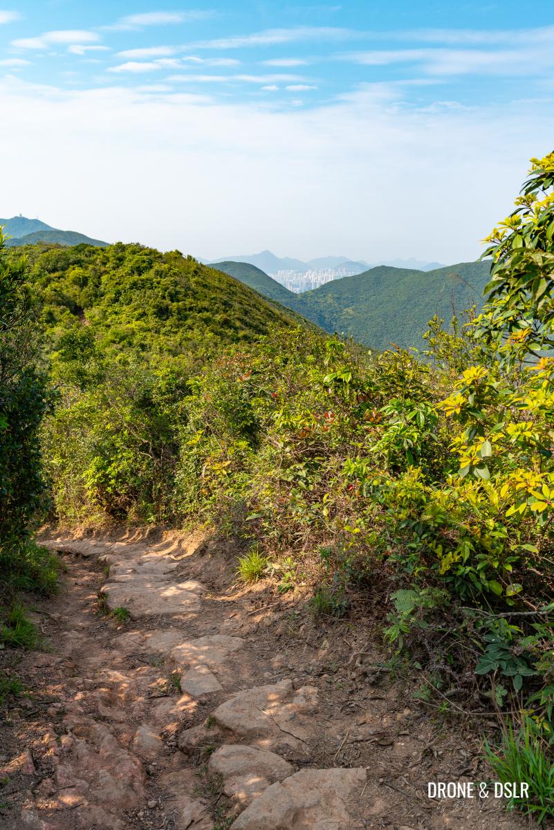
Views of Kowloon on a clear day from the Dragon’s Back ridge
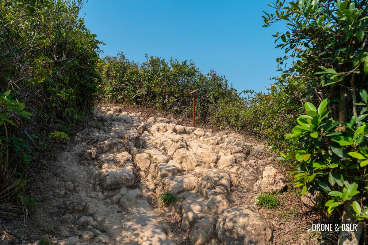
The trail then briefly ascends over a jagged surface before arriving at another viewing point with two benches.
-
- Still a bit undulating
-
- Almost at the next viewing point
-
- The second viewing point with benches on the Dragon’s Back
Feel free to take a break here and enjoy the views of Big Wave Bay below.
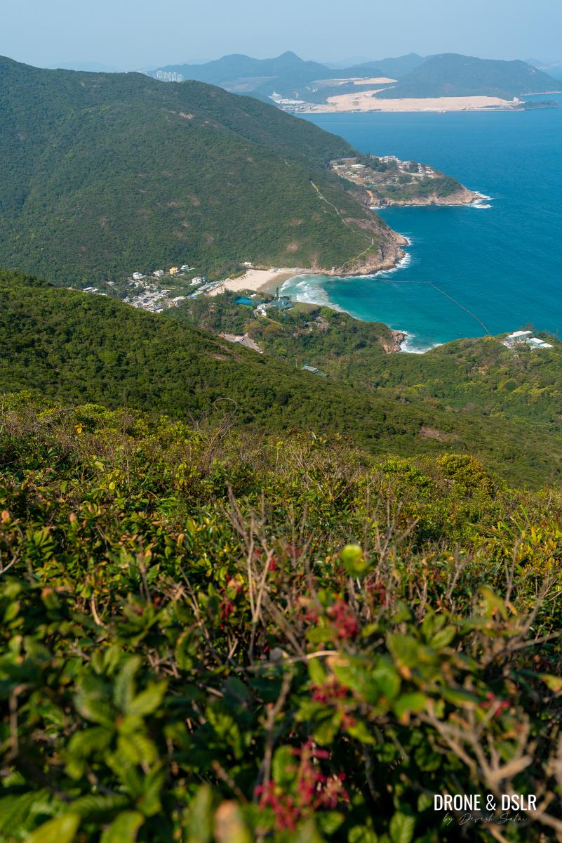
Views of Big Wave Bay from the second viewing point
Unlike the Dragon’s Back Viewing Point, this viewing point is usually much less crowded or even empty.
This time, the views of Big Wave Bay are closer
To The End of The Dragon’s Back Spinal Ridge
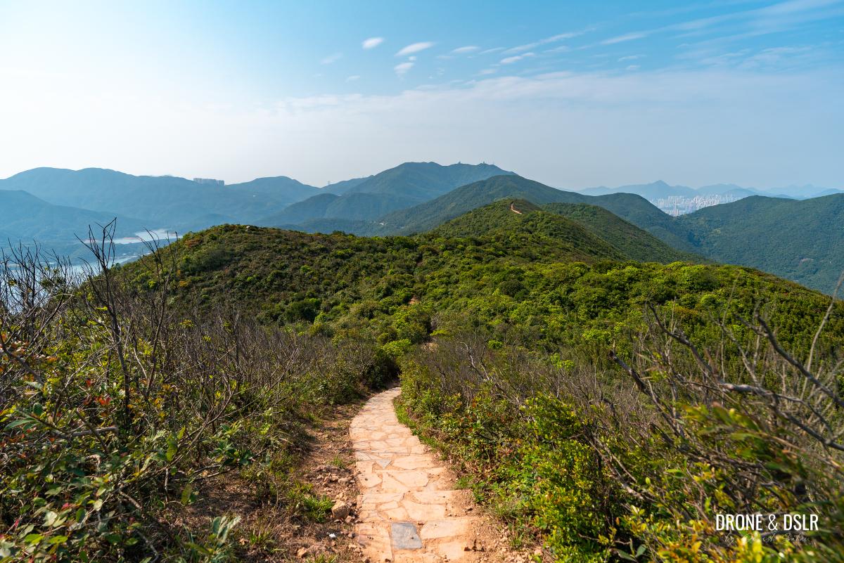
From this viewing point, I find that the trail becomes slightly more scenic. The views on either side open up, and the trail itself set against the backdrop of the hills looks quite picturesque.
-
- The scenic spinal ridge continues
-
- Getting closer to the end of the Dragon’s Back
Unfortunately, this scenery doesn’t last long. And before you know it, the trail veers off the ridge and begins its descent down a relatively narrow and rocky section. (Technically, you could bushwhack your way back to the ridge and continue hiking to Mount Collinson at the point where the trail turns left, but we don’t recommend this unless you’re an experienced hiker.)
-
- The final descent from the Dragon’s Back
-
- This is where the trail veers left, and you’re finally off the ridge
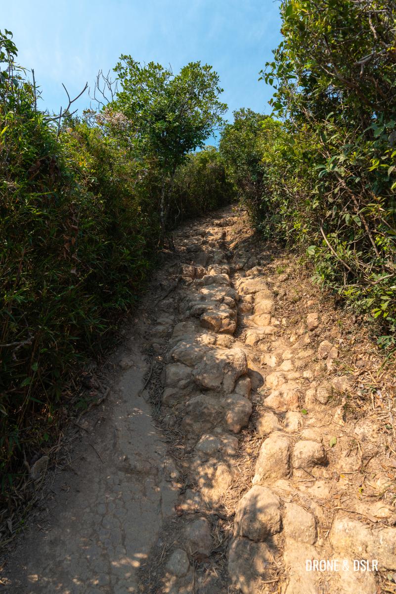
This rocky descent is just over 200 metres long and reconnects with the flat trail that runs parallel to the Dragon’s Back.
-
- A rough descent
-
- The trail remains quite rocky and uneven as it heads downhill

This is the same trail you would have been on if you had gone straight instead of turning right at the pavilion, at the start of the spinal ridge.
Merging with the trail that runs parallelly below the Dragon’s Back
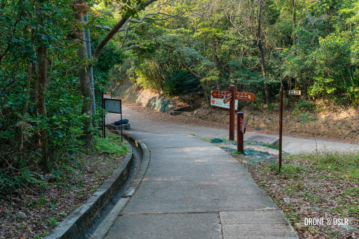
Towards Tai Tam Gap
To stay on Hong Kong Trail Section 8, turn right the end of the descent and follow the signs for Tai Tam Gap.
-
- Follow the signs for Tai Tam Gap
-
- Continue towards Tai Tam Gap on Hong Kong Trail Section 8
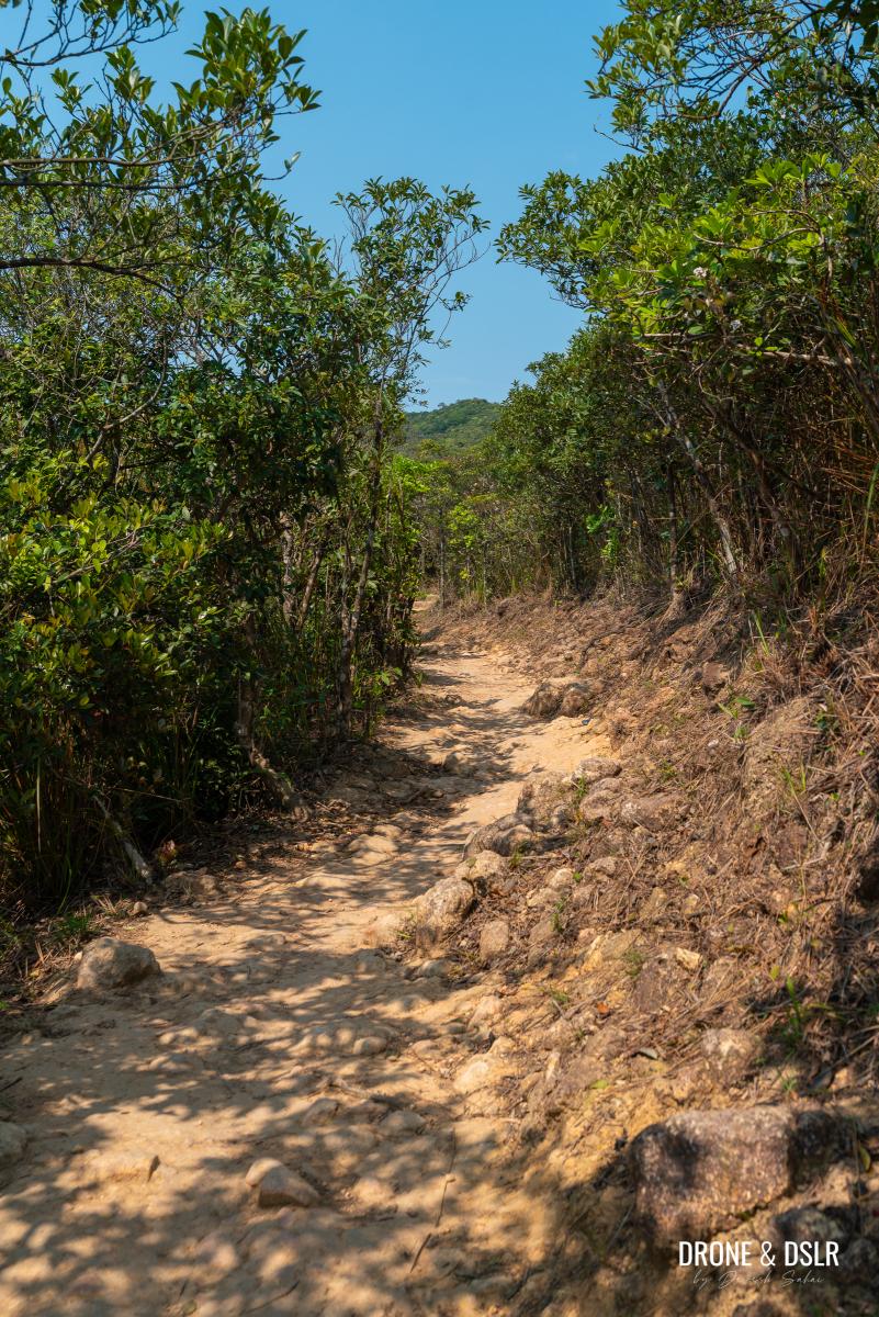
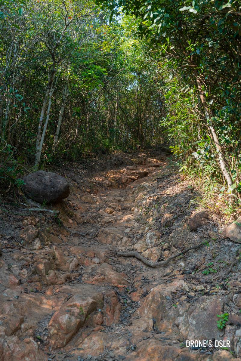
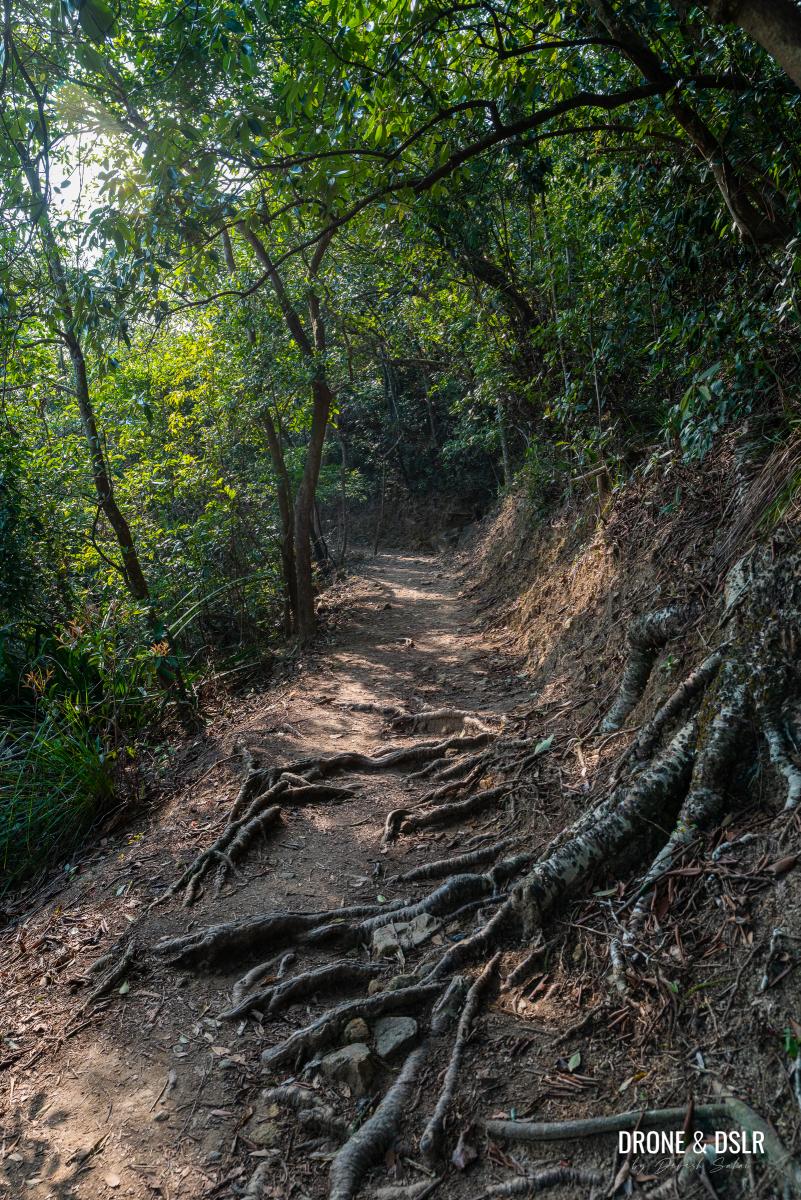
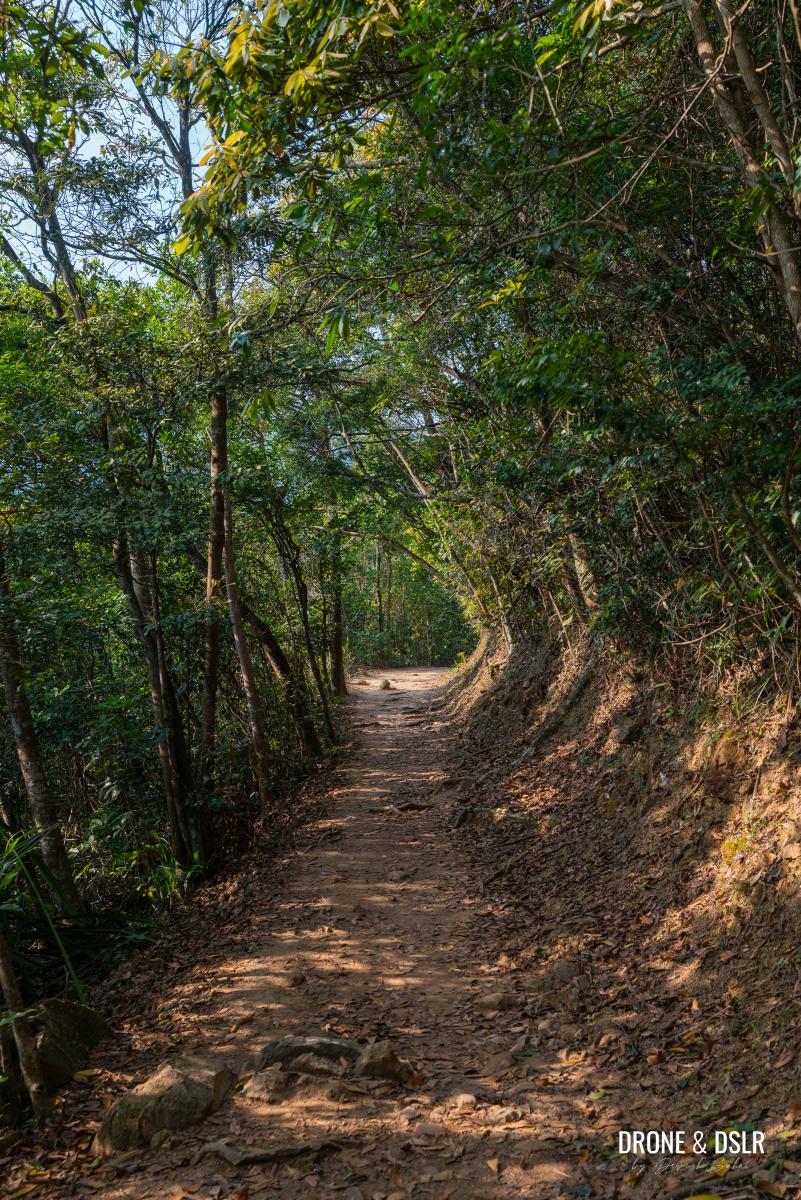
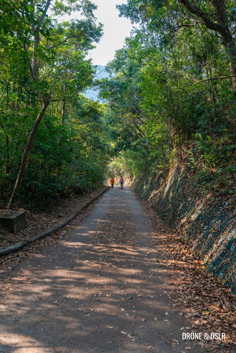
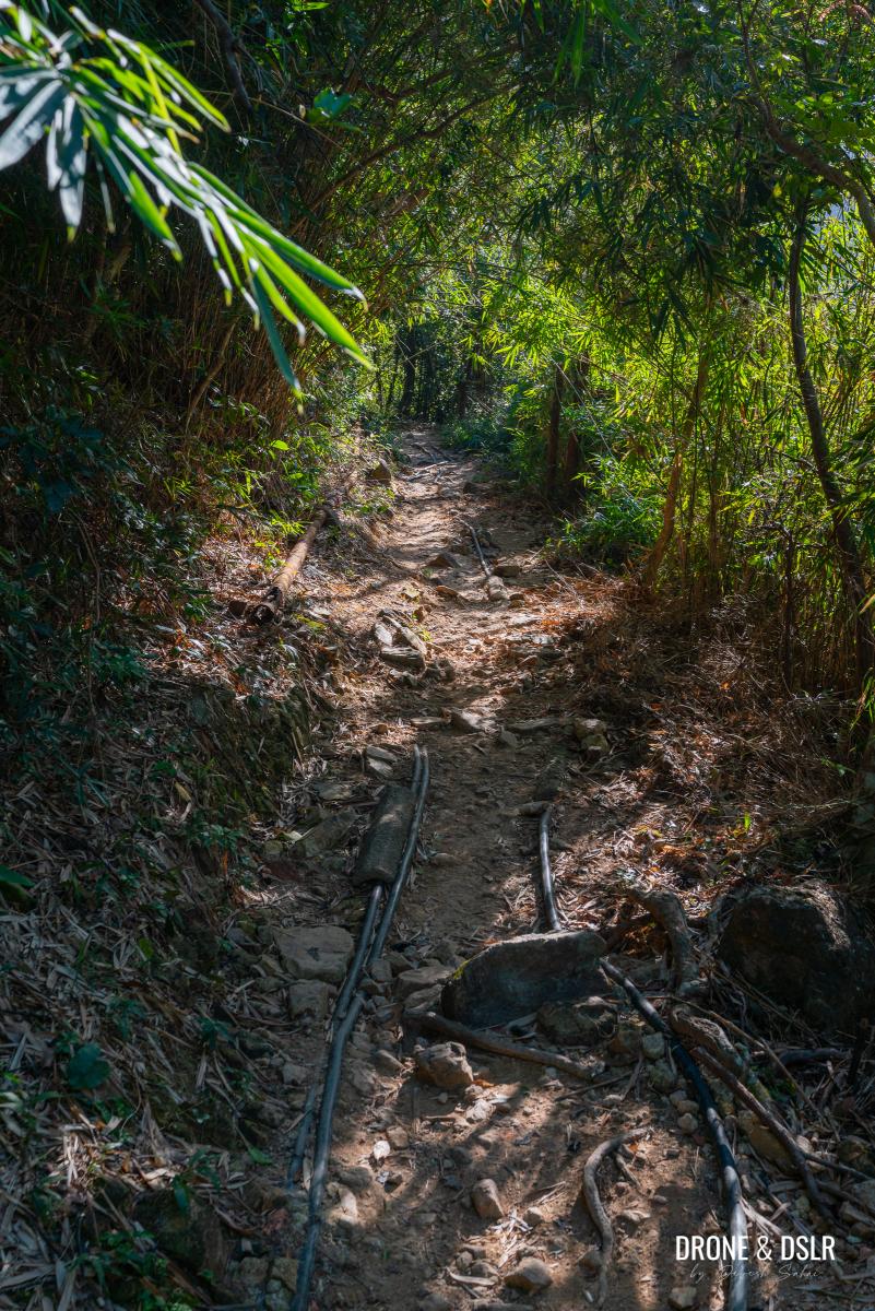
From here on out, you might understand why many hikers choose the first exit option. There are no views along the trail, and unless you have company, it can feel quite monotonous.
The trail for the next 2 km is flat and shaded
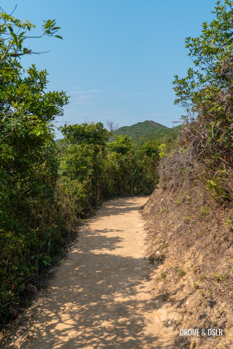
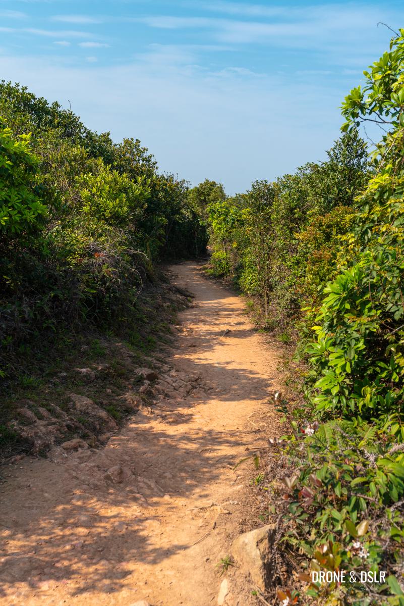
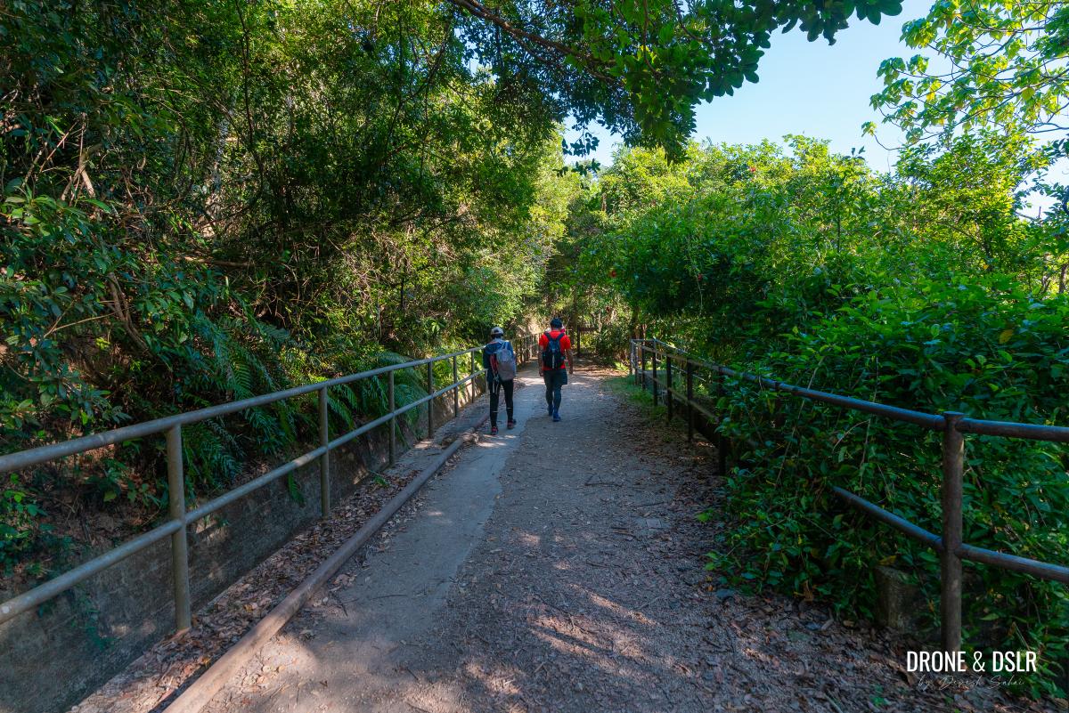
The next 2 km of the trail remain flat and covered in a canopy of trees. And to be honest, there aren’t any mentionable highlights along the way.
-
- Hardly any views along the way
-
- Keep walking towards Tai Tam Gap
Just keep walking till the dirt track ends next to the Mount Collinson Water Pumping Station.
-
- Almost there!
-
- The dirt track ends at the Mount Collinson Water Pumping Station
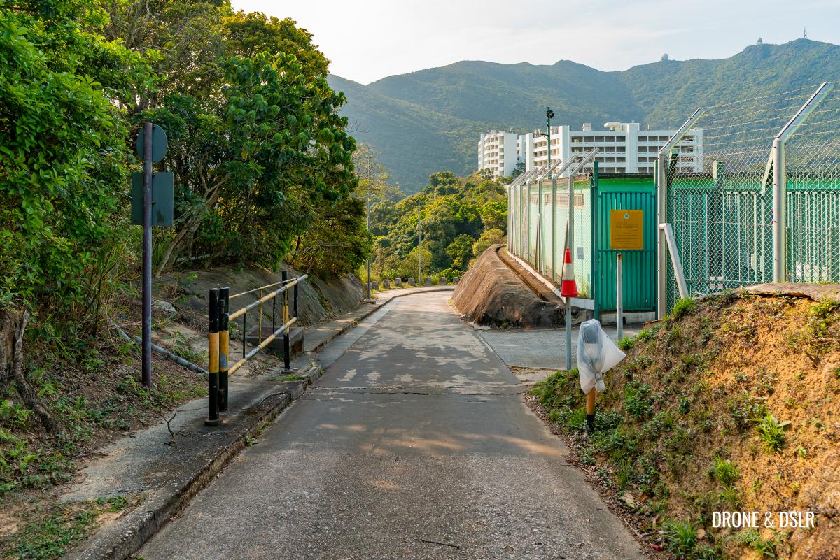
At this point, the trail transitions to a cement track gently descends and connects with the Hong Kong Forest Track – Mount Collinson Section.
The trail finally merges with Hong Kong Forest Track – Mount Collinson Section
Exit 2 — For those who want to return to the city
Decision to be made, exit at Tai Tam Gap or continue to Big Wave Bay
If you don’t want to end your hike at Shek O Beach or Big Wave Bay Beach, and want to head back to the city, turn left on Hong Kong Forest Track – Mount Collinson Section.
Follow the track towards the Tai Tam Correctional Institution and just around the bend, take the steps downhill (signs for the bus stop).
-
- Turn left and walk downhill
-
- Walk past the Tai Tam Correctional Institution
-
- Take these steps down (follow the sign for the bus stop)

Once back on Shek O Road, cross the road to catch any bus back to Shau Kei Wan or walk to Tai Tam Road to catch a bus towards Stanley.
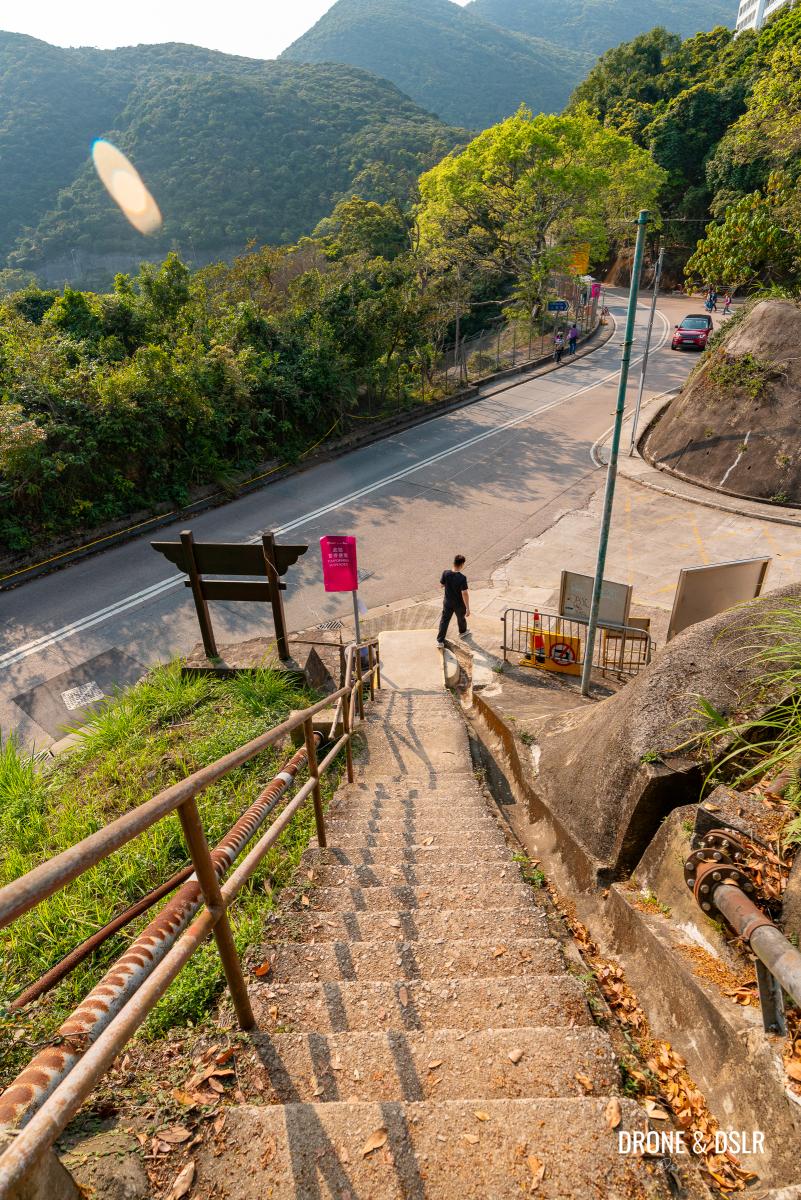
Exit 2 at Tai Tam Gap, Shek O Road
Towards Pottinger Gap
For those wanting to continue hiking the entire Hong Kong Trail Section 8, from Dragon’s Back to Big Wave Bay, the hike continues.
Once you reach the Hong Kong Forest Track – Mount Collinson Section, turn right and follow the track into one of the easiest sections of the entire hike.
-
- Turn right on the Hong Kong Forest Track – Mount Collinson Section
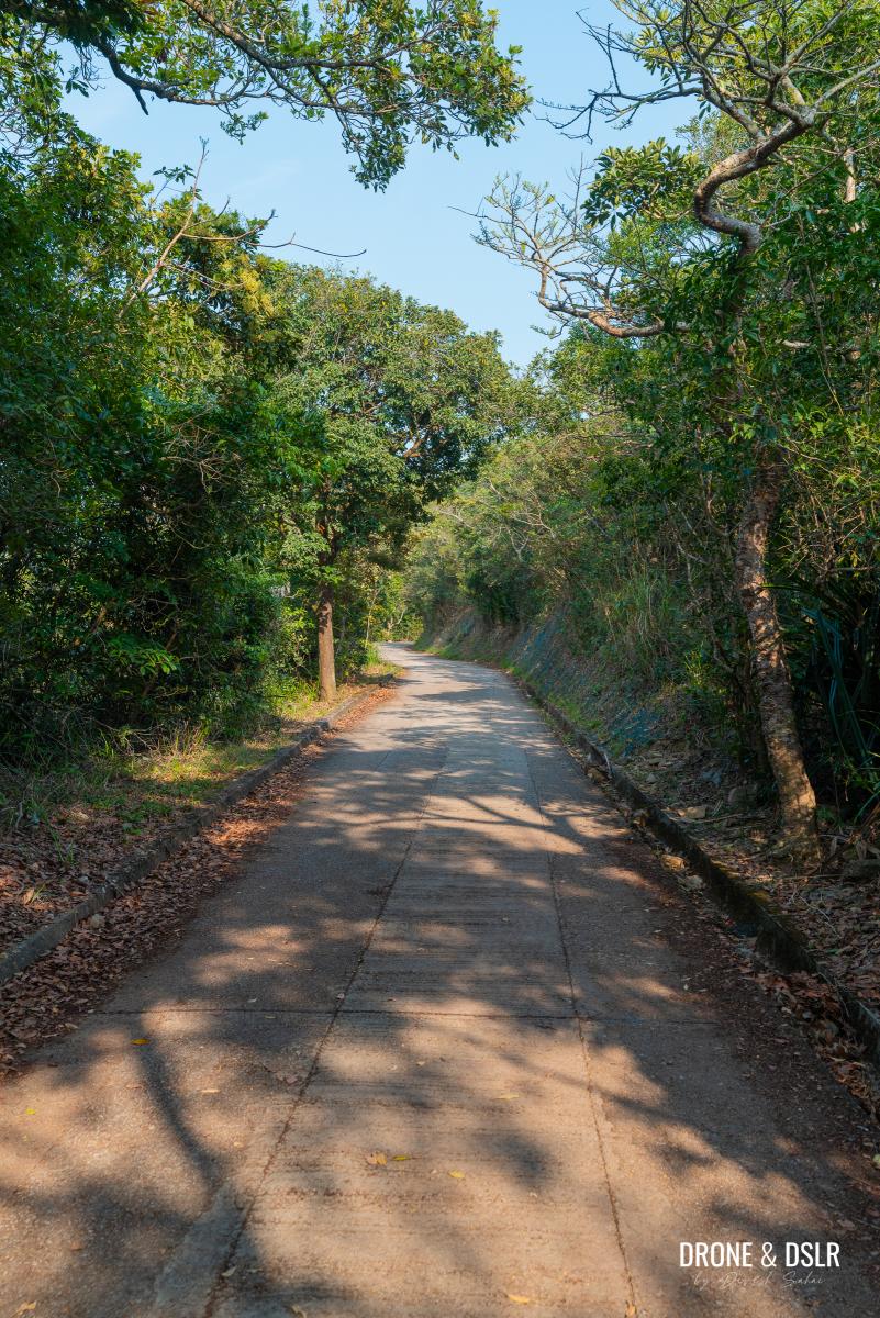
-
- Stay on the track for about 1.5 km
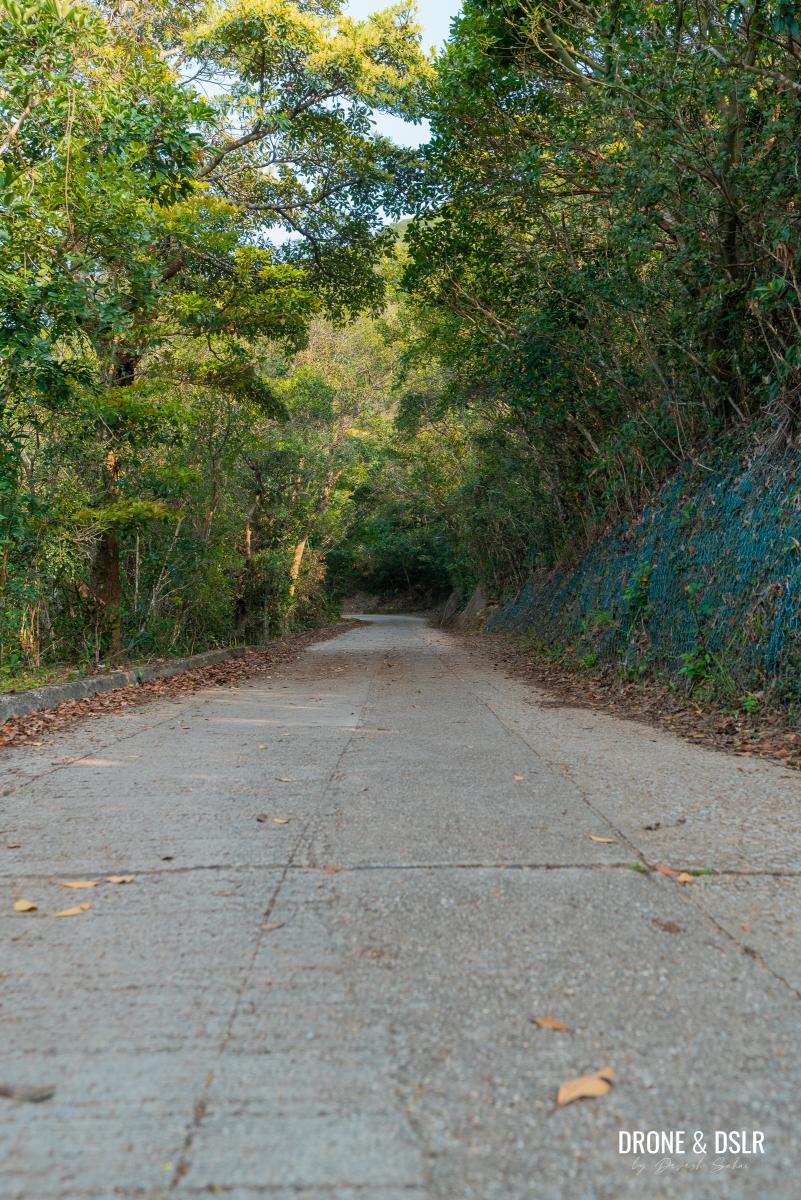
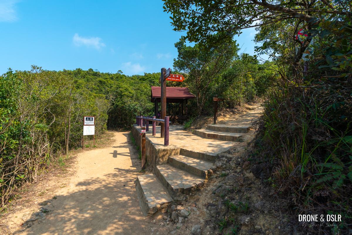
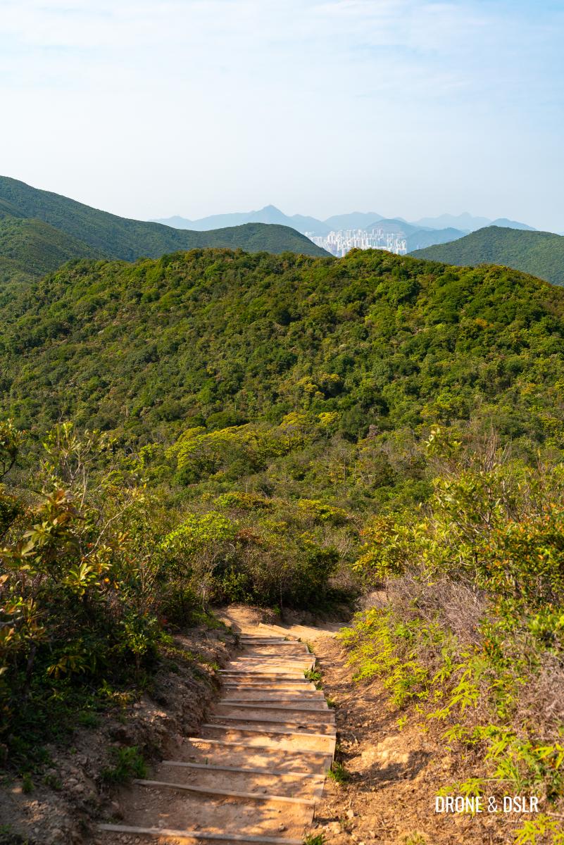
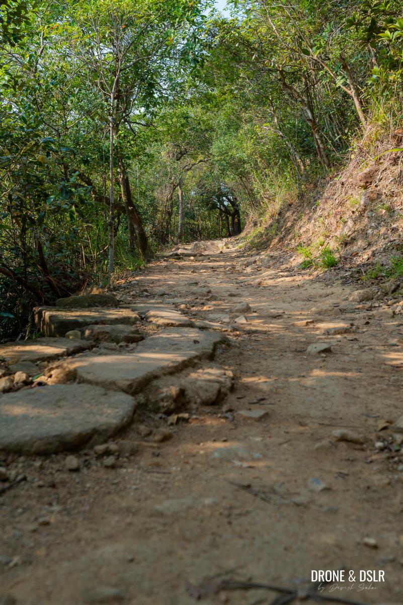
For the next 1.5 km, follow the paved path that connects Tai Tam Gap with Pottinger Gap. The trail twists and turns at the base of Mount Collinson as it gradually makes its way to the next stop — Pottinger Gap.
-
- To continue to Big Wave Bay, follow the signs at Pottinger Gap
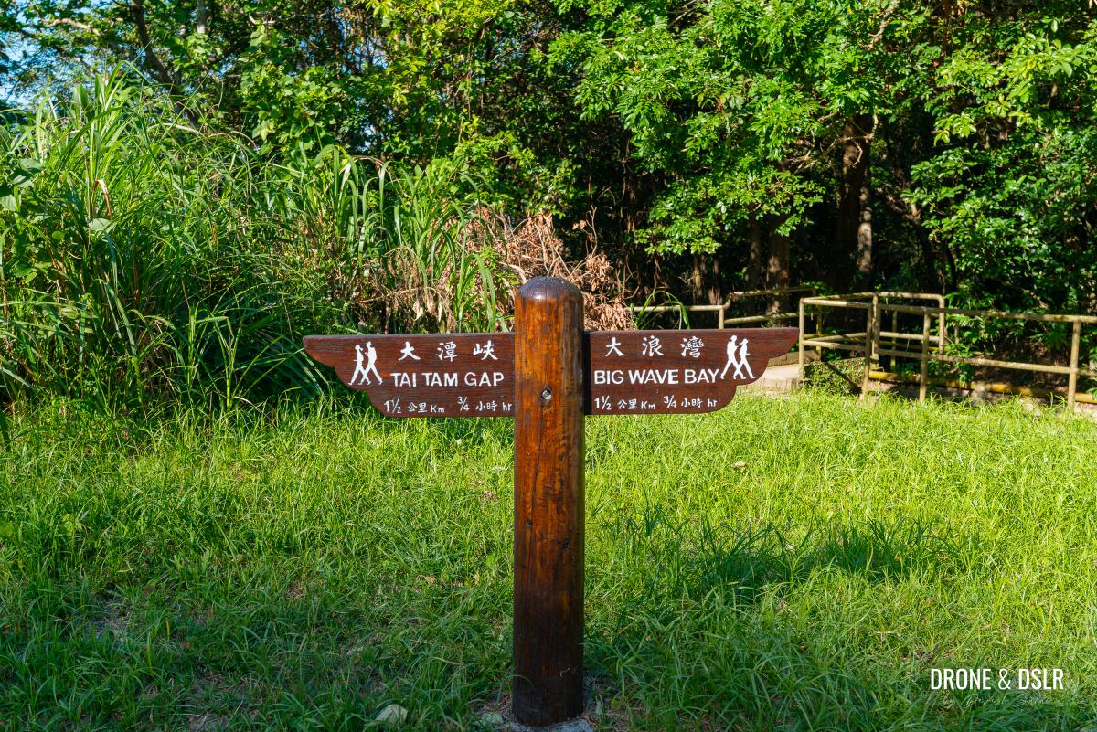
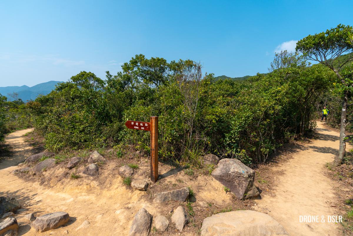
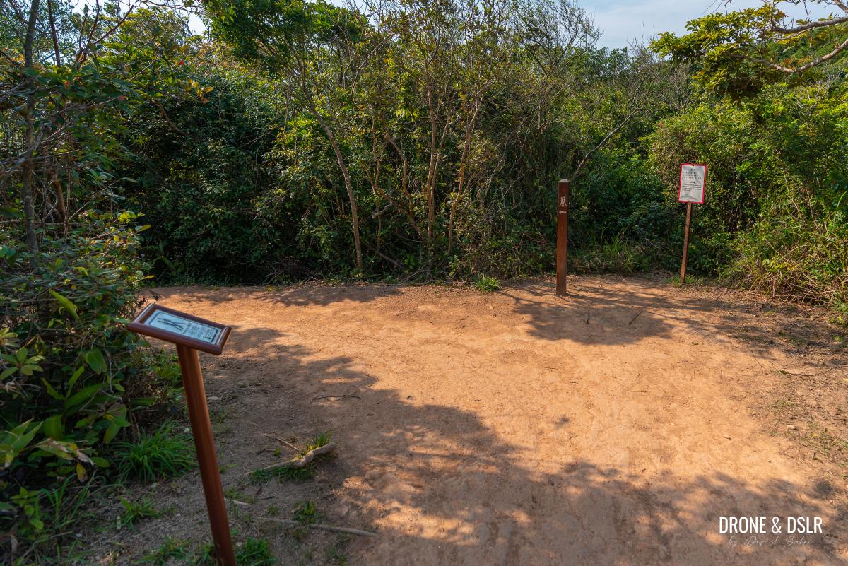
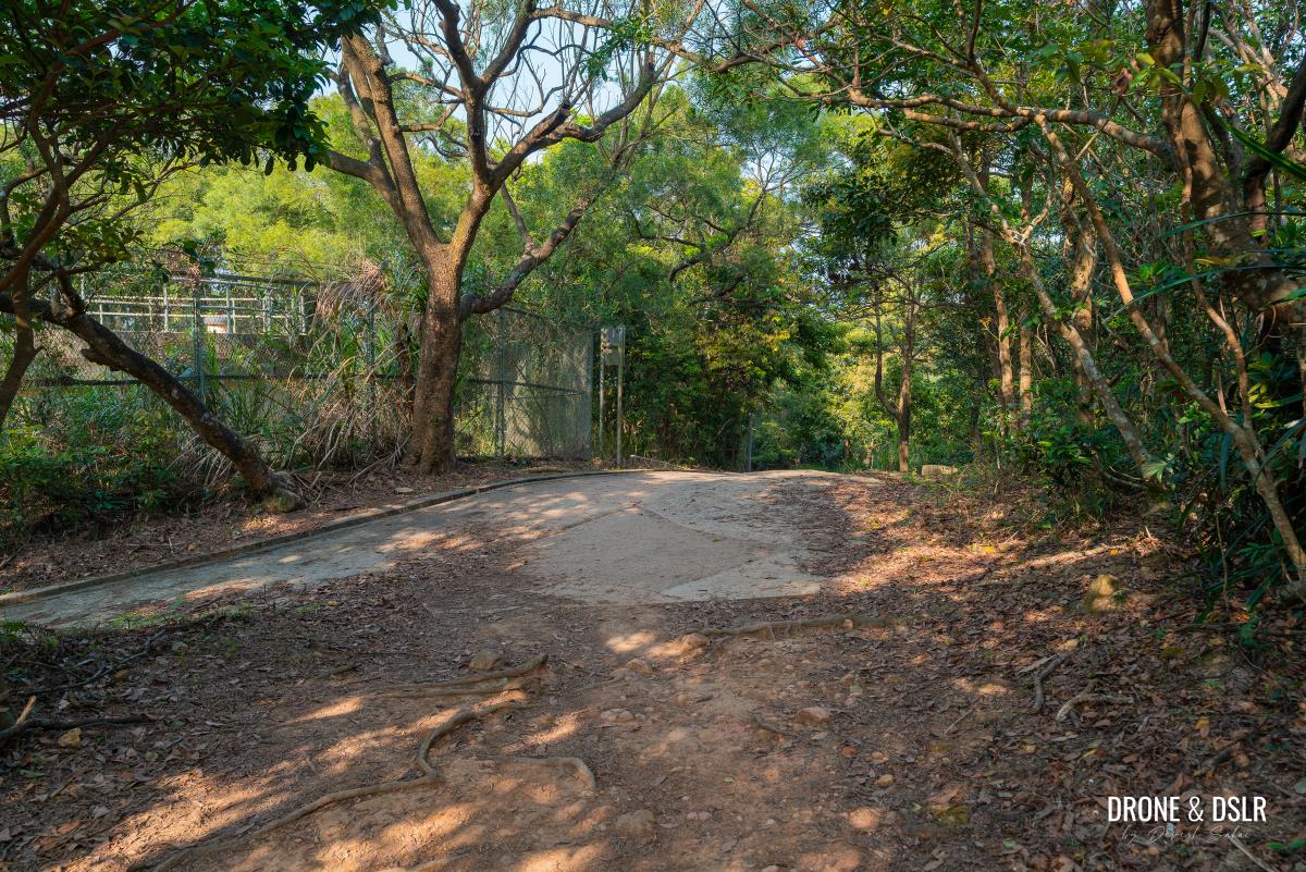
You’ll know you’ve arrived at Pottinger Gap when the trail ends next to an open rest area featuring benches and a pavilion. This spot serves as a junction for multiple trails, including the one that connects Chai Wan to Big Wave Bay.
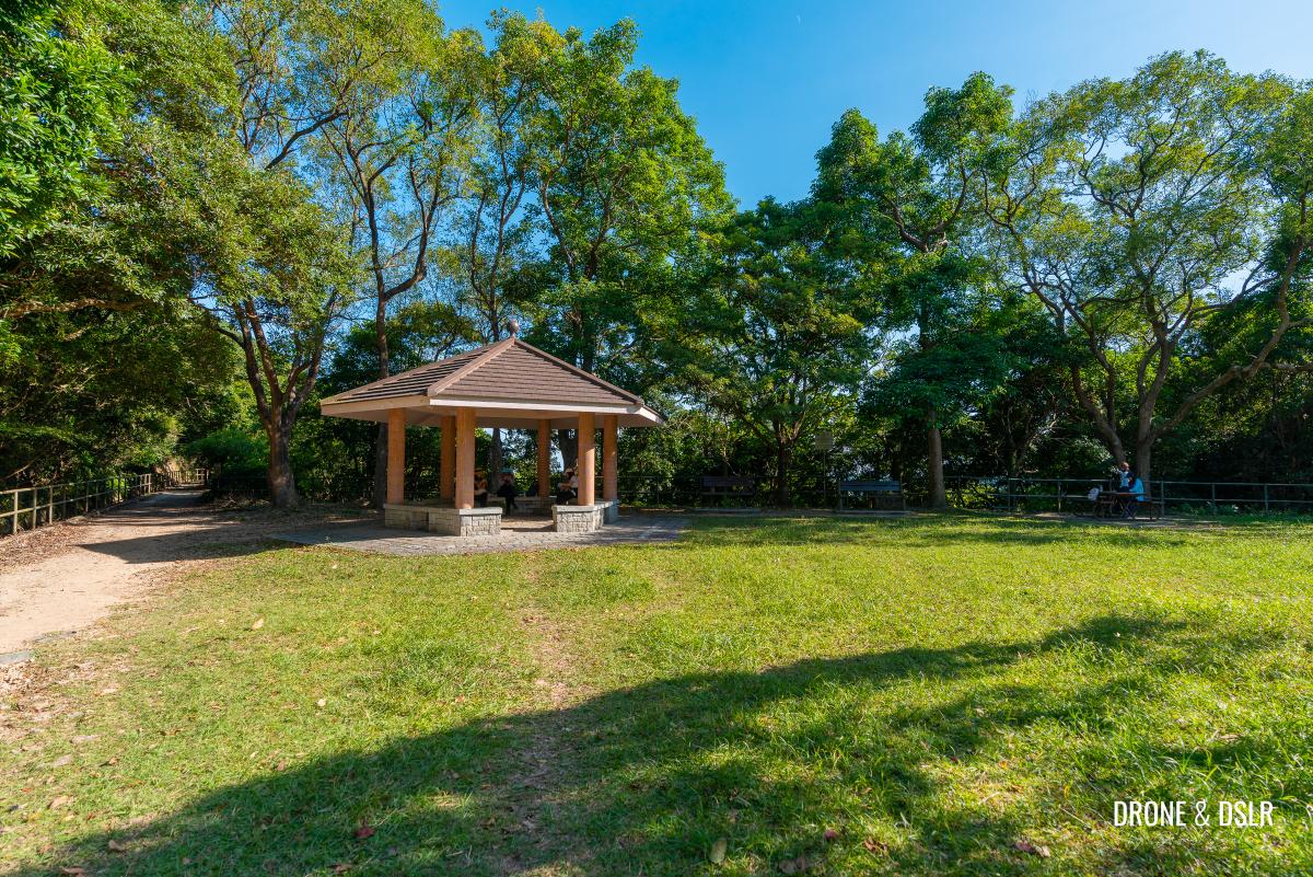
Take a break at Pottinger Gap
Feel free to take a break before heading down the final section of the hike.
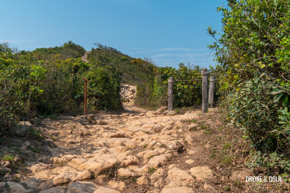
The Final Descent To Big Wave Bay
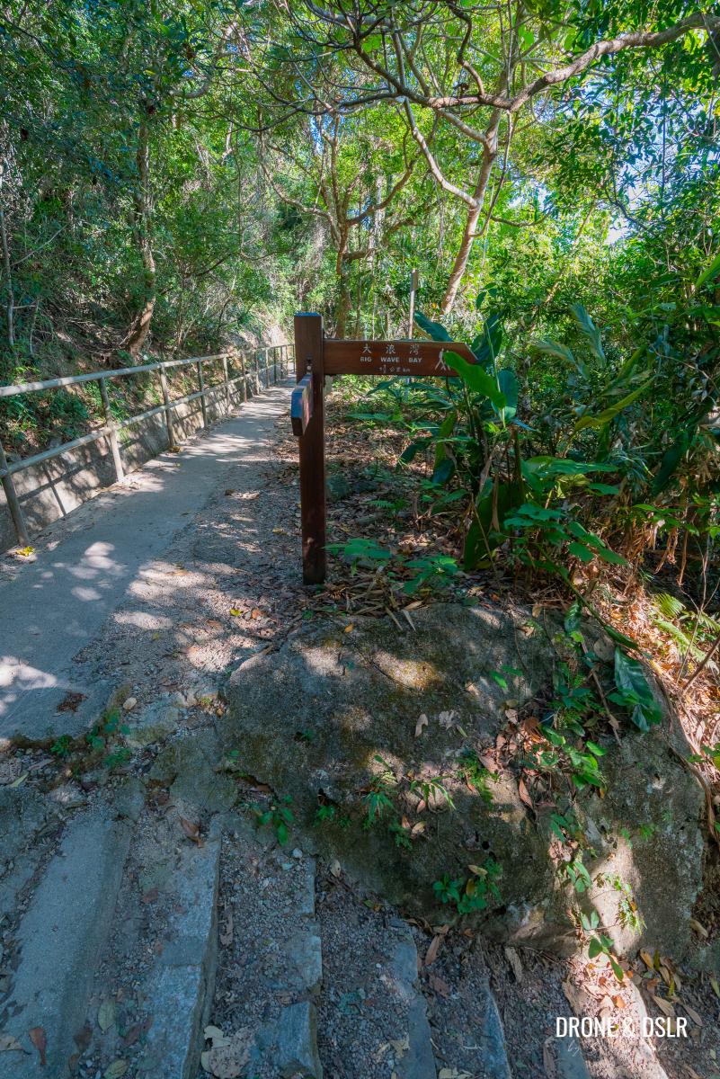
To continue hiking toward Big Wave Bay, take the path behind the pavilion. Walk for 15 metres, then follow the steps with the sign for Big Wave Bay as they lead you downhill.
-
- Take the catchwater path behind the pavilion
-
- Follow the sign for Big Wave Bay and take the steps downhill
This 1.5 km section of the trail links Big Wave Bay Village (Tai Long Wan Village) to Pottinger Gap.
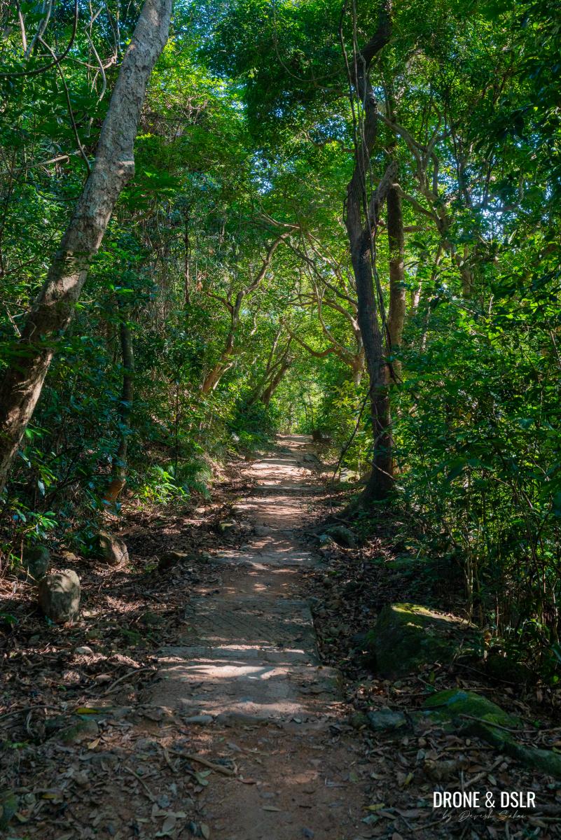
Unfortunately, this part of the hike is also quite uneventful, with dense tree cover and no views to speak of, making it feel a bit monotonous.
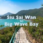
Alternative route option: If you prefer a more scenic but longer route, I recommend skipping this right turn, continuing on the catchwater trail for another kilometre, and then turning right for Big Wave Bay. It’s a far more scenic descent, which you can read about and see the photos of in the Siu Sai Wan to Big Wave Bay Hike (under the heading “Final Descent to Big Wave Bay”).
-
- Section 8 of the Hong Kong Trail to Big Wave Bay
-
- The trail doesn’t offer much excitement
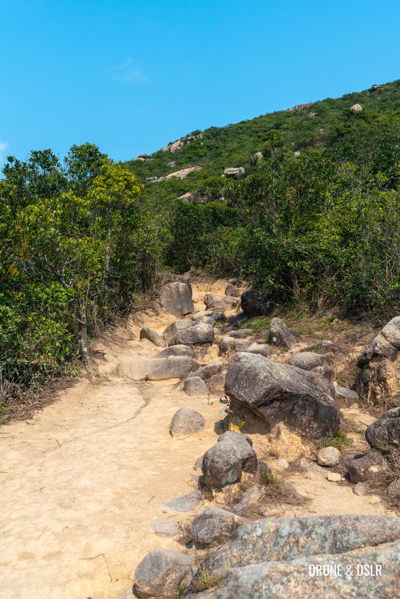
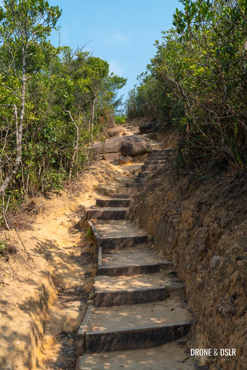
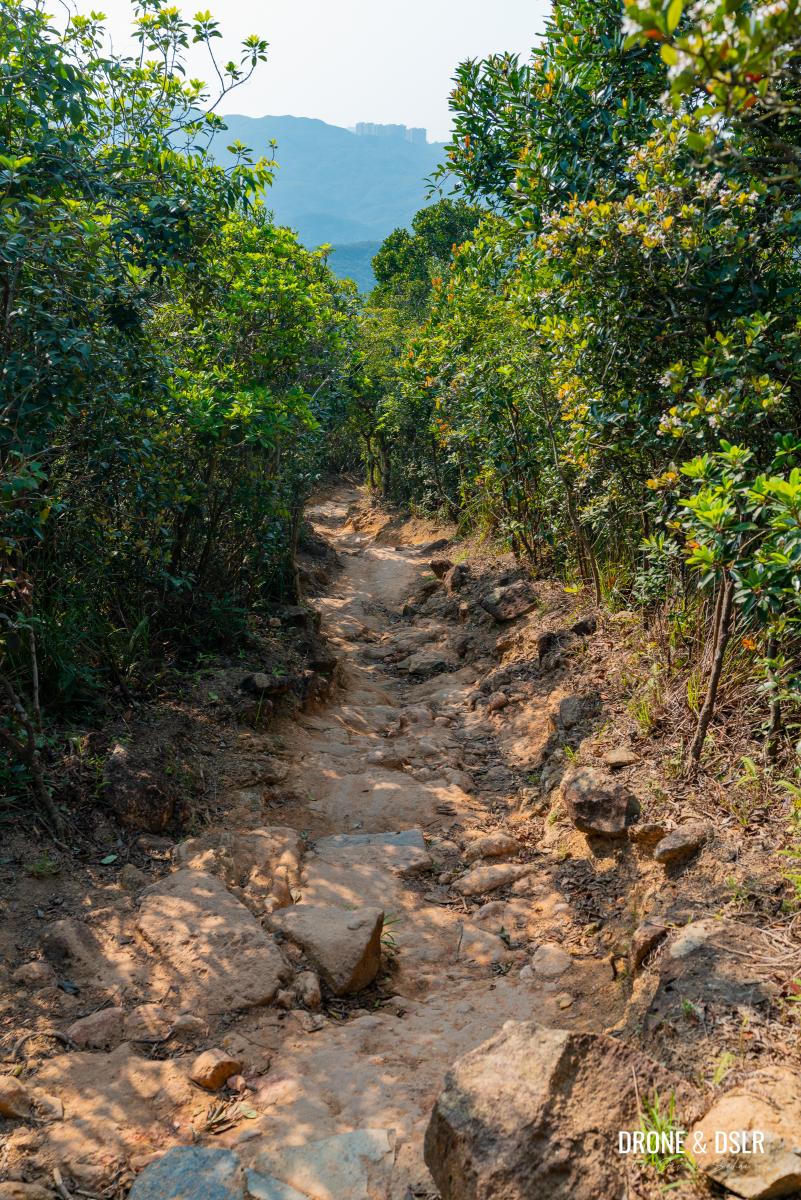
While the trail descends gently, its surface is another story. Expect loose rocks and large boulders, which can make hiking uncomfortable.
-
- Watch out for the boulders and loose rocks
-
- Hong Kong Trail Section 8 to Big Wave Bay

-
- The downhill section is very jarring, and it helps to wear proper hiking shoes
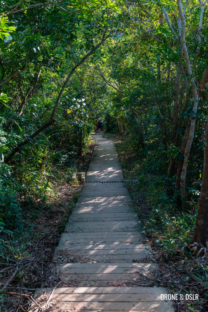
You’ll know you’re just a couple of hundred metres from the village when the uneven trail transitions into a flat paved path. And the flat paved path descends into Big Wave Bay Village, bringing to end Section 8 of the Hong Kong Trail.
-
- The steps signal that the village is close by
-
- The end of downhill section of the hike
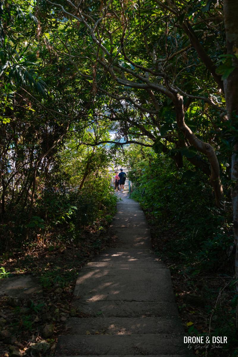
-
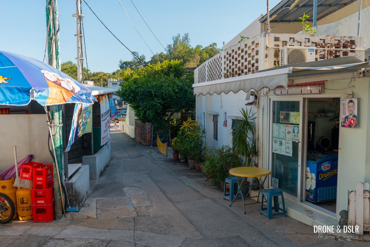
- Welcome to Big Wave Bay Village!
Exit 3 — For those who wish to end at Big Wave Bay Beach
As you enter Big Wave Bay Village, continue downhill on the path that winds between the houses. At the bottom of the steps, you’ll see signs welcoming you to Big Wave Bay.
-
- Stay on the path and walk in-between the houses
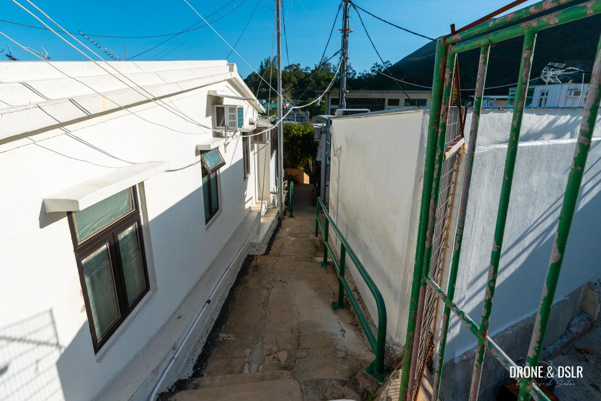
-
- Signs welcoming you to Big Wave Bay (quite a nice touch)
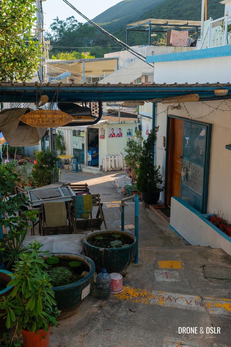
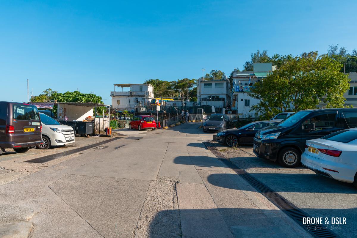
Keep walking straight through the alleys until you reach a large car park, located just before a small bridge.
-
- Keep walking straight ahead
-
- Walk past the car park and onto the bridge
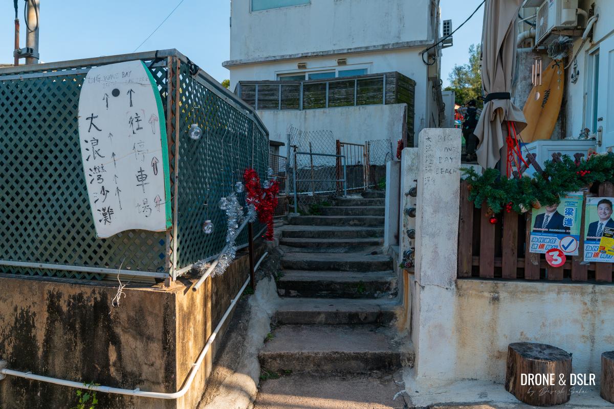
Cross the bridge and take the alleyway with steps between the houses, where you’ll find a couple of signs pointing to Big Wave Bay Beach. Walk through the alley and turn left as soon as you exit.
-
- After the bridge, take this alley (look for the signs)
-
- Exit the alley and take a left
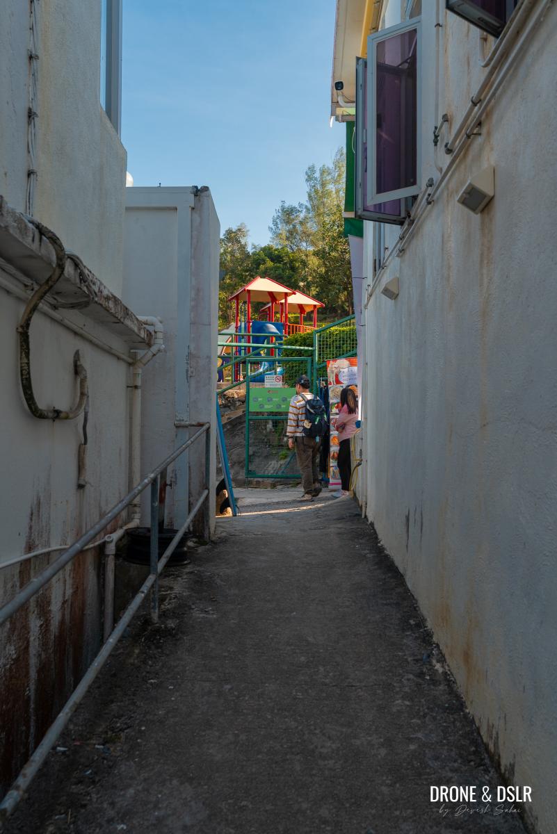
Continue down this road, and at the end, you’ll arrive at Big Wave Bay Beach. This marks the completion of Section 8 of the Hong Kong Trail, which takes you across the scenic Dragon’s Back and down to Big Wave Bay!
-
- Walk down this road to arrive at the Big Wave Bay Beach
-
- The magnificent Big Wave Bay Beach
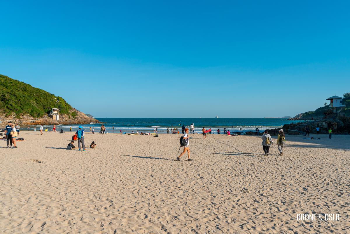
Be sure to check out the prehistoric rock carvings at Big Wave Bay!
The Easy Guide to Dragon’s Back
The Dragon’s Back was the very first hike I did in Hong Kong, even before moving to the city. It was my initial introduction to a different side of Hong Kong. After spending so much time in the city, this hike felt like a breath of fresh air, both in terms of scenery and experience.
Gorgeous views all along the Dragon’s Back Hike
I know many others who were introduced to hiking in Hong Kong through the Dragon’s Back. It’s no surprise, really — it’s a scenic and easy hike, that eventually ends with beach day.
Once you’ve completed the Dragon’s Back Hike and are looking for more hiking adventures in Hong Kong, I highly recommend tackling Lion’s Rock (Hong Kong’s most iconic peak) or Tai Mo Shan (Hong Kong’s tallest hill). If you enjoyed the views of D’Aguilar Peninsula, be sure to explore Cape D’Aguilar, which is a very popular destination.
If you enjoy our work, come join us on Instagram and YouTube 🙂


You might also like


35 Comments
It’s exit A3
Thanks!
Do we need to hike back if we were to go the longer route? Or is there a bus or anyway back? Thanks!
Hey John, you can catch the minibus back from the Big Wave Bay. From the beach, just walk towards the main road/parking lot. That’s where the bus stop is back to Shau Kei Wan. Hope that helps.
Is it easy to spot the minibus back to Shau Kei Wan, and what is the frequency like? How much is the bus fare?
I assume you want to catch the minibus from Shek O or Big Wave Bay? Yes, it is easy to spot. The bus stop is at the the parking lot (at both beaches). Bus fare would be 10 or 12 HKD depending on the day of the week. And if I remember, they only accept cash (no Octopus). All the info you need on the minibus is available on this page: http://www.16seats.net/eng/rmb/r_h09.html
Oh, your blog is filled up with so many articles of Hong Kong. Have you lived there? Thanks so much for sharing your experience. It helps me so much choose the best trail for my trip in 5 days. Keep up with your good work!
Thank you! And yes, I live here.
Cab you swim at big wave?
Yes, absolutely. The water quality at Big Wave Bay is “fair” according to the govt.
If I do the dragon’s back hike… how can I reach Cape d Aguilera from either option 1 (shek o) or 2 (big wave beach)? tks
Hey,
Yes, you can reach Cape D’Aguilar through option 1. Basically head back to the bus stop. From there you could either walk it to Cape D’Aguilar Road, or take the bus that drops you off at Cape D’Aguilar Road (should be one stop away).
Will u recommend doing option 2 then take minibus back to Shau Kei Wan and head on to Cape D’Aguilar?
Hey, Rowena,
Sure, you could do that depending on how much energy you still have left. Although Cape D Aguilar isn’t a strenuous hike, it’s still a relatively long walk.
Hope that helps!
Hi Devesh, thanks for another awesome guide and maps 🙂 The views are incredible, it seems like a perfect way to escape from the city bustle.
The longer route seems to be more interesting, but when I check your maps on Google Maps it says “This route has restricted usage or private roads.” for the last two parts. Do you know if this route has been permitted or something?
I was also thinking, on the way back, in the last part, where you need to take the steps on the right side (in the woods) there is also option of going straight ahead along the Pottinger Peak Country Trail and along the railing, and then taking the stone steps on the right which lead to the Rock Carving at Big Wave Bay. What do you think about this route? It’s definitely longer but judging from the photos on Google Maps it seems to be better marked out. Have you ever take this route?
Thanks,
Zooey
Hey, Zoeey,
Yes, I’ve taken both routes. The first route says it’s restricted because it passes through the Big Wave Bay village, right next to the houses. But it’s closed.
Of course you can take Pottinger Country Trail. In fact, I’d recommend it because the views are quite pretty (there are no views if you go through the village). I’ve done the Pottinger Trail down to Big Wave Bay as part of the hike from Chai Wan a couple of times 🙂
Thank you for explaining it.
The Pottinger Trail seems to be really interesting and the views as you come down towards the sea are incredible. Can’t wait to get there! 🙂
It is pretty, especially on a clear day. In fact, I hiked down to Big Wave Bay today on the Pottinger Trail.
We’re thinking of doing this! Is there a best time of year when it’s less busy but weather is still nice? We’re trying to prioritize our time there and want to schedule it all out ahead of time. Looks wonderful, thanks!
Hey Lorie,
The weather in Hong Kong is hiking-friendly between October and March. You can do it in the summer months too, but then make sure you either start early, or end late when it’s not too hot.
Hope that helps!
Thank you very much for the information in this website. They’re so useful. We did the hiking for the first time on this trail and we love it!
You’re very welcome, and we’re glad you enjoyed your Dragon’s Back Hike!
Devesh,
Thanks so much for the response, I missed it until just now! I think we’ll try for mid March, hopefully, it’s still pleasant by then. What’s your absolute favorite place/hike that we just cannot miss? I want to make sure we have that in our list. Thanks!
Thanks for this awesome post and super cool website Devesh! So clear, informative and easy to use. I basically answered all my questions just coming here, and the photography rocks! Well Done!
Thanks a ton, Brandon! Appreciate it 🙂
I love hiking and Hong Kong looks just beautiful!
Thanks for putting this together for us all to enjoy.
Take care
Jamie
Thanks, Jamie! Appreciate it.
hi i did the second route, and this was honestly super fun even though i did this for school,so uhm i loved this expect the part that i had to hike it 2 times since i went the wrong way and also the fact that had rocks in my feet. i needed to record this and this helped a lot thanks!
Hi Tiffany,
Thank you very much! Glad to hear you had fun during the hike and found the post helpful, even if you got lost a little (don’t worry, happens to me all the time)!
Hi , can you start at big wave bay and hike to dragon’s back and then loop back to big wave bay beach?
Hey Albert,
Yes, absolutely! This is what the long version of the hike might look like – https://goo.gl/maps/GAYX8We2RYvV9QK7A
Hi,
Your hike guide is in very detail. Love your photos too. HK still has more hiking trails for you to explore. Keep the good work on!
By the way, for Option 2 to Tai Wave Bay, don’t miss the Rock Carving with probably over 3,000 years history, which was declared as monument in 1978.
Thank you very much, Cathrine!
You’re right, I love the rock carving at Big Wave Bay. I make of mention of it in my Big Wave Bay Guide 🙂
The route that goes down to Big Wave Bay along the cliffs from the Pottinger Peak Country trail has recently been completely renovated. It is a fantastic ending to the hike, particularly when compared with the somewhat miserable descent along the hk trail. Is it worth mentioning it as an alternative in the main article. It is now my favourite part of the hole hike!
I am in my first year here in HK and your is probably the site I visit most often. Many thanks for all the information.
Hi Peter,
That’s a great suggestion. I’ve been down that route on numerous occasions and agree, it’s far more scenic!