
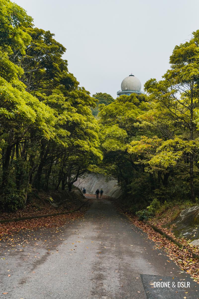
Mount Parker is easily one of the most recognizable peaks on Hong Kong Island. Much like Tate’s Cairn, its summit is occupied by not one, but two large football looking radar stations.
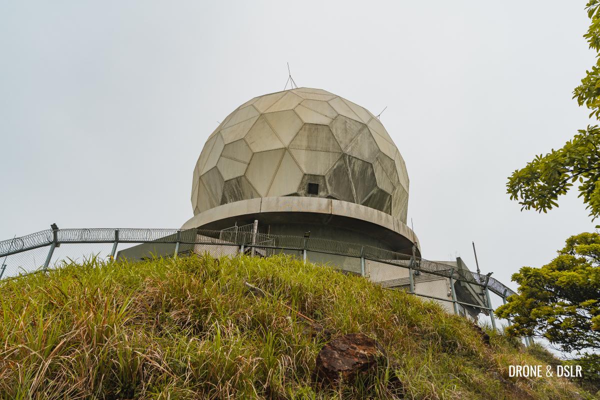
The football shaped Route Surveillance Radar (RSR) on top of Mount Parker
Mount Parker is one of the two hills flanking Quarry Bay (the other is Mount Butler) and is quite a popular hike in the area. Not surprising because there is a paved motorable road all the way to its summit (again, much like Tate’s Cairn). But honestly, I’m not one for paved roads. So, this guide aims to mix things up, while keeping the Mount Parker Hike easy and accessible.
Unfortunately, the Mount Parker hike doesn’t offer too many views to hikers. Which makes it ideal for a hazy or cloudy day, like the one when we hiked.
So, if you want an alternative but easy hiking route to Mount Parker, read on.
About the Mount Parker Hike
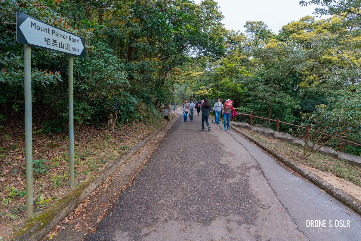
I don’t think most people need a guide to hike up to Mount Parker. The instructions are simple — walk till the end of Mount Parker Road from Quarry Bay.
Some hikers may choose to combine Mount Parker after completing the Jardine’s Lookout and Mount Butler Hike.
But if you want to avoid walking uphill on Mount Parker Road, this guide walks you through an easy route via Tai Tam Road and the Boa Vista Forest Track. And then you can descend on Mount Parker Road.

Mount Parker Hike Trail Map
Following this guide takes you through a forest trail, which makes it feel like a hike, as opposed to only walking up a road. I’m also aware that there are a few unmaintained trails through the Quarry Bay Valley. But those might be a bit more treacherous.

There are unmarked ribbon trails that cut through the valley to Mount Parker
Understanding the Mount Parker Summit
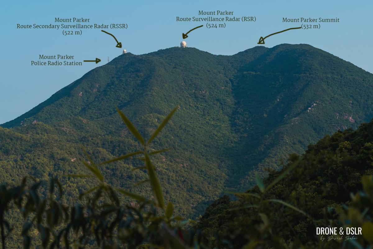
The eagle-eyed observers may have already noticed that the summit of Mount Parker consists of three peaks, of nearly identical height. Two of those peaks are occupied by the large football looking radar stations.
The lowest of the three peaks, at 522 metres, is occupied by the Mount Parker Route Secondary Surveillance Radar (RSSR). And next to the RSSR, is a police radio station.
The middle peak, at 524 metres, is occupied by the Mount Parker Route Surveillance Radar (RSR), the larger of the two stations.
The real Mount Parker summit, at 532 metres, isn’t occupied, and is accessible via an unmarked trail from the RSR.
Understanding the structures on top of Mount Parker
Most hikers consider the middle peak, occupied by the RSR, to be the top of Mount Parker. And so will this guide. But I’ll also show you how to reach the real Mount Parker summit.

For most hikers, this marks the end of the Mount Parker Hike
Let’s go!
Starting Point
My recommended starting point for the Mount Parker Hike is from Tai Tam Road. More specifically, the Sai Wan Treatment Works bus stop on Tai Tam Road.

Sai Wan Treatment Works bus stop: the starting point
To arrive here, you can catch either bus number 9 from Shau Kei Wan or 14 from Sai Wan Ho. Alight at the Sai Wan Treatment Works bus stop and then walk back on the same road.

Get off the bus and walk back. Be careful of the traffic.
I’ll admit, thanks to the narrow road, walking here is challenging. Be careful as you walk on Tai Tam Road as there is a short section with no space for pedestrians.

The pedestrian path is narrow
After that, stay on the pedestrian path till you reach the railing in the middle of it.

Stick to the right or left of this railing
Walk on either side of the railing (the right-hand side might be safer) till it ends. At this point, look across the road. You should see the starting point for a trail, behind a transformer box on the opposite side.

At the end of the railing, cross the road (very carefully) to this transformer box
Very, very carefully cross the road. I promise the hike only gets easier from here.
To The Mount Parker Upper Catchwater
Once you step off Tai Tam Road, walk to the steps and start climbing.

And the trail begins from here
The initial section of the trail consists of relatively steep steps. Go slow, take your time.
-

- The initial steps are a bit steep

-
- Take your time going up the initial section
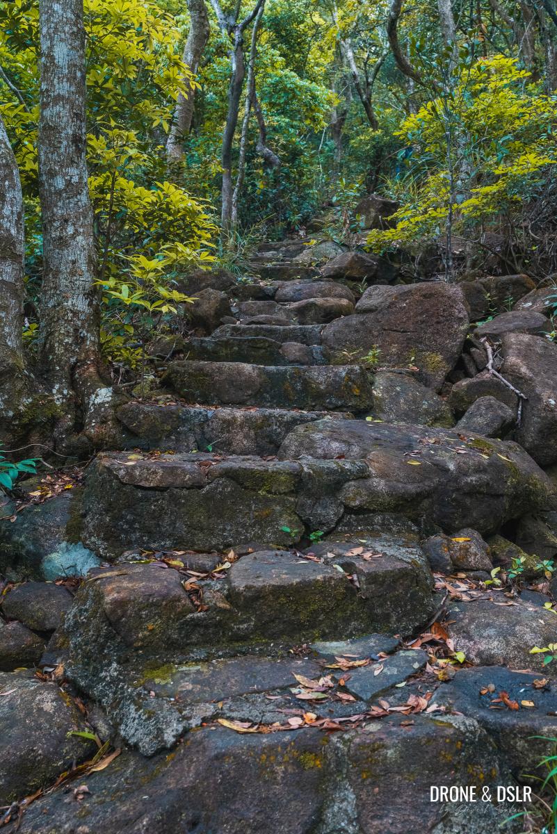
At the halfway mark, the steps reduce in intensity, becoming somewhat flatter and easier to climb.

The steps later become less steep
Simply keep climbing and after approximately 200 metres from the start, the trail arrives a meeting point with five options.
The steps end at the Mount Parker Upper Catchwater, a meeting point of multiple trails
This junction is located along the Mount Parker Upper Catchwater, and can leave you wondering, where next?
It’s simple — turn right, walk over the catchwater, and follow the sign for “Tai Fung Au”.
-
- Turn right and walk over the catchwater to continue

-
- Follow the sign for Tai Fung Au (aka Quarry Pass)

The Boa Vista Forest Track
The next 1.8 km of the trail follows the Boa Vista Forest Track to Quarry Pass (大風坳), or also known as the Quarry Gap or Tai Fung Au.
The start of the Boa Vista Forest Track
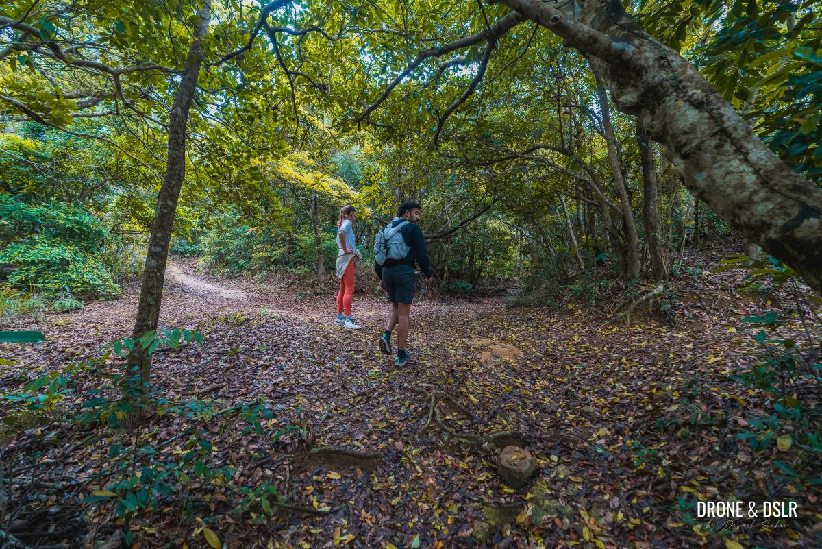
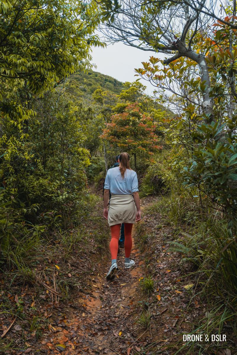
Boa Vista Forest Track is a relatively easy trail, with some very rocky sections.
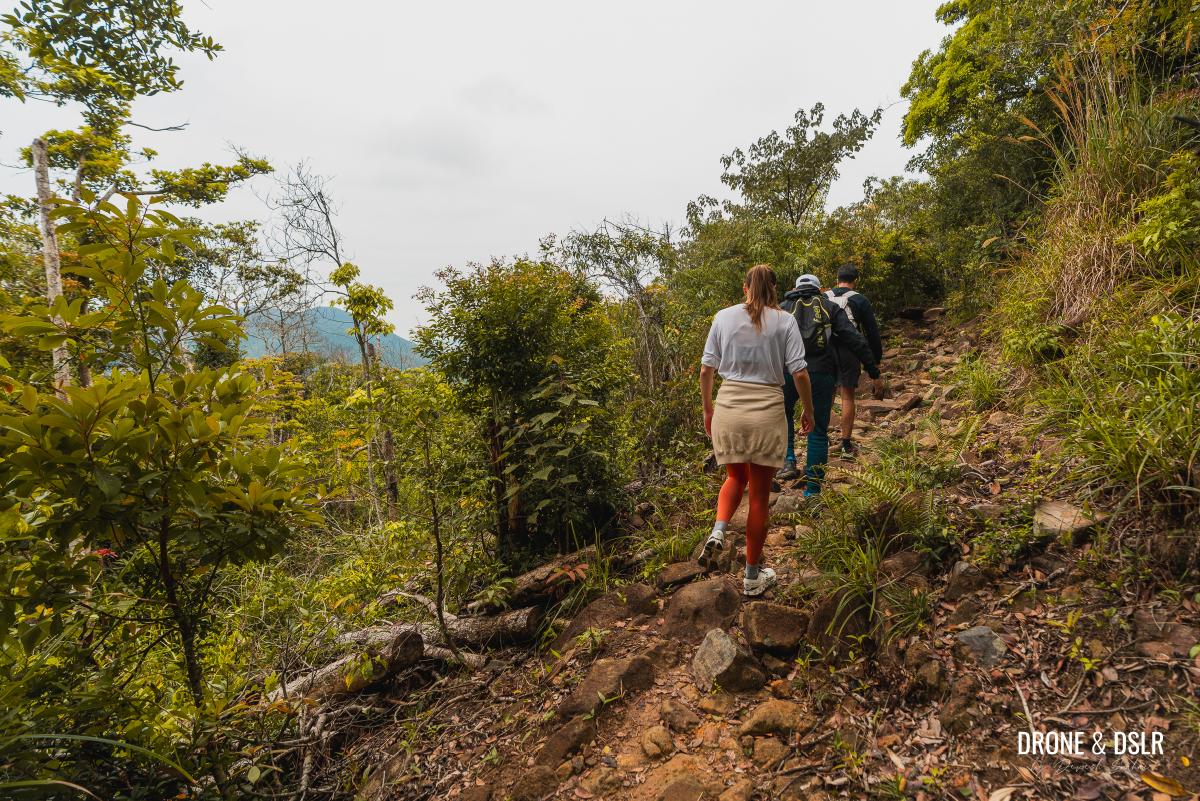
Parts of the Boa Vista Forest Track are very rocky
The track is mostly shaded, with the occasional views of Tai Tam Country Park and Tai Tam Reservoir.
-
- I much prefer the Boa Vista Forest Track to reach Mount Parker than the Mount Parker Road

-
- The track is fairly flat but uneven

The trail remains pretty much flat for the entire duration. Although it does gain approximately 80 metres of elevation, you don’t feel it over the 1.8 km distance.
-
- Boa Vista Forest Track is covered, which means no problem on sunny days

-
- The track doesn’t offer much in terms of views

Take your time as you make your way through the Boa Vista Forest Track, which feels like an easy nature walk.
-
- The lush feel of the Boa Vista Forest Track

-
- There is a narrow section with this railing

Finally, the track comes to an end at Quarry Gap, a relatively busy meeting point of some of the most popular hikes on Hong Kong Island.
-
- Cutting across Tai Tam Country Park on our way to Mount Parker

-
- And the steps signal the end of the track at Quarry Pass

To The Junk Bay Lookout
From this point onwards, the hike continues on Mount Parker Road. As you exit the Boa Vista Forest Track, turn right and start walking up on Mount Parker Road.
-
- Exit the forest track and turn right onto Mount Parker Road

-
- And now, the rest of the hike stays on Mount Parker Road

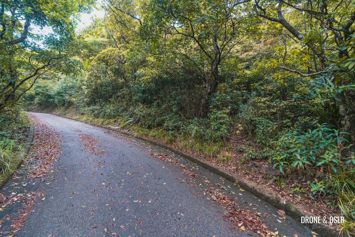
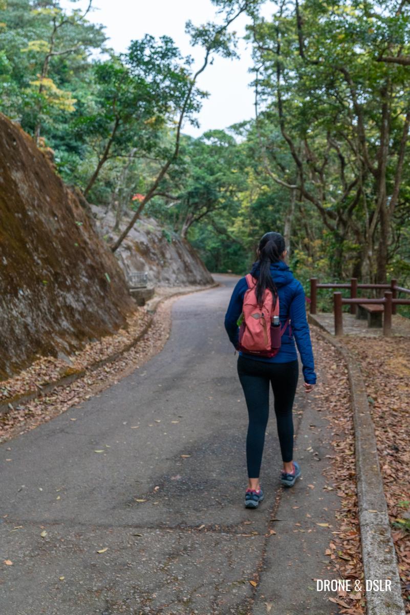
Fortunately, the incline at this stage of the road isn’t that difficult. The road maintains a steady and relatively easy incline as it continues uphill.
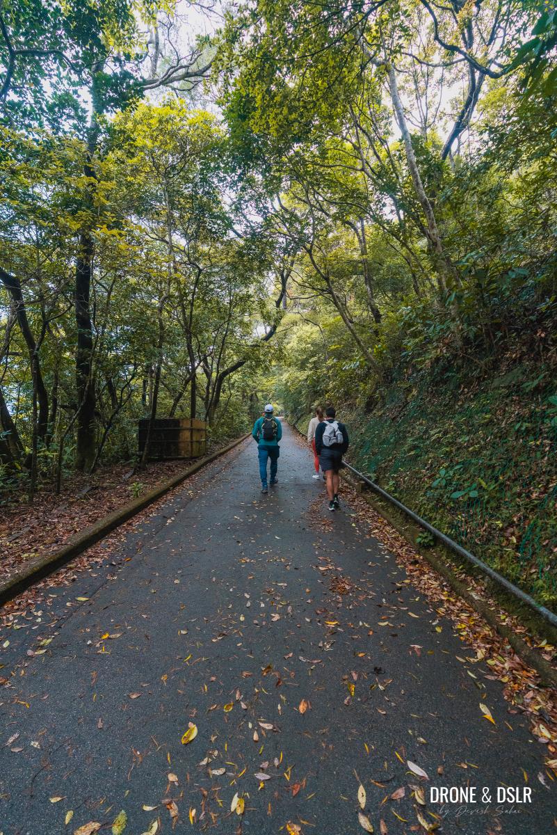
Mount Parker Road maintains a steady but easy incline
Once again, you aren’t treated to any views because of the tree cover. And because we hiked up while it was drizzling, the passing clouds made the uphill walk quite serene.
-
- Limited views on the Mount Parker Hike

-
- Walking through the clouds and mist on our way to Mount Parker

Keep walking uphill on Mount Parker Road till you arrive at a bench overlooking Junk Bay and Tseung Kwan O.

The bench with the views just below Mount Parker
Take a break here if you want to enjoy the views.

Take a moment to enjoy the views of Junk Bay and TKO
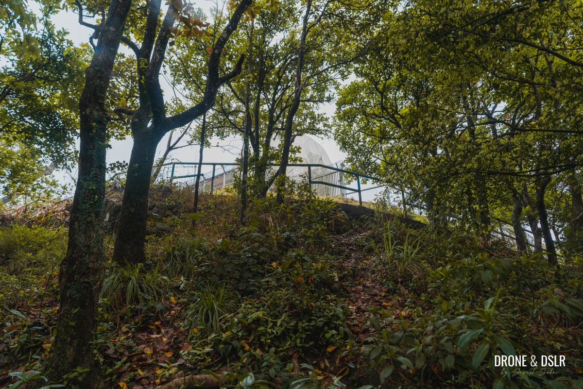
The Shortcut To The Mount Parker RSR
The scenic bench is located right below the Mount Parker RSR.
From the bench, walk uphill for approximately 50 metres till the road curves left. Notice an unmarked entrance on the right-hand side.
There is a shortcut to the Mount Parker Route Surveillance Radar (RSR), just after the bench as the road curves
At this point you have a choice to make:
- Take the shortcut to the RSR (distance = 90 metres)
- Continue walking on Mount Parker Road to the RSR (distance = 220 metres)
We opted for the shortcut, which is easy to spot on the right-hand side of the road. Simply follow the trail as it heads uphill.

Cut across this slope to avoid taking the longer route
The unmarked trail emerges at the Mount Parker RSR.
The shortcut emerges at Mount Parker Route Surveillance Radar (RSR)
The Highest Point on Mount Parker
For most hikers, the Mount Parker Hike ends at the RSR or the RSSR.

And just like that, we’ve reached the top of Mount Parker (sort of)
But if you’re curious to know how to reach the highest point on Mount Parker, I suggest taking a walk around the RSR.

There is a circular path around the RSR
As you emerge from the shortcut, turn right and walk along the fence.

Take a loop around the RSR
Just along the flight of steps, there is a ribbon tied to a broken section of the railing. If you were to hop across the railing and follow the unmarked trail, for approximately 240 metres, you’ll arrive at the highest point of Mount Parker.
-
- Notice the ribbon and the broken railing, which marks the trail to Mount Parker summit

-
- It’s a 500-metre return to Mount Parker summit from this point

Because of the slippery surface of the trail and the continuous drizzle, we decided not to head down this path. Instead, we circumnavigated the RSR, enjoying the scenic view of Tai Tam Bay while retracing our steps on Mount Parker Road back to Quarry Bay.

Views of Tai Tam Bay from behind the Mount Parker RSR
Ending The Hike
On your way down, you could also visit the RSSR. While we skipped it this time, the RSSR actually offers more impressive views of the east.
On your way down, feel free to visit the Mount Parker Route Secondary Surveillance Radar (RSSR) for some better views
To end the hike, the easiest option is to follow Mount Parker Road for 4.5 km to Quarry Bay. It’s honestly, very straightforward.
However, if you’re a bit more adventurous, you could always seek out one of the unmarked trails that connect with Hong Pak Country Trail.
But of course, Mount Parker Road is the safest and easiest option to end the Mount Parker Hike. Along the way, there are a few lookout pavilions, and even some points of interest, such as the Woodside Biodiversity Education Centre.
-
- Head down Mount Parker Road for the final leg of the hike
-
- Mount Parker Road is an easy walk downhill
-
- Continuing down Mount Parker Road and past the entrance for Sir Cecil’s Ride
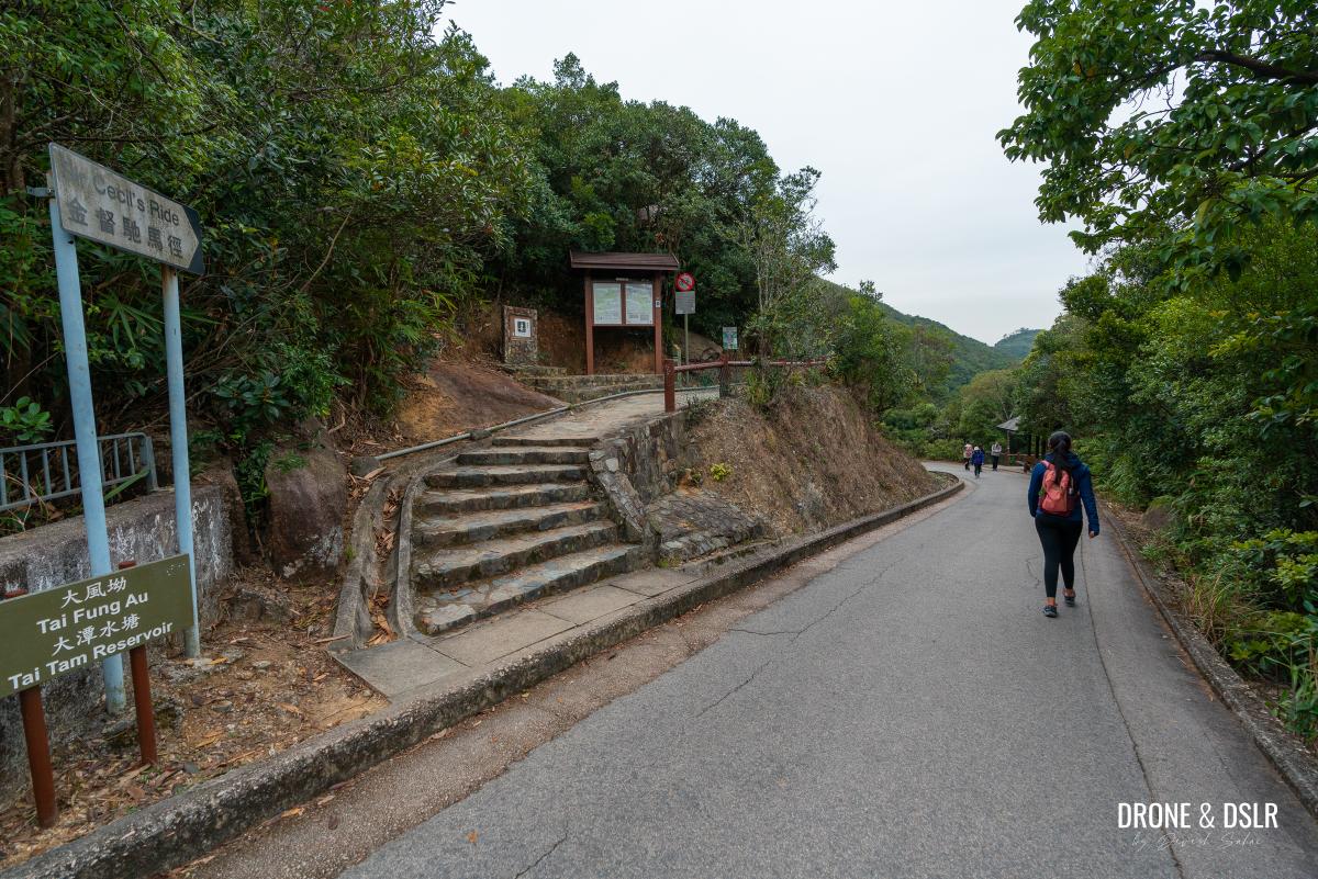
-
- Just up ahead, Mount Parker Road ends onto King’s Road
Also, don’t be surprised if you spot wild boars along the way.
The Mount Parker Hike
I hope that you found this Mount Parker Hike guide resourceful and that you learned a little more about the hill itself.
If you want to explore more hikes in the vicinity, I highly recommend the Jardine’s Lookout and Mount Butler Hike. Or if you’re feeling adventurous, the Boa Vista Hike.
There are also much easier and summer friendly hikes in Quarry Bay. My favourite include the Quarry Bay Tree Walk and the Hong Pak Country Trail.
We’d love to hear about your Mount Parker experience. Do drop us a comment below or feel free to share this post on the social media channel of your choice.
If you enjoy our work, come join us on Instagram and YouTube 🙂


You might also like


Leave a reply