
The Quarry Bay Tree Walk is an easy, shaded trail brimming with natural beauty and historical sites, right in the heart of Hong Kong. The trail is short and easy, making it kid-friendly and also a great option for a summer hike.
As you make your way along the trail, keep an eye out not only for the diverse species of trees but also for remnants from Hong Kong’s fascinating past. Because this tranquil tree walk is just an excuse to uncover a Japanese army tunnel, the ruins of wartime stoves, the site of the former Mount Parker Cable Car, and even an abandoned shooting range!
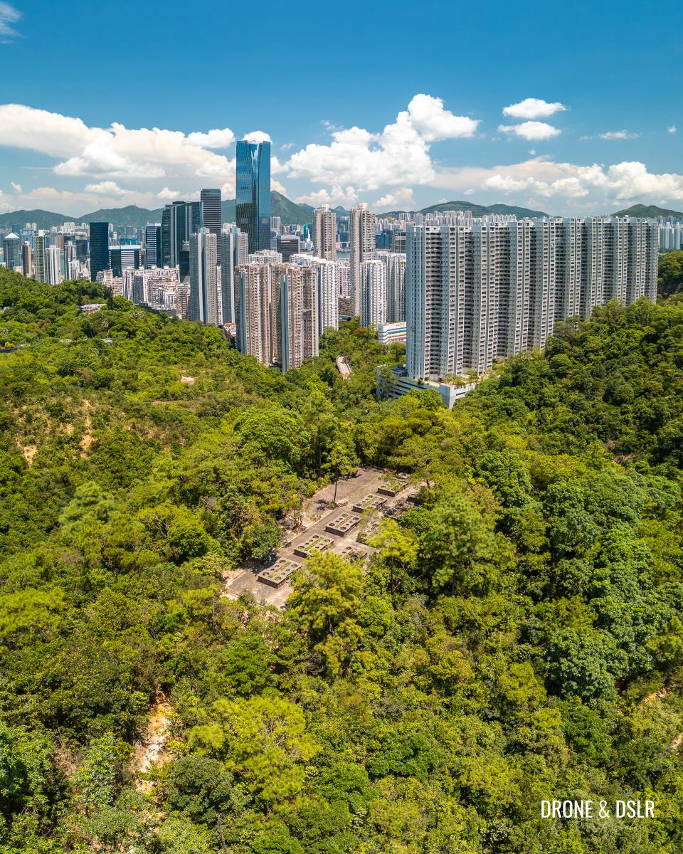
A fascinating part of the city’s history lies just behind Quarry Bay
About the Quarry Bay Tree Walk
The Quarry Bay Tree Walk, located in Tai Tam Country Park behind Quarry Bay and Tai Koo, is a 1 km trail that offers a unique experience. However, to reach the starting point from Quarry Bay, you’ll need to embark on a 450m walk from the MTR station to Mount Parker Road, followed by a 1.1 km uphill hike along Mount Parker Road. After completing the trail, the final leg of the journey involves a 450m walk back down to Grieg Road. In total, this hike covers approximately 3 km.
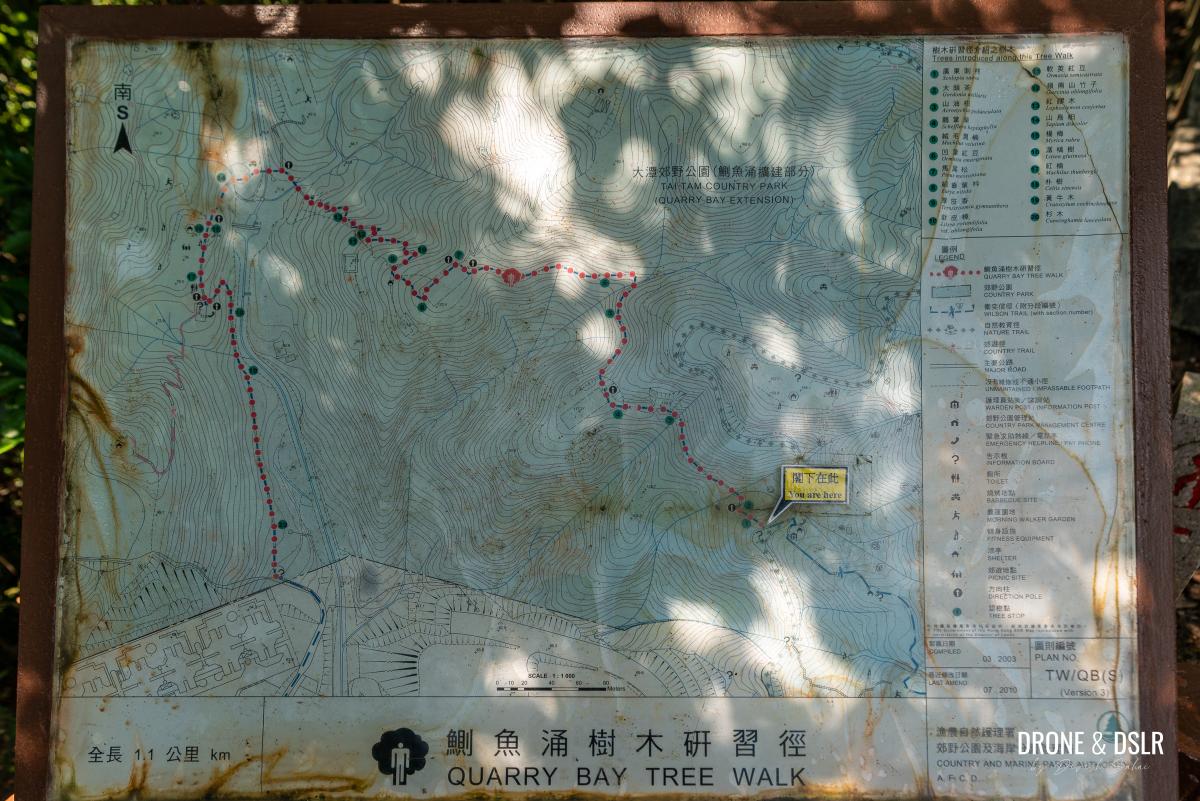
Quarry Bay Tree Walk map
Most of the hike is surprisingly easy-going, with the notable exception of the 1.1 km ascent on Mount Parker Road.
You might wonder what makes a 1 km trail worth exploring. But the Quarry Bay Tree Walk delivers on that and more, featuring numerous historical relics from Hong Kong’s World War II era. While some of these landmarks are clearly marked along the trail, others remain hidden.
You’ll also encounter numerous species of flora and even stumble upon a few streams.
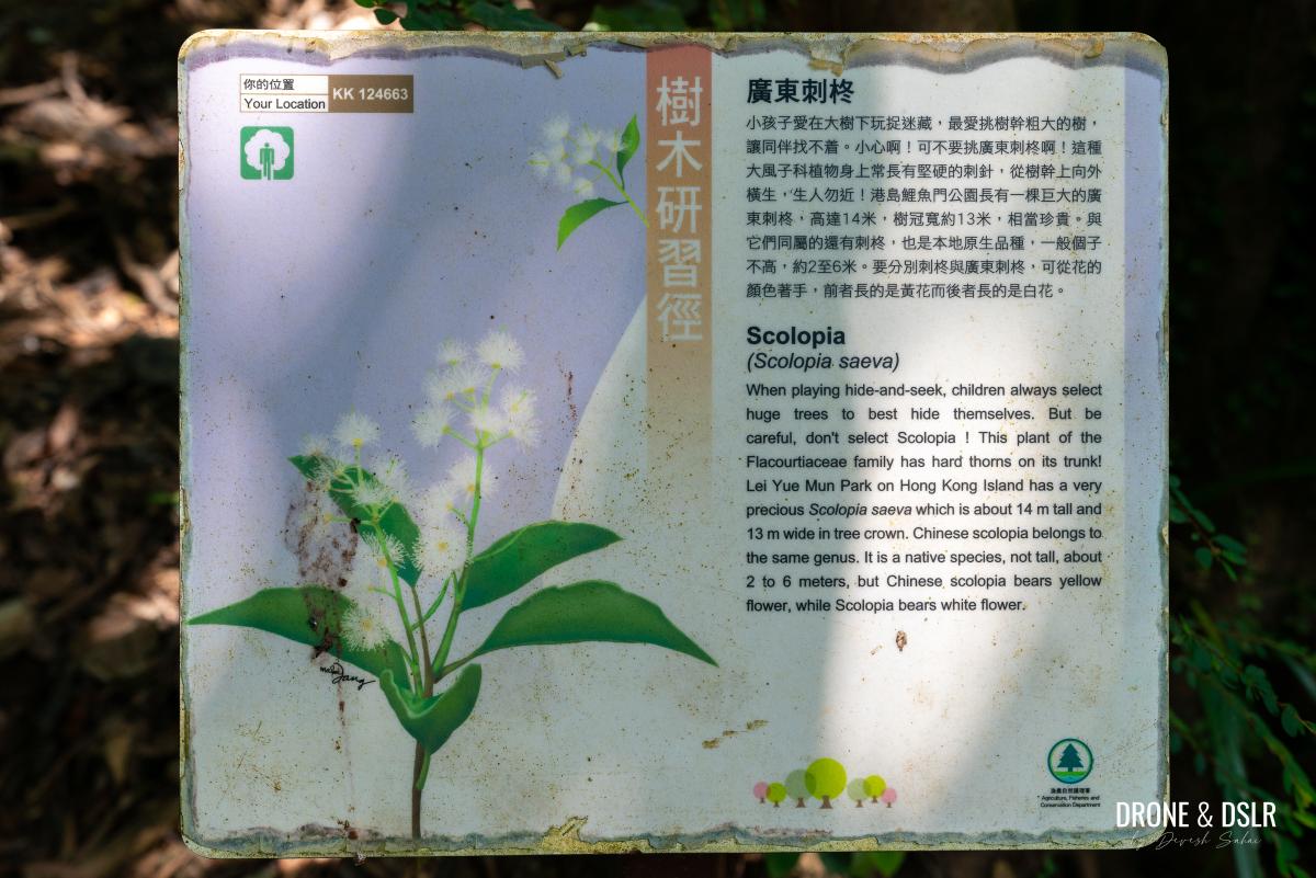
As you explore the Quarry Bay Tree Walk, keep an eye out for informative signs about the diverse plant life that thrives here
How to get to the starting point
The Quarry Bay Tree Walk is situated between Mount Parker Road and Grieg Road, making it accessible from either side. However, for the purpose of this guide, we’ll start the hike from Mount Parker Road. Here’s a link to get to the starting point on Google Maps, with more detailed instructions below.
To get to the starting point by MTR, take Exit A at Quarry Bay Station on to King’s Road. Turn right and walk approximately 450 meters to reach the beginning of Mount Parker Road (also known as Mount Parker Road Green Trail). This is where the uphill incline begins.
-

- Exit the MTR and turn right onto King’s Road
-
- Turn right before the “Monster Building”

-
- Turn right at the sign for Mount Parker Road Green Trail
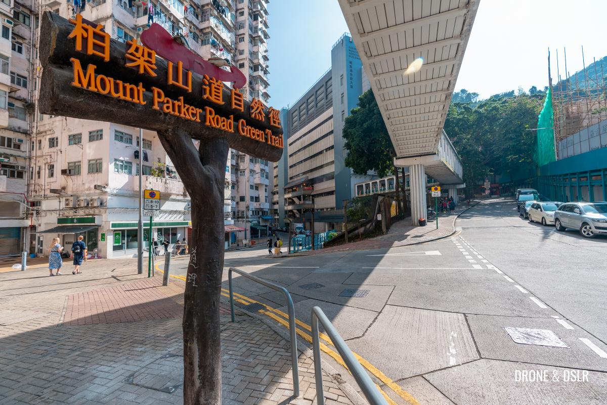
Mount Parker Road is a popular hiking trail that serves as the gateway to Tai Tam Country Park. From this point, hikers can access various trails, including those leading to Mount Parker, Hong Pak Country Trail, Mount Butler, Boa Vista, and the Tai Tam Reservoirs. You can also hike from Quarry Bay to Repulse Bay via this route.
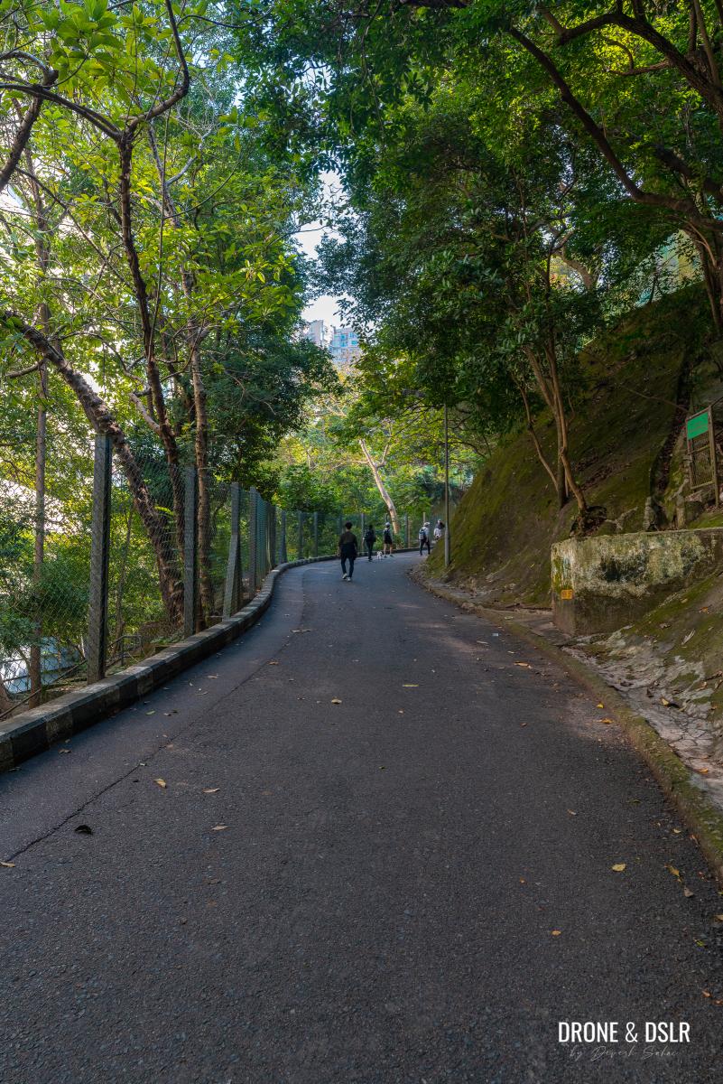
Start by walking uphill on Mount Parker Road. The incline is relatively straightforward, with numerous outdoor seating areas and viewing points where you can take a break along the way.
-
- The incline on Mount Parker Road begins
-
- The Woodside Biodiversity Education Centre is the first landmark on Mount Parker Road
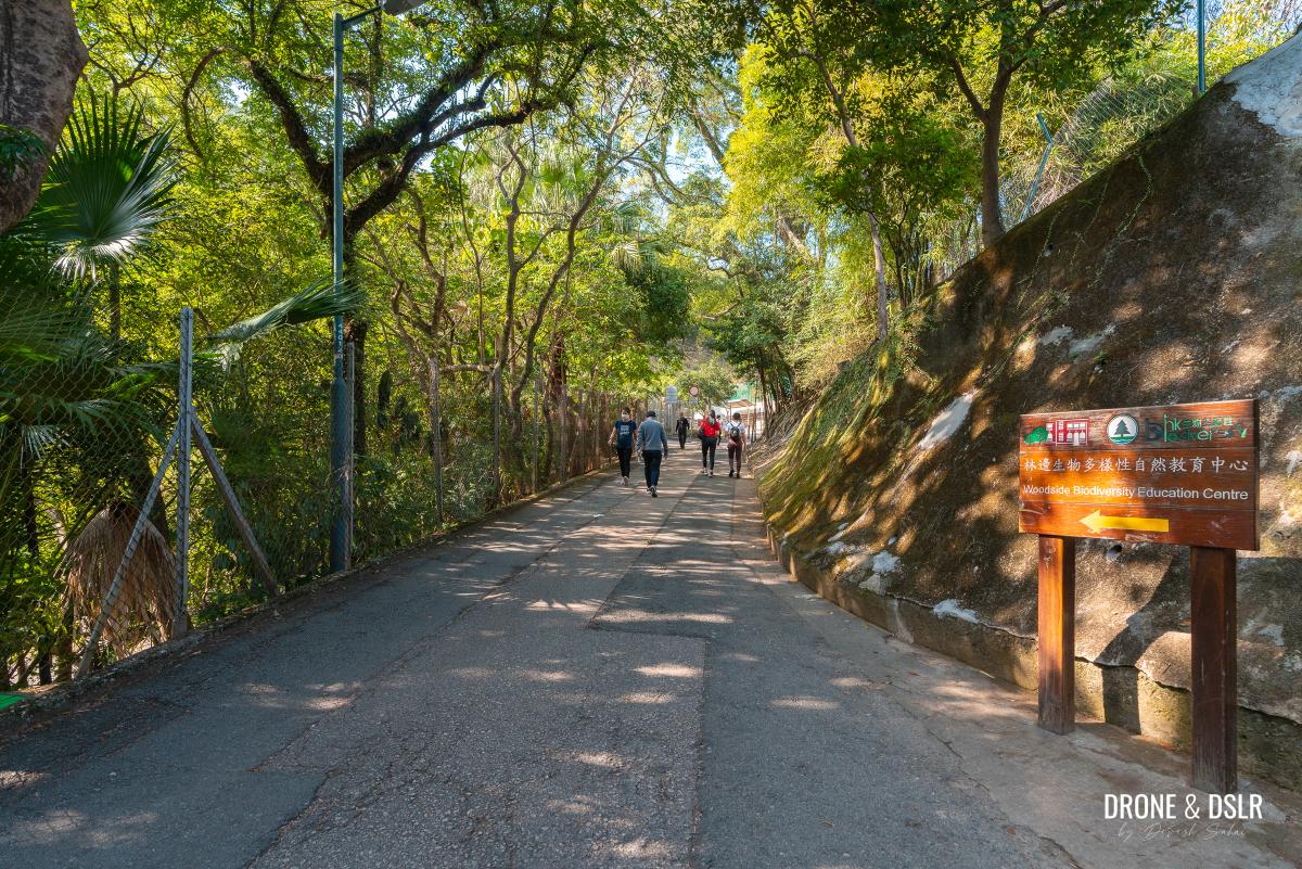
As you ascend, you’ll pass by the Woodside Biodiversity Education Centre, followed by the entrances to Wilson Trail Section 2 and Sir Cecil’s Ride.
-
- Walk past the entrance to Wilson Trail Section 2

-
- Walk uphill on Mount Parker Road

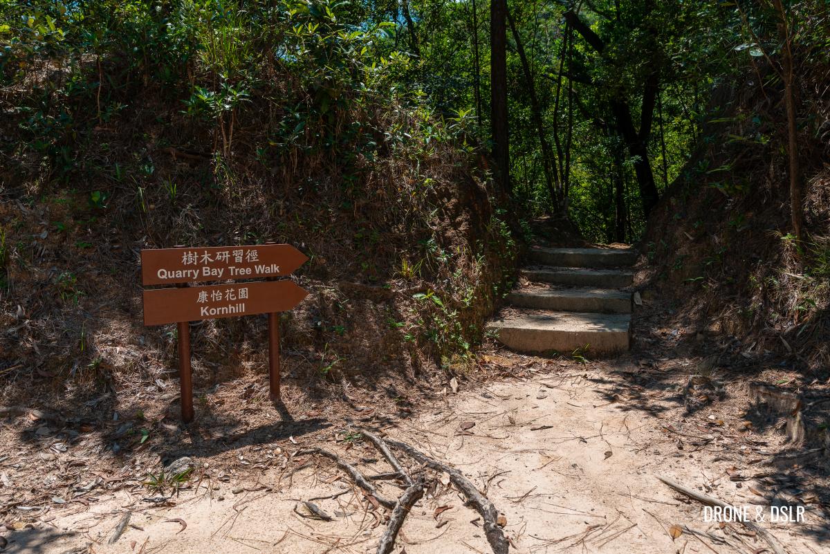
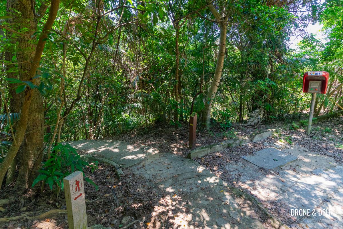
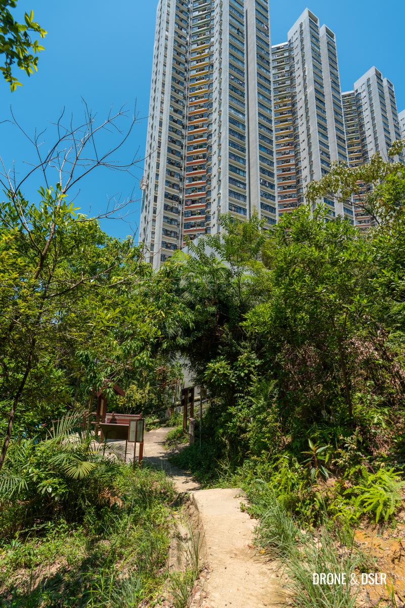
And hiking uphill for approximately 1.1 km, you’ll arrive at the entrance for the Quarry Bay Tree Walk.
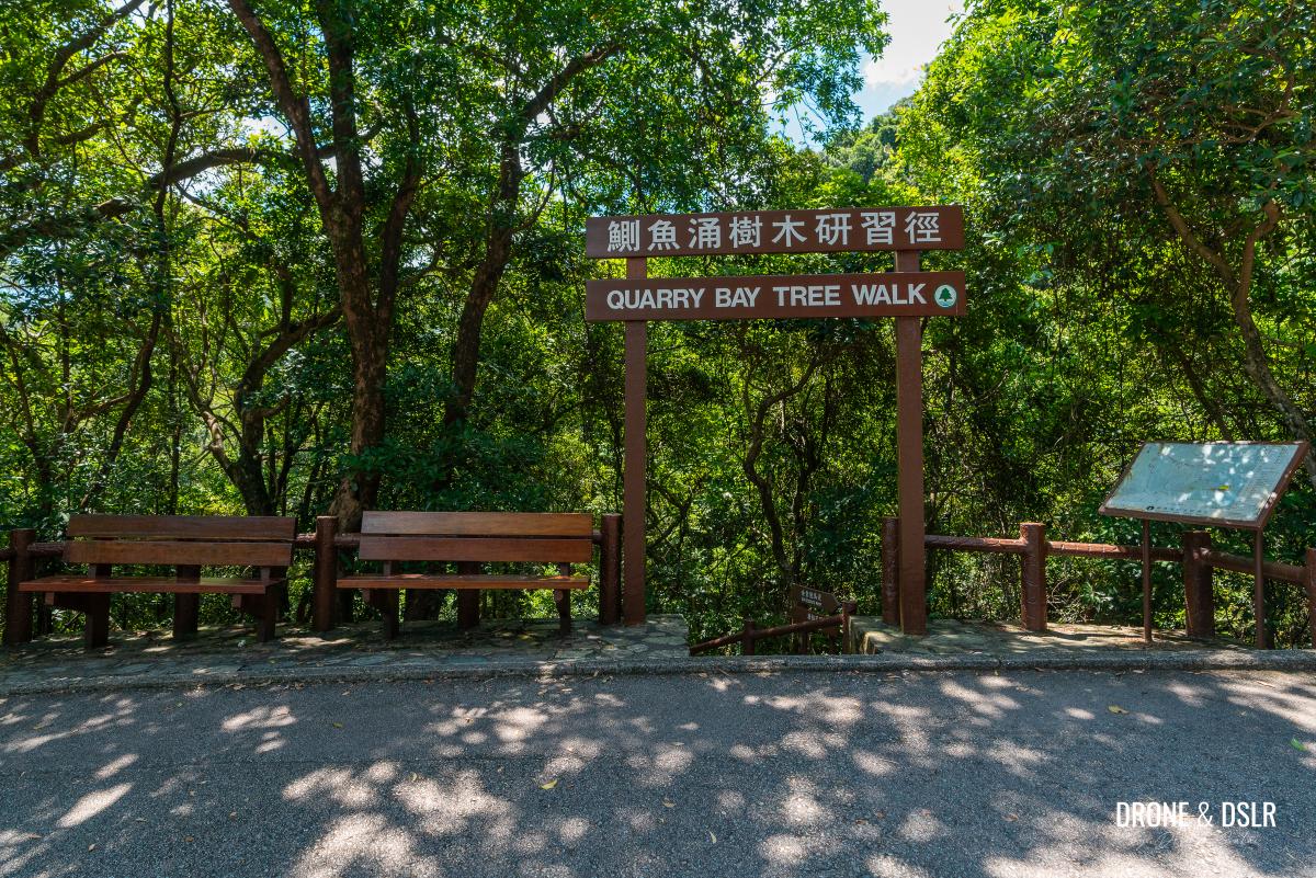
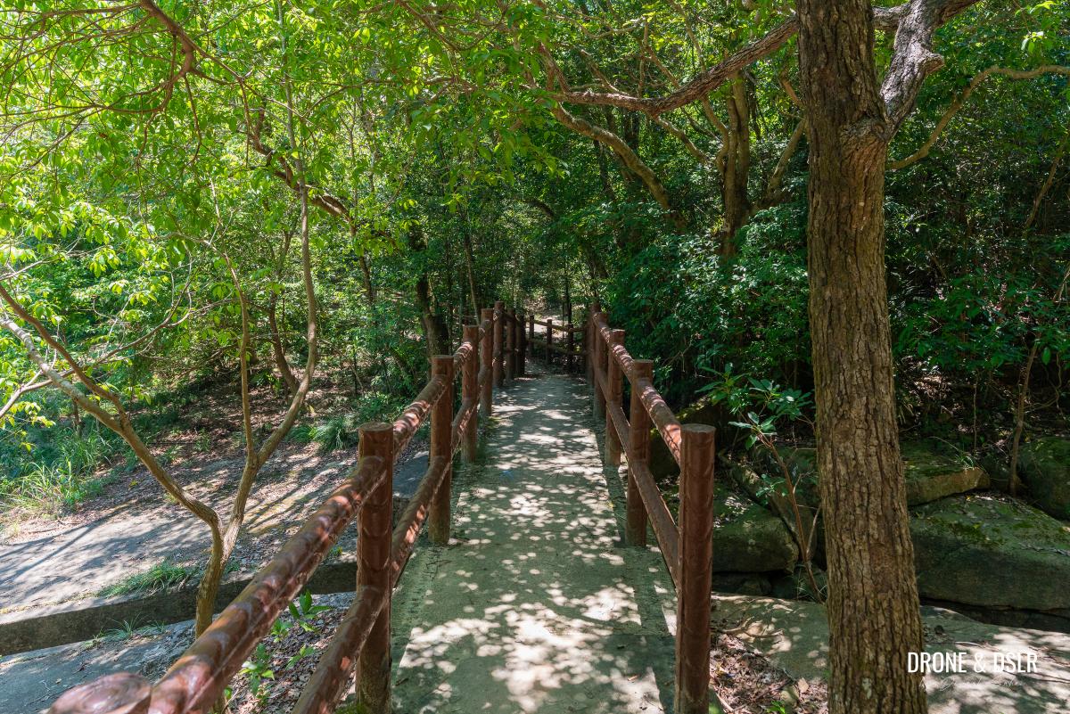
The entrance to the Quarry Bay Tree Walk
The Quarry Bay Tree Walk Begins
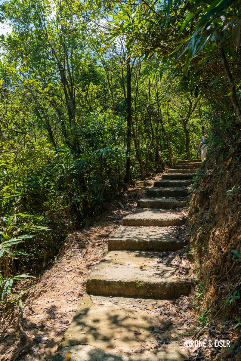
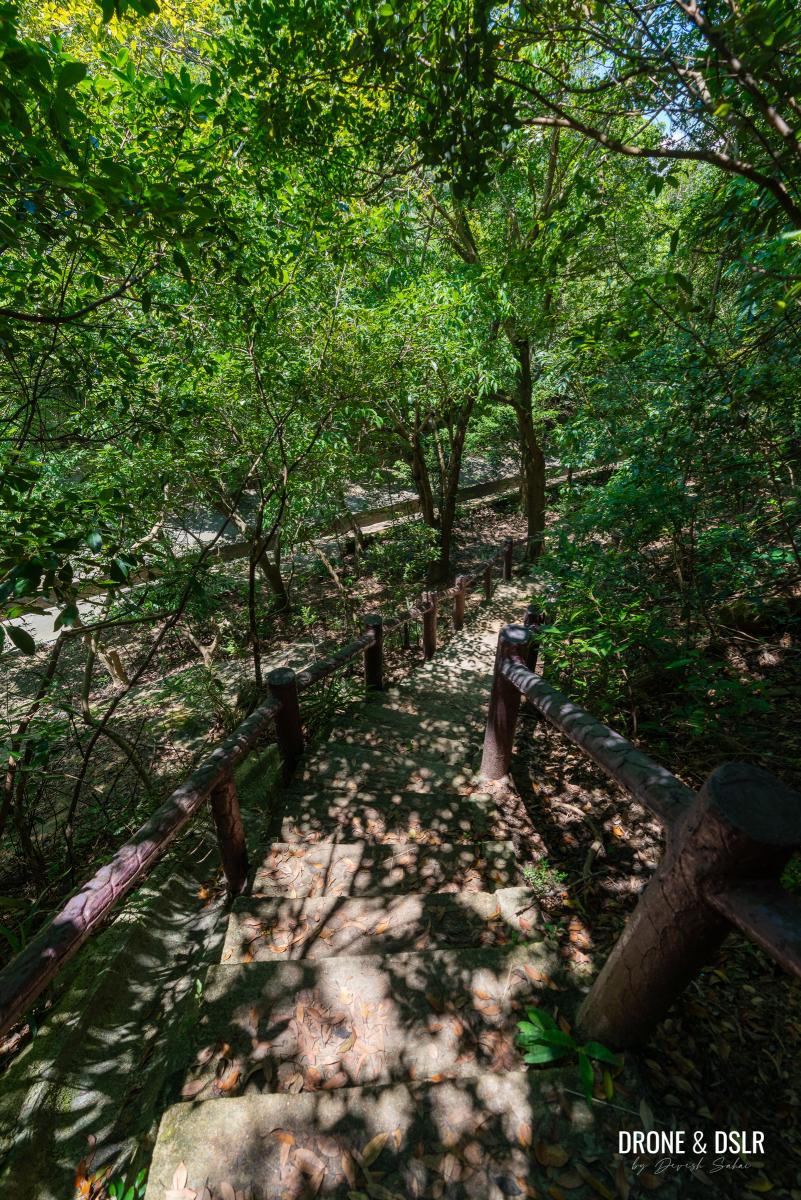
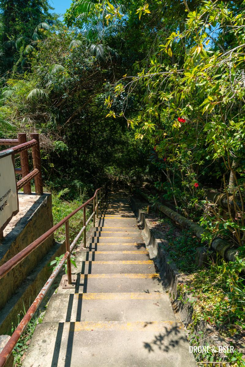
One of the advantages of starting the trail from this end is that you’ve completed all the climbing, and the rest of the hike is all downhill.
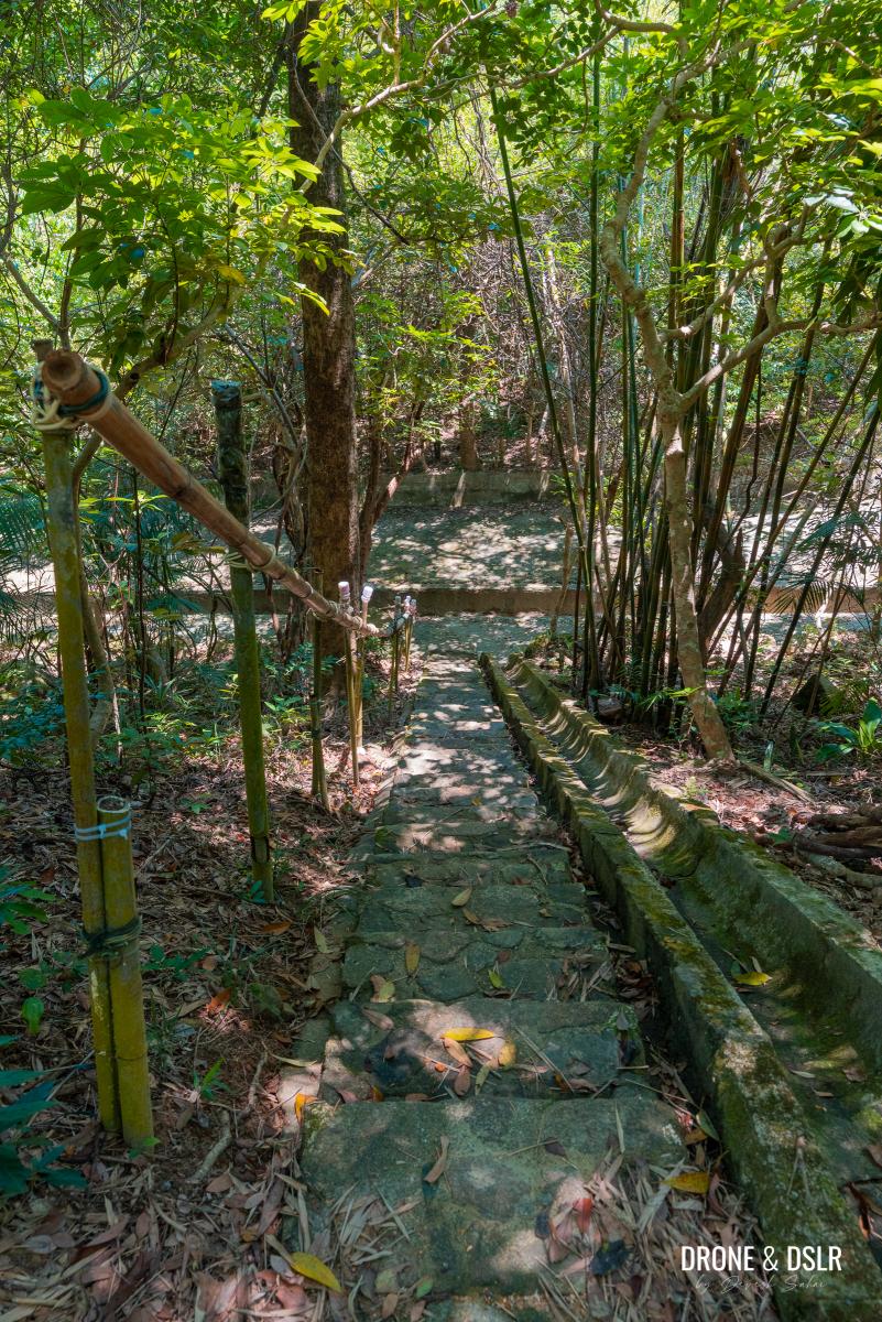
The trail starts on these steps downhill
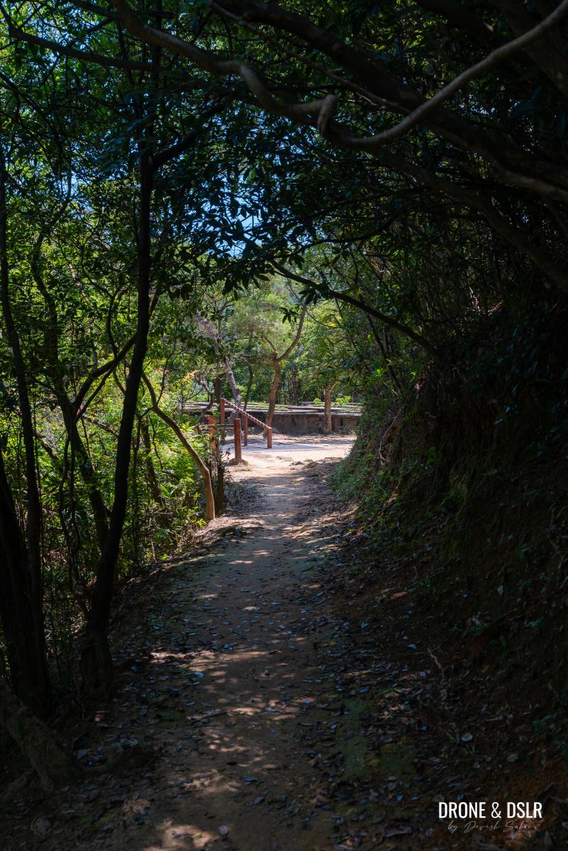
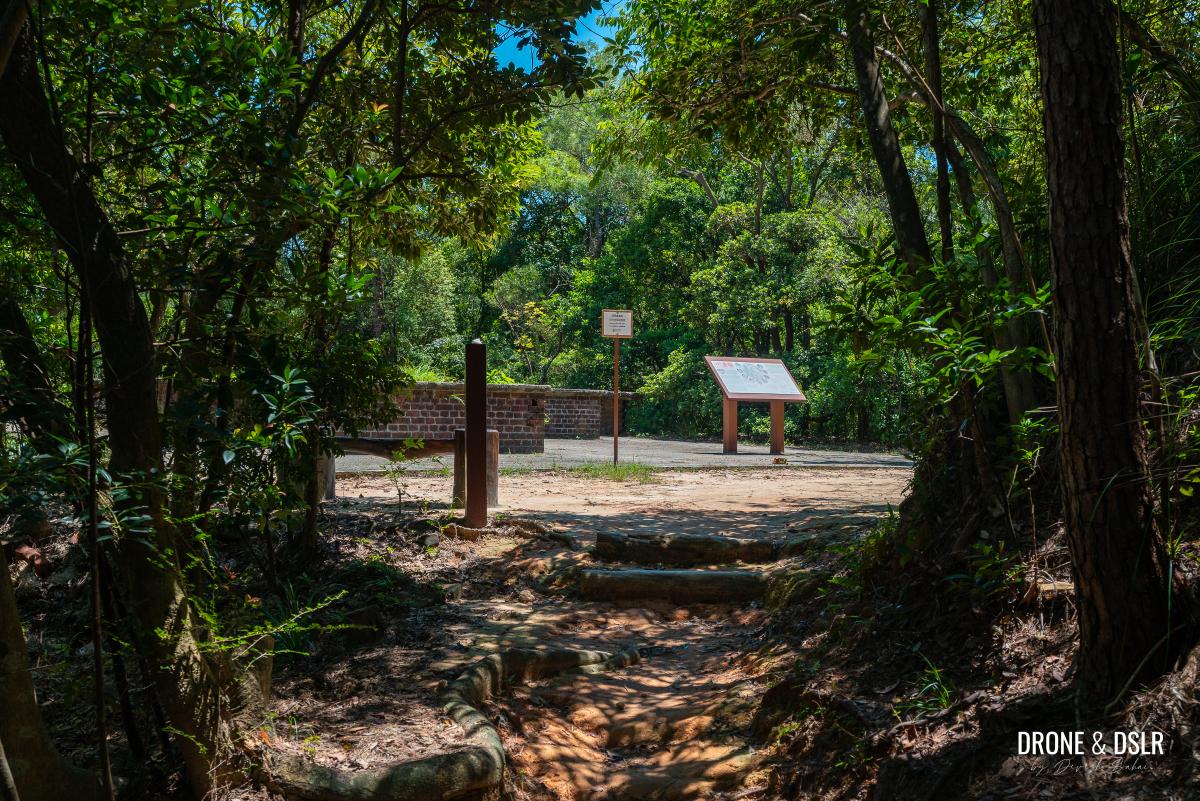
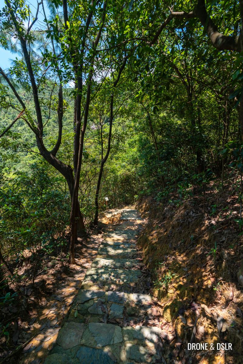
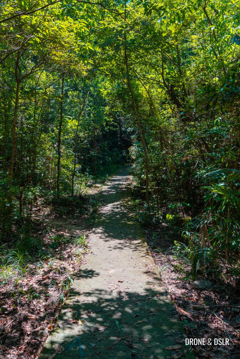
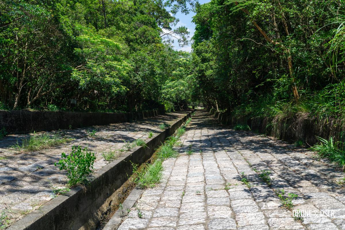
The Quarry Bay Tree Walk starts on a trail of gently descending steps. Right from the start, you’ll notice the information boards, educating hikers about the various trees along the walk.
The shaded path along the Quarry Bay Tree Walk
As mentioned earlier, this short 1 km trail packs so many attractions, that you can expect to see one every couple of hundred metres. And as the trail gently meanders between the trees, you’ll stumble upon the first attraction.
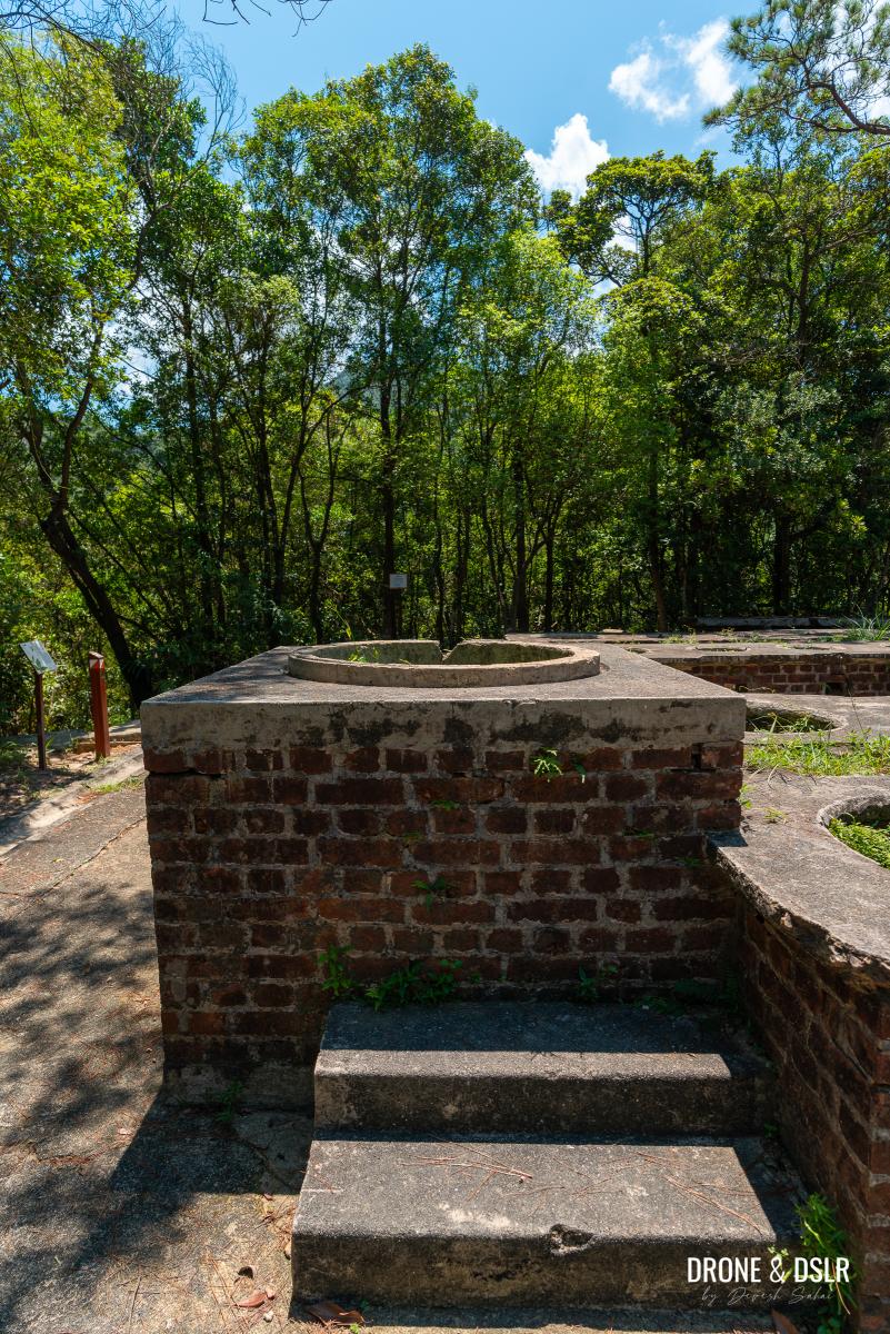
Attraction 1: Dry Latrine
I’m sure many of you weren’t expecting to see a historical toilet on your hike, but here it is. The first historical site on the Quarry Bay Tree Walk is a dry latrine that was built for a nearby communal kitchen of the Tai Koo Reservoir Dispersal Area.
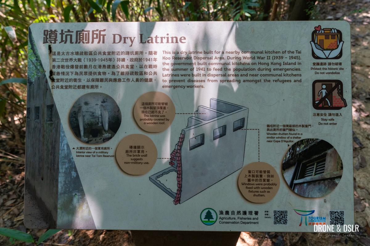
Information on the dry latrine
During World War II, from 1939 to 1945, the government built communal kitchens on Hong Kong Island in the summer of 1941 to provide emergency food supplies for the population.
The first attraction, a dry latrine is a short distance from the entrance
As part of this initiative, latrines were also built in dispersal areas and near these communal kitchens. This was done to minimize the risk of disease transmission among refugees and emergency workers.
And just a short walk from the dry latrine is the next attraction.
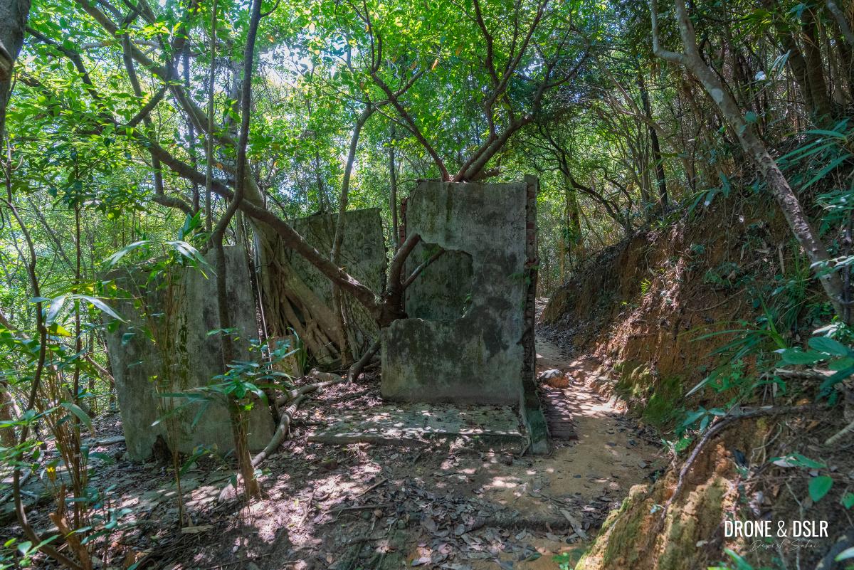
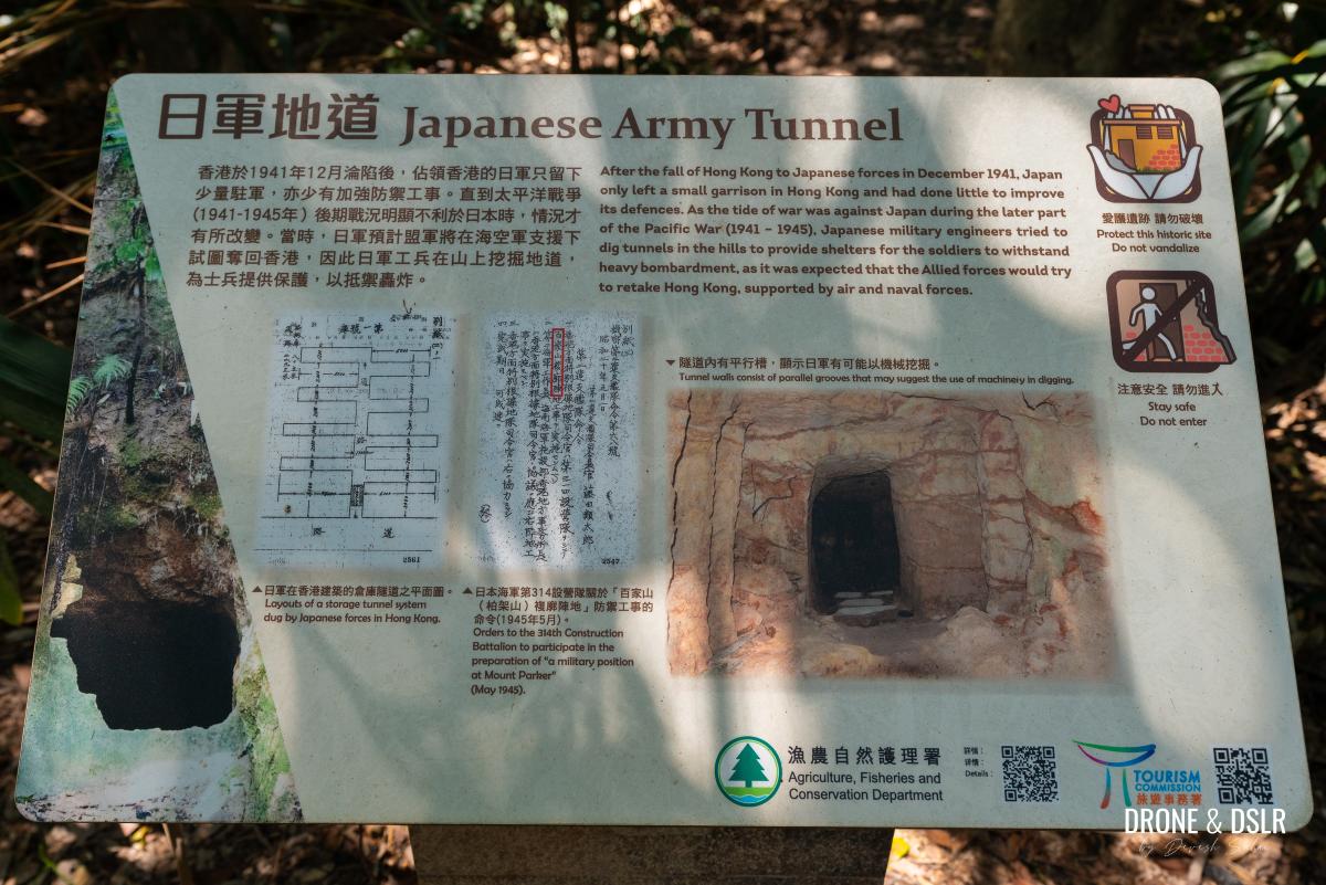
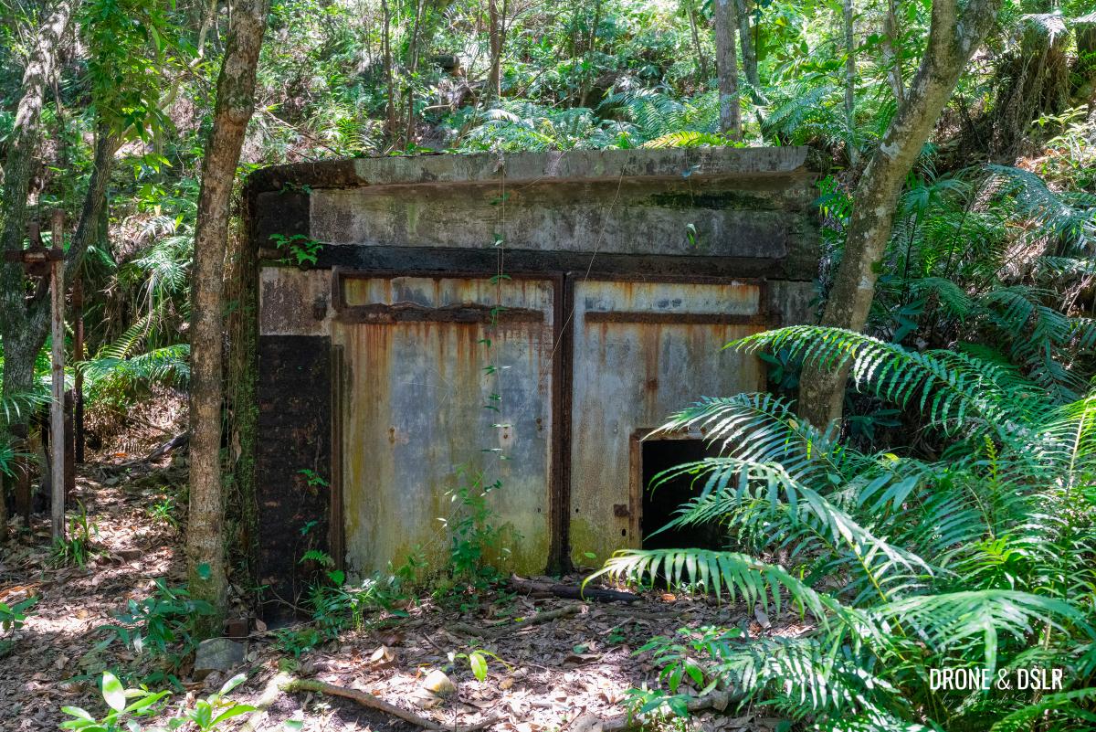
Attraction 2: Japanese Army Tunnel
While I’ve had the opportunity to visit numerous Japanese war tunnels throughout Hong Kong Island and Lamma Island, I never grow tired of seeing another one.
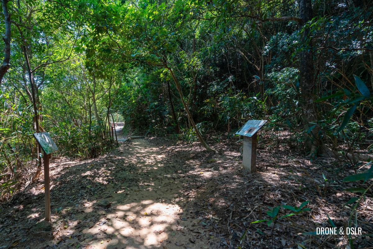
Just across the dry latrine, is the sign for the next attraction
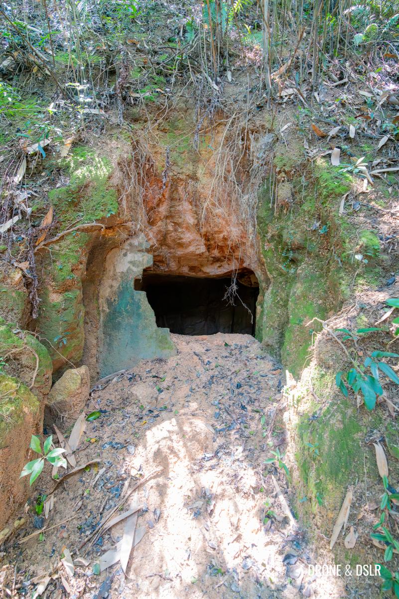
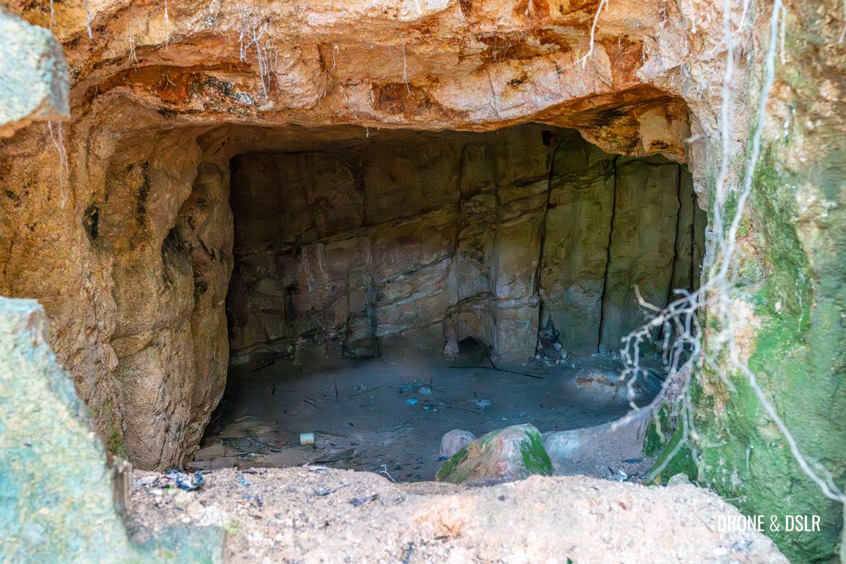
The Japanese war tunnel on the Quarry Bay Tree Walk is situated right besides the trail. You can approach the entrance to admire it, but for safety reasons, please refrain from entering the tunnel itself.
-
- Information board on the Japanese army tunnel
-
- The Japanese army tunnel, Quarry Bay Tree Walk
-
- Taking a closer look inside the war tunnel
From the Japanese army tunnel, you’ll have a clear view of the next attraction, which lies just 50 metres ahead. A short walk through the canopy of trees will bring you to the first site of the wartime stoves.
A short distance from the tunnel is the first site for the wartime stoves
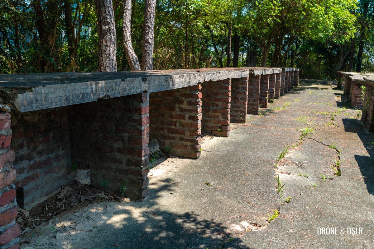
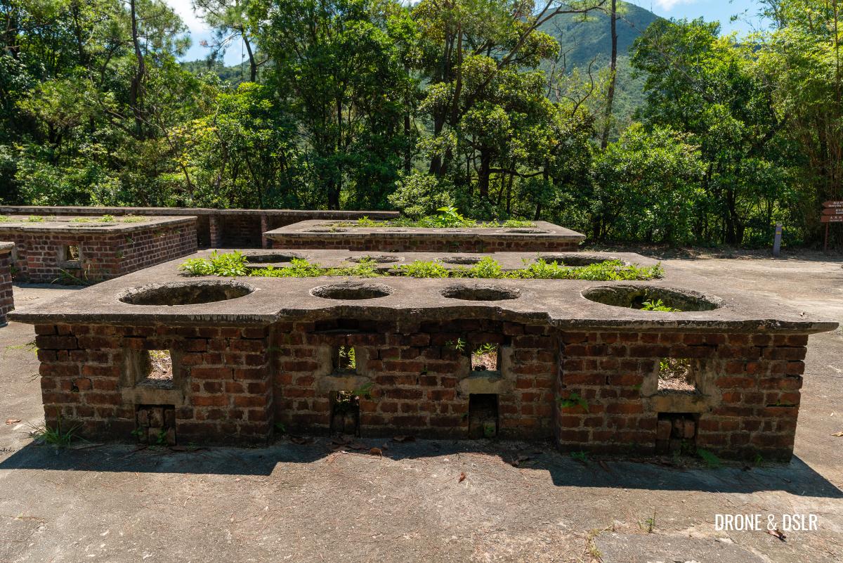
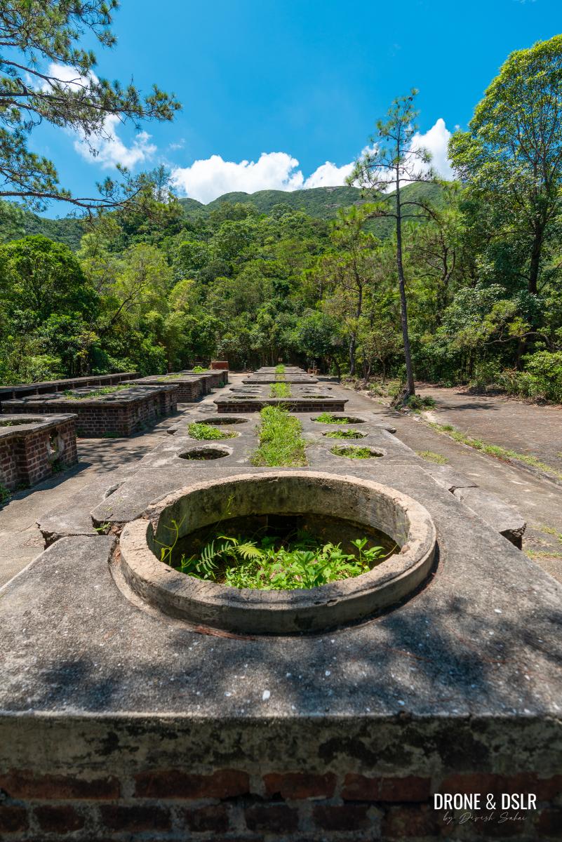
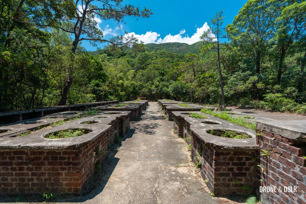
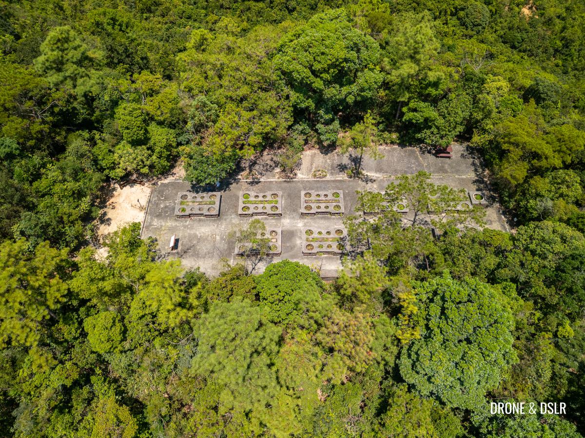
Attraction 3: Wartime Stoves (1st Site)
There are three sites in good condition of these wartime stoves along on the Quarry Bay Tree Walk. This is the first.
-
- Wartime stoves, first site
-
- Stoves that were never used
Take your time to admire this incredible wartime relic in Hong Kong and also to learn its history.
A Brief History of the Wartime Stoves
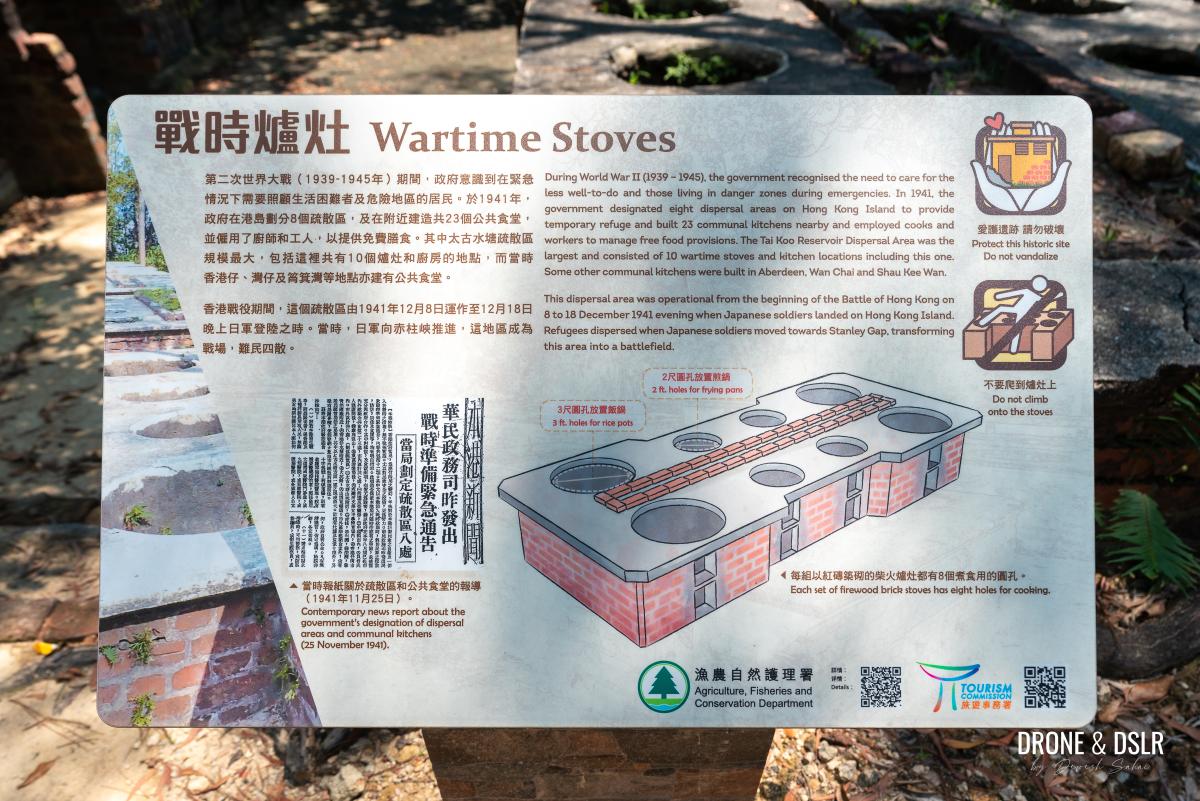
Information board on the wartime stoves
In anticipation of potential conflict during WWII, the government constructed a series of wartime cooking ranges near Quarry Bay Tree Walk in Tai Tam Country Park between 1938-1939. These facilities were designed to provide essential food supplies in the event of war to support vulnerable populations and those living in high-risk areas during times of crisis.
-
- The insides of the stoves have been taken over by nature

-
- The shelves and storage area behind the wartime stoves
-
- The first of the three wartime stoves sites
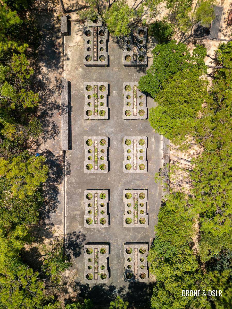
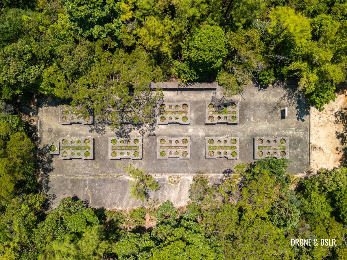
The Tai Koo Reservoir Dispersal Area was one of the largest, featuring a network of ten wartime kitchen stations. Today, the wartime brick stoves mostly survive in three sites (which we’ll visit on this trail) including the workbenches on both sides and a large stove possibly used for boiling water.
Each site has one of these giant stoves, probably made for cooking rice
As the Battle of Hong Kong unfolded on December 8-18, 1941, Japanese forces poured onto the island, prompting a mass evacuation from this dispersal area. Hong Kong fell under Japanese occupation just over two weeks after the start of the Battle of Hong Kong on December 8, 1941 – a swift turn of events that left these cooking ranges unused.
Aerial view of the first site of the wartime stoves
Continue on the Quarry Bay Tree Walk
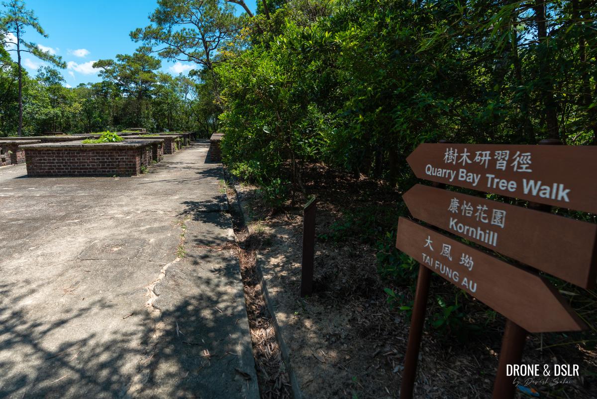
Once you’re done admiring the first site of the wartime stoves, follow the signs for the “Quarry Bay Tree Walk” and exit onto the trail.
To continue on the trail, follow the signs
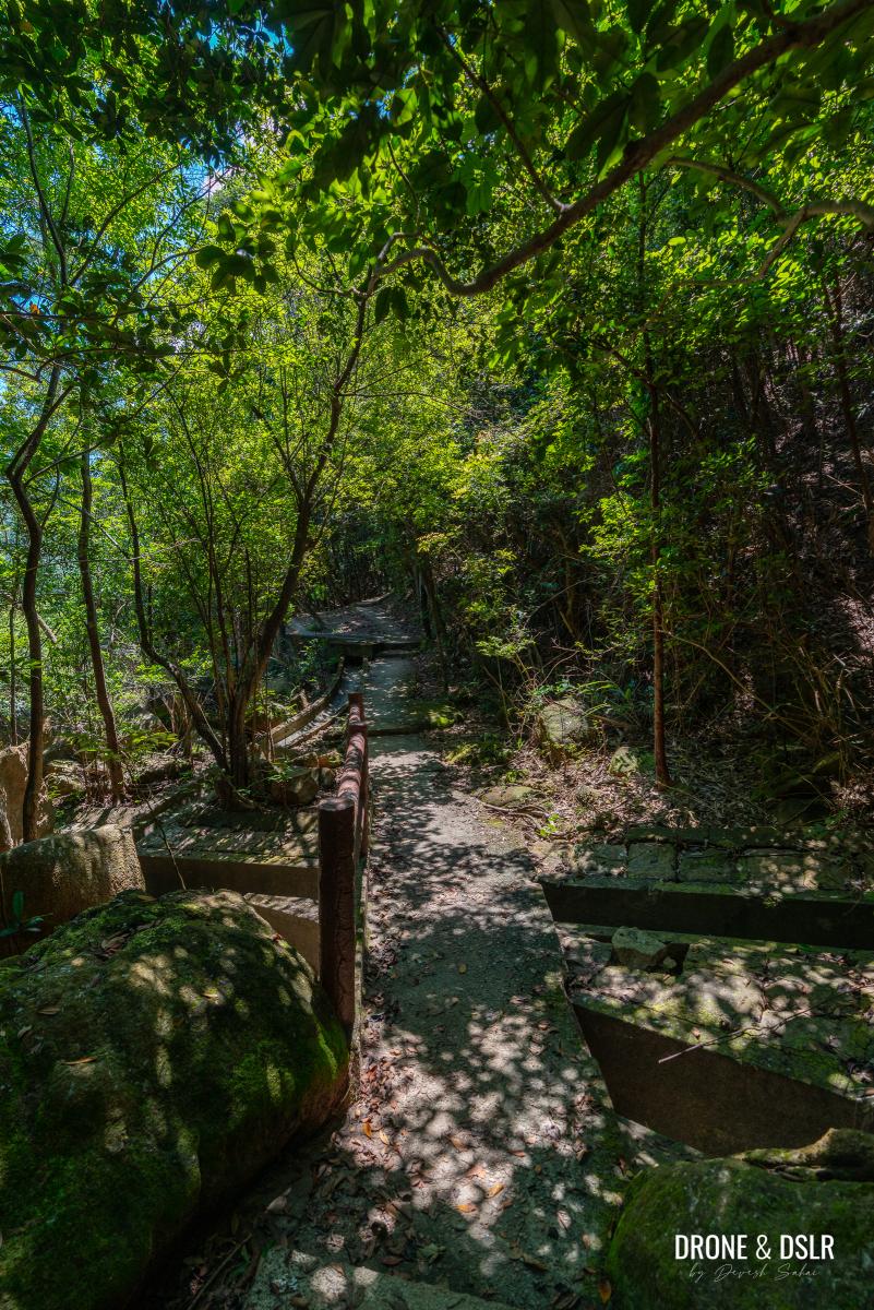
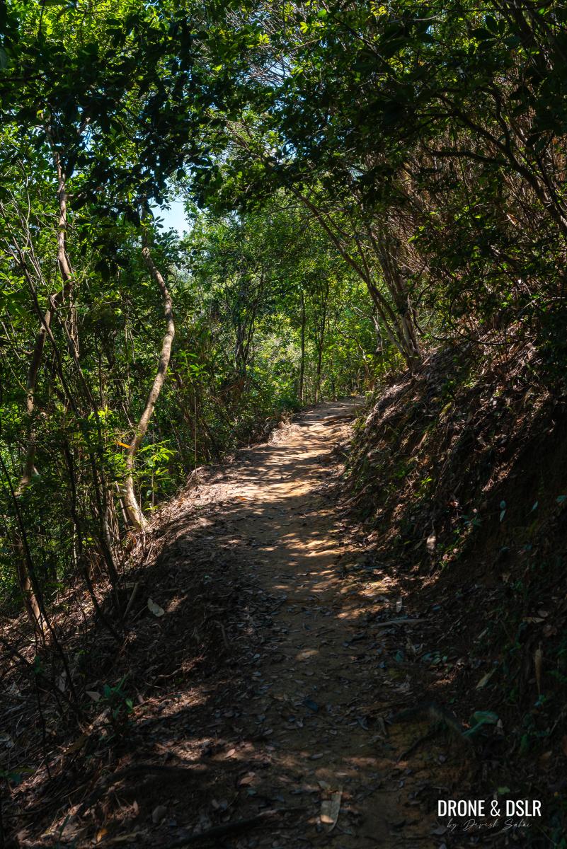
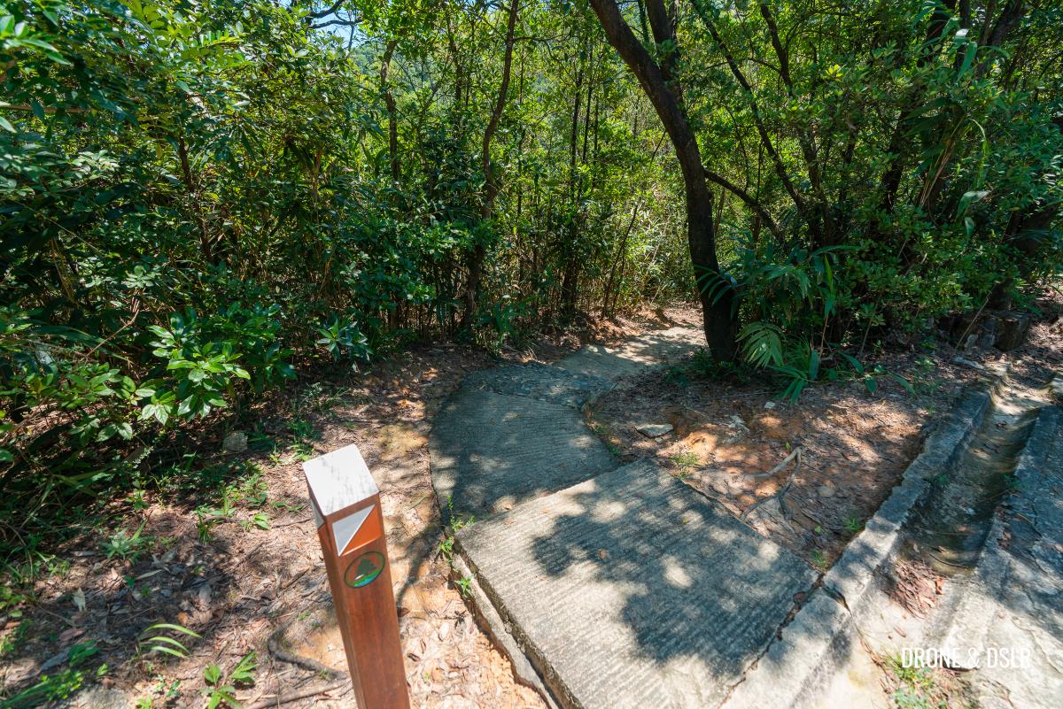
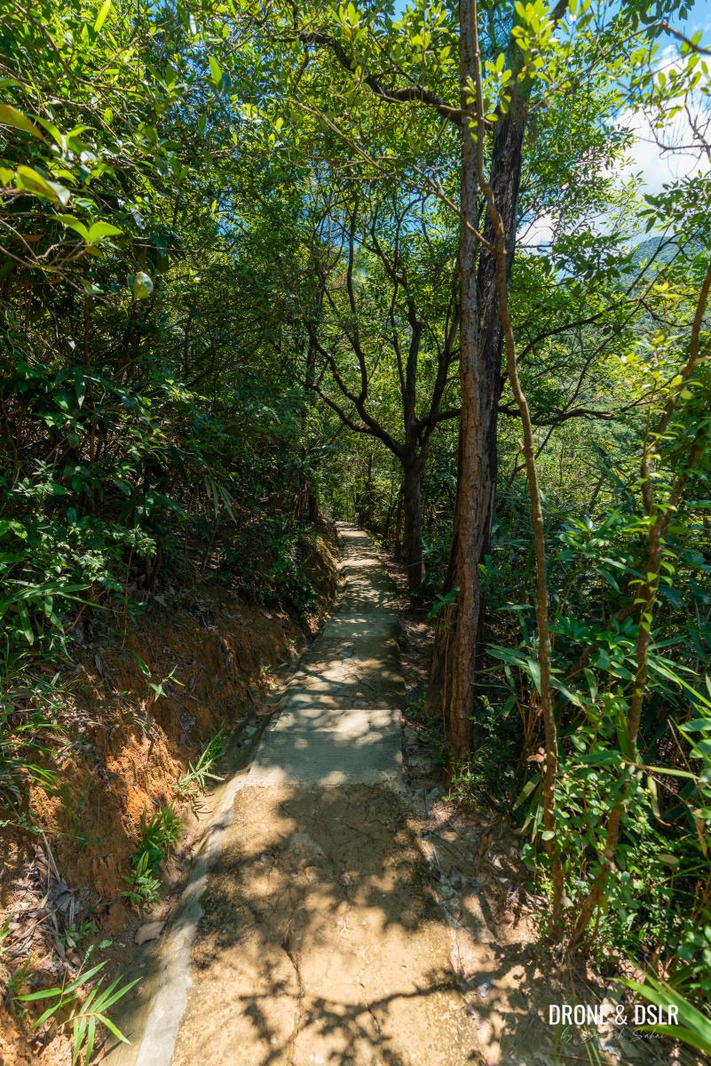
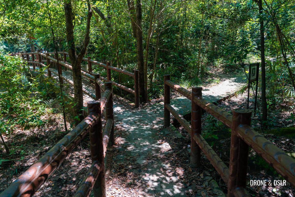
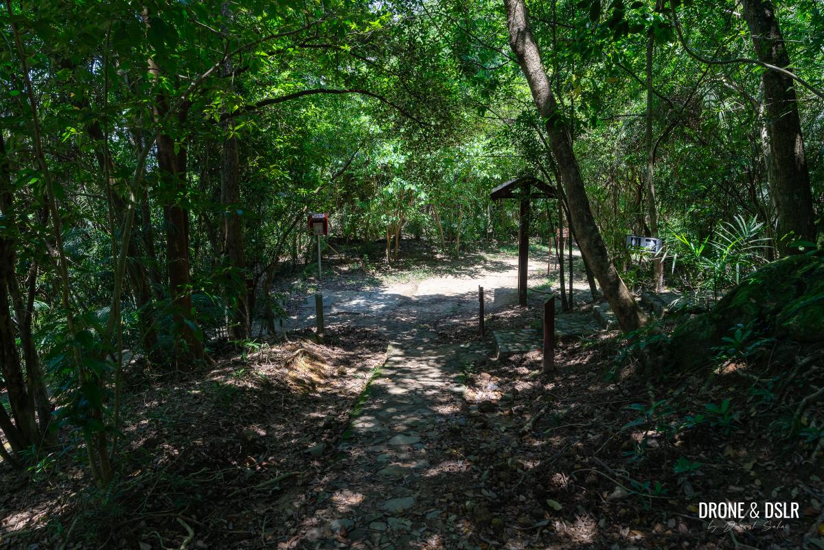
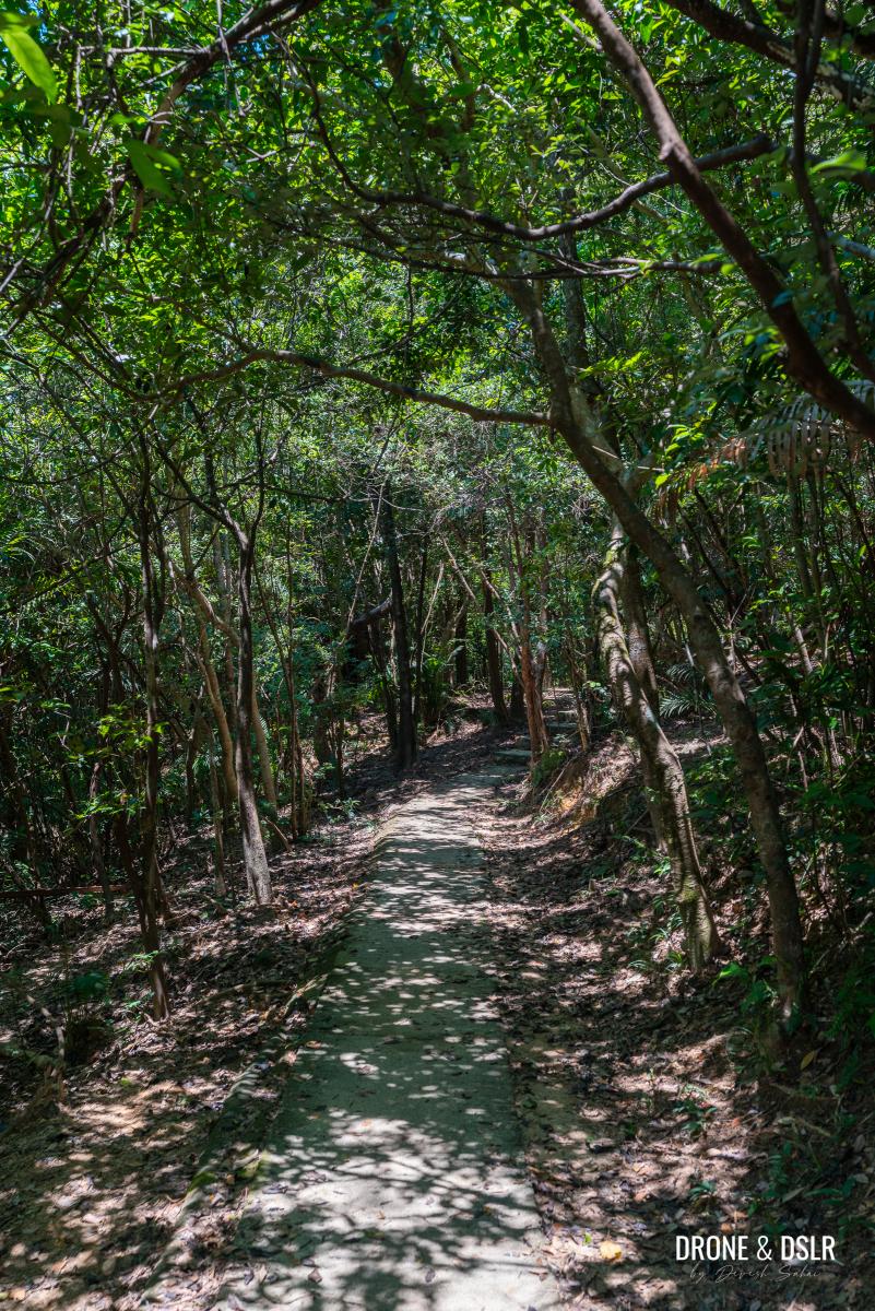
From here, the trail becomes slightly undulating with as it passes under a canopy of trees.
The undulating trail continues
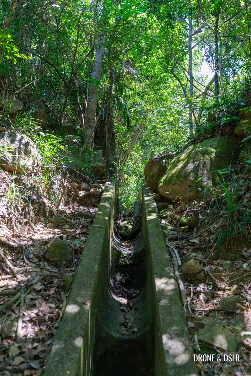
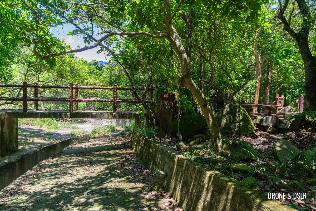
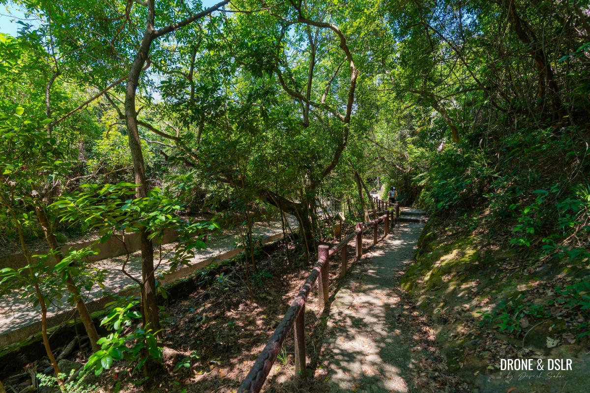
A short distance ahead, the trail crosses a small bridge over a narrow catchwater. Once you’ve crossed, the trail levels out and becomes even more tranquil with glimpses of Tai Koo through the trees.
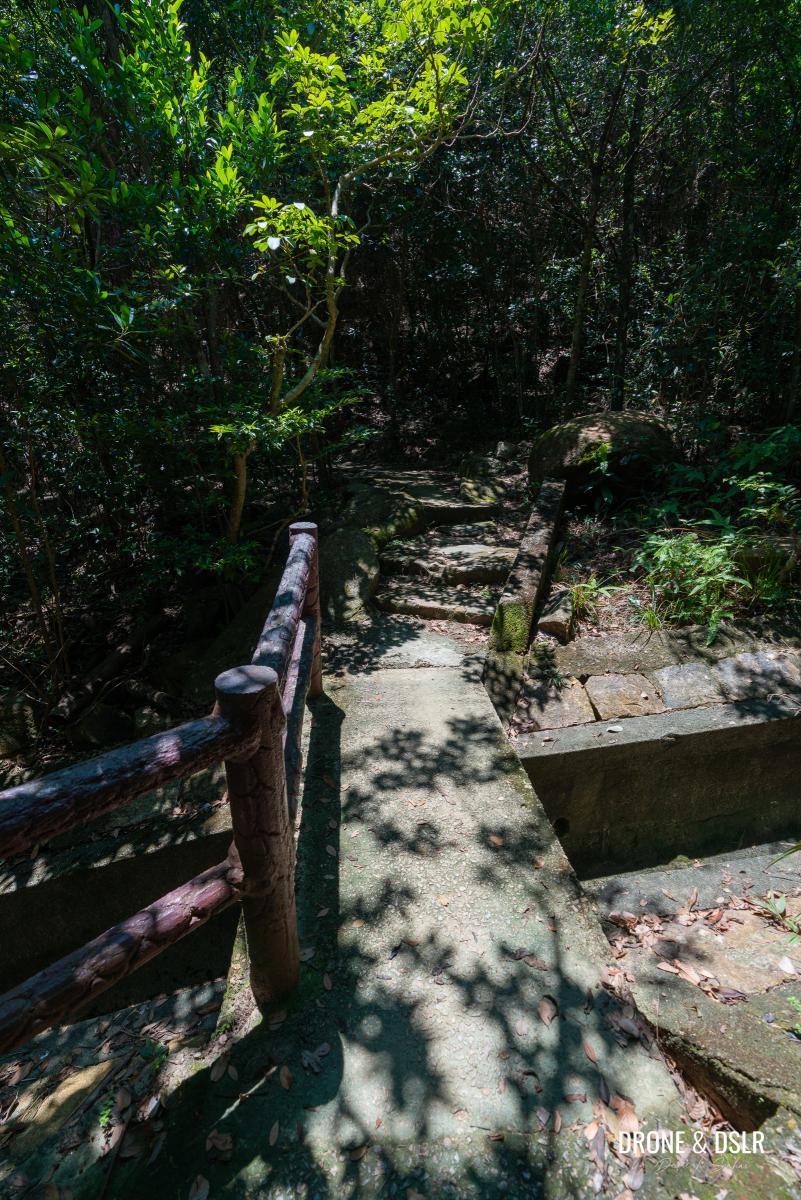
You’ll come across many catchwaters along the Quarry Bay Tree Walk
The peaceful atmosphere will continue until the tree canopy comes to an end, at which point you’ll find yourself in front of the second site of the wartime stoves.
-
- The trail flattens out after the catchwater
-
- The trail exits at the next attraction
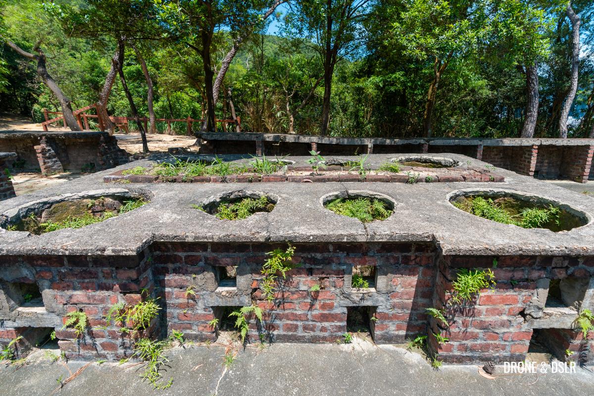
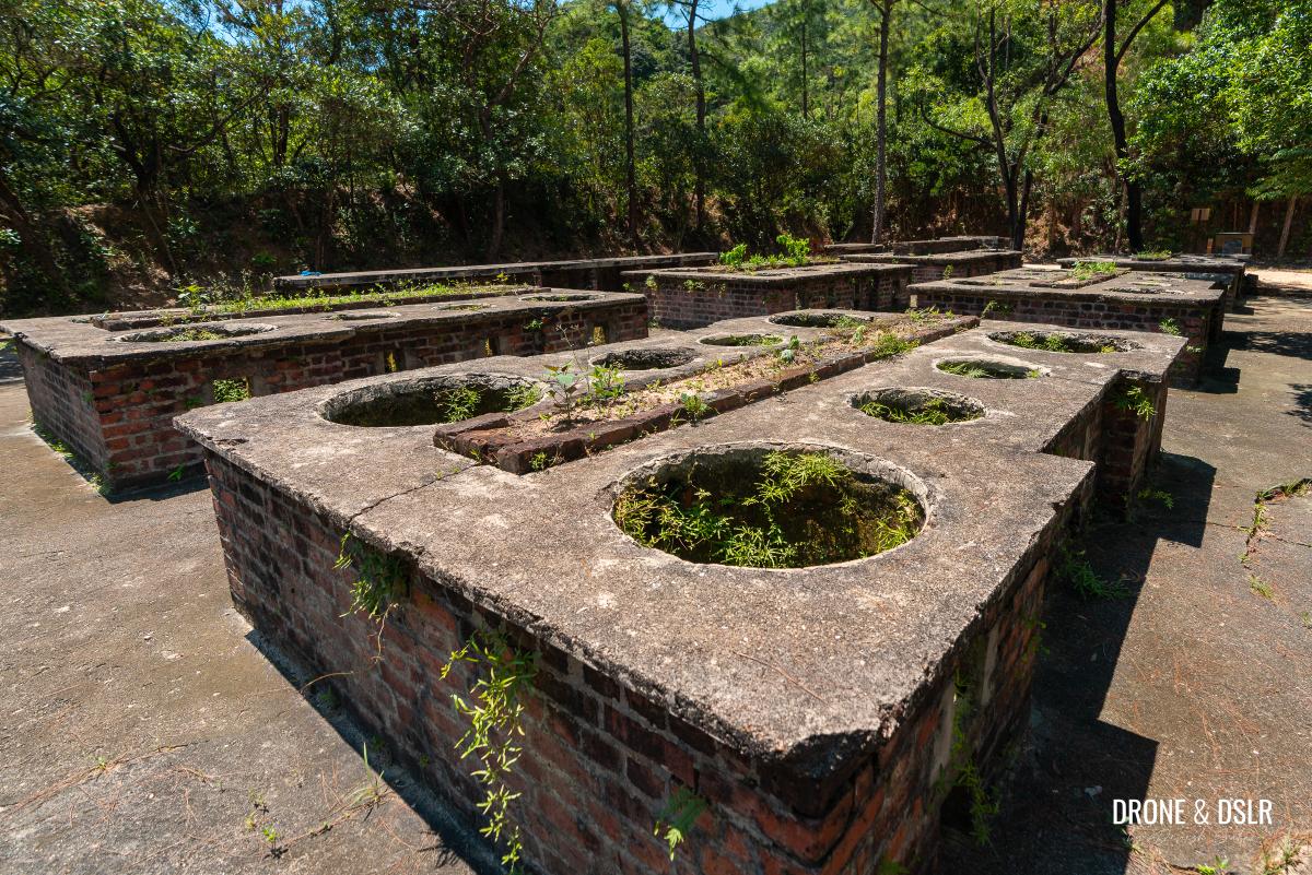
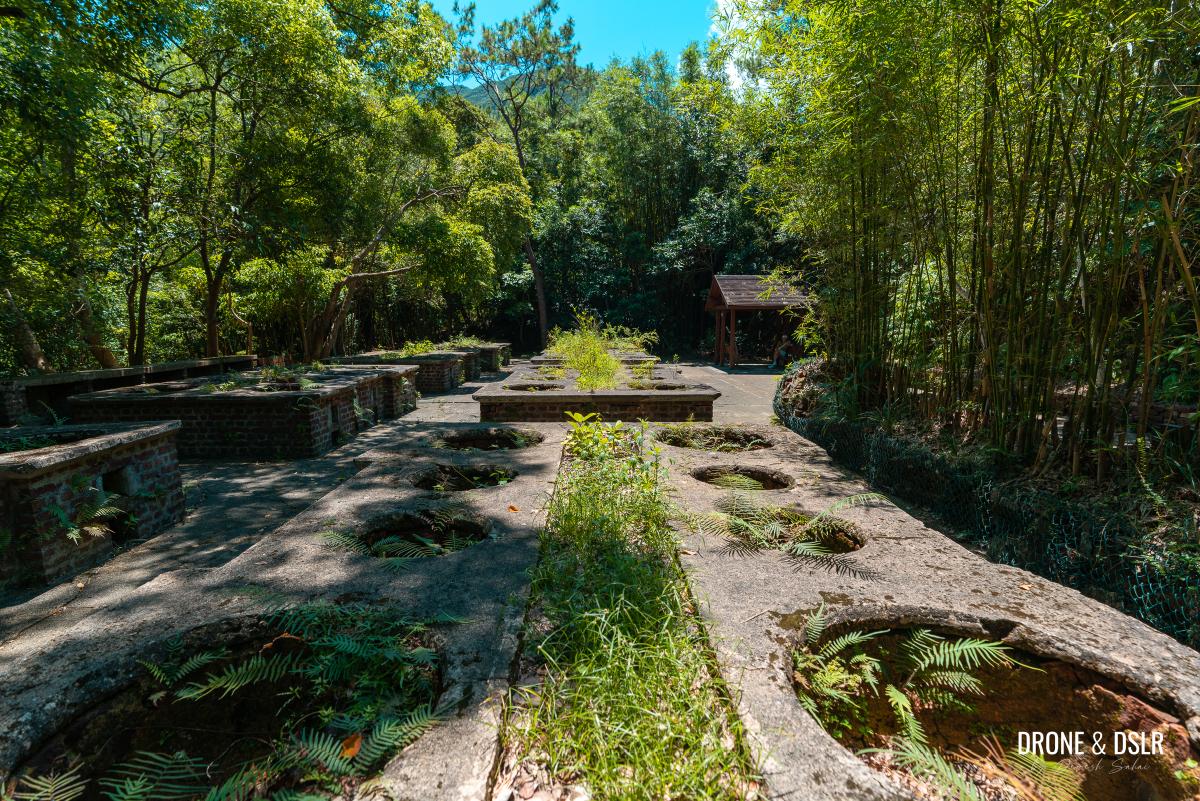
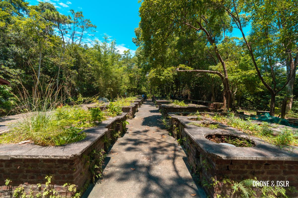
Attraction 4: Wartime Stoves (2nd Site)
The second site of the wartime stoves is quite similar to the first site with the noticeable exception of one missing station (9 instead of 10).
-
- More wartime stoves
-
- History in our backyard
-
- The wartime stoves are tucked away in plain sight
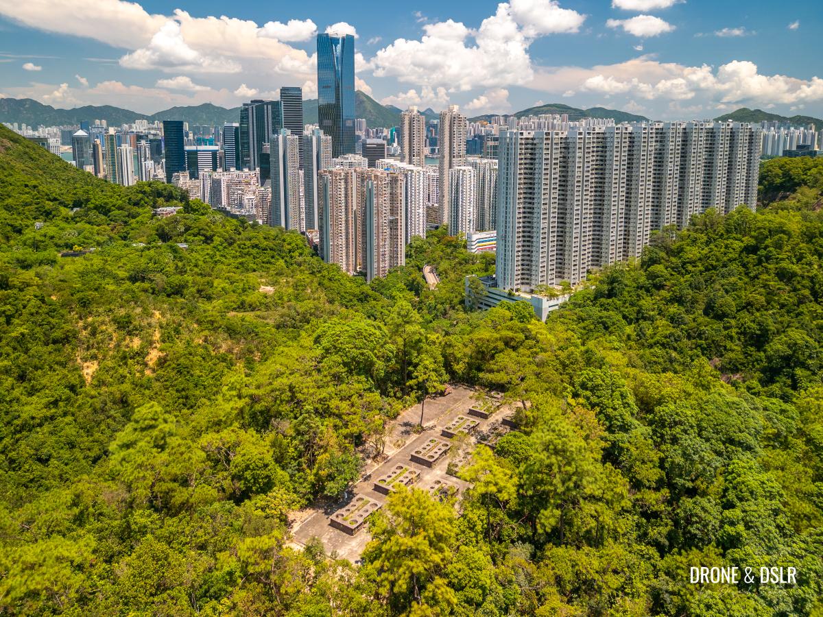
The information board at the second site also includes a much more detailed history of the wartime stoves, which I highly recommend reading.
-
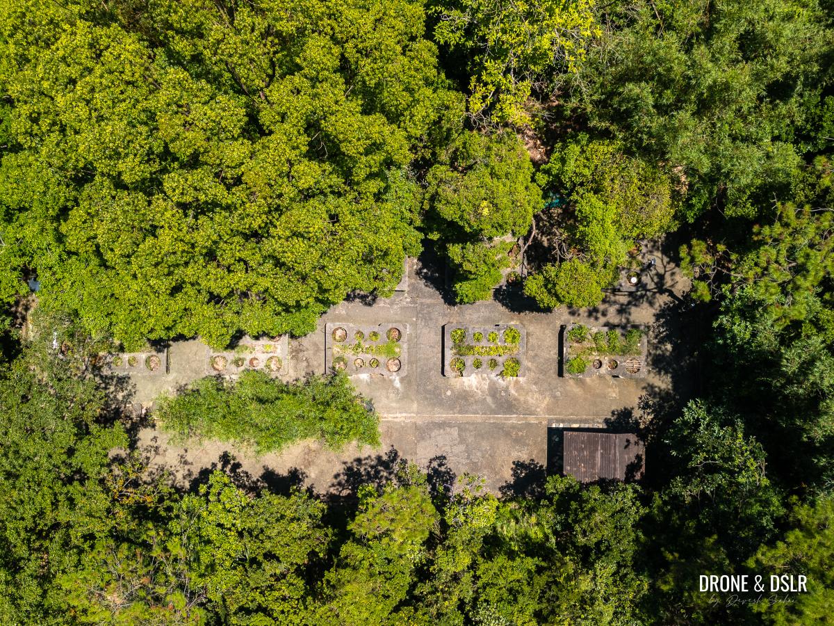
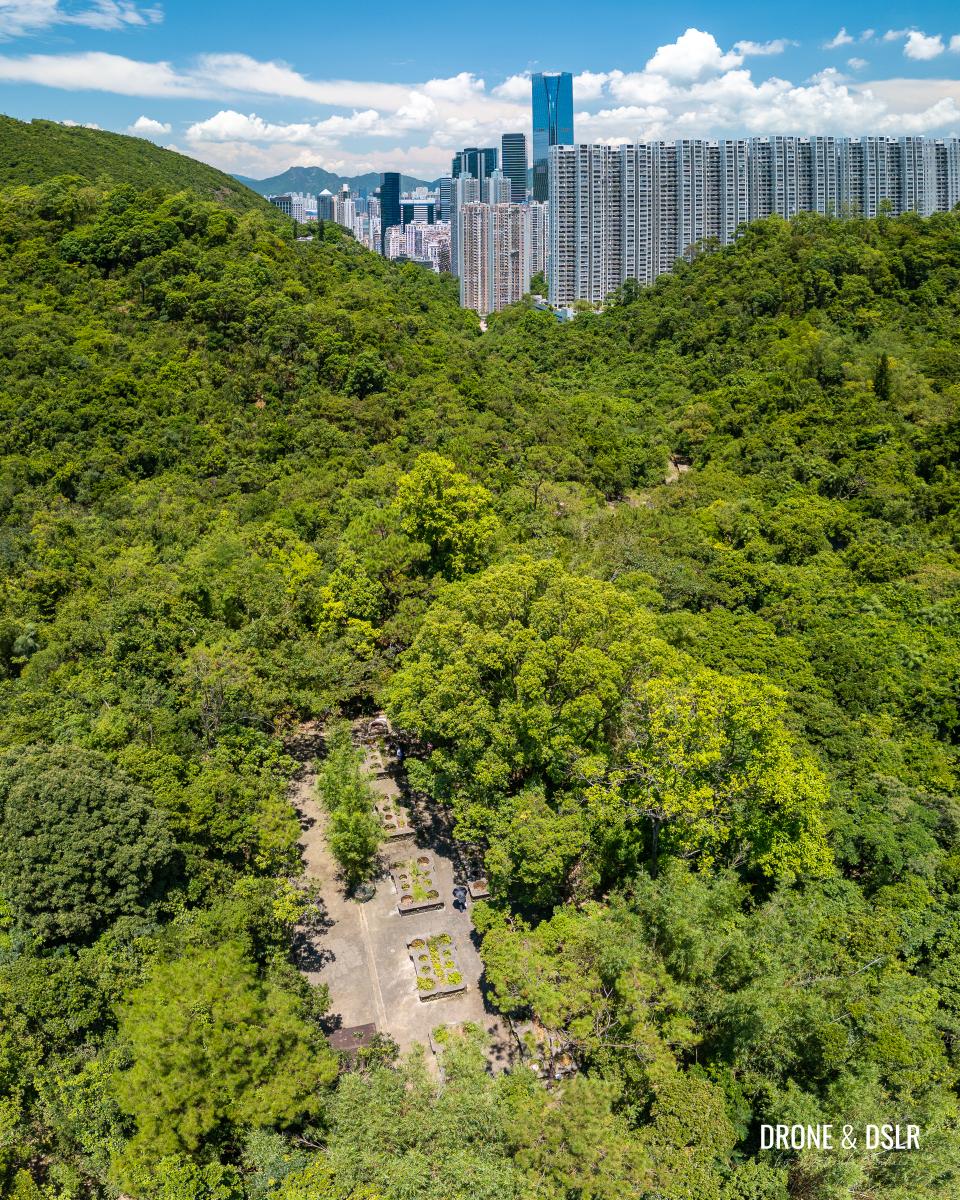
- Bird’s eye view of the second site of the wartime stoves
-
- The second site of the wartime stoves
Follow the trail downhill
The Quarry Bay Tree Walk continues at the other end of the wartime stoves. From here, the trail continues downhill.
-
- Remember the Quarry Bay Tree Walk continues on the opposite side
-
- The trail continues downhill, on the opposite side as the entrance
-
- After the second wartime stoves site, the trail descends
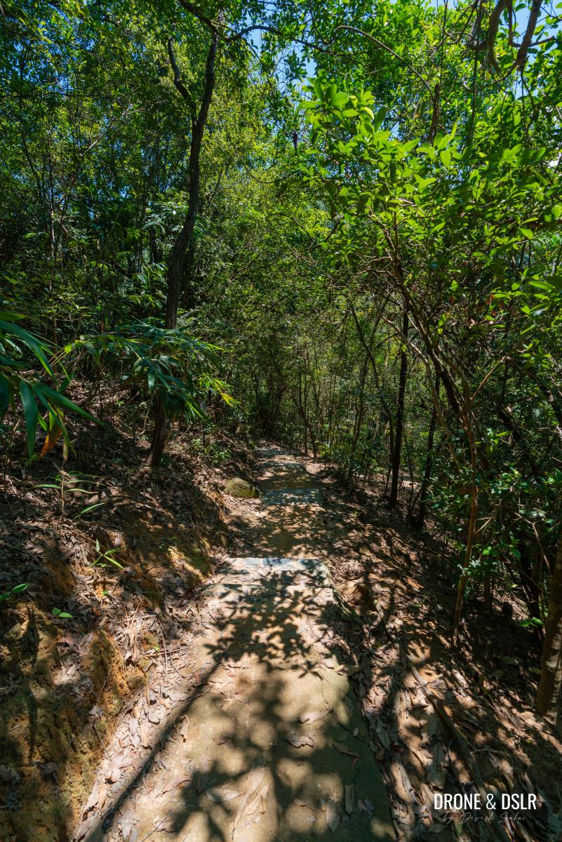
After about 100 metres of descending on zigzagging steps, you’ll notice a sign for the “Former Site of Cable Car Stand”.
-
- Follow the zigzag steps

-
- Keep on the trail till the next attraction
-
- Time to take a very short detour to the former site of the Mount Parker Cable Car
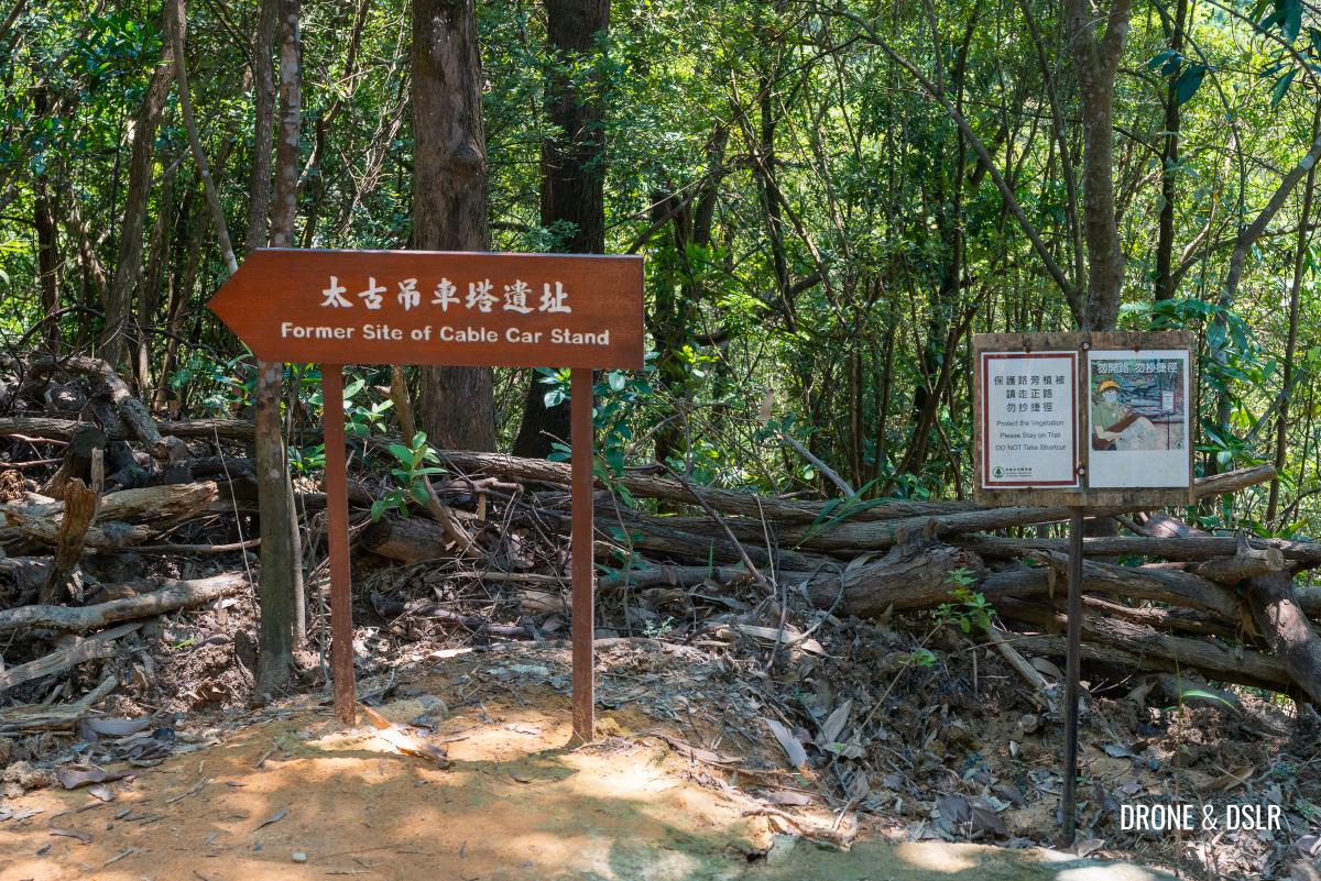
I suggest taking that extremely short detour and going off trail for a moment to explore another relic that once existed among these hills.
Attraction 5: Former Site of Cable Car Stand
Approximately 10–20 metres off trail is the site of the former cable car stand of the Mount Parker Cable Car (or Taikoo Cable Car) on Mount Parker.
The site is at the landing of these steps
A Brief History of the Mount Parker Cable Car
For those unaware, Mount Parker Cable Car was a 2.3 kilometre-long aerial tramway system in Hong Kong, connecting Quarry Gap (between Mount Parker and Mount Butler) and Quarry Bay. It was the world’s first steam-powered cable car system for recreational purposes.
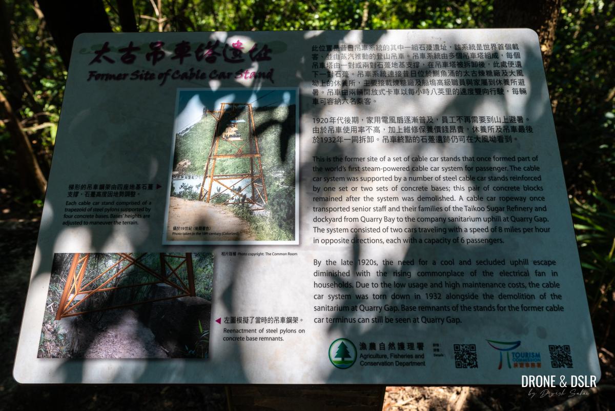
Information board for the former Mount Parker Cable Car
In 1892, the Taikoo Sugar Refinery commissioned the construction of this cable car system, so staff members could escape the summer heat. It ran from Yau Man Street up to Tai Fung Au, where The Sanitarium, a summer retreat, was located.
The system consisted of two cars travelling with a speed of 8 miles per hour (12.87 km/h) in opposite directions, each with a capacity of 6 passengers.
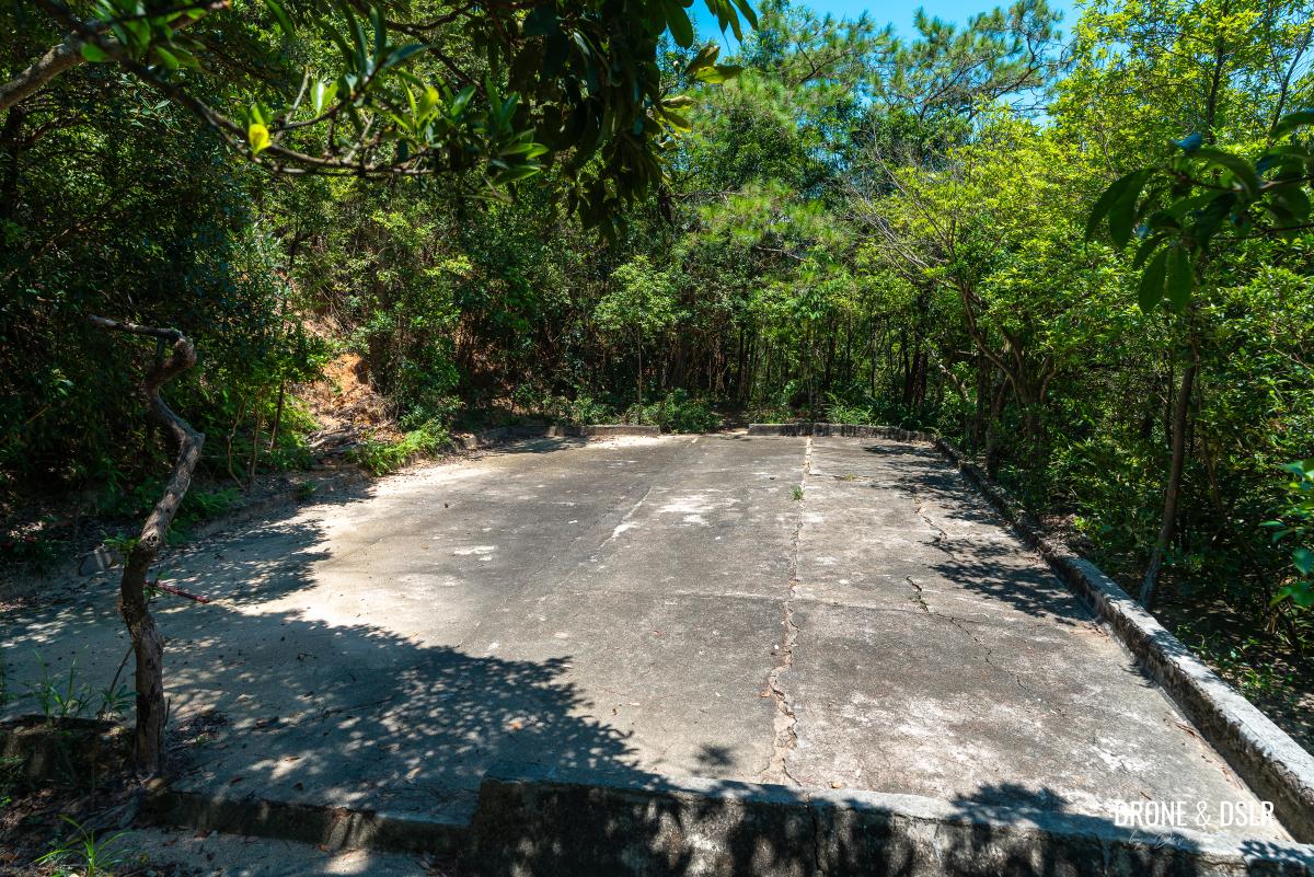
Not much to look at except imagine what was once here
However, by the late 1920s, the need for a cool and secluded uphill escape diminished with the rising commonplace of the electrical fan in households. Due to the low usage and high maintenance costs, the cable car system was torn down in 1932 alongside the demolition of the sanitarium at Quarry Gap.
This site is one of the many remnants of the stands for the former cable car.
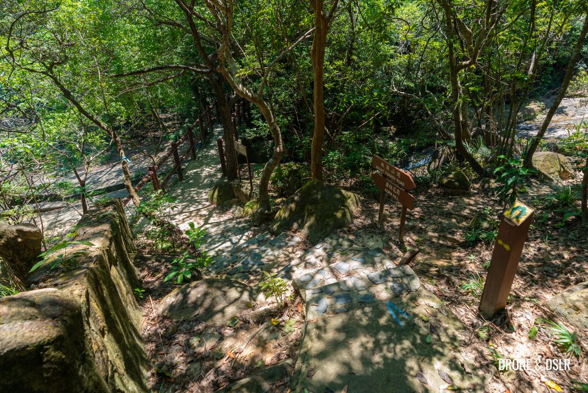
Head down to the Siu Ma East Stream
After admiring and learning more about the incredible history of part of Hong Kong, return to the Quarry Bay Tree Walk and continue walking downhill on the steps.
Return to the trail and keep walking downhill
After a very short distance, the trail reaches a footbridge over the Siu Ma East Stream. As with many of the streams in this area, the raw stream gets channelled into a catchwater under this bridge.
-
- The trail approaches the another catchwater
-
- Cross the bridge over the Siu Ma East Stream
As you cross the bridge and walk ahead, notice a gap in the railing on the right-hand side. To reach the next few attractions, you’ll have to go off the Quarry Bay Tree Walk and turn right here.
-
- Turn right here, where there’s a gap in the railing
-
- This detour leads you to the next group of attraction
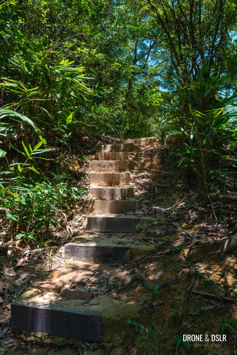
Follow the trail as it climbs up a flight of steps and lands next to some bushes, behind which is the third site of the wartime stoves.
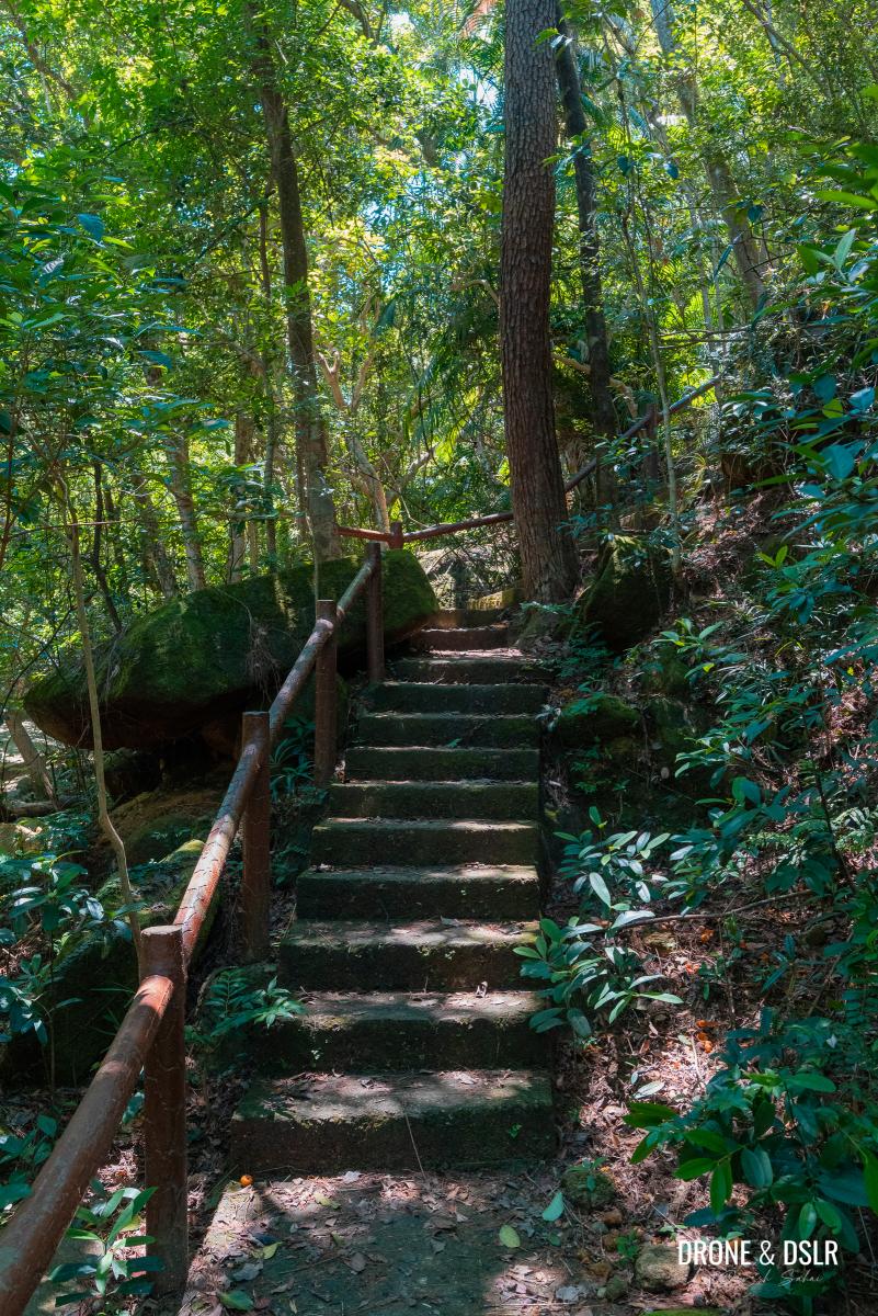
Walk up the steps to the next site of the wartime stoves
Attraction 6: Wartime Stoves (3rd Site)
The third and final site of the wartime stoves on this trail is as impressive as the others.
-
- The third site of the wartime stoves
-
- This site is probably the least looked after
-
- Aerial view of the third site of the wartime stoves
-
- View of Quarry Bay from the third site of the wartime stoves
But if you’re not too keen on spending too much time here, walk to the end of the site and look for the steps going down to the catchwater.
Walk down these steps to the catchwater on the other side of the wartime stoves
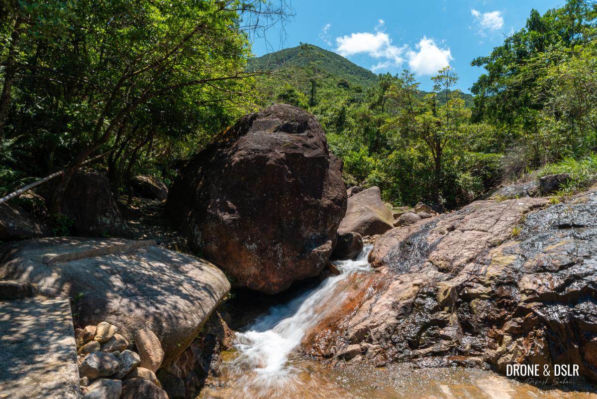
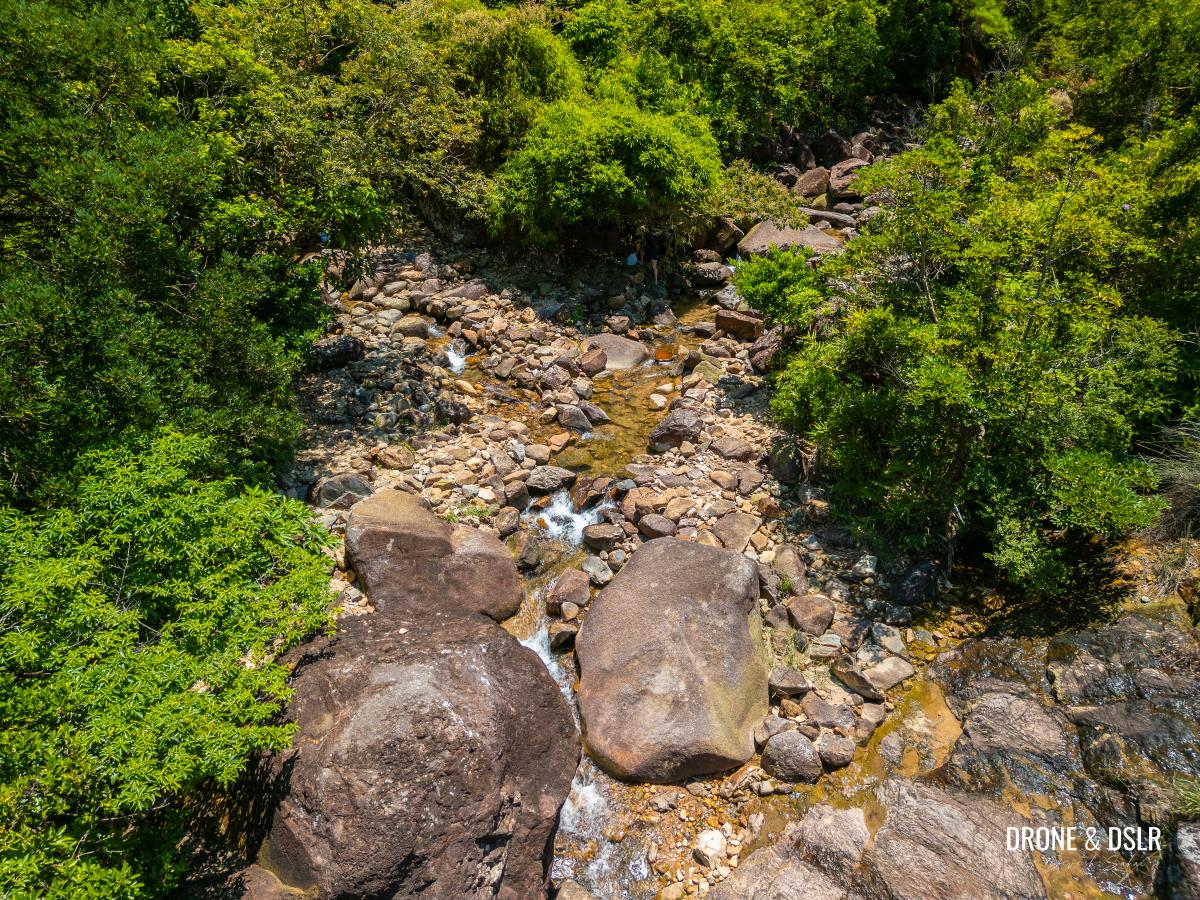
Walk down the steps onto what I think is a very picturesque looking catchwater, covered by a gorgeous canopy of tree. Once on the catchwater, walk upstream to where the stream feeds into the catchwater.

Once at the catchwater, walk upstream and carefully jump onto the other side
Attraction 7: A Confluence of Streams
Depending on recent rainfall, you might have the opportunity to dip your feet in one of the streams that feed into this catchwater.
-
- Time to enjoy a short break next to this stream
-
- Siu Ma East Stream (Right Branch) on the other side
The waterway is situated at the confluence of two streams: Pak Zam Stream on the left and Siu Ma East Stream (Right Branch) to the right.
The confluence of two streams
Feel free to explore upstream, but be mindful of the slippery rocks along the way.
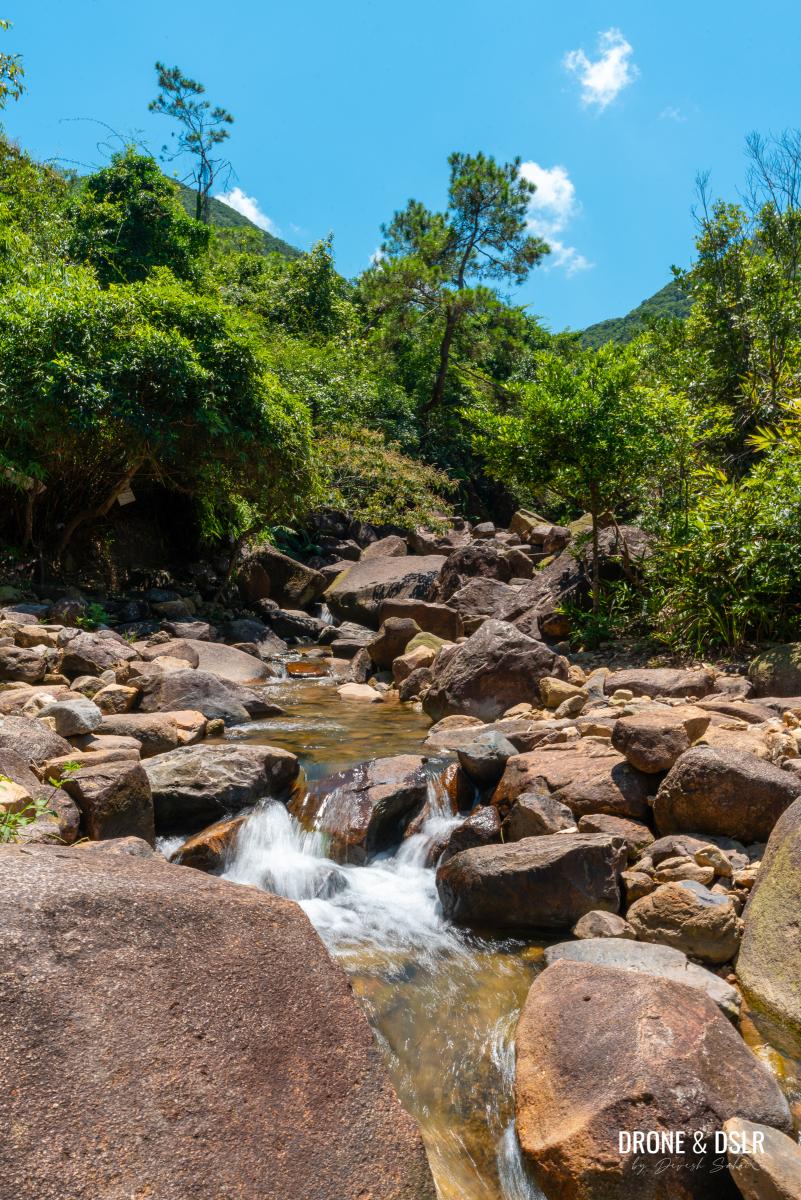
Siu Ma East Stream (Right Branch) on the other side
Once you’re done enjoying the streams, walk down the catchwater but stay on the right-hand side. About 30–40 metres ahead, lookout for a drain on the slope, next to a wall.
-
- Walk downstream again and stay on the right-hand side
-
- Lookout for this drain, next to a wall above. Climb up to get to the next site
Climb up the slope to reach a hidden relic of the past!
Attraction 8: Ruins of a British Shooting Range
This area may seem unremarkable today, but it holds an important piece of history: between 1955 and 1965, it was used as a rifle shooting range by the British Army.

The ruins of a British shooting range
Although time has taken its toll, remnants of the site remain. You can still see the stone wall that shielded those working with targets, as well as steel brackets that held the targets in place.
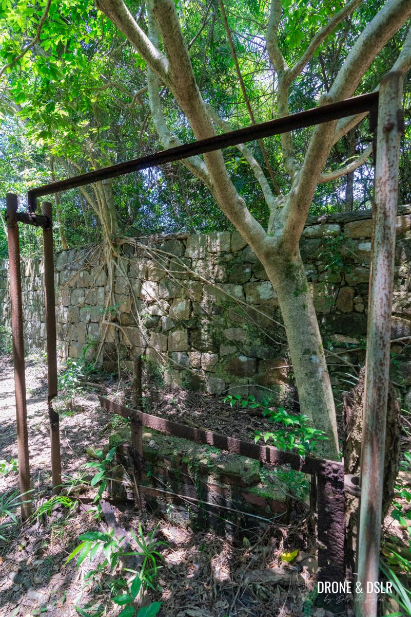
The steel brackets that held the targets for shooting practice in place
Also, visible is a sturdy shelter nearby that was likely used to store equipment.
A shelter or storage area at the shooting range
I managed to dig up an old photo and some information about this rifle range, including a fascinating anecdote shared by someone who experienced it first-hand.
Return to the Quarry Bay Tree Walk
To return to the Quarry Bay Tree Walk, simply head back to the catchwater and follow the water downstream towards the bridge. Just before the bridge, climb onto the picnic site and reconnect with the trail.
-
- Head back towards the bridge and climb up on the right-hand side
-
- Walk past the picnic area and onto the Quarry Bay Tree Walk
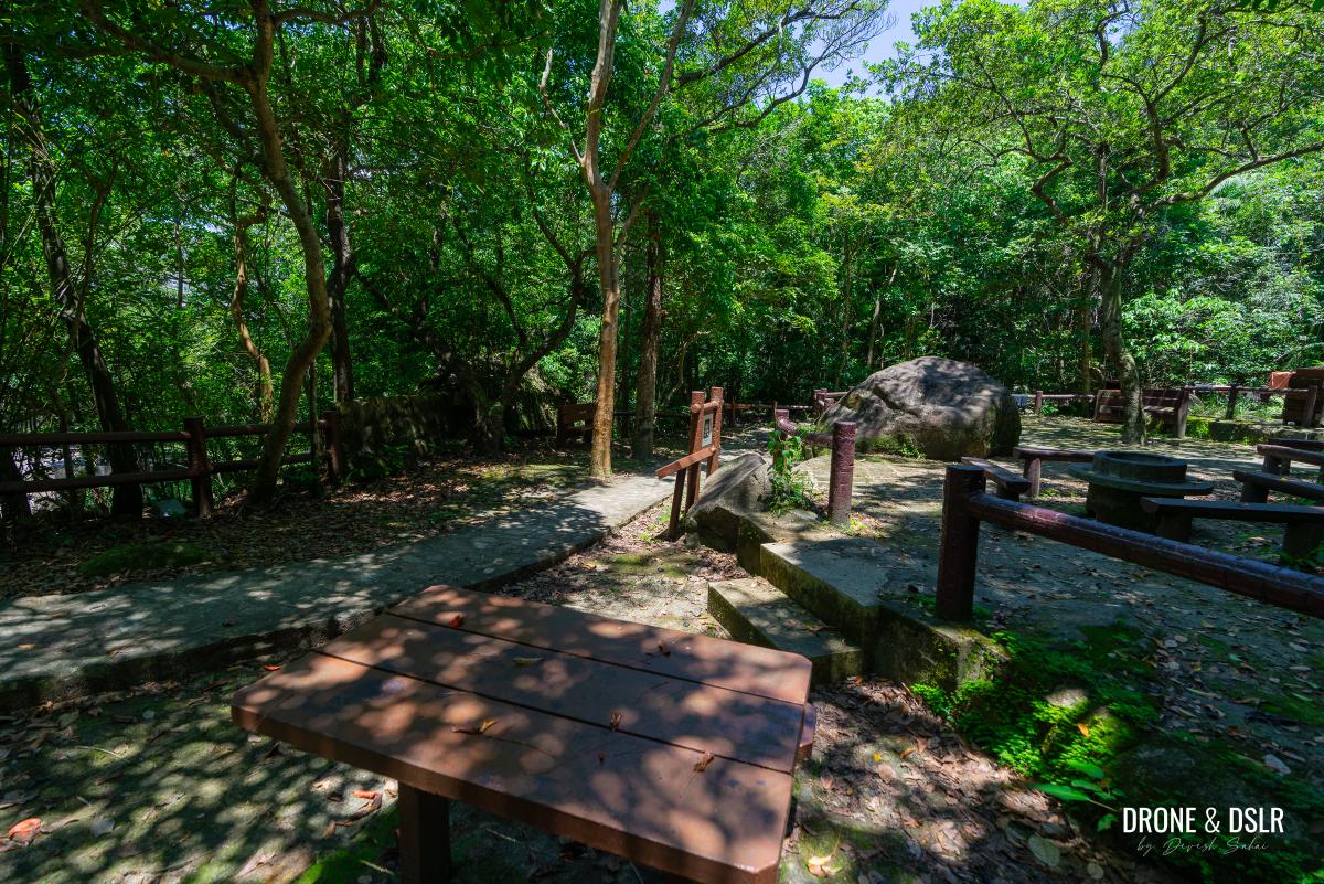
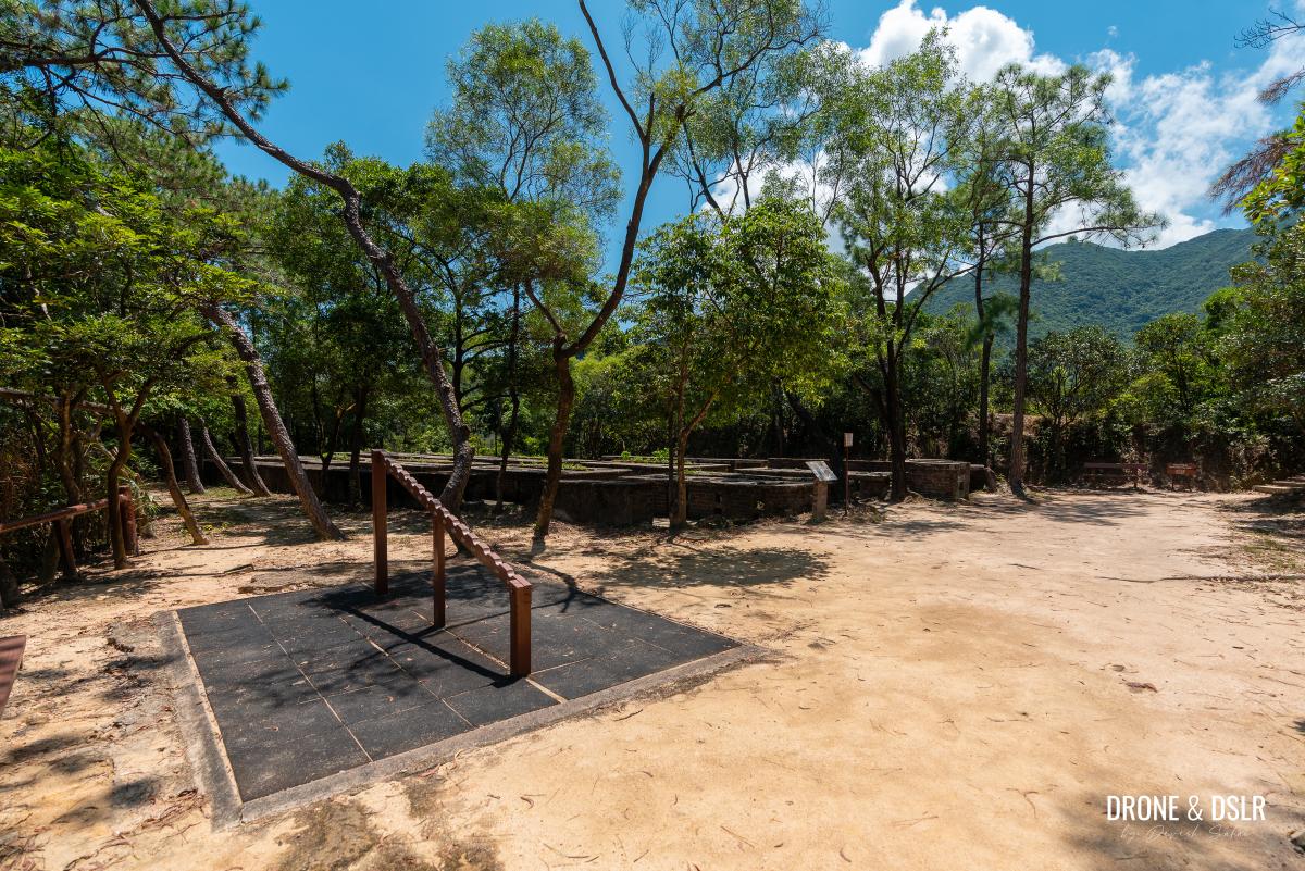
Walk past the picnic site and outdoor seating area that follows. Just beyond the seating area, the trail gently descends to reach a junction with another trail.
-
- Follow the steps up

-
- Walk past this large seating and outdoor area
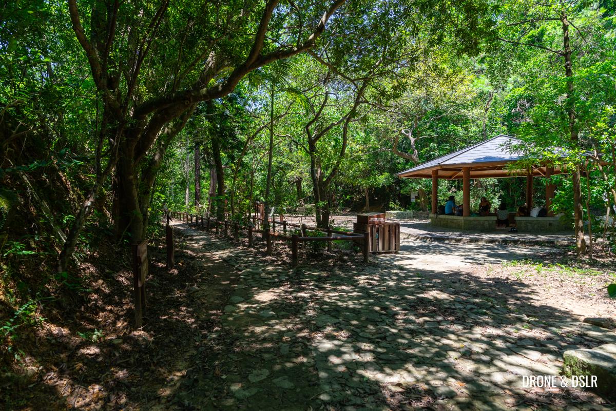
At this point, you’ll notice an emergency phone and toilet — this is where Hong Pak Country Trail meets Quarry Bay Tree Walk.
After the seating area, the Quarry Bay Tree Walk merges with the Hong Pak Country Trail next to this toilet
To stay on track, turn left at the junction (at the red emergency phone) and head downhill.
-
- To continue, turn left next to the emergency phone
-
- Walk back down to the catchwater
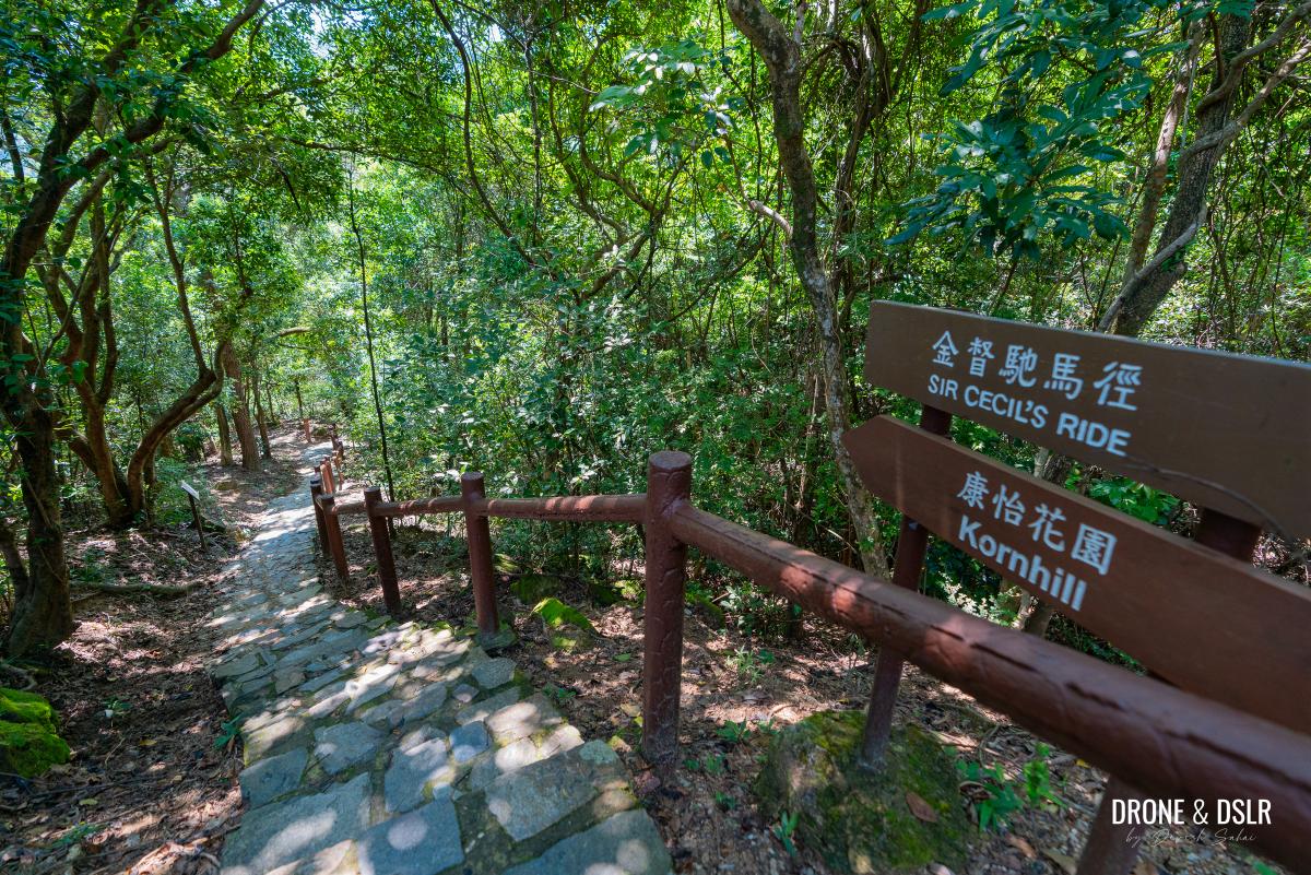
The Quarry Bay Tree Walk will continue along the catchwater, eventually exiting Tai Tam Country Park behind Kornhill.
-
- Continue walking next to the catchwater
-
- Coming close to the end of the Quarry Bay Tree Walk
-
- The trail finally ends behind Kornhill
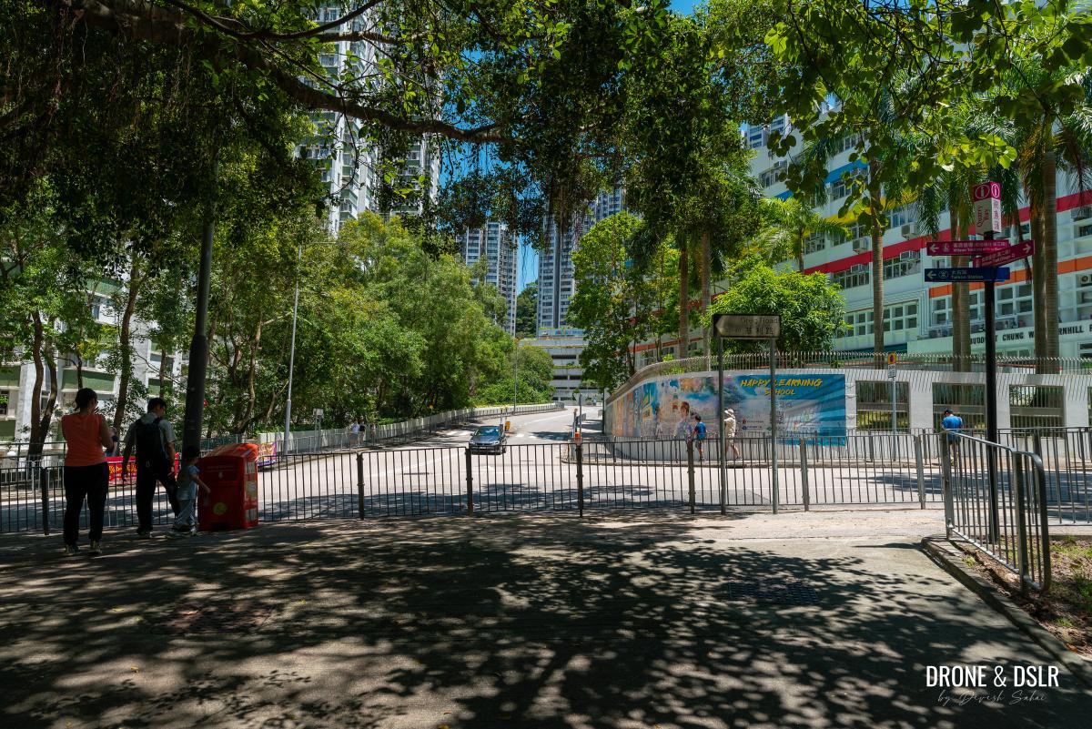
Exit onto Greig Road
The final 300 metres of this trail conclude on a paved path that runs along the edge of Kornhill and ends on Greig Road.
-
- Walk down these steps to exit the trail
-
- Continue walking on the path adjacent to Kornhill

From Greig Road, it’s another 350 metres to King’s Road where all modes of transportation await you.
-
- The path almost coming to an end

-
- And back to civilization at Grieg Road
Easy Trail Filled With Historic Sites
I hope you found our guide to the Quarry Bay Tree Walk resourceful. After reading this guide, I hope you see that this trail is much more than just a “tree walk”. It’s really an an informative tree walk, through a maze of historical sites and relics.
Aerial shot of the wartime stoves (second site)
This walk is perfect if you have kids, or you’re looking for an easy and informative trail in the summer months.
And as you’ve gathered, there are many other hikes in this area behind Quarry Bay. Hong Pak Trail is another fun and easy trail with plenty of interesting sites. But if you’re looking for something more challenging, why not hike to Siu Ma Shan, Mount Butler and Jardine’s Lookout, or Mount Parker?
But if you want to embark on another easy WWII trail on Hong Kong Island, I highly recommend the Wong Nai Chung Gap Trail.
We’d love to hear your thoughts in the comments below! Feel free to share this post on social media, too, so we can all enjoy exploring this hidden gem together.
If you enjoy our work, come join us on Instagram and YouTube 🙂


You might also like


Leave a reply