
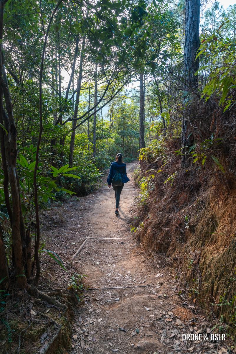
The Hong Pak Country Trail is an easy and family-friendly hike located in Quarry Bay on Hong Kong Island.
The Hong Pak Country Trail
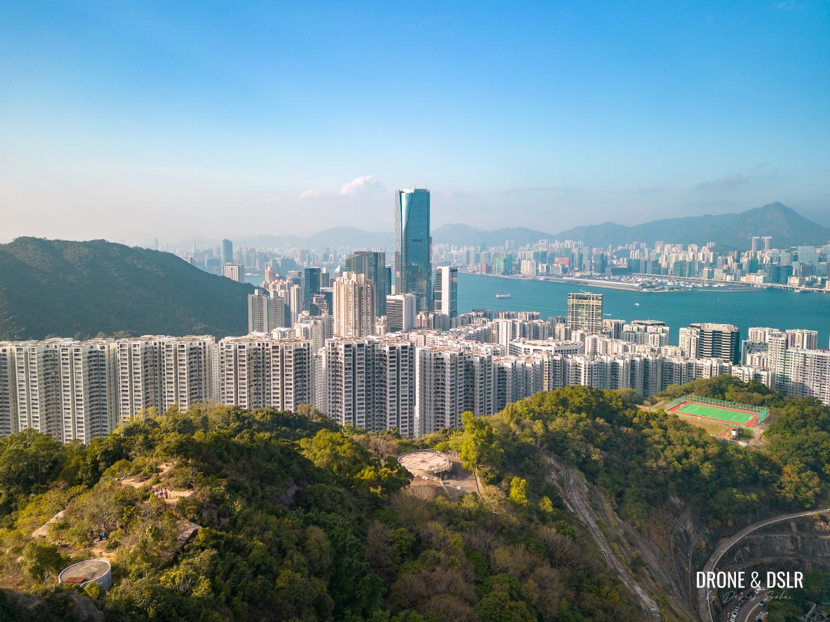
Other than the initial incline, the hike is mostly on a flat trail that encircles the valley between Mount Butler and Mount Parker. Along the hike not only can you enjoy beautiful views of the valley itself, but also of the eastern districts of Hong Kong Island and Kowloon. And if that wasn’t enough, there’s also a Dinosaur Rock and Japanese war tunnels on the trail!
-

- Aerial views of Quarry Bay and beyond
-
- Doesn’t it resemble a dinosaur’s head?

About the Hong Pak Country Trail
The Hong Pak Country Trail is a 3.6 km trail in the valley between Mount Butler and Mount Parker. However, reaching the start of the trail requires a 2 km uphill walk on Mount Parker Road. But exiting it is a much shorter walk (approximately 600 metres).

The Hong Pak Country Trail is between Kornhill and Mount Parker Road
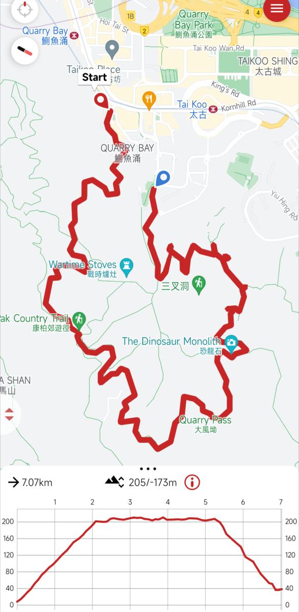
Hong Pak Country Trail hike map
Overall the Hong Pak Country Trail is very easy which can make it monotonous for some. But thanks to a few panoramic viewpoints, a rock in the shape of a dinosaur head, and Japanese war tunnels, there’s something to look forward to on the hike!
Starting point
Reaching the starting point for Hong Pak Country Trail is a hike in itself, unfortunately. But I promise the rest of the trail is much easier.
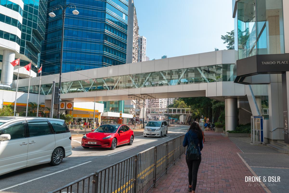
The most convenient way to reach the starting point is to first take the MTR to Quarry Bay and exit onto King’s Road (Exit A). Then turn right onto King’s Road and walk for approximately 400 metres to Mount Parker Road.
Exit the MTR and turn right onto King’s Road
Mount Parker Road is located right before the famous Monster Building. Keep a lookout for the Mount Parker Road Green Trail sign.

Turn right before the “Monster Building”
Once on Mount Parker Road walk straight and begin the uphill walk.
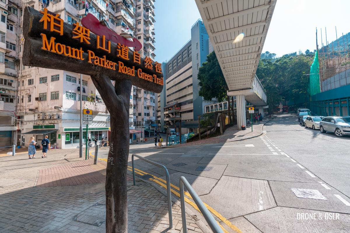
Turn right at the sign for Mount Parker Road Green Trail
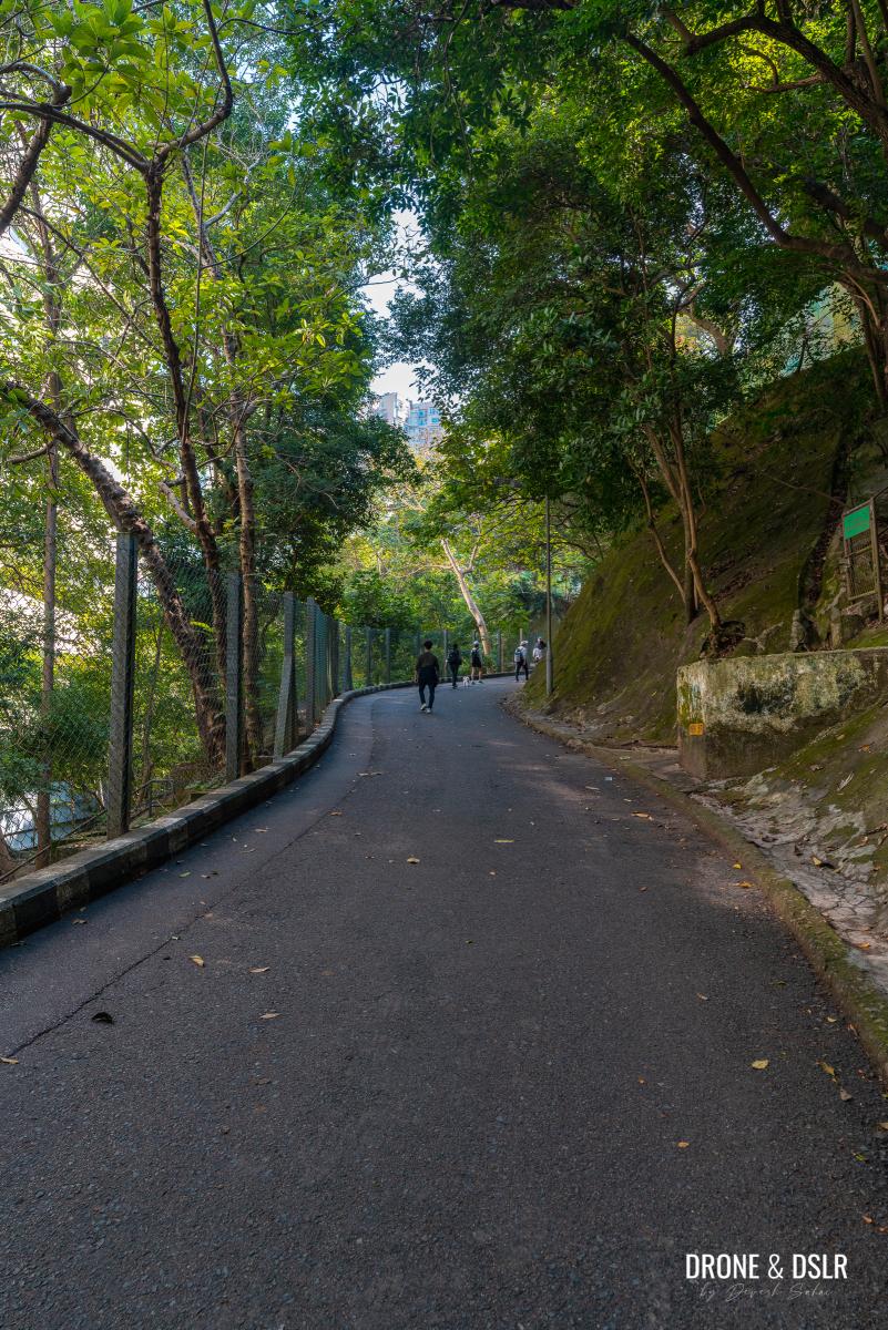
The incline is relatively straightforward and to reach Hong Pak Country Trail, all you need to do is walk uphill. Along the way, there are plenty of outdoor seating areas and viewing points to take a break.
-
- The incline on Mount Parker Road begins
-
- The Woodside Biodiversity Education Centre is the first landmark on Mount Parker Road
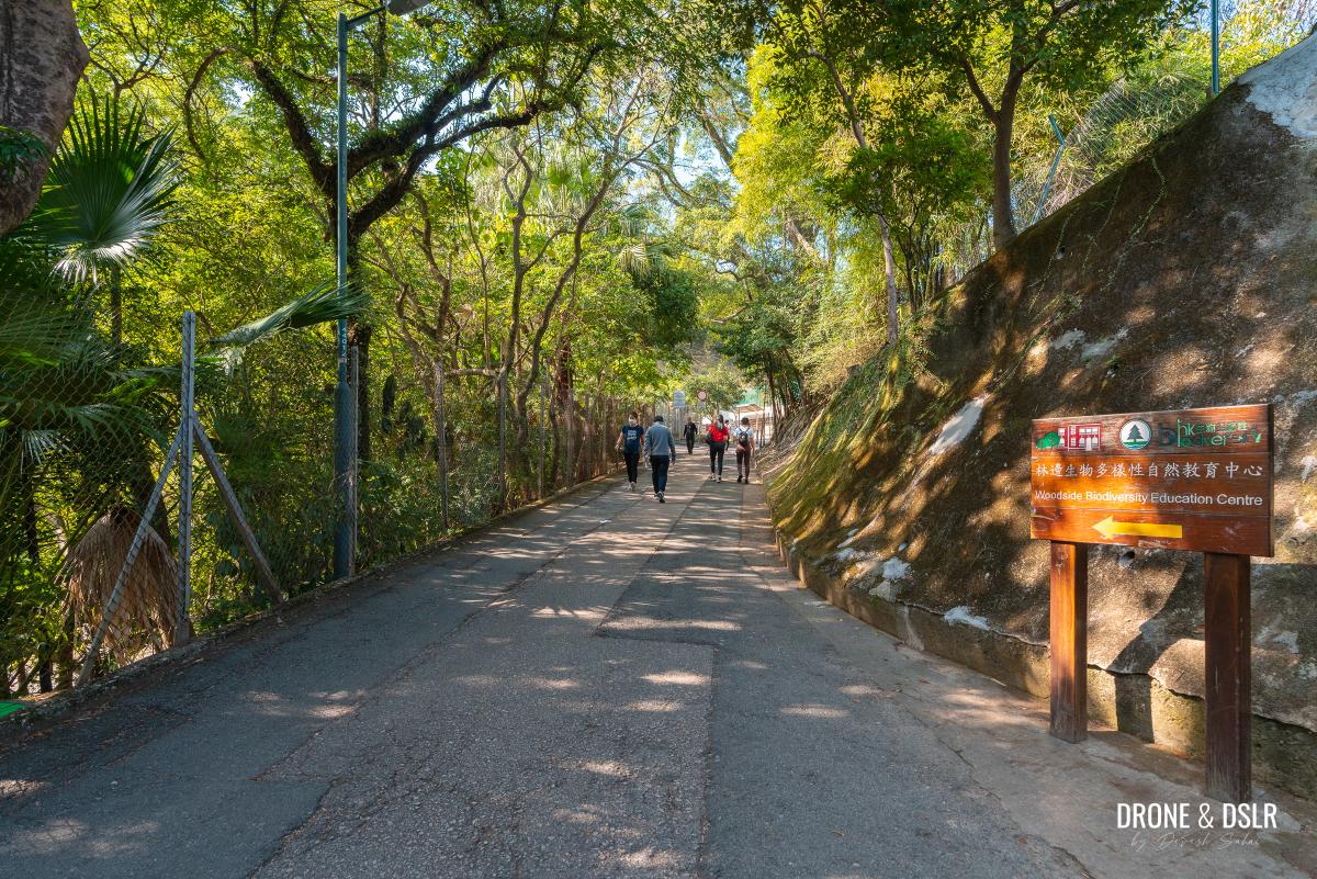
The first milestone on the way is the Woodside Biodiversity Education Centre. And next, come the entrances to Wilson Trail Section 2 and the Quarry Bay Tree Walk.
-
- Walk past the entrance to Wilson Trail Section 2

-
- Walk uphill on Mount Parker Road

-
- Walk past the entrance to the Quarry Bay Tree Walk
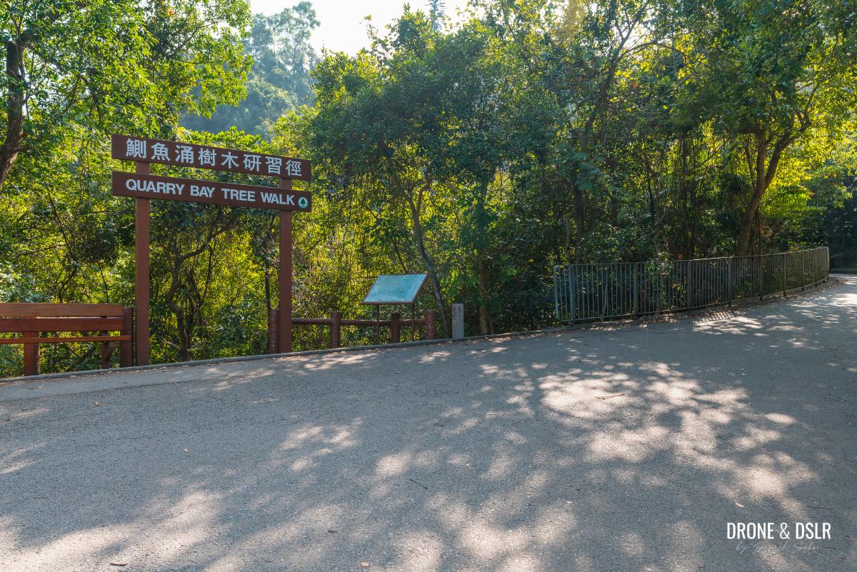
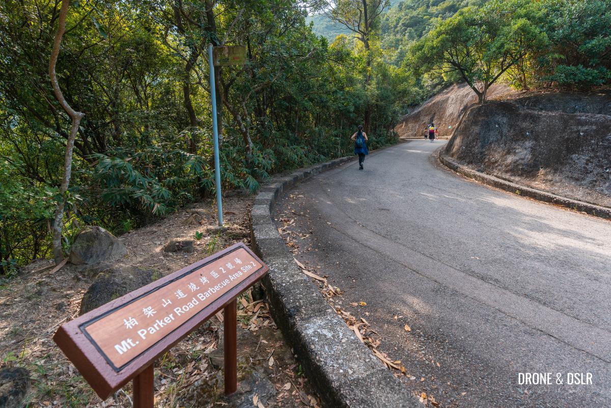
Shortly after the Quarry Bay Tree Walk is the first barbecue site on Mount Parker Road.

An awesome viewpoint and pavilion on Mount Parker Road
And after the first barbecue area, is the next, much smaller barbecue site.
-
- Cross the second barbecue area
-
- Almost at the starting point

-
- Taking a quick break to enjoy the views

Walk past the second barbecue site and continue walking uphill for another 400 metres till the fork in the road with a sign for Tai Tam Country Park, Quarry Bay Management Centre.
At the fork, turn left and the entrance to the Hong Pak Country Trail is at the start of this road.
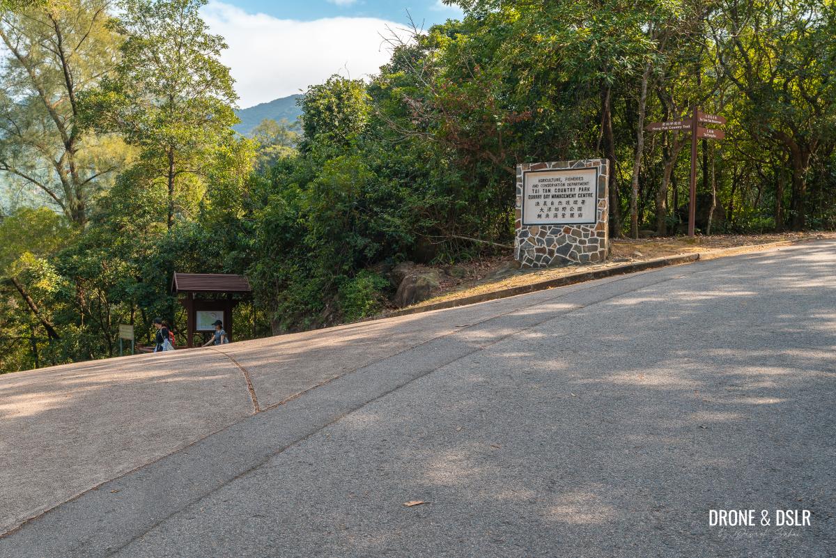
Turn left at this fork
The Hong Pak Country Trail begins
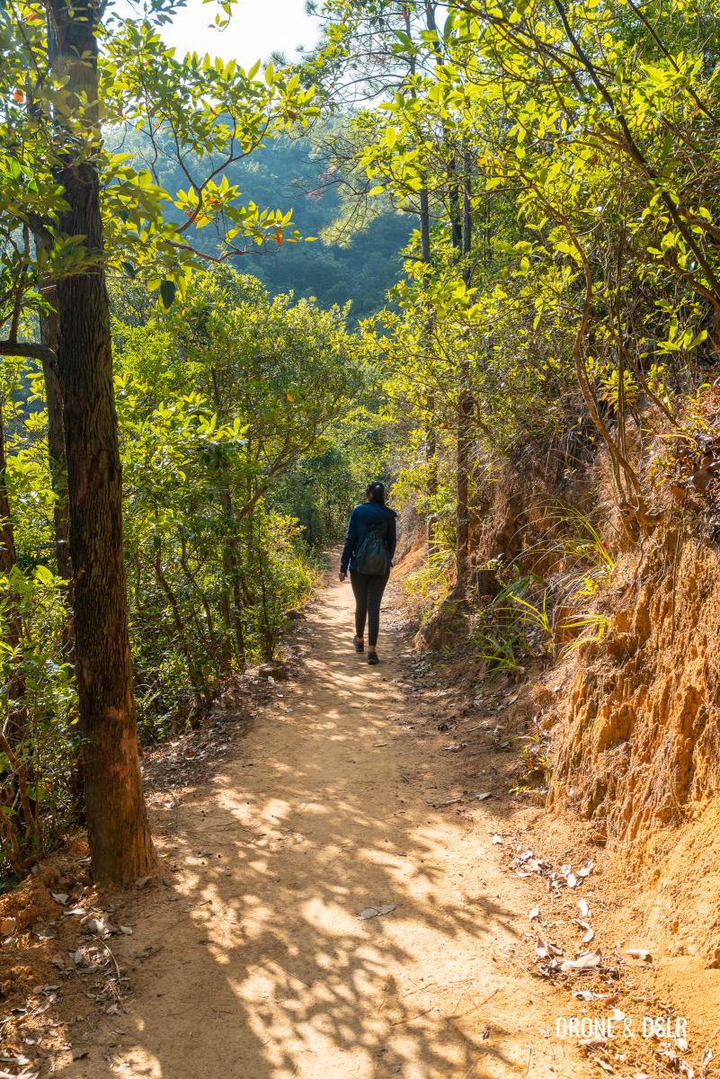
By now you’re already quite exhausted from walking uphill, especially when you were promised an easy hike. But as you enter the Hong Pak Country Trail, you can expect it to get much easier.
-
- Hong Pak Country Trail starting point

-
- The map of Hong Pak Country Trail

The Hong Pak Country Trail is a 3.6 km trail in the valley between Mount Butler and Mount Parker. The highlights of the route include the beautiful views of Quarry Bay and the valley, the numerous streams, and of course the Dinosaur Rock and war tunnels!
Getting ready to start the Hong Pak Country Trail hike
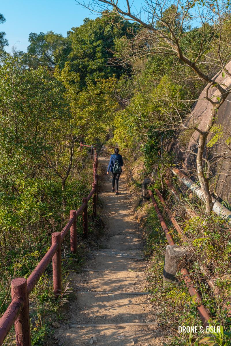
The initial section
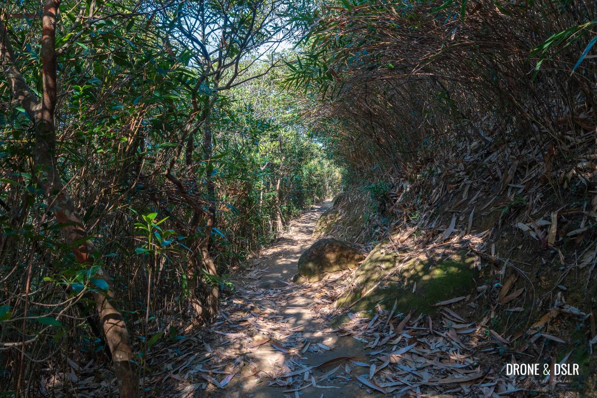
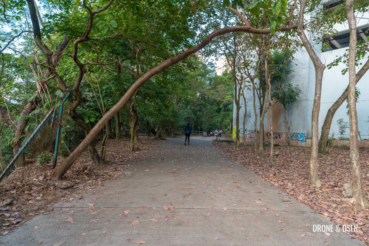
The initial section of the Hong Pak Country Trail is relatively mellow and quiet.
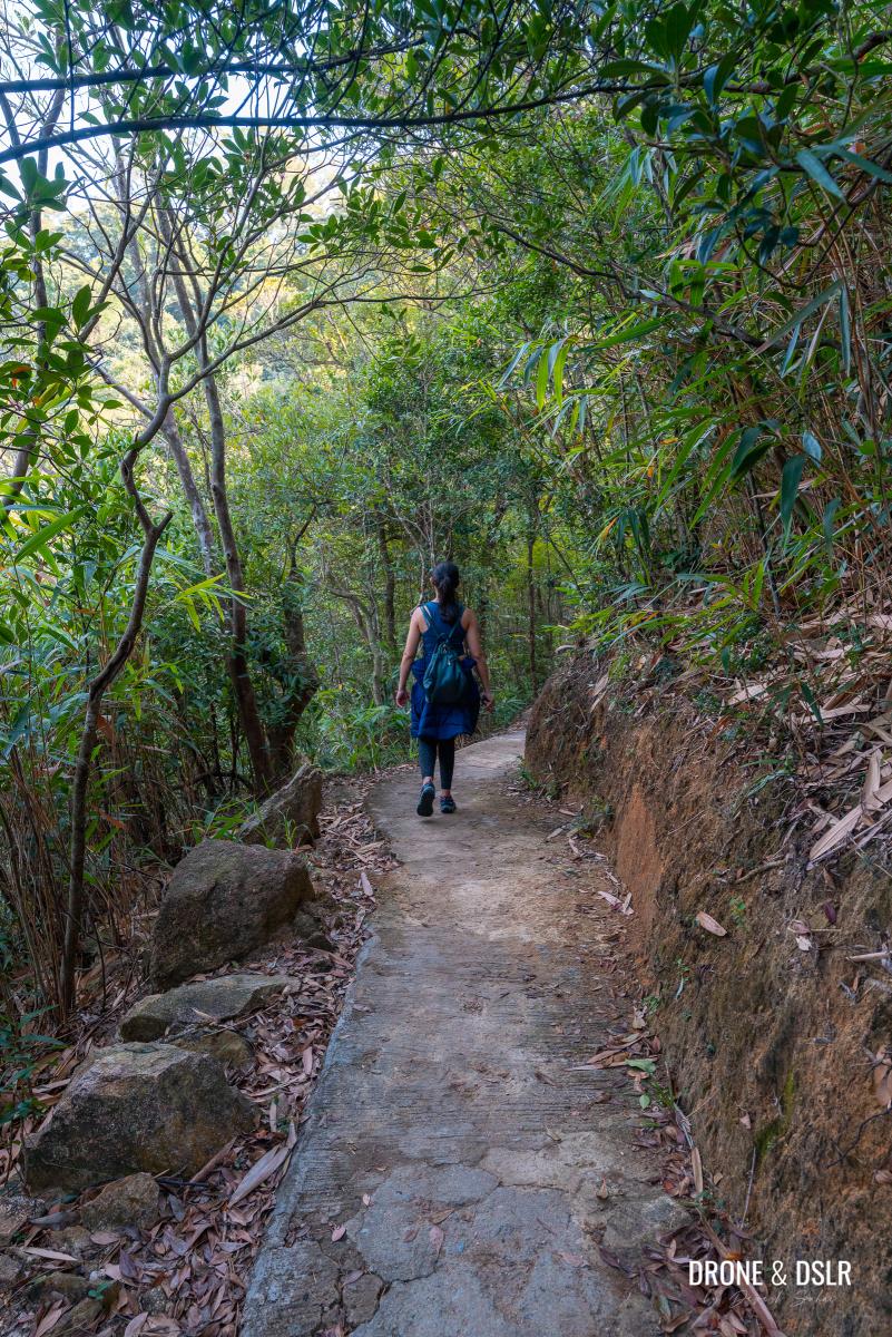
The initial section of the trail is paved
The trail starts on a flat terrain as it navigates its way between trees on both sides. After a couple of hundred metres and a few twists and turns, the trail approaches its first bridge.
-
- Nothing like basking in the winter sun whilst on a hike

-
- The first bridge on the Hong Pak Country Trail

We hiked the Hong Pak Country Trail in the winter months, but I imagine this trail would be far more exciting after the rain. There are numerous streams to cross during the hike and the first one is the Siu Ma East Stream Left Branch Stream.
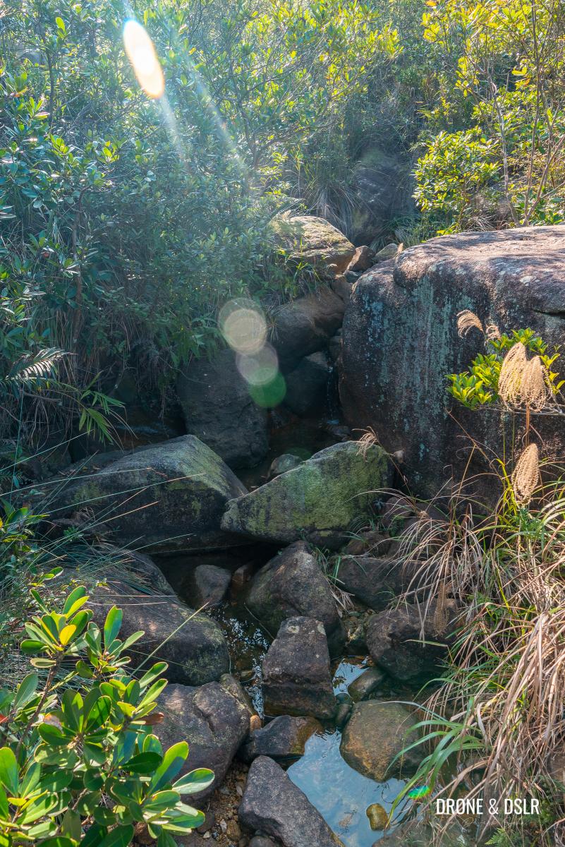
The streams were dry when we visited
The stream was almost dry when we crossed over it.
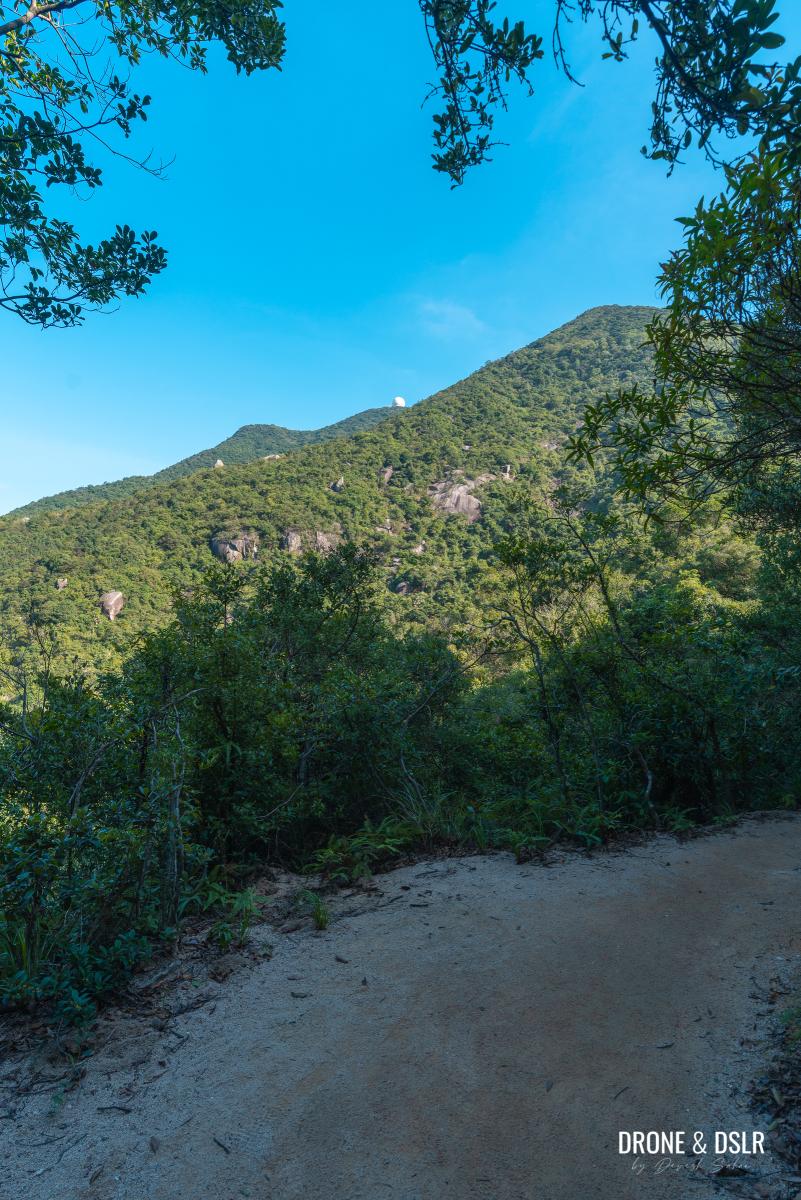
After the stream, the trail continues with views of the city and Mount Parker.
-
- Quite a pretty section
-
- Quarry Bay, Kornhill, and Kowloon in the distance
And as the trail finally turns towards the inner valley, the trees begin to clear up and the views become unobstructed.

The first views of Mount Parker from the trail
The Inner Valley
The first sign that the trail is entering the inner valley is the stunning view of Mount Parker and the valley between Mount Parker and Mount Butler.

The most scenic section of Hong Pak Country Trail!
If you were to look at the map of Hong Pak Country Trail, you can tell that the trail makes a W-shape in the valley.
After the section with the clear views of Mount Parker, the trail reaches the next stream.
-
- Spectacular views of the valley between Mount Parker and Mount Butler

-
- Enjoying a sunny hike on the Hong Pak Country Trail
-
- Crossing a bridge on the Hong Pak Country Trail

Continue walking for another 230 metres to the third stream.
-
- The trail is easy and family-friendly

-
- Beautiful day for a hike on the Hong Pak Country Trail
-
- Another bridge over a stream

It was rather unfortunate that all these streams were dry when we visited. The only sight we could admire was that of Quarry Bay, which had moved further away from us as we were now deep in the valley.
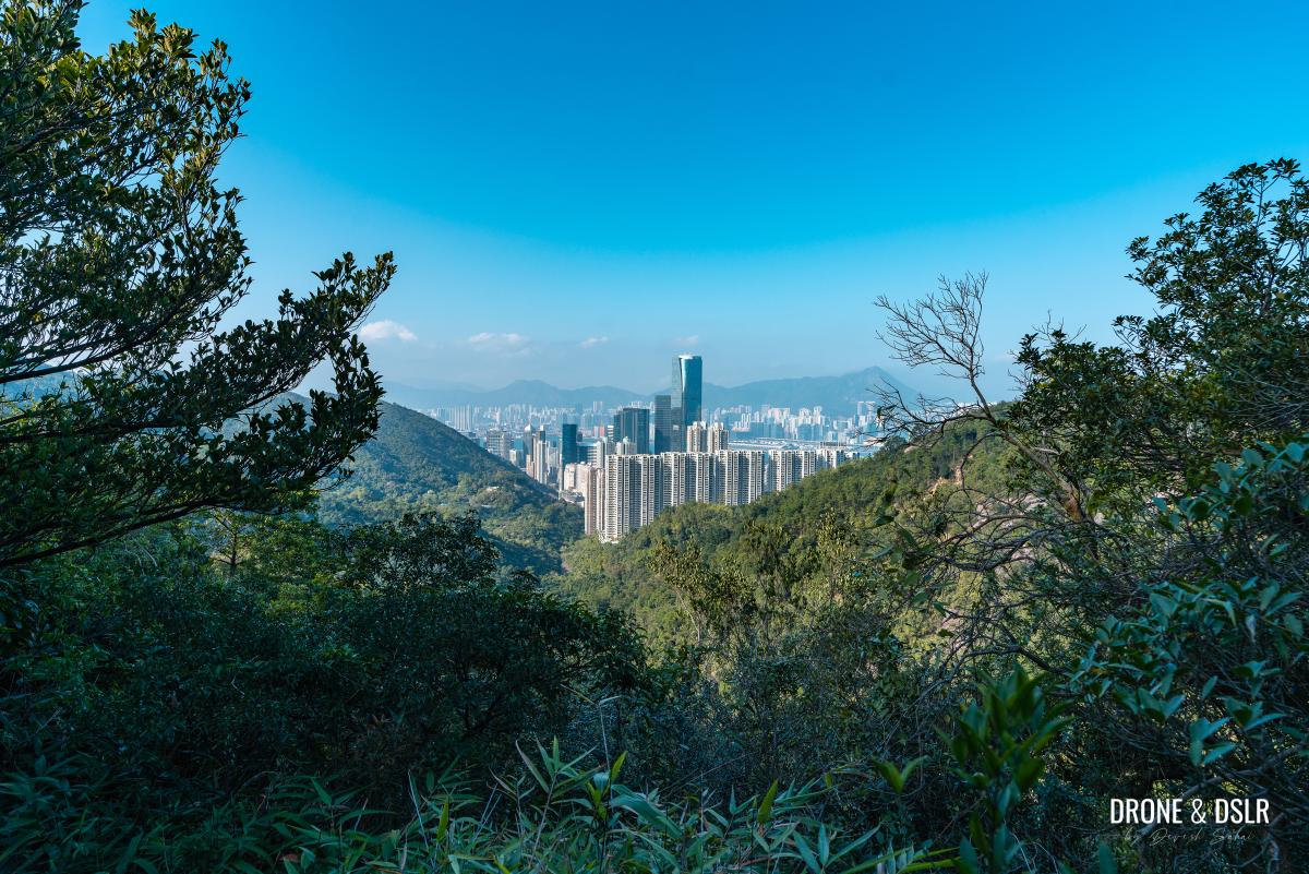
Quarry Bay views from deep in the valley
The W-shaped section of the trail continues for approximately 1.5 km and the views of Quarry Bay come and go at every turn.
And just before the trail exits the inner valley, it crosses one final stream.
-
- The last view of Mount Parker

-
- The final bridge to cross
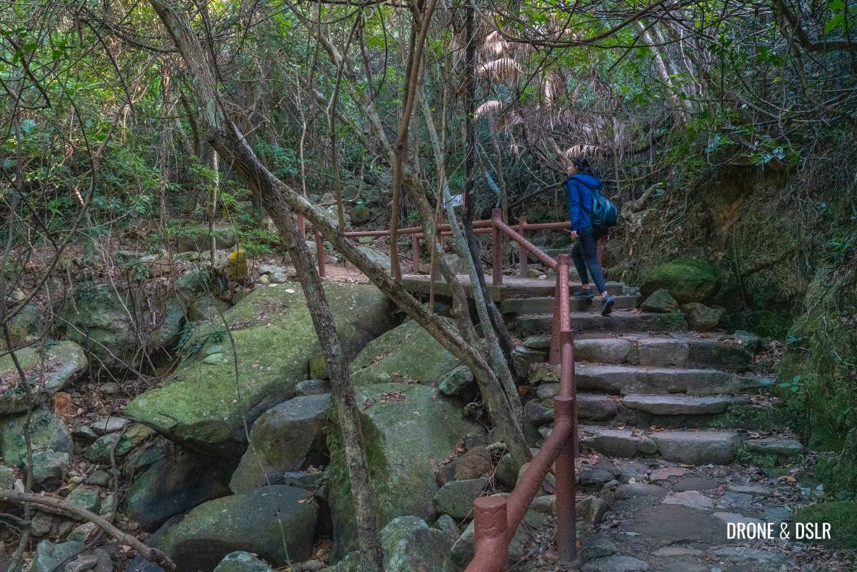
After the stream, the trail continues viewless for a short distance and then approaches a short flight of steps.
-
- Almost at the inner of the inner valley

-
- The rare steps on the trail

It’s only after the steps you realise that you’re on the opposite side of where you started. From here, the views of the Mount Butler side are equally beautiful.

You’re on the opposite side of the valley now
At this point, it’s quite obvious that the trail is at the end of its inner valley sojourn.

Gorgeous views of the valley
Dinosaur Rock
Just a short distance from where Hong Pak Country Trail exits the inner valley is Dinosaur Rock (labelled as Dinosaur Monolith on Google Maps). The large rock, hanging off the side of the trail, resembles the head of a dinosaur.

Turn around to find the dinosaur’s head
Coming from this direction, the Dinosaur rock is hidden and may not be obvious where it’s located. You will need to turn around and look behind.

Dinosaur Rock (Dinosaur Monolith) on the Hong Pak Country Trail
I couldn’t help but notice that someone had placed branches in the dinosaur’s mouth!
You can add this to my list of fascinating rock formations in Hong Kong, which includes Rhino Rock, Shark Rock, and of course, Lion Rock.
To the rock with the red writing
Continue on the Hong Pak Country Trail as it loops and reaches the opposite side of Dinosaur Rock.
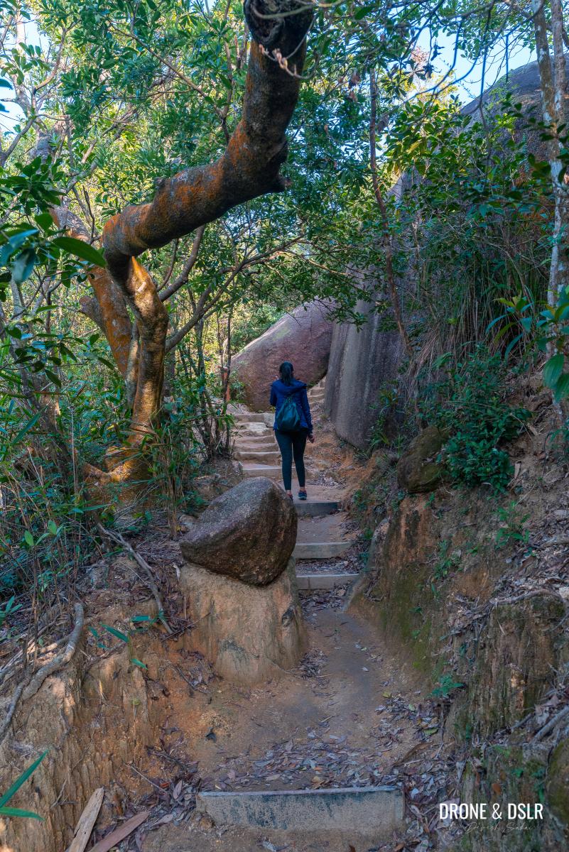
The rocky section after the Dinosaur Rock
From here, follow the sign for Kornhill and then stay left on the trail as it splits in two.
-
- Follow the signs for Kornhill

-
- Walk on the left side

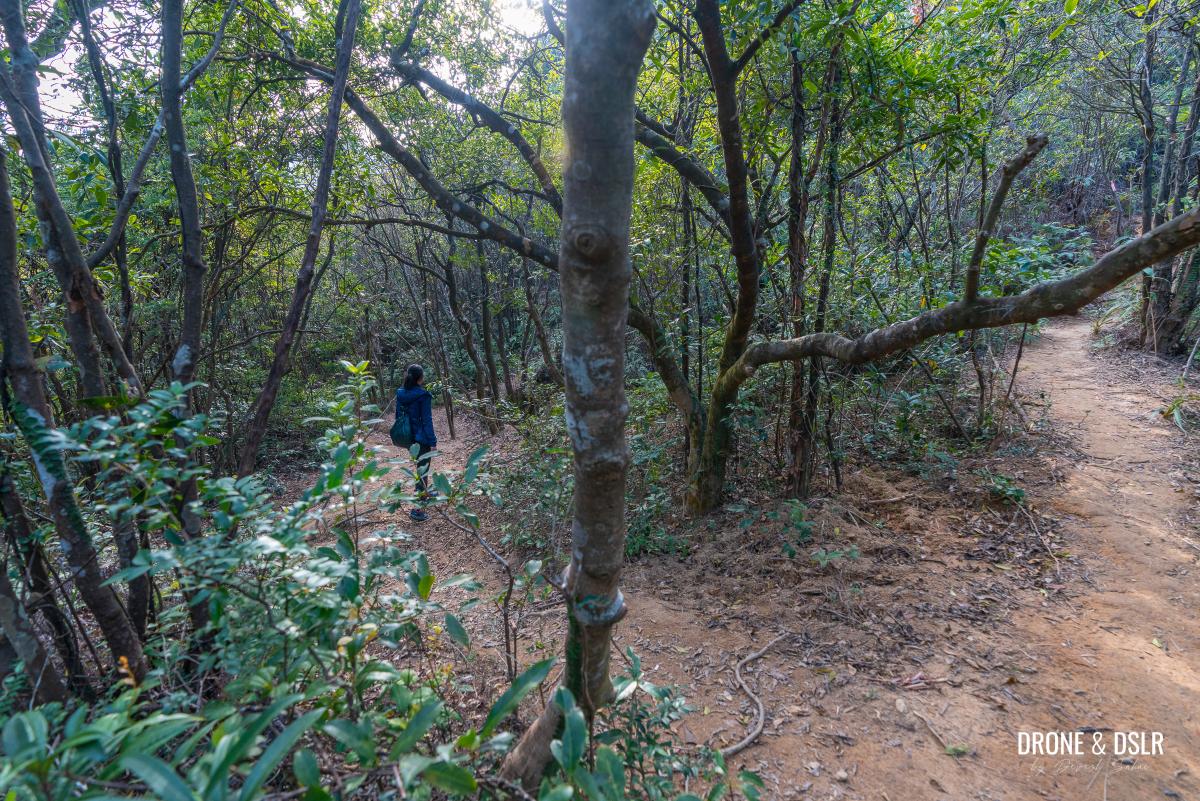
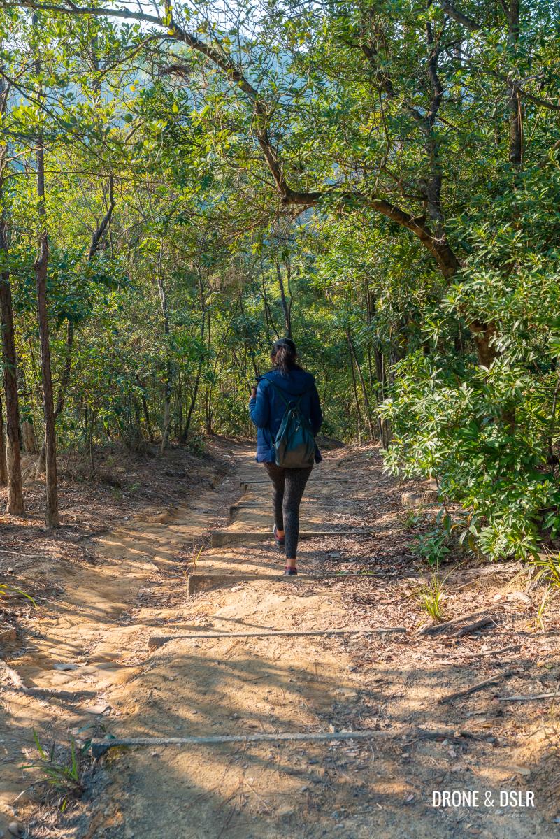
The coniferous trees ahead provide the perfect combination of shade and light, giving the trail a refreshing characteristic.

Quite a scenic section of the trail
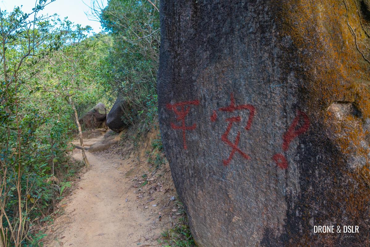
Keep walking on the trail till you reach another large boulder with some Chinese characters written in red (sorry, I can’t tell what the characters say).
-
- A breezy hike on the Hong Pak Country Trail

-
- The rock with the red writing
Japanese War Tunnels
Directly opposite the boulder with the writing is an unmarked trail. This unmarked trail is a shortcut that cuts down over 500 metres of the Hong Pak Country Trail. And it also passes by two Japanese war tunnels!

The unmarked path opposite the rock with the red writing where the war tunnels are located
However, if you take the shortcut you miss the best viewing point from this trail. But if you don’t then you miss the war tunnels.
But there’s a way to get the best of both worlds! Because one of the tunnels is located at the start of the unmarked trail.
Enter the unmarked trail and walk a couple of metres ahead till you see cleared area on the left-hand side.
Take the path on the left to view the war tunnel
Step into the clearing and locate the Japanese war tunnel on the right-hand side. It’s usually not a safe idea to step inside these war tunnels.
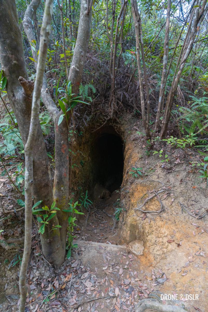
A Japanese war tunnel on the Hong Pak Country Trail
This valley is home to numerous war tunnels and even wartime stoves built during WWII.
Once you’re done admiring the tunnel, return to the rock with the red writing and continue hiking the trail.
Or if you want to take the shortcut and visit the second tunnel, continue straight on the unmarked trail.
If you’re feeling adventurous, you can take this shortcut
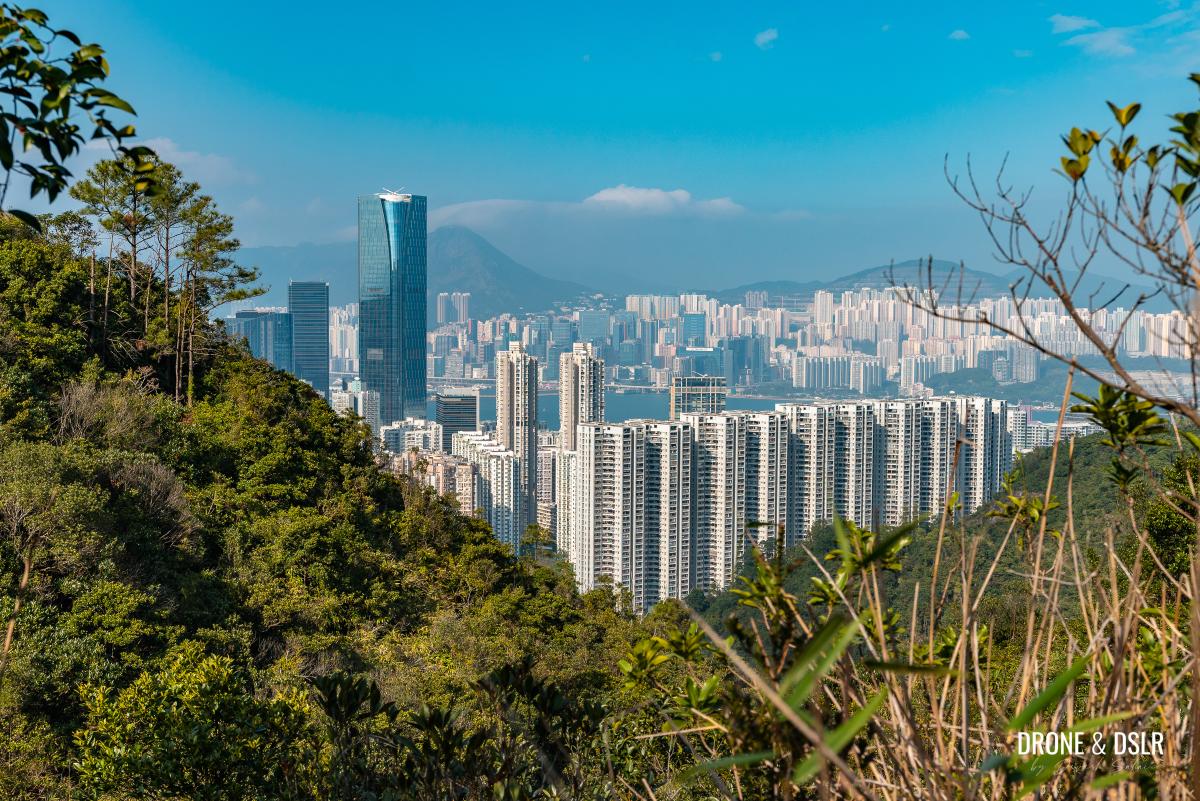
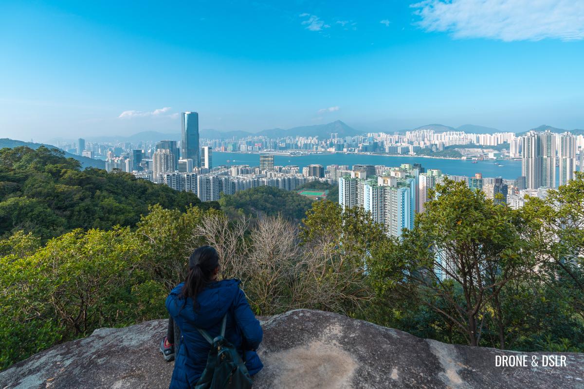
Shau Kei Wan High-Level Fresh Water Reservoir Viewpoint
As the trail continues, the skyscrapers appear much closer, reminding you that the trail has almost returned to the city.

Returning to the trail after the war tunnel
Keep hiking for another 400 metres till the trail reaches a flight of steps downhill. But just before the steps is another unmarked trail to the right.
Take that trail and walk a few metres ahead to reach the best viewing point on the Hong Pak Country Trail.

Return to the steps and keep walking down
Situated on top of a flat rock, this viewing point is located next to the Shau Kei Wan High-Level Fresh Water Reservoir and offers panoramic views of Hong Kong Island’s eastern side, from Quarry Bay to Shau Kei Wan.
-
- What an amazing view!

-
- Views of Quarry Bay, Shau Kei Wan, and east Kowloon

And across the channel, you can see Kowloon Peak and the entire range of hills in the distance. And further to the east, Devil’s Peak, Black Hill and Yau Tong.
The next viewing point
Return to the steps and continue walking downhill. It’s from this point onwards that the Hong Pak Country Trail begins its descent towards Kornhill.

The picturesque Hong Pak Country Trail
Keep walking on the trail till it reaches a pavilion. Unfortunately, there are no views from the pavilion. But locate the path behind the pavilion and climb up the hill to reach another viewing point.
-
- The pavilion

-
- Bit of an adventure getting to the second viewing point

The views of Shau Kei Wan and the east are much clearer from this viewing point than they were from the previous viewing point.
-
- The second viewing point

-
- Views of Shau Kei Wan

And the viewing point also extends slightly to the west, but the trees obstruct the views.

Views to the west are slightly obstructed
Finish the Hong Pak Country Trail
After enjoying the views, return to the pavilion and continue walking downhill.
Country hiking after the pavilion
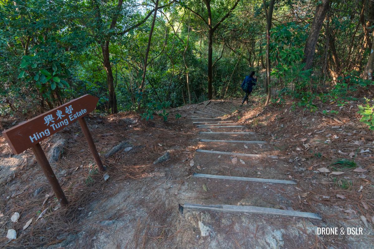
After a short distance, the trail splits in two. The trail on the right heads down to Hing Tung Estate, whereas the trail on the left heads down towards Kornhill.
-
- Turn right for Hing Tung Estate
-
- Turn left for Kornhill

Unless you wish to exit at Hing Tung Estate, continue on Hong Pak Country Trail towards Kornhill.
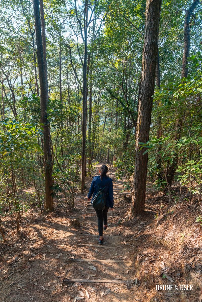
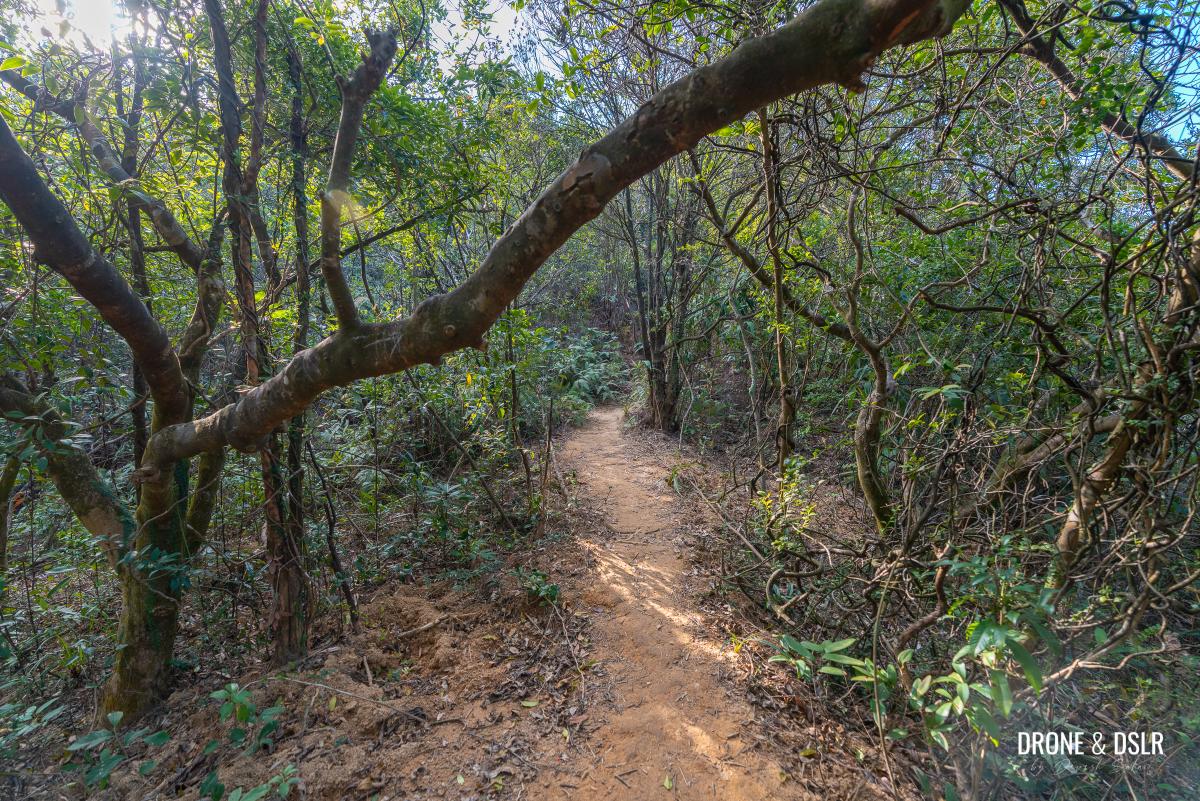
Another beautiful section of the Hong Pak Country Trail
The trail gently descends through another picturesque section of the woods before arriving at a flight of steps behind Kornhill.
-
- Keeping hiking downhill

-
- Getting closer to Kornhill

At the end of the steps, turn left onto the trail and continue walking till the sharp bend ahead. For the curious, the shortcut with the Japanese war tunnels reunites with Hong Pak Country Trail at this bend.

The bend where the shortcut reunites with Hong Pak Country Trail
So, make sure that you take the U-turn at the bend and continue walking downhill.
-
- Walk around the bend and stay on the trail

-
- Getting closer to the end of the hike
Stay on the trail till it reaches the cemented path. And then walk down the cemented path as it leads you to the end of the Hong Pak Country Trail.
-
- The start of the cemented section

-
- The final section of the trail

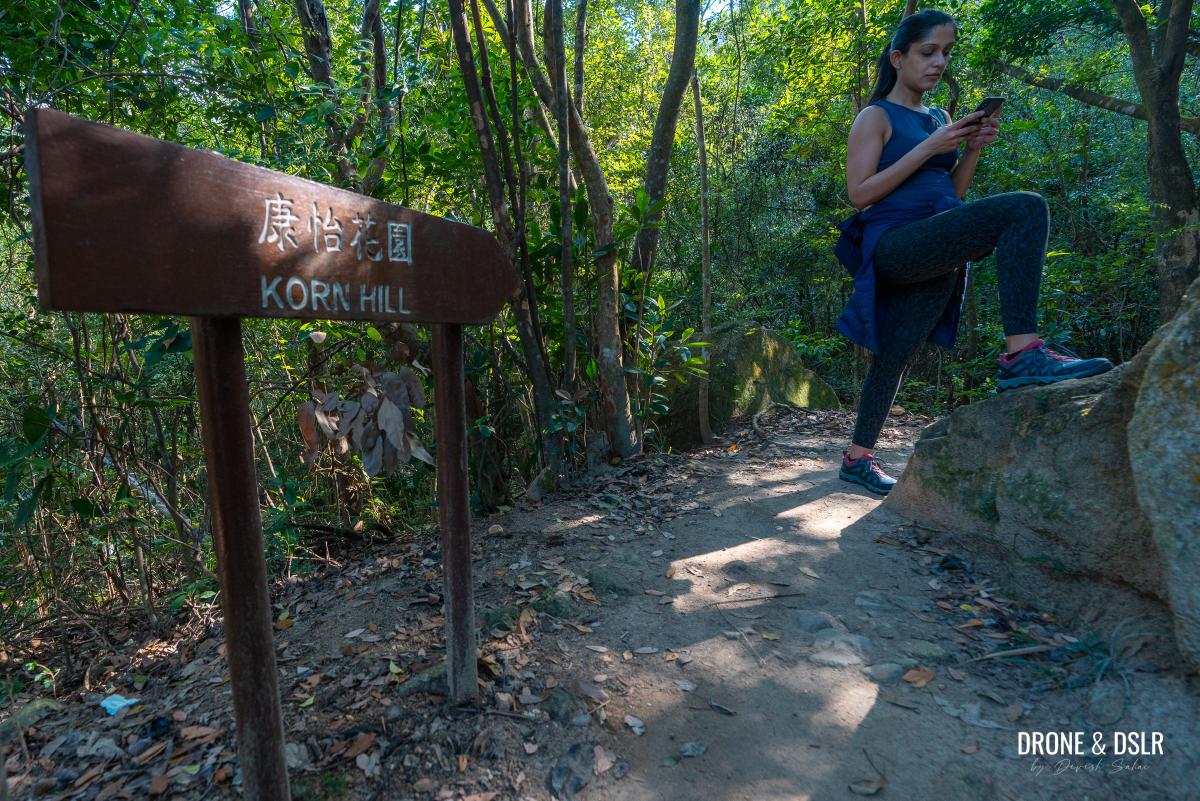
Exit at Nam Fung Sun Chuen/Kornhill
The Hong Pak Country Trail doesn’t end at Kornhill but in the woods behind Kornhill. It shares this start/endpoint with the Quarry Bay Tree Walk, next to an information board and a toilet.

The end of Hong Pak Country Trail
To continue towards Kornhill, take the steps going down.

Go down the steps at the end of Hong Pak Country Trail
At the end of the steps, turn right and walk along the catchwater drain.
-
- Turn right and walk on the path along the catchwater

-
- The path emerges behind Kornhill’s Block A

The catchwater path reaches an outdoor seating area behind Block A of Kornhill. Take the steps down and continue walking on the path just behind Kornhill.
-
- Walk down the steps behind the seating area

-
- Take the path directly behind Kornhill
The path crosses the Quarry Bay Reservoir Garden below before going under Hong Pak Path and then emerging onto Greig Road.
-
- Walk under Hong Pak Path

-
- Back to civilisation on Greig Road
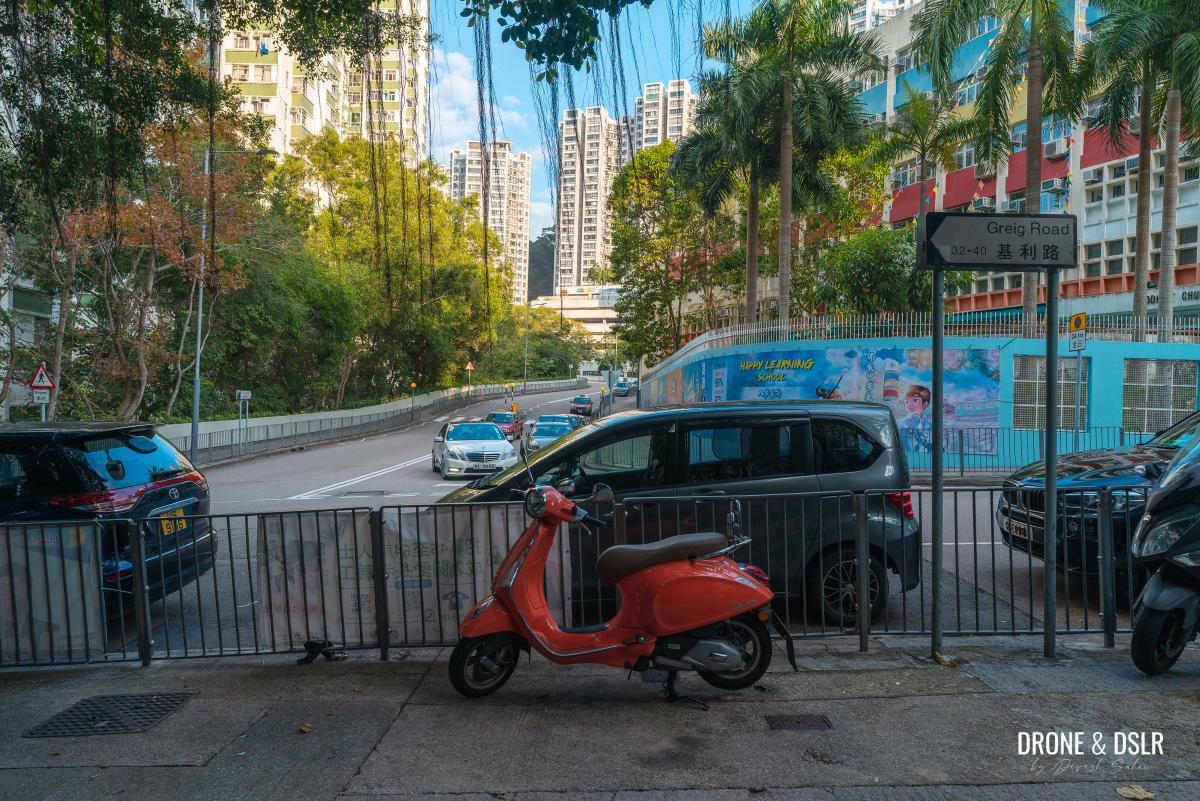
From here, you can turn left and return to King’s Road to complete the loop.
An easy hike in Quarry Bay
We hope you found our guide to the Hong Pak Country Trail resourceful!
The trail itself is quite easy, but getting to its elevation is the only challenge. However, once on it, the views, the streams, the Dinosaur Rock and the war tunnel do not disappoint! If you enjoyed this hike, we highly recommend the Quarry Bay Tree Walk (which is definitely a lot more than a tree walk).
Enjoying the views!
If you’re looking for more challenging hikes in the area, why not hike up Siu Ma Shan or Mount Butler and Jardine’s Lookout? Or explore the Sai Wan Battery, which is a hidden gem in Shau Kei Wan!
Please feel free to share this post on the social media channel of your choice and drop us a comment below.
If you enjoy our work, come join us on Instagram and YouTube 🙂


You might also like


Leave a reply