
The Rhino Rock Hike is a short but adventurous trail that leads you to a large rock shaped like a rhino! Located on the Bluff Head peninsula at Stanley, Rhino Rock is probably the furthest us civilians can get to before reaching the gates of the Chek Chue Barracks (Stanley Barracks).
Getting up close with the Rhino Rock
Its appeal lies not only in its unique shape but also in the stunning views of Tai Tam Bay from the hillside. Although the trail is very short (less than a kilometre each way), it is completely unmarked and challenging to navigate. However, if you are good with directions and comfortable following ribbon markers, you shouldn’t have any trouble finding your way.
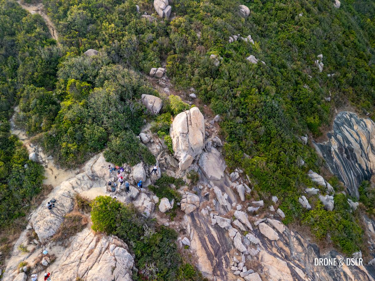
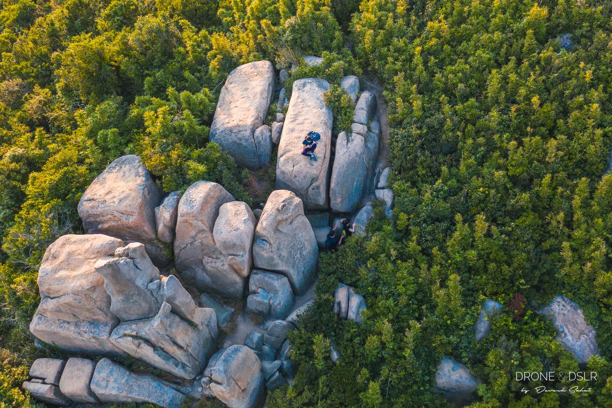
Bird’s eye view of Rhino Rock
So, with that out of the way, let’s find out how to reach this incredibly unique rock.
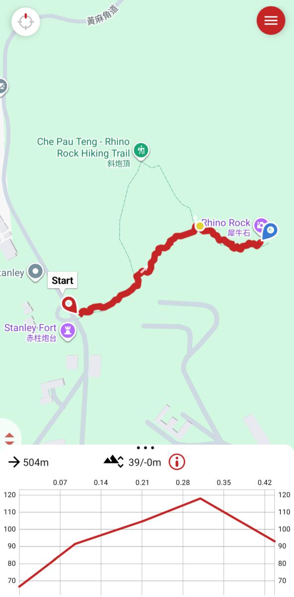
Rhino Rock Hike Map
As mentioned, the Rhino Rock hike is short, and relatively easy. There are certain sections of the trail that are extremely steep, or challenging to navigate thanks to the lack of any signs.
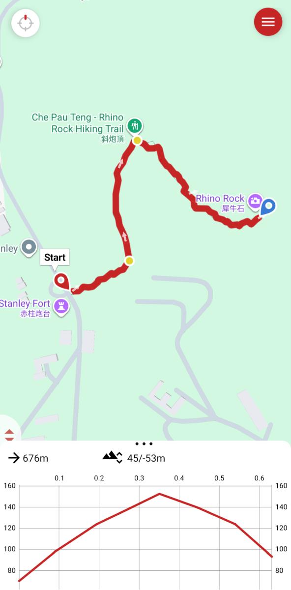
Rhino Rock Hike Trail Map via Che Pau Teng, Hong Kong
But thanks to ribbon markers, and other hikers on the trail, you should be able to navigate yourself to Rhino Rock.
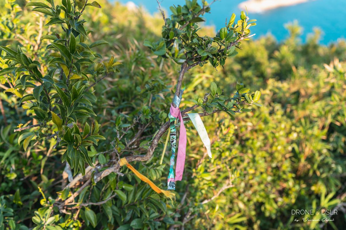
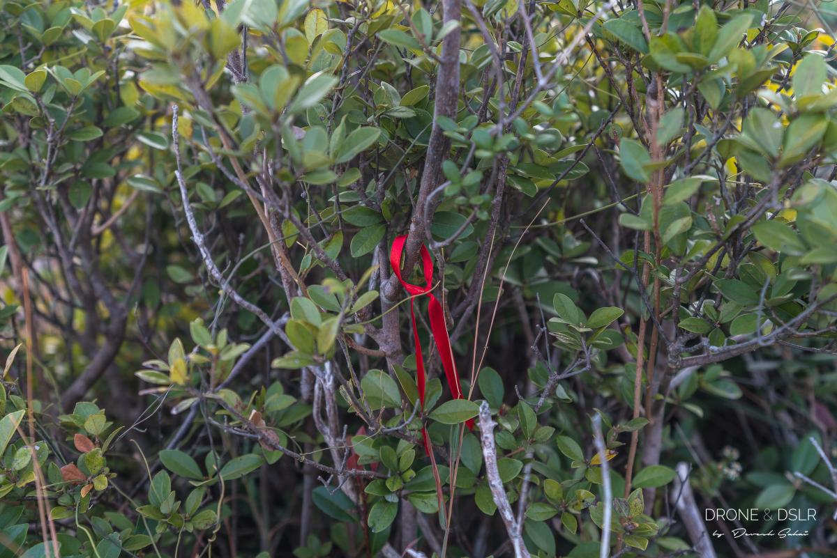
Keep an eye out for colourful ribbons along the Rhino Rock Trail
Also, in this guide, we’ll highlight an alternative route to the Rhino Rock that does not involve climbing to Che Pau Teng, and approaches the rock from the south side. However, there’s a lot of bushwhacking on this alternative route.
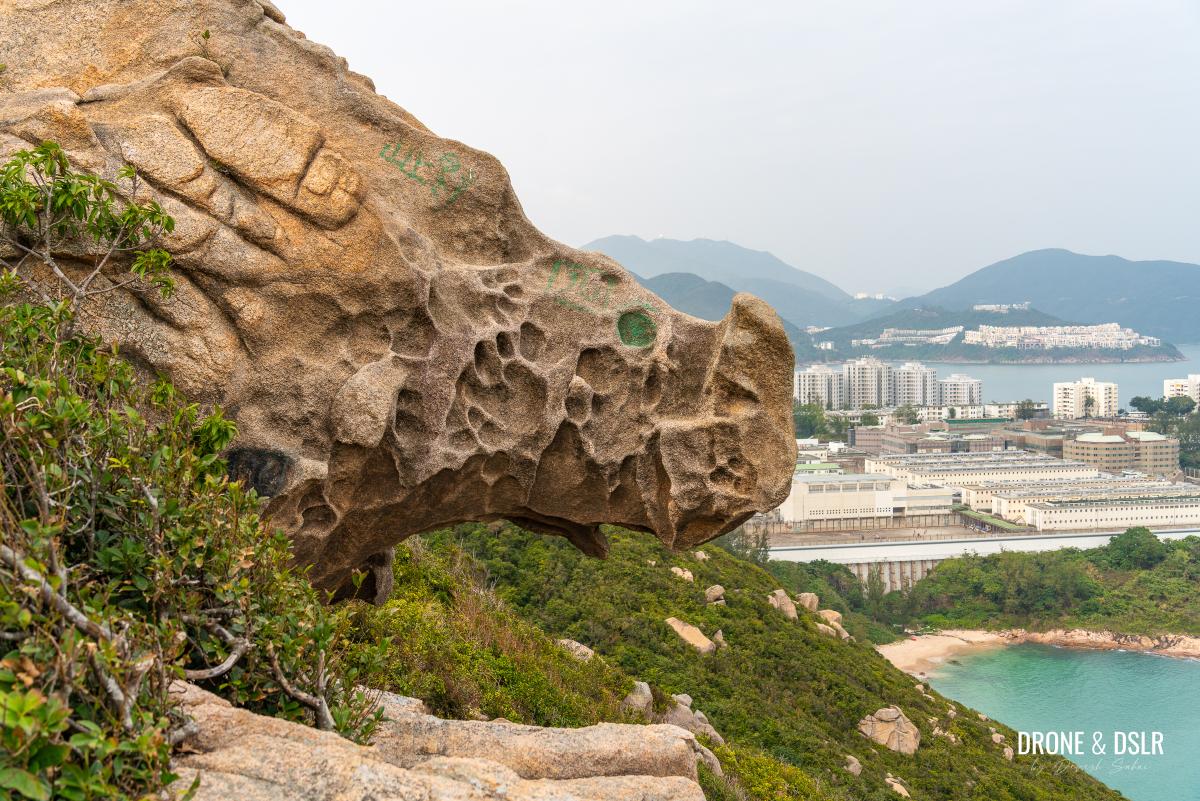
Rhino Rock with Stanley prison in the background
And finally, before we move onto the guide, a few pieces of advice for this hike:
- Wear comfortable, hiking shoes. It can get slippery.
- As the Rhino Rock is on the eastern face of the hill, try to get to it by morning / early afternoon. By the evening the sun begins to set behind the hill.
Starting Point
The Rhino Rock Hike starts from the end of Wong Ma Kok Road in Stanley. To arrive here, you can either take bus 14 (from Sai Wan Ho) or 6A (from Central Exchange Square).
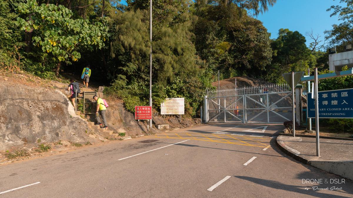
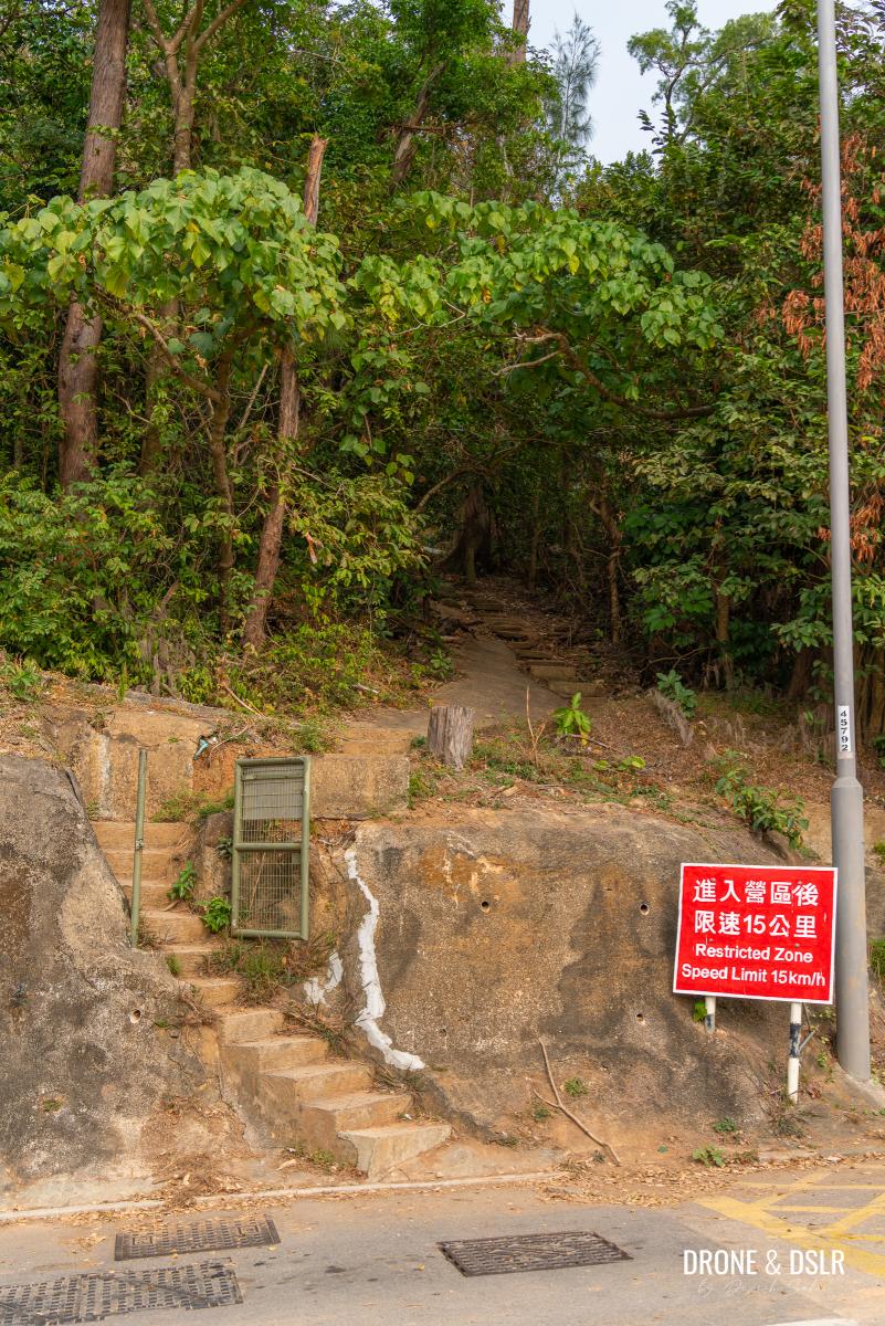
Take the steps on the left of the gate to start your hike to the Rhino Rock
Take either of these buses to Stanley Fort, which should be the last stop.
The Stanley Fort bus stop on Wong Ma Kok Road is your starting point for the Rhino Rock hike.
You could also walk to the starting point from the Stanley Market, but keep in mind that the walk is about 2 km long and will take you approximately 30 minutes. That’s why I’d advise taking the bus.
Stanley Fort Bus Stop to Che Pau Teng
Once you reach the Stanley Fort bus stop, look for the steps on the side of the hill, before the gate to Stanley Barracks.
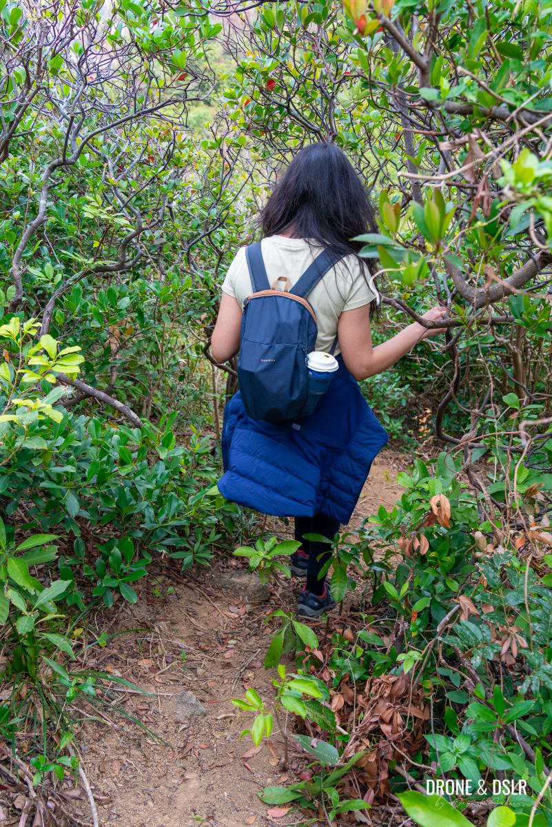
Let the Rhino Rock Hike begin
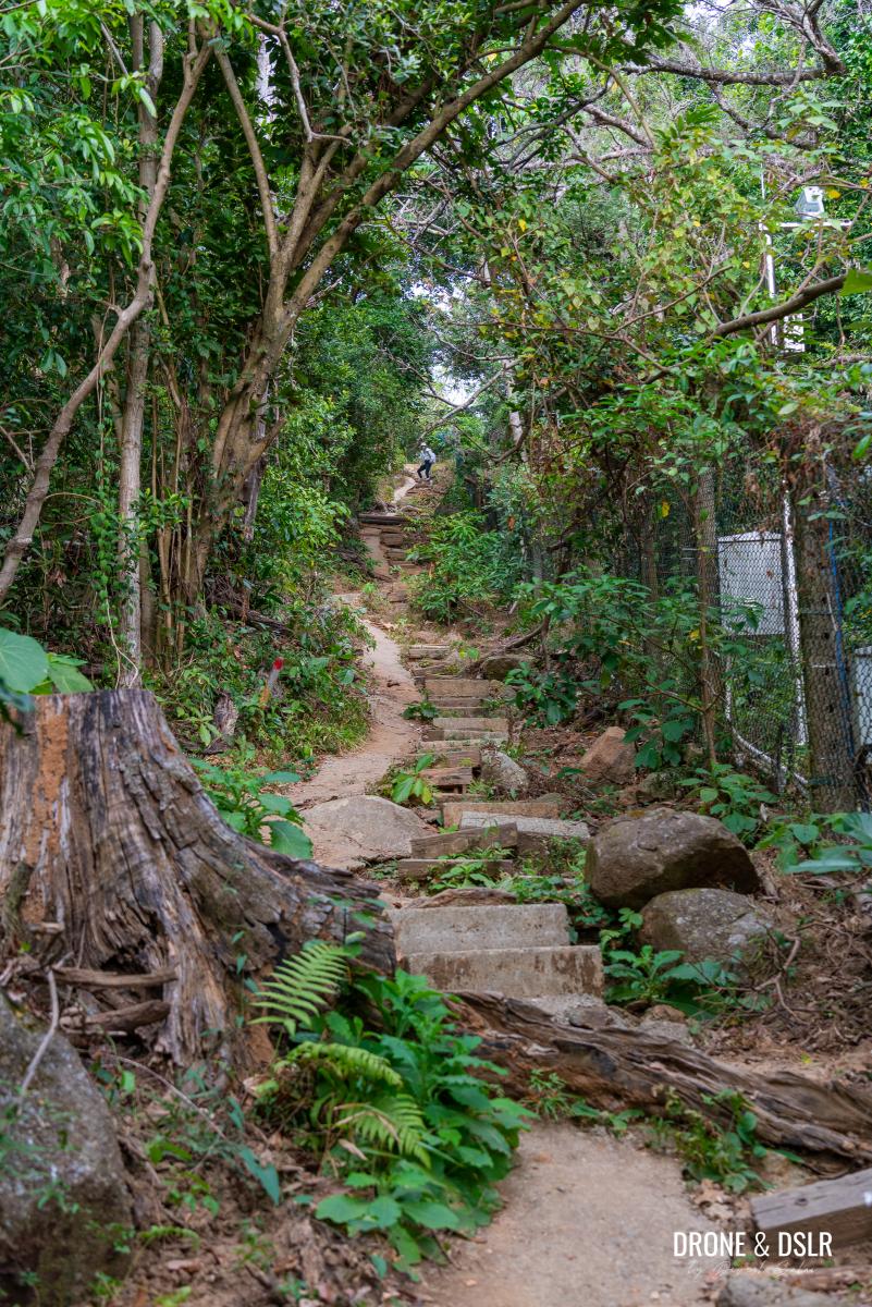
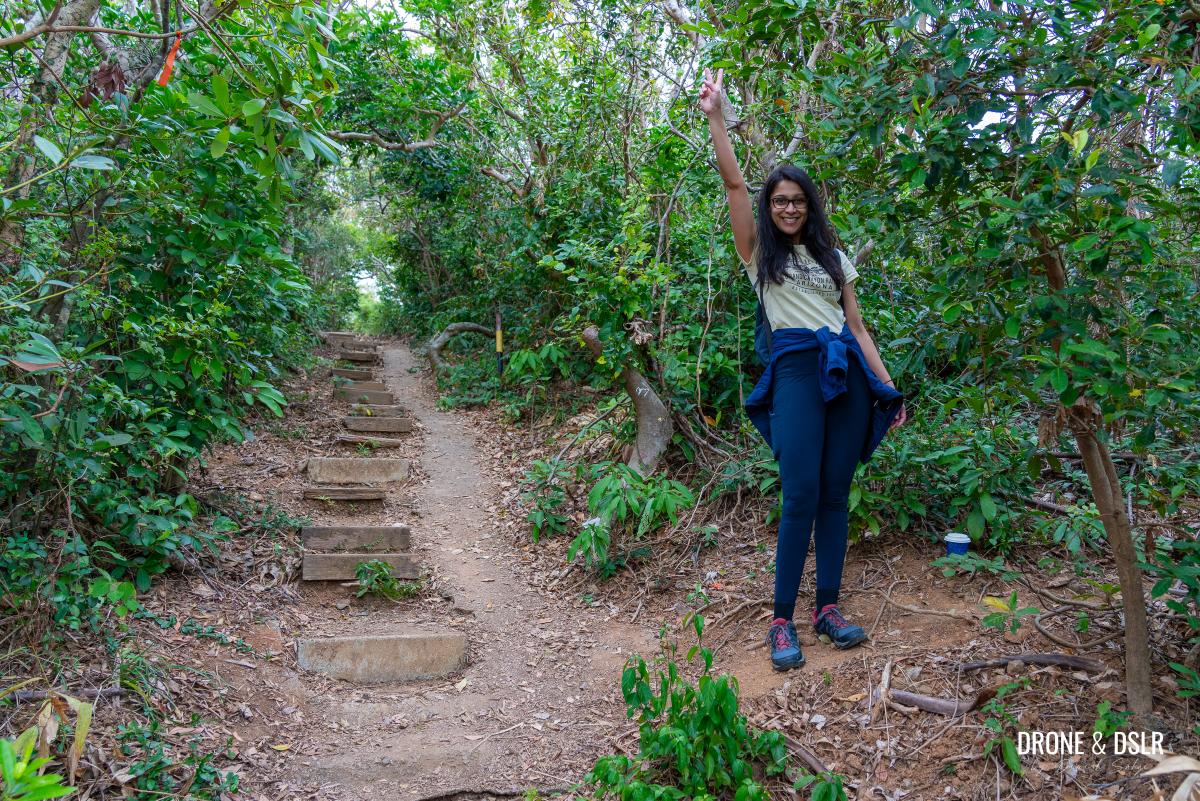
The entrance leads you to a short but slightly steep climb up these steps. Over the years, these steps have undergone significant wear and tear, and the last time I was there, they were quite challenging.
The initial climb up
The steps have become uneven, loosen, or in some cases fallen off exposing the iron rods below. So, needless to say, be careful while climbing and coming back down. However, while climbing, you can take advantage of the slope on the side of the steps.
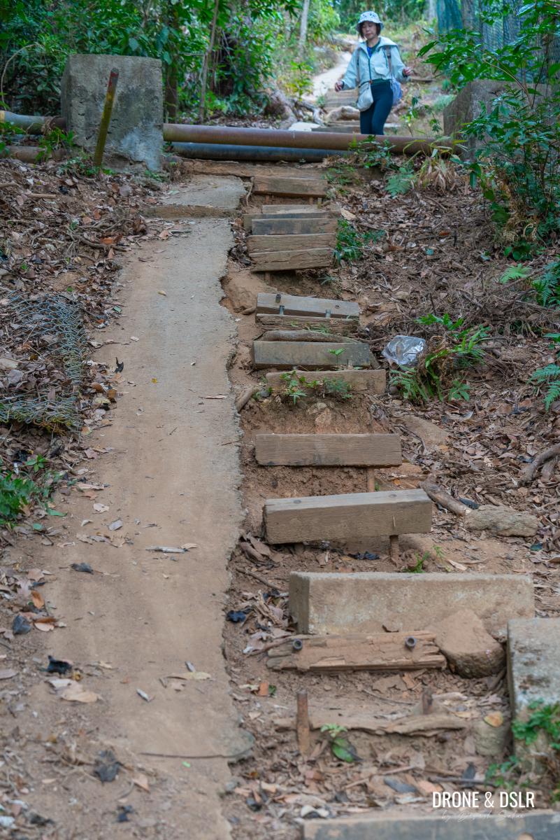
These steps are in a bad shape, easier to walk on the slope
At the end of the steps, the trail curves left and flattens. Way for a few metres, and you may notice an unmarked trail on the right-hand side. This is the alternative route to Rhino Rock.
Click the accordion below if you wish to learn more about this route.
The Alternative Route to The Outcrop
Rhino Rock Hike Trail Map Alternative Route, Hong Kong
If you’re feeling adventurous, you can take a shortcut to the outcrop just before you reach Rhino Rock. While this route is slightly shorter (by 200 metres) and avoids steep slopes, it is harder to navigate and requires some light bushwhacking.
It’s time to take the alternative route
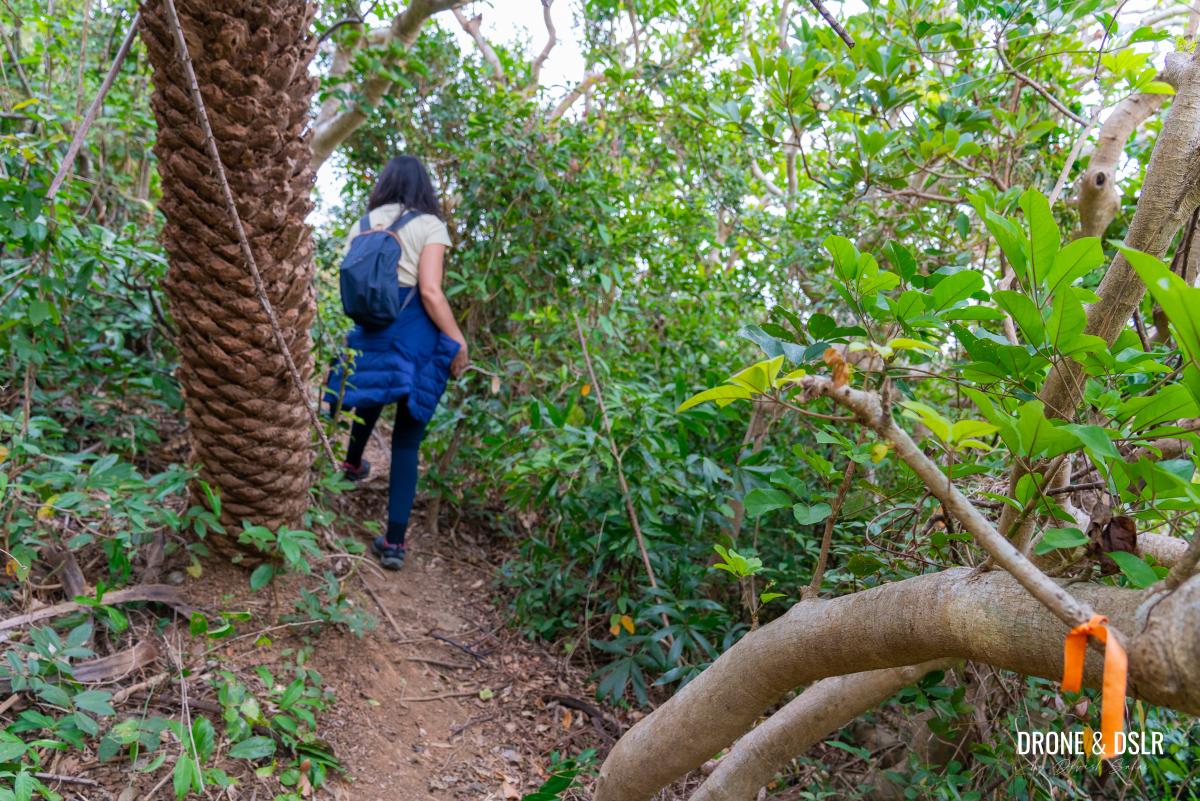
If you’re up for it, turn onto the unmarked trail and follow it through the trees until you reach a clearing. The path then leads downhill through a patch of shrubs and a dense bamboo thicket.
-

- Follow the trail through the bushes
-
- Head down this trail through the trees and bushes, don’t get scratched
-
- Keep following the ribbon markers
-
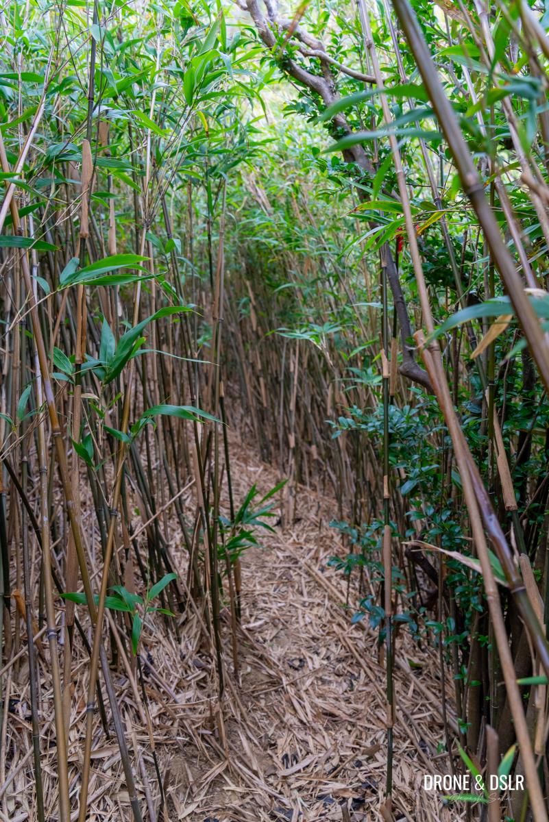
- Enter the bamboo forest
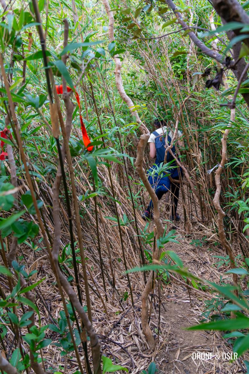
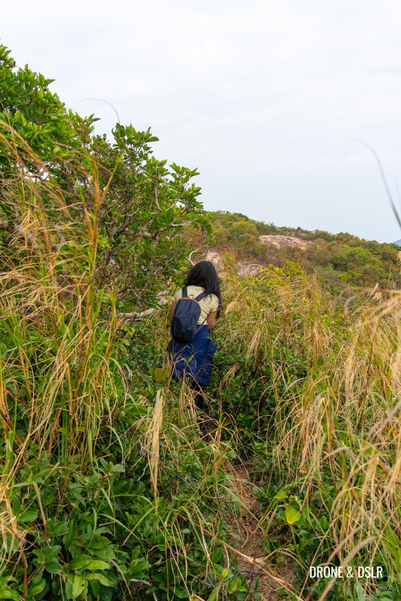
Follow the trampled stems to find your way through. Once you exit the bamboo, you’ll reach the base of a rocky slope.
-
- Follow the clearing
-
- After the bamboos, go up this rocky slope
Climb up, turn right, and walk along the ridge to enjoy the views of Stanley Barracks.
-
- Follow the trail on the ridge
-
- The best views of the Stanley Barracks are from this alternative route
Keep a sharp eye out for a ribbon marker on your left, which will lead you through the bushes to the other side of the hill.
-
- Look out for the ribbon
-
- And we’re back on the trail!
From there, follow the trail downhill toward the large outcrop, where you’ll merge with the main path (via Che Pau Teng).
-
- Continue your descent
-
- Follow the trail to the outcrop up ahead
Congratulations if you followed this alternative route and didn’t get lost!
Choose your path: the normal route (go straight), or the alternative route (turn right)?
Else, if you want to take the regular route, keep walking on the paved trail, as it gradually heads uphill and finally reaches Che Pau Teng.
-
- The steps are pretty easy to climb
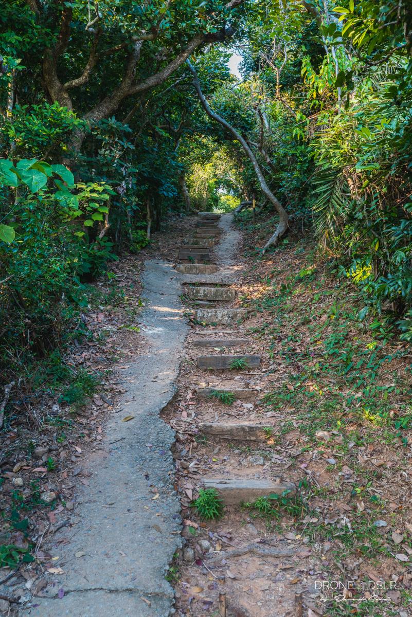
-
- The path after the steps is really easy – Rhino Rock Hike
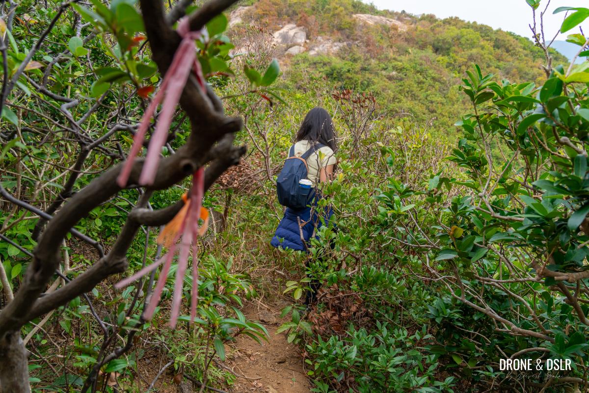
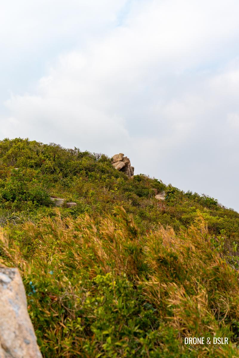
From the triangulation station on top of this short hill, the trail continues through the bushes on the right-hand side.
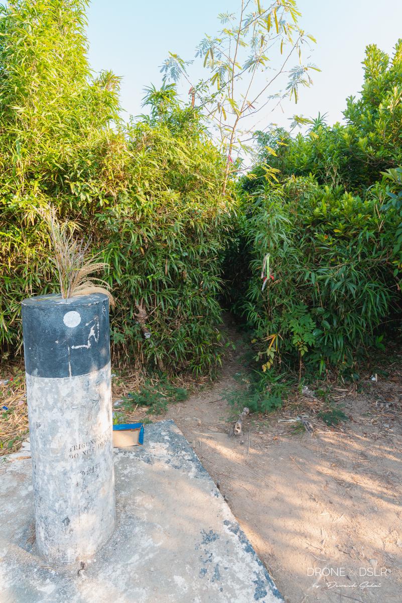
The marker for Che Pau Teng. Enter the bushes next to the ribbon.
And it’s also about to get more challenging.
Che Pau Teng to The Large Outcrop
To continue along the Rhino Rock trail, enter the bushes to the right of the triangulation station and exit on the other side of the hill.
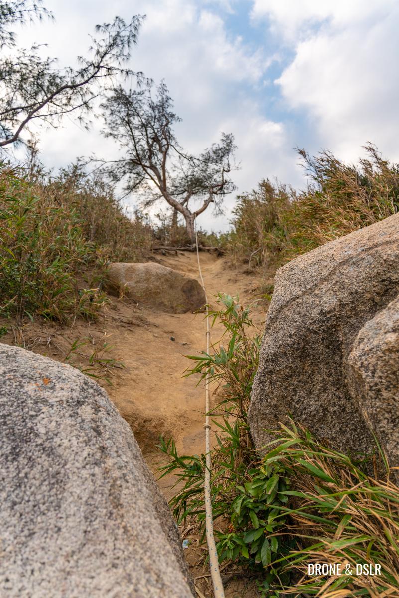
You will immediately reach the steepest, most eroded section of the path. Use the rope to descend carefully.
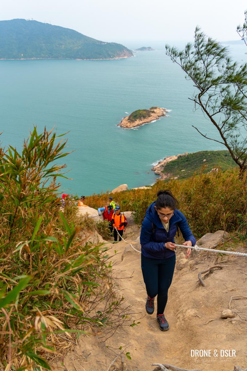
Be careful going down this steep section
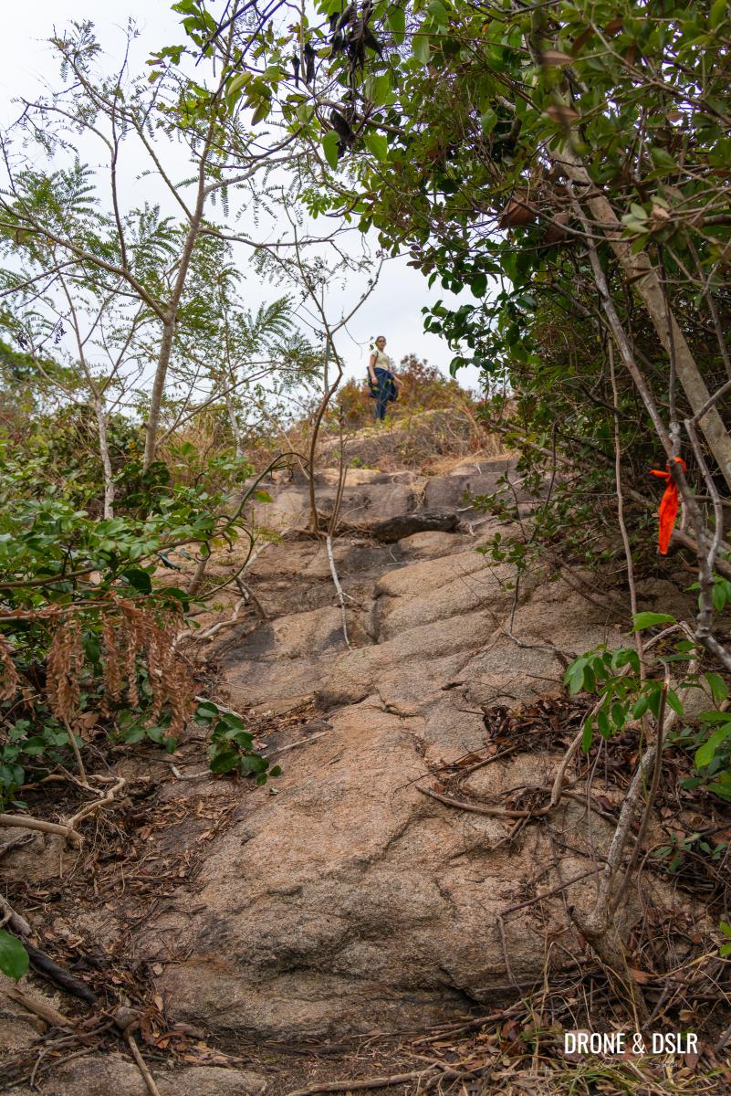
After the trail turns right and continues its descent, look for the colorful ribbon markers that lead toward Rhino Rock. Be cautious, as certain sections of the trail are quite slippery.

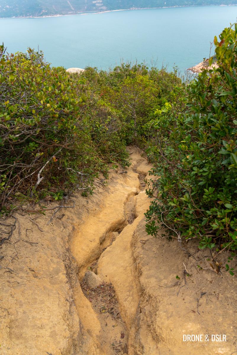
The view of the sea as you emerge from the bushes
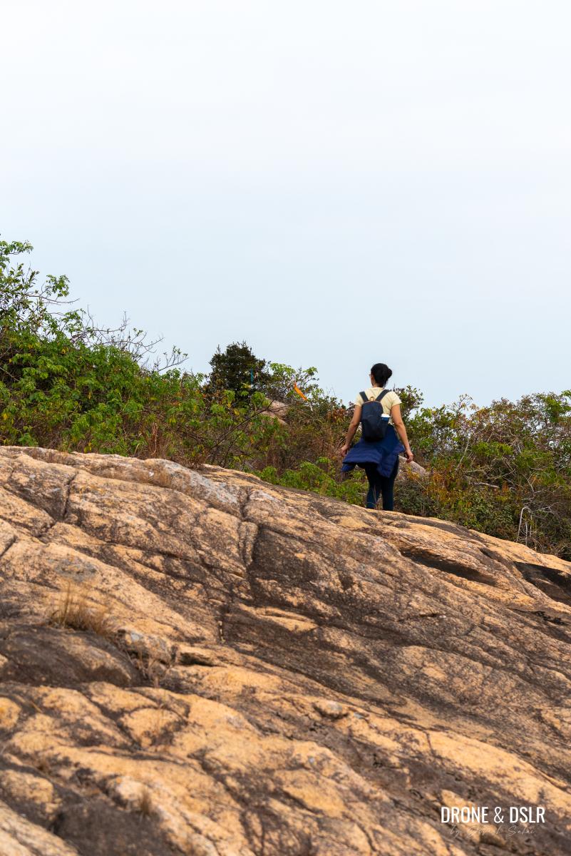
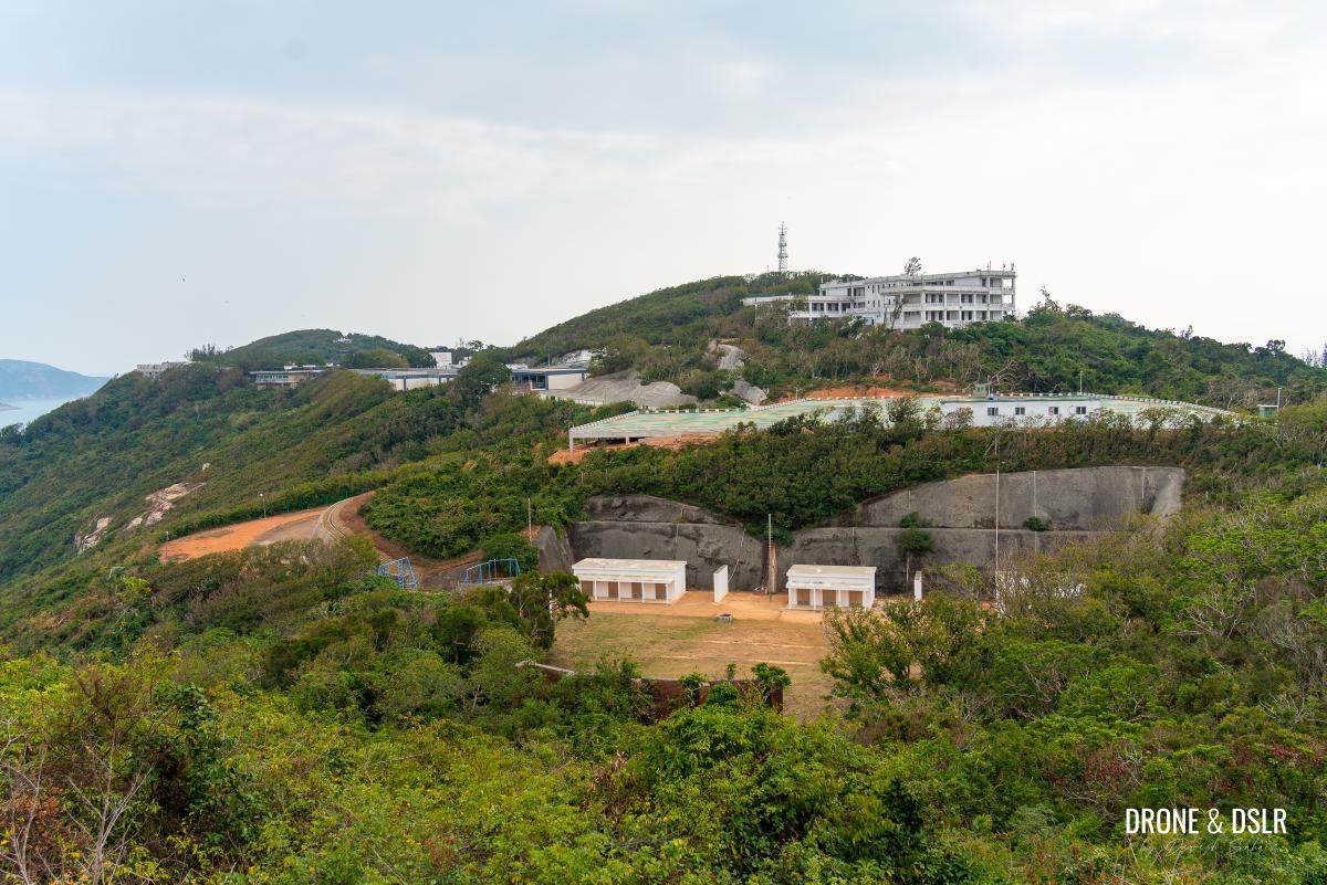
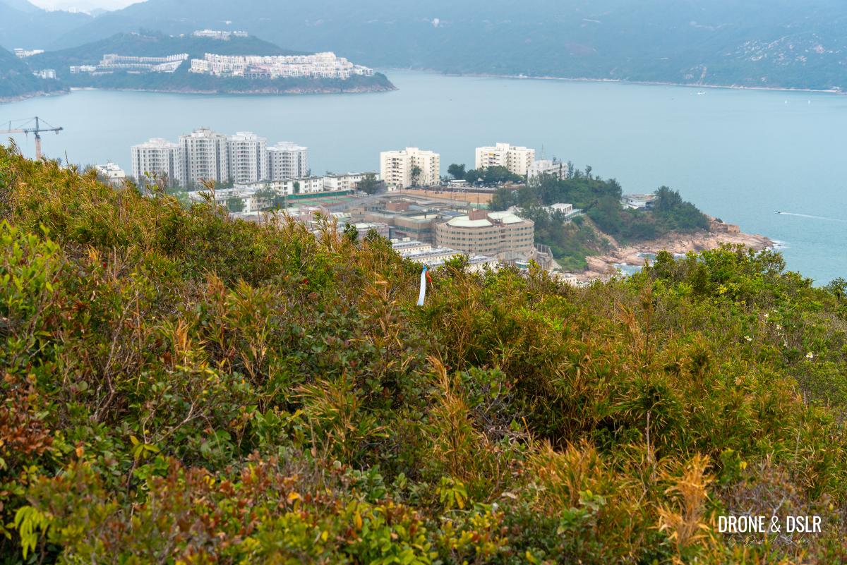
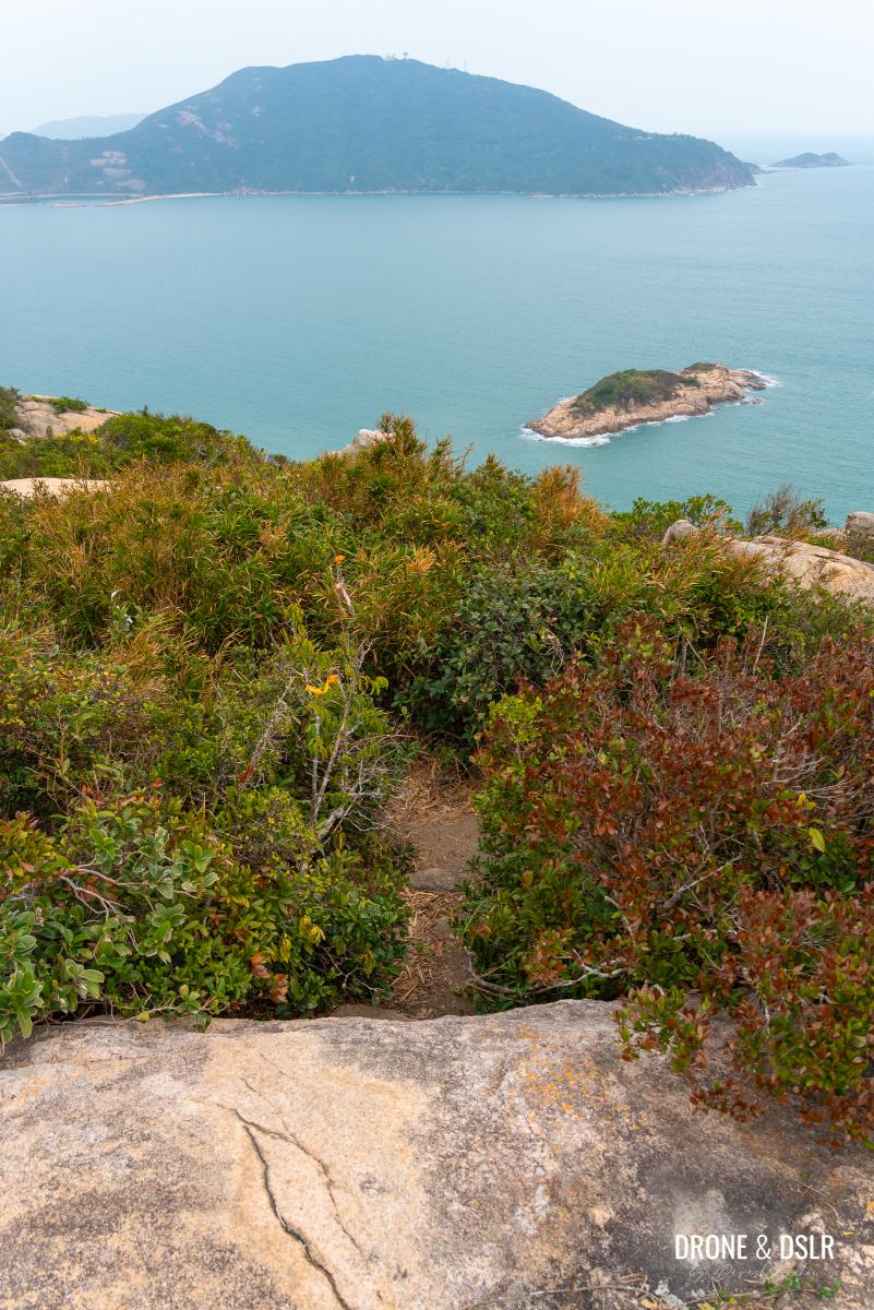
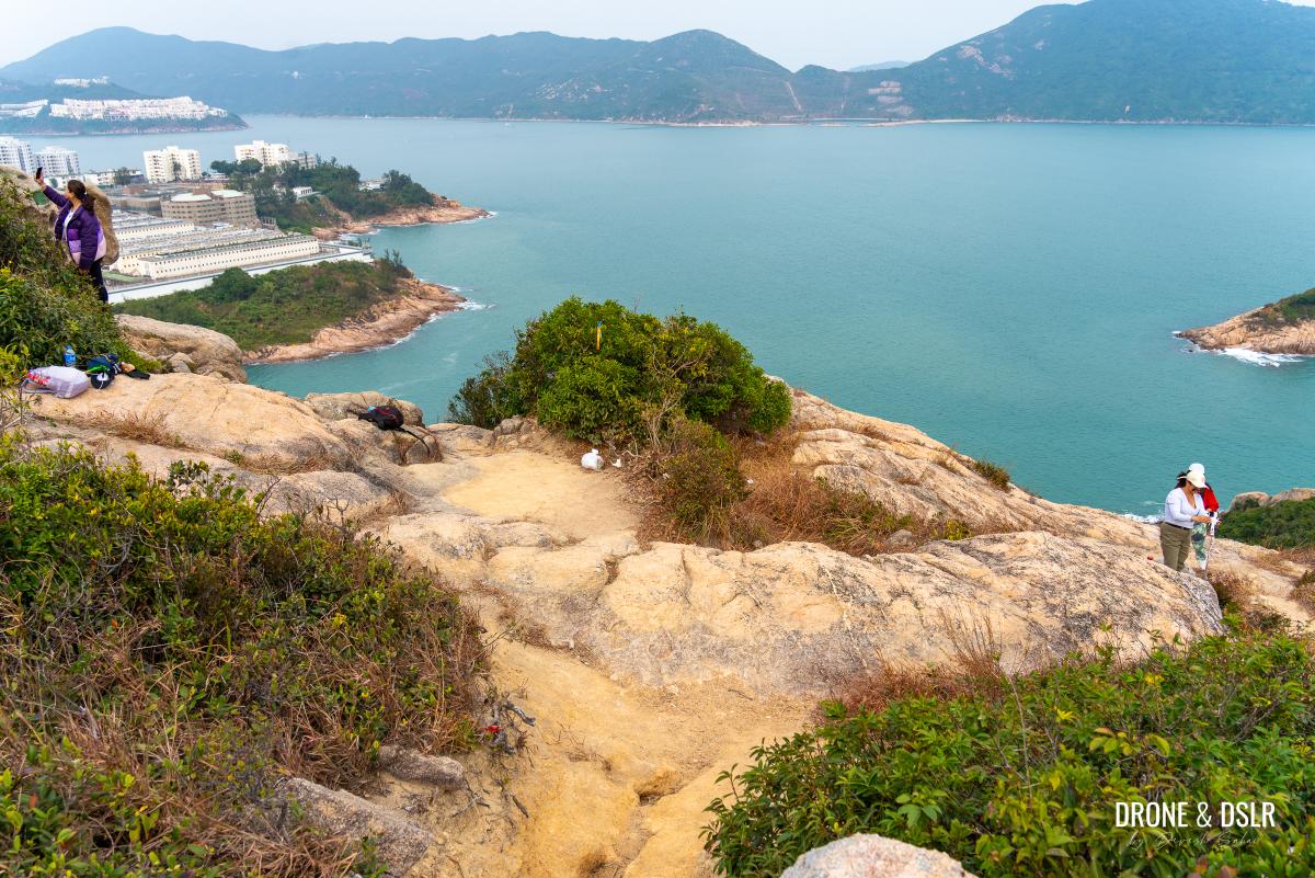
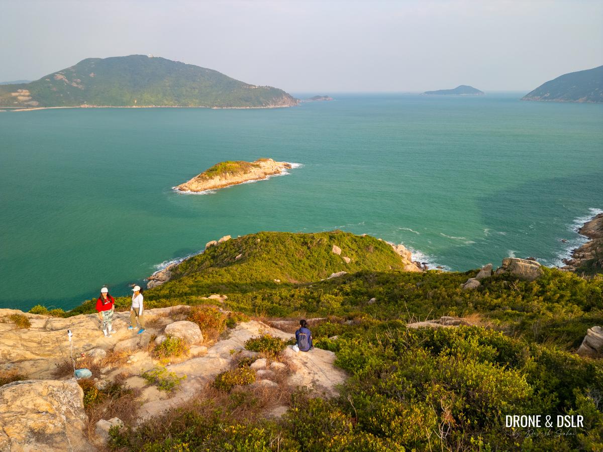
You may choose to stop and take advantage of the many vantage points from where you can admire the views. On the left, there’s Stanley Prison, and in the front Tai Tam Bay and Shek O Country Park — where the Dragon’s Back and Cape D’Aguilar are located.

Plenty of vantage points to enjoy the scenic views of Tai Tam Bay
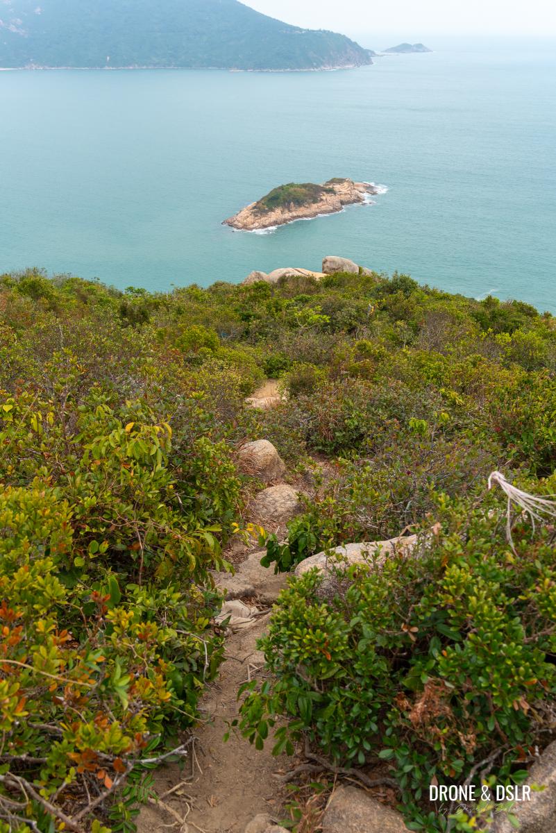
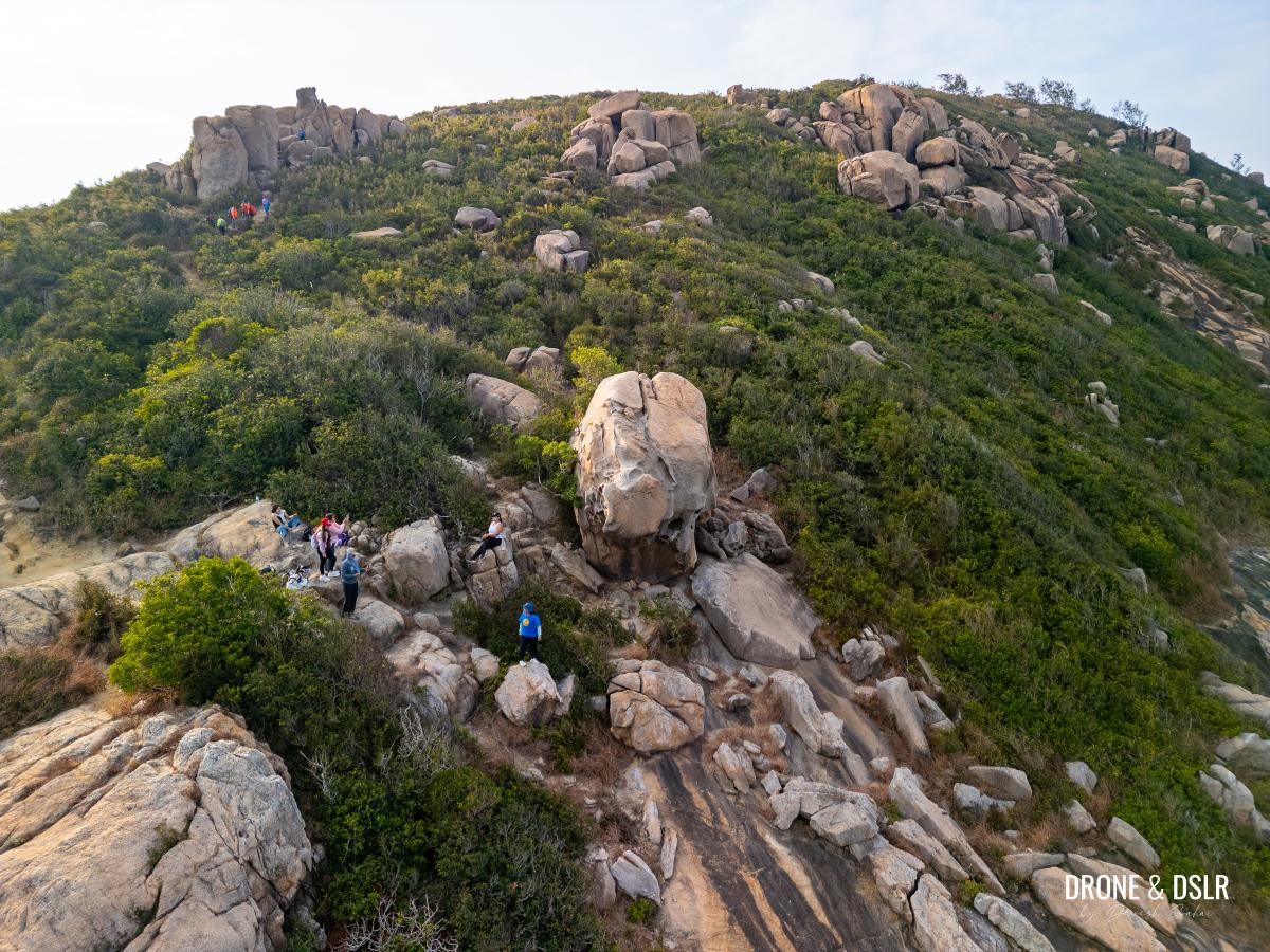
Keep following the trail as it heads downhill, and approaches a massive outcrop.
These riboons will guide you to Rhino Rock
Final Section To Rhino Rock
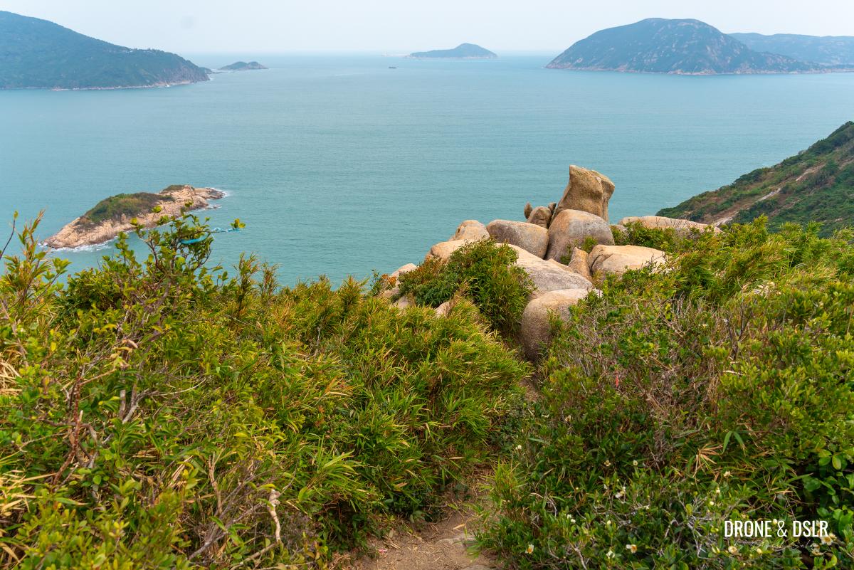
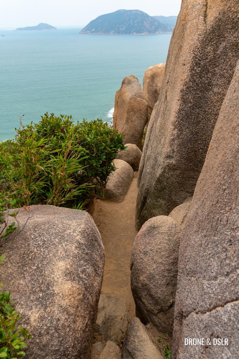
In my opinion, crossing the outcrop is one of the toughest parts of the trail. The path narrows as it cuts between the rocks, so proceed slowly and use your hands for balance during the descent.
-
- Squeeze through these rocks – Rhino Rock Trail

-
- You can see hikers navigate their way through the rocks
-
- The trail that emerges from the rocks

-
- The trail becomes super narrow as it crosses the outcrop
As you exit the outcrop, you’ll encounter a short but steep path that leads onto a flat, rocky area. On the left of this area, lies Rhino Rock.
-
- After the outcrop, this is the final section of the trail
-
- The flat, rocky terrain to the left of which is the Rhino Rock
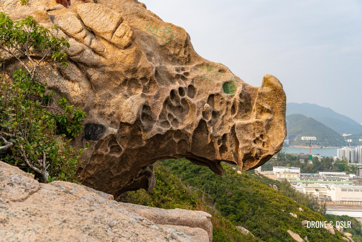
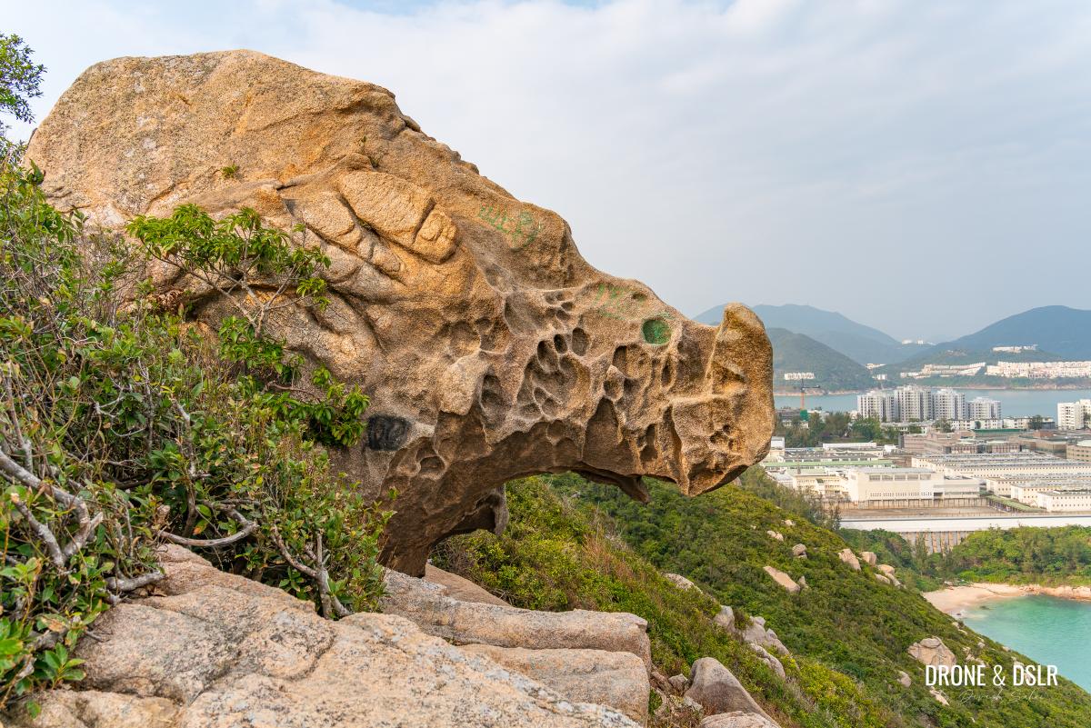
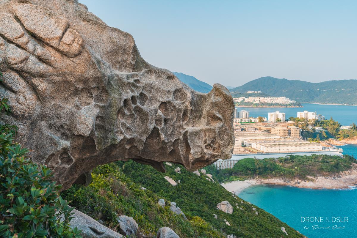
The Rhino Rock
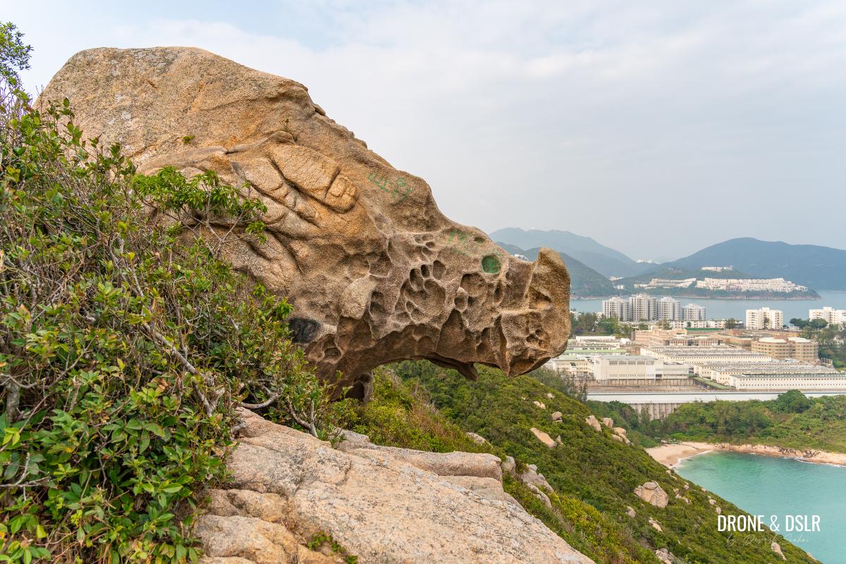
The resemblance is uncanny!
Although many hikers like to mount the rhino, I choose to admire it from a distance. But if you do plan on climbing it, be extremely careful.

Everybody loves climbing the Rhino Rock
I love honestly love how nature shapes these rocks to resemble creatures in real life. And Hong Kong has quite a few of these unique shaped rocks. Don’t believe me, check out the Shark Rock!
-
- The Rhino Rock
-
- The Rhino Rock seen from the other side, with the Stanley Barracks in the background

-
- The front of the Rhino Rock
After you’re done admiring Rhino Rock, I highly recommend taking in the beauty of Tai Tam Bay.
Done with the Rhino? Soak in these views!
End The Hike
Sadly, there’s only one way to end the Rhino Rock Hike, and that is to retrace your steps back to the Stanley Fort bus stop.

The trail can get very slippery in parts
I did feel that climbing back up was much easier, which is usually is on such unmarked and steep slopes.
-
- Just point yourself towards those rocks and follow the ribbon trail
-
- Climbing back up shouldn’t be too difficult
Rhino Rock Trail, Stanley
I hope you enjoyed this simple hiking guide to the Rhino Rock. It’s definitely a short but adventurous hike in Stanley. On your way back, I highly recommend stopping at Stanley to explore it.
If you enjoyed this, I would highly recommend checking two more unique rock formations — Devil’s Paw and Snoopy Rock. Both are accessible via a similar hike on the adjacent Chung Hom Kok Peninsula in Stanley.
Rhino Rock in Stanley, Hong Kong
As always, feel free to drop us a comment below or share this post on the social media channel of your choice.
If you enjoy our work, come join us on Instagram and YouTube 🙂


You might also like


4 Comments
Did this hike a few days ago following your instructions. I’d say it was more like a short sharp assault course than a hike, but it was fun and I got great photos. Thank you for sharing.
Thank you and I like the way you describe it!
LOL @ easy but challenging hike – or maybe you mean it’s challenging but quick / short? 🙂
Nice catch!