
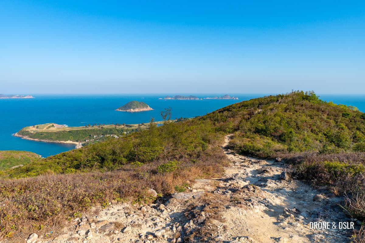
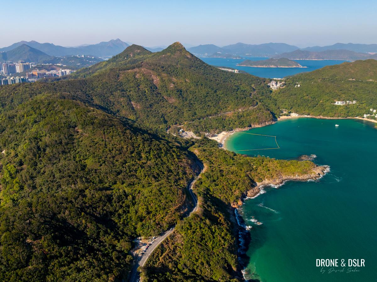
Tin Ha Shan is the last hill along the High Junk Peak Country Trail in Clearwater Bay, Hong Kong. Its unique position provides hikers with a breathtaking double-sided panorama: Clearwater Bay to the east and Junk Bay to the west.
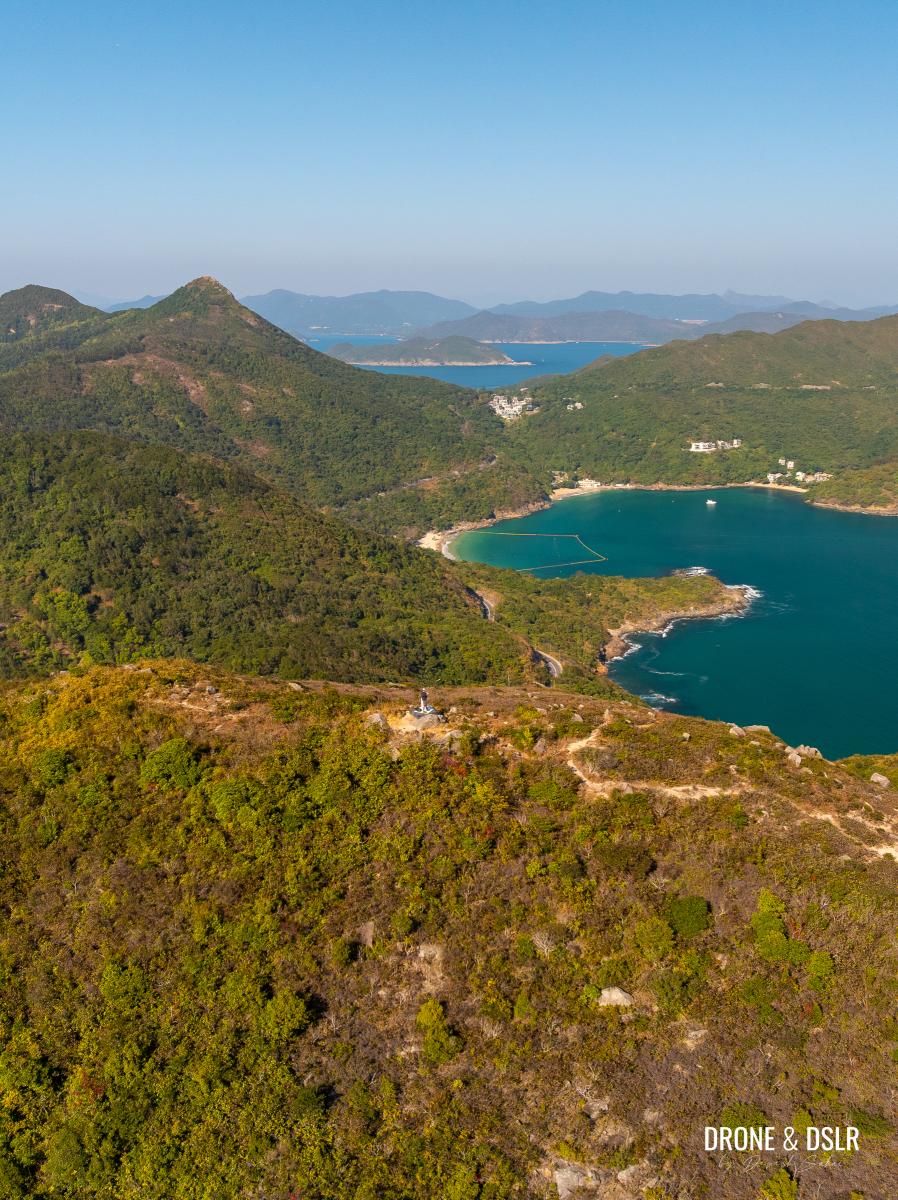
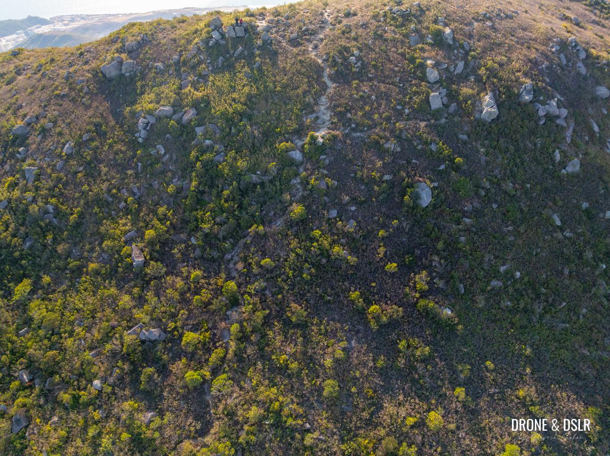
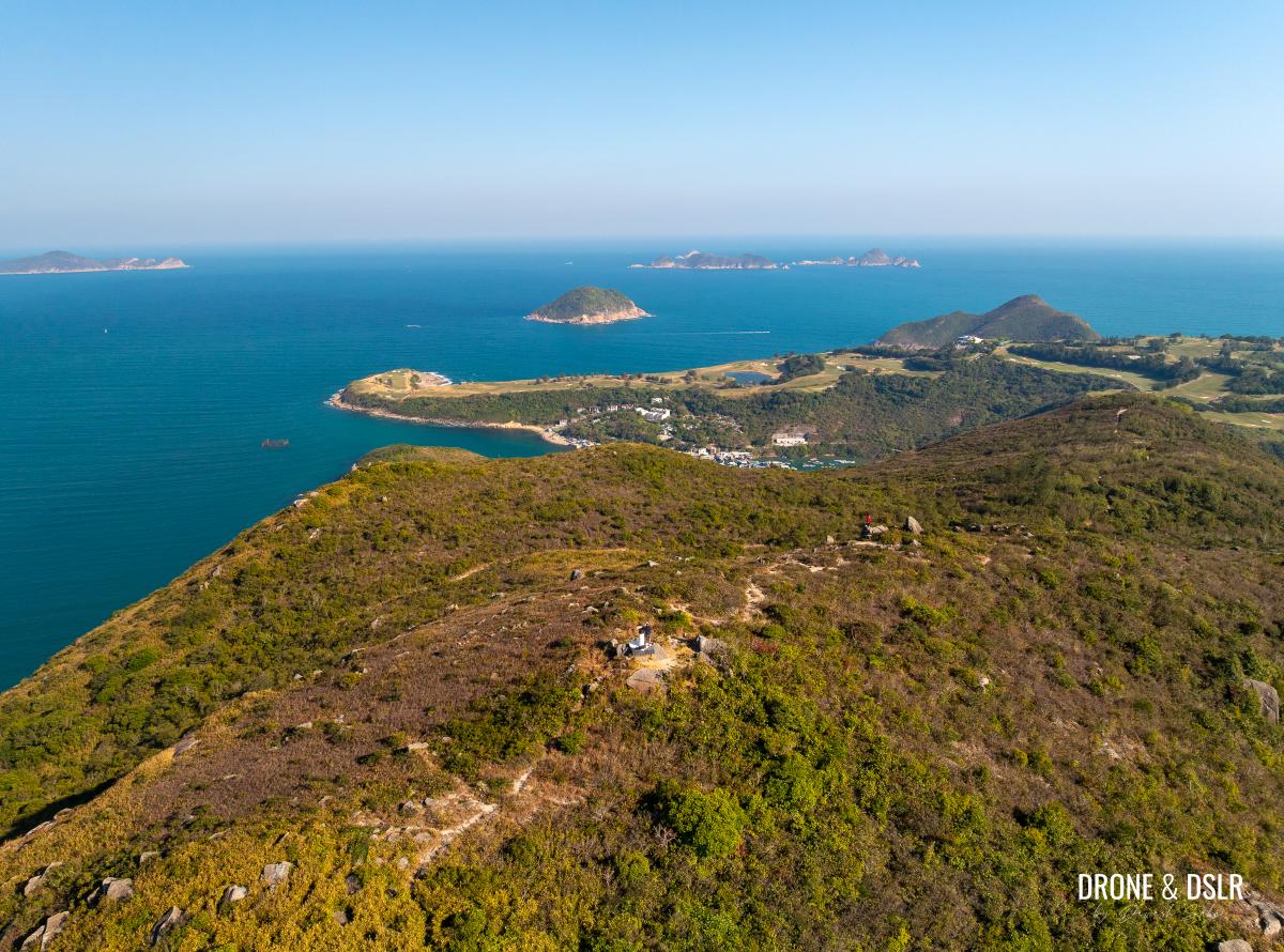
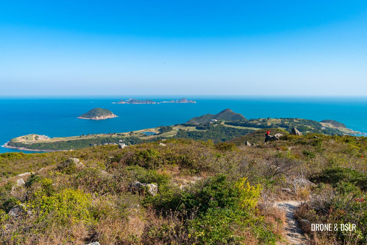
Aerial view of Tin Ha Shan with Clearwater Bay and High Junk Peak in the background
While it may not be as iconic as its neighbour, High Junk Peak, Tin Ha Shan is a fantastic alternative for those seeking a manageable hike with exceptional scenery. Although the summit itself is impressive, I found the views while descending toward Po Toi O and the Clearwater Bay Golf & Country Club to be truly outstanding!
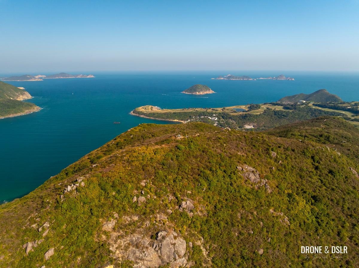
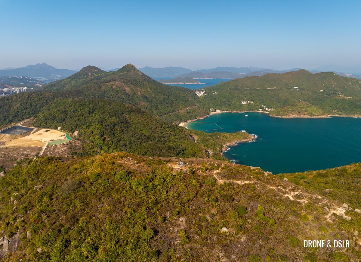
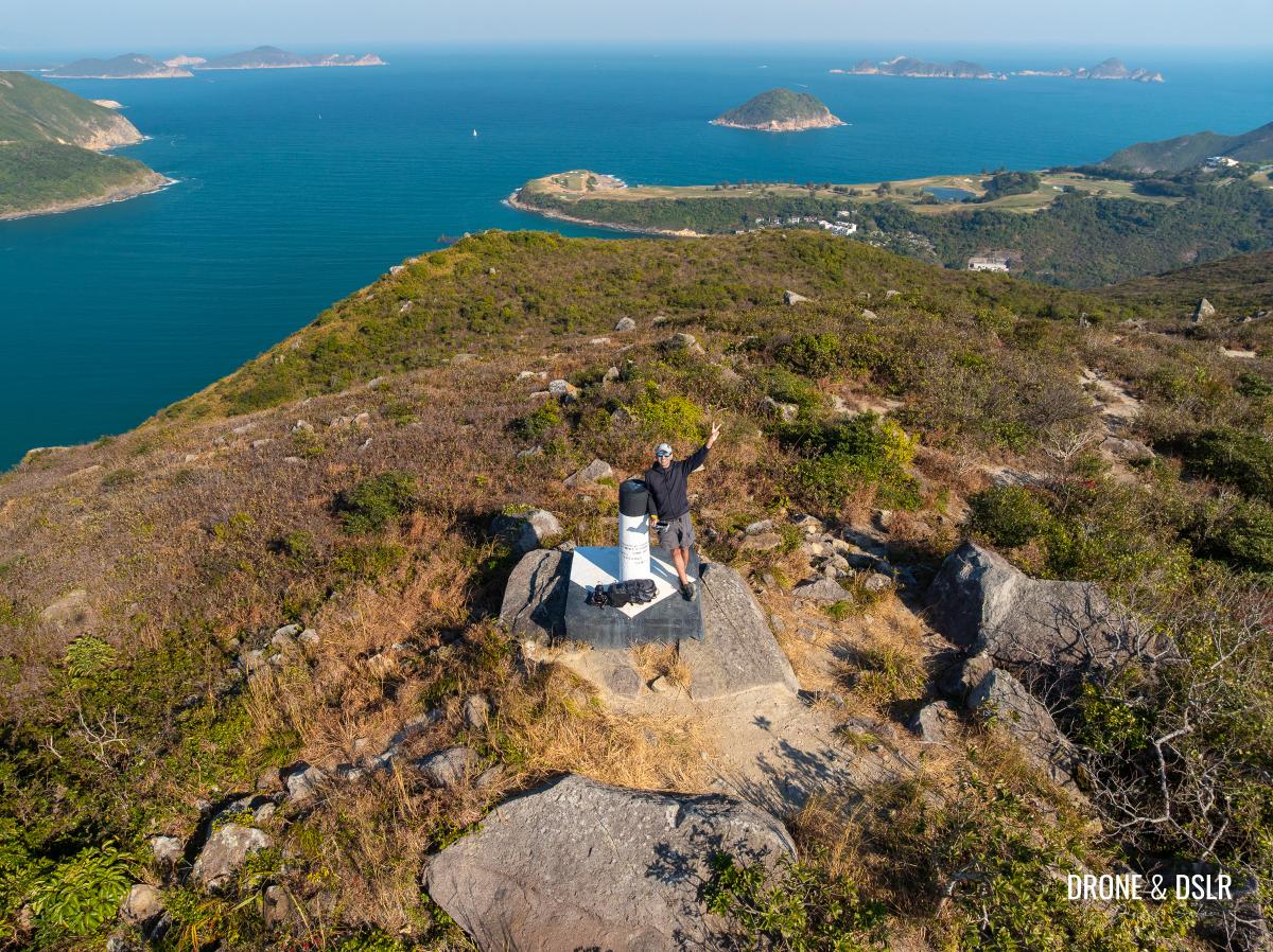
Aerial view of Tin Ha Shan summit with Clearwater Bay Golf & Country Club in the background
So, if you are looking for a rewarding, relatively easy hike, this is one you shouldn’t miss.
About the Tin Ha Shan Hike
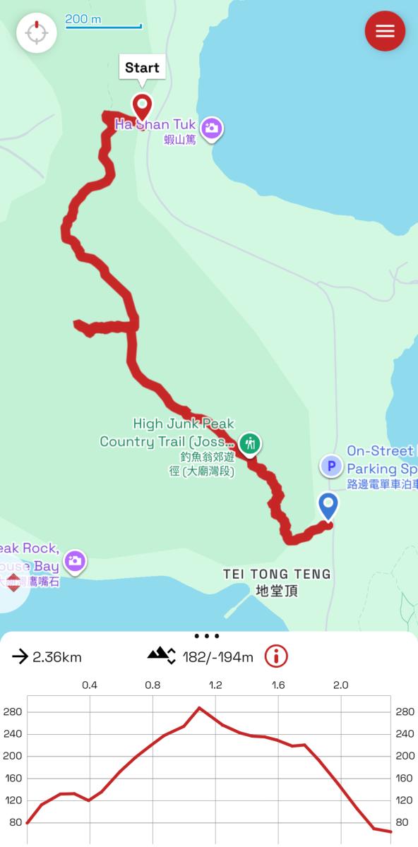
Tin Ha Shan Hike Trail Map
The 6.2 km High Junk Peak Country Trail passes plenty of hills along the way, most prominently High Junk Peak. However, if there is one other peak that worth diverting from the country trail and climbing, it’s Tin Ha Shan.
What makes Tin Ha Shan a good hike is that it’s relatively short, very scenic, and incorporates a fair bit of challenge especially while climbing to the summit. And what’s more is that you end the hike at Po Toi O for lunch (or dinner), where you can grab some of the best seafood in Hong Kong.
Now although you could approach this hike from the start of the High Junk Peak Country Trail, this guide will focus on the easiest access points (entrance and exit) to Tin Ha Shan.
BTW, if you own a pair of hiking gloves, I’d recommend carrying them on this hike.
Starting Point
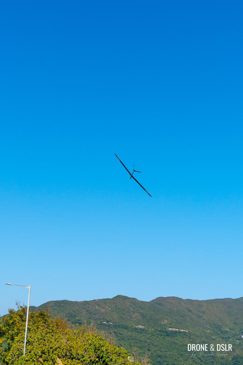
The closest entry point to Tin Ha Shan on the High Junk Country Trail is located at Radio Control Glider Spot Pavilion on Tai Au Mun Road. For those unaware, the Radio Control Glider Spot is one of the two locations (that I know of) where locals head out to fly their radio-controlled model planes. Even if you’re not planning a hike, it’s a joy watching all the planes fly around this area!
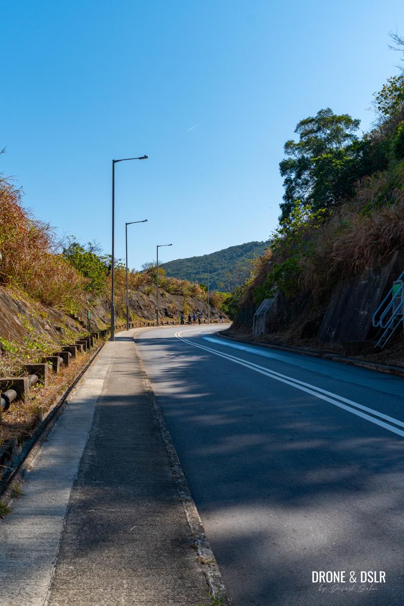
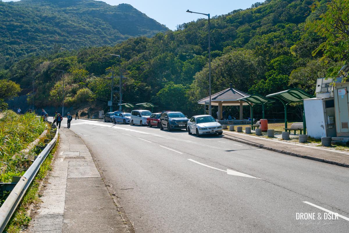
But unfortunately, there is no bus stop next to the pavilion. The closest bus stop, Clear Water Bay Bus Terminus (above Clear Water Bay Second Beach), is located approximately 650-700 metres from the starting point.
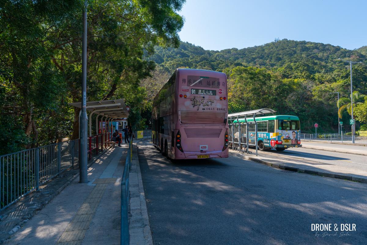
Take a bus to the Clear Water Bay Bus Terminus (above Clear Water Bay Second Beach)
Depending on your location, you can chart your route using Google Maps. Once you arrive the bus stop/car park for Clear Water Bay Second Beach, walk towards Tai Au Mun Road, and turn left.
Exit the car park and bus terminal onto Tai Au Mun Road, and turn left
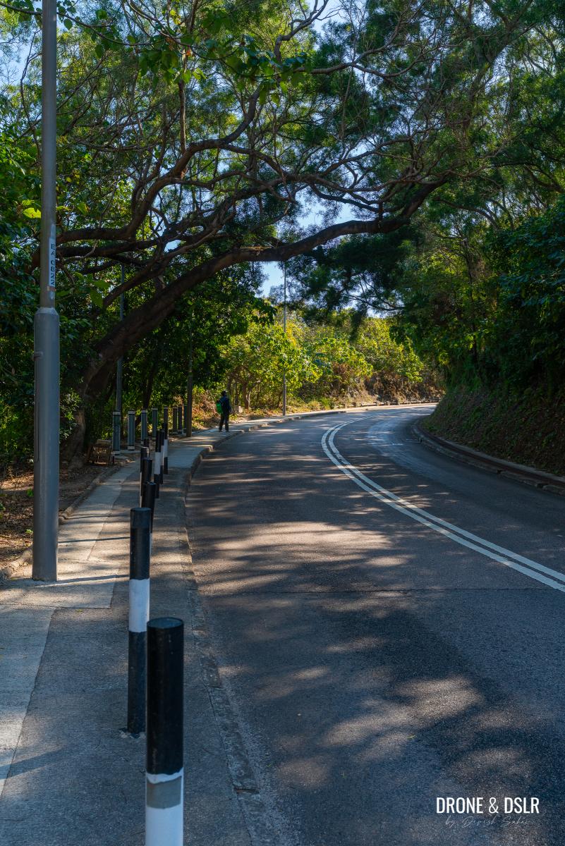
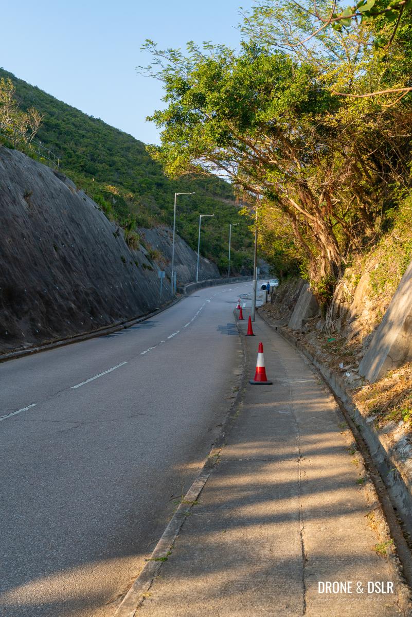
Luckily there is a pedestrian path as you walk uphill on Tai Au Mun Road. As this is a twisting road, pay close attention to the traffic.
But more importantly, don’t forget to enjoy the views of Clearwater Bay as you walk.
-

- Walk up on Tai Au Mun Road for bout 700 m
-
- Enjoy the views of Clearwater Bay from Tai Au Mun Road
After approximately 650-700 metres of walking, you’ll arrive at the Radio Control Glider Spot. If you’re lucky, you might get to see some of these model planes flying around.
-
- Keep walking on Tai Au Mun Road (luckily there is a pavement)
-
- If you’re lucky you’ll get to see a few of these gliders at the Radio Control Glider Spot
-
- You’ll arrive at the Radio Control Glider Spot, the starting point for Tin Ha Shan
Cross the road, towards the pavilion, and locate the steps a few paces behind the pavilion. This is the starting point for the Tin Ha Shan Hike.
The Steps To High Junk Peak Country Trail
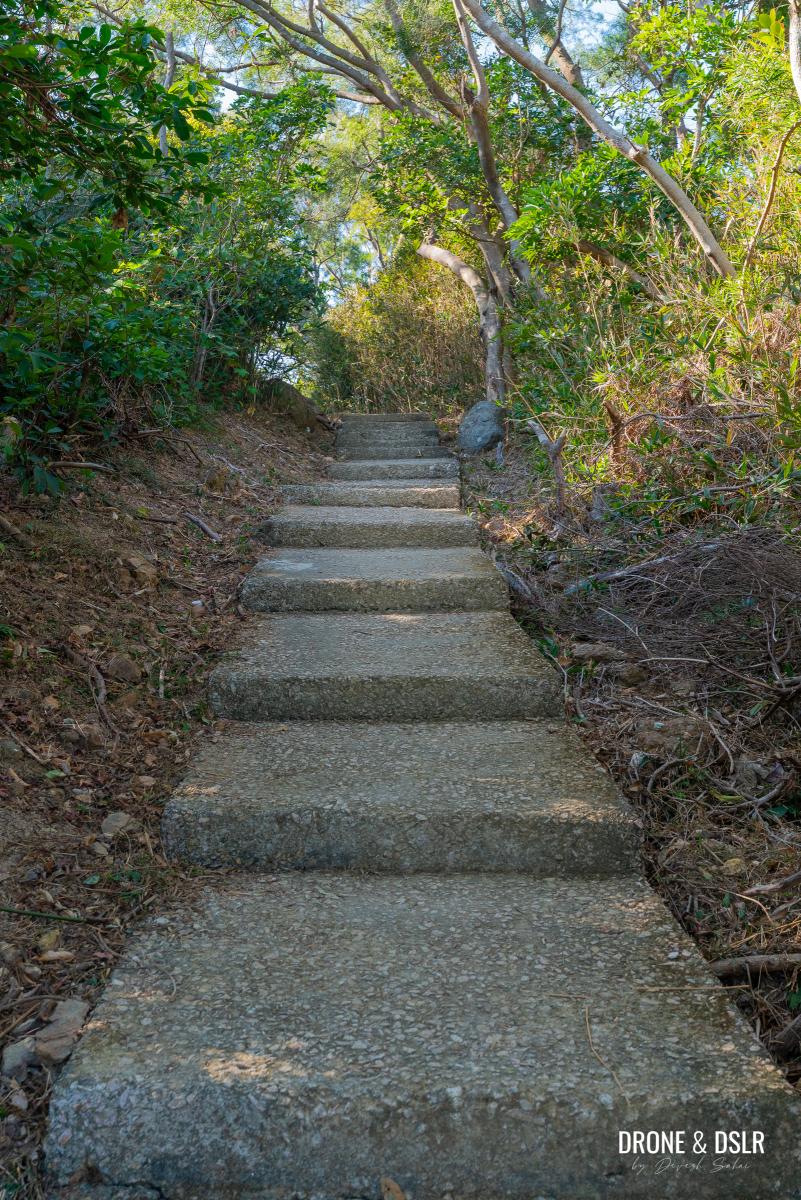
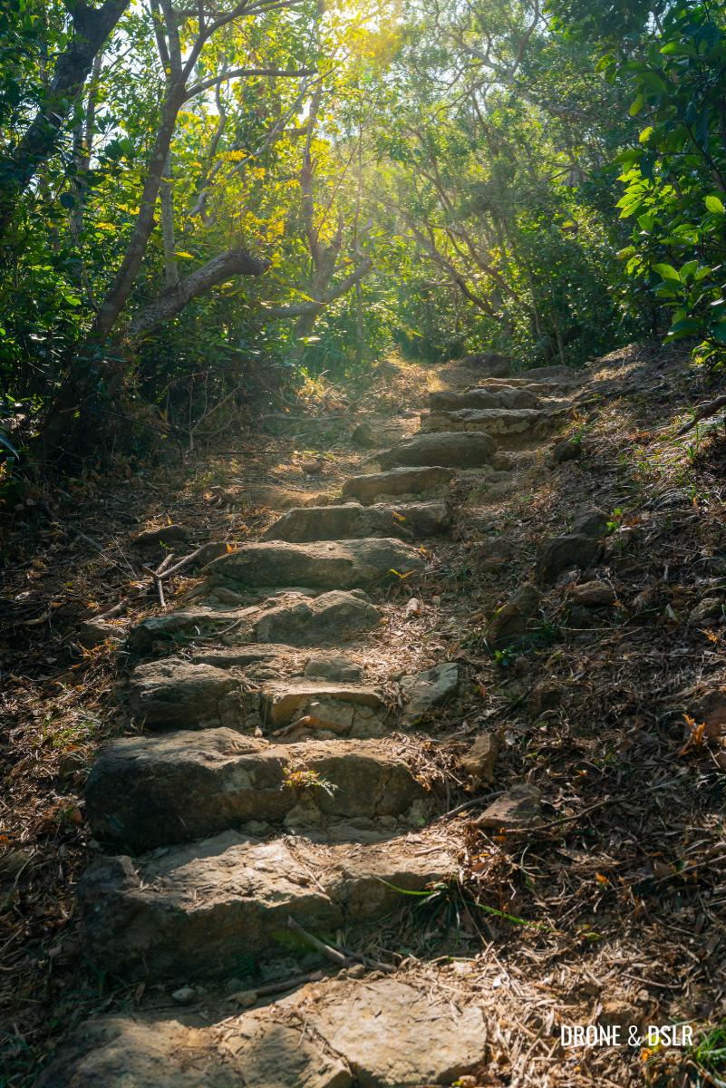
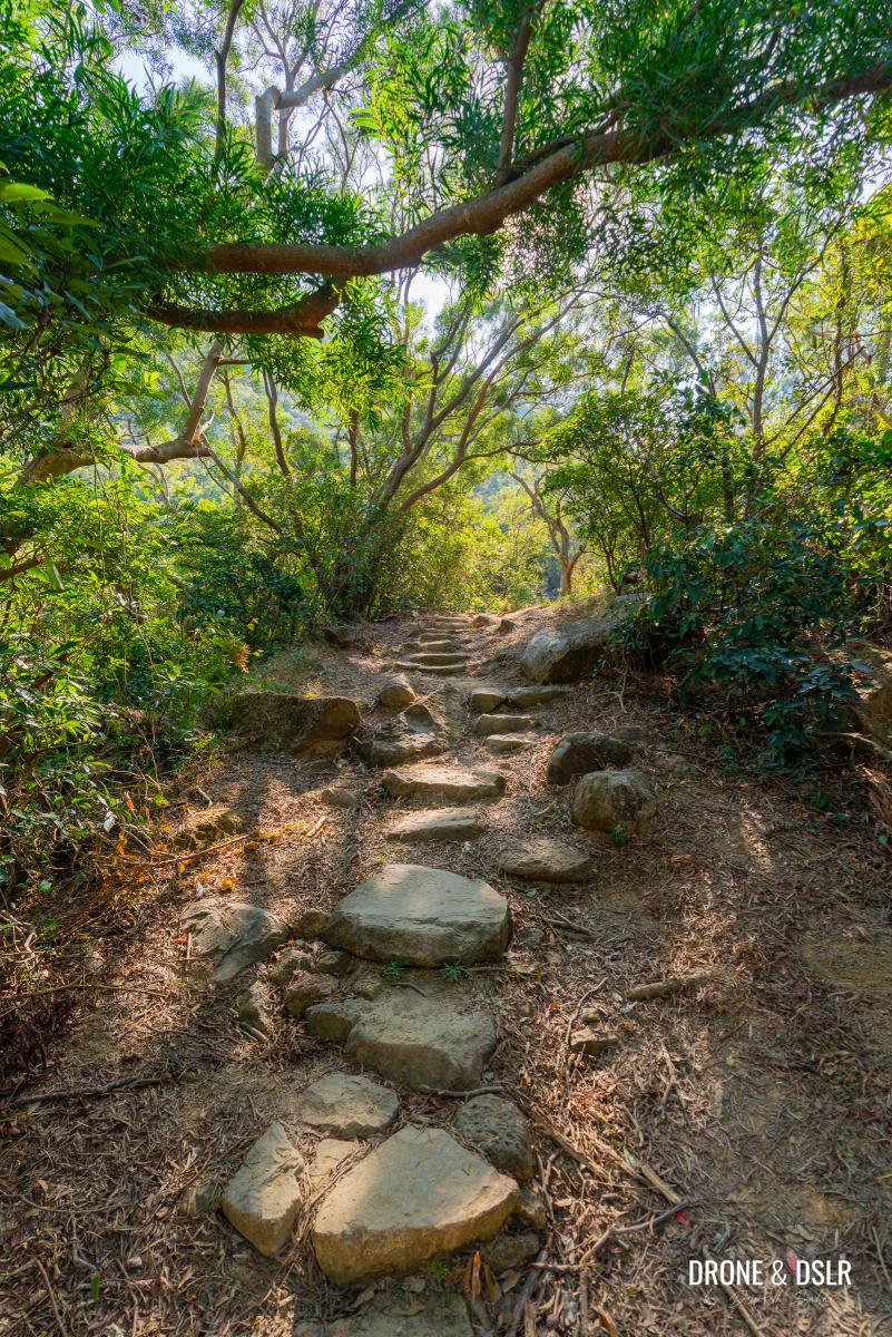
As you step off the road, and the leave the sights of radio-controlled planes behind, you’re greeted immediately with a flight of steps. Typical Hong Kong hiking.
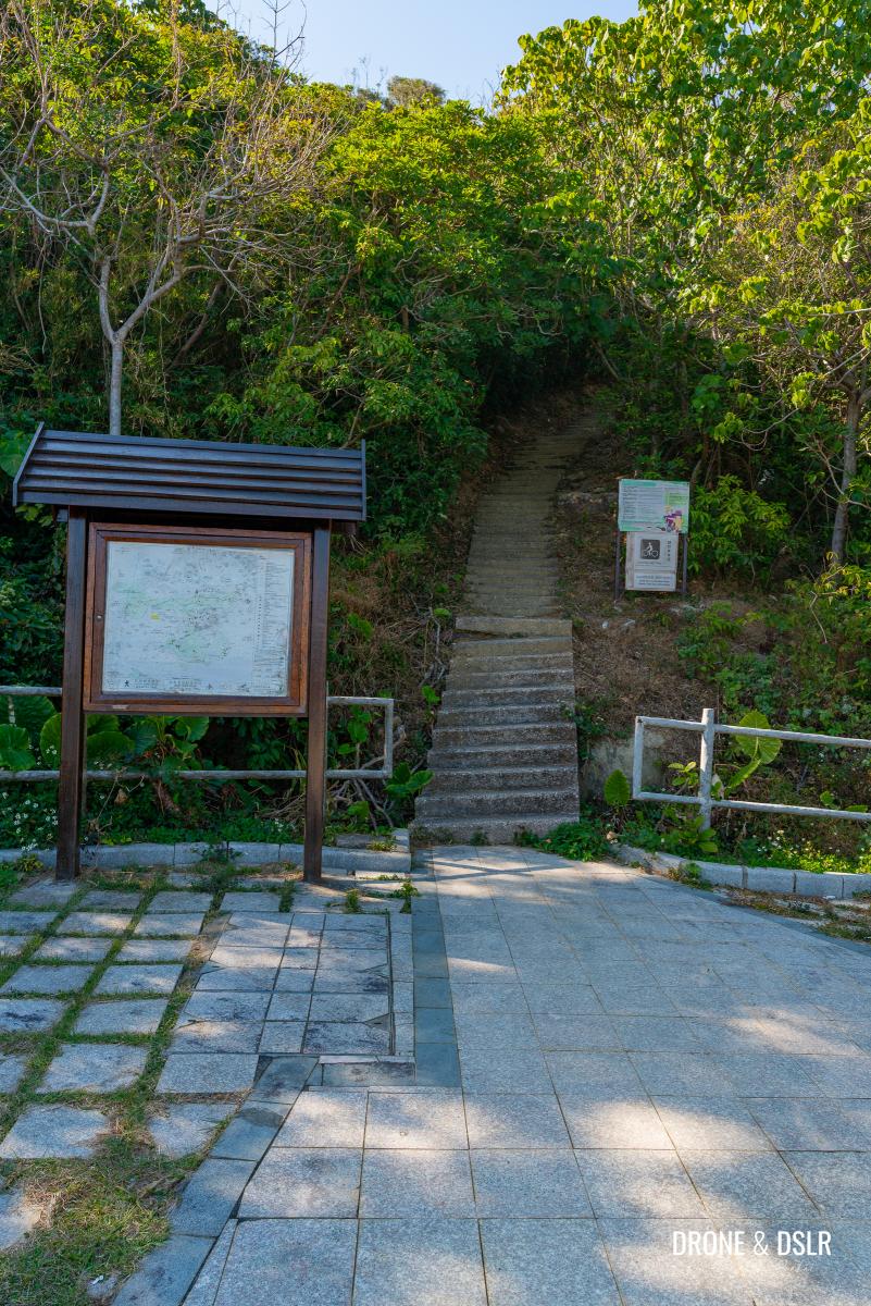
The entrance to the High Junk Peak Country Trail behind Radio Control Glider Spot. Let’s go!
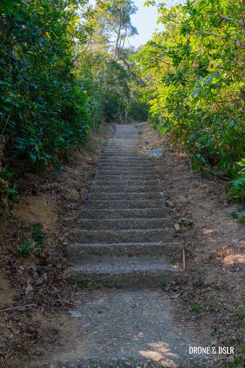
Fortunately, the steps are shaded and not too steep. They start off at a slightly challenging incline, and gradually taper towards the end.
-
- Start by walking up these steps
-
- Luckily the steps are easy and shaded
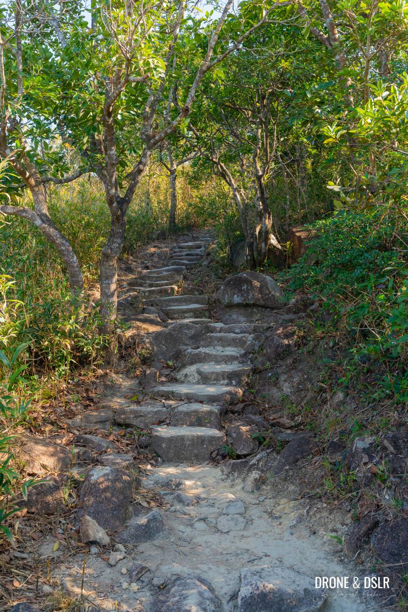
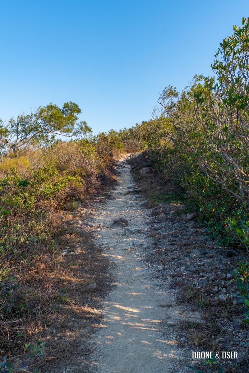
After approximately 120 metres of climbing steps, the steps will end at High Junk Peak Country Trail.
Turn left once the steps land on High Junk Peak Country Trail
To The Gap Before The Climb
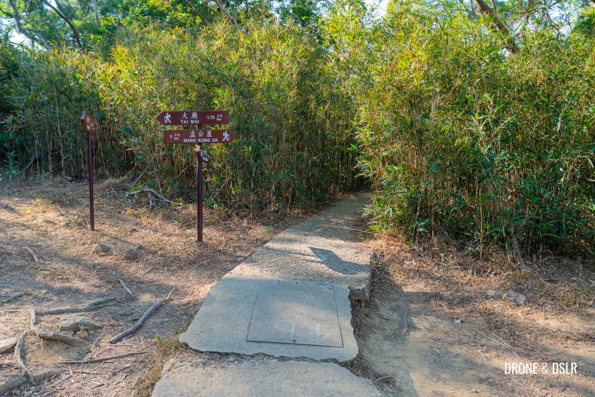
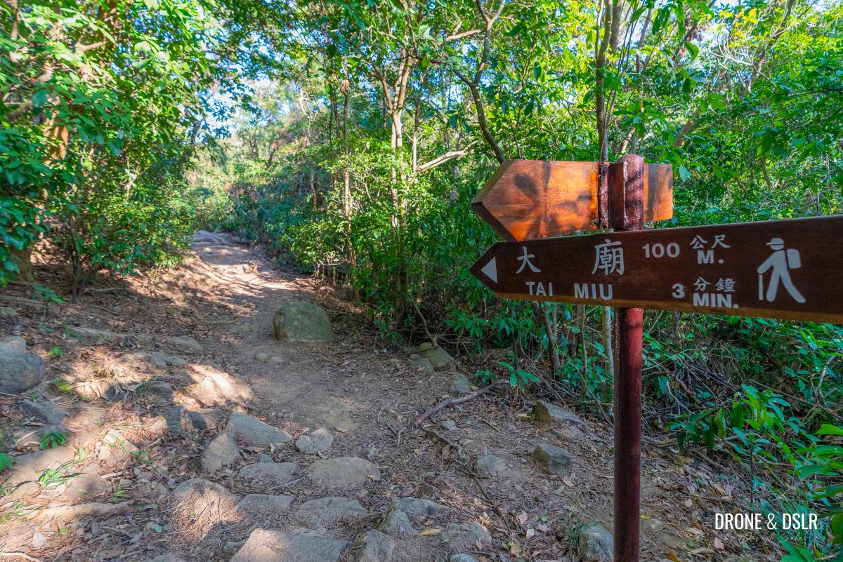
The moment you step onto High Junk Peak Country Trail, turn left and follow the signs for Tai Miu.
To hike towards Tin Ha Shan, follow signs for Tai Miu
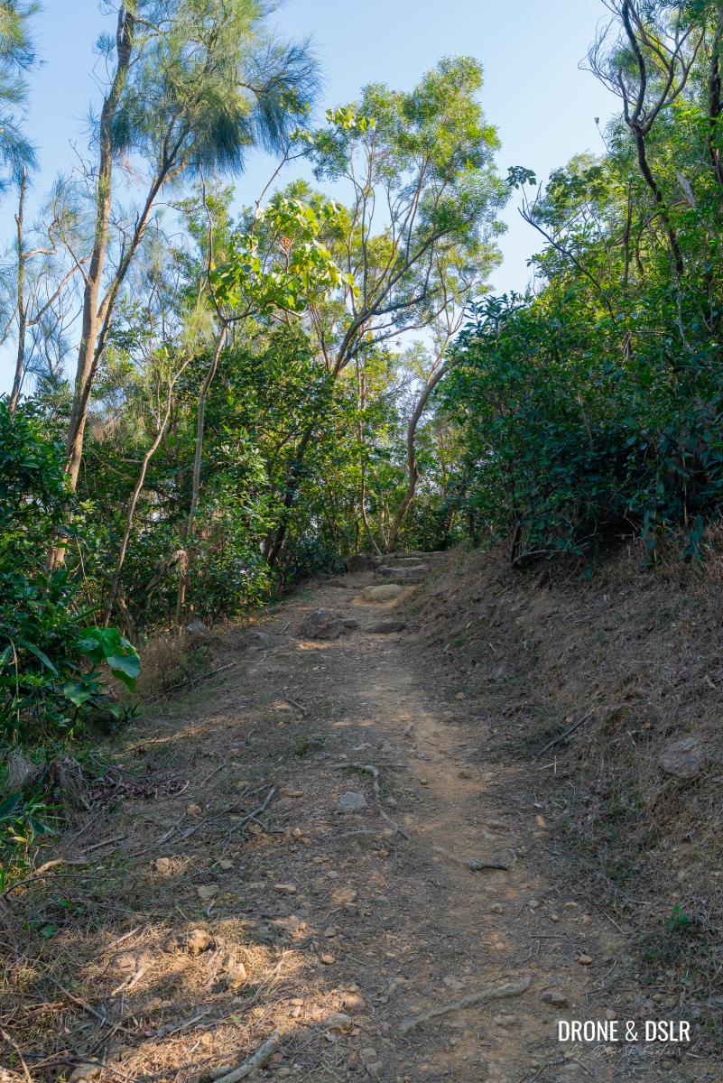
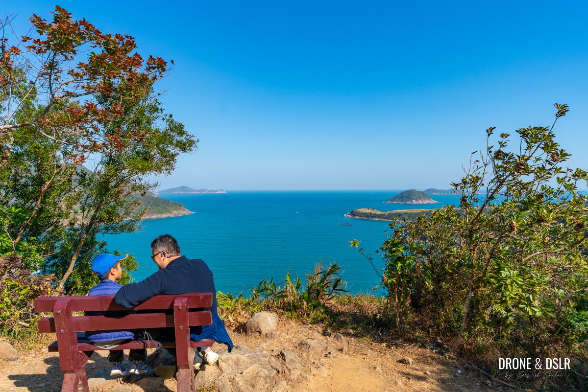
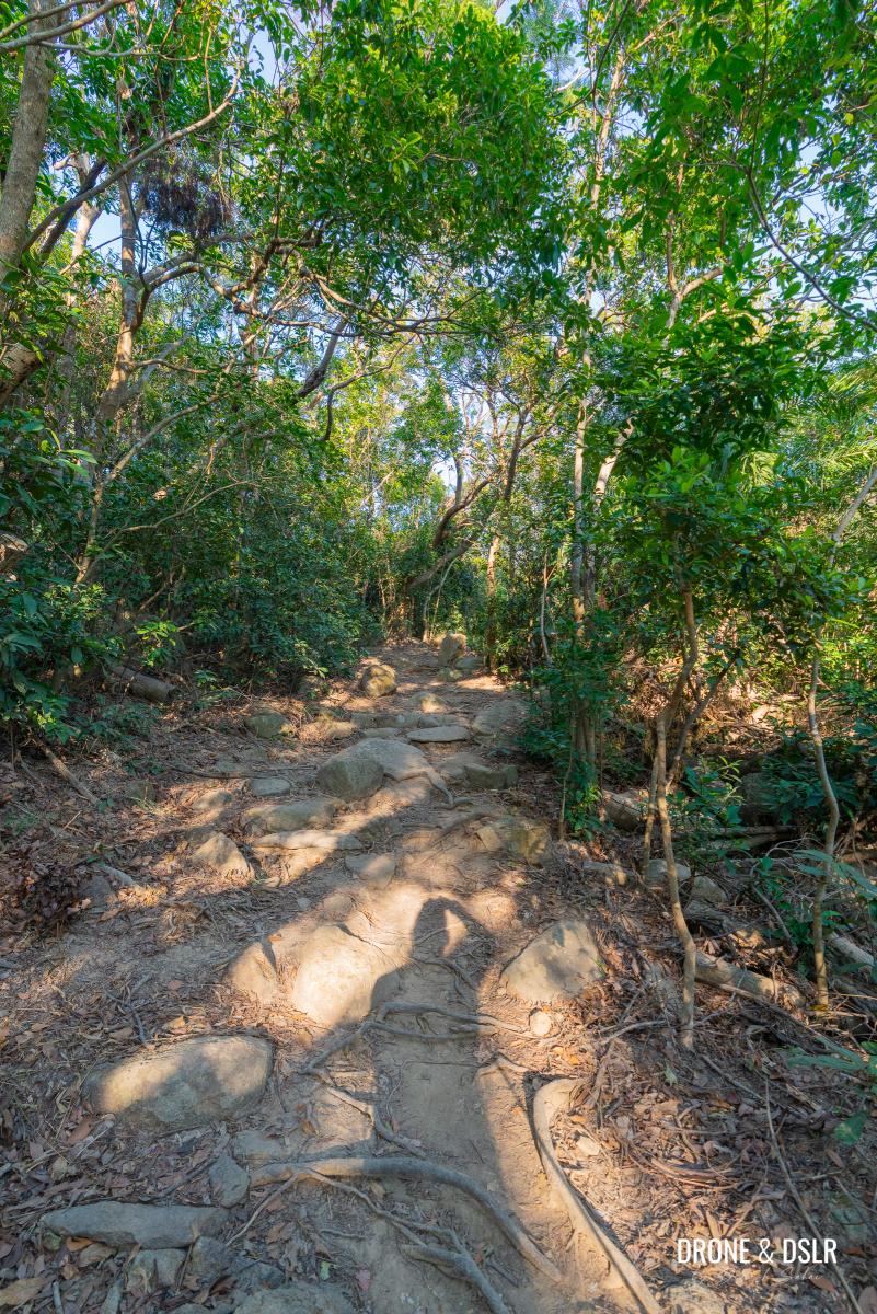
The trail at this stage of its journey is relatively very easy. It follows a flat dirt track, onto gentle flight of steps that brings you to a bench with some of the best views of Clearwater Bay. Unlike the area below, this one is usually secluded.
-
- The High Junk Peak Country Trail at this stage is quite easy
-
- Easy steps to ease you in
-
- The steps bring you to this very scenic bench
After the bench, the trail follows a gentle and scenic descent into a canopy of trees, before it reaches the gap.
-
- From the bench, there is a short section with these amazing views
-
- Head down to the gap
-
- When the trail flattens, you know you’re at the gap
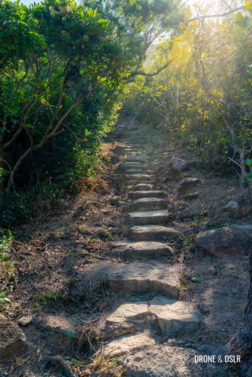
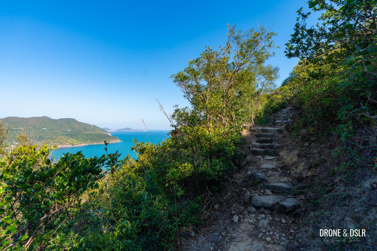
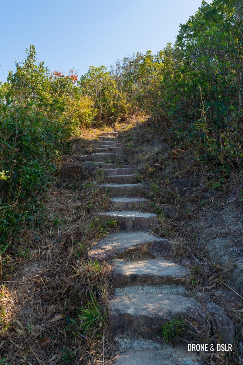
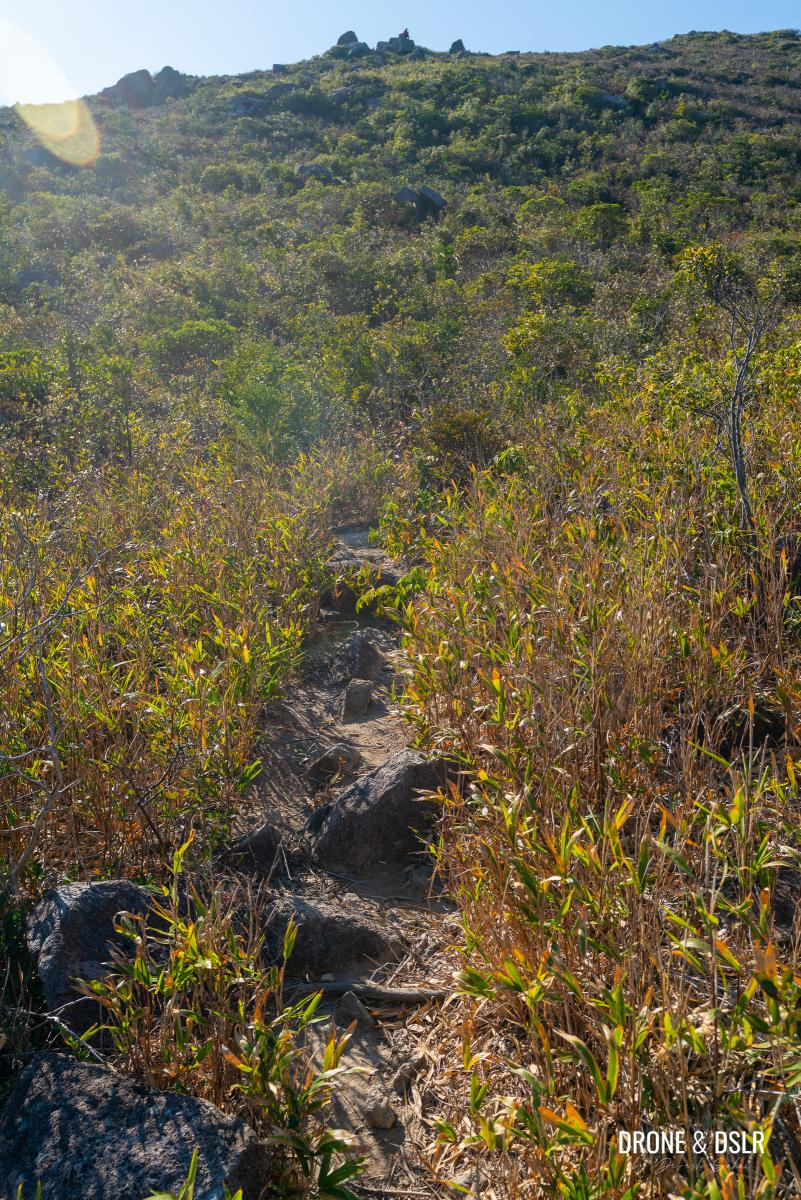
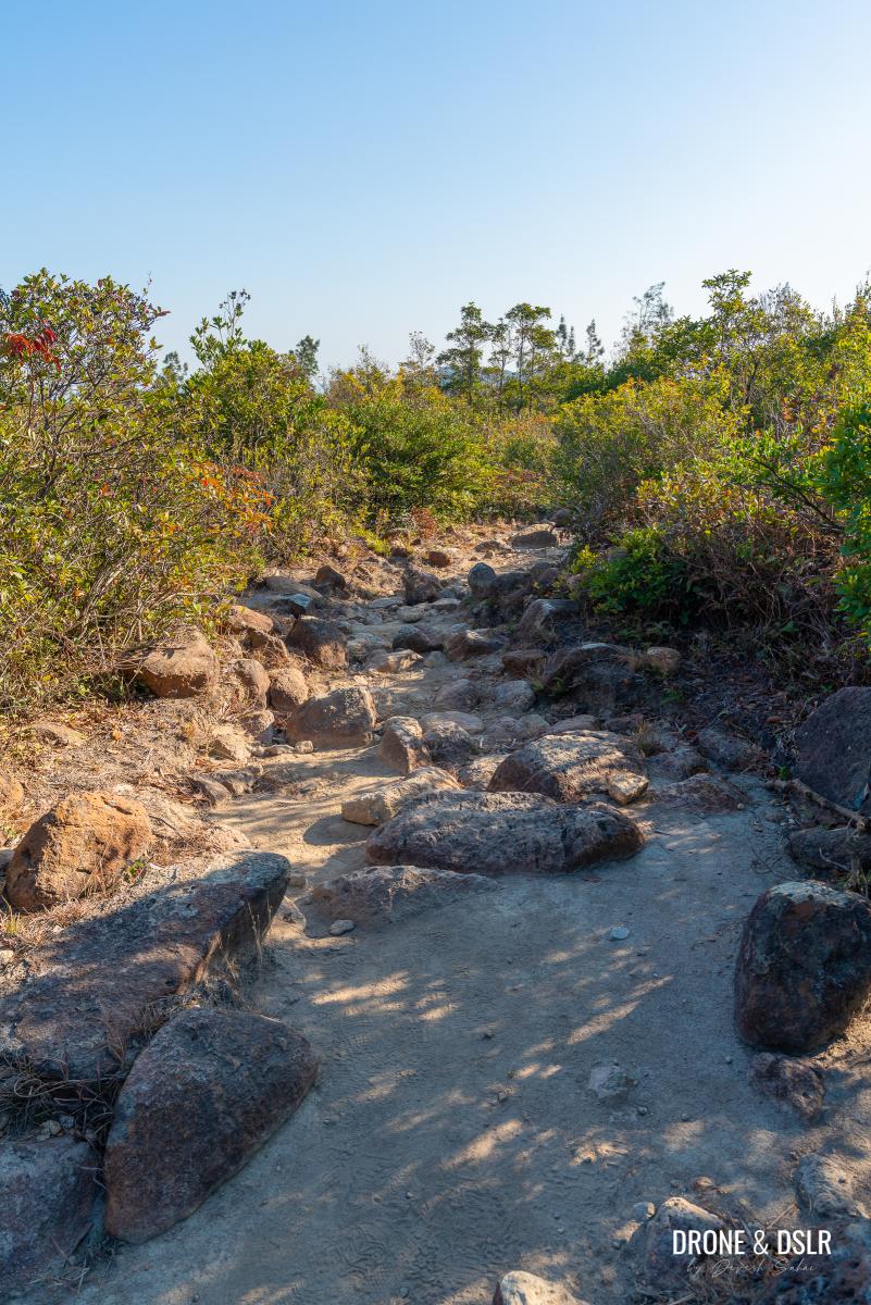
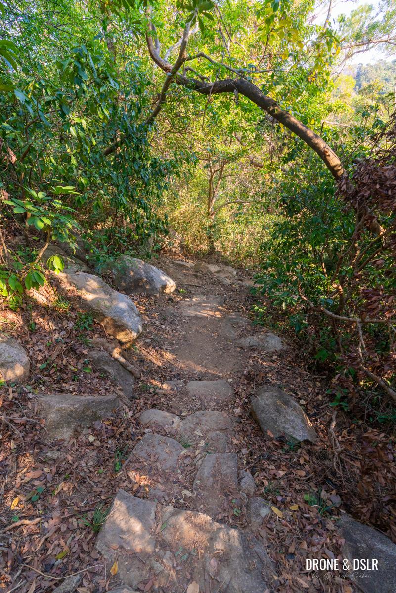
The Long, Challenging Climb
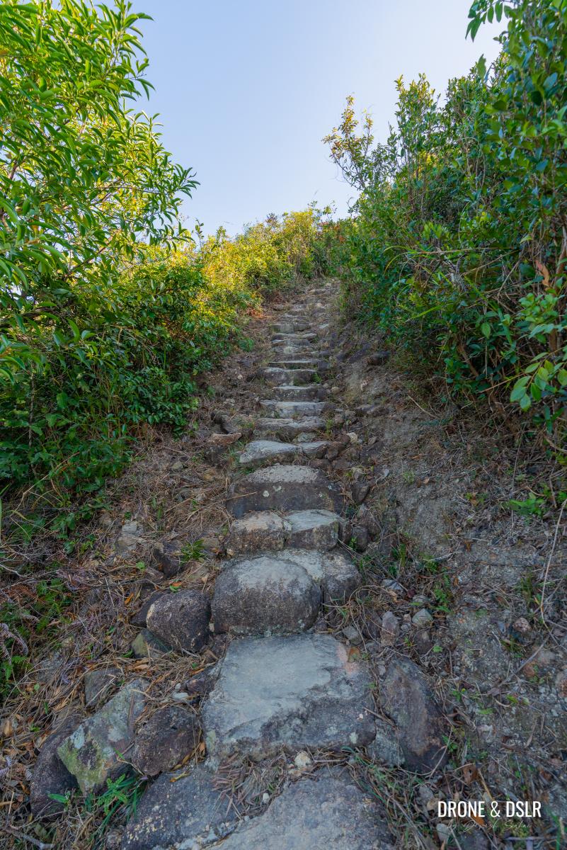
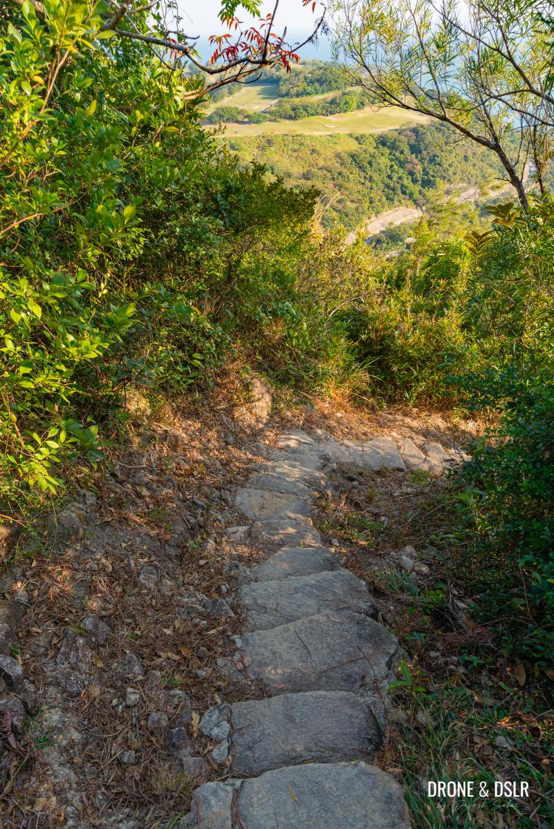
It doesn’t take long for the toughest section of the Tin Ha Shan hike to reveal itself. As the gap ends, the trail begins a challenging ascent. Although this stretch is only about 500 metres long, the steepness makes it feel much further.
-
- After the gap, comes the toughest section of the Tin Ha Shan Hike
-
- The steps are quite challenging, go slow
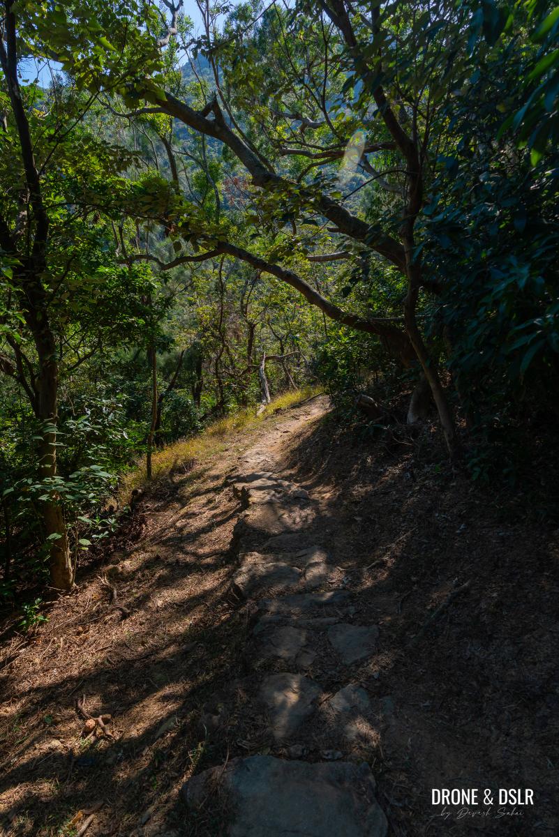
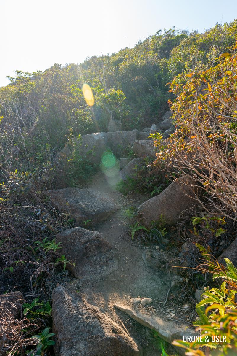
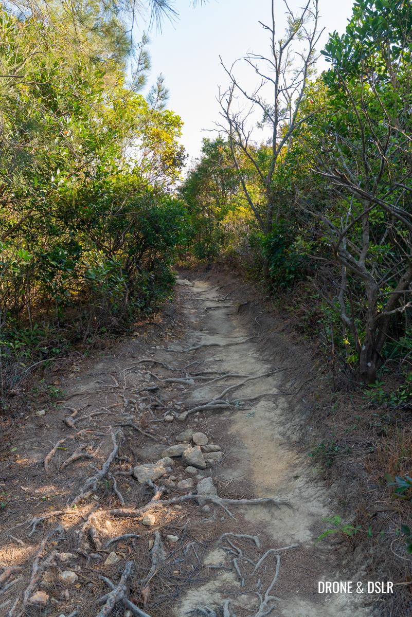
The climb starts gently under a canopy of trees, but the incline soon sharpens, leaving you wondering where the scenery and shade went.
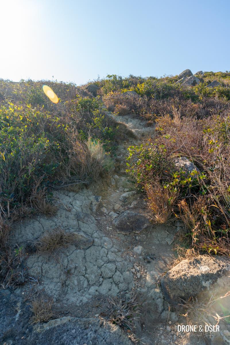
The path turns into rugged stone steps winding through thick vegetation, which, depending on the sun’s position, may provide some shade.
These steps seem to never end
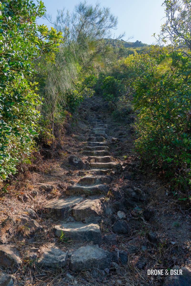
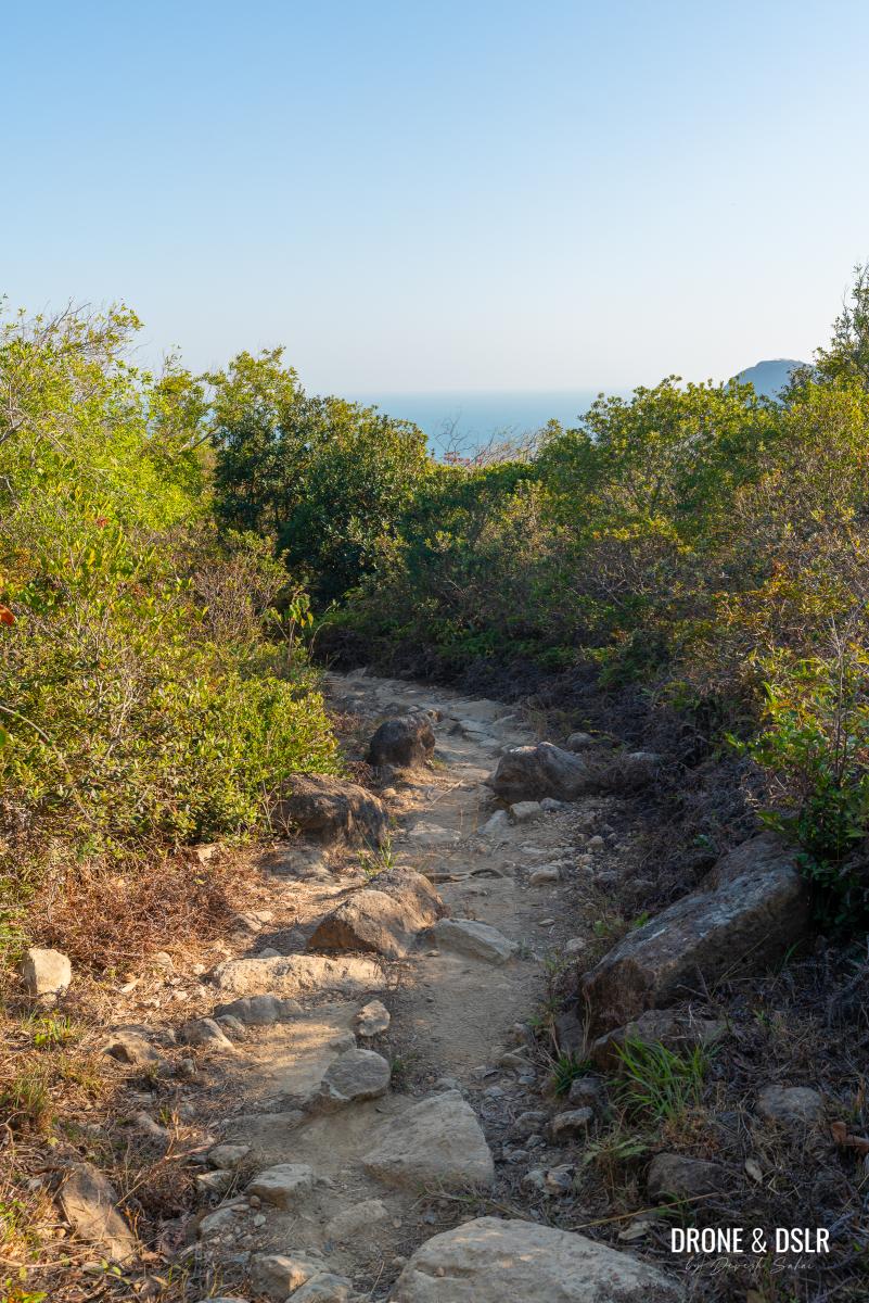
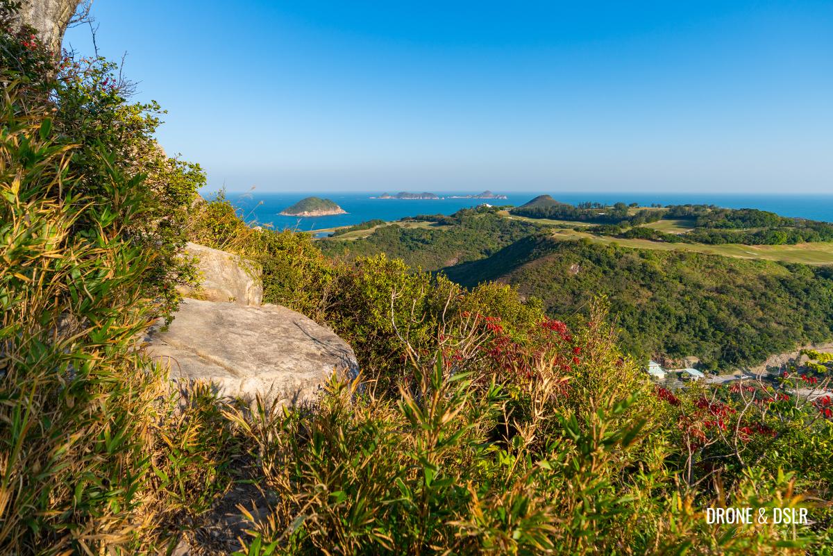
As the steps roughen and the slope steepens, the trail veers left to finally unveil a gorgeous view of Clearwater Bay. Take a moment to catch your breath and soak in the sight.
Luckily the views open to reveal this amazing vista as you continue to climb
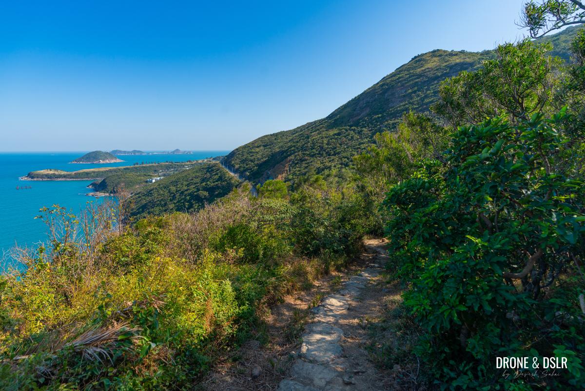
From here, the views keep you company as you continue upward. Looking back, you can see as far as High Junk Peak and LOHAS Park.
-
- Keep going towards Tin Ha Shan
-
- Don’t forget to admire the views of Clearwater Bay as you continue to climb the steps
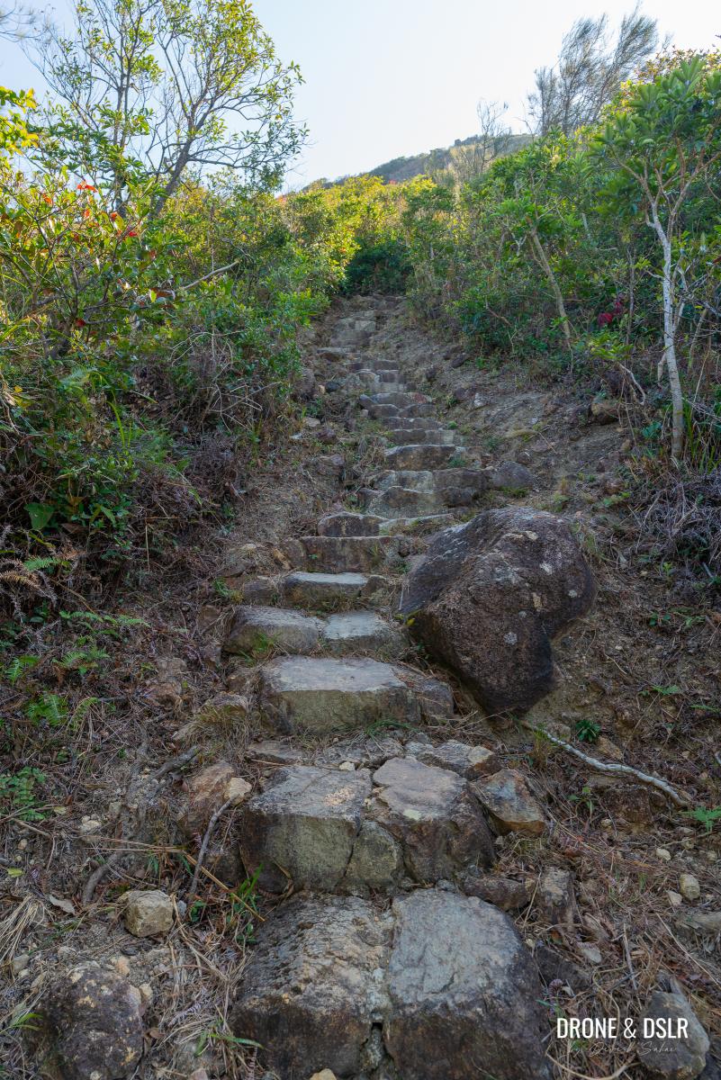
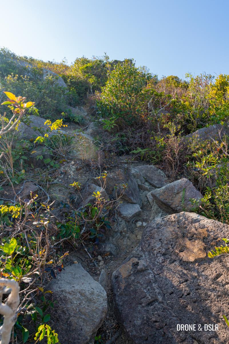
Eventually, the trail curves right and the incline levels off, though it still remains on an uphill trajectory. Follow the path past the trees until the stone steps disappear, and the ground flattens.
-
- The steps veer right as the views disappear
-
- Luckily, the steps become less steep
-
- Walk past this area with the shade
-
- Getting closer to Tin Ha Shan
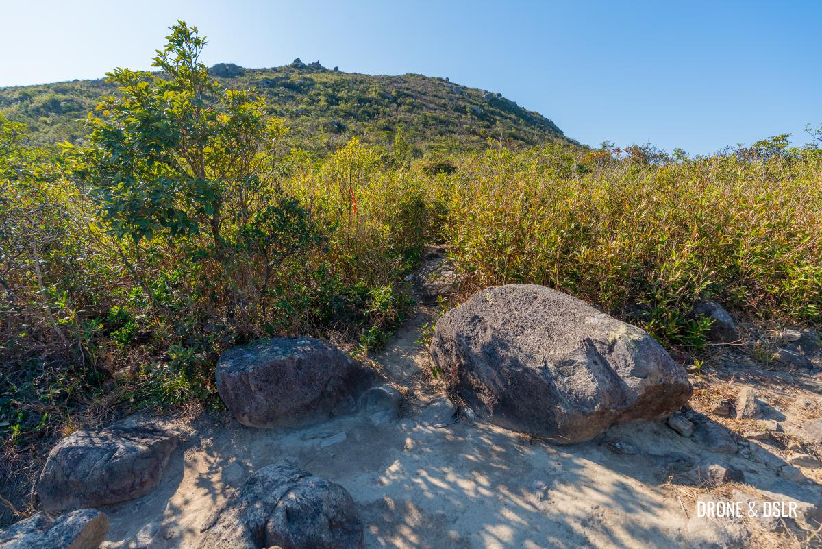
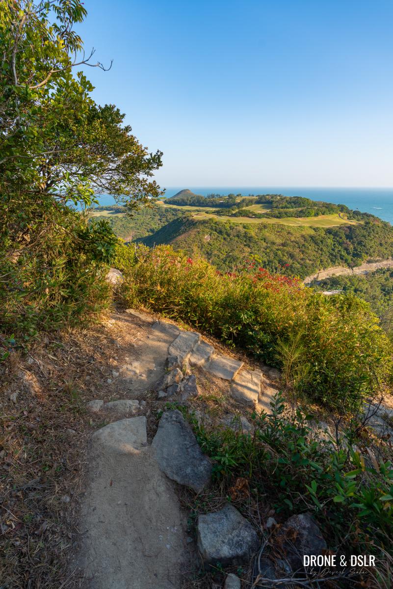
At the flat section, keep an eye out for a large boulder on your right. Tucked behind it is the unmarked trail leading to the summit of Tin Ha Shan.
-
- When the High Junk Peak Country Trail flattens, keep an eye for an unmarked trail between two boulders
-
- The unmarked trail to Tin Ha Shan between two boulders
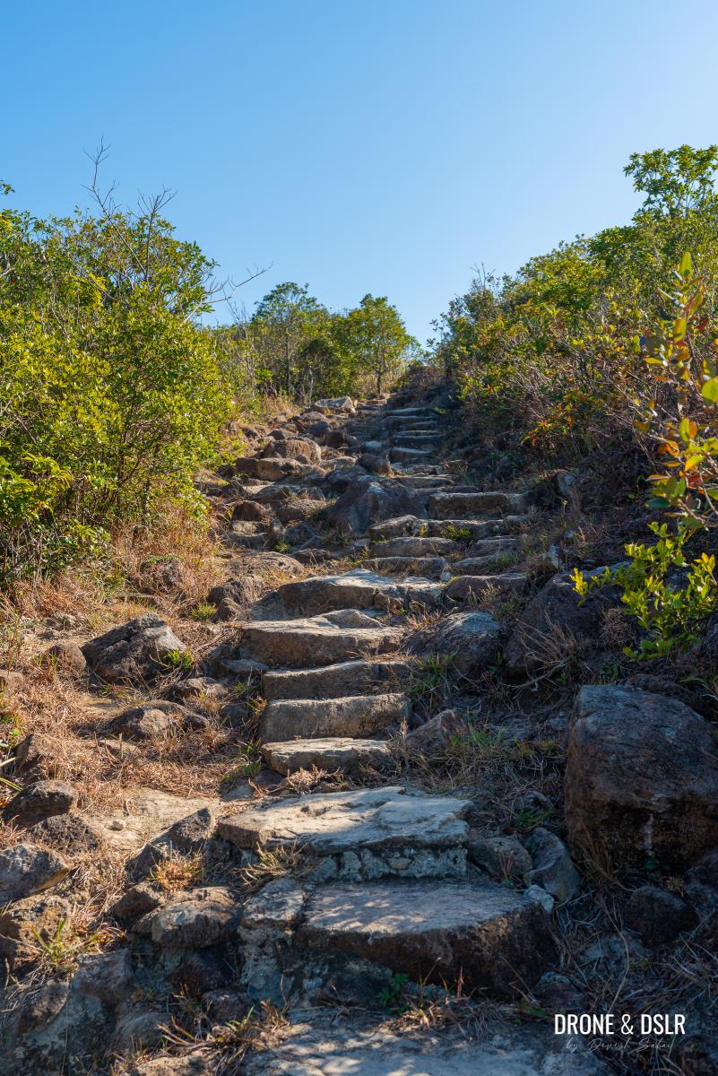
Scramble Up Tin Ha Shan
As you turn to face the unmarked trail, you get a good view of Tin Ha Shan with its outcrop summit. And although there is no maintained trail to the summit, you should be able to follow the cleared pathway between the thickets and boulders.
Point yourself in the direction of the rock outcrop on the top and follow the unmarked trail towards them
The initial section is relatively easy but as a slope picks up, you might need to hoist yourself up the rocks using your hands.
The unmarked trail to Tin Ha Shan is a bit rocky in parts
You may notice multiple clearing as you climb. Truth be told, as long as you point yourself towards the summit and watch your step, you’ll be just fine ascending Tin Ha Shan. Luckily the vegetation is short enough for you to see all your surroundings. So, there’s no chance that you’d get lost.
-
- It helps to have gloves when you’re hiking on this trail to Tin Ha Shan
-
- Aerial view of the unmarked trail heading up to Tin Ha Shan
In fact, when I reached the outcrop, I realized that it wasn’t even the summit. The summit was another 50 metres to the right.
-
- The trail can be a slightly slippery in parts
-
- Once at the top, look for the triangulation station — the summit of Tin Ha Shan
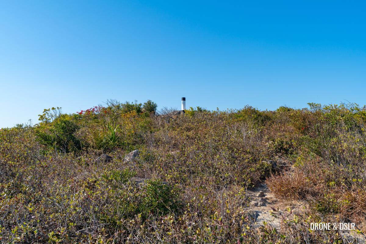
Luckily I could see the triangulation station beyond the thickets, and made my way over to it.
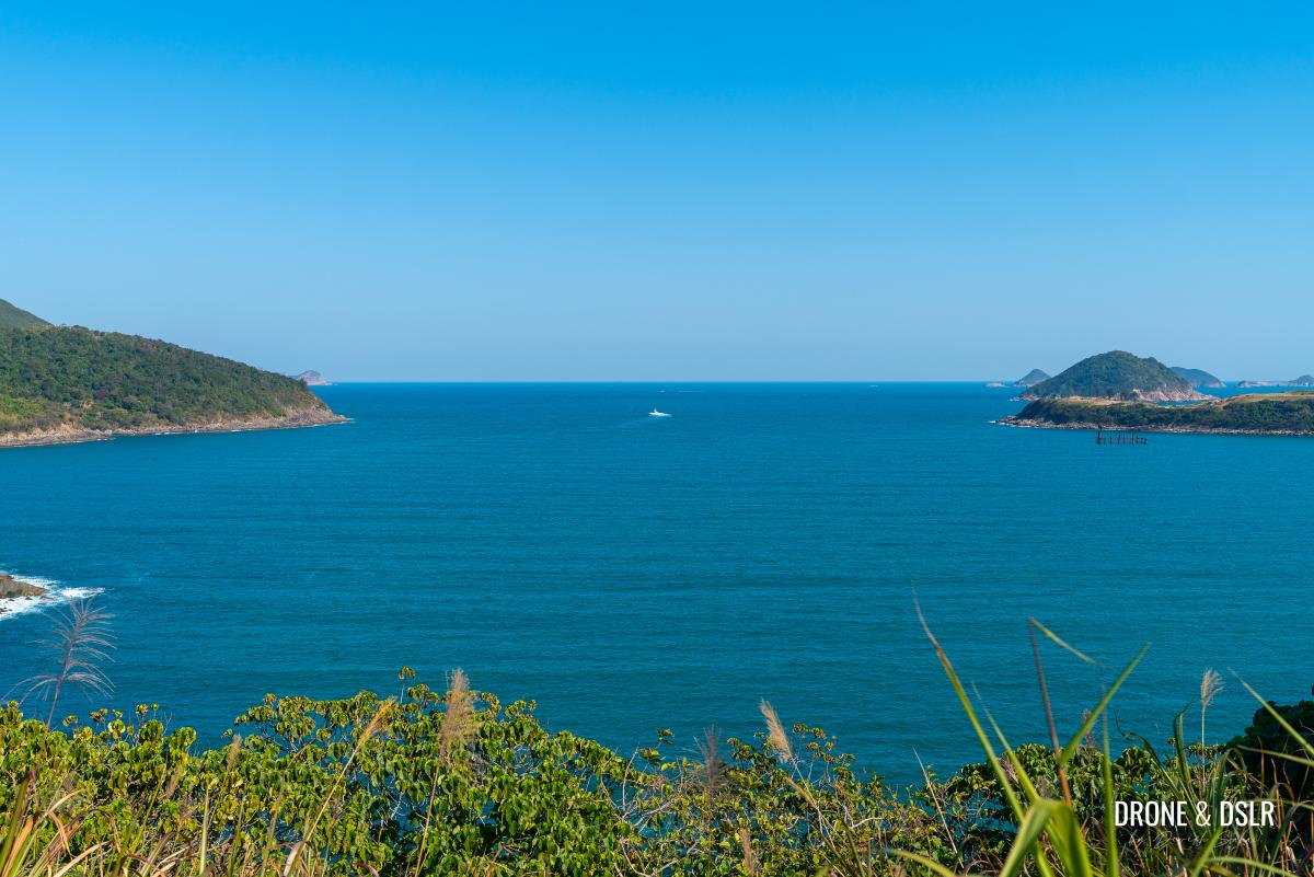
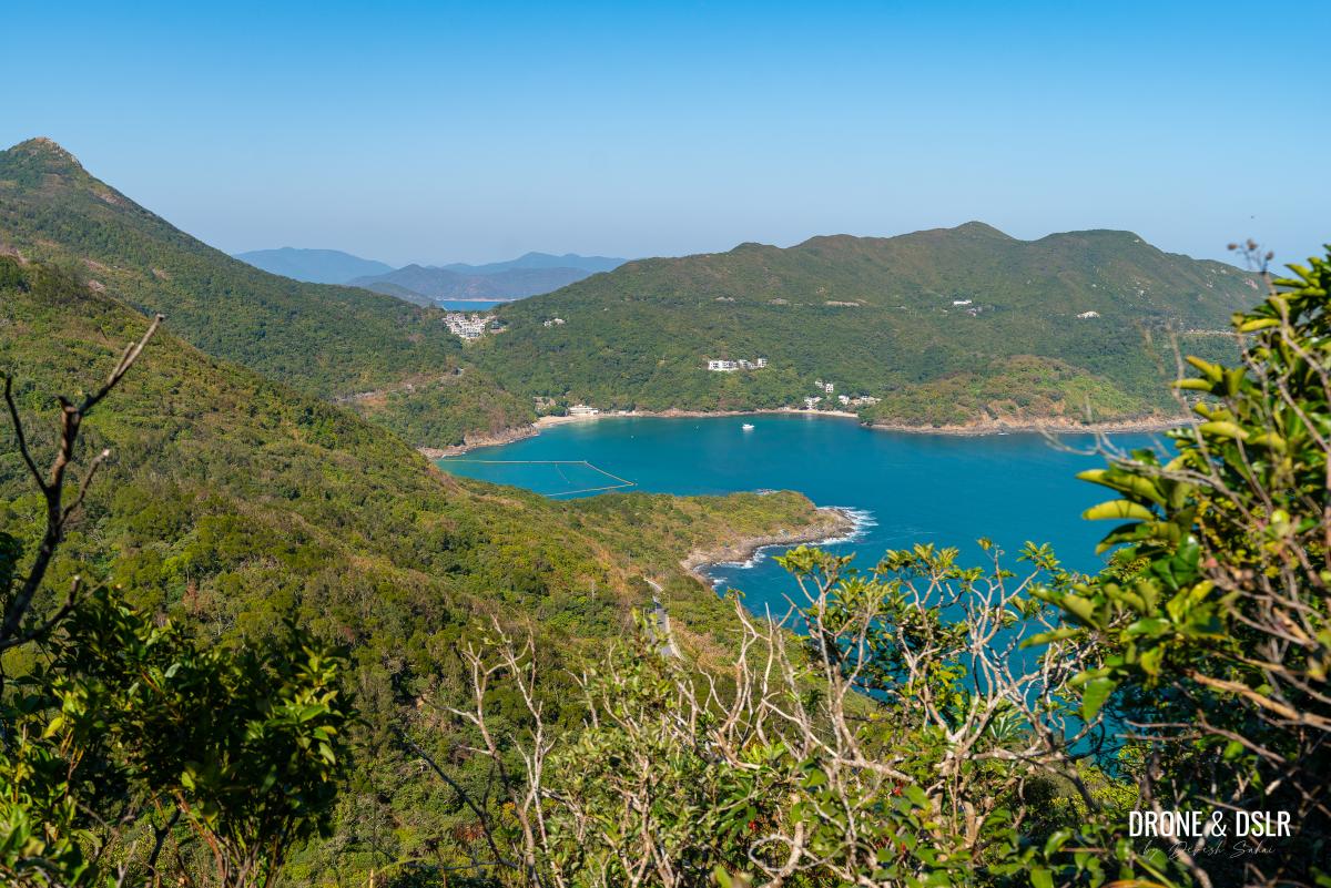
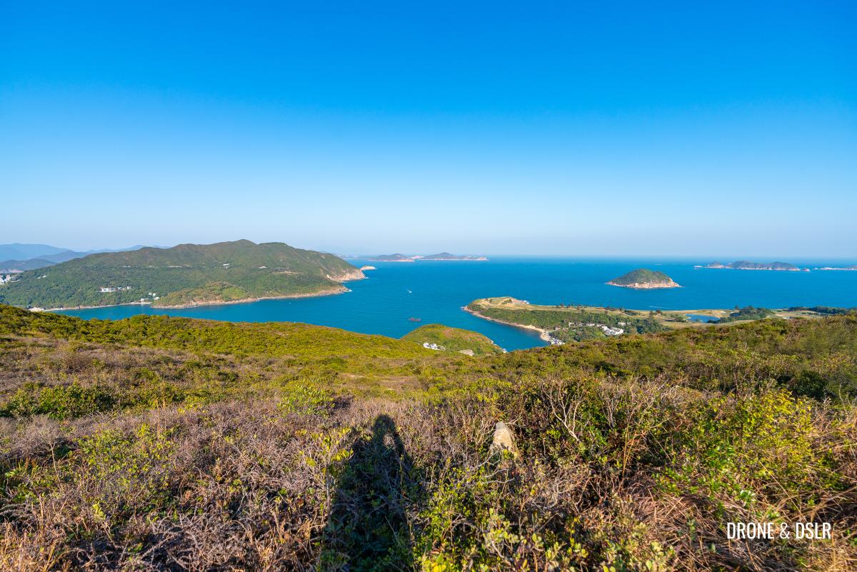
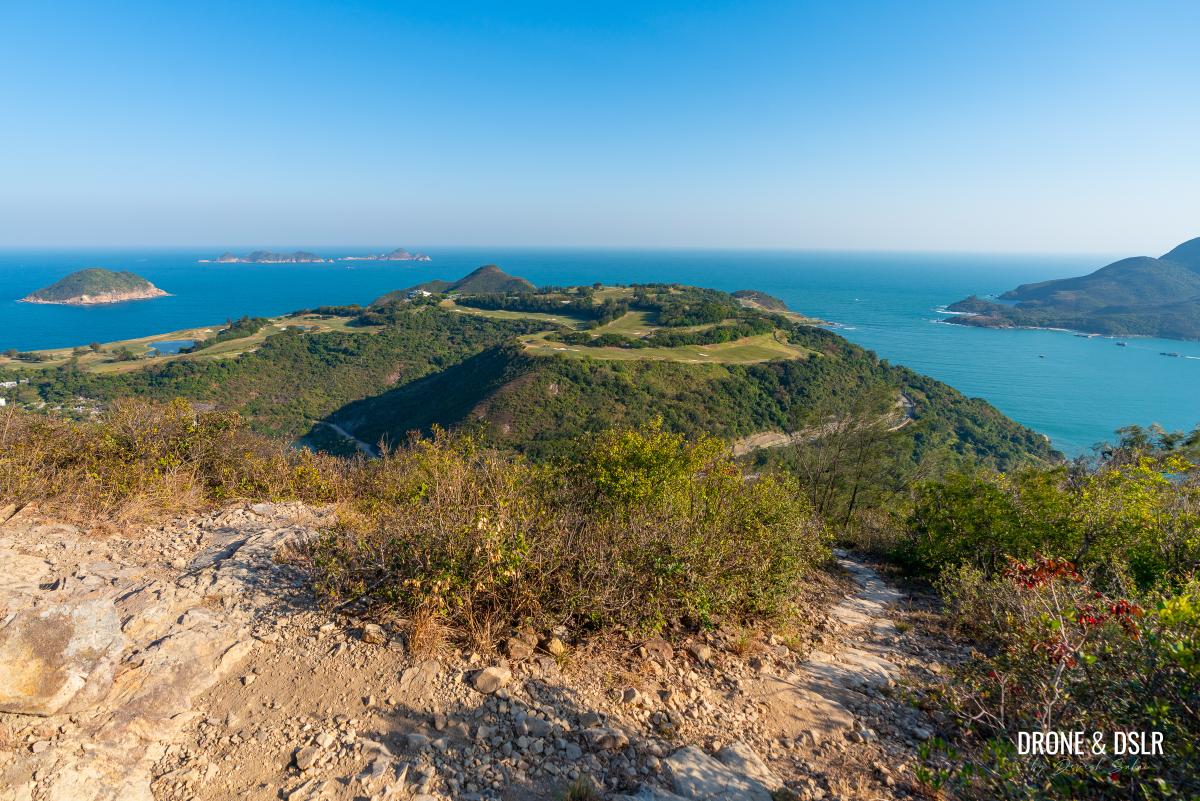
Views from Tin Ha Shan
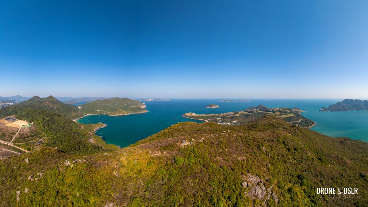
Aerial panorama of Tin Ha Shan in the centre, flanked by High Junk Peak and the Clearwater Bay Golf & Country Club
Although the views from High Junk Peak are some of my favourite, I will admit, the views from Tin Ha Shan come close.
-
- Aerial view of Tin Ha Shan and Clearwater Bay Golf & Country Club
-
- The flattop summit of Tin Ha Shan
Tin Ha Shan is a relatively short hill (273 metres), but luckily its summit is unobstructed and located at unique position giving it 360 degree sweeping views.
-
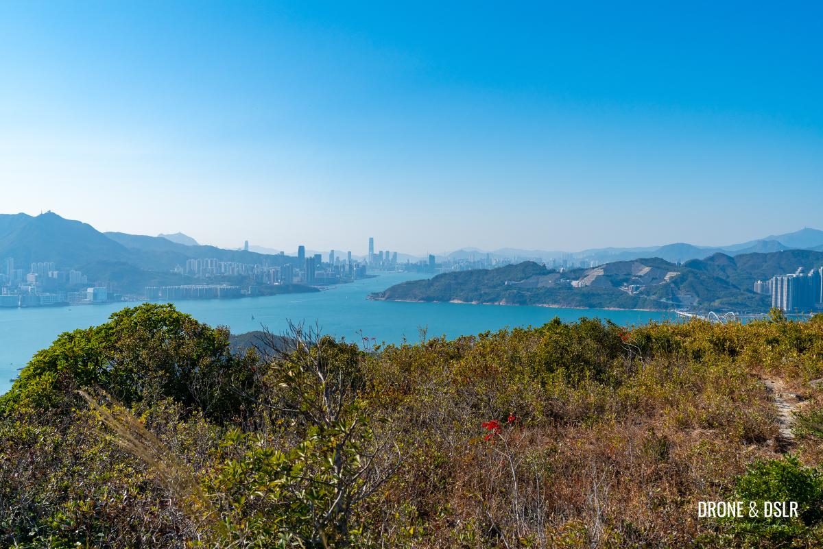
- The views of Hong Kong’s skyline and Junk Bay behind Tin Ha Shan
-
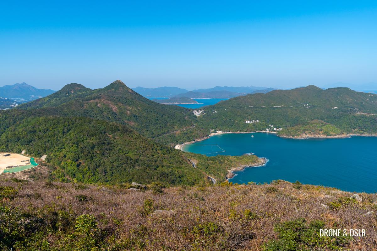
- Views of High Junk Peak and Clearwater Bay from Tin Ha Shan
From High Junk Peak, Clearwater Bay, and the Clearwater Bay Golf & Country Club to the east, to Junk Bay and the Hong Kong skyline to the west – you can see it all from here!
-
- Views of the Clearwater Bay Golf & Country Club from Tin Ha Shan
-
- Aerial views of Junk Bay and TKO from Tin Ha Shan

The views are magnificent, and I had them all to myself.
Hello from on top of Tin Ha Shan!
Head Back Down
If you’re carrying hiking gloves, now is a good time to bring them out.
After soaking in all the views, head back down the same way.
What incredible views of the Clearwater Bay Golf & Country Club from Tin Ha Shan!
Going down these rocky and unmarked trails is usually more difficult than climbing up. And having hiking gloves makes it easier to grab a boulder or shrub for balance as you descend.
After enjoying the views, head back down to High Junk Peak Country Trail
Descend carefully and return to High Junk Peak Country Trail.
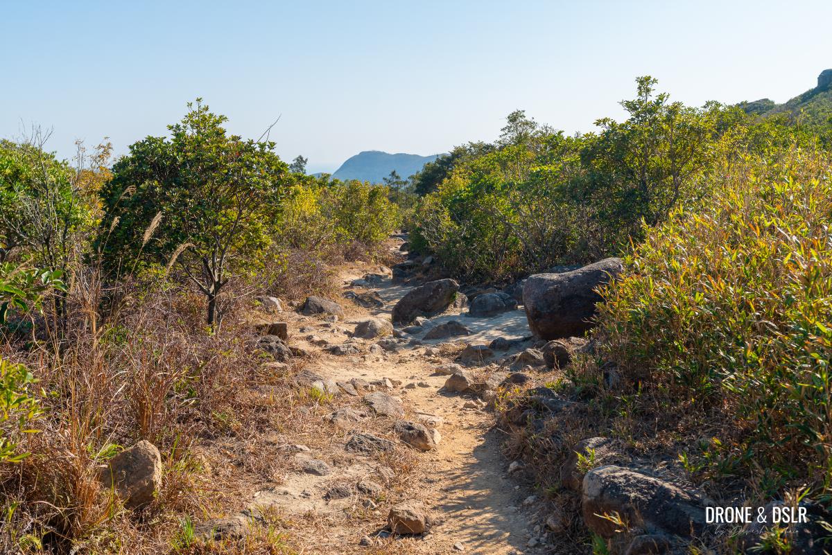
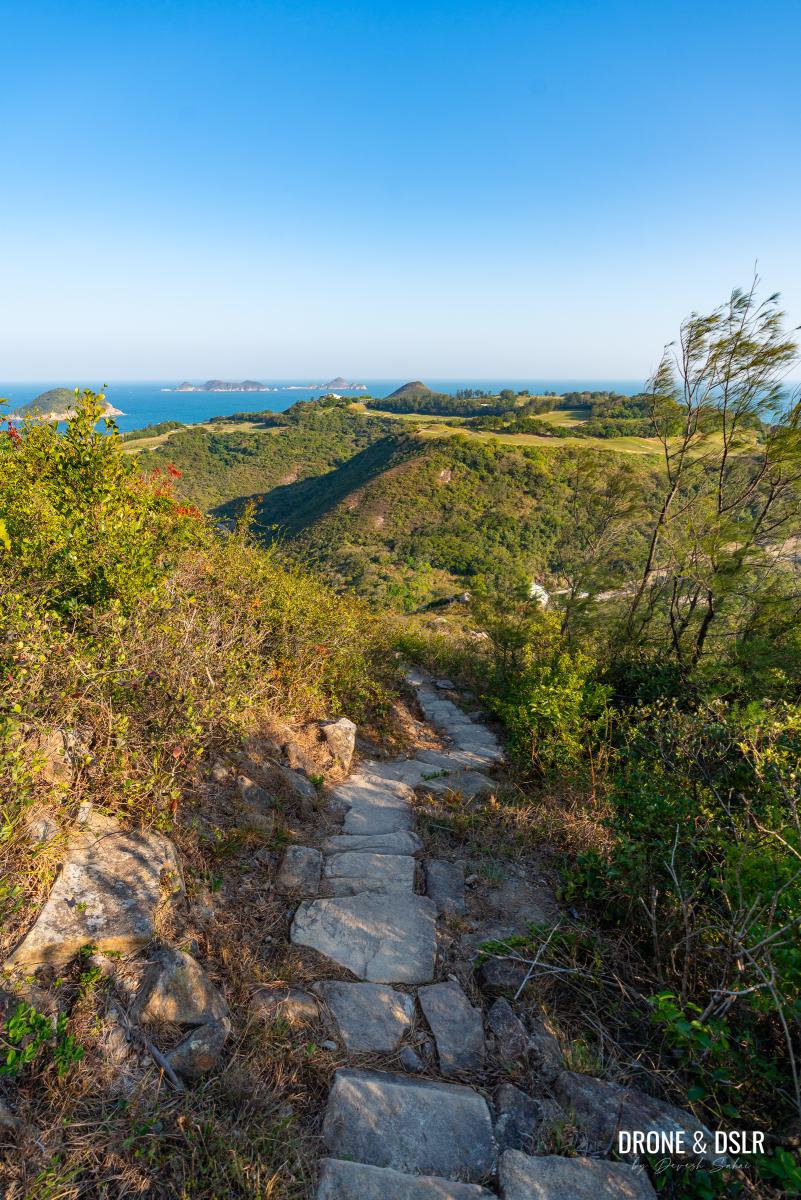
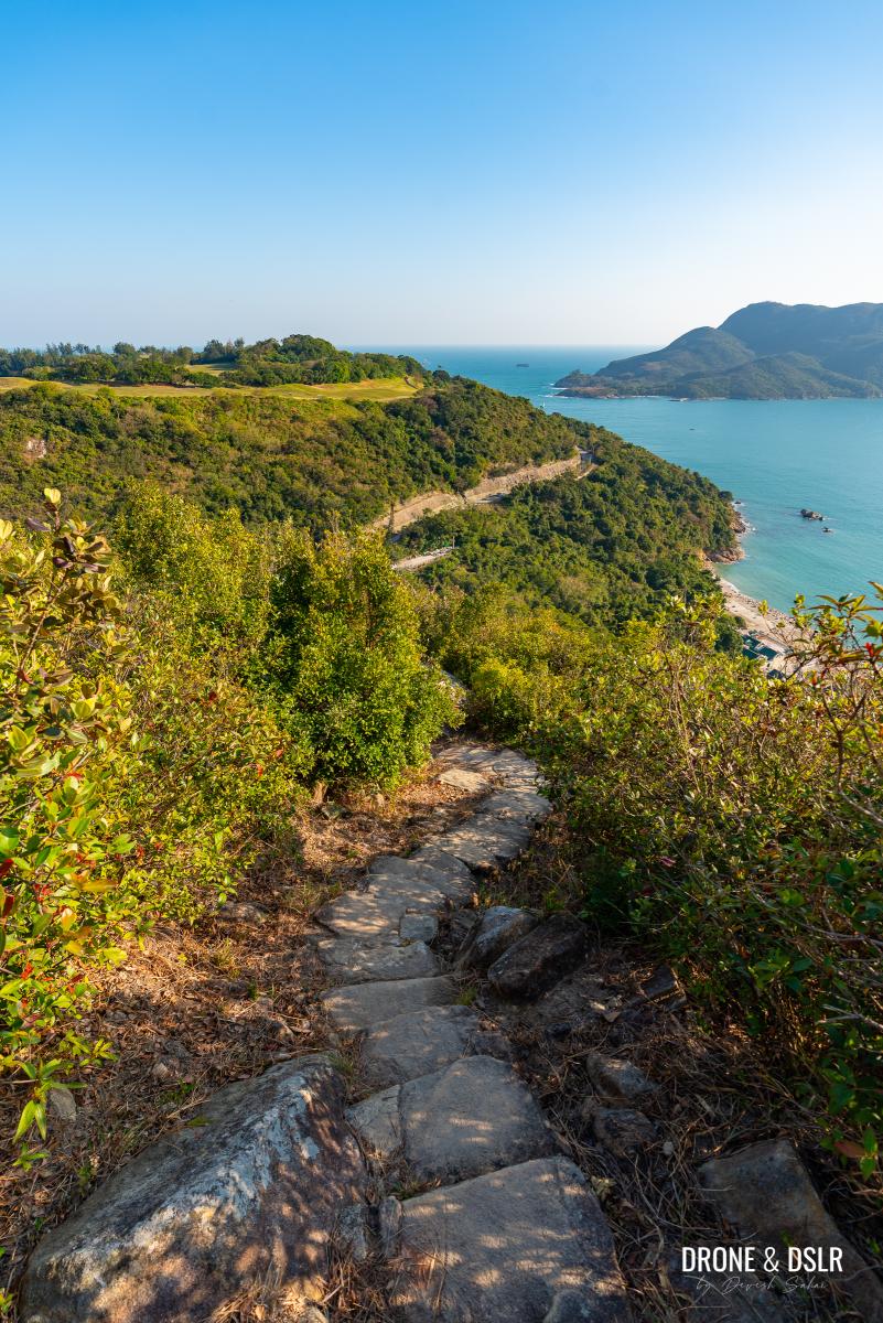
The Flat & Scenic Section
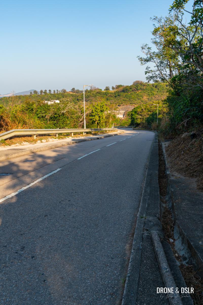
Once you’re back on High Junk Peak Country Trail, turn right and head toward Tai Miu. This section follows the base of Tin Ha Shan and is relatively easy, mostly flat with some rocky patches, flanked by vegetation.
-
- Turn right and continue on High Junk Peak Country Trail once you’ve returned to it
-
- After all the climbing, this part of the hike feels like a breeze
-
- As the trail becomes rocky again, get ready for something special
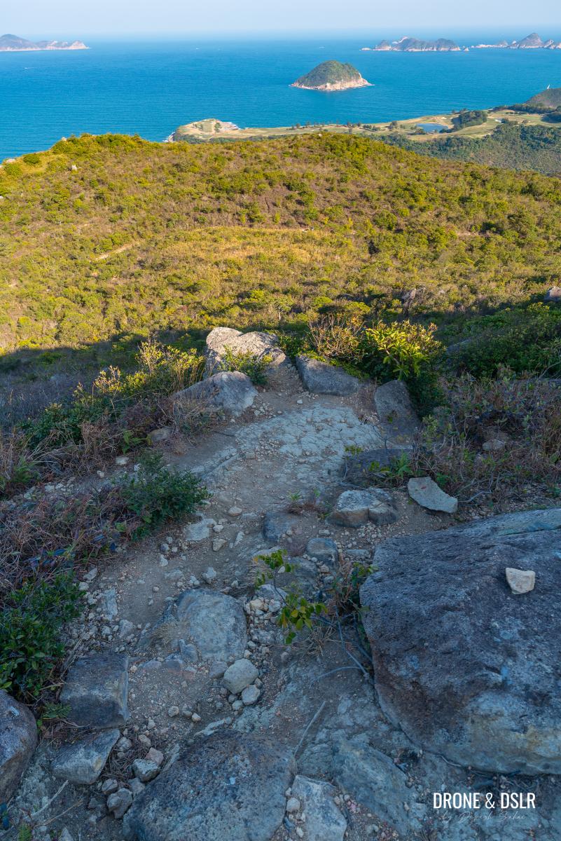
Continue along the path as it begins a gentle descent. As the treeline thins, the trail opens up to reveal one of the most spectacular views of Clearwater Bay on this hike!
The views of Clearwater Bay return!
The terrain becomes rocky again for a stretch, but remains unobstructed, allowing you to enjoy the glorious scenery as you hike.
The trail, now with its open views, is a pleasure to hike on
Eventually, the view disappears, and a canopy of trees appears up ahead. You might find yourself longing for the open ridges you just left behind, but keep going because you may be surprised by what lies just ahead.
-
- The views disappear, but only momentarily
-
- Get ready for something even more special on the other side of the trees
The Incredibly Scenic Descent To Tai Miu
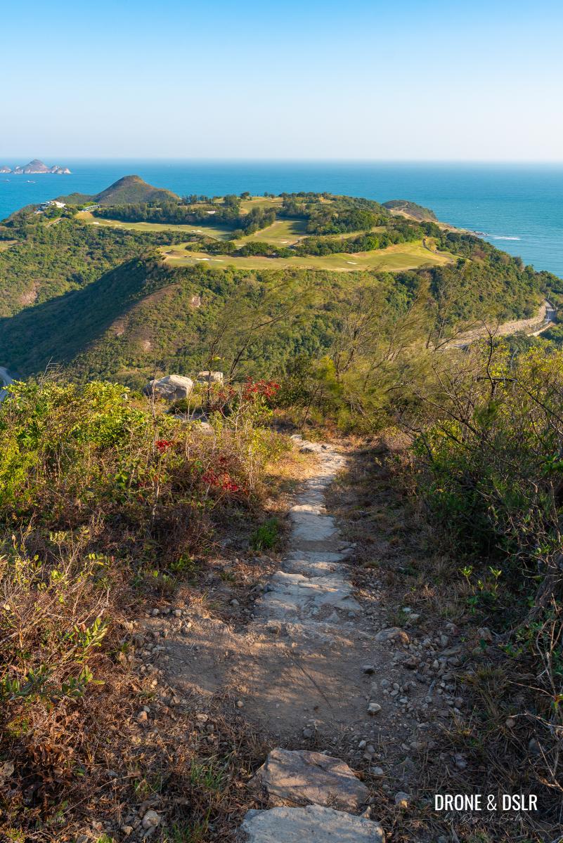
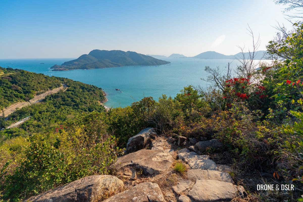
As the trail emerges from the canopy, you are treated to a spectacular, head-on perspective of the Clearwater Bay Golf & Country Club, possibly the best angle on the hike. At certain points, the path is so steep it feels as though you are descending directly onto the greens!
-
- As you emerge on the other side of the trees, this is what you’re facing — just incredible views!
-
- Definitely one of the most scenic descents on any hike in Hong Kong
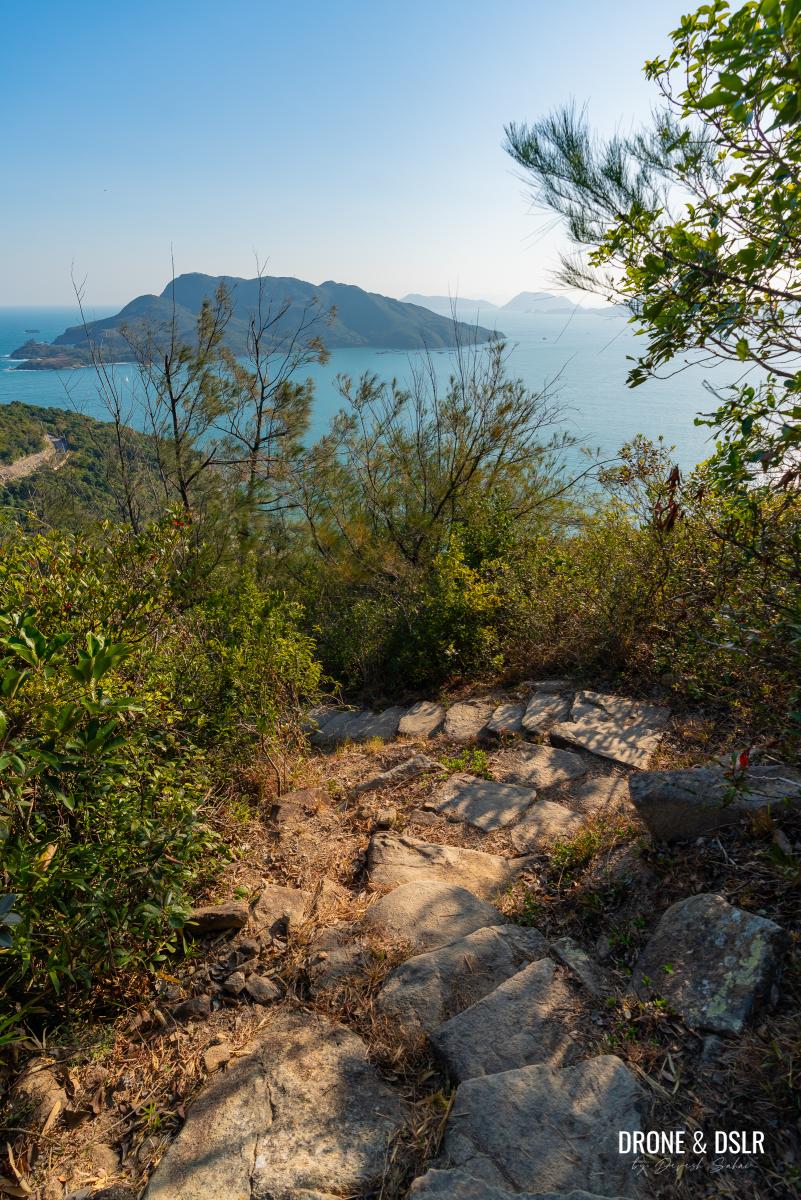
As the trail continues to descend and veer left, the scenery focus on the fishing village of Po Toi O.
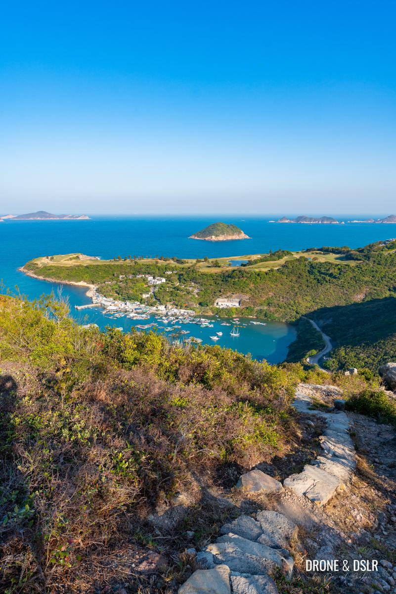
And now views of Po Toi O as you descend
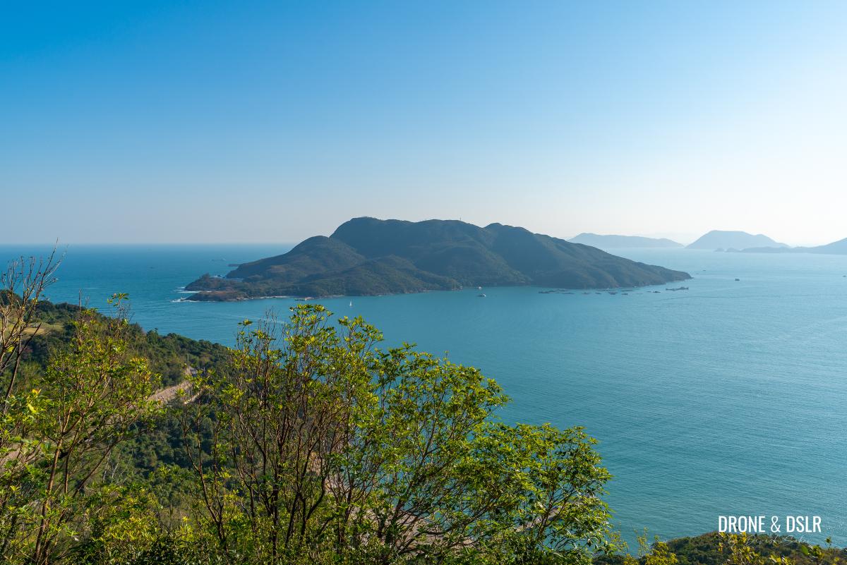
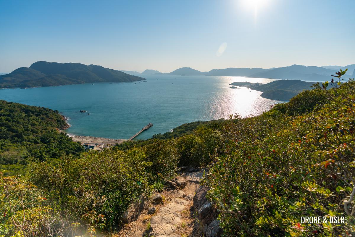
While the path steepens and briefly ducks into the bushes, the views soon return, expanding to include Tung Lung Chau, Joss House Bay, and beyond. If you’re hiking on a clear day, you’re in for a treat.
-
- The views disappear briefly when the trail turns
-
- After the trail turn, you’re left staring down Joss House Bay and Tung Lung Chau
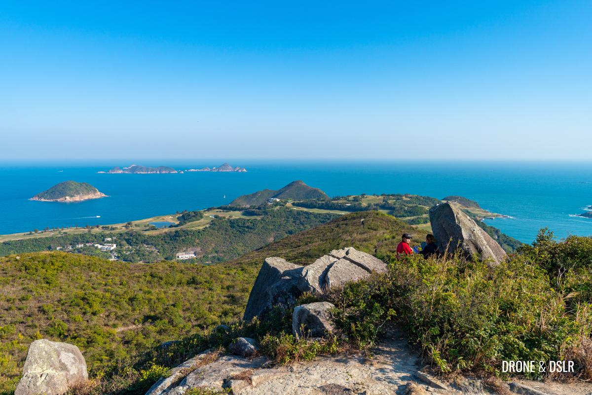
This stretch offers a rotating panorama of the golf course and the outlying islands. Along the way, keep an eye out for rocky outcrops; they are perfect spots to sit, rest, and capture an incredible photo.
-
- And back to views of Clearwater Bay Golf & Country Club
-
- I noticed a few flat boulders perfect for sitting and admiring the views
-
- And back to views of Tung Lung Chau
Naturally, as you lose elevation, the “awe factor” of the height begins to fade, but the beauty remains. Before the dense vegetation returns, you’ll get one final, clear look at Joss House Bay and Tung Lung Chau.
-
- Some of the best views of the Clearwater Bay Golf & Country Club are from this descent
-
- Gorgeous views of Joss House Bay
-
- Obviously, the lower you get, the less impressive the views of Clearwater Bay Golf & Country Club become
-
- One last clear view of Joss House Bay
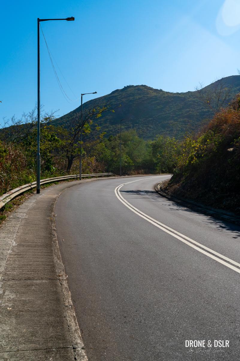
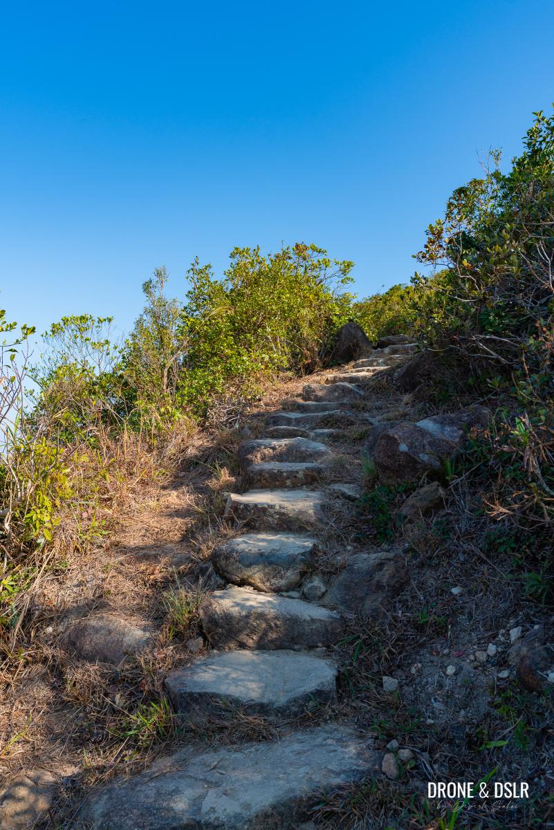
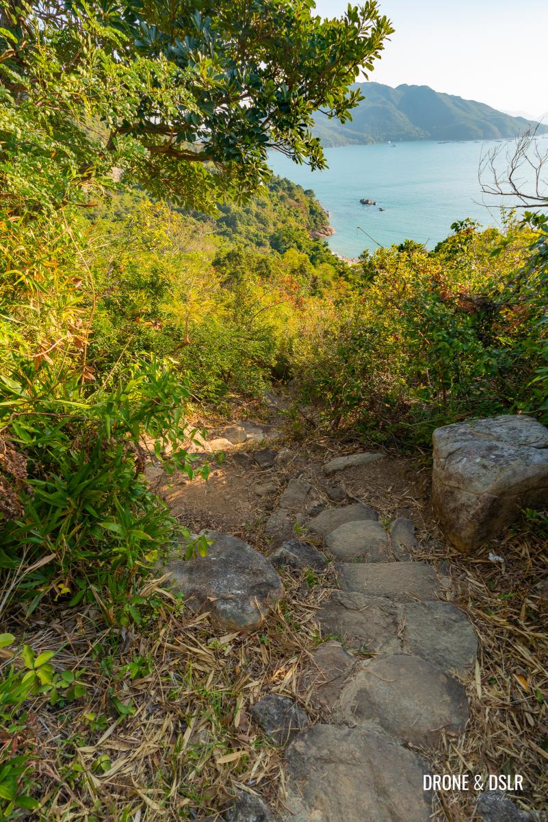
Continue downhill till the vegetation returns, and the trail is back under a canopy. Walk until the descent levels out, then turn left following the signs for Tai Miu.
-
- The shade slowly returns to engulf the trail
-
- And just like that, the views are gone
-
- At the end of the steps, turn left and follow the signs for Tai Miu
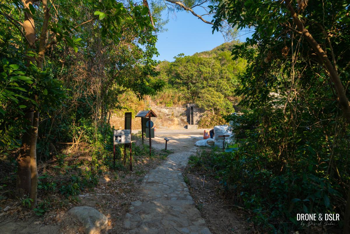
A final 100-metre walk through the trees will bring you to the end of the High Junk Peak Country Trail at Tai Miu Au, the gap separating the hill you just conquered from the one home to the golf club.
-
- The final section of the High Junk Peak Country Trail
-
- The High Junk Peak Country Trail ends here, next to the entrance of the Clearwater Bay Golf & Country Club, at Tai Miu
And with that, the panoramic descent and the hike come to an end.
Options To End The Hike
Standing in front of the gates of the Clearwater Bay Golf & Country Club, you have a couple of options to end the hike.
Recommended: Grab a meal at Po Toi O
Turn left on Tai Au Mun Road, walk for 120 metres, and then turn right on Po Toi O Chuen Road.
Turn left and walk down Tai Au Mun Road
Then walk downhill on this road to Po Toi O village.
Walk down Po Toi O Chuen Road to reach Po Toi O
At the end of the village is one of our favourite seafood restaurants outside the main city. Grab a meal with a drink here, you’ve earned it.
-
- Seafood Islands Restaurant, Po Toi O

-
- Beer and good seafood

Or head back
If you don’t feel like grabbing a bite, you can catch GMB 16 from the intersection of Po Toi O Chuen Road and Tai Au Mun Road to Hang Hau MTR.
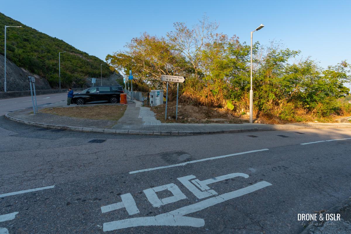
At the intersection of Tai Au Mun Road and Po Toi O Chuen Road, you can decide whether to head down to Po Toi O to grab a meal, or catch a bus back to Hang Hau
Another Gorgeous Hike In Clearwater Bay
One of my favourite hikes in Hong Kong is the Lung Ha Wan Country Trail, which is also located in Clearwater Bay. So, it is no surprise that Tin Ha Shan ranks highly as well given that it offers similar views. In terms of difficulty, I would say Tin Ha Shan is more comparable to Lung Ha Wan than the steeper High Junk Peak.
This part of Hong Kong, Clearwater Bay, has the best hiking views!
Ultimately, regardless of which you choose, all three trails offer some of the most spectacular hiking views in Hong Kong.
We hope you found this guide to the Tin Ha Shan Hike resourceful. As always, feel free to share it on your social media channels and drop us a message if you reach the summit of Tin Ha Shan following this guide.
If you enjoy our work, come join us on Instagram and YouTube 🙂


You might also like


Leave a reply