
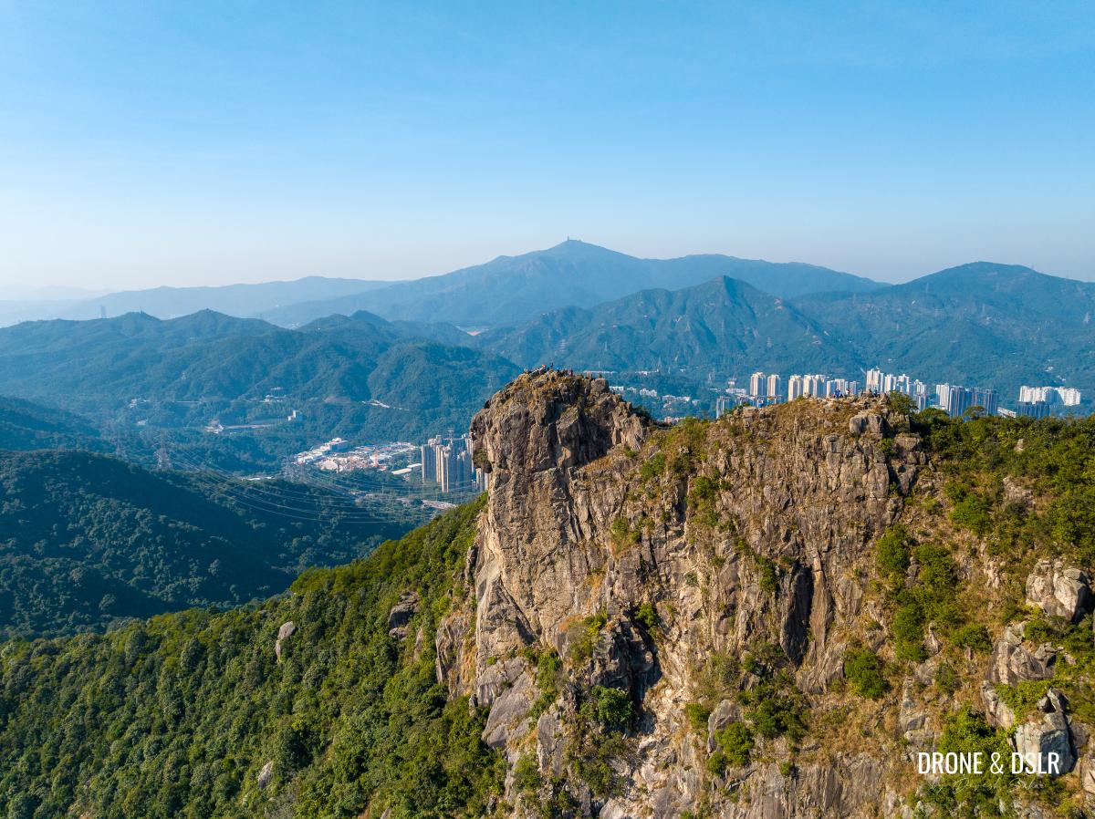
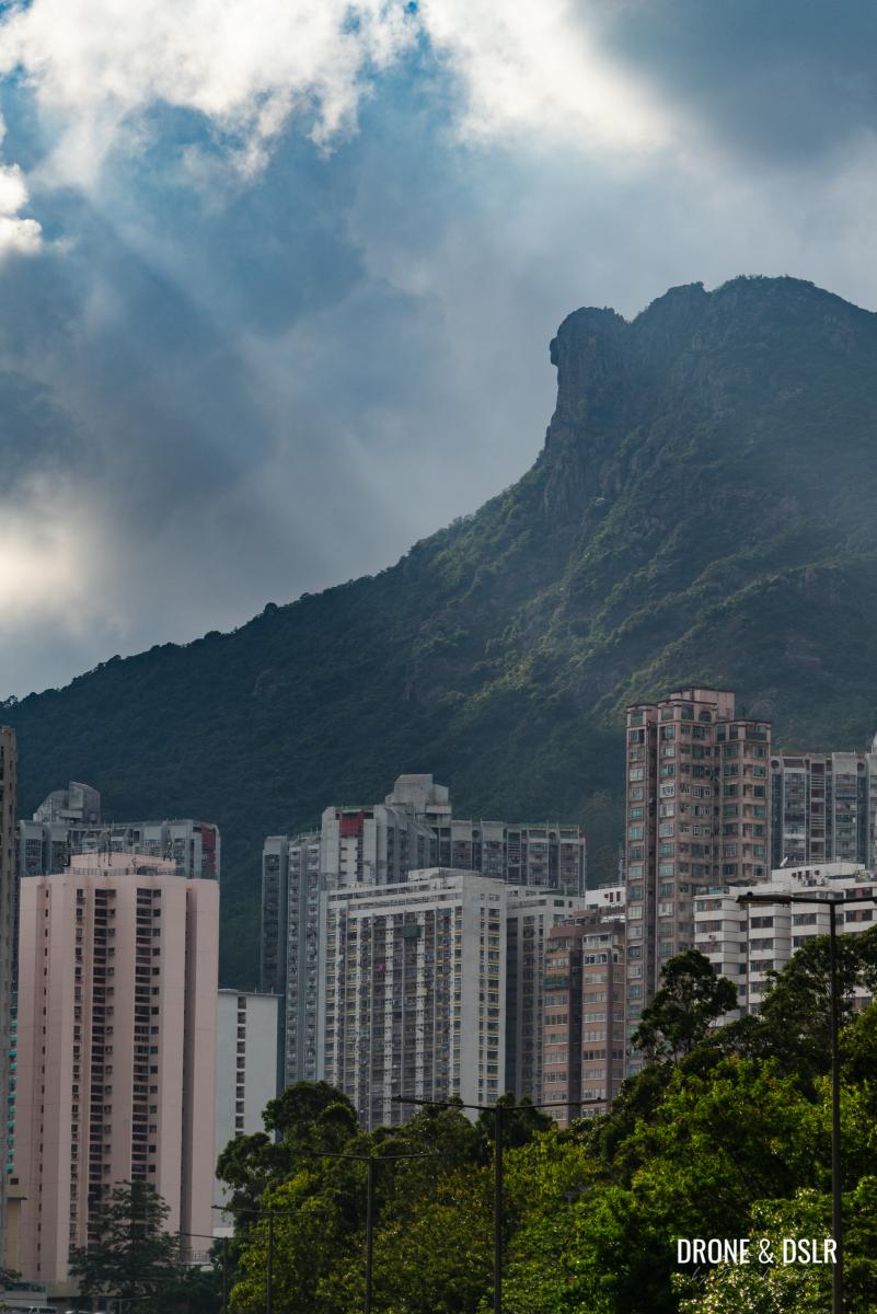
Lion Rock — Hong Kong’s iconic peak is not only known for its breathtaking views of the city but also for its peculiar shape that can be identified from miles away. For those living in Hong Kong, this lion-shaped hill overlooking the city is a symbol of grit and determination. And for many, Lion Rock is a must-do hike!

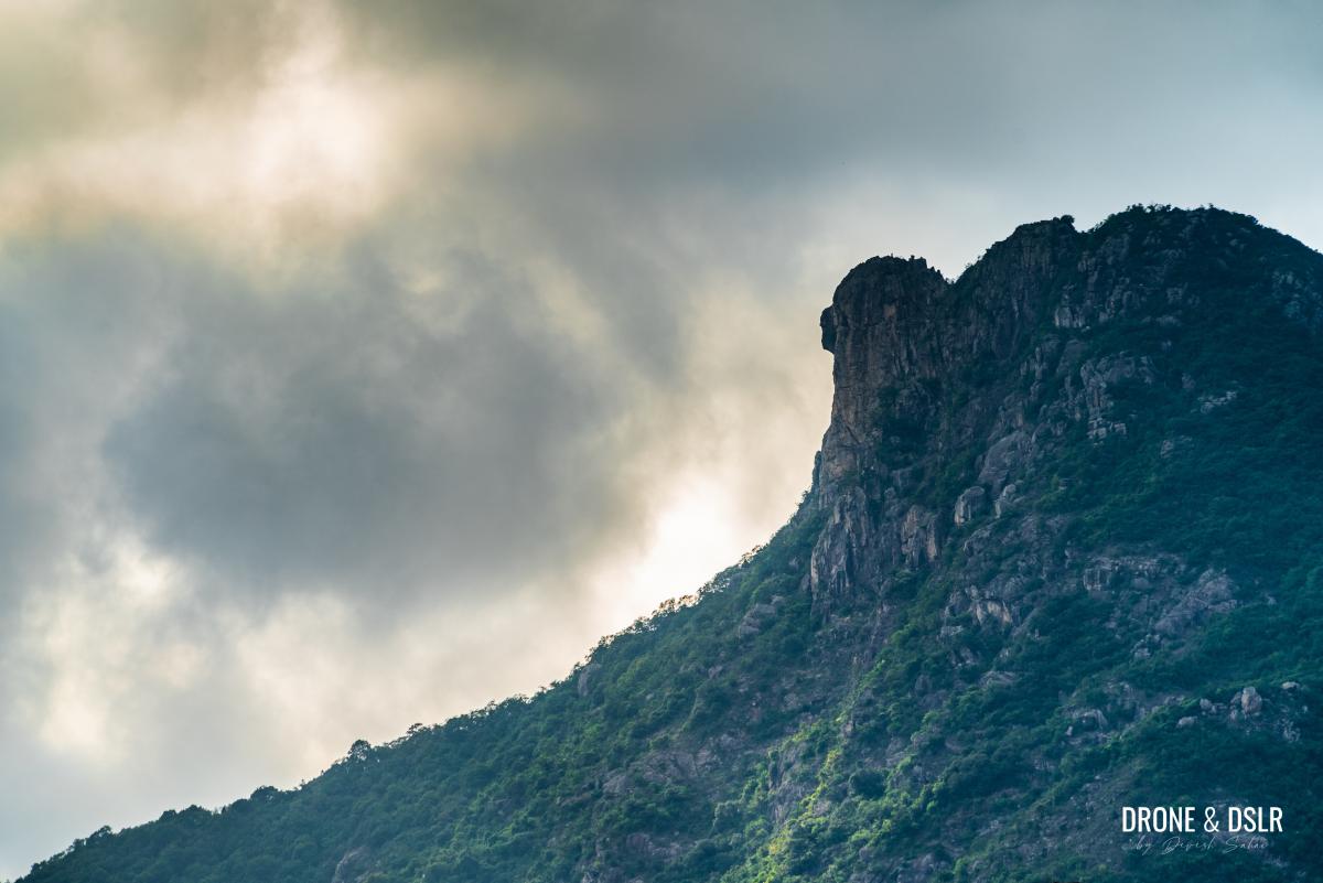
Rocks and clouds – Lion Rock Peak, Hong Kong
The first time I completed the Lion Rock Hike, I waited for ages for the perfect day. Although it turned out to be hotter than expected, the views from the hike more than made up for the scorching sun!
Lion Rock is a must-do hike in Hong Kong
For those of you looking to hike up Lion Rock, I have put together this guide. I’m going to keep things simple yet thorough while answering all the questions you may have about the hike.
How Difficult Is Lion Rock?
I would say moderately difficult in parts thanks to the steps.
Of course, this depends on your level of fitness and how comfortable you are with hiking. On the other hand, I don’t think anyone would classify Lion Rock Hike as an easy hike.
Lion Rock, Hong Kong
There are many tracks to Lion Rock Peak, and most of them are equally challenging. But this post will focus on the most popular and scenic route from Wong Tai Sin.
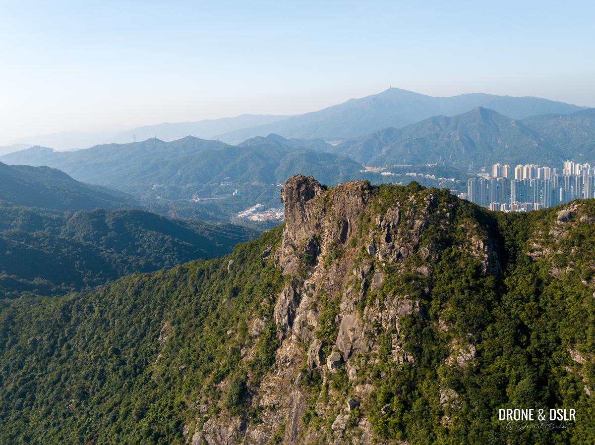
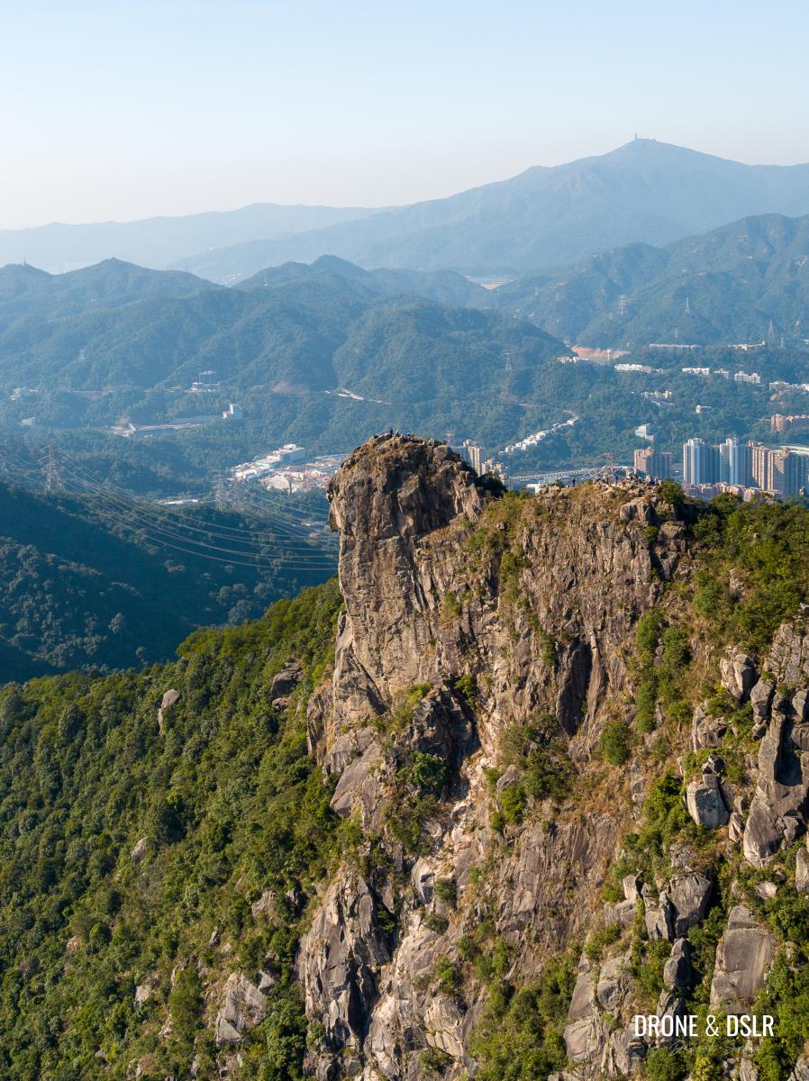
The peculiar shape of Lion Rock can be seen from miles away
Here’s a quick video that walks you through the hike. It should give you an idea of the difficulty.
Subscribe to my YouTube channelDifferent hiking routes to Lion Rock
Situated in the Lion Rock Country Park, Lion Rock is situated along MacLehose Trail Section 5, between Kowloon Pass and Shatin Pass. It is flanked by Beacon Hill to the west, and Temple Hill (Tsz Wan Shan) to the east.

Lion Rock and Beacon Hill on the other side
It’s location essentially means that there are numerous trails that lead up to the summit of Lion Rock Peak. But most approaches start from either Wong Tai Sin, Tsz Wan Shan, or Shatin.
The most popular starting point among them is Wong Tai Sin because it’s well-connected by public transport (including the MTR).
However, if you’re interested in learning how to reach Lion Rock from Shatin, you can follow the route to Kowloon Pass from Amah Rock, and then follow the signs to Lion Rock. Alternatively, if you’re interested in starting from Tsz Wan Shan, you can follow the route to Shatin Pass and then enter MacLehose Trail Section 5. I’ve detailed the steps in my guide to the Temple Hill Hike post.
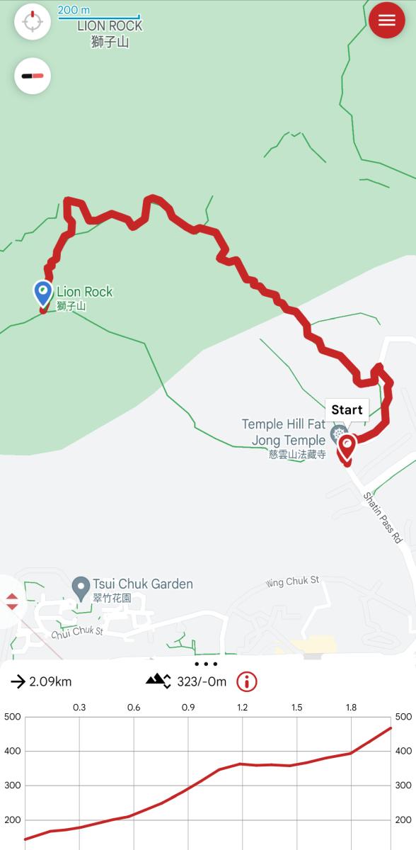
Lion Rock Hike Map & Elevation Profile
As mentioned above, in this post we’ll focus on hiking to Lion Rock from Wong Tai Sin. But even from Wong Tai Sin, there are two slightly varying options,
- From Shatin Pass via MacLehose Trail Section 5, and
- Via the steps behind Fung Wong Fresh Water Service Reservoir
Both trails meet at Sze Tsz Au, which is the gap between Shatin Pass and Garter Pass (at the base of Lion Rock).
The trail from Shatin Pass is longer but scenic and the trail via the steps behind Fung Wong Fresh Water Service Reservoir is shorter, steeper, and not at all scenic.
I’ll provide guides to both the options in this post, and you can decide which one to pick or mix and match if you like.

Lion Rock Peak — quite a resemblance
Below is the map for the Lion Rock Hike from Fat Jong Temple via Shatin Pass and MacLehose Trail Section 5. You can also open this trail in Google Maps.
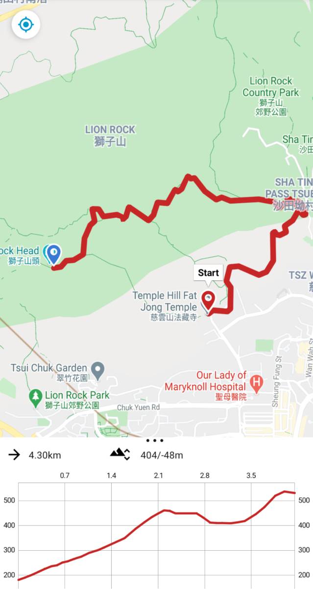
Lion Rock Hike map and elevation profile (long route)
Similarly, here is the trail map and elevation profile via Fung Wong Fresh Water Service Reservoir steps.
Lion Rock Hike Map (shortcut)
I usually recommend first timers to go up from Shatin Pass, and then come down via the Fung Wong Fresh Water Service Reservoir steps. If you follow this route, it should take you just over 2 hours to complete the Lion Rock Hike — 1.5 hours to climb up, and then 45 minutes to come down.
One last reminder, the summit of Lion Rock offers little shade. So, carry sufficient sun protection and at least 1 litre of water. Maybe more if it’s a hot day.
Lion Rock Hike Starting Point
The Lion Rock Hike from Wong Tai Sin starts from Fat Jong Temple, which is located on Shatin Pass Road.

Fat Jong Temple, the start of Lion Rock Hike
To reach the Fat Jong Temple, you have two options,
- Walk to it from Wong Tai Sin MTR Station. It’s a 1.1 km steep, uphill walk.
- Take a taxi to it from Wong Tai Sin MTR Station. It will save you time and help you conserve energy.
- You could take the green minibus 18M from outside Exit E to Shatin Pass Estate. The housing complex is across the street from Fat Jong Temple.
Once you reach Fat Jong Temple, it’s time to start hiking up to Lion Rock!
Fat Jong Temple to Fung Wong Fresh Water Service Reservoir
From the beautiful Fat Jong Temple, begin your hike by walking uphill on the Shatin Pass Road. If you walked up to Fat Jong Temple, then continue on Shatin Pass Road.
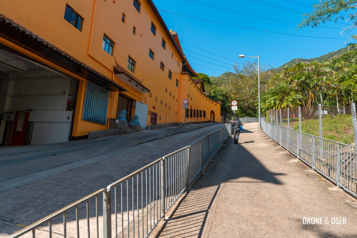
Start your hike from the Fat Jong Temple
The road gradually increases in intensity as it meanders its way uphill and behind Shatin Pass Estate.
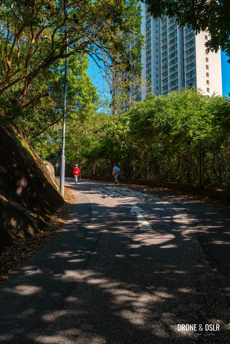
Walk up Shatin Pass Road behind Shatin Pass Estate
Walk up at a comfortable pace and stay on the side of the road. As this is a public road, you may find the odd vehicle pass you.
After approximately 330 metres of walking uphill, you’ll arrive at a gate (for the Shatin Pass Fresh Water Pumping House) on the side of the road. Continue walking for another 20 metres till you see a flight of steps heading uphill.
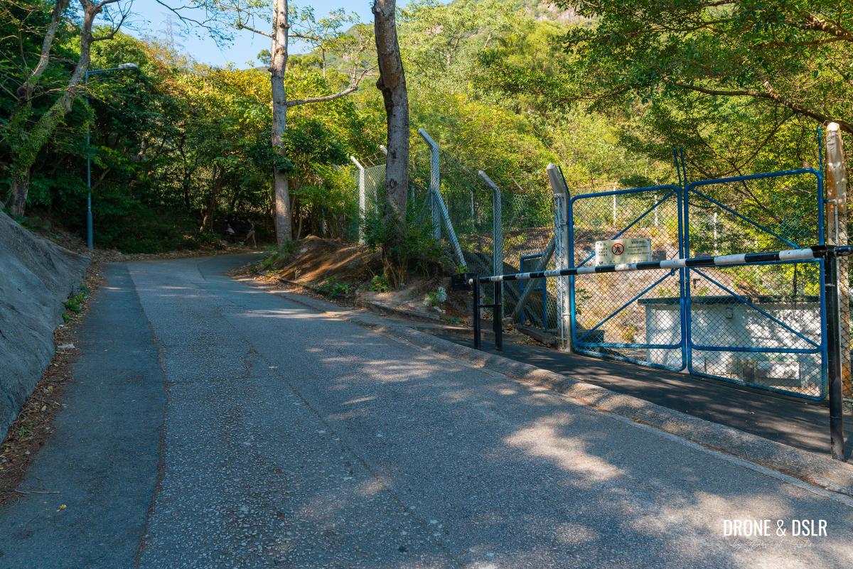
The gate for the Shatin Pass Fresh Water Pumping House
At this juncture, you have the option to take these steps to Sze Tsz Au, or continue on Shatin Pass Road to Shatin Pass and then take MacLehose Trail, which also reaches Sze Tsz Au. Keep in mind, the former is shorter and consists of only steps, but the latter is longer and scenic.
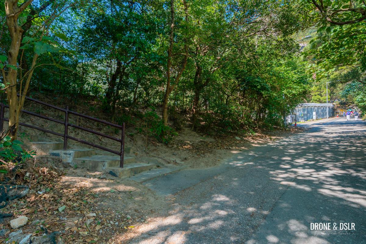
At this point, you can either continue on Shatin Pass Road or take these steps on the left as a shortcut. Both routes meet up at Sze Tsz Au
Click here if you’d like to take the shortcut
Shortcut to Sze Tsz Au from Fung Wong Fresh Water Service Reservoir
To take the shortcut, turn left onto the steps and behind walking up.
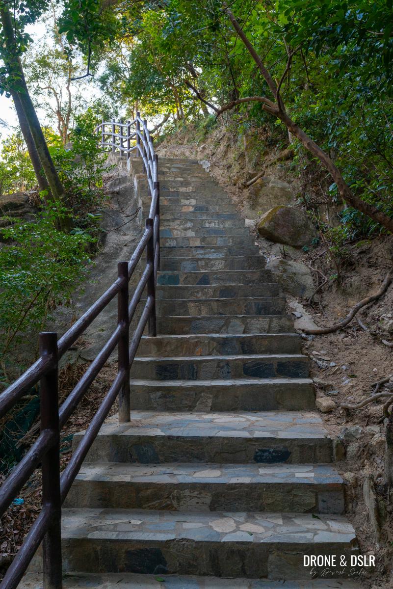
The steps that go behind the Fung Wong Fresh Water Service Reservoir
At the top of the steps is a seating area and beyond that, the steps run alongside the Fung Wong Fresh Water Service Reservoir’s fence.

The trail runs alongside the reservoir’s fence
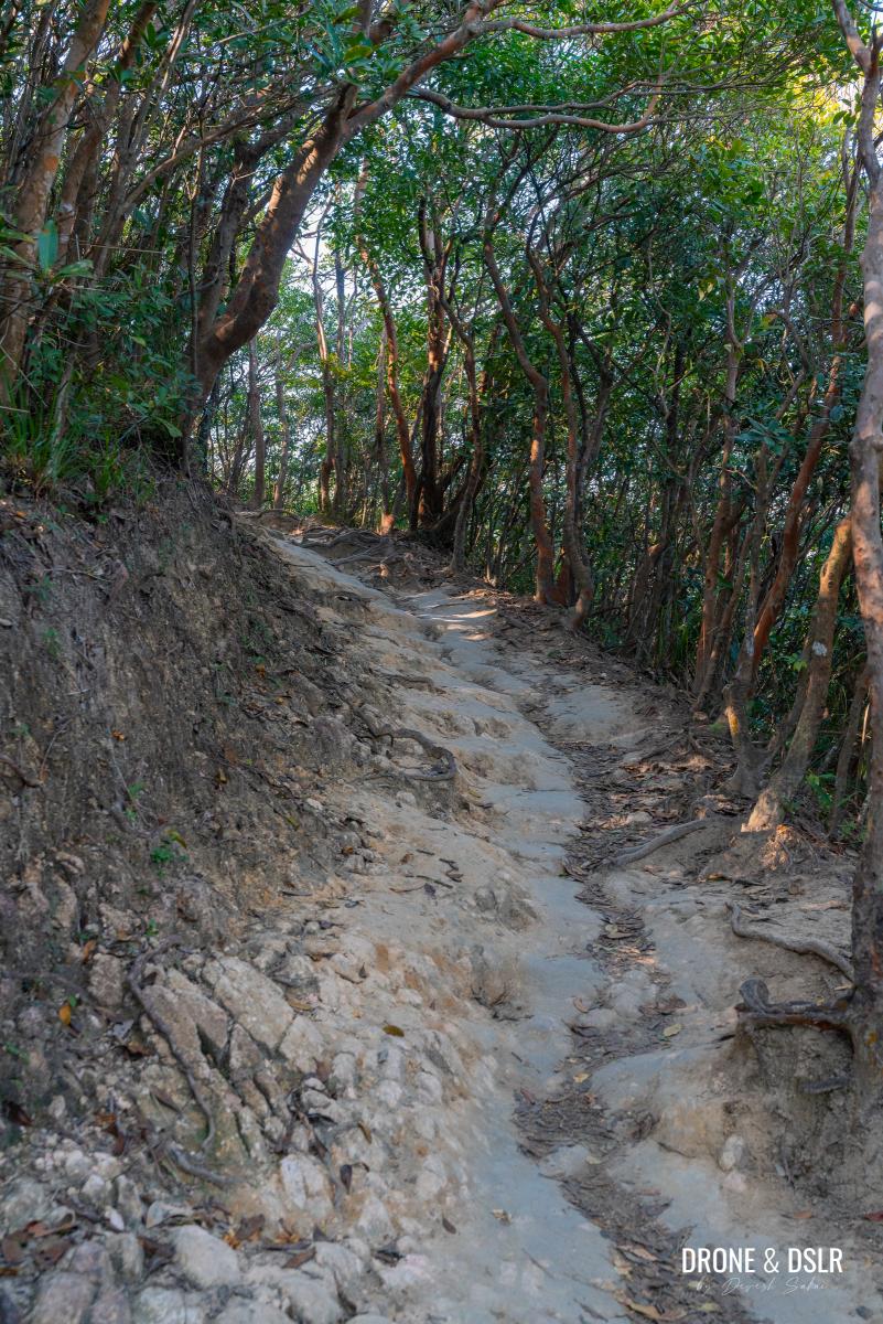
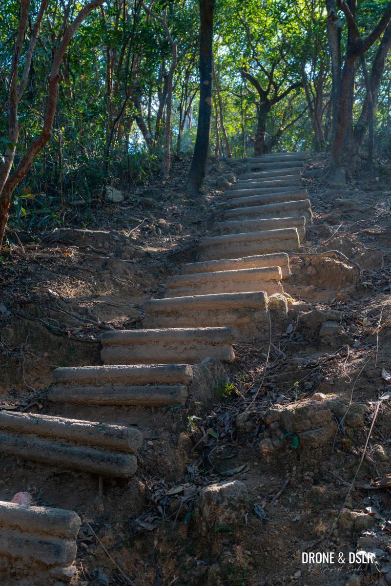
The initial section of the steps is relatively easy and the also well maintained. However, as the climb progresses, the incline becomes steeper and the steps become rougher.
-

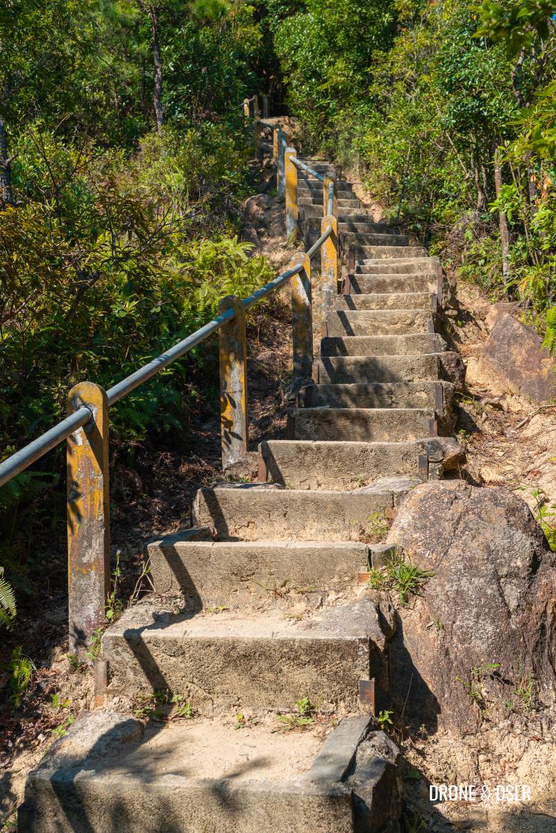
- The steps become a bit rough as they climb

-
- The steps are a shorter route but offer no views

Fortunately, there is plenty of shade and I’d advise taking frequent breaks.
As the steps get closer to Sze Tsz Au, they become even steeper. Just what you don’t want at this stage!
-
- The incline starts becoming steeper
-
- Almost at the end of the steps
When the steps finally end at Sze Tsz Au, turn left to rejoin MacLehose Trail Section 5 towards Lion Rock.
-
- You’ve arrived at Sze Tsz Au
-
- Turn left and follow the signs for Lion Rock
If you took this shortcut, skip to the Sze Tsz Au to Garter Pass heading below.
Fung Wong Fresh Water Service Reservoir to Shatin Pass
If you decided against taking the steps, then continue walking uphill on Shatin Pass Road.
Just after the steps, you’ll pass the Fung Wong Fresh Water Service Reservoir on your left. The road twists and turns as it keeps ascending. Along the way, you’ll start to see views of Kowloon on the right. But I doubt this view would compensate for you being so out of breath at this stage.
You’ll know if you’re close to the end of this section of the hike, when you see the Tsz Chuk Pavilion and steps to Lion’s Pavilion at Shatin Pass.
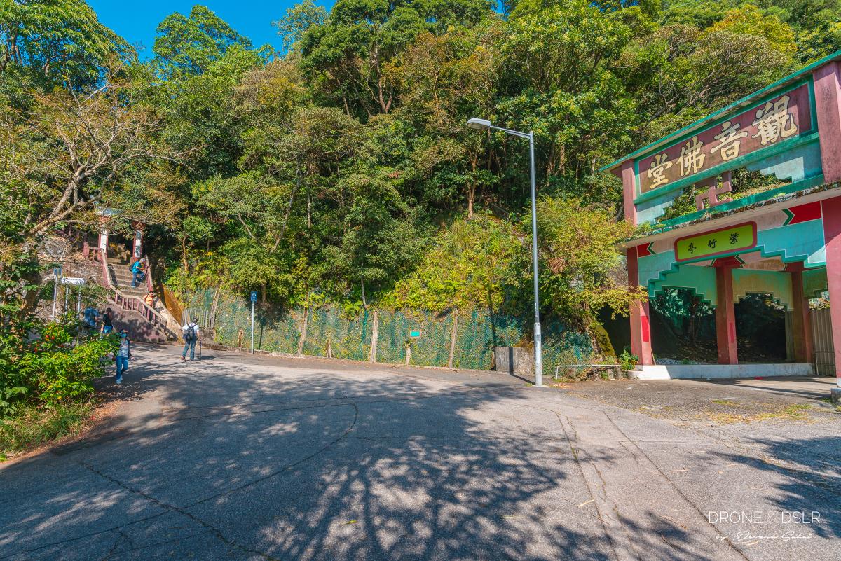
Tsz Chuk Pavilion
At this point, walk to the next bend after Tsz Chuk Pavilion to arrive at the entrance to Section 5 of the MacLehose Trail and the Lion Rock Country Park.
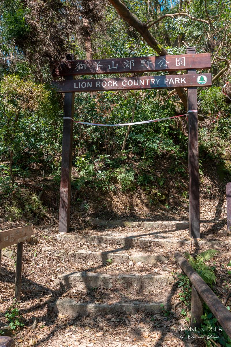
The entrance to the Lion Rock hike
Take a break, you’ve earned it!
Shatin Pass to Sze Tsz Au via MacLehose Trail Section 5
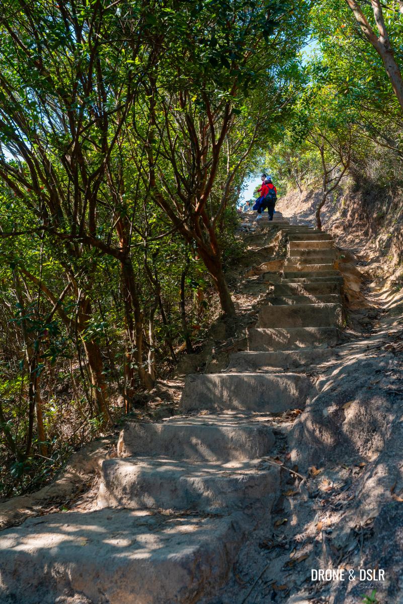
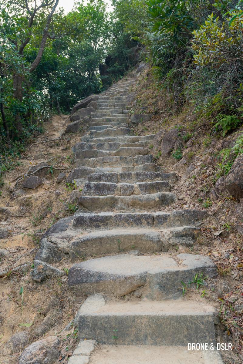
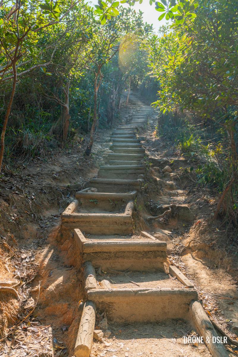
Once you enter Lion Rock Country Park, you trade the incline of a paved road for rugged country park steps. The steps at the start are relatively challenging but not too steep.

The Lion Rock Hike, Hong Kong
If you’re still recovering from the initial uphill walk, go slow and climb at a comfortable pace. There are a few good resting spots along the way.
-
- The initial section of the climb is relatively steep
-
- Winding steps

After the steps turn the corner, you’re greeted with panoramic views of Kowloon. There is a part where the views of the steps against the city are just so beautiful. It was here that I began to feel that the hike was worth it!
-
- The views as you ascend Lion Rock
-
- I found this stairway way too pretty to not click – Lion Rock Country Park
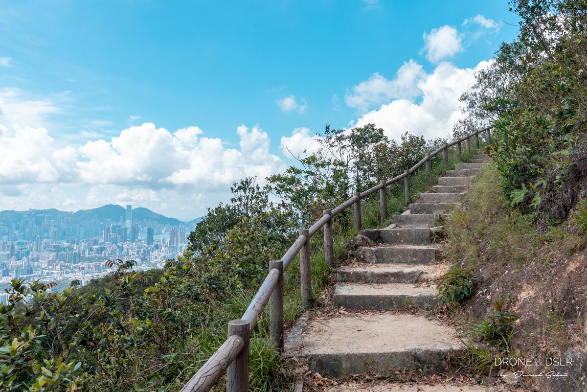
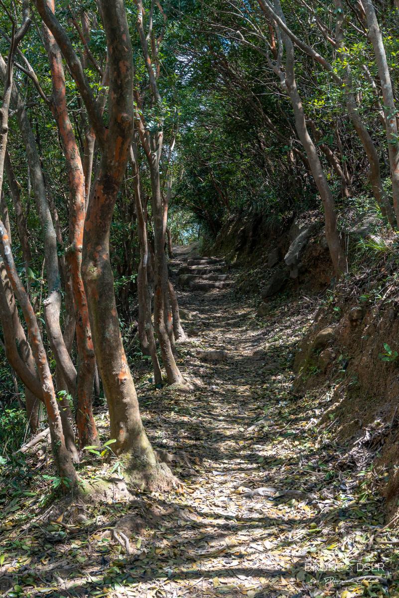
If you’ve chosen a clear day to hike up Lion Rock, the views from this section of the hike are quite enjoyable. I took my time to ascend these steps, because after them, the views disappear.
But the good news is that once the steps finish, the flat terrain begins. And it feels like such a relief after all this climbing.
-
- The trail finally flattens
-
- Back into the shade

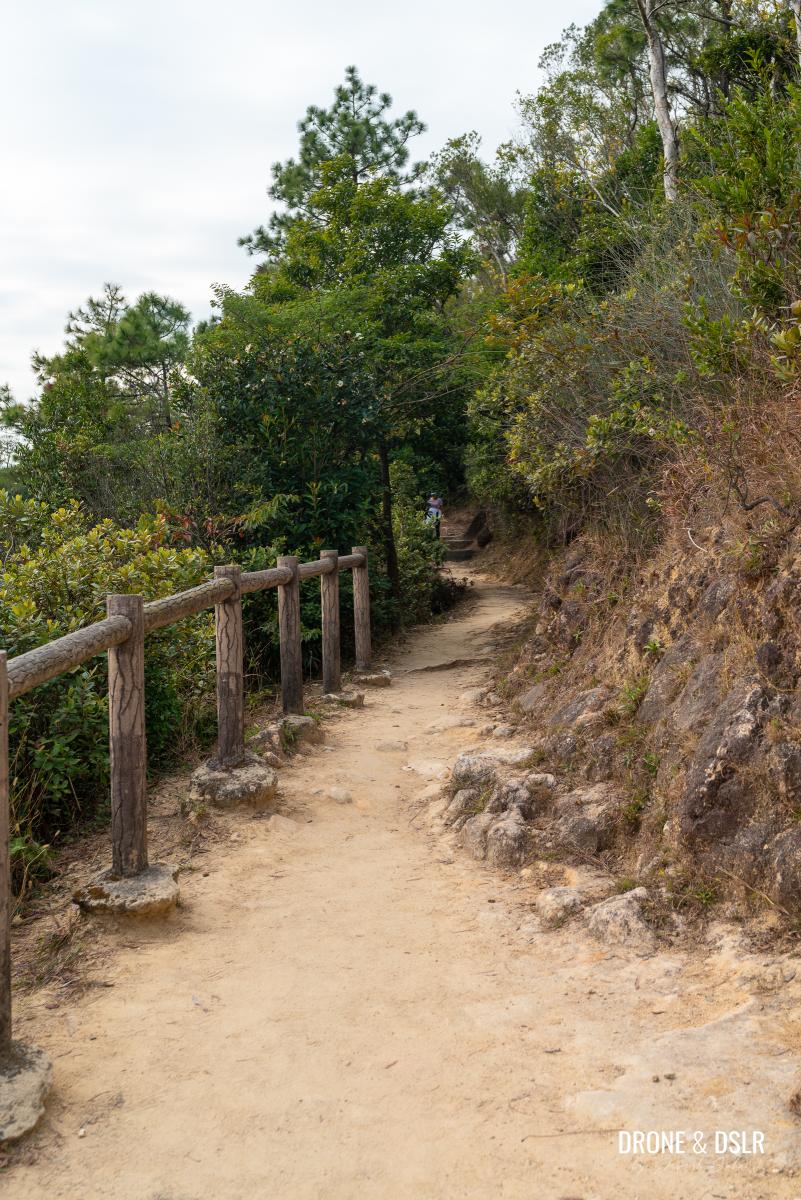
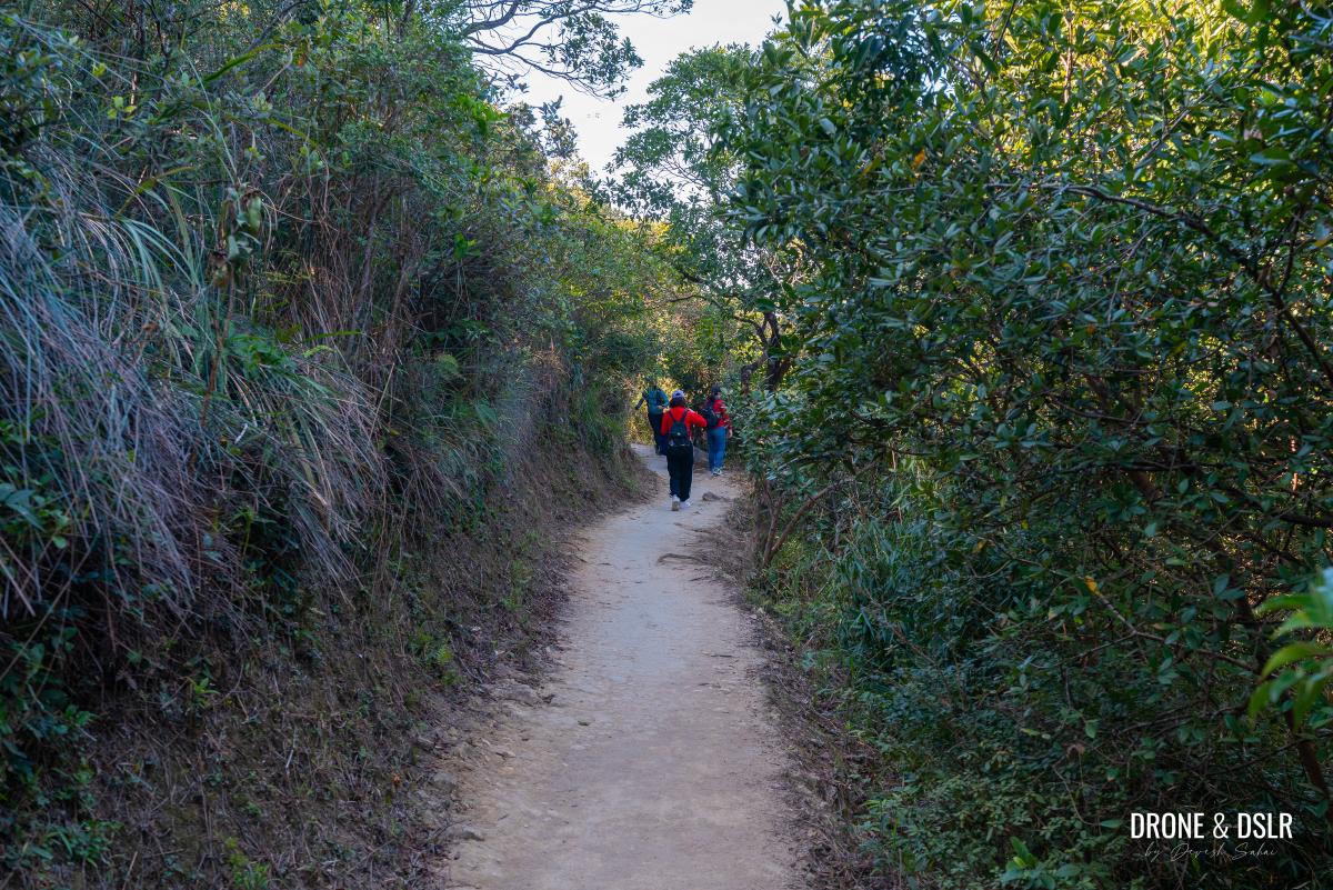
What follows next is a relatively flat and shaded section of the MacLehose Trail. There’s plenty of shade and depending on your luck, you may or may not spot monkeys on the trees.
The beautiful hiking path to Lion Rock (beware of monkeys)
Stay calm and carry on hiking. The monkeys won’t bother you if you don’t bother them. Refrain from feeding them, or eating in front of them.
Side note: In case you hadn’t noticed, this section of MacLehose Trail overlaps with the War Relics Trail (Lion Rock and Ma On Shan). Keep a lookout for interesting markers for WWII relics along the trail!

A direction slab from WWII
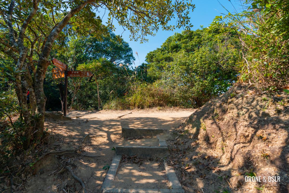
After approximately, 700 metres after the steps, you’ll arrive at Sze Tsz Au, the gap where the steps from Fung Wong Fresh Water Service Reservoir meet the Maclehose Trail.
Sze Tsz Au to Garter Pass
Whether you arrived at Sze Tsz Au via the shortcut or MacLehose Trail, the next 500 metres is an easy walk to Garter Pass.
MacLehose Section Trail Section 5 continues after Sze Tsz Au
MacLehose Trail continues to meander through Lion Rock Country Park, remaining more or less flat. During this section, you can continue to admire the gorgeous views of Shatin and the way to Plover Cove Reservoir on a clear day.

Views of Shatin and beyond
The War Relics Trail (Lion Rock and Ma On Shan) also continues and there are a few more fascinating relics on this side of Sze Tsz Au, such as a pillbox (with a viewing deck built onto of it) and more direction markers.
-
- One of the more fascinating relics along the way – a pillbox

-
- A lookout point built above the pillbox

-
- This section of the hike overlaps with the War Relics Trail (Lion Rock and Ma On Shan). Expect to see such markers along the way

Take your time to read about these relics, and if they pique your interest, I highly recommend the Shing Mun War Relics Trail or the Wong Nai Ching Gap Trail.
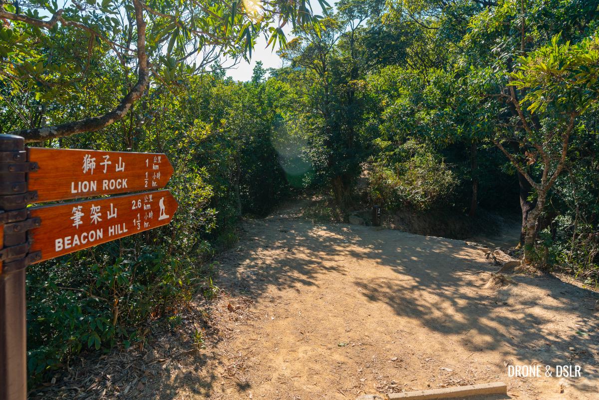
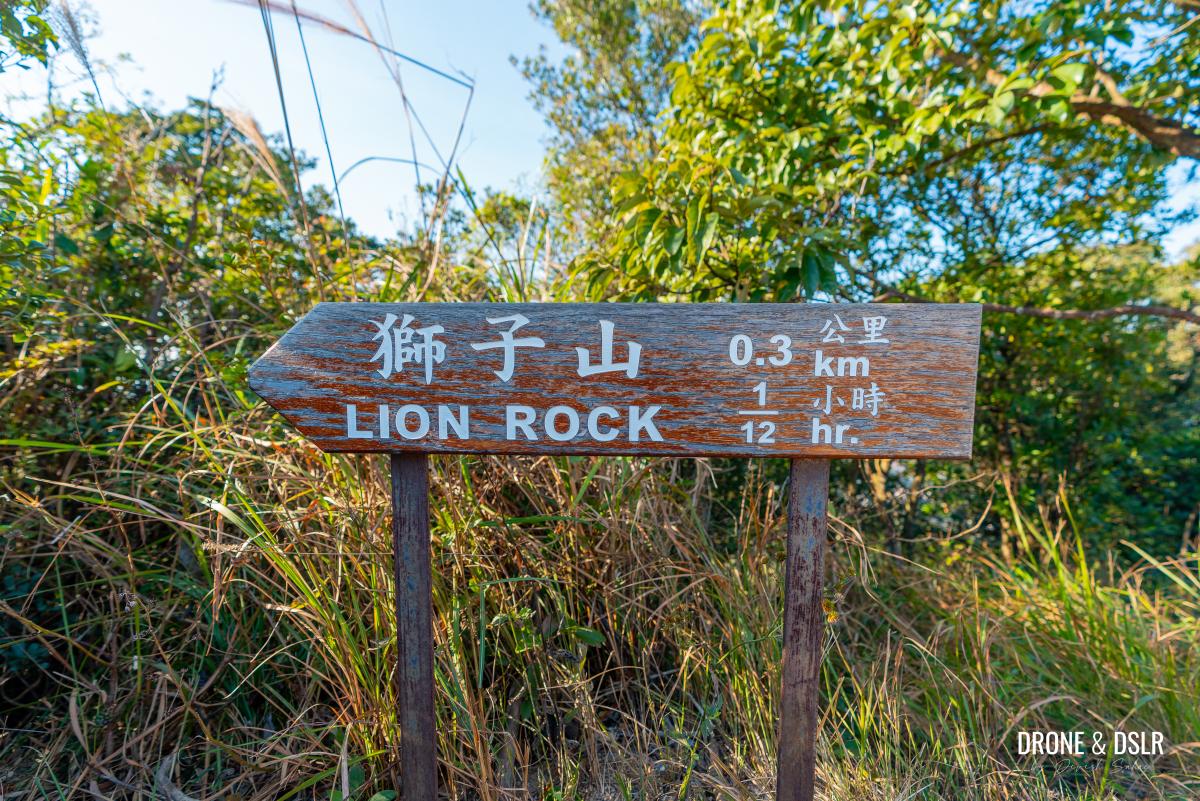
Stay on this trail till you reach Garter Pass, where you’ll notice a flight of steps with signs for Lion Rock Peak.
Almost at Garter Pass
Take a break here if you need to before you begin the final ascent to Lion Rock Peak.
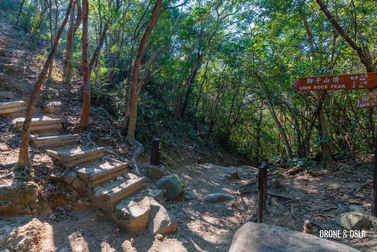
At Garter Pass, turn left and follow the signs for Lion Rock Peak
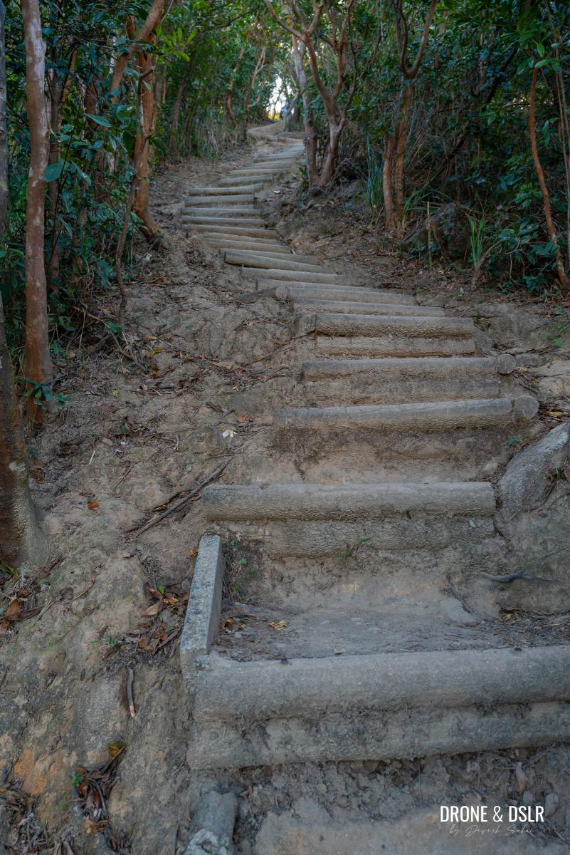
The Challenging 500 m Ascent to Lion Rock
From Garter Pass, Lion Rock Peak is only 500 metres away. But unfortunately, the first 300 metres of the final ascent consists of very steep steps. This section is fiendishly challenging, and you must summon your own “Lion Rock Spirit” to conquer it!
The final 500 metres is no easy walk
There is no need to rush yourself. Go slow, take it easy, and climb at a pace that you’re comfortable with.
The final ascent can be very challenging for some. Go easy!
At the halfway point, there is a giant boulder. It’s worth taking a break here (quite literally on the boulder) to catch your breath and enjoy the views of Shatin.
Continue to push yourself for another 150 odd metres till you finally see the end!
Huffing and puffing your way to Lion Rock Peak
When you emerge from the steps, you’ll be greeted by some of the most spectacular views of Hong Kong right in front of you! Congratulations, you made it to Lion Rock!
-
- It feels good to see the end
-
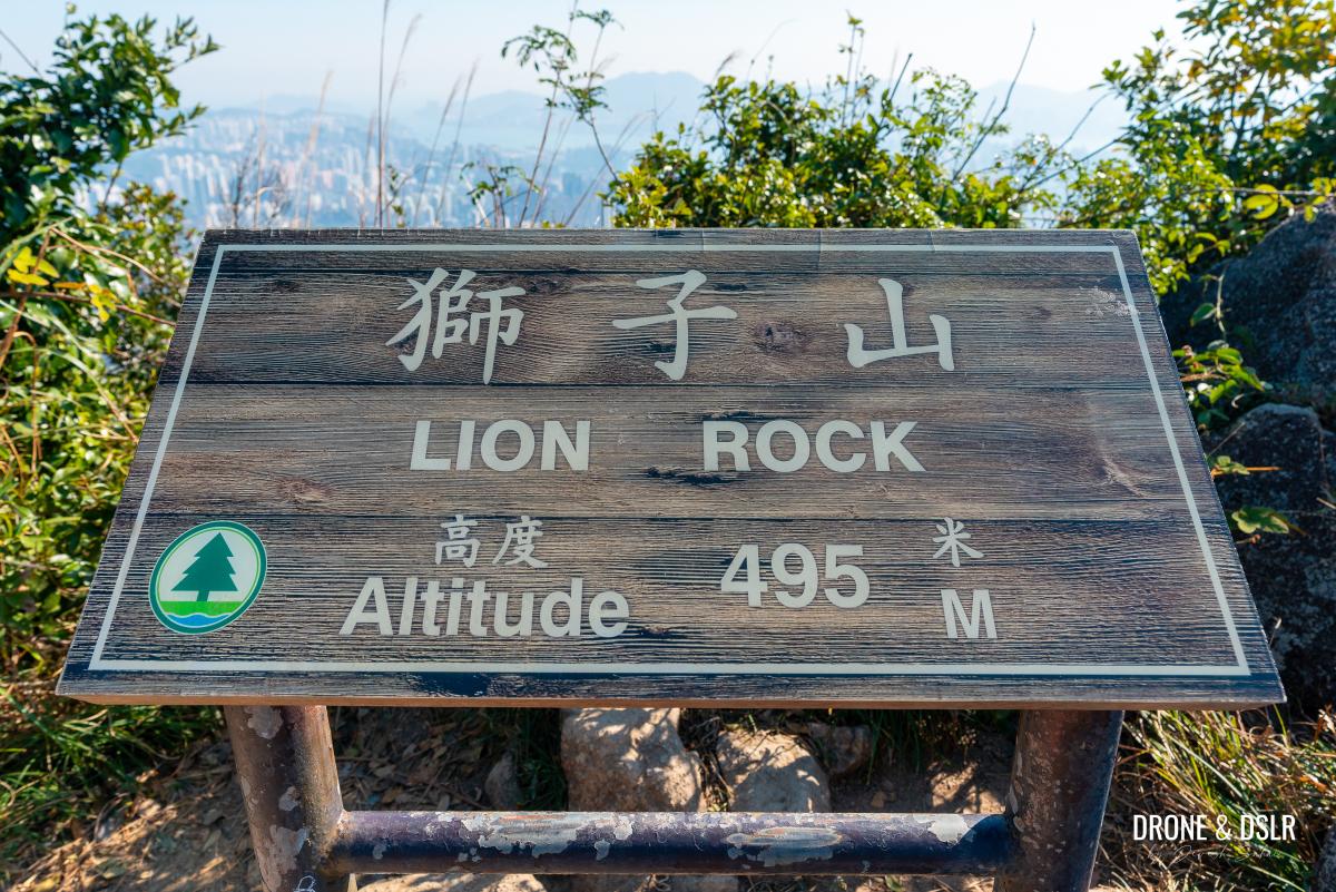
- Welcome to Lion Rock, 495 metres above sea level
But the hike doesn’t end here.
To Lion Rock Head
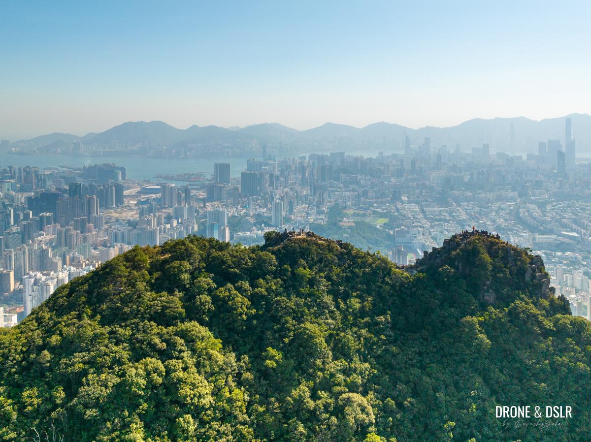
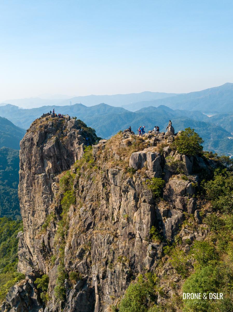
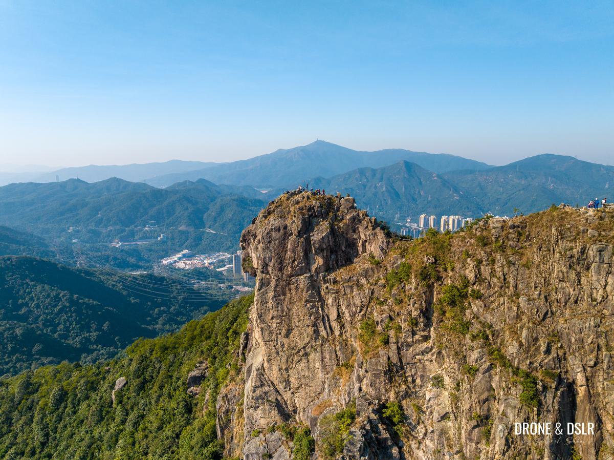
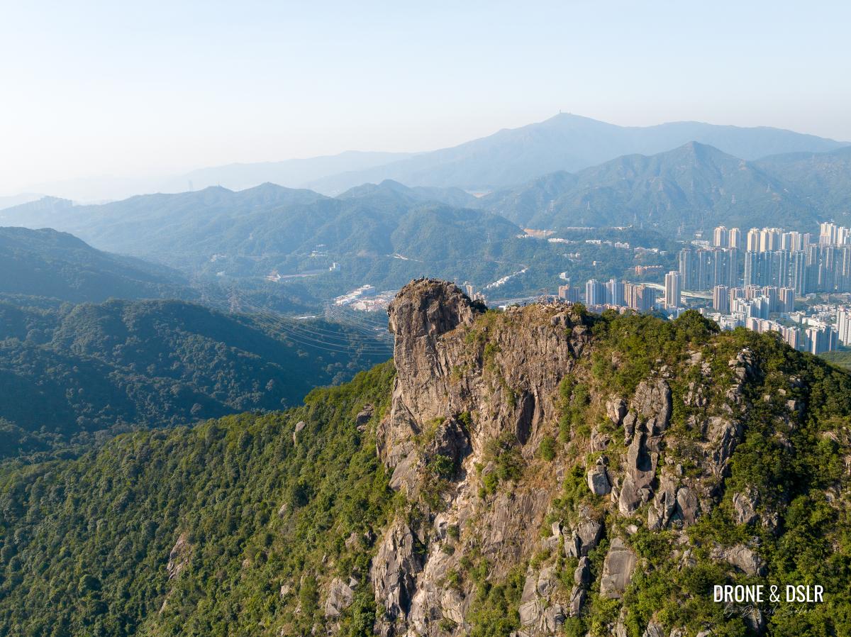
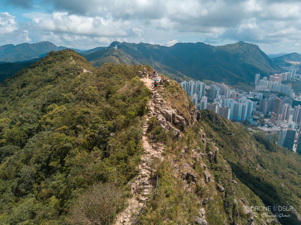
From my perspective, there are three sections on Lion Rock – the tail, the body, and the head. The steps emerge at the tail of the lion. Standing here, you can see the Lion Rock Head at the other end, separated by the body.
Lion Rock overlooking Hong Kong
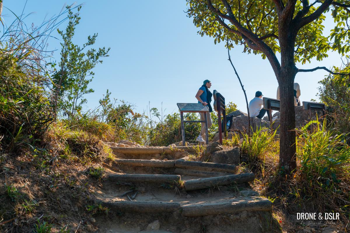
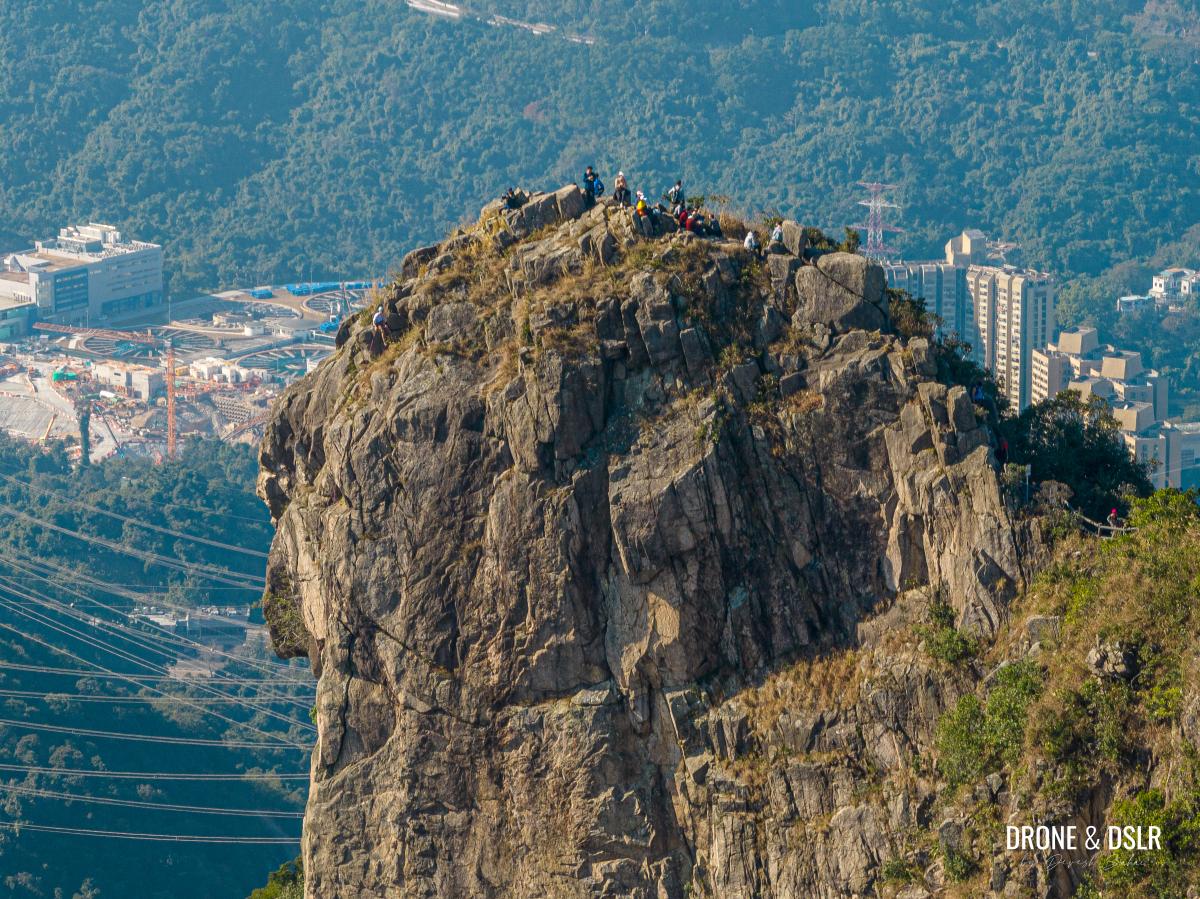
If you want to reach the end of the lion, i.e. Lion Rock Head, it’s short excursion to get there from the tail.
-
- Lion Rock Head is another 300-metre walk from where the steps end
-
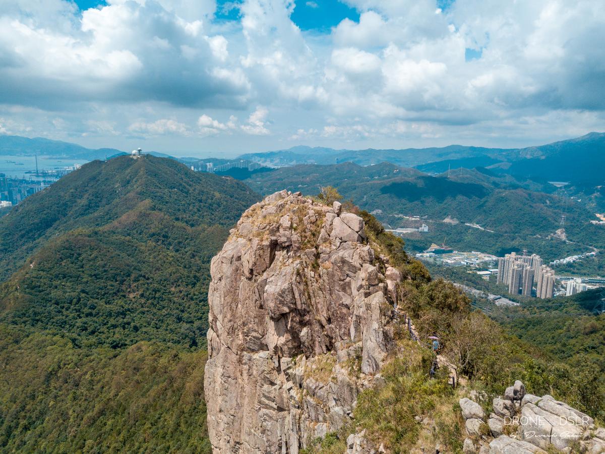
- A close-up of Lion Rock Head
I suggest taking your time to explore the summit of this iconic peak as you walk along the trail at the top.
-
- Hikers enjoying the views from on top of Lion Rock
-
- The trail on top of Lion Rock
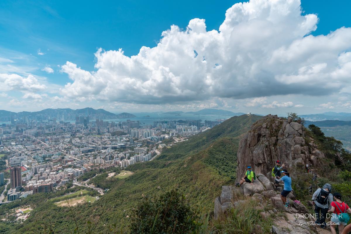
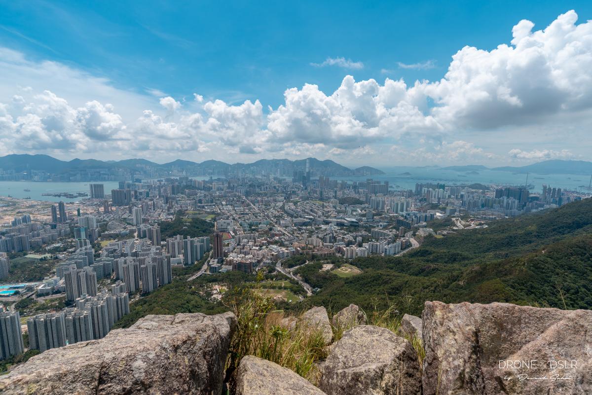
Views From Lion Rock Peak
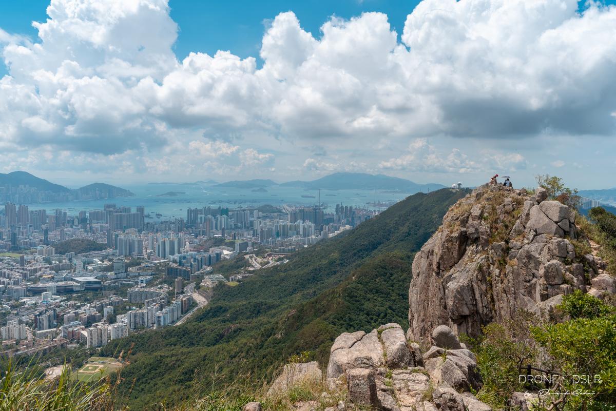
Needless to say, the views from Lion Rock Peak of Hong Kong are phenomenal! Just check out the photos of the views from on top of Lion Rock. I don’t think words are needed.

Survey the city below you as you stand on top of Lion Rock
-
- Your first glimpse of Lion Rock Peak as you emerge from the final 500 metres

-
- The perfect photo-op on top of Lion Rock
-
- The lion’s head – the most iconic peak in Hong Kong!
-
- The short dip between the two peaks – Lion Rock, Hong Kong
-
- The lion overlooks the city
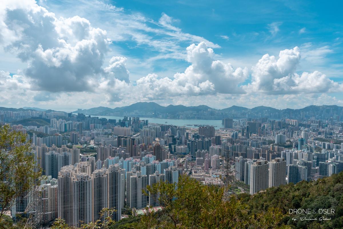
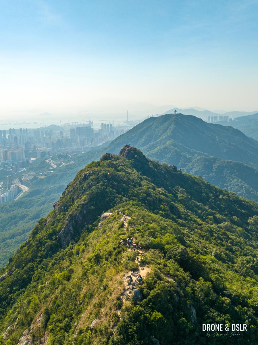
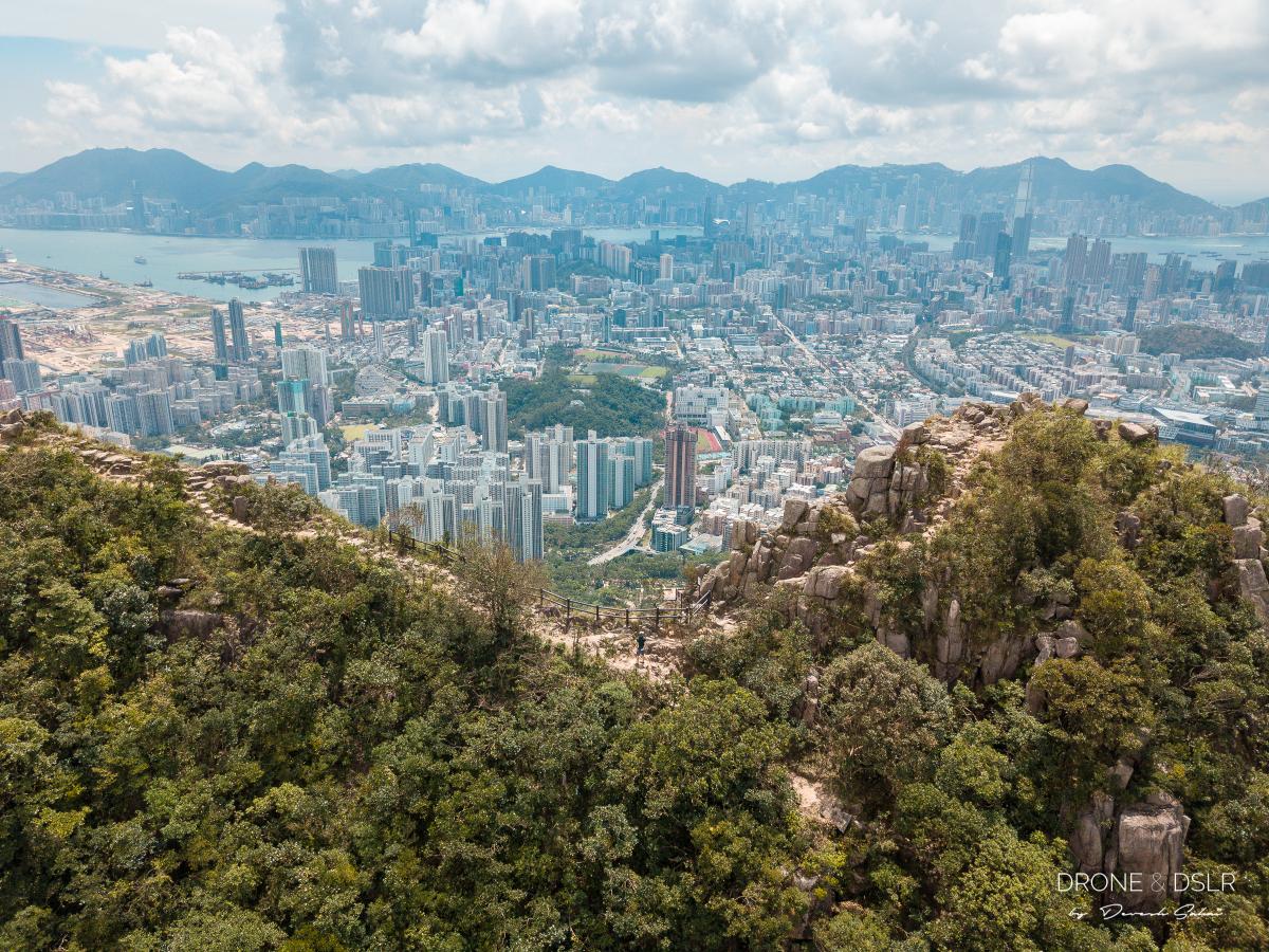
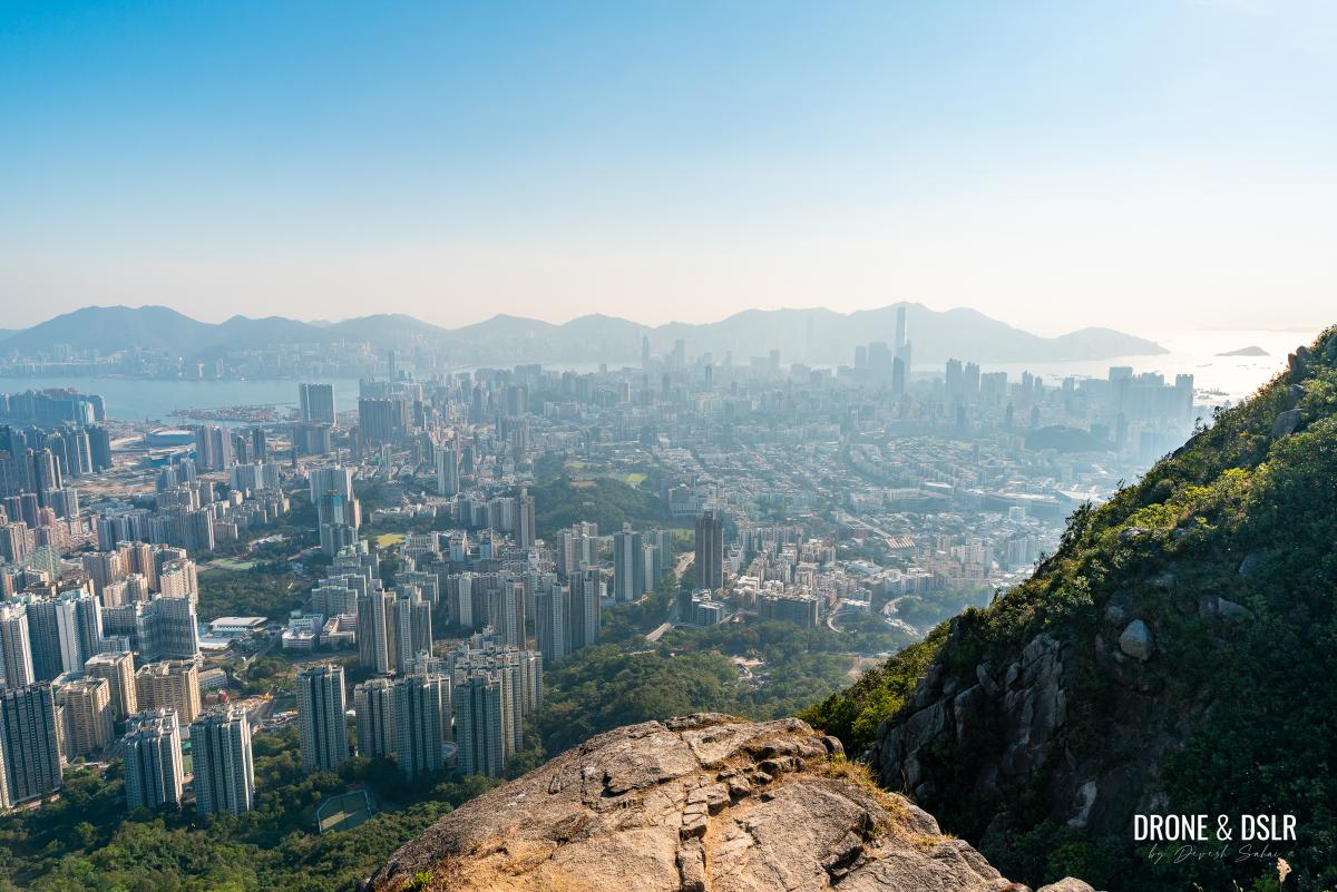
The peak lies on a ridge that separates Kowloon from the New Territories. So, on a clear day, you can see Kowloon and Hong Kong Island on one side. The panoramic view stretches from Kowloon Peak to Beacon Hill and beyond on the other side!
Views of east Kowloon from Lion Rock
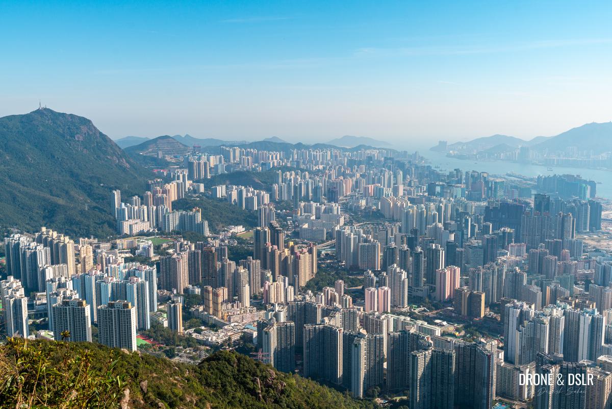
Behind Lion Rock, the most obvious peak that towers above everything else is Tai Mo Shan. One can also admire the New Territories – Shatin, Ma On Shan, Plover Cove. And the other hills too, such as Needle Hill, Grassy Hill, and all the way to the Eight Immortals (Pat Sin Leng).
Panoramic views of what lies behind Lion Rock Peak
Lion Rock offers hikes some of the best panoramic views of Hong Kong. No wonder it’s a must-do hike for anyone in Hong Kong!
-
- Looking over the shoulder of Lion Rock Peak, Hong Kong

-
- A symbol of pride in Hong Kong
-
- The ridge on the Lion Rock Peak
-
- The Lion Rock Head, Hong Kong
-
- Lion Rock, Hong Kong
-
- The view from Lion Rock. Isn’t this what you came for?
There are also numerous spots on the summit to get a good picture of yours with the city in the background. Feel free to walk around and explore the various points. Each offers a different perspective in my opinion.
-
- There are plenty of photogenic spots across Lion Rock

-
- The views of the city from Lion Rock
End The Hike
Once you’re done soaking in all the views from Lion Rock, it’s time to head back down. As mentioned earlier, I recommend taking the steps to Fung Wong Fresh Water Service Reservoir from Sze Tsz Au.
Just keep an eye out for the signpost for Shatin Pass Estate on your way back (Click here to open the trail in Google Maps).

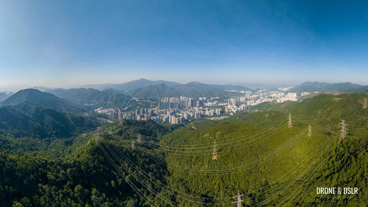
Panoramic view of Lion Rock in between Kowloon (on the right) and Sha Tin (on the left)
This trail will bring you out just behind the Fat Jong Temple, near the Shatin Pass Pump House. From here you can walk down to Wong Tai Sin MTR station, or take the green minibus 18M from Shatin Pass Estate back to the station.
However, many also choose to continue to Beacon Hill or Temple Hill from Lion Rock.
Best Time For The Hike
The Lion Rock Hike is best enjoyed on a clear day, before midday or in the evening.
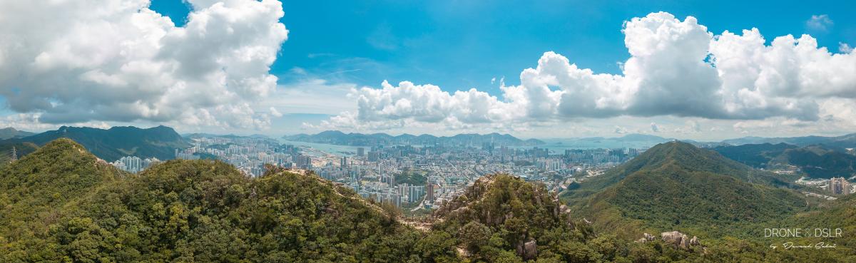
Panoramic view of Lion Rock Peak seen from the New Territories side
If you decide to hike in the morning, I would advise you to start early and complete the trail before noon. Or you can start in the afternoon, and complete it by early evening (before sundown).
A vast portion of the hike lacks shade, including the peak. On a clear, hot day the sun can be very unforgiving on Lion Rock Peak. Again, remember to carry sufficient sun protection.
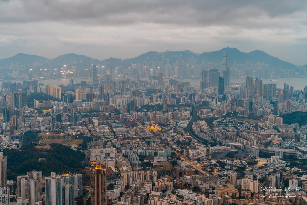
Lion Rock Night Hike
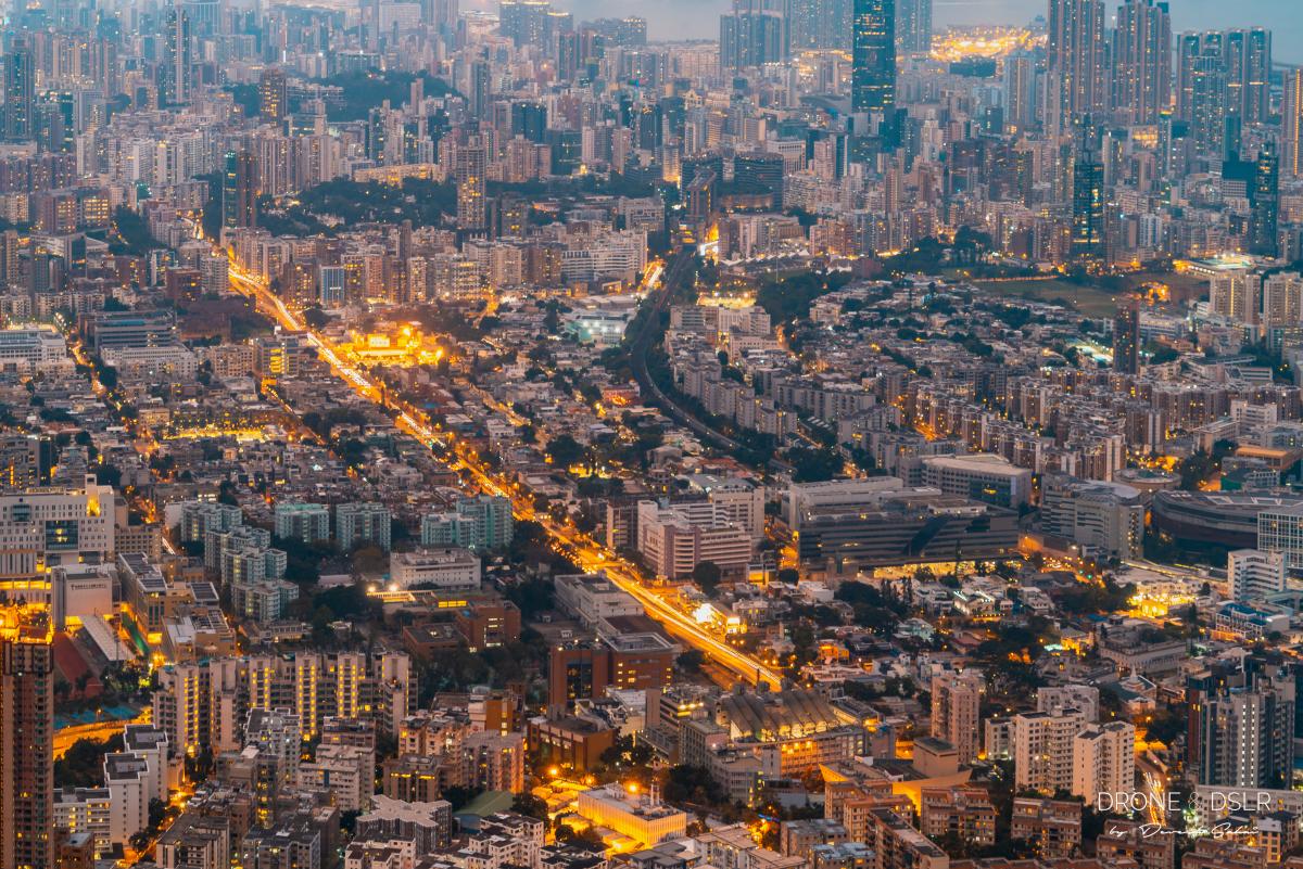
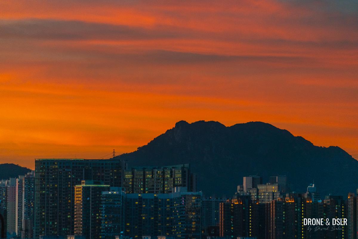
The hike is equally popular as a night activity. The views of the city at night from Lion Rock are equally spectacular, except that you get to see the city lights! You can stand there and watch the lights come on and illuminate the world beneath you in spectacular fashion.
-
- View of Hong Kong from the Lion Rock at dusk
-
- View of Hong Kong from Lion Rock at dusk

-
- View of Kowloon Tong at night
-
- View from Lion Rock at night

However, I wouldn’t recommend that you attempt the night hike before you’ve conquered Lion Rock during the daytime. Once you’re comfortable with the trail and confident of your level of fitness, go for it. And most importantly, don’t forget to carry a torch.
Lion Rock – Hong Kong’s Iconic & Symbolic Peak
Completing the Lion Rock Hike feels like unlocking an achievement in Hong Kong. After all, it’s one of the most iconic hikes in the city.
The icon, the legend!
Speaking of iconic hikes, if you’re new to Hong Kong or just visiting, I would recommend Dragon’s Back as a good starter hike. But if you’re hiking for similar views of the city, I would recommend the hike to Temple Hill or Beacon Hill. They both offer equally great views, with slightly less climbing.
Lion Rock at sunset
Hope you enjoyed this guide. As always, feel free to share it on the social media channel of your choice or leave a comment below.
If you enjoy our work, come join us on Instagram and YouTube 🙂


You might also like


22 Comments
I like your pictures so much… They are beautifuls and make me excited to explore more on hong kong trails…. Your description is superb and very informative… Hope to enjoy my stay here in hong kong as much as u guys did… Kuddos👍👍👍👍
Thank you very much! You will definitely love Hong Kong!
I’m so glad I found this article! Your map and all the information are super useful. I couldn’t find the “right” way to Lion Rock on Google Maps, there are so many paths, but just by looking on them on a map it’s hard to tell which one is actually doable. I was really confused. At first I was thinking ‘why not going from Fat Jong Temple along the path that goes almost directly to the Lion Rock, since it’s the shortest one. But this doesn’t seem to be a safe way! Even the “middle” path (that you showed for the way back) looks really hard, can’t imagine how hard is the shortest one.
So thanks for sharing all tips for this hike. It looks quite difficult and tiring but the views are so worth it… Can’t wait to get on this trail! Hope to get clear views, as you did. 🙂
Thank for your feedback, Zooey. We’re glad this helped you plan your hike up Lion Rock. Just FYI, on a clear day the top of Lion Rock can be scorching! Carry plenty of water, sunscreen, and an umbrella!
Hope you get some great pics 🙂
Hi Devesh, thank you so much for the advice! I just hope there will be a clear day in November too. 🙂
I have just one question. I’ve read that on some trails there are a lot of monkeys and they can be quite mean… Are there monkeys on this trail? I’m not sure if I should be worried about them.
BTW, your website is so informative! I’ve added it to my bookmarks and now I’m getting through all of your articles about hikes and other things to do in Hong Kong. I will probably have more questions, if you don’t mind 🙂 I think I will plan my whole trip with your website! 😀
Hey Zooey,
November can be a gamble with the haze, but we can always hope for a clear day! Good thing though is that it will be much cooler.
There are plenty of monkeys on trails close to Kowloon Reservoir (Kam Shan Country Park, Lion Rock Country Park) and Shing Mun Reservoir that I’ve encountered. Personally, I don’t think they are mean. If you keep to yourself, stay calm and keep walking, they won’t bother you. They only become mean when they smell food. They’re use to people in their habitat, so unless provoked, they don’t attack.
Thanks again and yes, please feel free to reach out to us anytime for any advice on Hong Kong 😀
Hey Devesh,
Thanks for explaining everything, I will be definitely careful with the monkeys and keep my snacks in the backpack. 🙂
After you wrote there may be haze in November I read dozens of websites about the weather and smog in Hong Kong and I’ve just realized I might have chosen the wrong dates… I was looking for flights in late October/early November because of the weather, but it turns out the smog level and the wind direction may cause the haze. I’m really worried about it, because I don’t want to spend my whole trip in the city, I want to spend most of the time hiking, maybe going to some of the small islands. But hiking when the smog level is high and you can’t see any of those amazing views seems pointless 🙁 When do you usually hike (and when did you take these beautiful photos)? Which month would you say is the best for hiking? I’m beginning to think that with Hong Kong you have a choice: hot and high humidity vs. cool weather and high smog level. I’m not used to this, hence my confusion 🙂
Hey Zooey,
So that is true to an extent. The wind direction in the winter months changes and brings smog down to Hong Kong. But it’s more of an observation than a rule. There can be plenty of clear winter days. In fact, we’ve just had two days of very high pollution and haze mid-summer.
I usually go hiking during the summer months for the views. It’s not ideal, but early morning or late evenings are usually more pleasant.
Don’t worry, November is a good time to visit. Hopefully the skies are clear and you get to enjoy being outdoors when it’s not unbearably hot and humid 🙂
Oh.. I get it now 🙂
I’m wondering – is the smog visible in the whole area? I mean, if there is a haze in the city, is it also in the north part, in Sai Kung Country Parks or in the south part like in Shek O, or on other islands like Lamma Island? I’m just wondering if you can escape from it! 😀
BTW, is it “unbearably hot and humid” in late May/early June already? 🙂
In my experience the smog is visible everywhere. I guess it just becomes more apparent the further you look into the horizon.
Personally, I hate humidity. I can handle the heat, but the humidity gets to me. Fortunately this year the heat and humidity only kicked-in in June and has continued into July.
Hey Devesh,
Thank you a lot for taking the time to share all this useful information. I think I will stick to my plan for visiting Hong Kong in late October/early November but maybe for one week instead of two, and come back for another week in late Spring next year. Hopefully this will allow me to enjoy Hong Kong even more 🙂
Thank you again, another great hike today using your guide. Quite a challenge but well worth it! Cheers. 🙂
Thanks, Jason!
Thank you for your clear directions.
The last 500m was a bit steep, but entirely do-able. We targeted a night walk: we reached the peak about 15 min before the sunset and left about 30 min after sunset. We walked down to the Reunification Pavilion and then to Lion Rock Park.
You’re welcome! With the heat these days, a night hike to Lion Rock is actually a good idea.
Thank you Devesh 🙂 did Lion Rock hike today , I loved it although weather was bit cloudy and rainy but enjoyed the journey 🙂
You’re welcome, Aniruddha! Hope you got some good views from the top!
Just wanted to share:
From the Reunification Pavilion, walking down to Lion Rock Park has been the best exit for us. From the park, it is just a few minutes walk to Ma Chai Hang Recreation Ground bus stop to take Bus 103 to Causeway Bay, Wanchai, Admiralty or Central. Whenever we have trekked to Lion Rock, this has been our best exit route back to HK island.
I find your website really useful, keep up the good work.
I did this lion rock hike recently. You have given several warnings about the steep incline from the MTR station to the temple, then the challenging climb to the top etc. We were mentally prepared and actually found it wasn’t too difficult, until we got to the peak, when we thought the toughest bit was behind us. However, the short “walk” from the peak to the lion head was a bit terrifying for me, and at one point I needed to descent to a rock surface and I wasn’t sure if I should proceed as it looked like the edge of the cliff (sort of anyway!) and I couldn’t see the path in front of me. Luckily I plucked up courage to do so and it was actually not too dangerous but you need to be careful nevertheless! I would say exercise caution while you are up there and don’t get carried away with selfies!
Thank you very much, Mel!
I agree with you. I think when I did the hike, I wasn’t mentally prepared to walk up an incline right at the beginning.
Oh yes, I know what you’re talking about. That does feel a bit tricky, getting onto the Lion Head.
But I’m glad you were able to get to the top of one of the most iconic hills in Hong Kong 🙂
Thanks for this guide, Devesh.
After earning my living with paper maps for some 50 years, I’m never happy going off piste without one.
But your words and pictures guided us along this trail quite confidently. Your advice and assessment of the trail was spot on. Actually, getting out of Wong Tai Sin MTR proved to be the only bit where we went wrong!
Next up, we hope to find time for the Dragon Back trail before we fly home. Thanks again!
Hi David,
I really appreciate your feedback and am delighted to hear that my guide proved handy! Hope you get time to complete the Dragon’s Back too before the rain this weekend.