
The Beacon Hill Hike has some of the most gorgeous and unique views of Kowloon and Hong Kong. This trail is a hidden gem, in my opinion, and doesn’t get as many hikers as some other neighbouring peaks, such as Lion Rock. The hike is relatively easy with minimal climbing.
Check out some views from the hike, and you’ll understand why I think this hike has some of the best views of the city’s skyline.
-

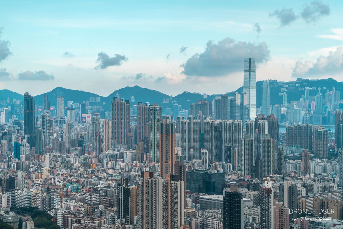
- From one jungle to another – Hong Kong from Eagle’s Nest Nature Trail to Beacon Hill
-
- Hong Kong’s skyline from Eagle’s Nest Nature Trail
-
- Kai Tak and East Kowloon seen from Beacon Hill Lookout
The best way to hike up Beacon Hill, in my opinion, is via Eagle’s Nest Nature Trail. The vantage points on this trail overlook the densely populated areas of Sham Shui Po and Mong Kok, and Kai Tak, Hong Kong’s old airport.
Beacon Hill Hike Map
Technically, the Beacon Hike is about 4.5 km. However, as I explain below, we took the longer route to finish the hike which extended the distance to almost 6 km.
Click to open in Google Maps
The hike honestly is only difficult in a few sections. Most of it is either flat or on a gradual incline.
Now that you have all the details, let’s get started.
Starting Point
The Eagle’s Nest Nature Trail is the starting point for this hike. The start of the trail can be accessed from the Shek Lei Pui Reservoir bus stop on Tai Po Road.
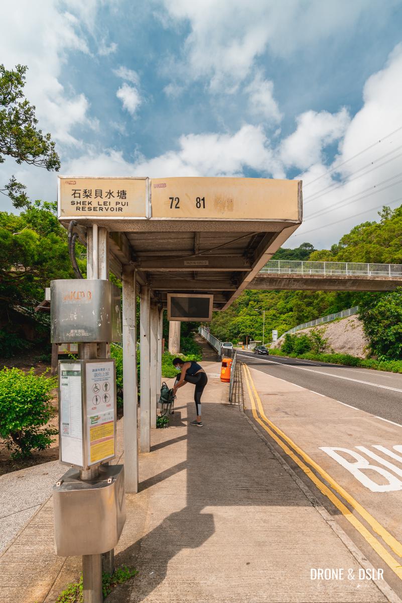
Shek Lei Pui Reservoir bus stop
To get to the starting point take either bus 72 or 81 to Shek Lei Pui Reservoir bus stop and locate the entrance for Lion Rock Country Park and Eagle’s Nest Country Trail. If you’re coming from the Kowloon side, you will need to cross the road.
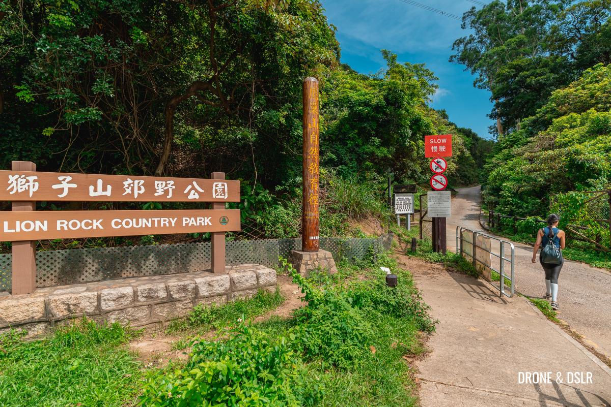
Enter Lion Rock Country Park
Walk past the entrance to Lion Rock Country Park for about 150 metres till you see the entrance for Eagle’s Nest Country Trail. This is the starting point for the hike.
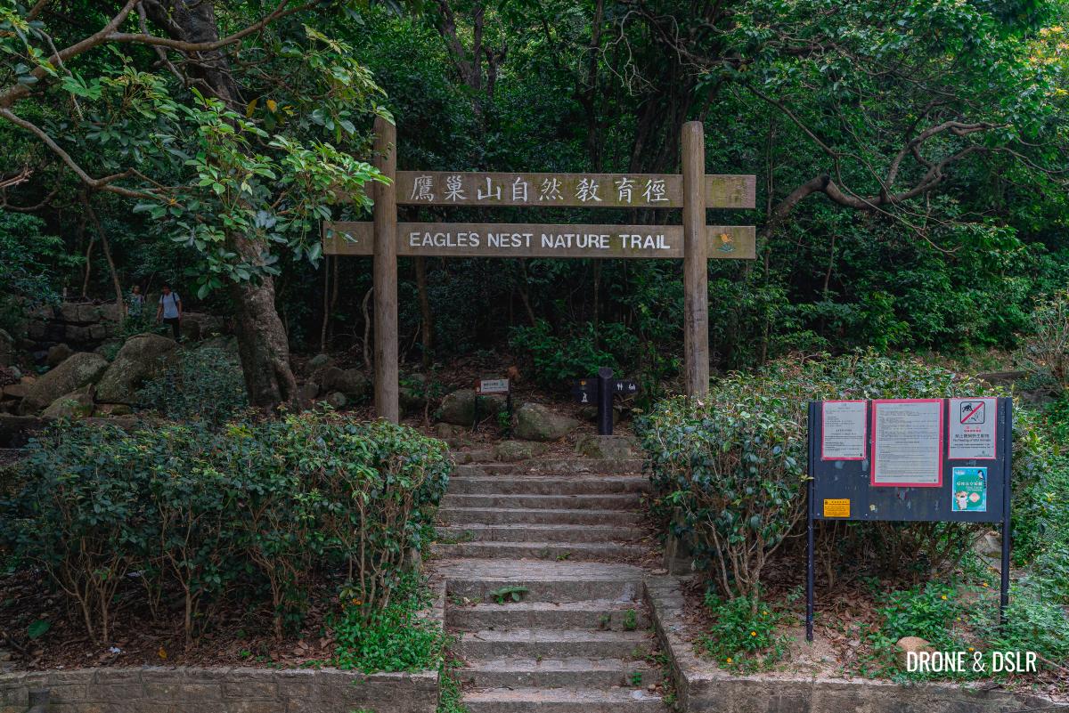
The entrance to Eagle’s Nest Country Trail
Eagle’s Nest Nature Trail
The Eagle’s Nest Nature Trail is a 3.5 km loop at the base of Eagle’s Nest Hill. However, to get to Beacon Hill you’ll only need to cover a part of the trail before breaking away onto Maclehose Trail Section 5. If you’re interested in learning more about the trail, be sure to read our guide to the Eagle’s Nest Nature Trail.
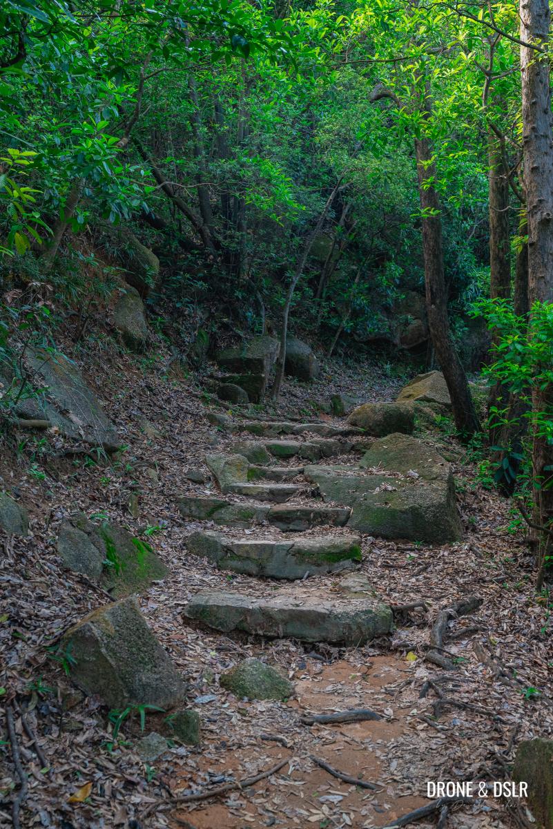
As you enter the Eagle’s Nest Nature Trail, turn right. Walk past the barbecue picnic area and continue down the trail. The hike at this point is straightforward.
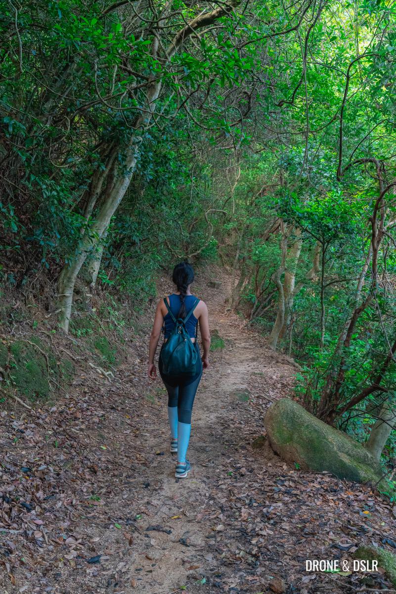
Keep walking down Eagle’s Nest Nature Trail
Although most of the trail is covered with trees, there are a few spots with stunning views overlooking Hong Kong. My favourite of course is the Kowloon Peninsula lookout point.
-
- Where the trees clear up to give you this view on Eagle’s Nest Nature Trail, Hong Kong

-
- The view in entirety from Eagle’s Nest Nature Trail Viewing Point
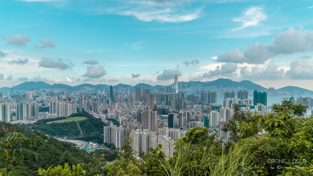
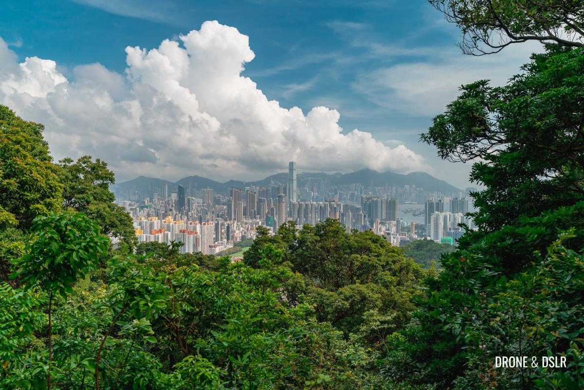
On a clear day, you can see right across Kowloon, and up to the hills on Hong Kong Island. You can see the dense low rises of Sham Shui Po, contrasting with the ICC and the other high rises on Kowloon West.
Approximately, 100 metres ahead of the Kowloon Peninsula lookout point is another lookout point with similar views. But unlike the previous lookout point, it’s more open.
-
- Appreciating the views from the lookout point on Eagle’s Nest Country Trail
-
- Picture perfect Hong Kong

-
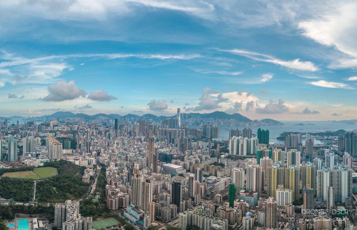
- An aerial panorama from Eagle’s Nest Nature Trail Viewing Point, Hong Kong
Take your time, enjoy the views! And if you came here just for the views and don’t want to hike any further, that’s also an option.
To the Pavilion
From the lookout points, continue walking down Eagle’s Nest Nature Trail for another kilometre or so. The trail at this point begins a slight uphill incline, that’s barely noticeable.
The trail begins its moderate incline after the second lookout point
Although the views of Kowloon slowly begin to disappear, Beacon Hill starts to become visible from this point on. Beacon Hill is easily recognizable from a distance thanks to the radar station on top of its summit.

The top of Beacon Hill as seen from Eagle’s Nest Nature Trail
Continue on the trail till you finally reach the pavilion.
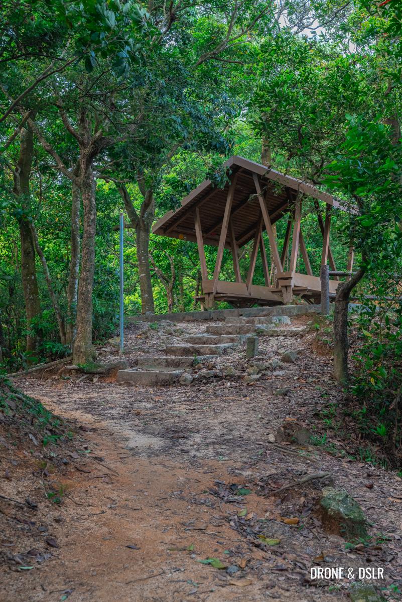
The pavilion on Eagle’s Nest Country Trail
The pavilion sits at the junction of Eagle’s Nest Nature Trail and Maclehose Trail Section 5. I recommend taking a break and enjoying the views of Hong Kong from the pavilion. Because after the pavilion, the real hike begins!
Views of Hong Kong from the pavilion
To the Beacon Hill Radar Station
From the pavilion, take the path with the steps going uphill. At this point, you leave Eagle’s Nest Nature Trail and continue the remaining hike on Maclehose Trail Section 5.
After about 150 metres, the steps will emerge onto Lung Yan Road. Cross the road and continue walking up the steps on the other side.
This next section of the steps is the most gruelling part of the entire hike. My advice is to take it slow and climb up at a comfortable pace.
After 300 metres, the trail will once again emerge on Lung Yan Road, which takes a longer, circuitous route uphill.
Once again, cross Lung Yan Road and continue on Maclehose Trail Section 5. Fortunately, the trail is not as steep at this stage. After about 400 metres, you’ll pass by the Beacon Hill Airport Secondary Surveillance Radar Station. Continue walking on Maclehose Trail Section 5 till you reach Lung Yan Road again.
This time, exit onto Lung Yan Road till you reach the main radar station on Beacon Hill.
Subscribe to my YouTube channel
Unfortunately, I don’t have pictures of the above section of the hike, but you can watch the video to get a better idea of what to expect.
To the Beacon Hill Viewing Point
Although the radar station sits on the top of Beacon Hill, it’s surrounded by trees and there aren’t any good vantage points. If you’re looking for city views, you need to head to the Beacon Hill Viewing Point.
From the radar station, locate Maclehose Trail Section 5 and continue on it as it begins its journey downhill. The views of Kowloon will slowly start emerging on this section of the trail as will Lion Rock right in front.
Follow the trail towards the Beacon Hill Viewing Point
Simply continue for about 380 metres till you finally reach the Beacon Hill Viewing Point.
-
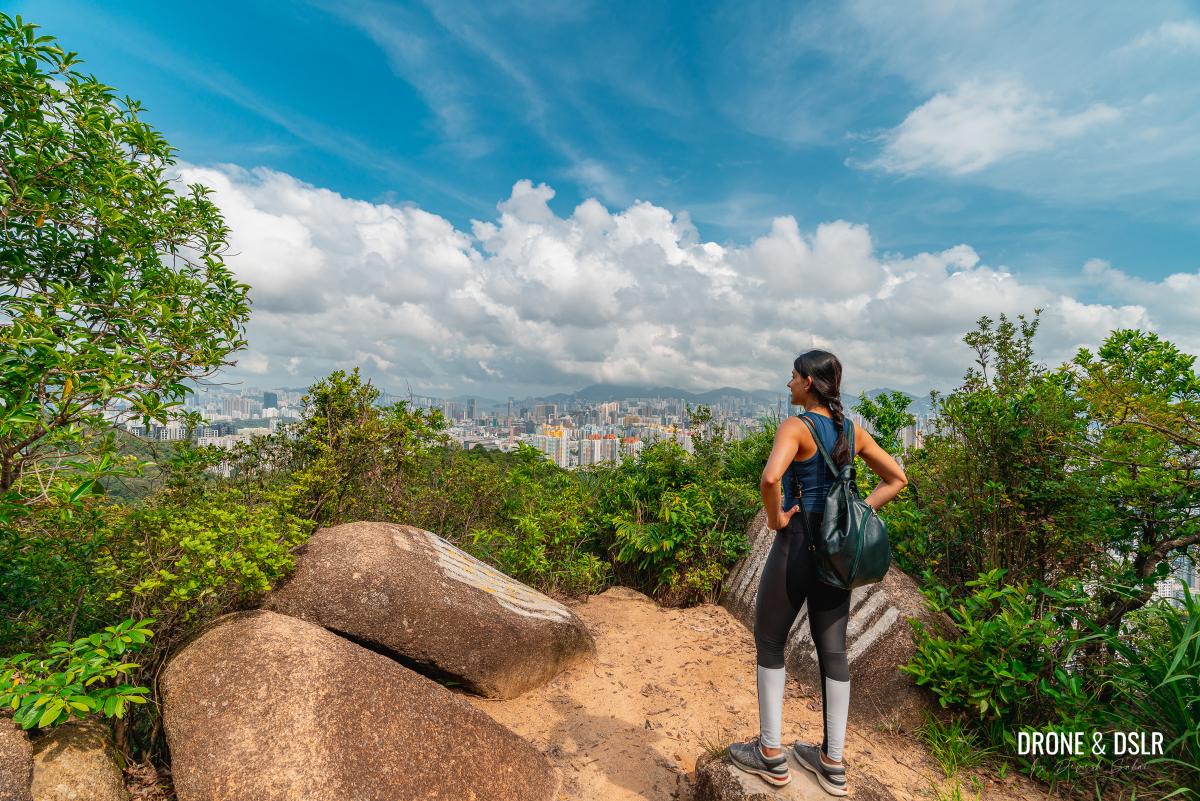
- Neha admires the view from Beacon Hill Lookout
-
- Kowloon City Aerial Photo – seen from Beacon Hill
-
- ICC can be seen from Beacon Hill Lookout
From here you get views over Kowloon Tong, Checkboard Hill, and Kai Tak, Hong Kong’s old airport. Just imagine the views from Beacon Hill when Kai Tak was operational!
Kai Tak, Hong Kong’s former airport – seen from Beacon Hill
And to the left, you’ll be able to admire Lion Rock. If you pay close attention, you should be able to see people on top of Lion Rock Head.
Look at the people on top of Lion Rock
Finish the Hike
There are a couple of options to end the hike.
The short route is to continue walking ahead on Maclehose Trail Section 5 for another 150 metres till it reaches Railway Pass. From the pass, turn right and follow the trail down to Lung Cheung Road. The descent from this option should be about 1 km.
Quick disclaimer here, when we did the Beacon Hill Hike, we didn’t take this route as it was getting dark and wanted to play it safe.
Lion Rock Head and the valley below
So, we ended up tracing our steps back all the way to the first point where Maclehose Trail Section 5 intersects Lung Yan Road (just above the pavilion from Eagle’s Nest Nature Trail). And from there, we simply walked down Lung Yan Road till it reached Lung Cheung Road. This was a much longer route to end the hike, but because there was no light, we felt safer walking down a paved vehicular road.
The descent from this option is about 2.5 km.
Final Words
The view from Beacon Hill is one of my favourites in Hong Kong. And unlike the neighbouring Lion Rock, Beacon Hill doesn’t get as many hikers. That means you get the views all to yourself!
If you’re looking for views of Hong Kong’s dense urban jungle from a new vantage point, I highly recommend Beacon Hill Hike.
As always, feel free to share this post on the social media channel of your choice or drop us a message below.
If you enjoy our work, come join us on Instagram and YouTube 🙂


You might also like


5 Comments
How difficult is the trail from Beacon Hill to Lion Rock, in comparison to the trail from Fat Jong Temple? It looks like a lot of stairs going up and down all the way up to Lion Rock. But I’m wondering if it would be more convenient to reach both peaks on one hike 🙂
It’s definitely possible, but very long and quite difficult. You’ll essentially be scaling two hills. I’d say it all depends on how comfortable you’re hiking and your level of fitness.
Thank you, Devesh, for the answer. After all, I think I will probably skip this hill during the first visit, as I may not have enough time. There is so much to do in Hong Kong and there are so many beautiful trails and hikes, it’s hard to decide which one do first 🙂 But I think I will go to the Lion Rock and do the Dragon’s Back hike first, with your awesome maps and tips. 🙂
Good choice, the two most popular hikes in Hong Kong 🙂
Thank you for the great directions.
As we walked into the Eagle’s Nest nature walk at the beginning, the indication arrow asked me to go left. It was only thanks to your blog that we went right and could get all the marvelous views of Kowloon peninsula.
One little interesting thing: About 50 feet before reaching the Beacon Hill TV station, we found a little opening on the right that led to some rocks on which we could sit and eat as we enjoyed the incredible views. Just next to that, on a completely flat ground, some people had pitched a tent and had perhaps spend the night there. Never seen a better place to camp!
After the Beacon Hill viewing point, we continued straight, reached the Reunification Pavilion and walked down to Lion Rock Park. From there, it was just a few minutes walk to Ma Chai Hang Recreation Ground bus stop to take Bus 103 to Causeway Bay, Wanchai, Admiralty or Central. Whenever we have trekked to Lion Rock, this has been our best exit route back to HK island.