
The Ma Dai Stream Hike, also known as the Tai Shui Hang Waterfall Hike, is a popular summer trail that follows the Ma Dai Stream upstream in Tai Shui Hang.
Located within Ma On Shan Country Park, the stream begins near Pyramid Hill and flows into the Shing Mun River, eventually reaching Tolo Harbour.
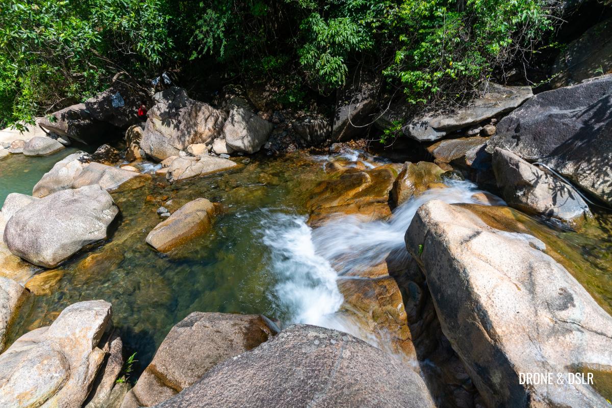
Known for its numerous waterfalls and countless freshwater pools formed among large boulders, the stream is buzzing with folk who come to relax on the boulders and enjoy the water, especially during Hong Kong’s scorching summers.
Multiple waterfalls and fresh water pools for you to cool off in the summer
About the Ma Dai Stream Hike
Broadly speaking, there are two main ways to hike upstream along the Ma Dai Stream: via the service road or along the riverbed. Depending on your goal, I like to think of it as a choose-your-own-adventure hike.
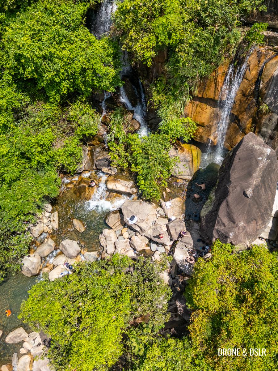
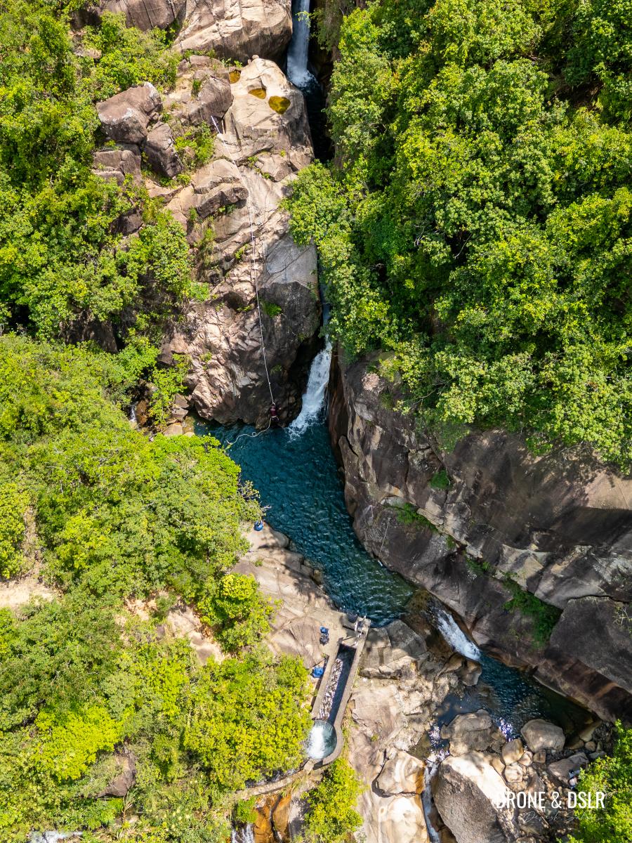
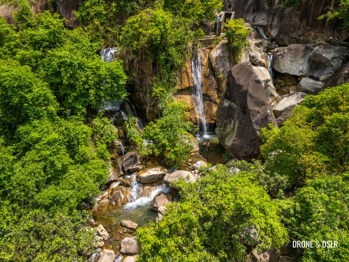
In this guide, I will outline three possible routes for you to follow, two primary routes (the service road and the riverbed) and a third hybrid option. All three routes end at “Hero Falls” (英雄瀑), the most popular waterfall and swimming spot on the Ma Dai Stream.
Hero Falls at Ma Dai Stream
Note: We took the hybrid option (Option 2 in this guide). Option 1 is much shorter, and quicker. And conversely, Option 3 is the longest and most challenging.
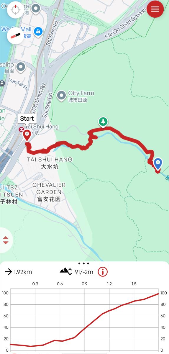
Ma Dai Stream Hike Map
However, the most important thing to remember is that you don’t have to reach Hero Falls if you’re not comfortable. Feel free to go till whatever point you’re comfortable. In fact, I find the area just below Hero Falls, with its two large waterfalls, numerous rapids, and swimming-friendly pools, actually more scenic and enjoyable.
But why hike upstream?
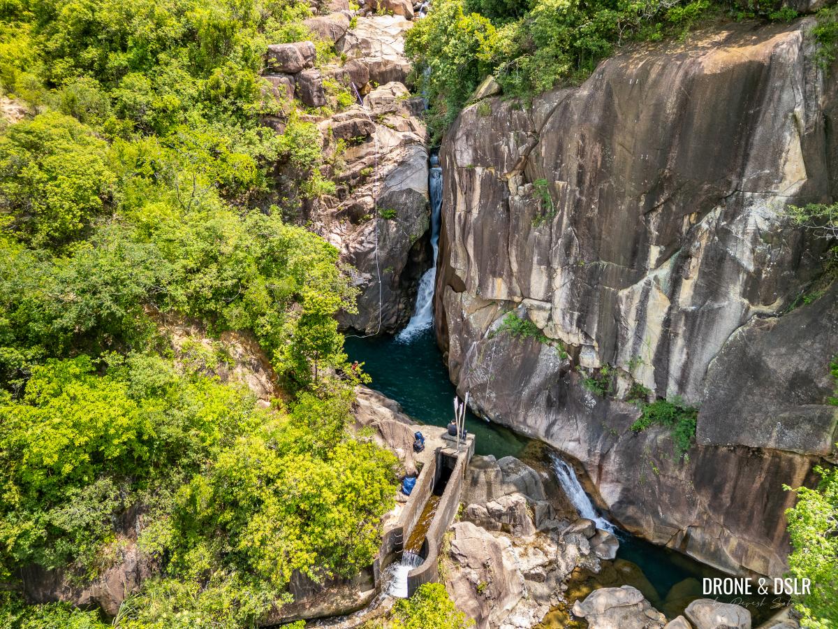
You might wonder why it’s important to hike upstream. Beyond the usual reasons, the key factor here is a small dam on the Ma Dai Stream that restricts water flow downstream.
Additionally, as the stream approaches Tai Shui Hang Tsuen, some water is diverted into the village.
In short, all the best sights and activities are found above the dam. With that said, let’s dive into the guides.
This is the reason you need to head upstream on Ma Dai Stream
Things to carry on the Ma Dai Stream Hike
Here’s are some items to carry/wear to better prepare you for your hike:
- Hiking shoes/sandals with good grip
- Towel and change of clothes
- Sun protection (if it’s a sunny day)
- Hiking gloves (good to have)
- Plenty of water (if attempting options 2 or 3 below)
There are plenty of fresh water pools on the Ma Dai Stream
Option 1: Easiest — Via The Service Road
We’ll begin with Option 1, the easiest way to reach the Ma Dai upstream area. This route is ideal for those who simply want to get above the dam hassle-free and enjoy their time there.
However, once you reach the stream, continuing upstream toward Hero Falls still requires significant effort to scramble over the boulders. As mentioned earlier, scramble as far as you feel comfortable.
Starting Point
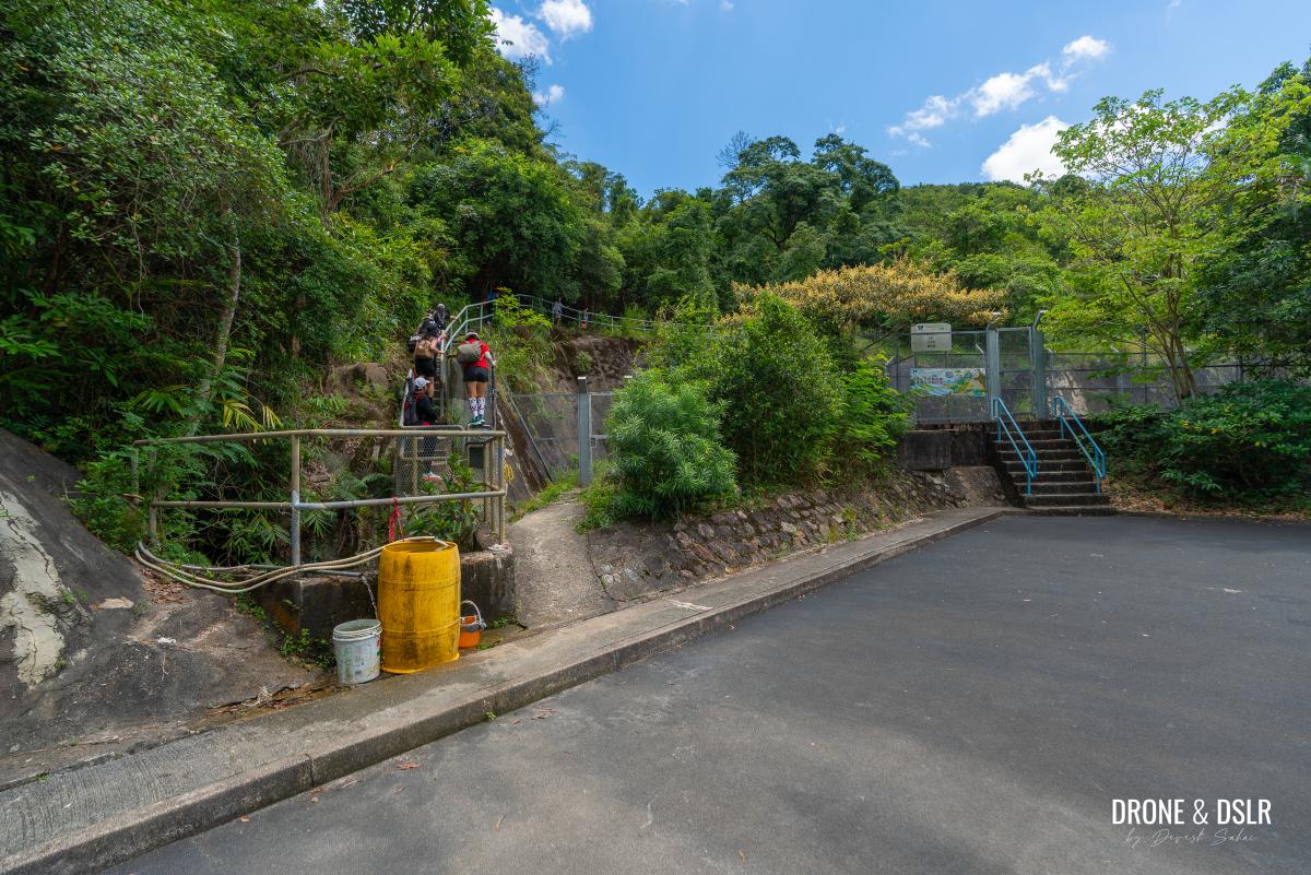
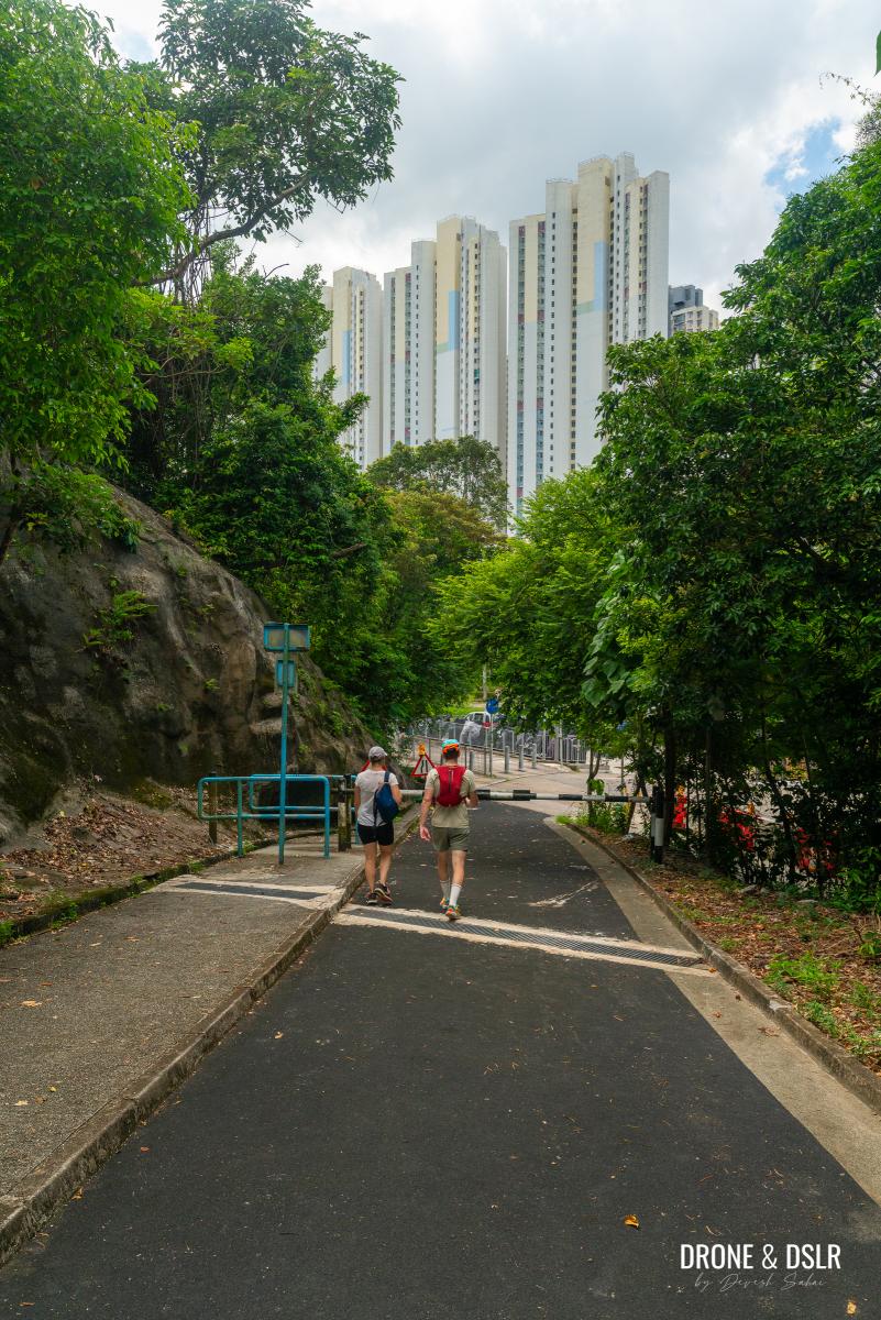
To start option 1, you need to reach the start of the service road that takes you to the Ma Dai Stream dam. The easiest option for most if to arrive here via the Tai Shui Hang MTR station.
At the MTR, take exit B, and make your way towards Hang Tak Street. Once you cross Hang Tak Street, turn left and walk to the unnamed road going uphill on the right.
On Google Maps, it’s right next to the “On-street Motorcycle Parking Spaces 路邊電單車泊車位 (骨位)”.
This road, with the bar gate, is the starting point.
To the Ma Dai Stream Dam
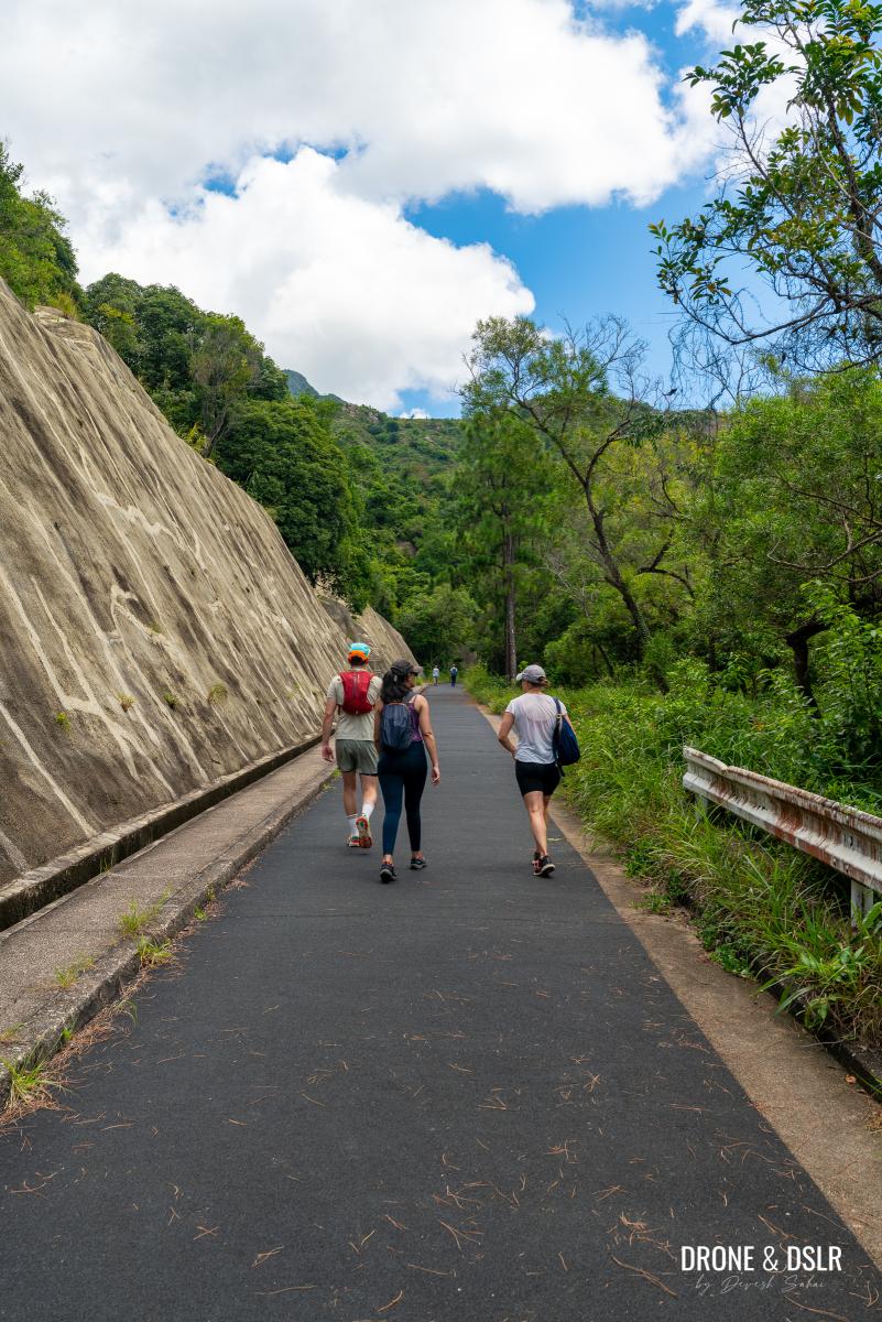
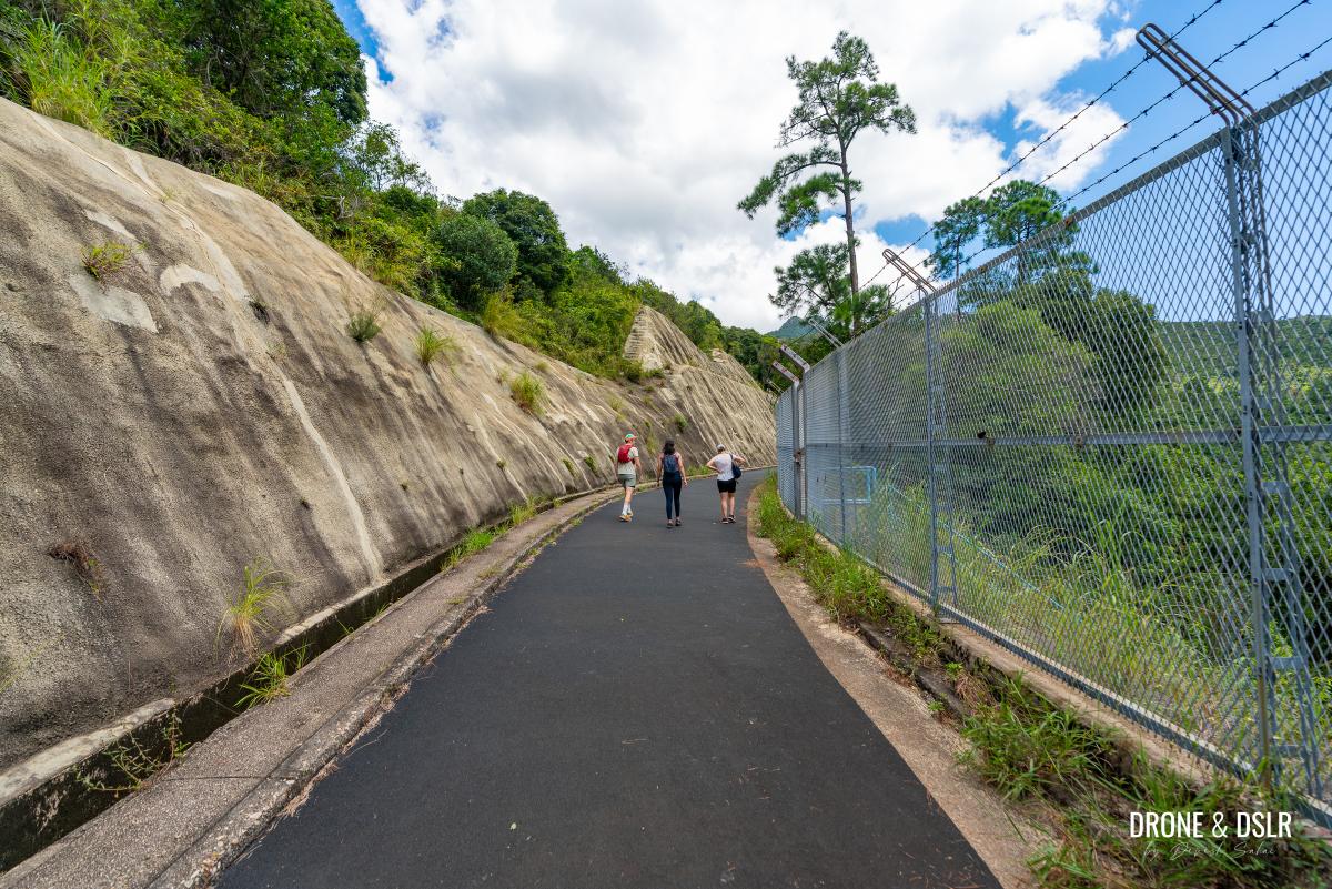
Once on the service road, walk past the bar gate, and begin walking uphill.
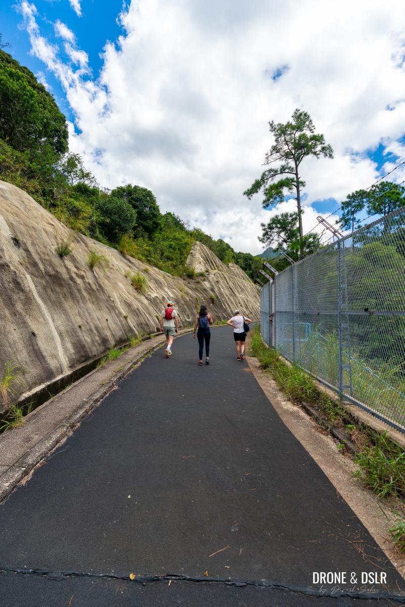
The service road takes you straight to the dam
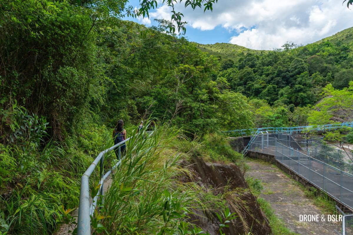
The road is narrow with a moderate incline for the first half. About halfway, you’ll come to a fence. Many hikers jump over it to reach a scenic pool below, which I’ll discuss in Option 2. For now, continue along the service road, which flattens out after the fence.
-

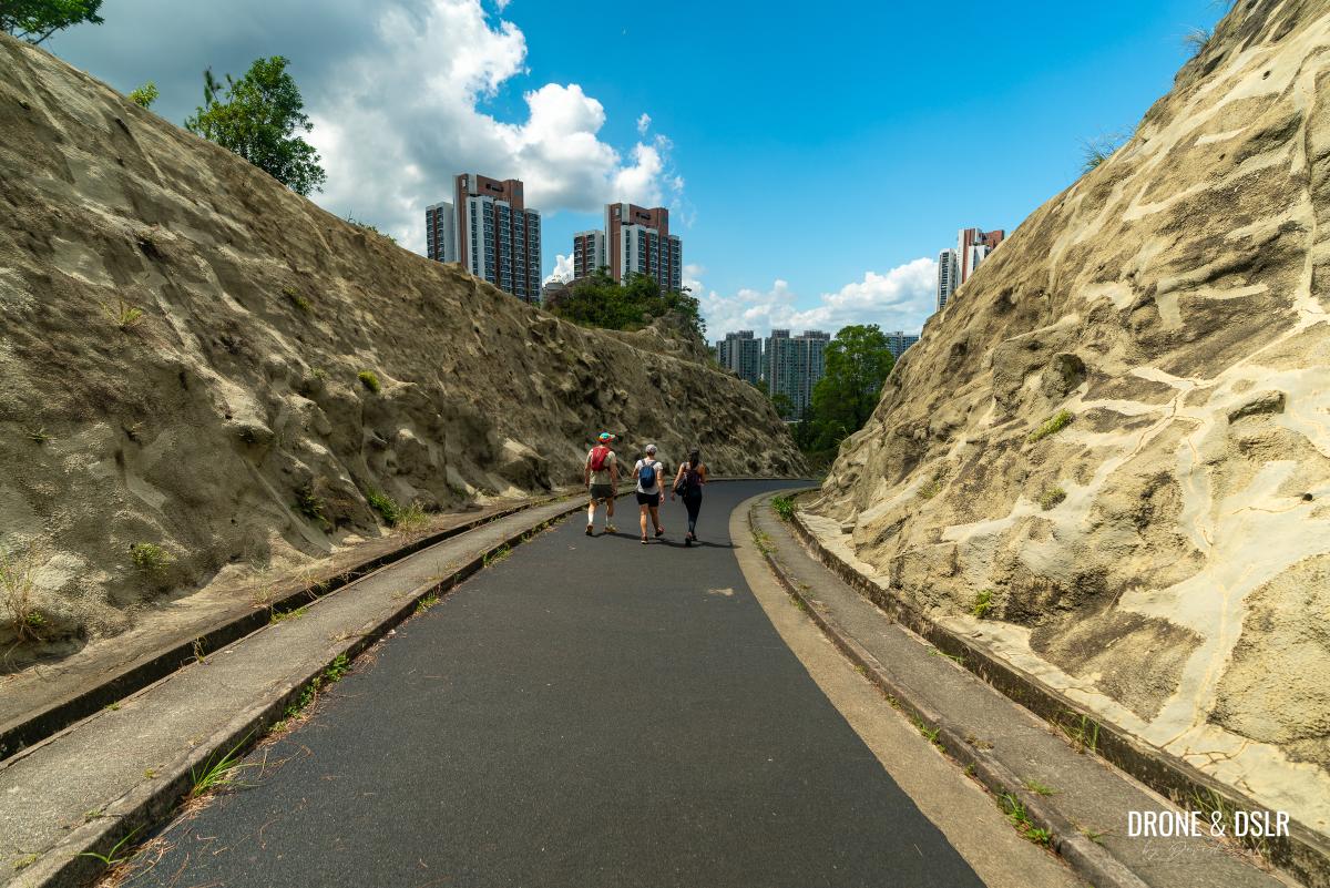
- The service road becomes flat in the second half
-
- Almost at the end of the service road
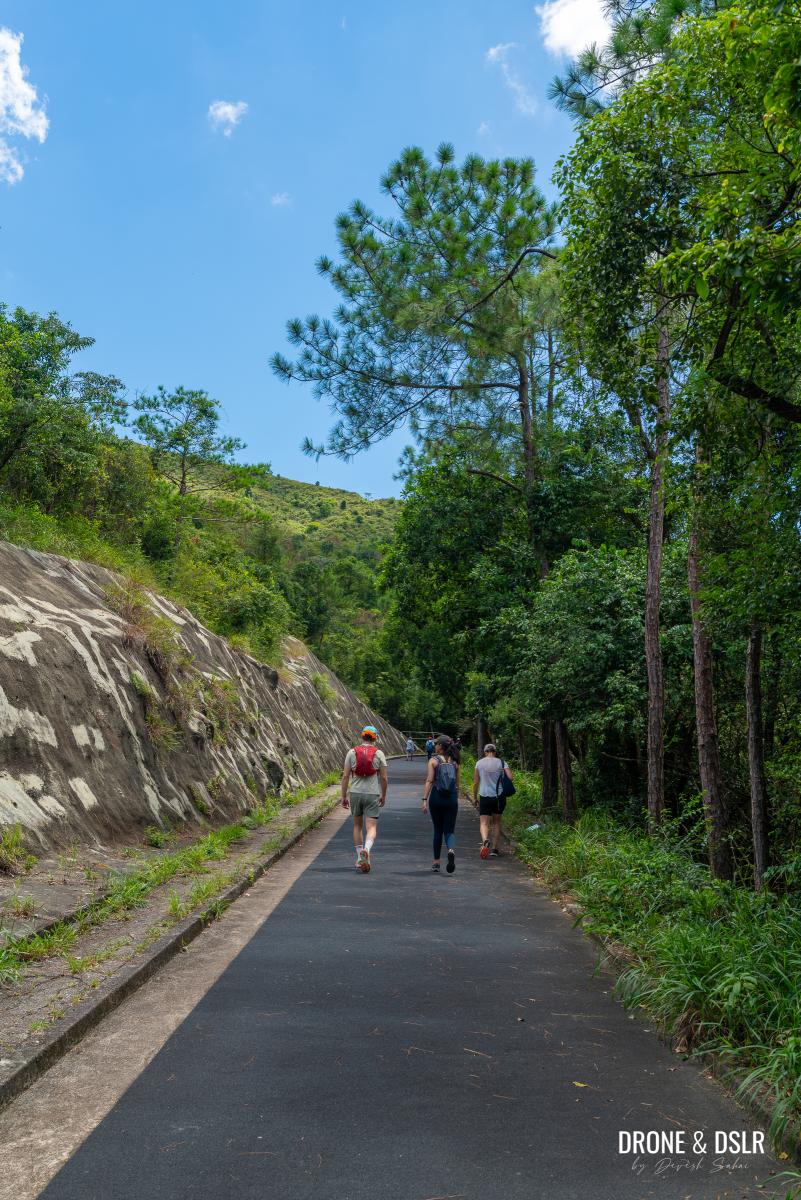
After approximately 900 meters, the service road ends at the Ma Dai Stream dam.
End of the service road, time to jump some railings
To The Stream
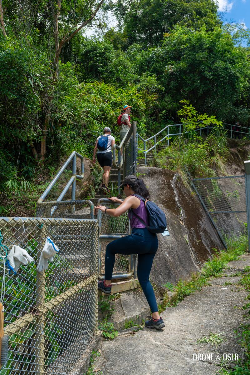
At the end of the service road, look for the fenced steps on the left-hand side. Climb over the fence and follow the path until you reach the Ma Dai Stream.
-
- Hope over this fence to the steps above
-
- Follow the path around
-
- Step off the path
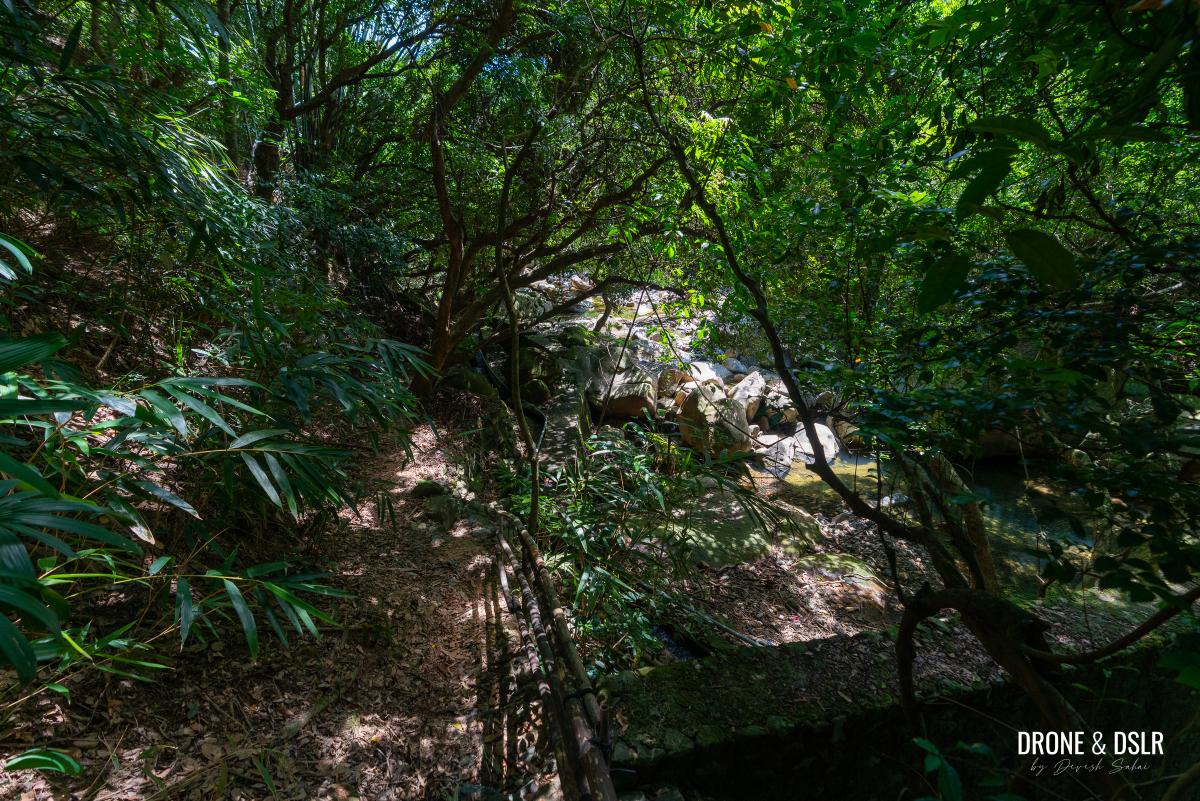
This section of the stream is well shaded by numerous trees along the banks and even within the stream itself. It’s also the easiest part of the stream to access above the dam, which is why it tends to be the most crowded.
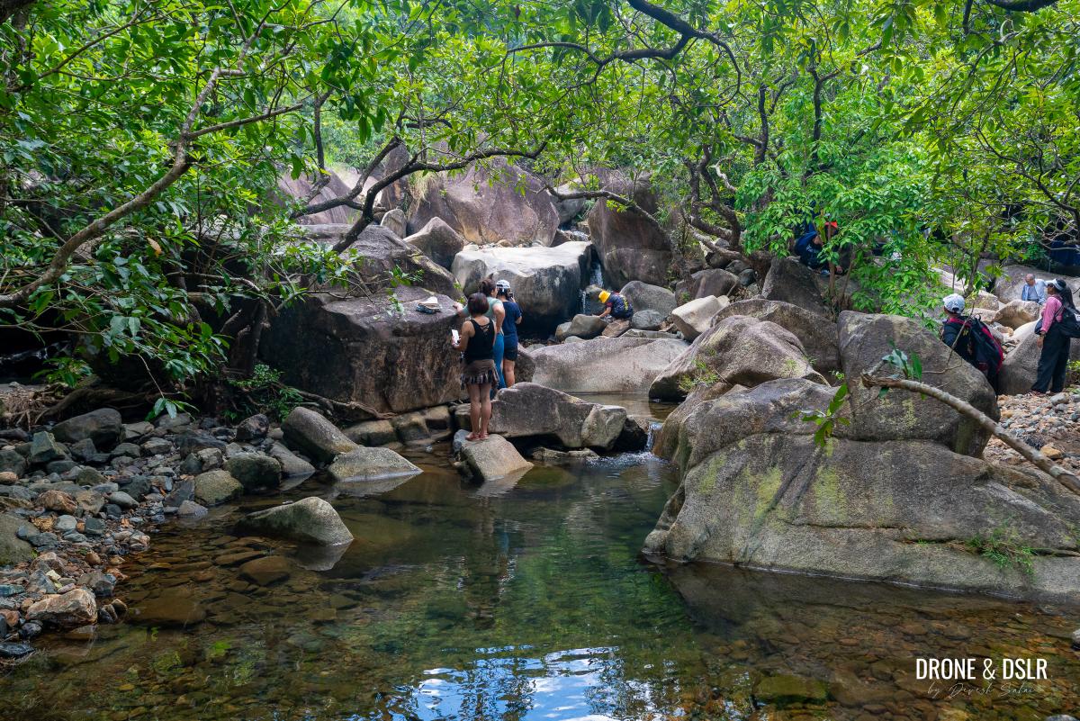
And you’ve arrived at the upstream section of Ma Dai Stream
To The Area Below Hero Falls
Reaching Hero Falls and the waterfalls below requires scrambling over boulders, as there is no clear path or markings.
This area is also quite crowded, so it’s best to further head upstream
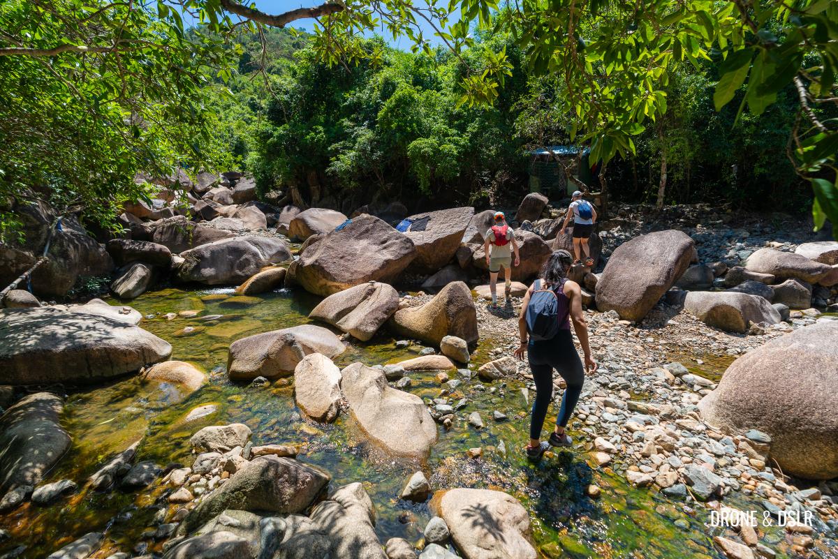
We began in the middle of the stream and then shifted to the left, where moving upstream felt easier. Along the way, we crossed several pools but resisted the temptation to stop and swim.
The rock pools are tempting, but we decided to go further up
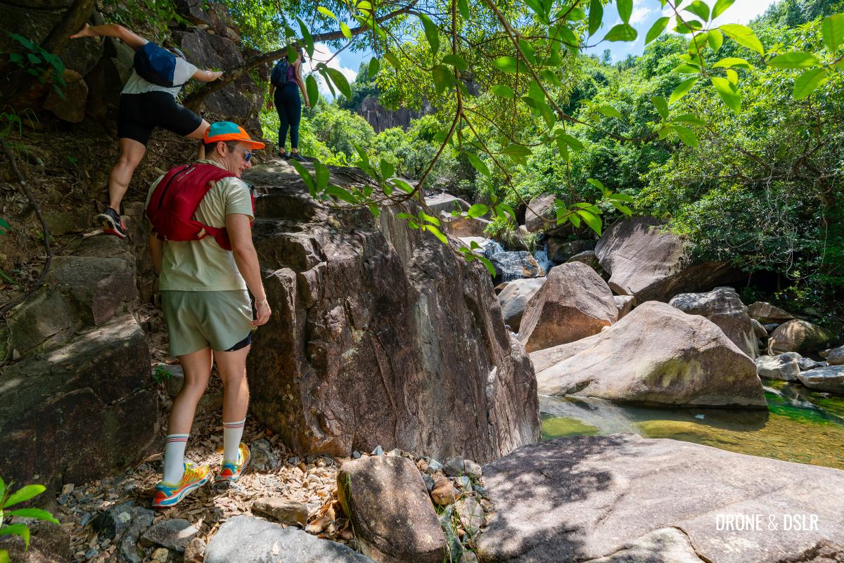
At one point, there was a vertical drop that required some skill to descend. After that, it became relatively easy to reach the area just below Hero Falls.
-
- This was the view from which we had to descend to the stream (the only real challenging part of the hike)
-
- Charting our way up to Hero Falls
-
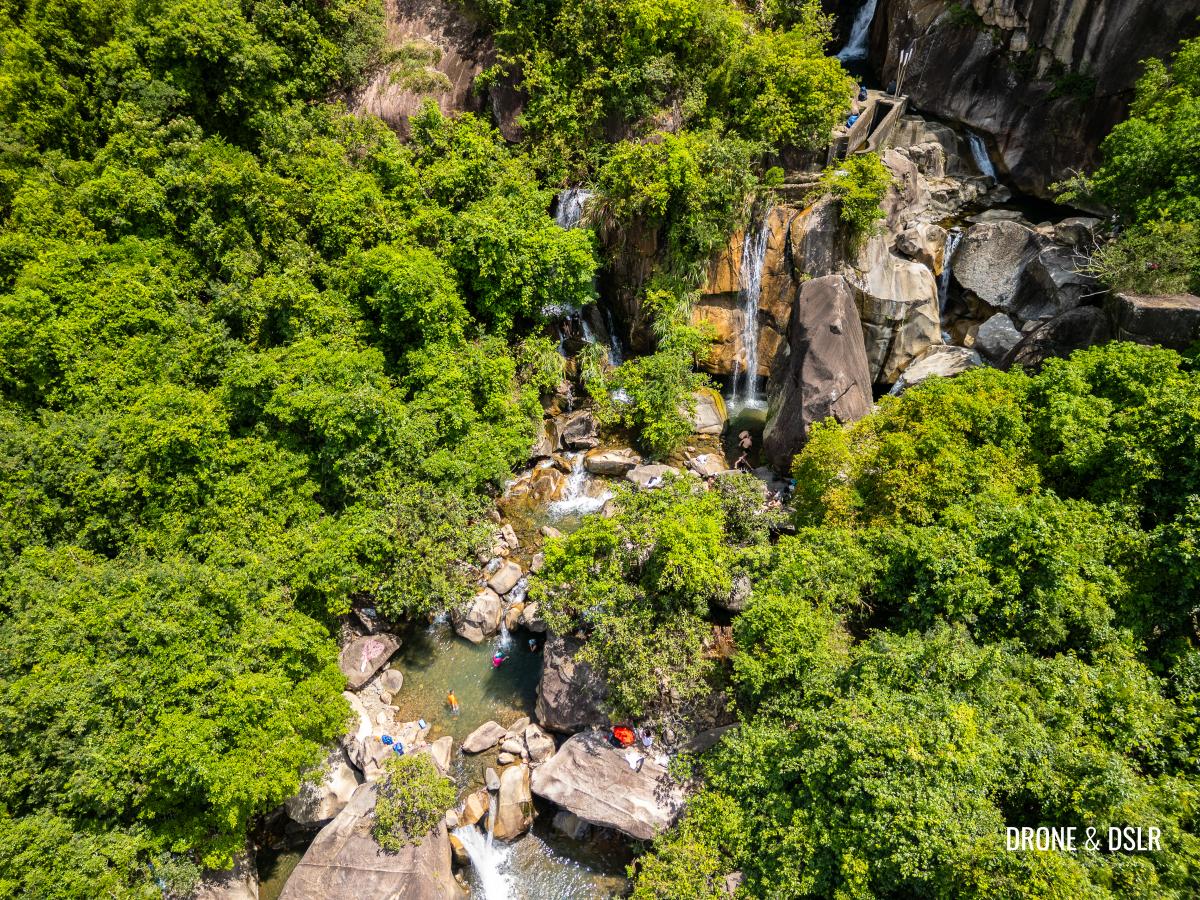
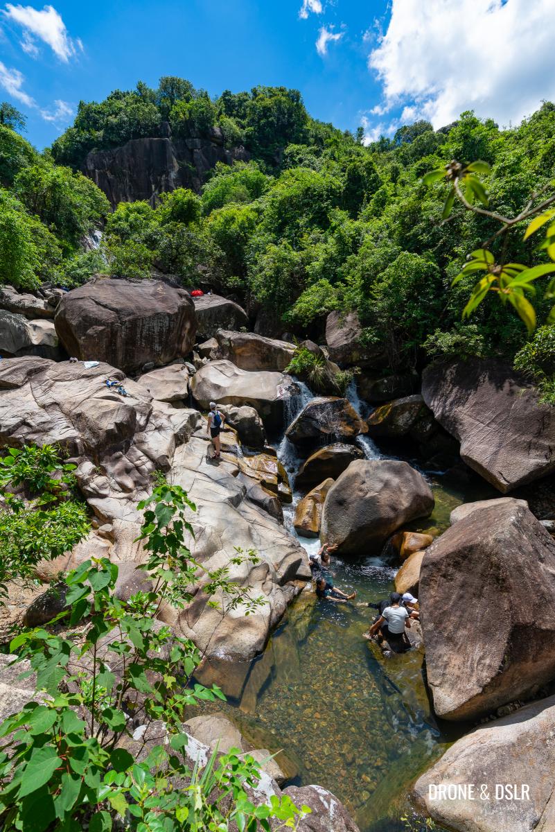
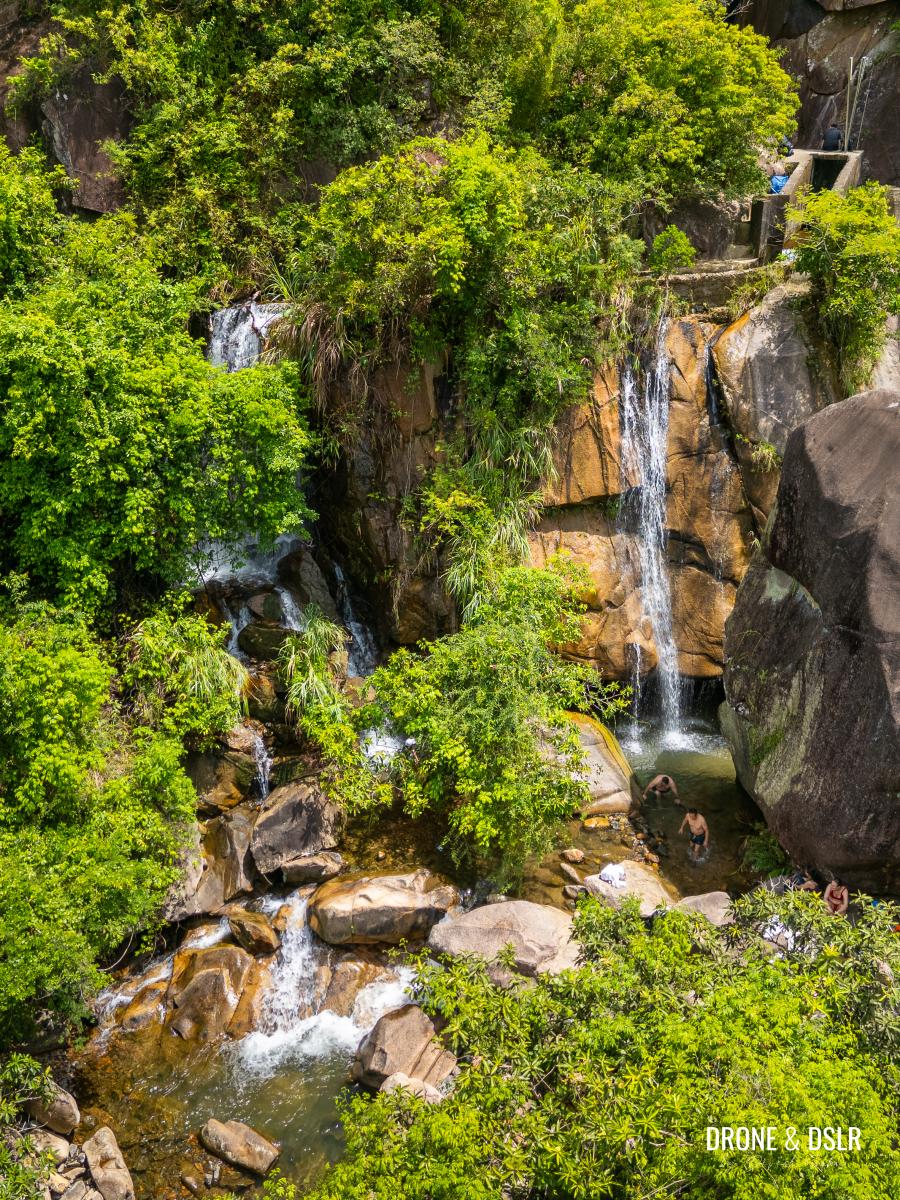
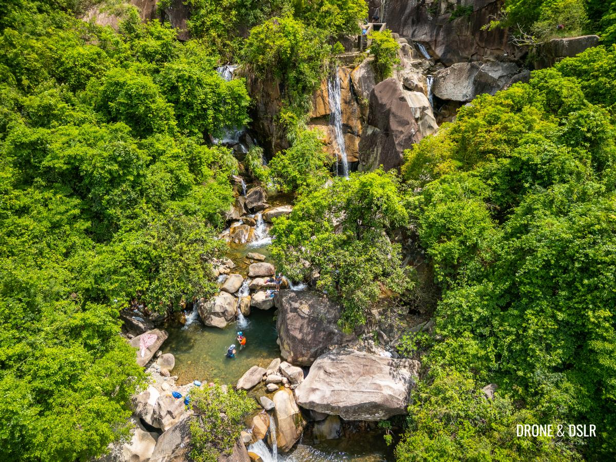
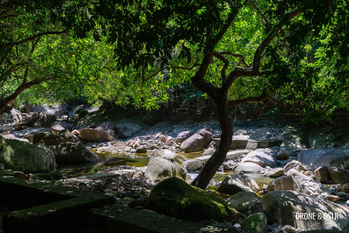
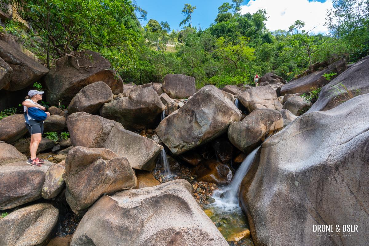
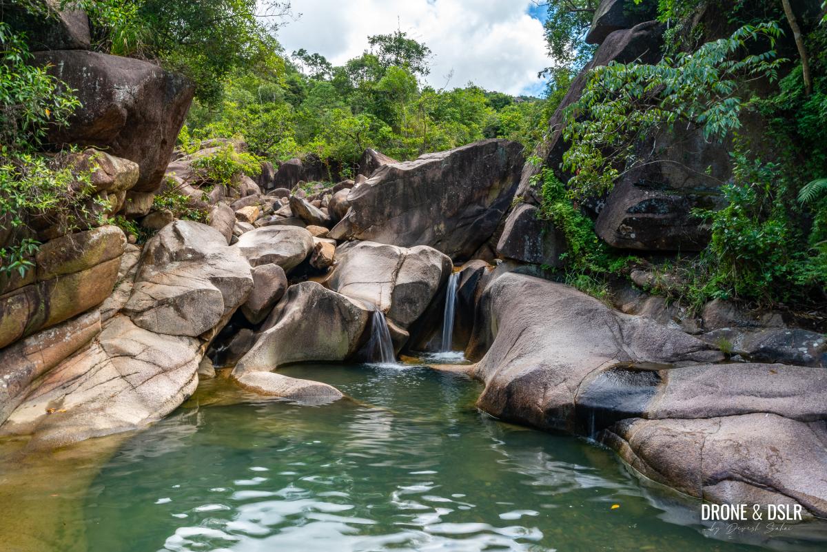
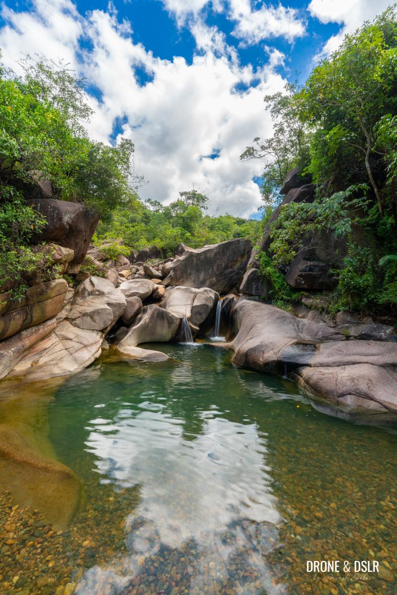
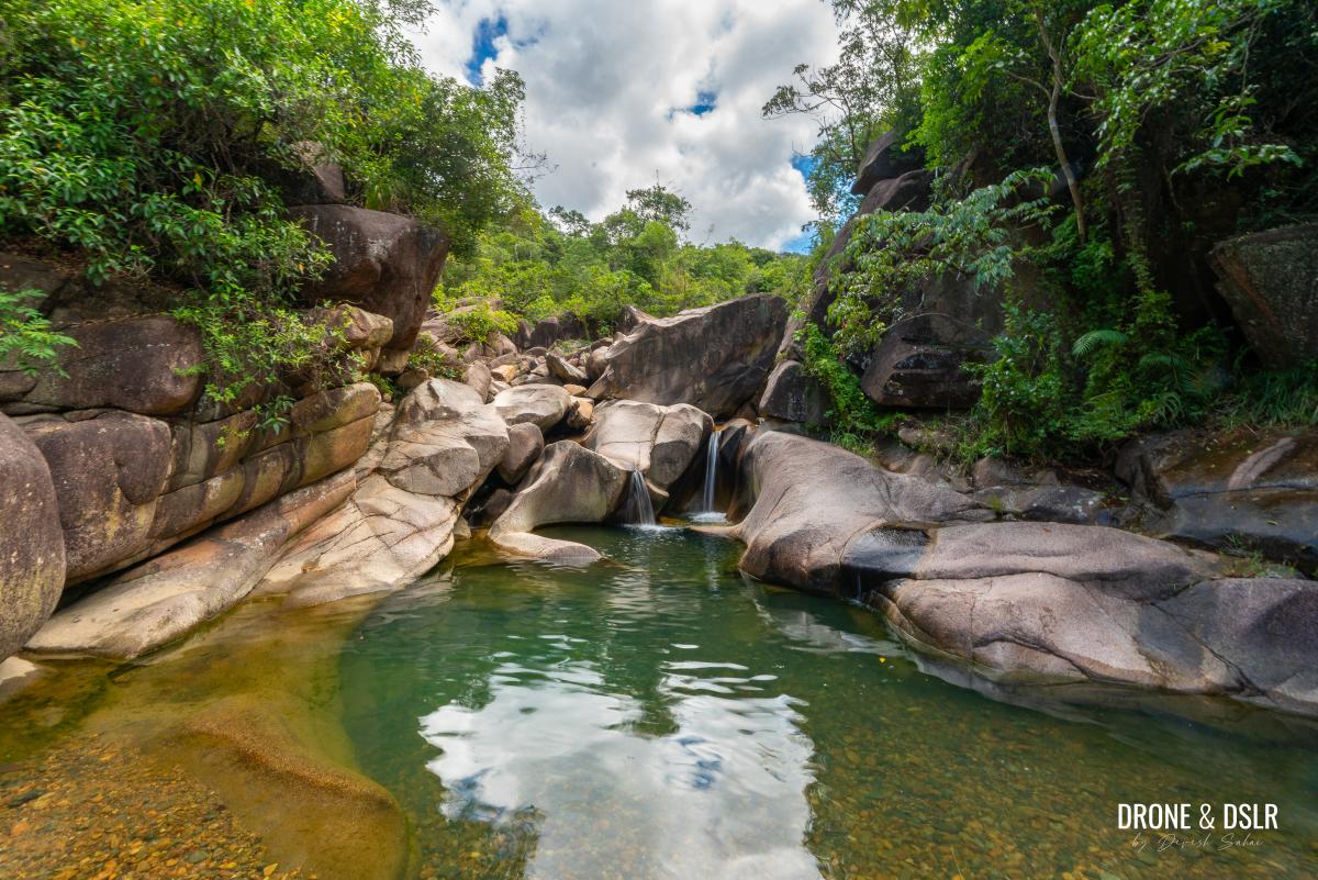
- The area directly below Hero Falls was our favourite
This spot features two waterfalls, plenty of trees, and numerous pools. In fact, I found this area far more exciting than Hero Falls itself.
-
- The waterfall and cascades area below Hero Falls
-
- Enjoying one of the waterfalls below Hero Falls
-
- Time to cool off
-
- The area below Hero Falls has plenty of fresh water pools
-
- One of the lushest looking waterfalls and pools
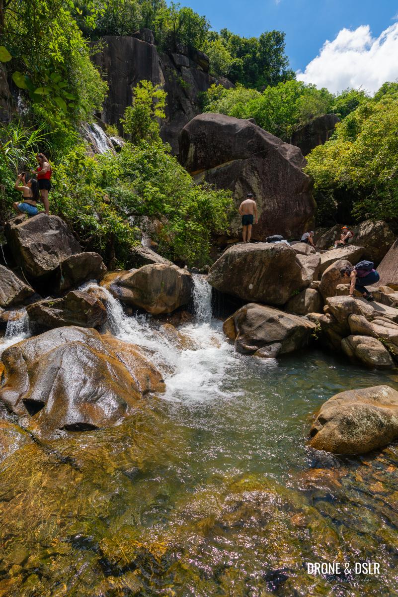
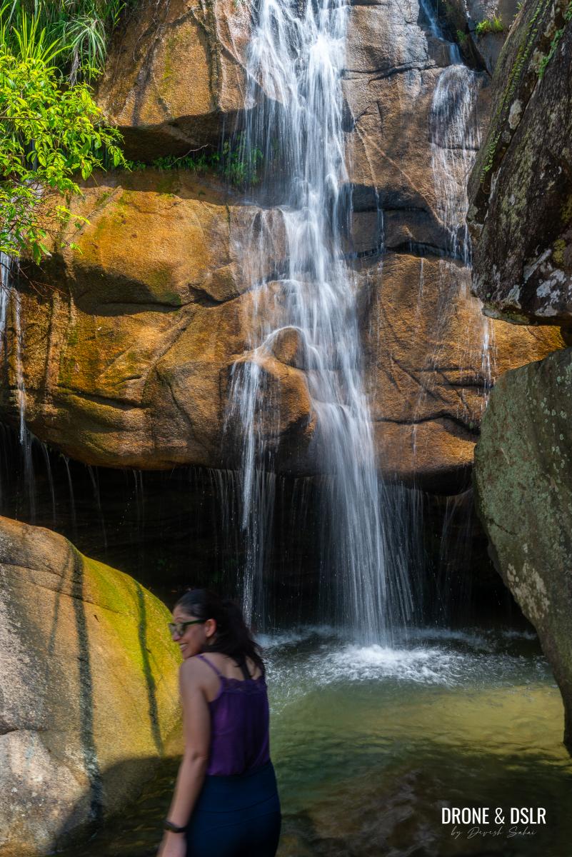
To Hero Falls (Ma Dai Waterfalls)
The Hero Falls are located just above this area. To reach them, cross the Ma Dai Stream to the right-hand side and find the path along the hillside.
To reach Hero Falls, take the route behind the trees on the right-hand side
This path circles around the stream and leads directly to Hero Falls and its pools. Hero Falls is the furthest upstream point that most hikers on the Ma Dai Stream explore.
Hero Falls is usually the highest point on the Ma Dai Stream frequented by hikers
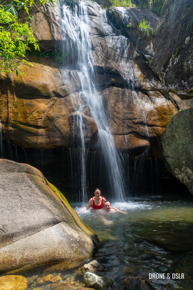
The waterfalls cascading down the hillside and the deep pools below are especially inviting on a hot summer day. There’s also a rope for the adventurous to climb and then dive into the pool.
Option 2: Moderate — Via The Riverbed and Service Road
This is the option we chose for our hike up Ma Dai Stream. It divides the hike into two equal sections. The first half involves scrambling upstream over boulders to reach the pool at the halfway point. From there, take the exit onto the service road and continue to Hero Falls, just like in Option 1, for the second half.
Starting Point
To begin this option, head to Hang Tak Pavilion and then enter Tai Shui Hang Village, which is located behind the pavilion.
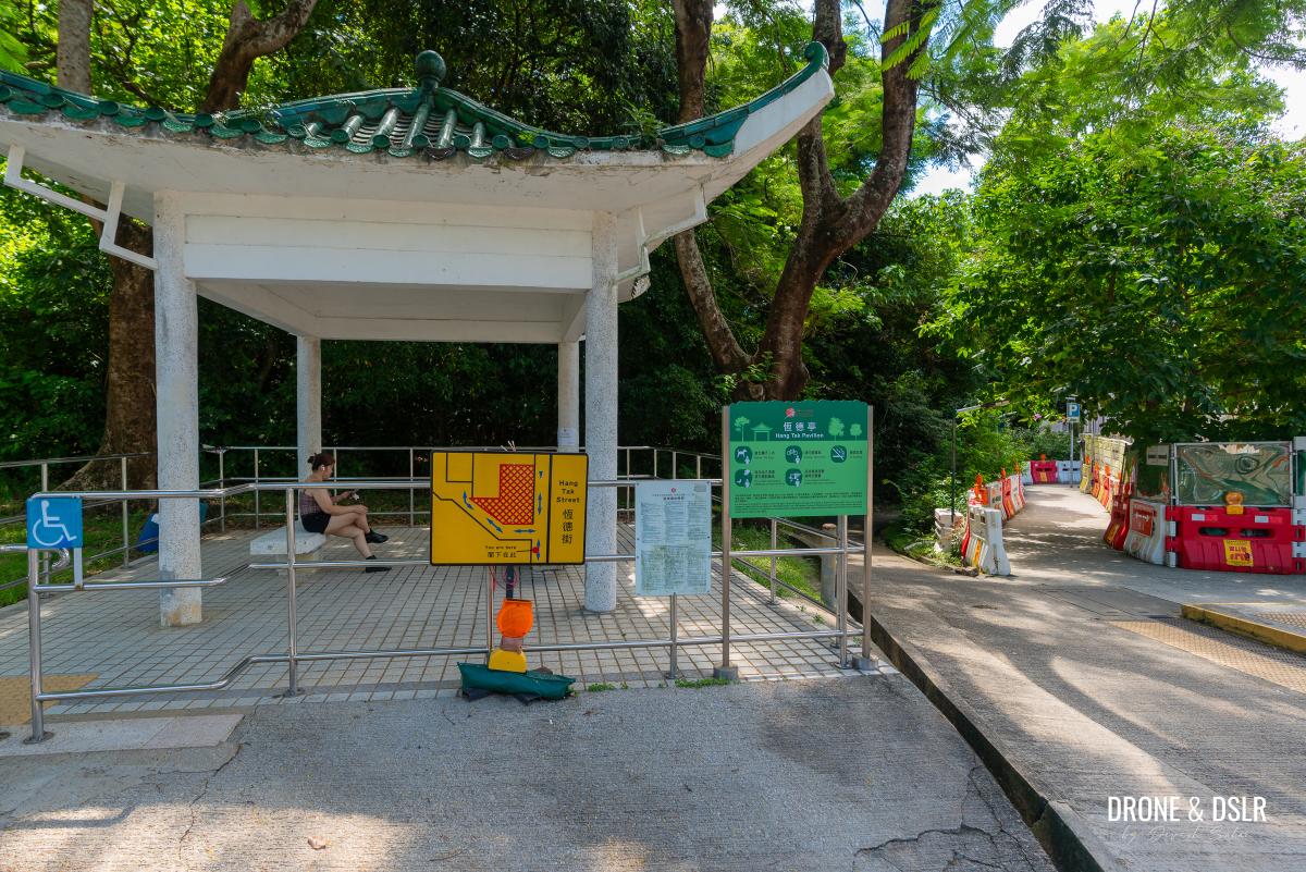
Hang Tak Pavilion
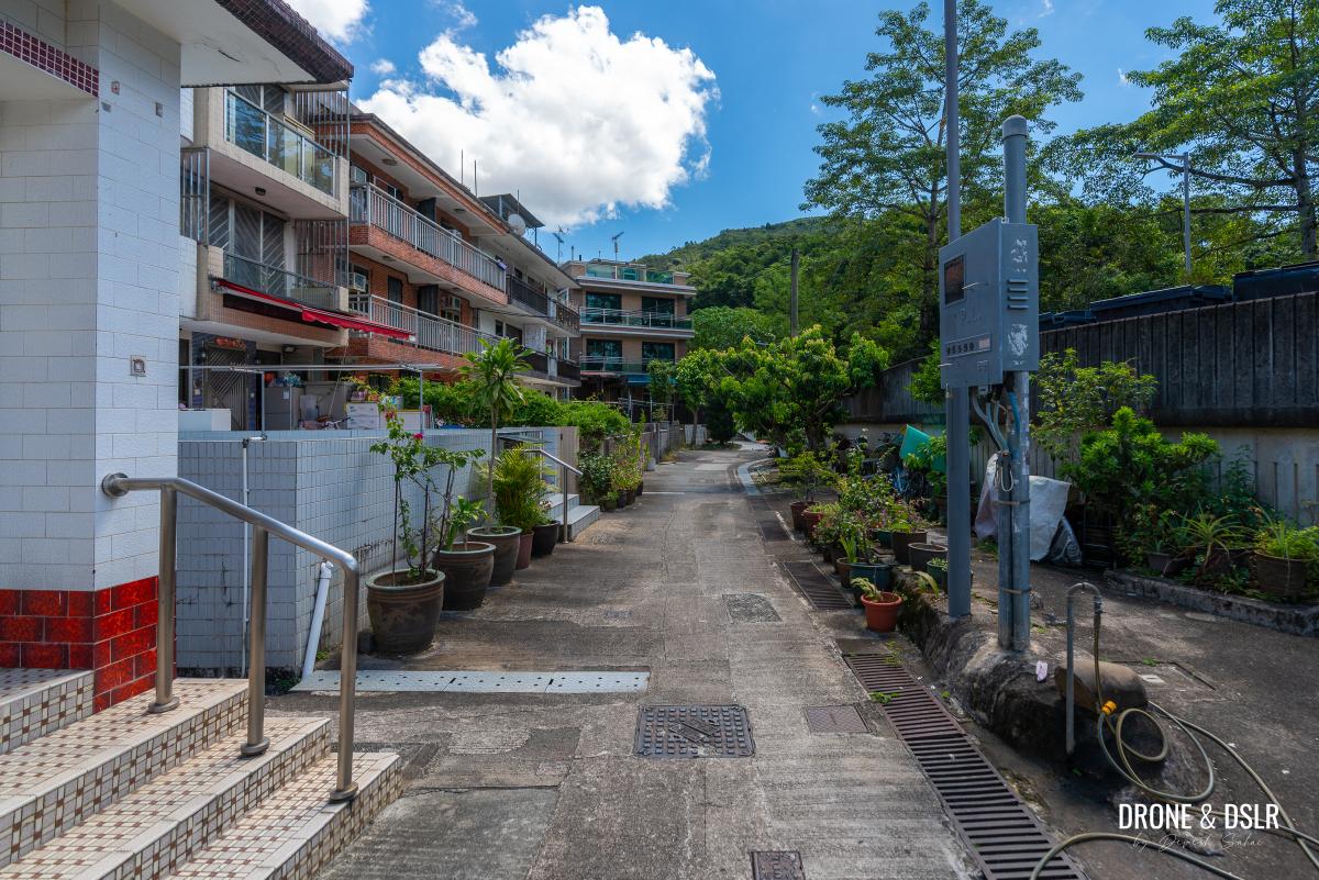
There are two lanes leading into the village: the upper lane on the right and the lower lane on the left — you can take either one.
-
- Walk into Tai Shui Hang Village behind the pavilion
-
- Enter Tai Shui Hang Village
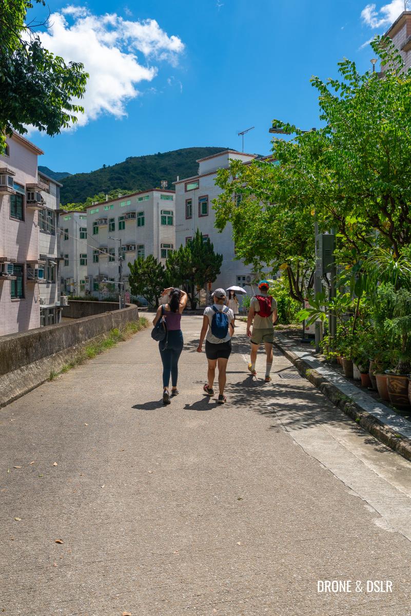
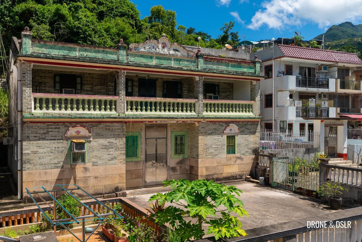
If you pick the upper lane, descend the steps to the lower lane after passing the beautiful abandoned house. Then, follow the lower lane as it curves left and exits Tai Shui Hang Village.
-
- After this beautiful house, ensure that you’re on the lower lane inside the village
-
- Follow this lane
-
- The lane curves left and exits Tai Shui Hang Village
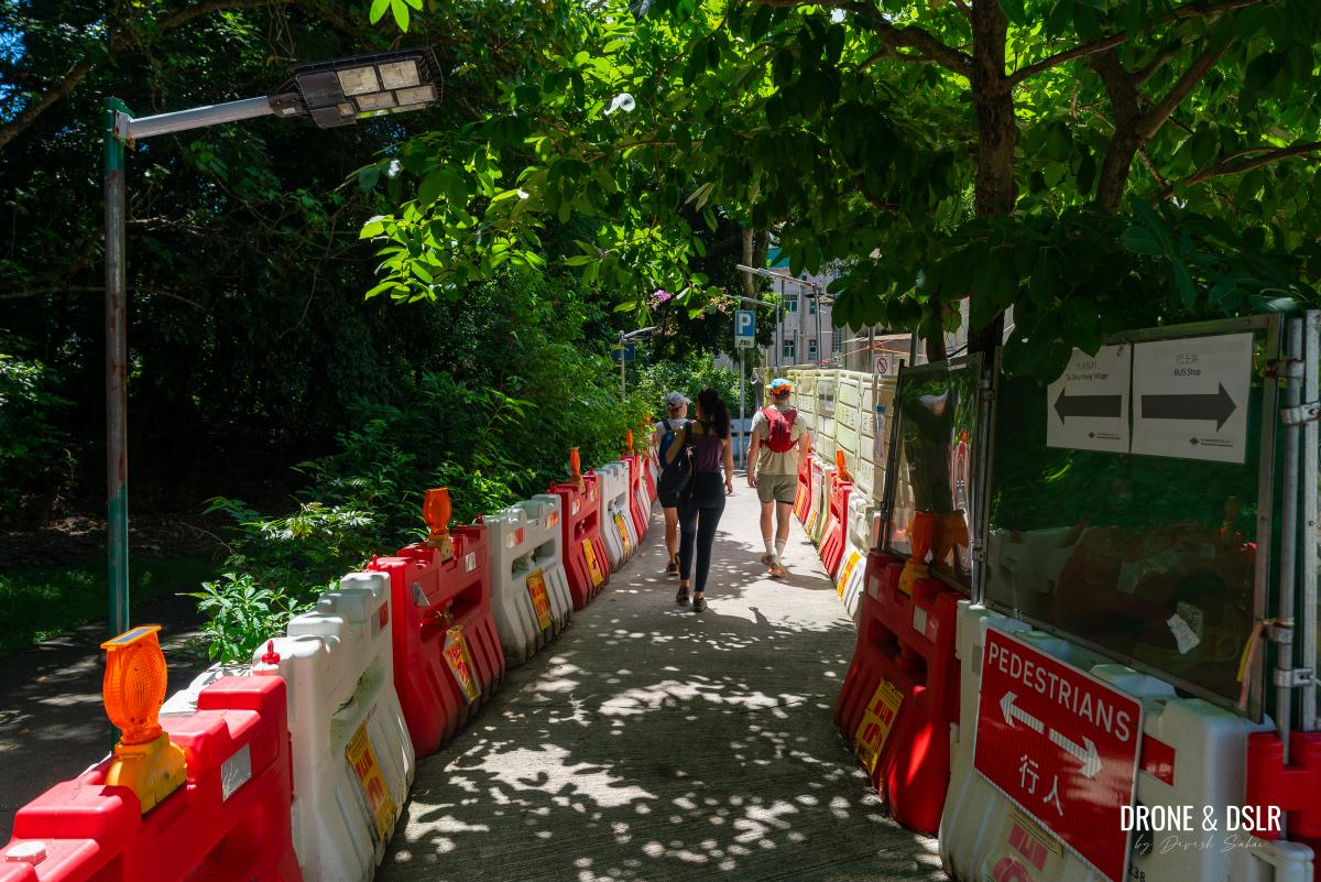
Short Trail Along The River
The path leaves the village beside the HK Forest Adventures Limited office. Follow the steps next to the building that lead into the country park.
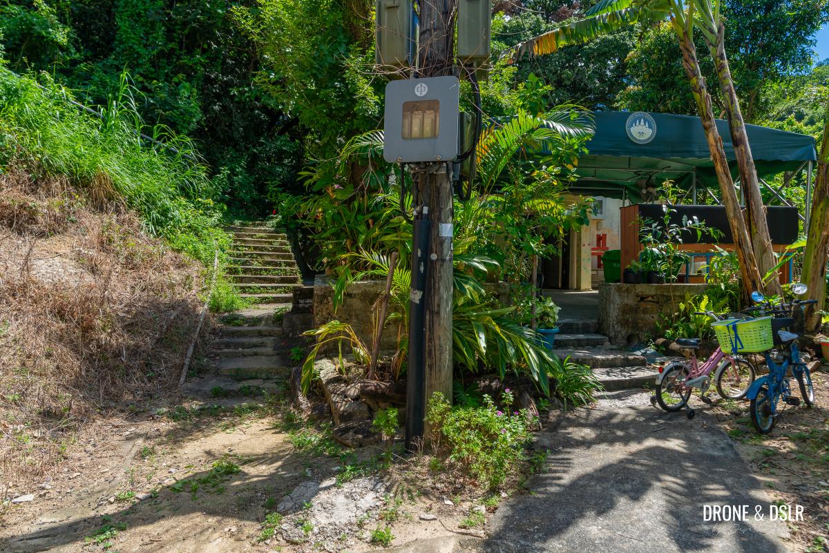
Notice the HK Forest Adventures Limited office just before you leave the village
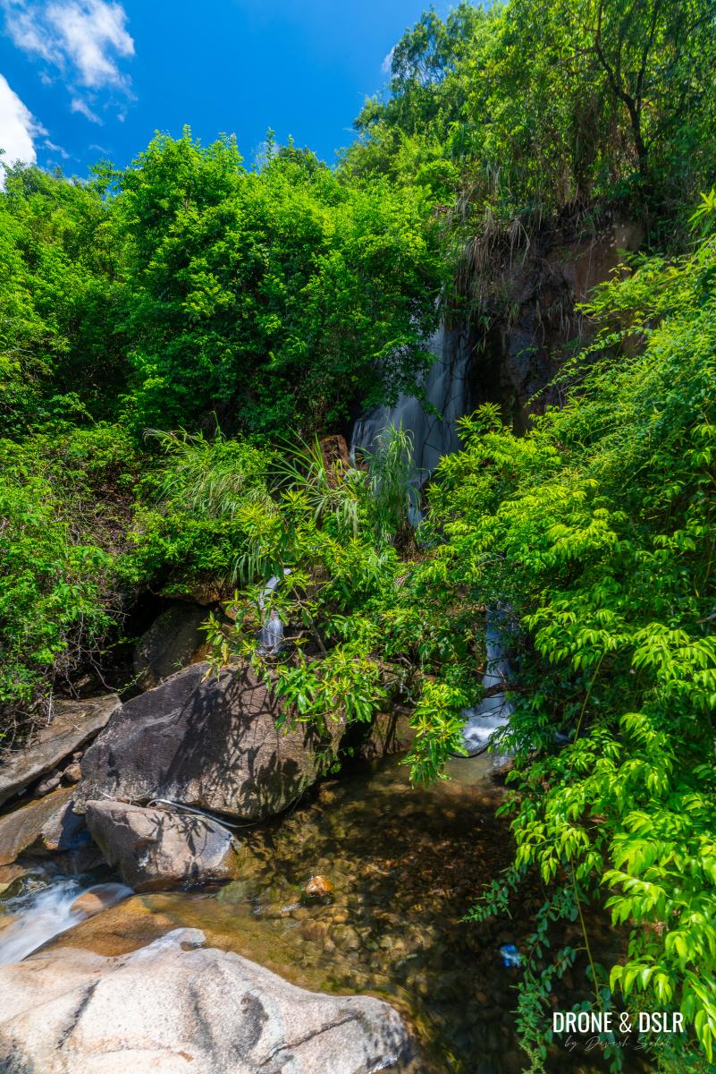
At this point, you’ll see two trails in front of you. The trail on the right descends to the stream, which isn’t very impressive here.
-
- You can take the path on the right to visit the stream
-
- Ma Dai Stream doesn’t look too impressive at this point
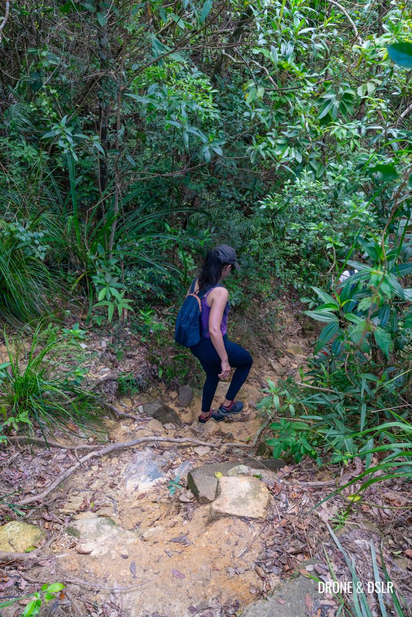
The trail on the left climbs uphill and then runs parallel to the stream. Take this trail and follow it until it ends back at the stream.
-
- Take the trail on the left that runs parallel to the stream
-
- Keep following this trail
Hike On The Riverbed
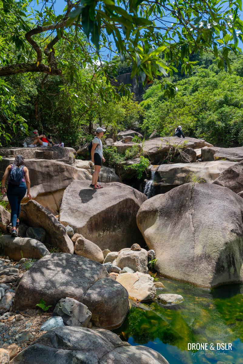
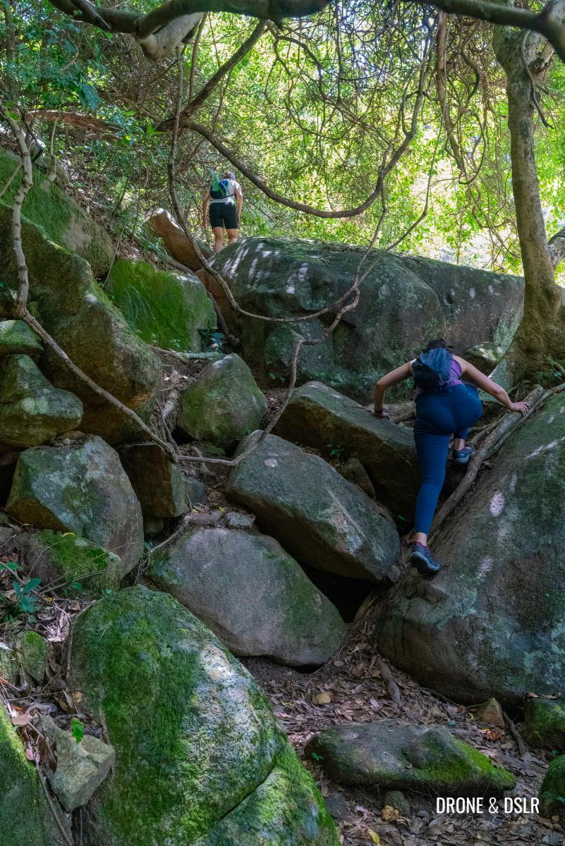
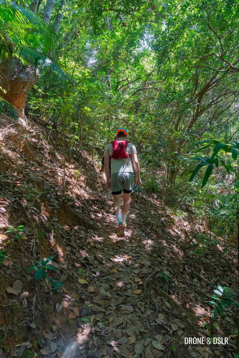
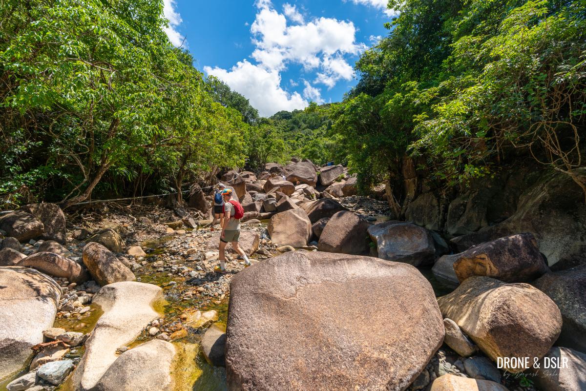
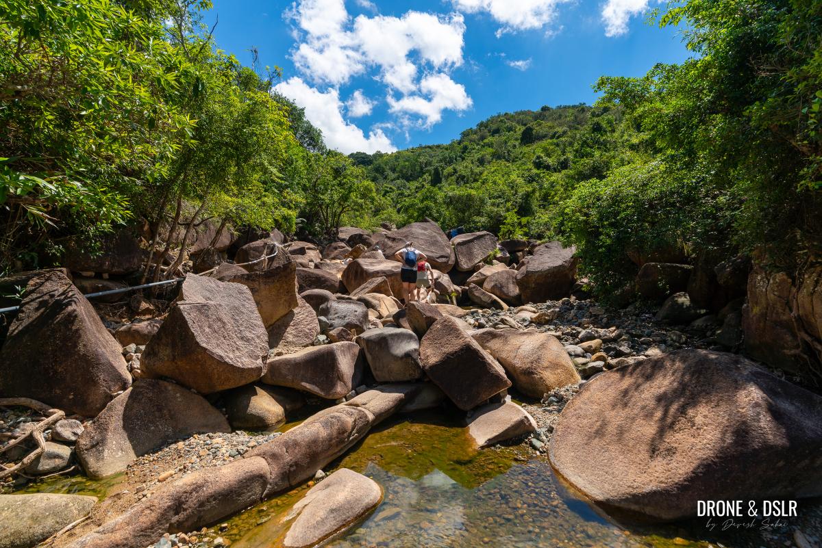
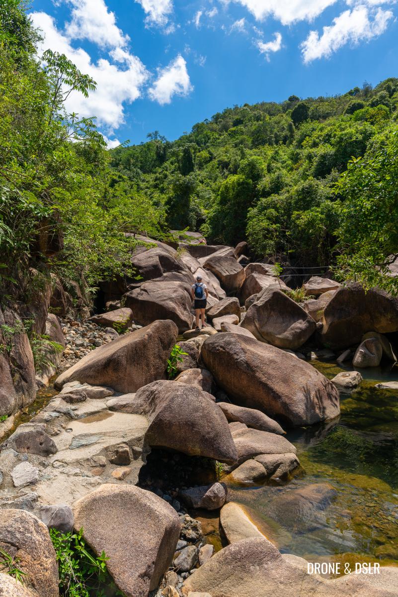
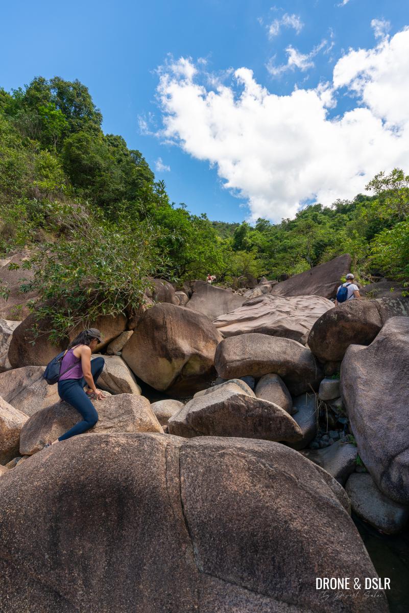
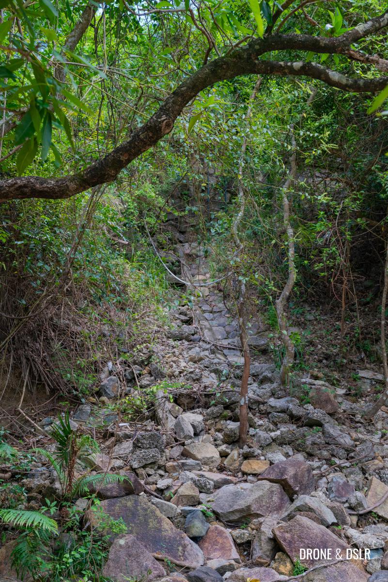
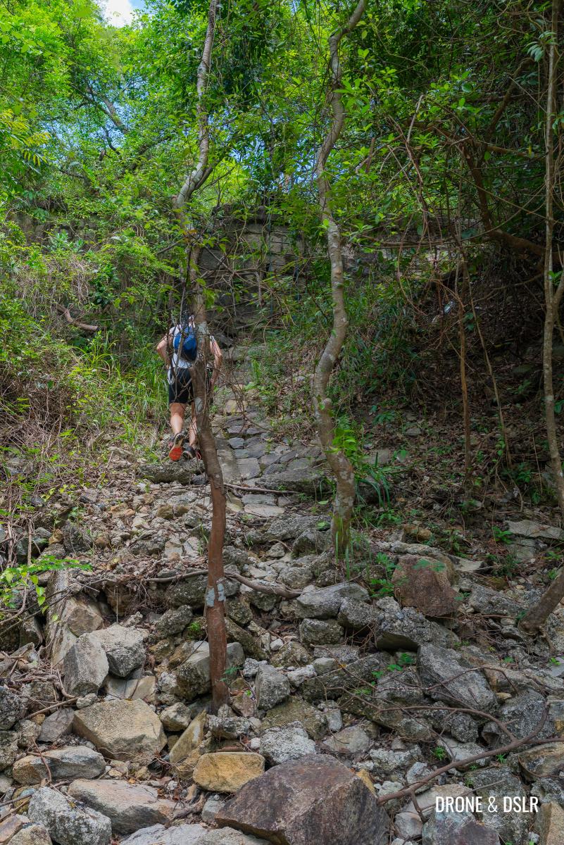
From this point on, the hike continues on the Ma Dai Stream. The riverbed is made up of boulders of various sizes, so watch your step and proceed with caution.
The trail then ends at the stream
Unfortunately, there isn’t a single clear path to follow. As we discovered, navigating the riverbed involves some trial and error.
Starting our upstream hike on Ma Dai Stream
Some sections were easier when it was obvious which boulders to step on to move forward, while others were less straightforward. In some places, we had to hoist ourselves onto larger boulders, but overall, it wasn’t too difficult. Thankfully, the dam upstream holds back much of the water, making hiking along the riverbed possible.
-
- Ma Dai Stream Hike
-
- You’ll be charting your own path in this section of the Ma Dai Stream hike
-
- Few boulders requiring climbing up
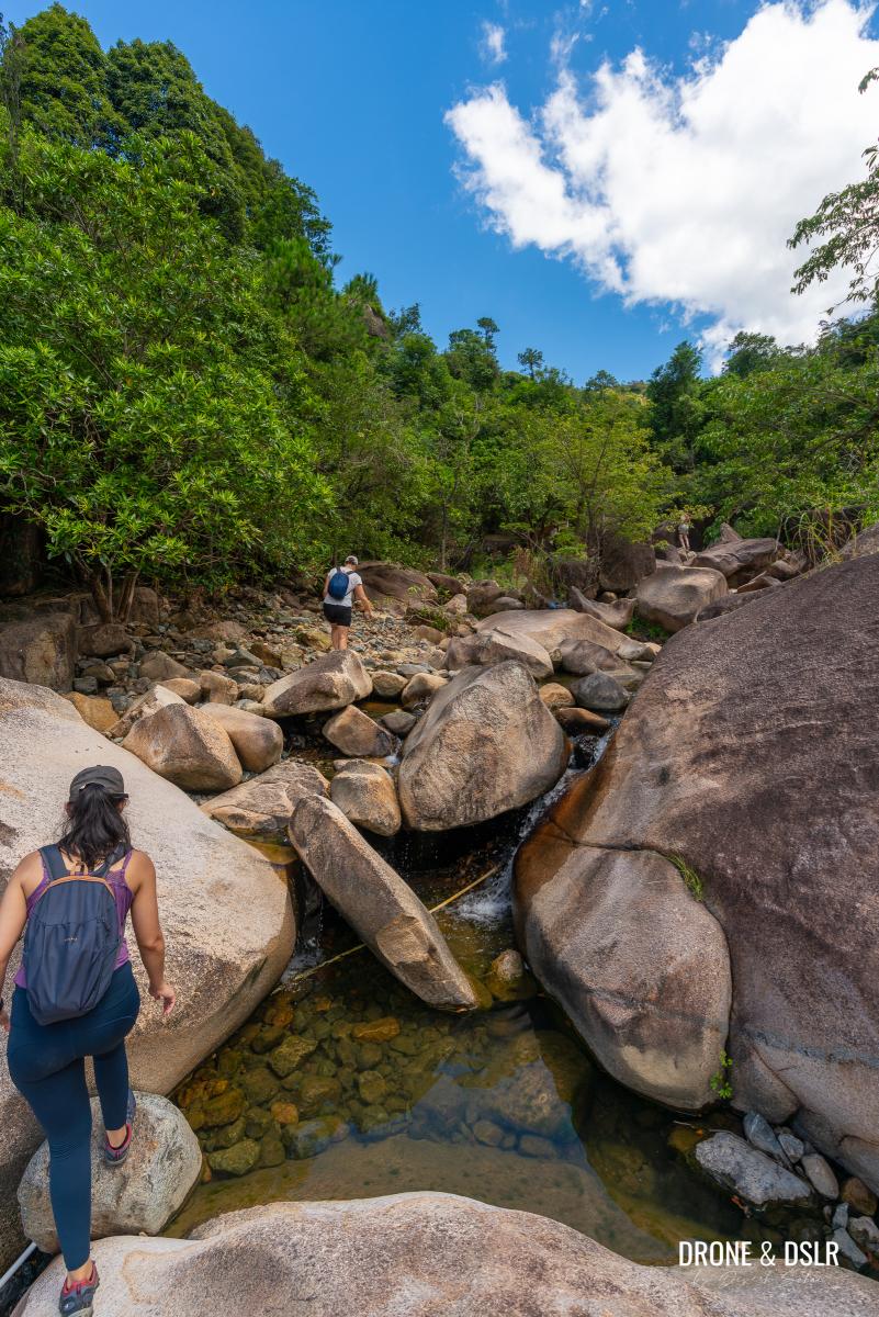
After a mostly gentle incline, the riverbed becomes steeper near the exit leading to the service road. You’ll only notice the exit once you climb the tall boulders and reach the point where the stream curves to the right.
-
- Watch your step as you hike upstream on Ma Dai Stream
-
- You’ll notice numerous rock pools as you hike
-
- The section where the incline increases is close to the exit (you can see the service road above in the pic)
Here, you should see ribbons and a rope marking the way up to the service road.
The rope where the exit is to the service road
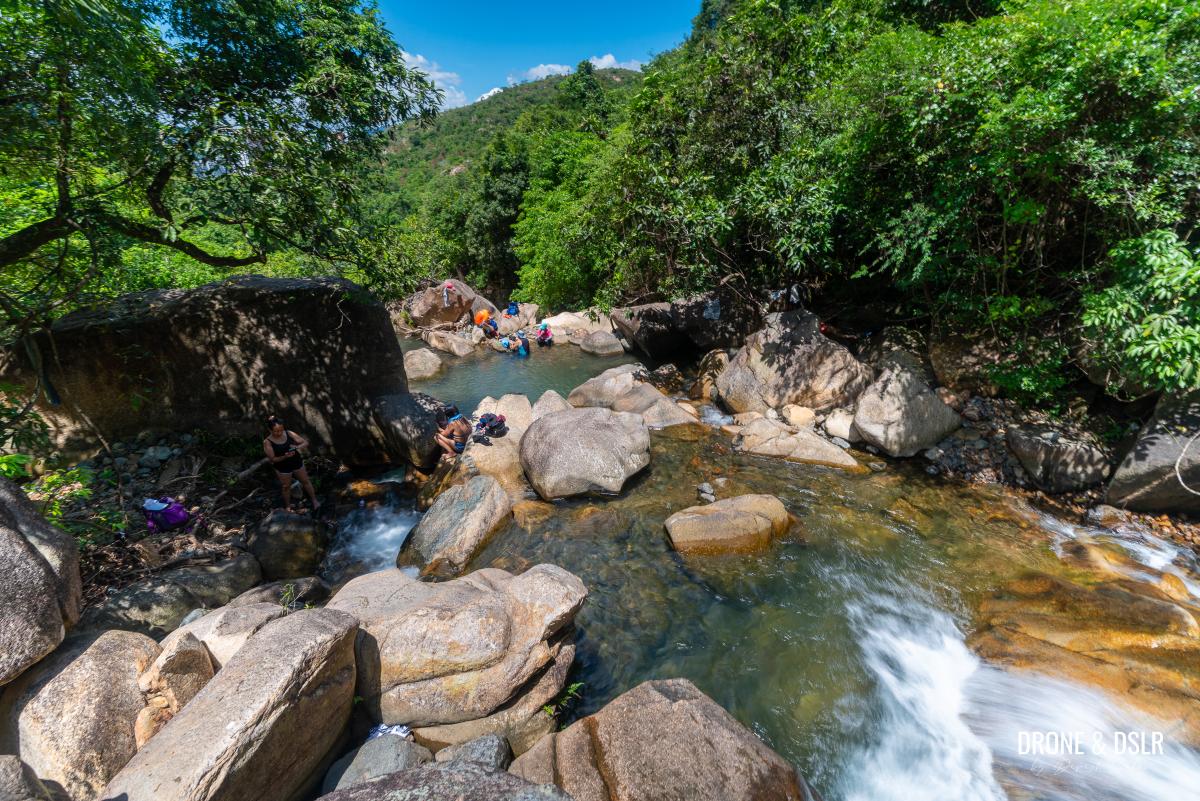
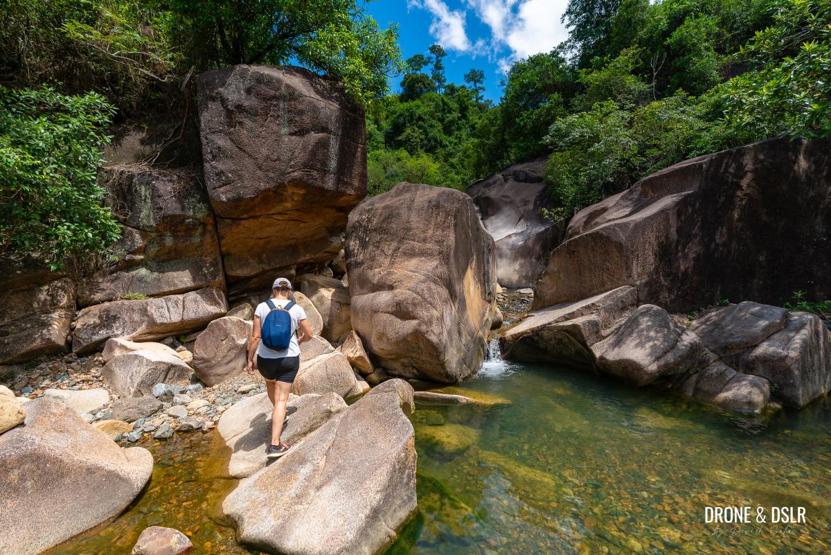
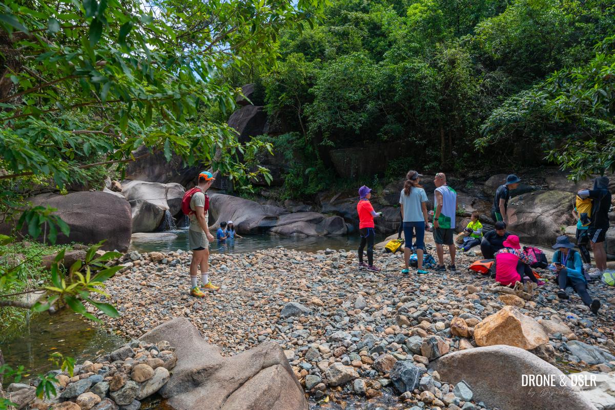
Before you take the exit, walk a little farther along the stream to reach a pool. This pool is the easiest to access along the Ma Dai Stream, as most visitors come from the service road and climb down to it.
-
- But first walk slightly ahead of the exit to arrive at this rock pool
-
- This is perhaps the easiest rock pool to arrive at on Ma Dai Stream
It’s also good enough for a quick swim.
Although this pool is relatively popular, it’s no comparison with the pools above the dam
But if you want something more scenic, then let’s keep moving.
Take The Exit To The Service Road
After you’ve finished admiring the rock pool, return to the exit marked by the rope.
Return to the rope and climb up the rocks
The rope leads to a wall, where you can either use the ladder or climb around to get onto the wall. Whichever way you choose to scale the wall, follow the steps that come next.
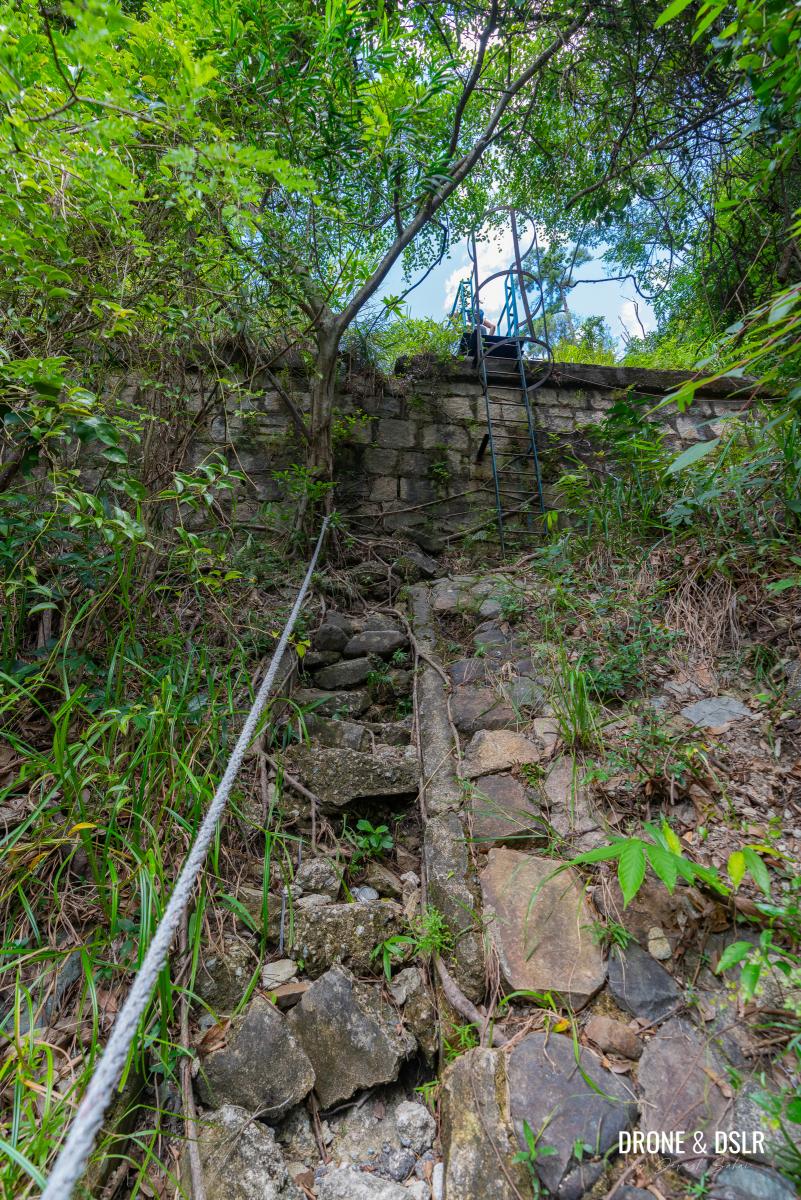
You can take the ladder or walk to the side, and climb up the wall
Unfortunately, the gate at the end of the steps is locked, so you’ll need to climb over the railing next to the storm drain. Then, walk along the railing until you reach the end of the fence, where you’ll exit onto the service road.
-
- Take the steps up
-
- Jump over the steps, and walk along the drain to the end of the fence to step onto the service road
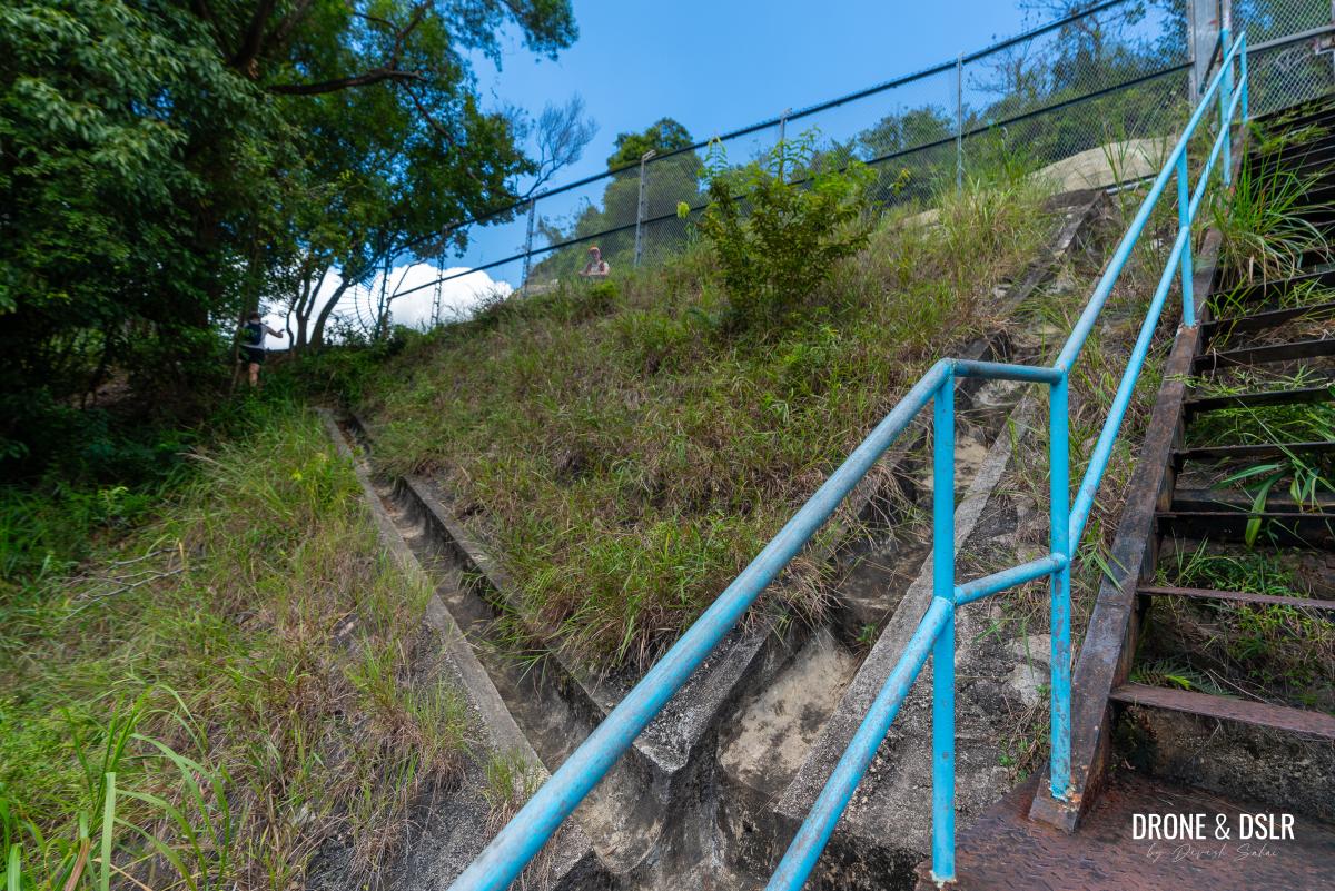
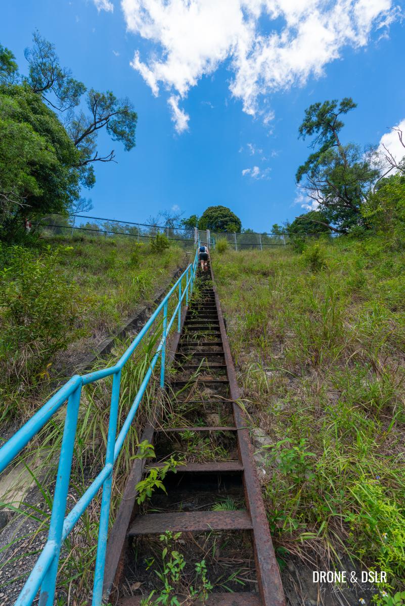
From this point onward, the rest of the hike follows the same route as Option 1.
Once on the service road, simply follow it to the end
Option 3: Difficult — Via The Riverbed
If you’re planning to hike all the way to the dam along the riverbed, you probably don’t need this guide! But just in case you were wondering, follow Option 2, but don’t take the exit to the service road. Keep going till you reach the dam.
While this option is entirely possible, I don’t recommend attempting it during or immediately after heavy rains. It’s safest to hike up the Ma Dai Stream riverbed when conditions are relatively dry.
End the Ma Dai Stream Hike
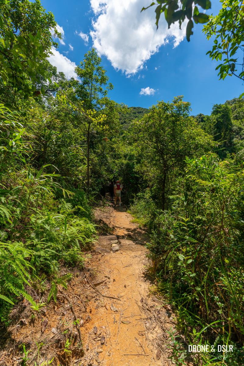
To return to the starting point, we highly recommend taking the service road all the way down to Hang Tak Street. It’s the most convenient and straightforward route for a safe return.
-
- It’s best to return via the service road
-
- The start and end of the service road at Hang Tak Street
However, some hikers choose to continue upstream from Hero Falls and then turn left toward the Ma On Shan Barbecue Site, near Ma On Shan Tsuen. We considered this option but decided against it because finding transportation at the barbecue site can be challenging.
A Fun Stream Hike
We hope you found our guide to the Ma Dai Stream hike resourceful and easy to follow.
The rock pool at the halfway point
During our visit, we observed that 98% of hikers picked Option 1, which is understandably the easiest way to enjoy the stream. The next most popular choice was following the service road to the fence and then descending to the rock pool at the halfway point. I believe we were the only ones who decided to hike upstream along the riverbed that day. No regrets, as it was a lot of fun!
The gorgeous upstream area of the Ma Dai Stream
If you’re interested in an easier stream hike nearby, I recommend the Ngau Wu Reservoir, also located in Ma On Shan Country Park. And during the cooler months, the Ma On Shan Hike or the Ma On Shan Country Trail Hike are excellent options for challenging and scenic hikes.
Please share this guide with anyone looking for an easy, or challenging, way to experience the beautiful Ma Dai Stream, and feel free to leave a comment below if you found this guide helpful.
If you enjoy our work, come join us on Instagram and YouTube 🙂


You might also like


Leave a reply