
Needle Hill or Cham Shan (針山) is a strikingly sharp peak with a flat summit located between Shing Mun Reservoir and Shatin, in the New Territories of Hong Kong. Although it technically isn’t one of the three Sharp Peaks of Hong Kong (High Junk Peak, Sharp Peak, and Castle Peak), hiking up to its summit is equally challenging!
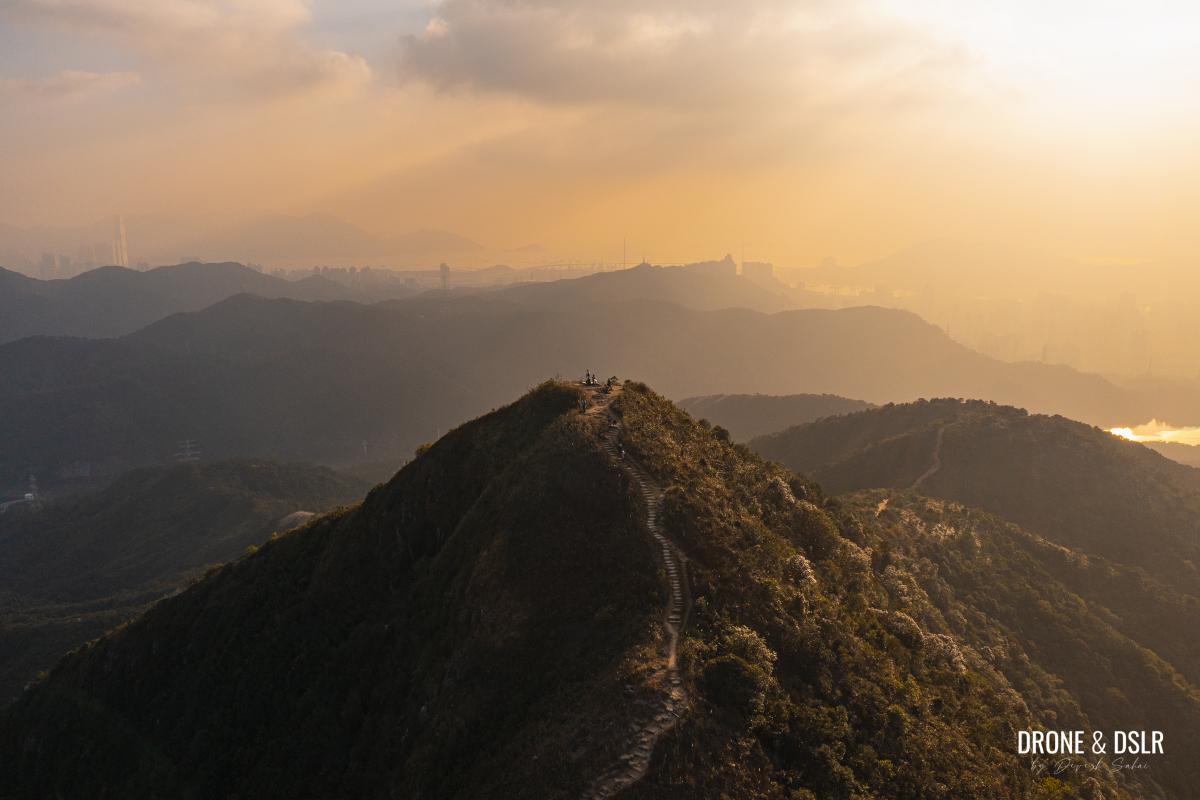
Bathed in gold – Needle Hill, Hong Kong
I believe the hill is sometimes referred to as “Jianshan”, a name given by the Hakka people who once lived in the area. In the Hakka dialect, the pronunciation of “Jian” and “needle” is quite similar, which is how the hill got its name.
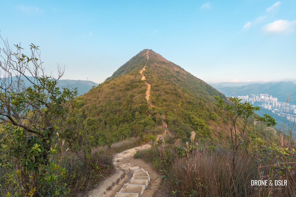
The magnificent Needle Hill
The Needle Hill Hike is as challenging as it is scenic. The sharp rising hill with its narrow peak offers 360-degree views of Tai Mo Shan, Tsuen Wan, Tsing Yi, Lantau Island, Shatin, and Ma On Shan.
The Needle Hill Hike
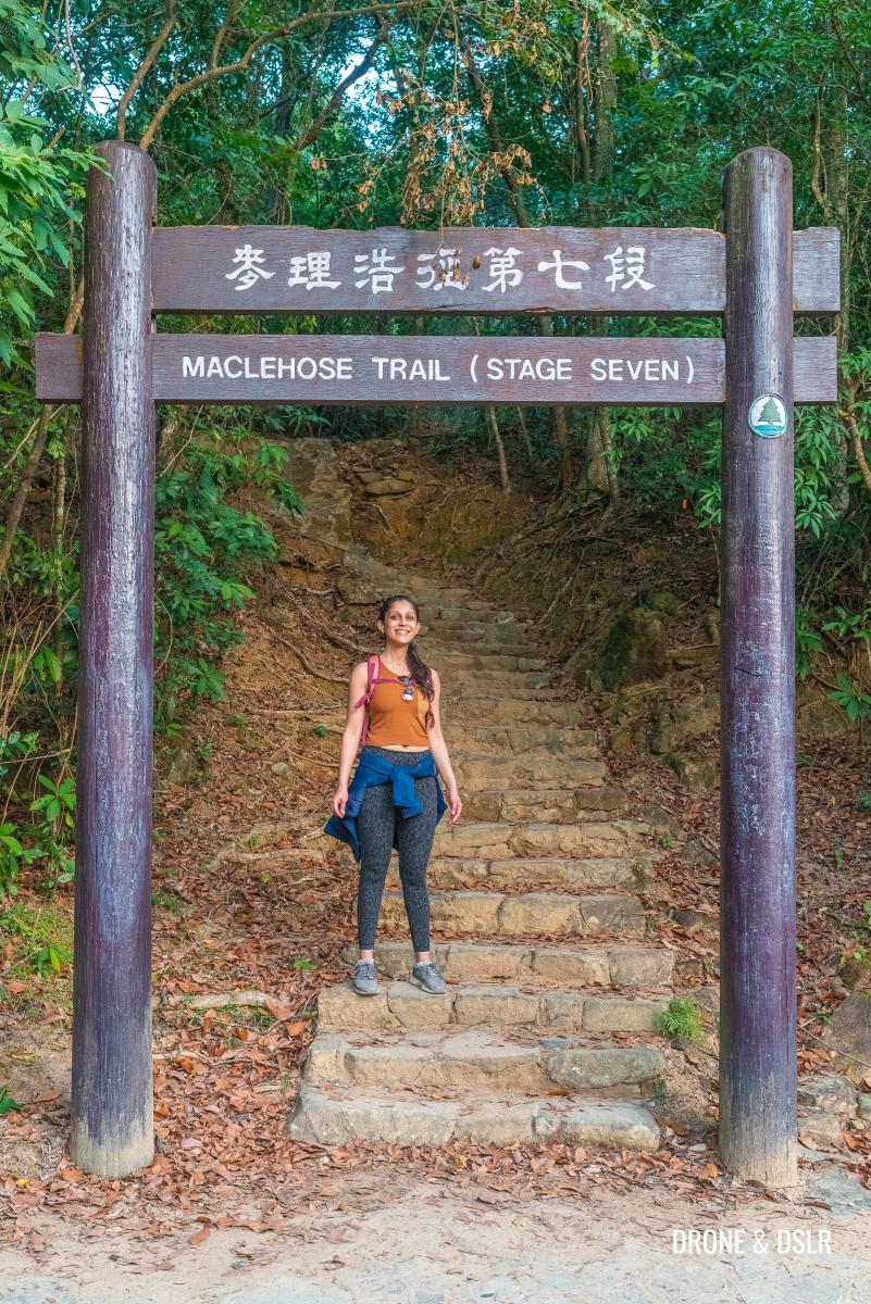
Situated on Maclehose Trail Section 7, Needle Hill offers hikers a few options to reach its summit. The hill also forms part of the popular hiking route from Tai Mo Shan and Grassy Hill.
But perhaps the most popular trail to Needle Hill is the one from Shing Mun Reservoir. The steep ascent is the shortest trail up to the summit. Although many chose to descend back to Shing Mun Reservoir, I recommend continuing the hike to Shatin.
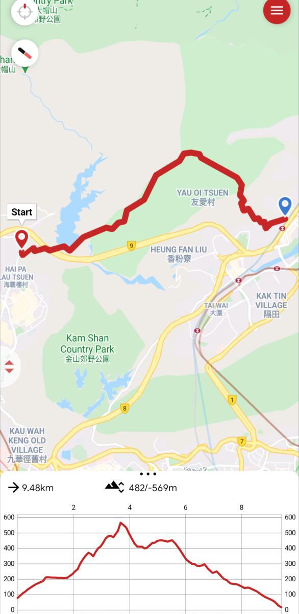
Needle Hill hike map and elevation profile
The Needle Hill Hike from Shing Mun Reservoir to Shatin is slightly longer than returning to Shing Mun Reservoir. But the descent on this route offers gorgeous views of Shatin, Ma On Shan Peak, and the range of hills in Lion Rock Country Park and Ma On Shan Country Park.
As amazing as this hike sounds, be advised that it is a challenging hike with no shade on the top of Needle Hill. So, please remember to carry enough water and sun protection.
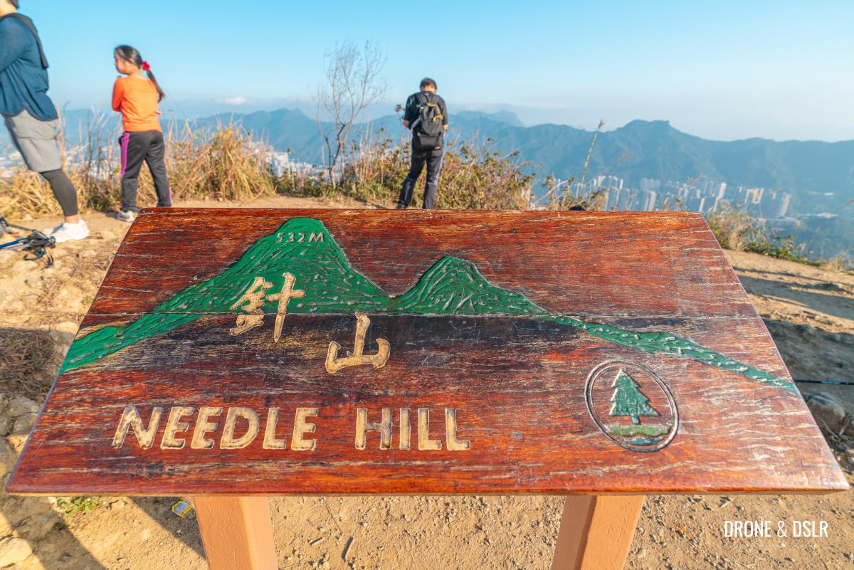
The sign on the top shows the elevation profile
Starting point
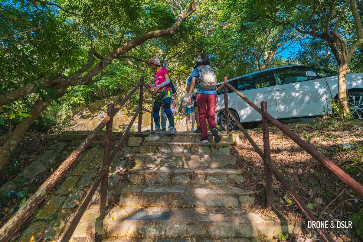
The starting point for the Needle Hill Hike from Shing Mun Reservoir is Lei Muk Shue Estate, the same as that for the Shing Mun Reservoir Walk.
For most, the easiest way to arrive here is from the Kwai Fong MTR Station. From the station, take any bus (or a taxi) to Lei Muk Shue Estate.
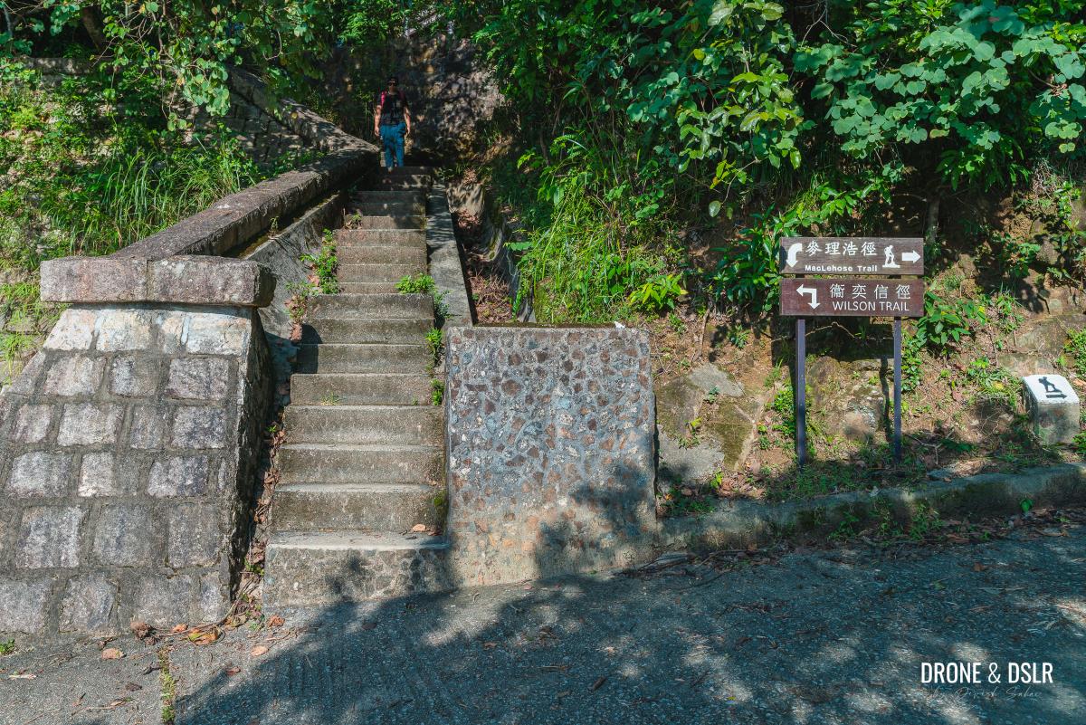
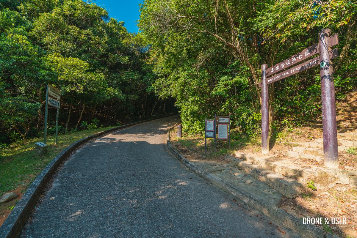
To Maclehose Trail Section 7
Once at Lei Muk Shue Shopping Centre, cross Wo Yi Hop Road and climb up the flight of steps on the side of the hill. Follow the winding path uphill and at the first three-point junction, turn left.
-

- Cross the road at Lei Muk Shue

-
- Take the steps after crossing the road
-
- The road is a gentle incline to the reservoir

-
- Turn left at the three-point junction
About 4oo metres after turning left, look for a flight of steps on the right. This shortcut of steps brings you directly to Maclehose Trail Section 7.
-
- Walk past all the containers
-
- Take the steps on the right for the shortcut
-
- Steps end on the road, which is also Stage 7 of the Maclehose Trail
To the Shing Mun Reservoir Main Dam
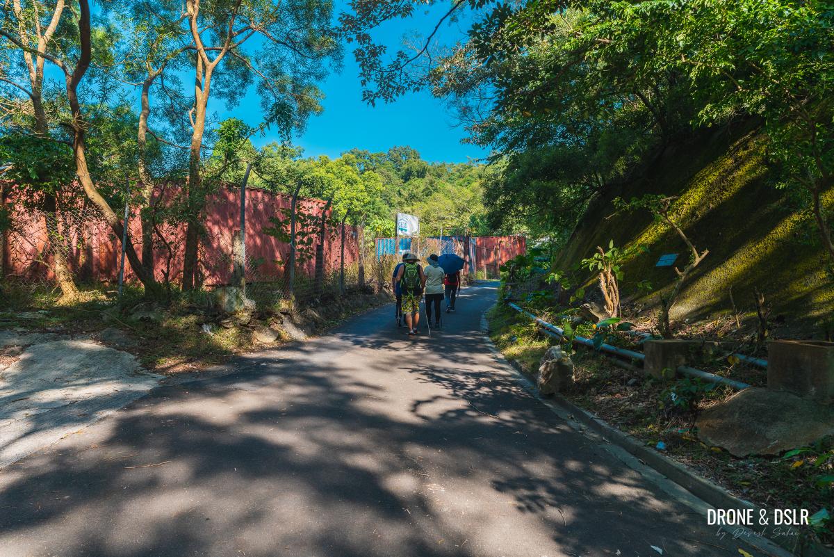
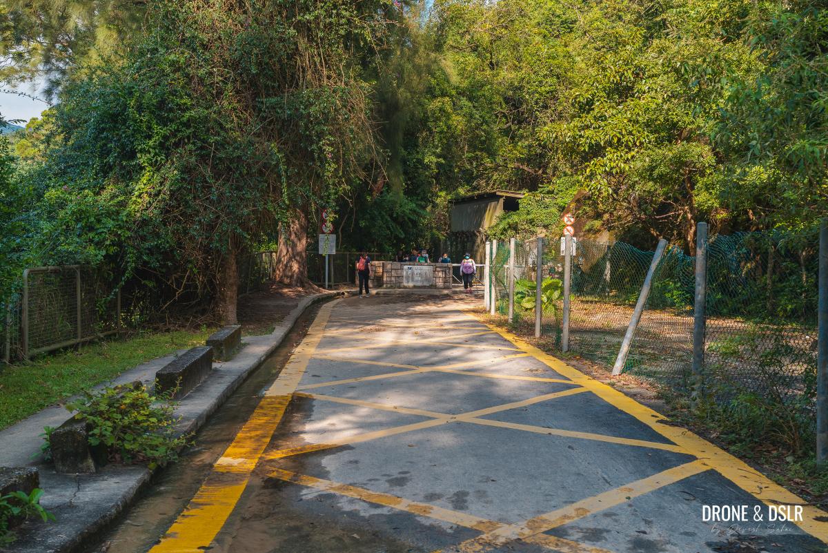
Once on Maclehose Trail Section 7, turn right and walk on the road till you reach a barbecue area.
-
- Turn right and walk on the road
-
- The barbecue area next to the entrance for the Shing Mun War Relics Trail
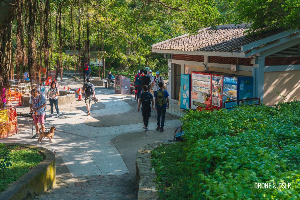
The barbecue area has toilets, a vending machine for drinks, and a water fountain in case you need any of its facilities. It is also the start of Section 6 of the Maclehose Trail and the Shing Mun War Relics Trail.
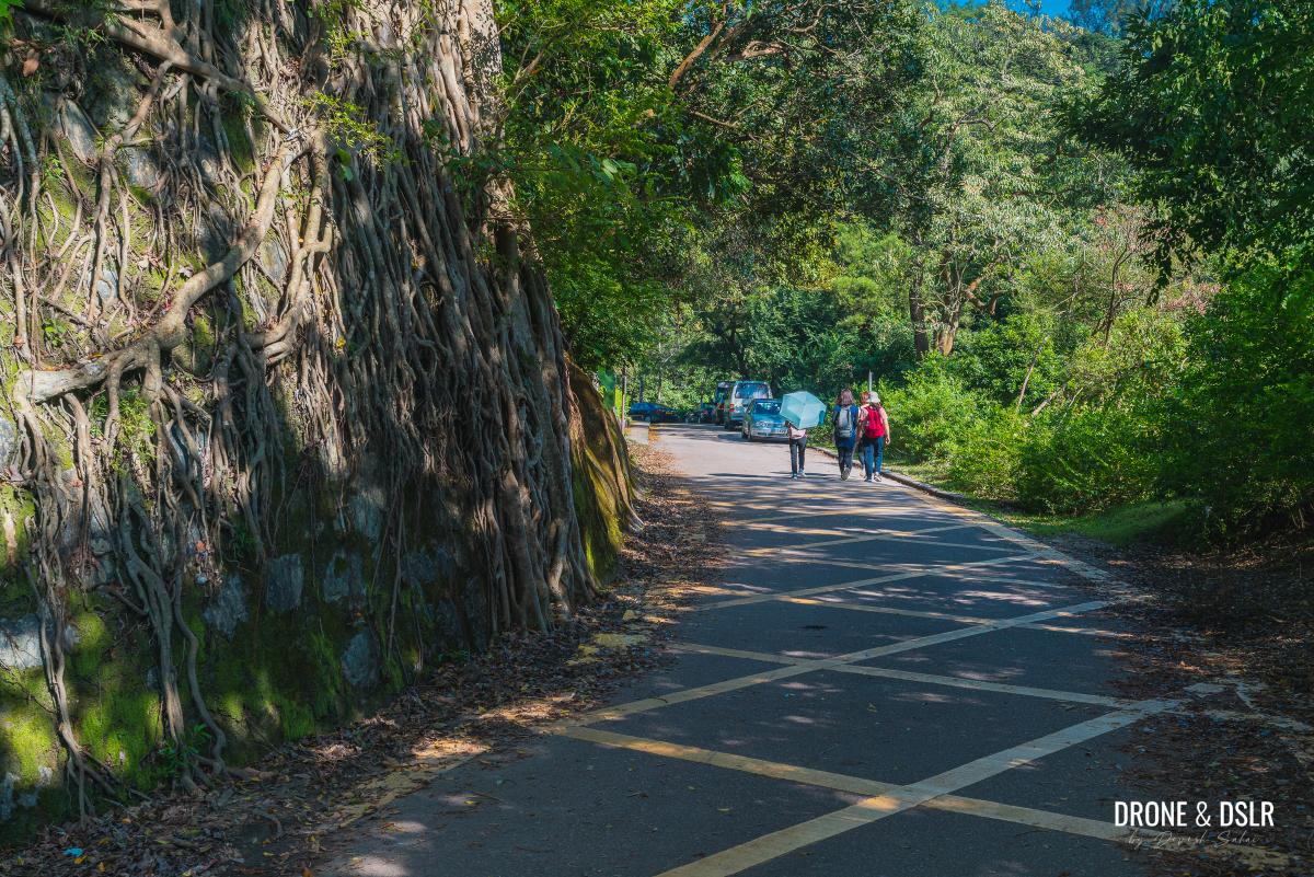
For now, continue walking on Maclehose Trail Section 7, alongside the reservoir. Slightly further ahead, you’ll get your first glimpse of the water.
-
- Stay on the Reservoir Walk
-
- Enjoying the first views of Shing Mun Reservoir

-
- No cars beyond this point
Continue walking on the road till you finally reach the main dam of the Shing Mun Reservoir.

Looking down on the main dam of the Shing Mun Reservoir
If this is your first time at Shing Mun Reservoir, you might want to take your time to admire the beautiful views from the dam. You can always return here to take a peaceful walk around Shing Mun Reservoir.
-
- On top of the Shing Mun Reservoir Main Dam

For now, cross the main dam and take the steps on the other side.
Take the steps at the end of the main dam
At the end of the steps are two paths – Section 7 of the Maclehose Trail that goes up to Needle Hill on the right, and the Shing Mun Reservoir Walk on the left. So naturally, it’s time to turn right.
Turn right to continue to Needle Hill
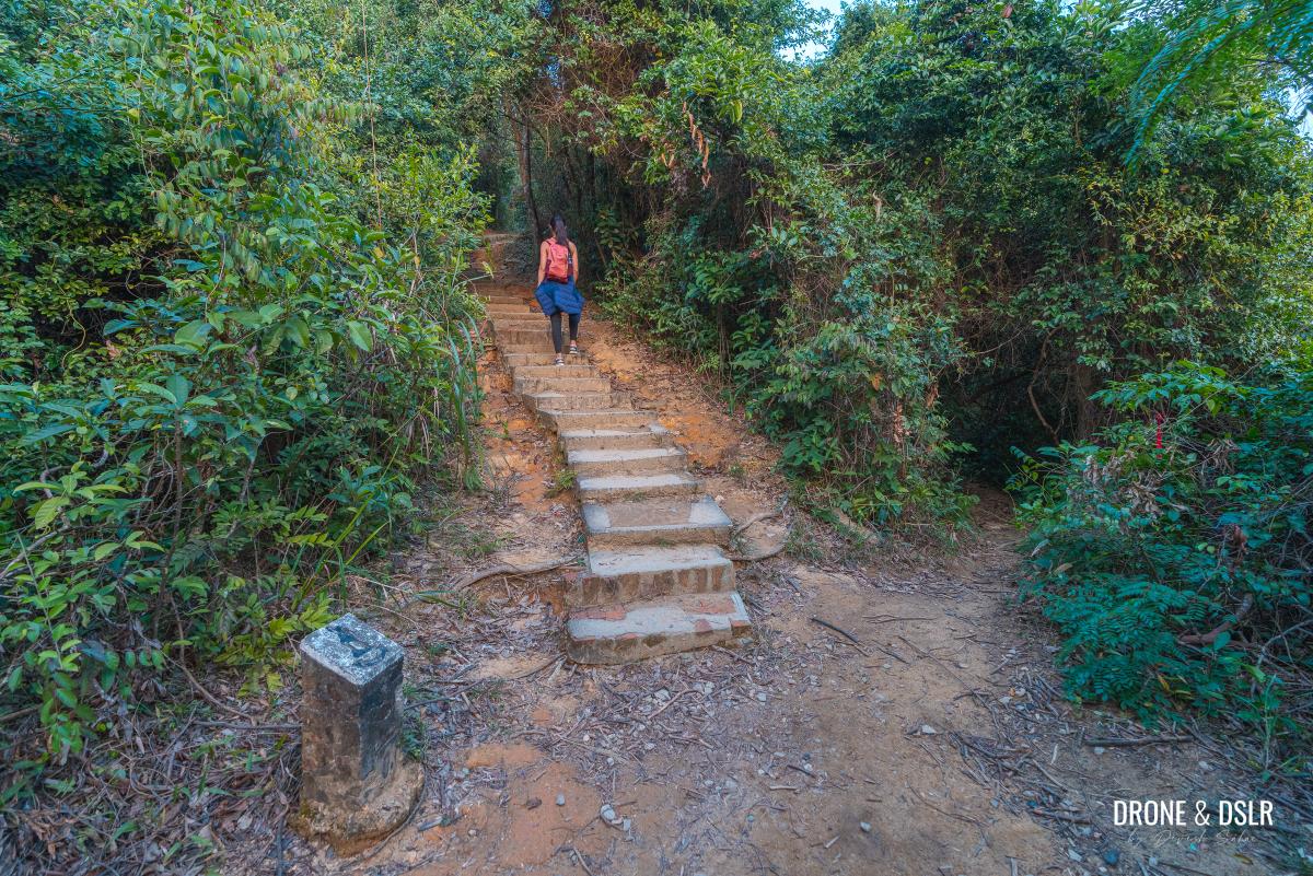
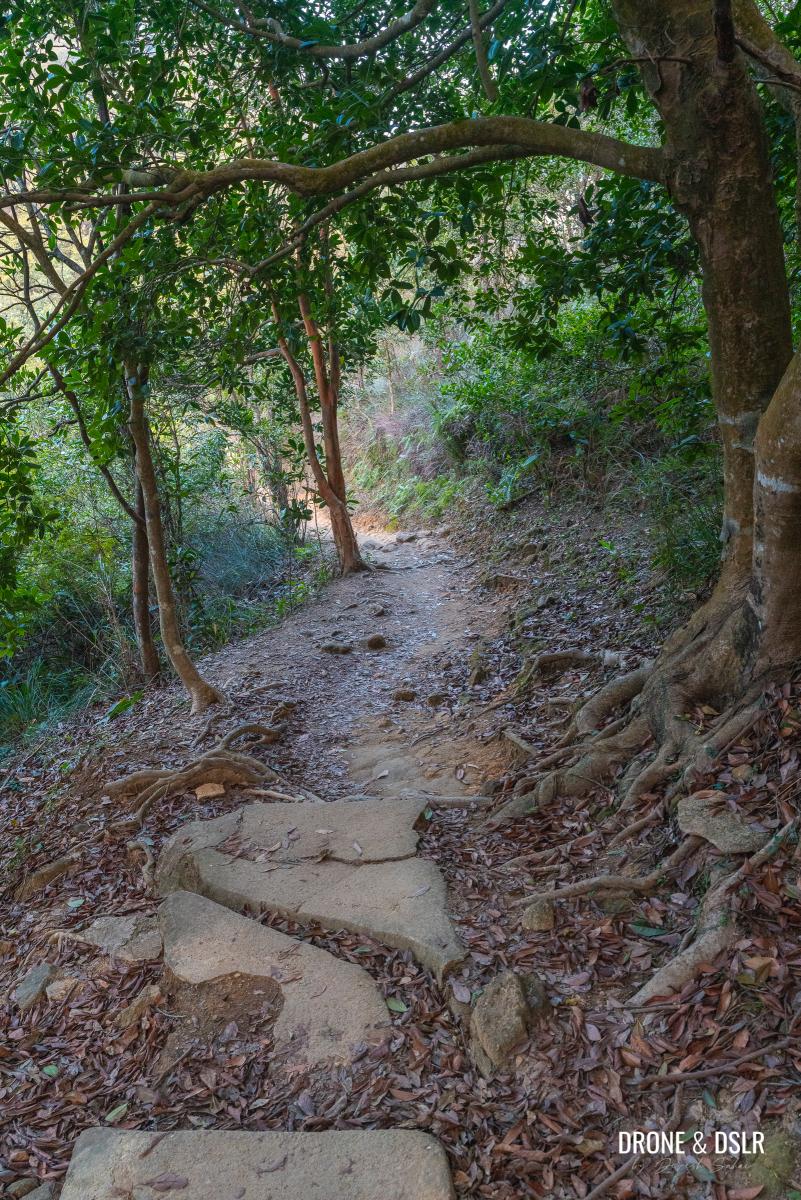
The first section of the climb
Up till this point, it’s been a warm-up to get here. The Needle Hill Hike starts at this entrance!
All smiles before the climb to Needle Hill
The hike up to Needle Hill can be thought of as three distinct climbs, with flat sections after the first and the second climbs.
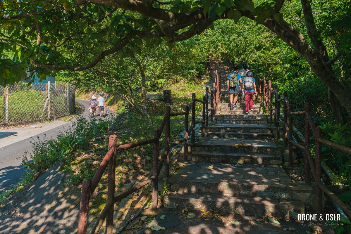
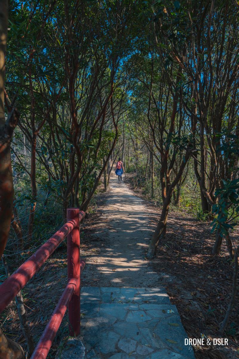
As you walk through the entrance, get ready to climb the first section (approximately 500 metres) of this daunting hike! The steps at the start are relatively easy and shaded.

The initial steps
You might notice an unmarked trail after the first flight of steps. Ignore it and continue climbing the steps to the left. The unmarked trail heads down to Lower Shing Mun Reservoir.
Stay on the steps to the left
The relatively easy steps soon become steep and difficult. So, remember to conserve your energy and take it slow.
-
- The long arduous climb begins

-
- Enjoying views of Shing Mun Reservoir
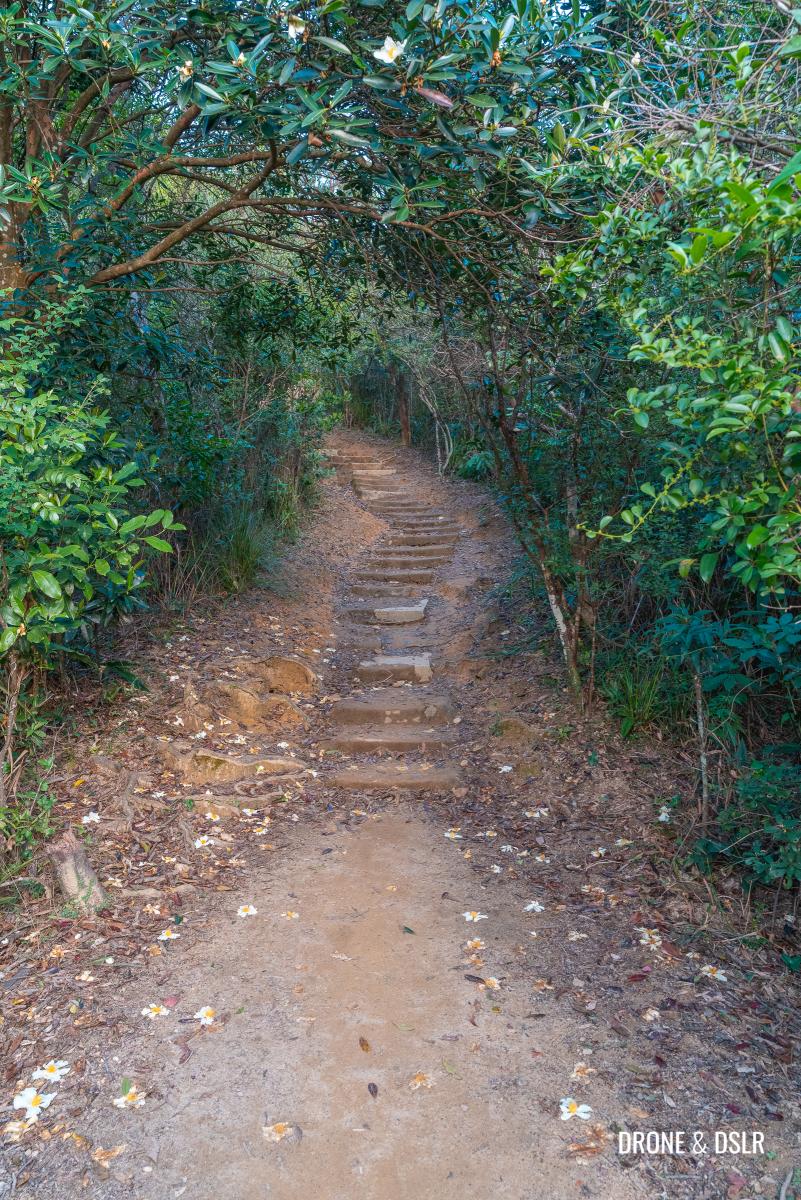
Although the steep section isn’t too long, it feels like an eternity. And after another 200 metres of climbing steps comes the first flat section.
Almost done with the first section of the climb
The first flat section
After this short intense climb, it’s time to catch your breath! The first flat section is a great spot to take a short break.
-
- The flat section begins

-
- The trail declines momentarily
This flat section is a little over 200 metres before the steps restart.
-
- The first flat section is just over 200 metres
-
- Winding down the easy part of the Needle Hill Hike

-
- The steps restart
The second section of the climb
At approximately 530 metres, the next section of the climb is equally challenging as the first. And the latter half of the steps aren’t shaded.
-
- Kids exhausted climbing up Needle Hill

-
- Time to take off the jacket because it gets hot climbing up

-
- The shade begins to disappear on the steps

Once again our advice is to take it easy and go slow. Climb at a comfortable pace.

The final steps of the second section of the climb
When you reach the open section of the climb, make sure to turn around to admire the views below. Of course, the best views are from the top of Needle Hill!
Once again, this section of the climb felt longer than it was. However, as the shade begins to disappear and the vegetation becomes thin, you know that you’re approaching the end of this section of the climb.
The second flat section
After the final step, the trail flattens one last time before revealing Needle Hill. If you haven’t realized it by now, Needle Hill remains hidden throughout the hike.
-
- The trail flattens again

-
- The first look at Needle Hill on the hike

Get your cameras out because Needle Hill looks very photogenic from this spot!

Needle Hill
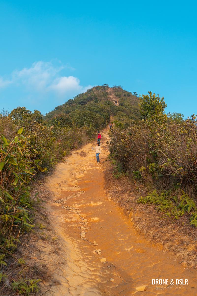
Keep walking as the trail dips at the base of Needle Hill and reveals the final ascent to the summit.

Admiring the final ascent to Needle Hill
So, take a break and hydrate yourself before getting ready for the final ascent!
The final ascent to Needle Hill
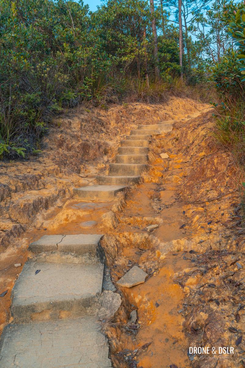
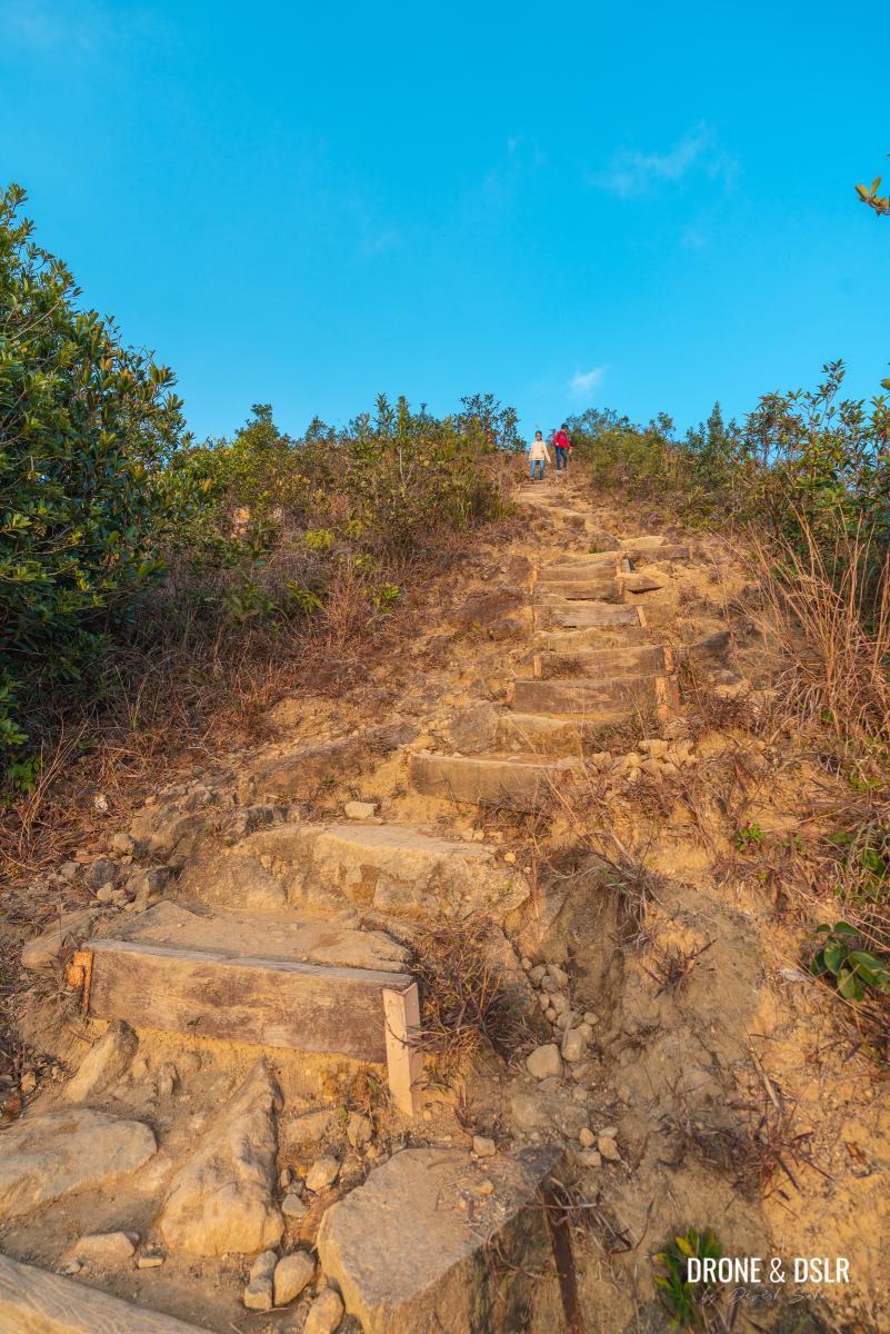
At this stage, you’re almost at the top! The final section of the hike to Needle Hill is a 400-metre sharp ascent that consists of slopes and broken steps.
-
- The final leg of the hike

-
- The raw incline
Unlike the previous sections, this section is not shaded. And if it’s a cloudless day, the sun can be brutal.
-
- An aerial view of the final ascent to Needle Hill

-
- Hike up at a comfortable pace

-
- The final climb to Needle Hill
-
- Another angle of the final climb to Needle Hill

So, take your time and climb at a comfortable pace. There’s no better feeling than approaching the summit at a slow and steady rate.
-
- Almost at the top of Needle Hill

-
- The peak of Needle Hill, Hong Kong
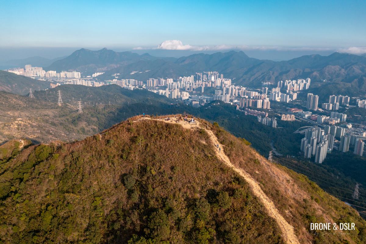
Needle Hill
Standing at 532 metres, Needle Hill offers 360 panoramic views of Hong Kong’s New Territories.
-
- Needle Hill triangulation station

-
- Posing with the Needle Hill sign

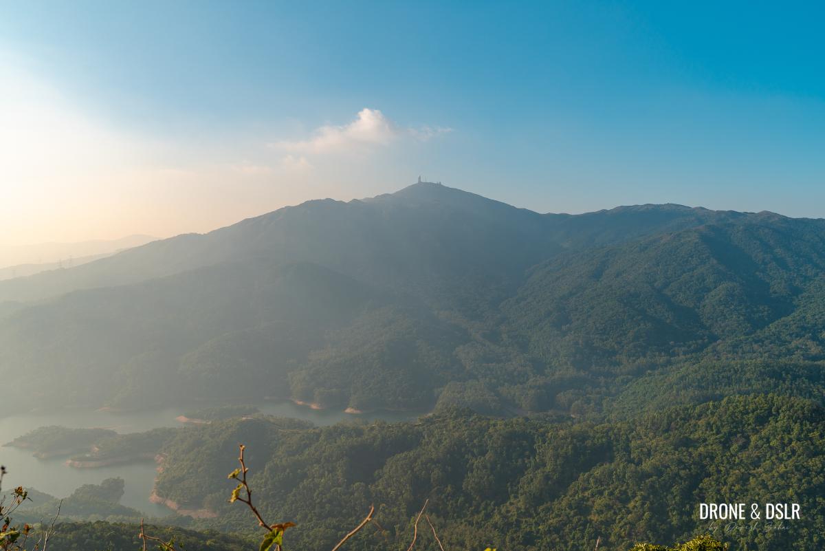
To the west lie Shing Mun Reservoir and Tai Mo Shan.

Shing Mun Reservoir and Tai Mo Shan next to Needle Hill
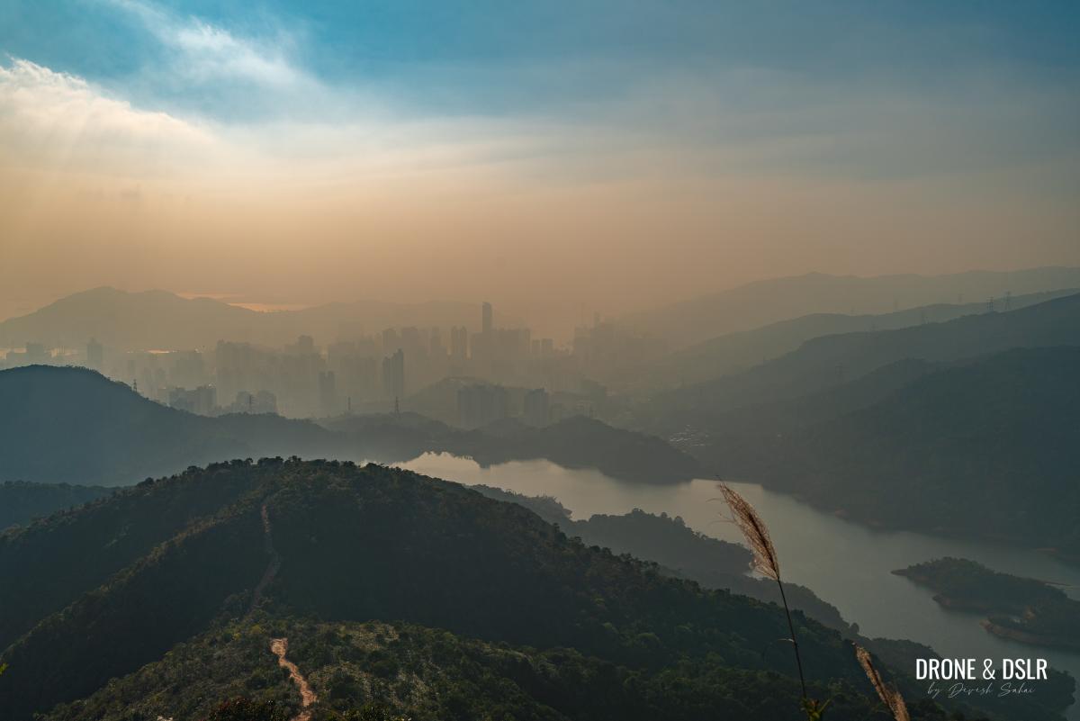
In the south, Tsuen Wan, Tsing Yi, and Lamma Island are visible. Unfortunately, on the day we hiked, the haze prevented us from getting those views.
-
- Hazy views of Shing Mun Reservoir and Tsuen Wan
-
- Views of Tai Mo Shan from on top of Needle Hill
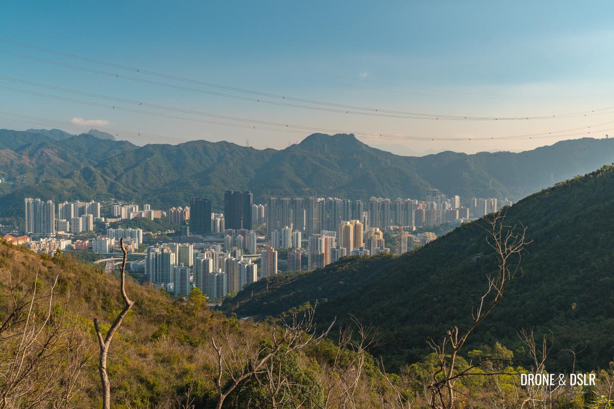
To the east and north lie the Shing Mun River valley, with Shatin and Ma On Shan. The entire range of hills in Lion Rock Country Park and Ma On Shan Country Park is visible. You can see the summits of Beacon Hill, Lion Rock, Temple Hill, Tate’s Cairn, and Kowloon Peak.
-
- Lion Rock seen from Needle Hill

-
- You can see ICC peaking out in the distance

And further north lie Buffalo Hill, Pyramid Hill, and Ma On Shan. On a really clear day, you can see as far as Plover Cove Reservoir.
-
- That’s Plover Cove Reservoir in the distance

-
- The summit of Needle Hill

The Needle Hill Hike is best done on a cool and clear day. The summit offers no shade, so bear that in mind.

Shatin and Ma On Shan behind Needle Hill
Subscribe to my YouTube channel
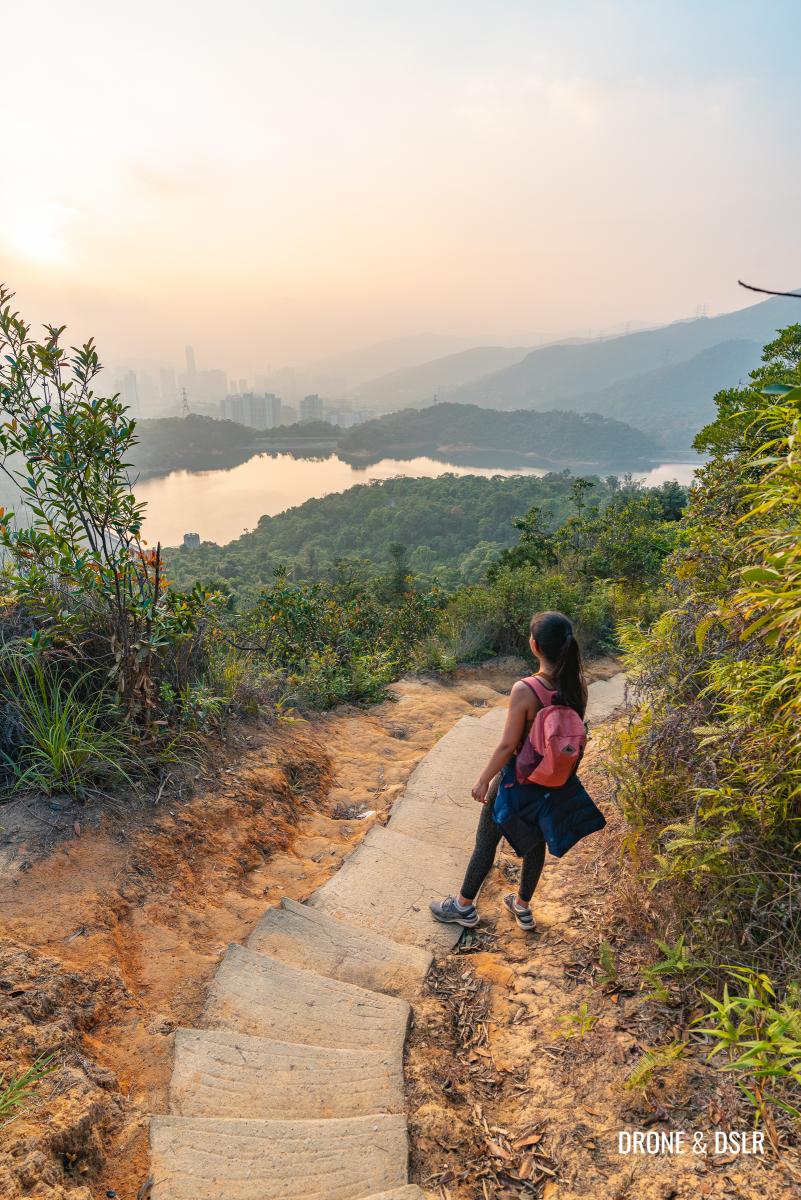
So, after soaking up the views, it’s time to descend. Many hikers prefer to retrace their steps back to Shing Mun Reservoir to finish the hike. You may pick this option.
However, if you wish to finish the hike in Shatin, read on.

A different angle of the other side of Needle Hill
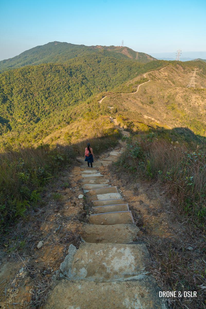
Descend Needle Hill
To finish the hike at Shatin, continue down Maclehose Trail Section 7 as it descends on the other side of Needle Hill.
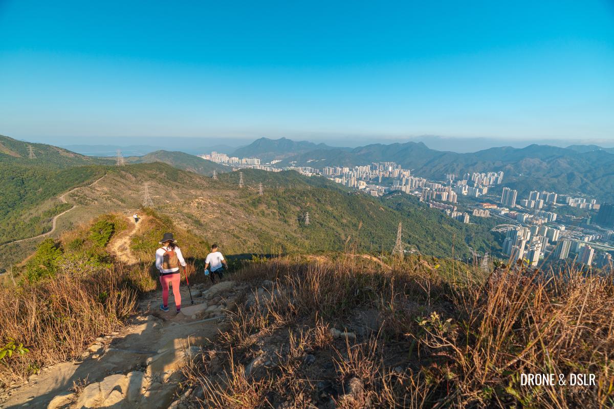
Time to descend towards Shatin
I found this descent to be incredibly picturesque!

Love how beautiful the trail looks from up here
The long winding trail down Needle Hill remains visible for quite a distance and looks quite beautiful! If you continue on this trail, you’ll reach Lead Mine Pass and Grassy Hill.
Heading down Needle Hill
And even while descending, the views of Lion Rock and Shatin on the right, and Tai Mo Shan on the left remain stunning!
We took our time descending Needle Hill as we kept stopping to take pictures.

Admiring Grassy Hill
But the slope on this side of the hill is shorter than the slope on the other side. So, before we knew it, we’d reached the base of Needle Hill.
-
- Almost at the base of Needle Hill
-
- The final stretch of the trail before the Shing Mun Reservoir Forest Track
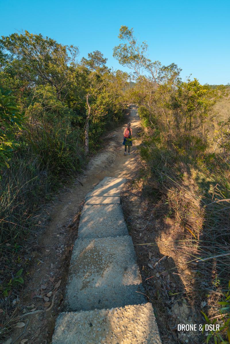
Shing Mun Reservoir Forest Track – Needle Hill Section
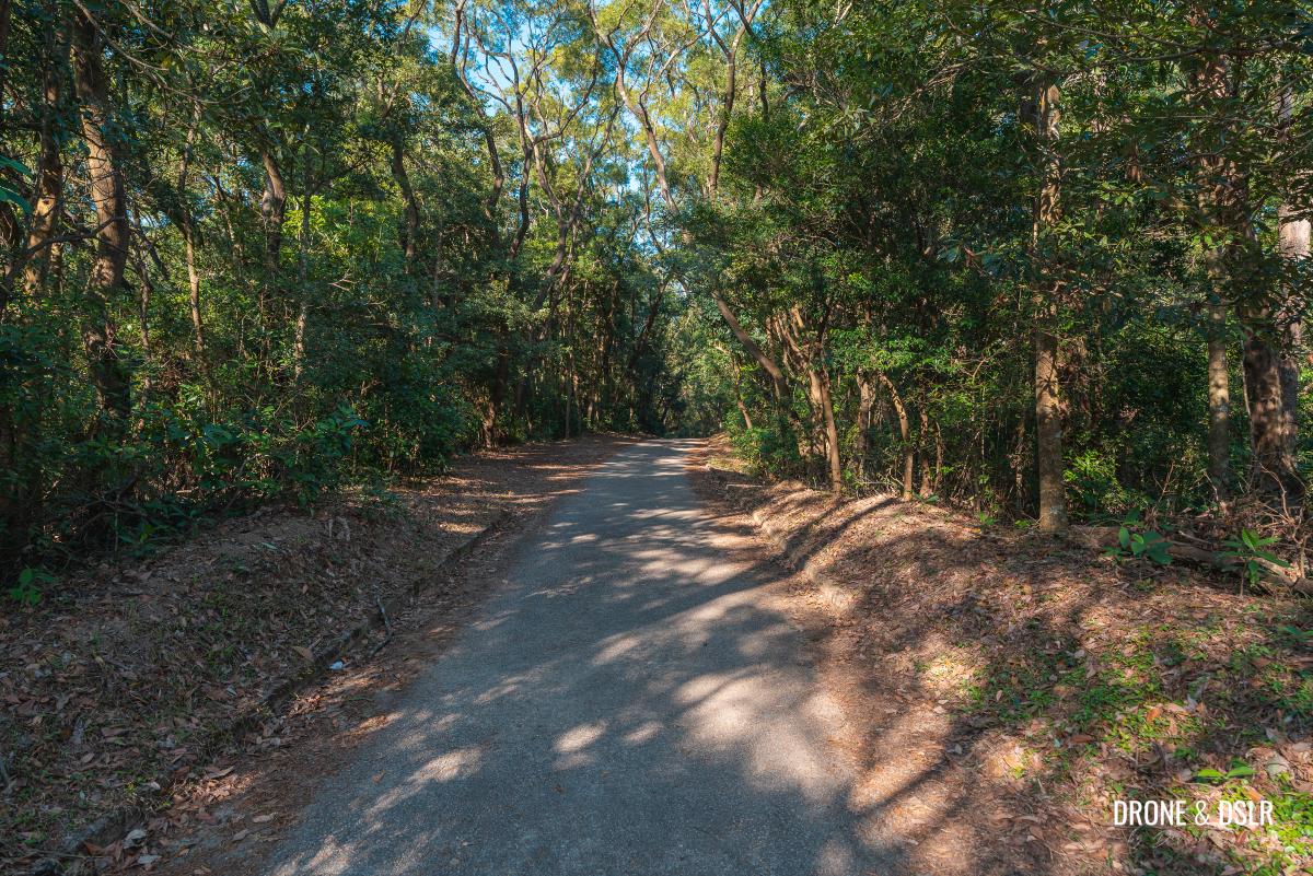
At the end of the descent, the trail turns into a paved road. This section of the hike runs on the Needle Hill Section of the Shing Mun Reservoir Forest Track. The Shing Mun Reservoir Forest Tracks are a set of paved roads around the reservoir.
The start of the paved road
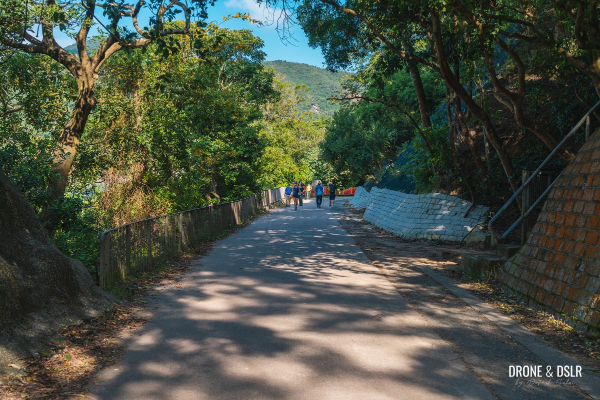
Once on the paved road, continue walking on its gentle incline.

The road with the views
Other than the views of Shatin below, make sure you turn around to admire the views of Needle Hill behind.
-
- Such lovely views of Lion Rock from the road
-
- Turn around to admire Needle Hill

The road gradually moves into the shaded area of Shing Mun Country Park, which is a relief on a sunny day.
-
- The gentle incline on the Shing Mun Reservoir Forest Track – Needle Hill Section

-
- Now entering the shaded section

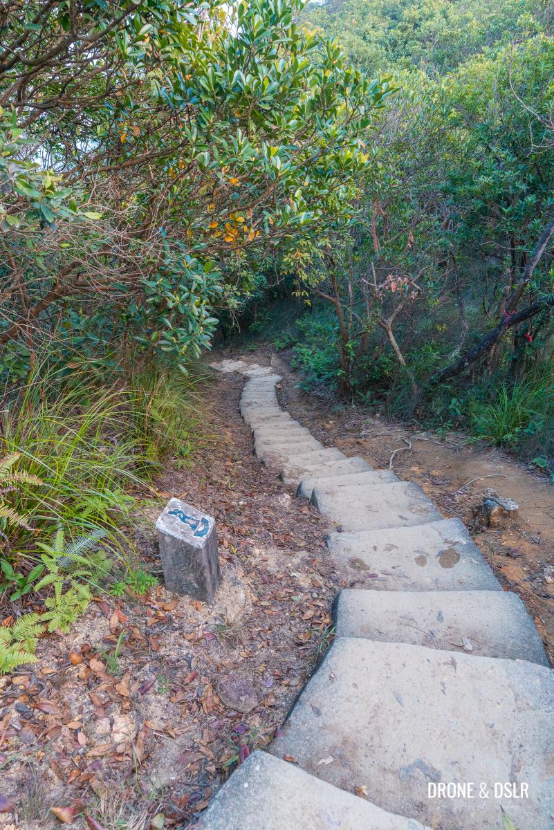
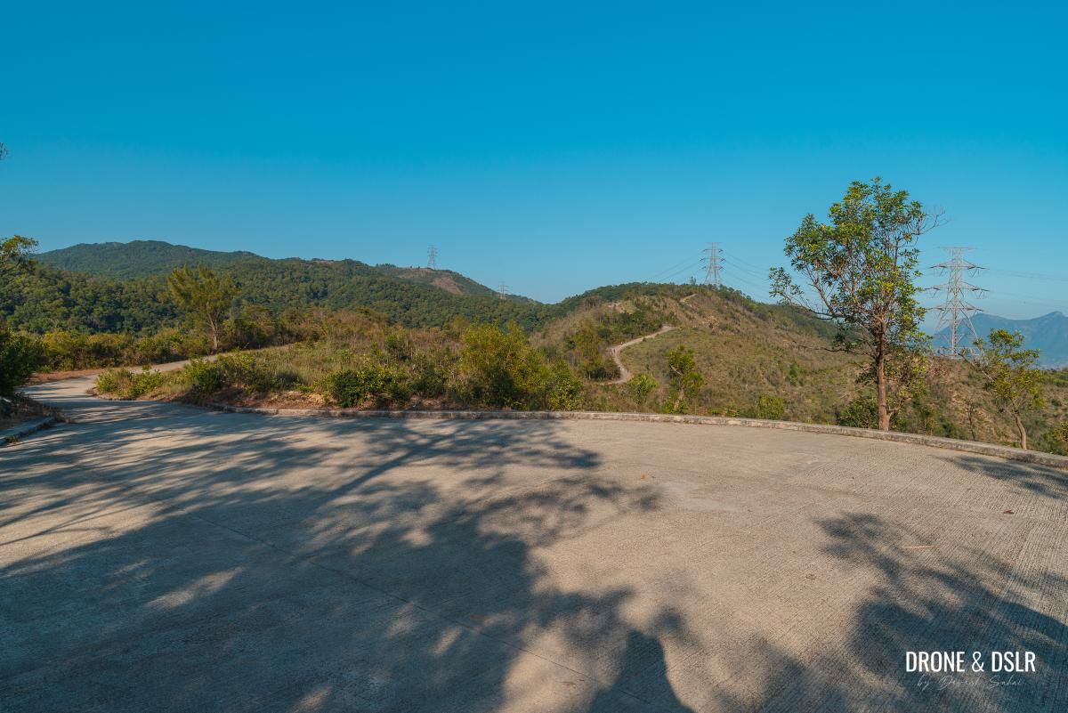
A few hundred metres ahead, the trail splits into two. On the right is an entrance marked “To Sha Tin Town”.
-
- Keep walking down the paved road
-
- Turn right at this point

The Shing Mun Reservoir Forest Track continues straight to Grassy Hill, but to head to Shatin, turn right.
A short trail to the steps
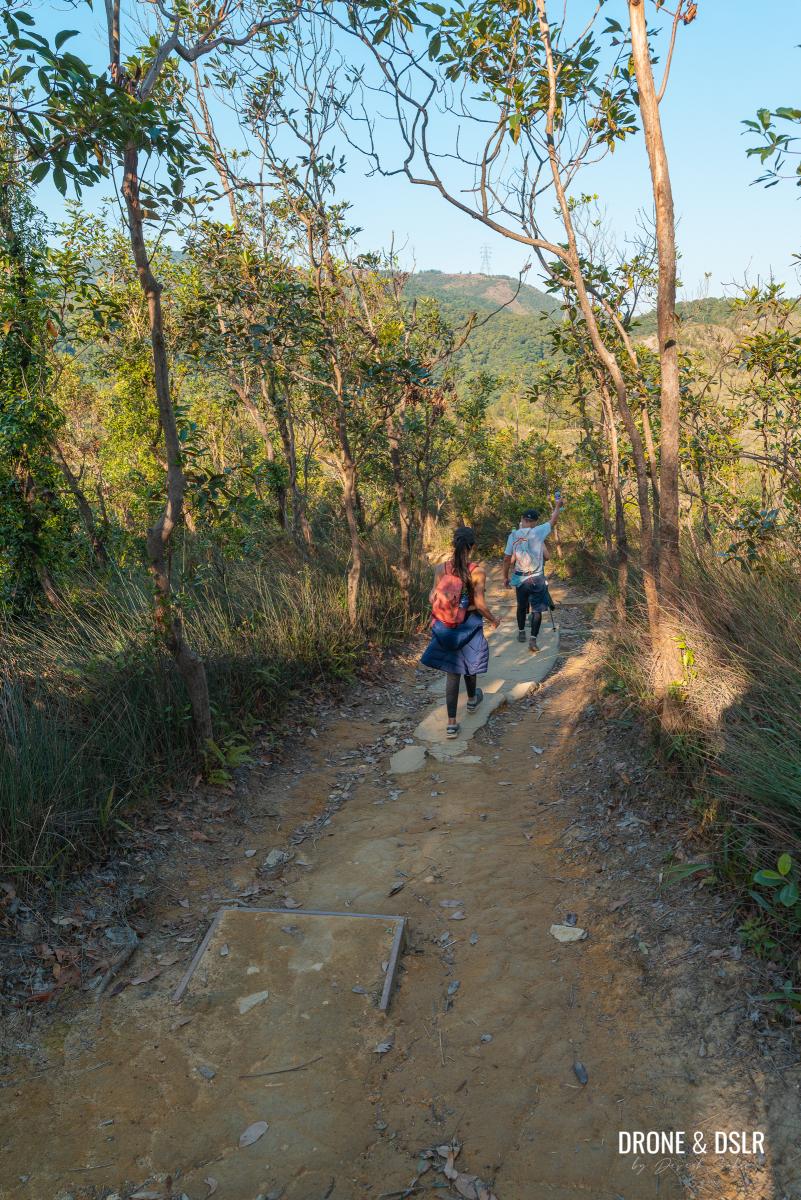
From this point on, we leave Maclehose Trail (Shing Mun Reservoir Forest Track) for Pai Tau Street to Shing Mun Country Park Trail. As the trail breaks away from the Shing Mun Reservoir Forest Track, it returns to a dirt trail.
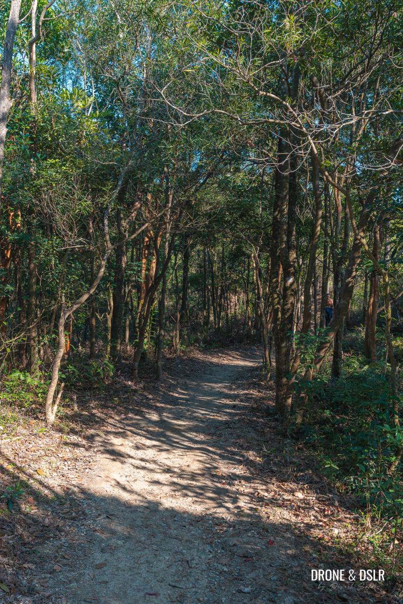
Start of the Pai Tau Street to Shing Mun Country Park Trail
Continue walking on the undulating trail for approximately 300 metres till it splits again. The trail headed straight heads to Greenwood Terrace (in Fo Tan), whereas the steps on the right go to Shatin main town.

Keep walking to the steps
As we’re headed to Shatin, take the steps on the right.

Turn right to head down to Shatin
Pai Tau Street to Shing Mun Country Park Trail
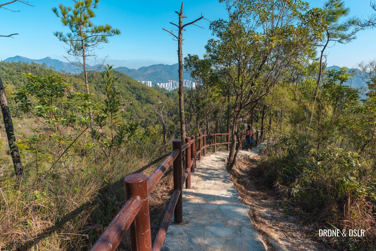
The next 1.7 km of the trail is a picturesque descent to Shatin on the Pai Tau Street to Shing Mun Country Park Trail.
The views as you begin your descent are covered thanks to the trees. But as soon as the trees thin out, you can begin to admire the open views of the valley below.
-
- And the descent to Shatin begins

-
- Keep walking down the steps

-
- Appreciating the views as we hike down

-
- The views of Shatin and Ma On Shan from Pai Tau Street to Shing Mun Country Park Trail

As the trail progresses, the steps gradually become less steep and the views become more prominent.
-
- The Pai Tau Street to Shing Mun Country Park Trail is quite beautiful

-
- Some more steps

Soon, the steps give way to a flat, paved trail. After passing a scenic bench, the trail becomes a dirt trail and then back into a paved trail.
-
- This lovely path

-
- Taking a break on this bench

-
- A short dirt trail

And after another short decline, the paved trail finally gives way to a shaded dirt trail.
-
- Some more views while walking downhill
-
- The dirt trail begins
At the end of this section of the trail is a flat area, with a few make-shift benches.
-
- A short shaded section

-
- The flat area with the make-shift benches

After the flat area, the trail sharply descends more steps. I thought the views from these steps were very stunning!
-
- The steps continue

-
- Lovely views of Ma On Shan

-
- One of the most picturesque steps in Hong Kong

At the bottom of the steps, the trail flattens momentarily before a short uphill climb. These are the only steps you’ll climb during this descent.
-
- At the bottom of the steps

-
- Taking some time to appreciate the trees

-
- The only uphill steps in this section

And at the end of this flight of steps, there is another flat area with some seating created by shaped trees.
-
- A beautiful seating area with twisted trees

-
- The flat area with the twisted trees

Past the twisted trees, the trail continues downhill on the final flight of steps.
-
- The steps continue on the other side

-
- Losing track of the number of steps by now

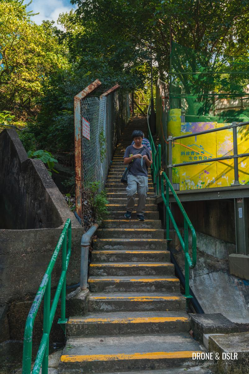
At the end of the steps, turn left and continue walking on the trail for another 230 metres till you reach civilization!
-
- The last of the steps. Turn left here
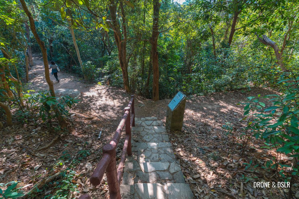
-
- Walk down this lovely trail

-
- Almost at the end of the trail

-
- Civilization, finally!

The Lutheran Theological Seminary
The first sight of civilization as you exit the trail is the Lutheran Theological Seminary. This campus of the Lutheran Theological Seminary was constructed in 1992 and sits on top of To Fung Shan, a short hill behind Shatin.

The Lutheran Theological Seminary
You can keep admiring the campus of the seminary as you walk down the road. We found the buildings to be quite beautiful.
-
- Walk along the Lutheran Theological Seminary campus

-
- More of the Lutheran Theological Seminary campus

Coincidentally enough, the Ten Thousand Buddhas Monastery is located on another hill adjacent to the Lutheran Theological Seminary.
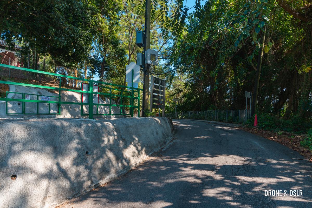
To Fung Shan Road
At the bottom of the road, next to the car park and the entrance to the seminary, is the start of To Fung Shan Road. The initial section of the road passes more halls and buildings of the Lutheran Theological Seminary.
-
- Taking our picture in front of the Lutheran Theological Seminary

-
- The start of To Fung Shan Road

Once past the buildings, continue walking downhill.
Keep walking on To Fung Shan Road
To Fung Shan Road twists and turns for approximately 700 metres till it reaches a small roundabout.
-
- Keep walking downhill after the campus

-
- Follow the signs for To Fung Shan Road
-
- The roundabout at To Fung Shan Road

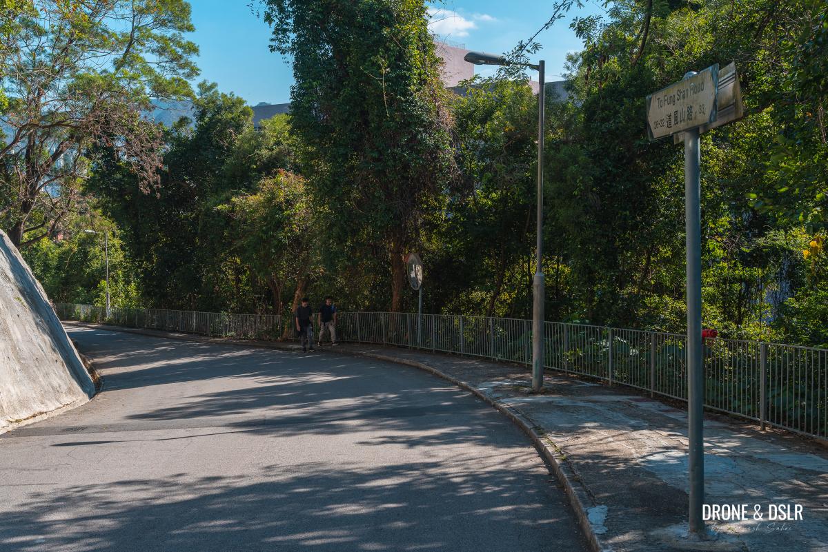
At the roundabout, To Fung Shan Road continues straight downhill, and Pak Lok Path is on the right. But there is also a slightly hidden pedestrian path on the left. Take this path.

Take this relatively hidden path
The final downhill path
This path is a continuation of the Pai Tau Street to Shing Mun Country Park Trail. The previous section simply overlaps with To Fung Shan Road.

Now approaching Pai Tau Village
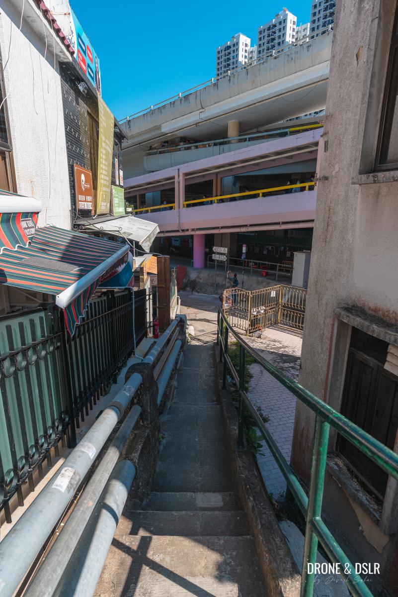
Fortunately, this path is a short and shaded trail between houses in the Pai Tau Village, that ends in front of the Shatin MTR Station.
-
- Pass by the houses in the village

-
- End the hike at Shatin MTR Station
And that brings this epic Needle Hill Hike to a close!
Shing Mun Reservoir to Shatin via Needle Hill
We hope you found our guide to the Needle Hill Hike resourceful. As always, you can do this hike from Shing Mun Reservoir to Shatin or in reverse. Or perhaps you prefer returning to where you started from.

Hazy views to the south of Needle Hill
Also, we advise that this hike be done in the cooler months because it is challenging and the trail around the summit offers no shade.
As always, feel free to drop us a comment below or share this post on the social media channel of your choice.
If you enjoy our work, come join us on Instagram and YouTube 🙂


You might also like


Leave a reply