
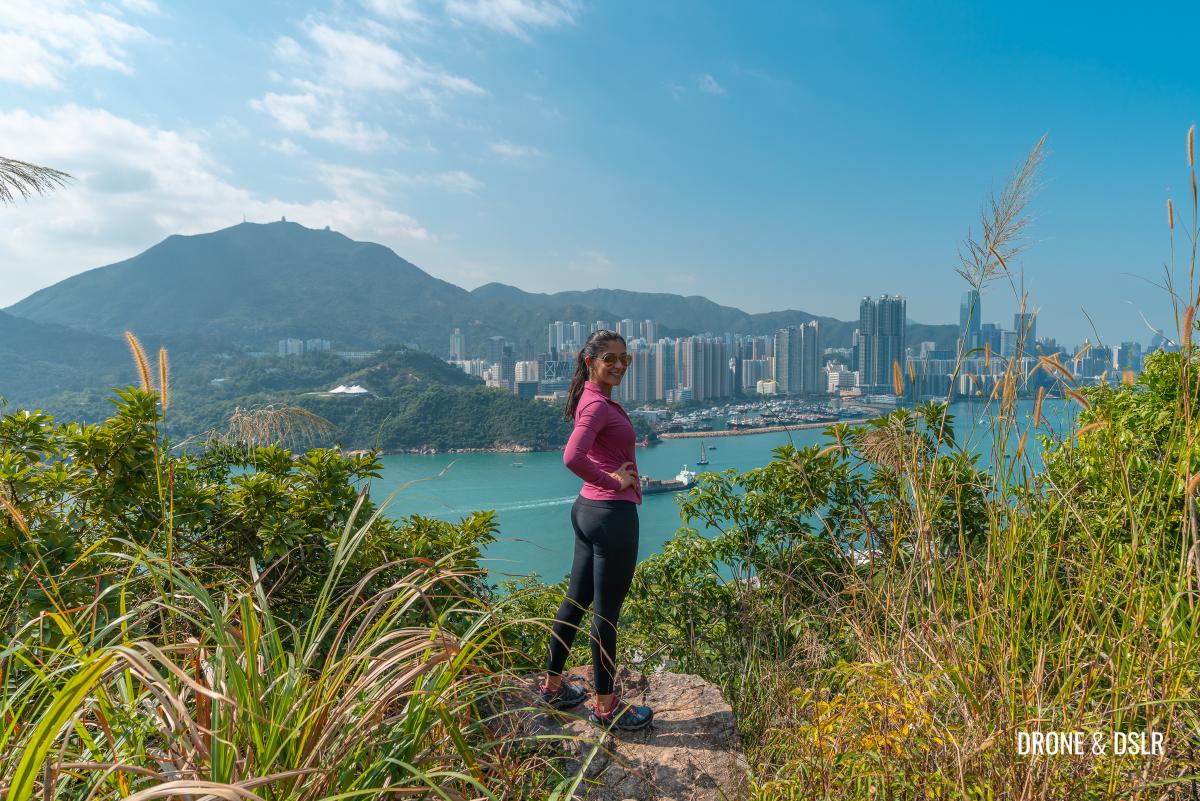
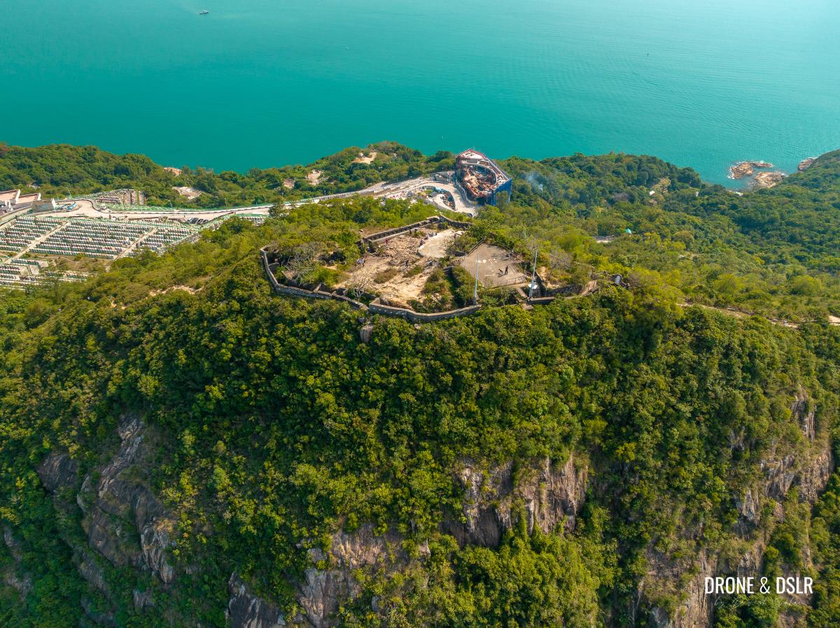
Devil’s Peak is one of the most fascinating and unique hikes in Hong Kong! Located on the south-east edge of Kowloon, it is an area of historical significance with many abandoned relics, scattered and hidden all over the hill.
Because of its location and vantage point, Devil’s Peak has been home to pirates, and even used as a strategic military base. But today it’s an easy family hike that offers not only great views of Hong Kong’s skyline and harbour, but also a chance to visit many of the former military batteries and fortications.
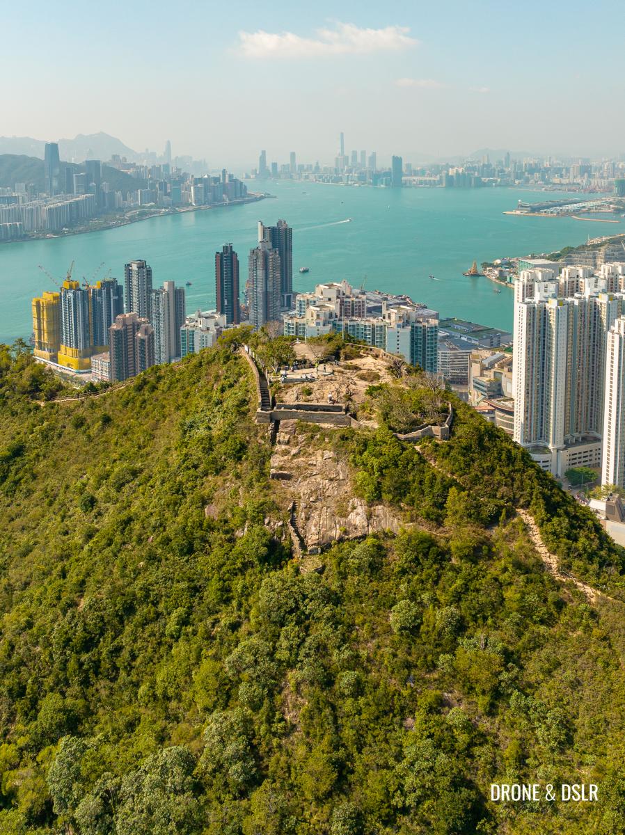
Devil’s Peak, Hong Kong
Although many of the fortifications are overrun by nature, some are still in good condition.
Not only is Devil’s Peak a fun and enjoyable hike for everyone but also adds a layer of history into Hong Kong’s past!
A Brief History of Devil’s Peak
Devil’s Peak gets its name from the ferocious pirates who once occupied the hill during the Ming Dynasty era. It was the home of the famous pirate Cheng Lin Cheong.

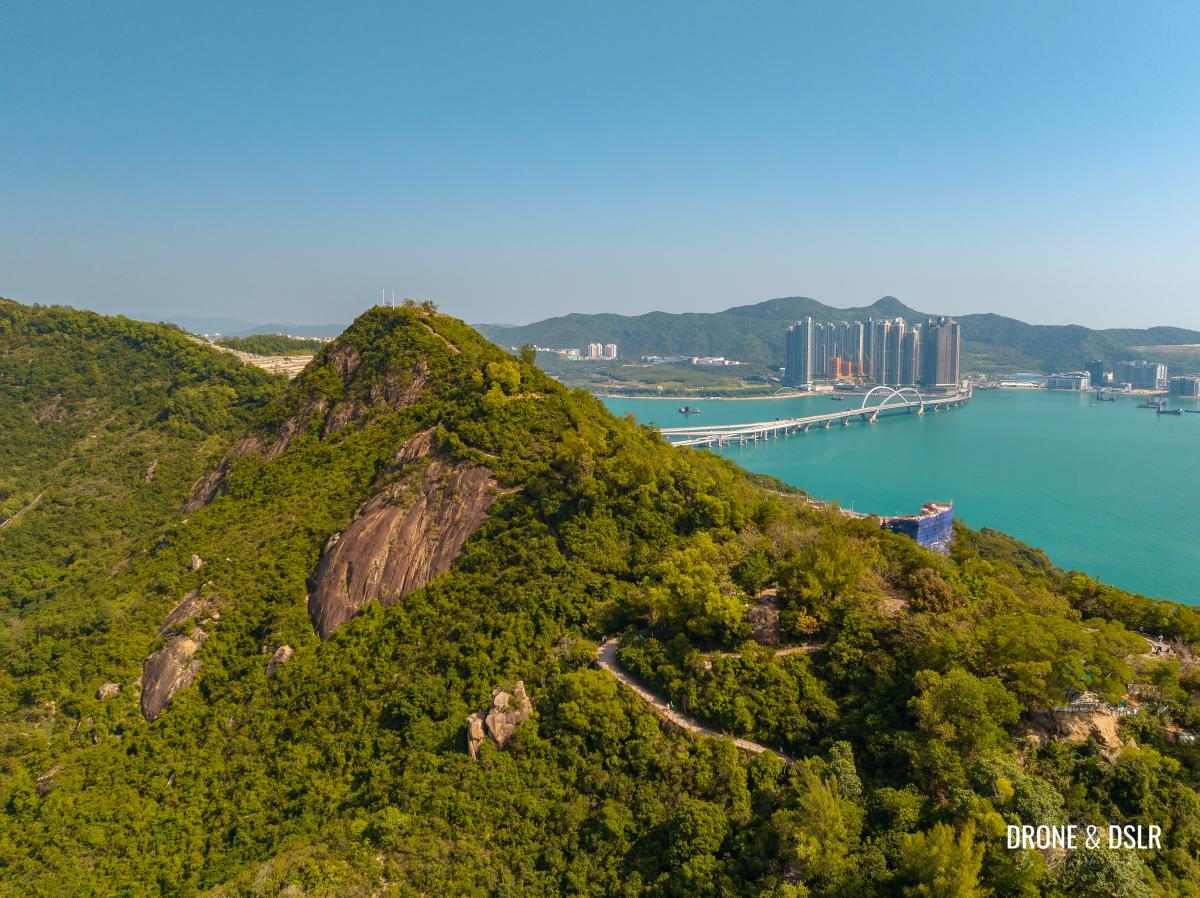
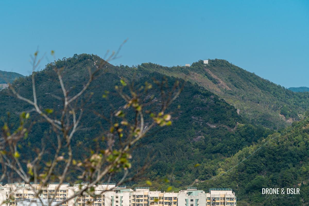
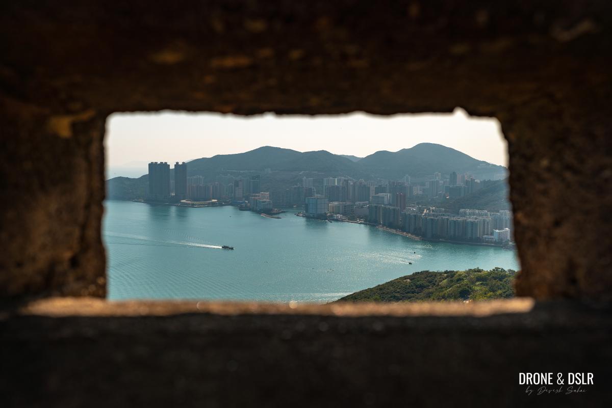
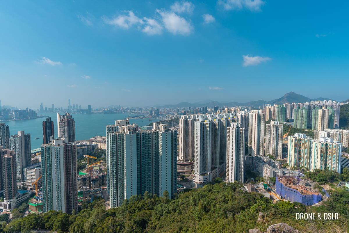
Devil’s Peak and Yau Tong to the side
The hill overlooks Lei Yue Mun, a narrow passageway to Victoria Harbour, classified as one of 16 major sea passages by the Ming Dynasty.

The narrow passageway to Victoria Harbour from Lei Yue Mun
When the British acquired the New Territories in 1898, they built military stations at Devil’s Peak – two gun batteries (named Gough & Pottinger) on the southern slopes, a smaller post, and a redoubt on top of Devil’s Peak.
The entrance to Hong Kong’s harbour via Lei Yue Mun
Before the Japanese invasion of Hong Kong on 8th December 1941, there were no guns at the Gough or Pottinger Battery. However, the sites at Devil’s Peak had become part of the Gin Drinker’s Line in the 1930s. Devil’s Peak was a crucial component of the Kowloon segment of the Line.
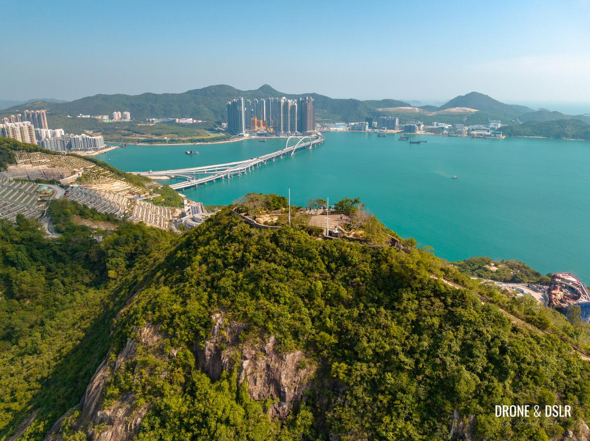
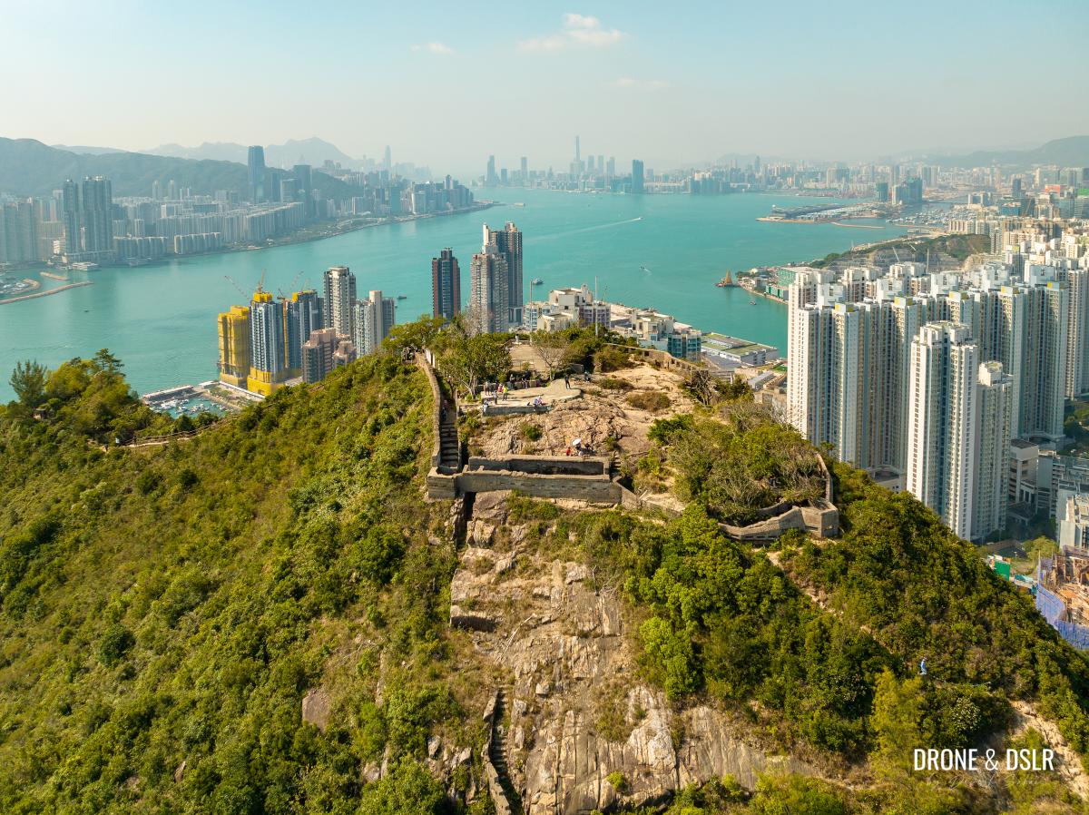
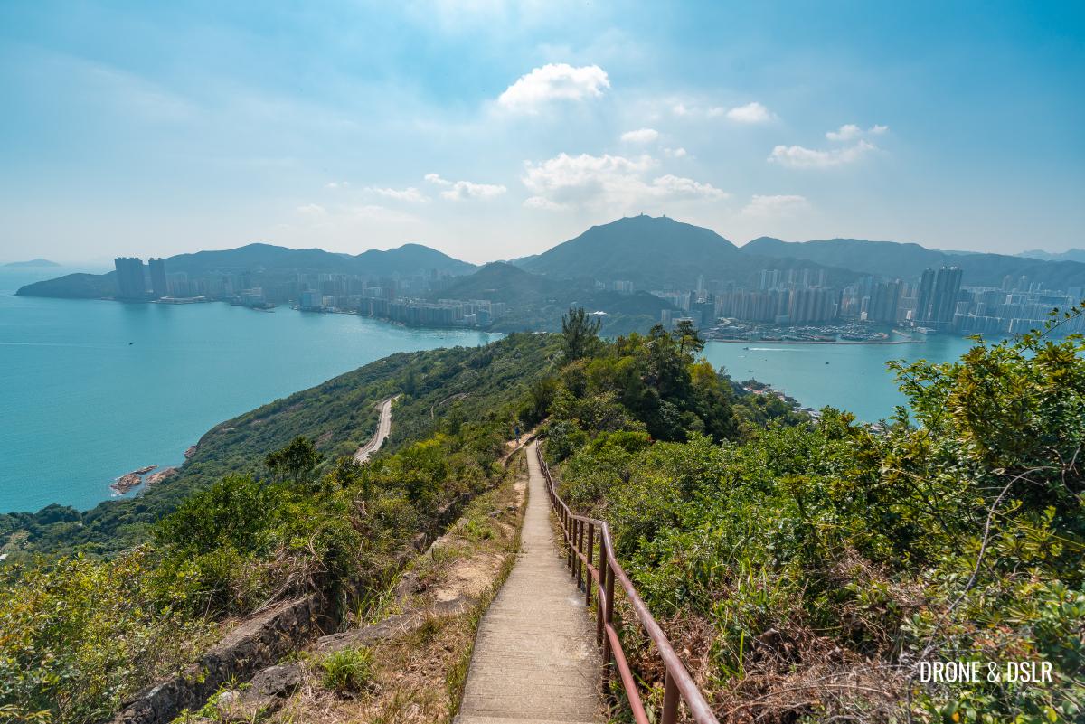
The top of Devil’s Peak with Junk Bay in the background
Defensive positions on the military sites on Devil’s Peak were taken up by the 5/7 Rajputs of the Hong Kong Garrison on 12th December, after the fall of the Shing Mun Redoubt in the western part of the Line three days before.
The sites at Devil’s Peak witnessed heavy defensive fighting by the 5/7 Rajputs and the First Mountain Battery of the Hong Kong and Singapore Artillery. The two evacuated to Hong Kong Island on the morning of 13th December and destroyed all equipment before they crossed the Harbour during the night.
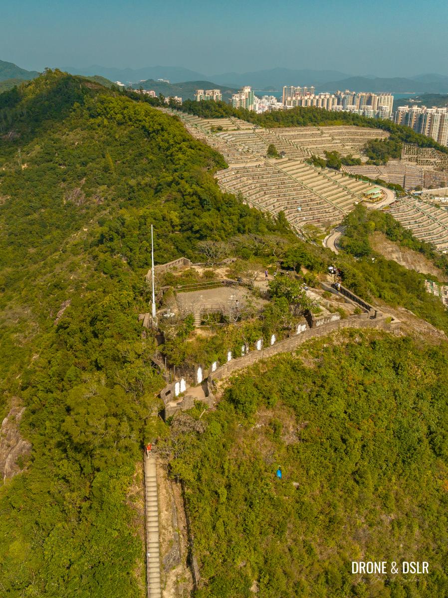
The Junk Bay Permanent Chinese Cemetery in the background
After Japan’s defeat, the Devil’s Peak sites were abandoned by the British and then later reoccupied and put into active military use until the mid-1980s.
-

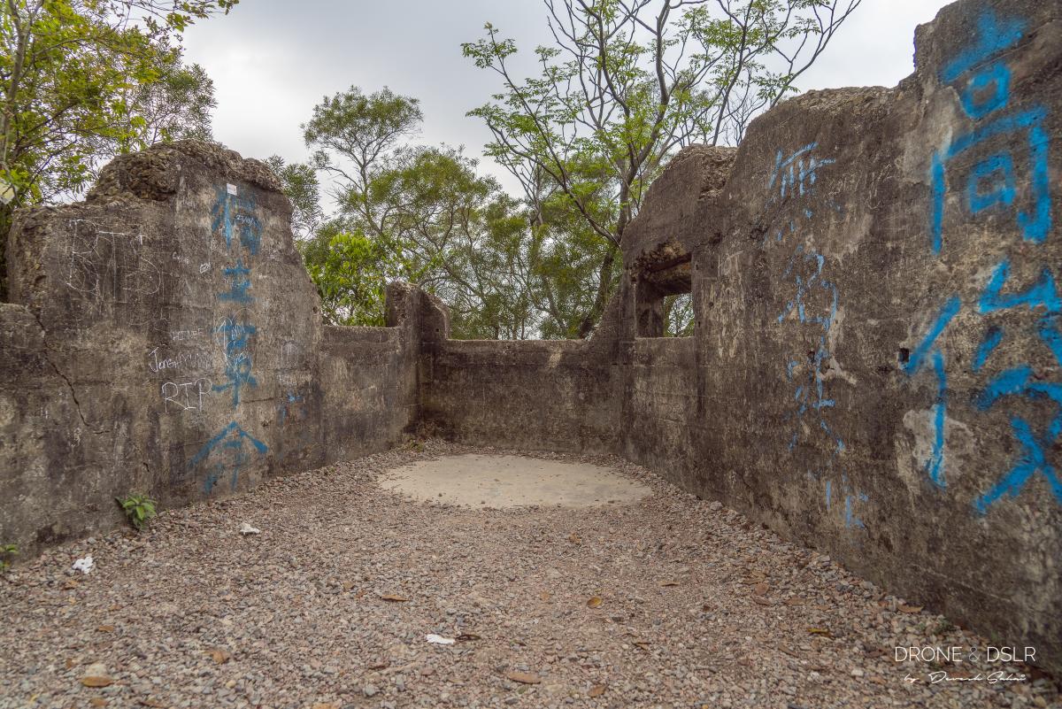
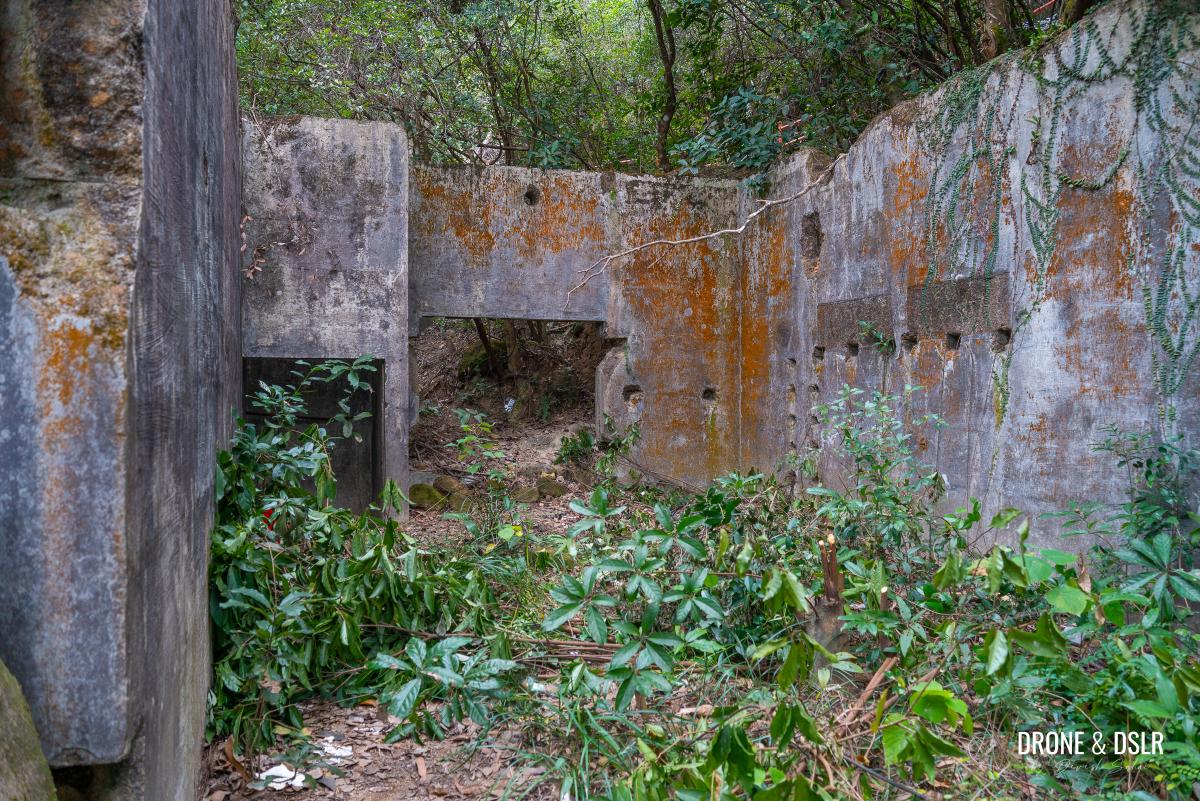
- Inside the ruins of Gough Battery, Devil’s Peak, Hong Kong

-
- The abandoned fortification of Devil’s Peak, Hong Kong

The Devil’s Peak Fortifications
The main structures on Devil’s Peak are the Pottinger Battery, Gough Battery, and Devil’s Peak Redoubt.

Gough Battery and Devil’s Peak
Although Gough Battery and the Devil’s Peak Redoubt fall along the trail, visiting Pottinger Battery requires a detour. Pottinger Battery is mostly covered by vegetation, but the military fortifications are still visible.
This guide will help you plan your hike through the military structures at Devil’s Peak, as you make your way to the top.
Devil’s Peak and LOHAS Park in the background
And as a bonus, here’s a quick video of the hike.
Subscribe to my YouTube channelThe Devil’s Peak Hike Details
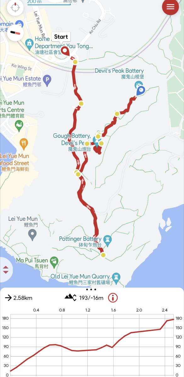
Devil’s Peak Hike Map
At 222 metres tall, Devil’s Peak is a relatively short hill along Section 3 of Wilson Trail. The trail to the summit is paved and doesn’t involve many steps, which in itself is pretty unique in Hong Kong. Not only that, the starting point for the hike can be accessed by MTR or bus.
This just means that the Devil’s Peak Hike is very easy and accessible!
At 222 metres tall, Devil’s Peak is one of the shortest hills in Hong Kong
The map above includes the detour to Pottinger Battery which adds 1 km to the hike. However, if you skip the detour, the Devil’s Peak Hike is only 1.5 km from Yau Tong to the Redoubt.
The views of the city along the hike are quite spectacular. So, we highly recommend picking a clear day for the hike.
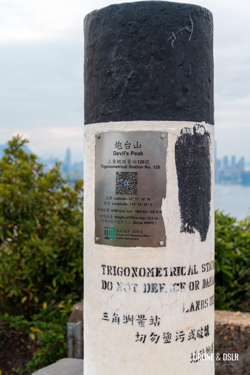
Devil’s Peak trigonometrical station
Starting Point
To start the hike to Devil’s Peak, make your way to the Junk Bay Chinese Permanent Cemetery Access Road in Yau Tong. Although there are quite a few buses that ply the adjacent Ko Chiu Road, taking an MTR to Yau Tong station might be the easiest way to arrive at the starting point.
At the Yau Tong MTR Station, take Exit A onto Ko Chiu Road. Once on Ko Chiu Road, walk towards Lei Yue Mun Estate and turn right onto the uphill road towards the Chinese Permanent Cemetery.

The start of the Devil’s Peak Hike – Junk Bay Chinese Permanent Cemetery Access Road
This is the start of the Devil’s Peak Hike.
To Wilson Trail Section 3 Starting Point
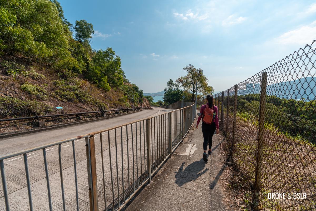
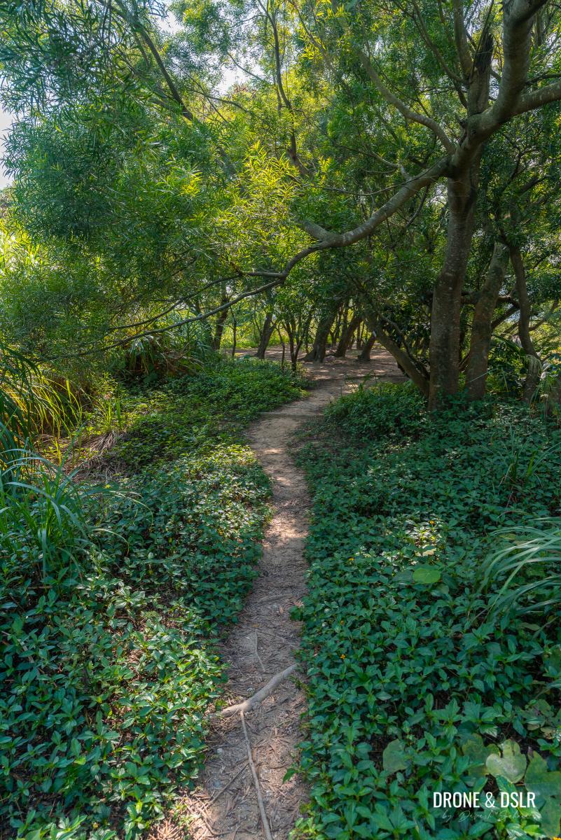
As you turn onto the Junk Bay Chinese Permanent Cemetery Access Road, the incline begins immediately.
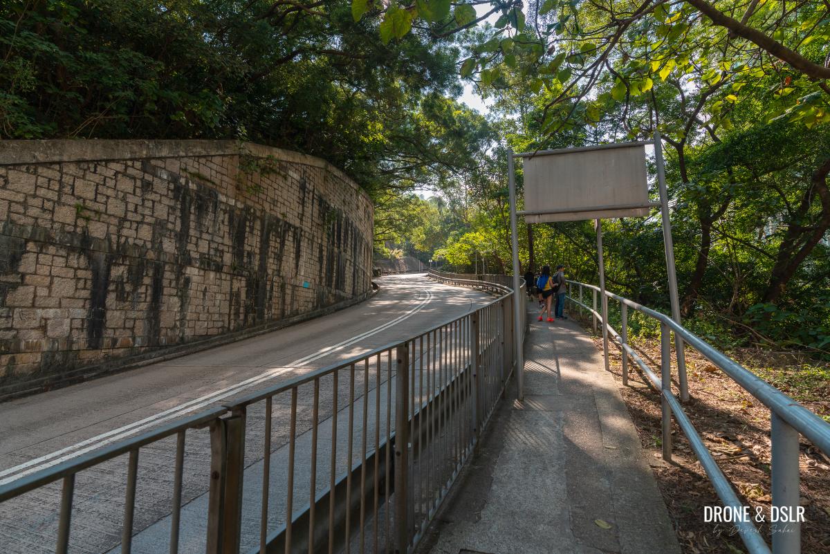
Start walking uphill
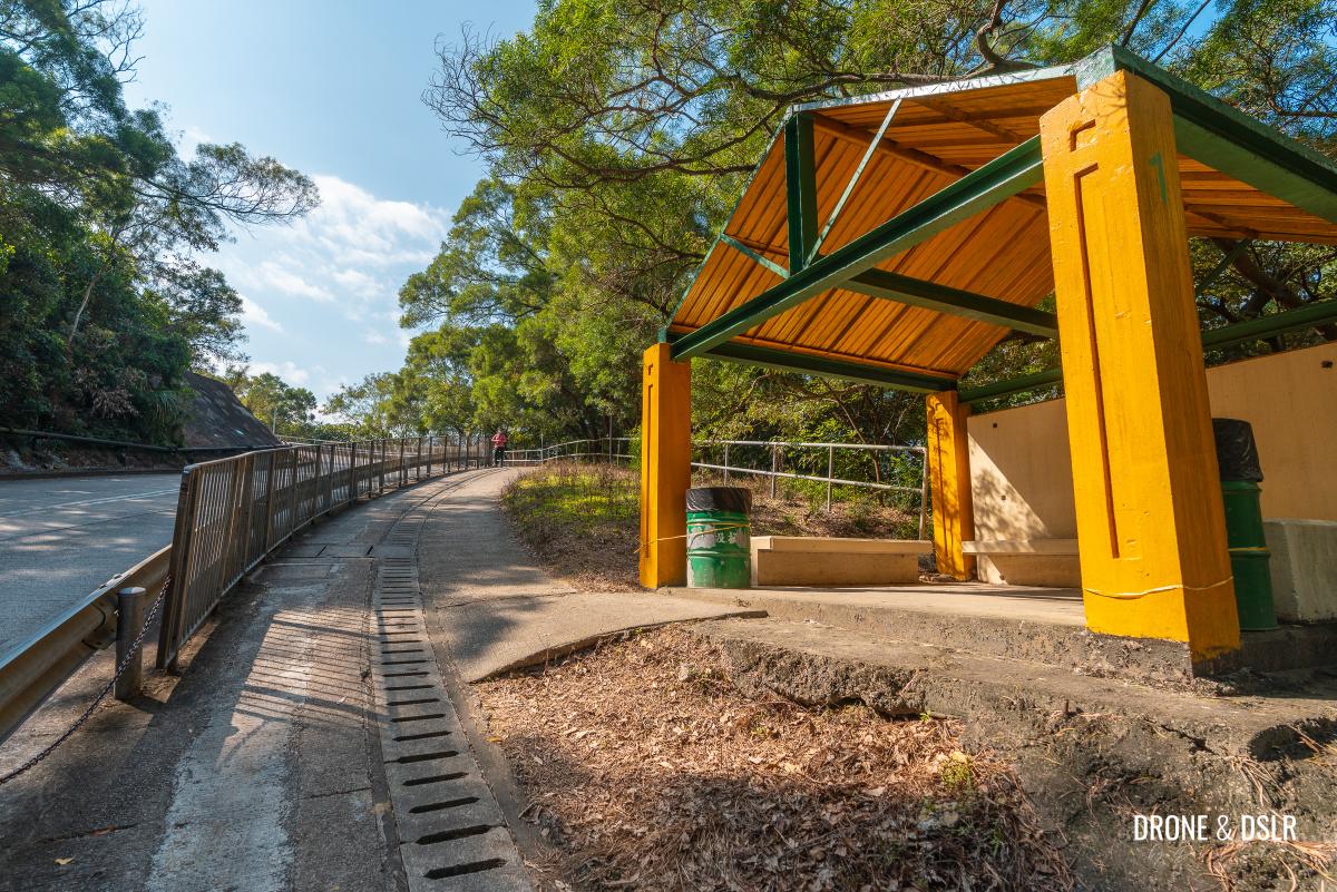
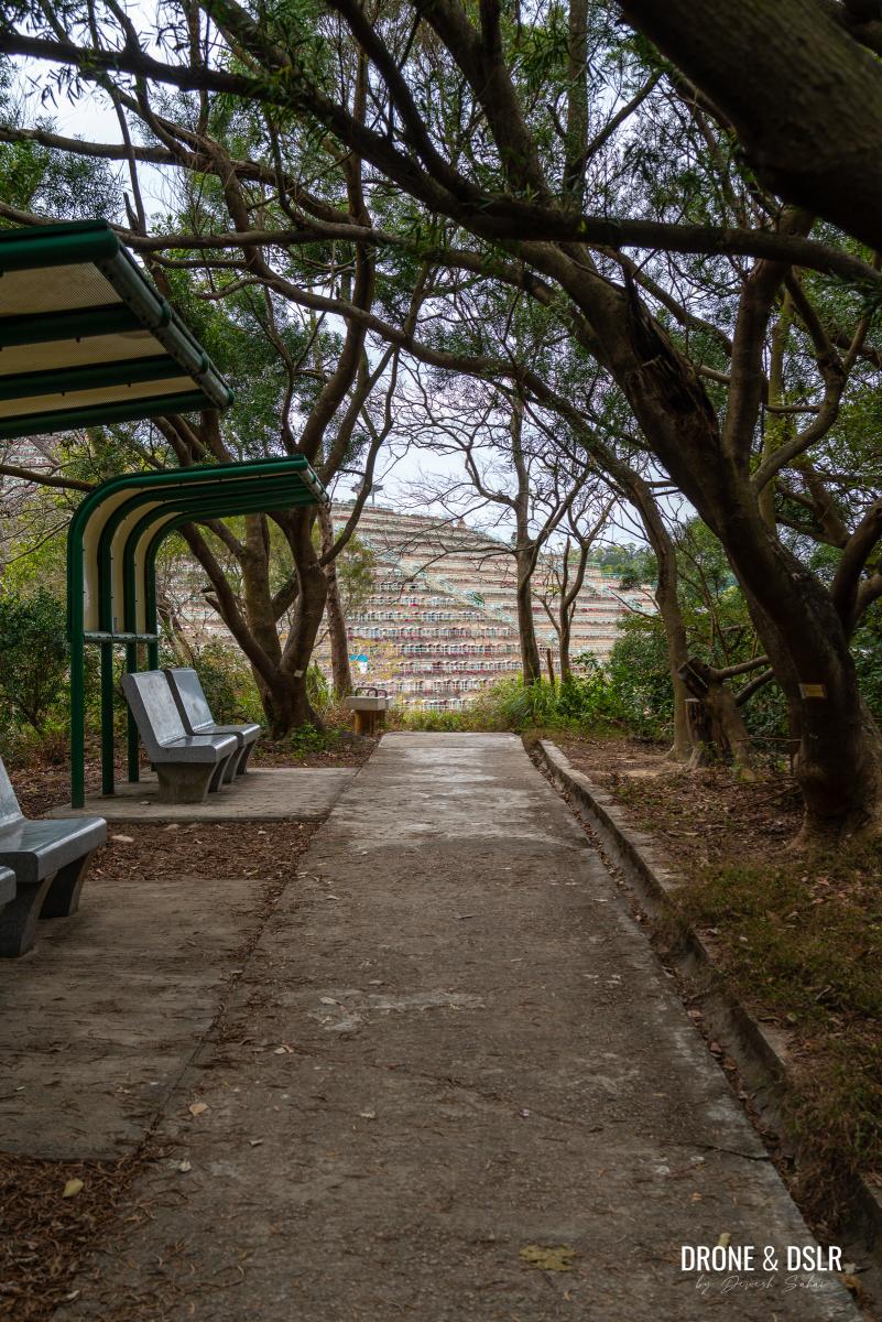
The incline is not too bad, and thankfully it’s shaded for most of the way. So, take your time as you make your way uphill. There is also a rest area for you to take a break.
-
- The incline is relatively quite easy

-
- A sheltered sitting area if you need to take a break
There are a couple of viewpoints along the way that offer views of Yau Tong. But trust me, the views get much better as you keep hiking.
-
- Keep walking uphill

-
- Almost at the top of the road

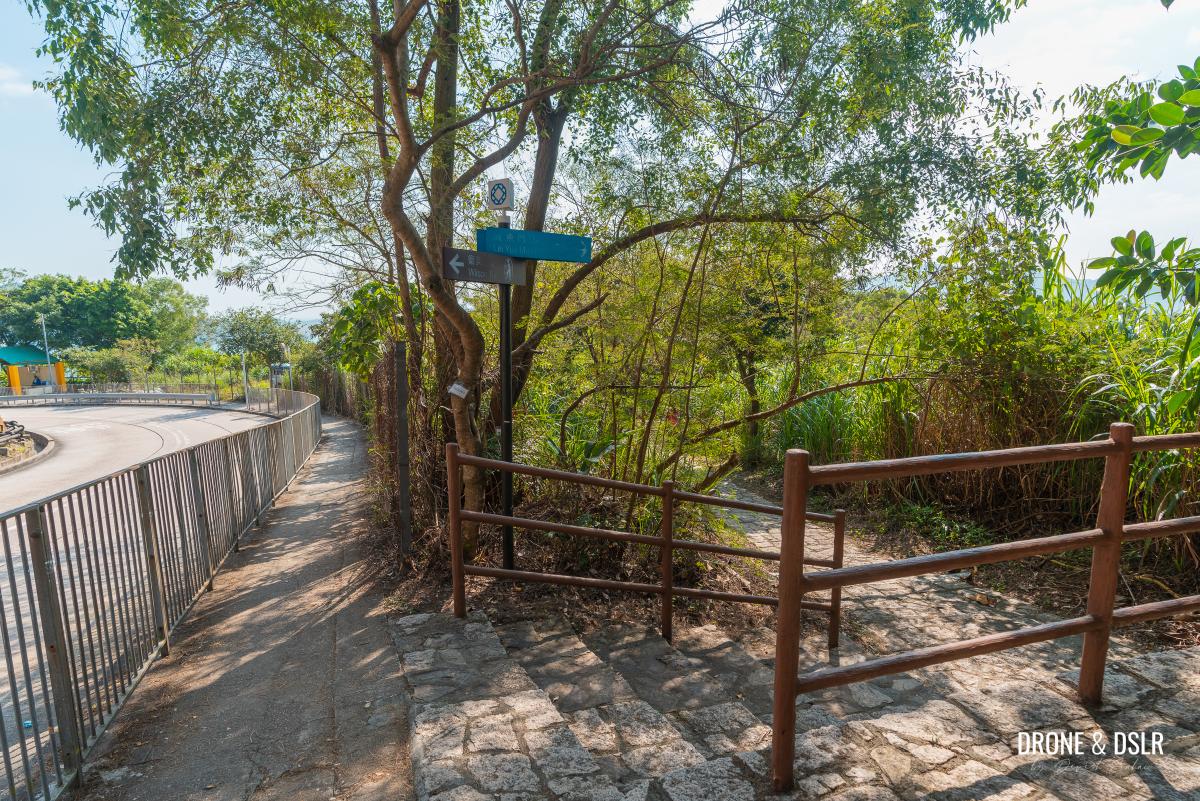
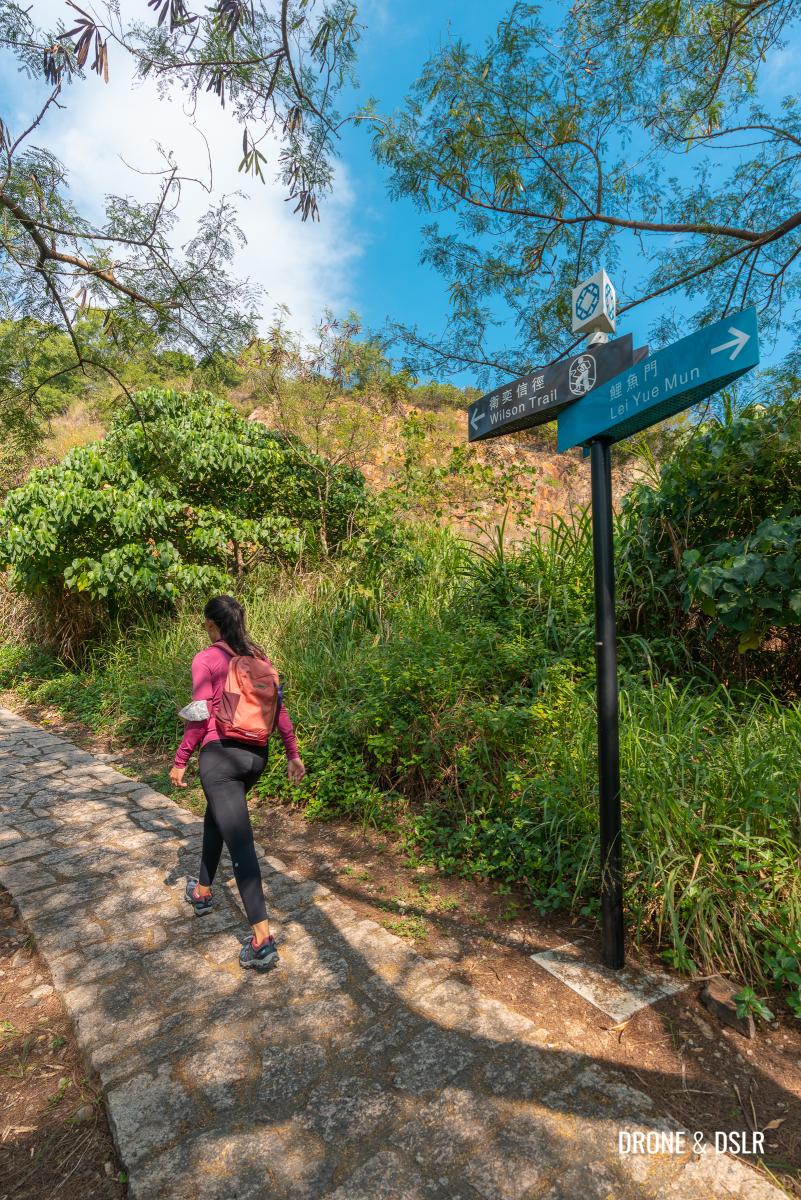
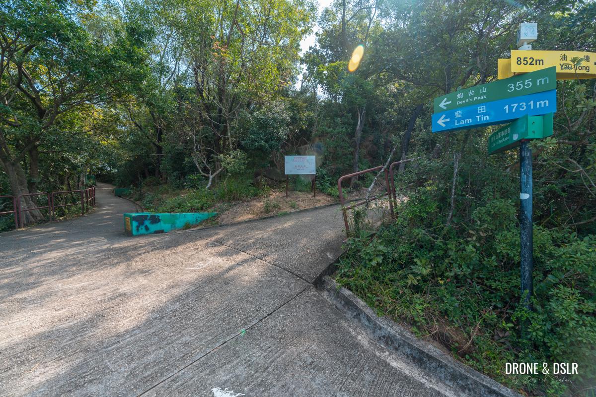
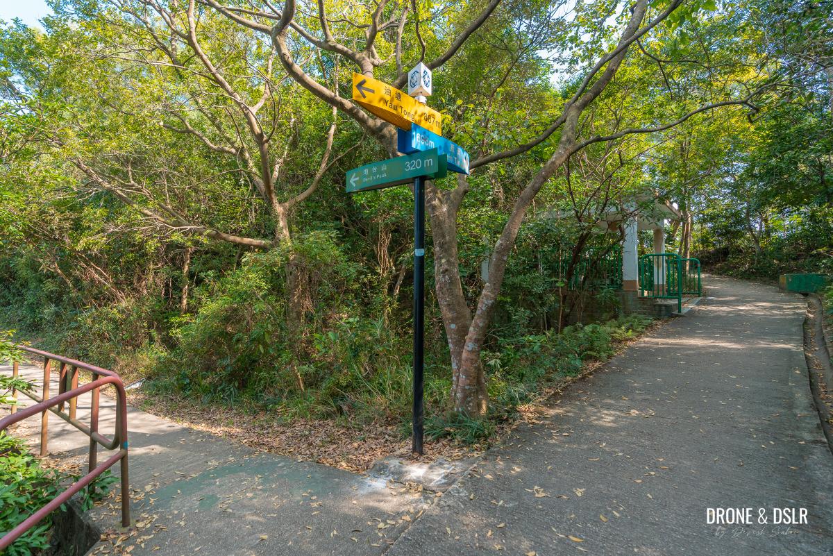
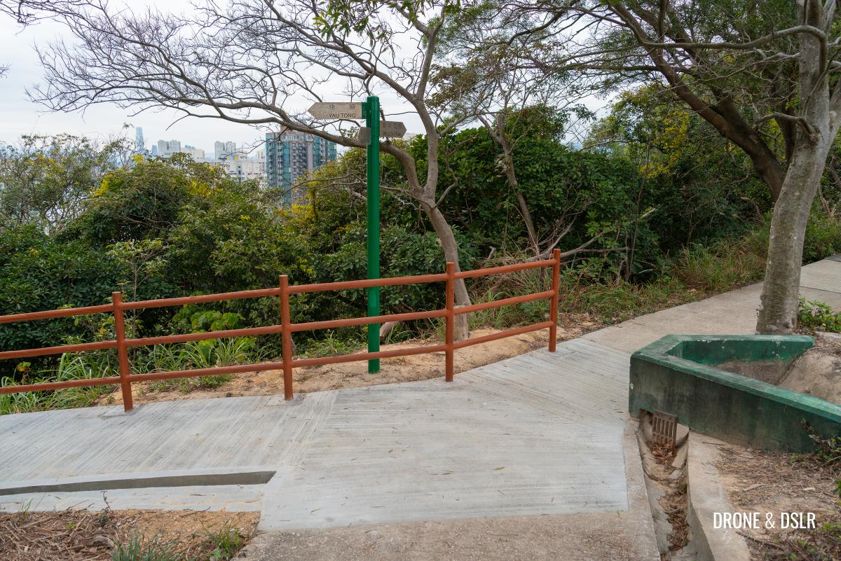
After approximately 600 metres of walking, you’ll arrive at the start of Wilson Trail Section 3.
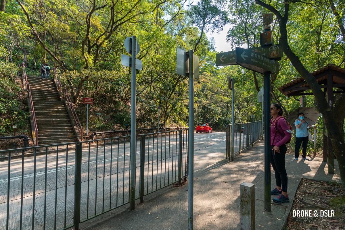
Decision point – head up Devil’s Peak or take the detour to Pottinger Battery
At this point, you have the decision to make: continue hiking on Wilson Trail towards Gough Battery or take a detour to visit Pottinger Battery.
The Pottinger Battery Detour (Optional)
To visit Pottinger Battery on Devil’s Peak requires a detour that might not be everyone’s cup of tea. It adds 1 km (back and forth) and involves a bit of off-trail bushwhacking.
However, if you’re up for a mini-adventure, don’t cross the road onto Wilson Trail. Instead, continue on Junk Bay Chinese Permanent Cemetery Access Road.
To visit Pottinger Battery, continue walking on the road
Continue walking downhill for 200 metres till a footpath on the right, heading down to Lei Yue Mun.
-
- Keep walking downhill
-
- Mount Parker from Devil’s Peak
-
- Turn right towards Lei Yue Mun
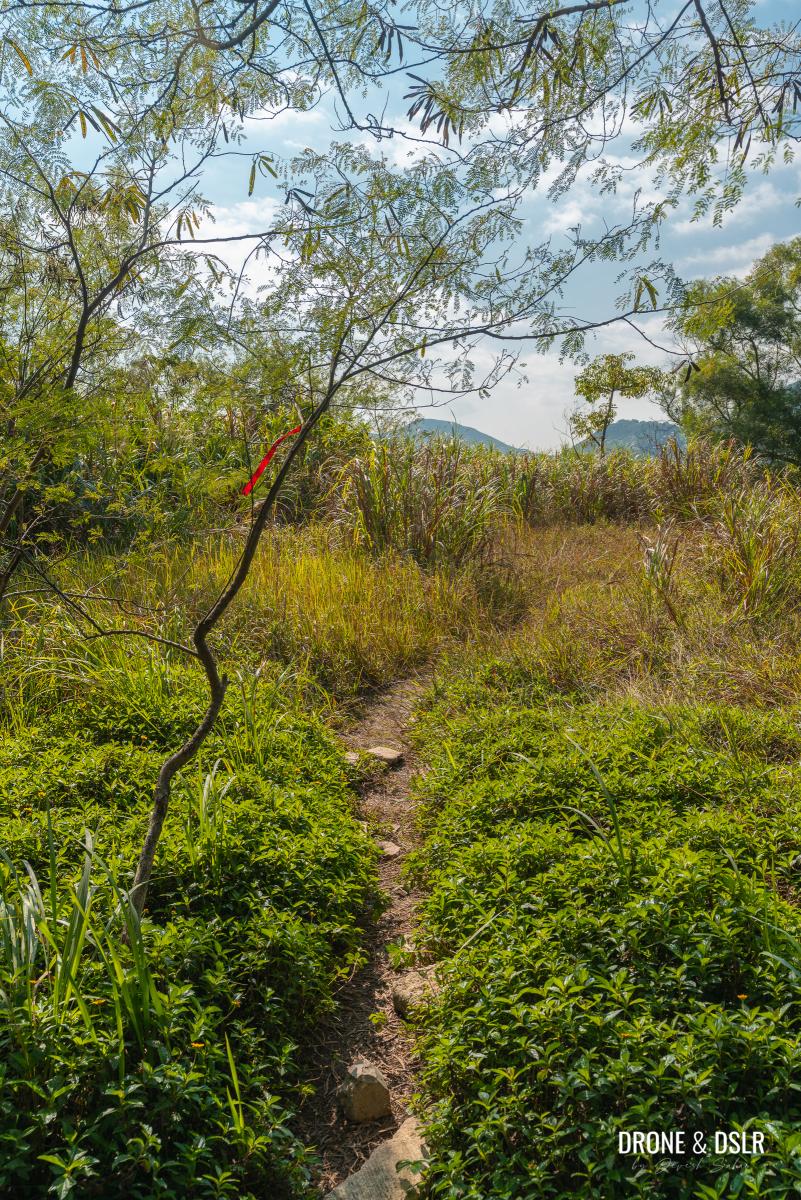
Walk down the path for approximately 90 metres and keep a lookout for a ribbon on a tree just before the path curves left.
-
- Follow the path towards Lei Yue Mun

-
- Turn left at the ribbon and go off trail towards Pottinger Battery
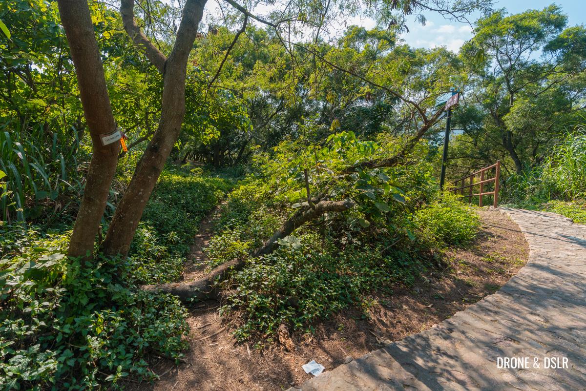
Take the unmarked trail and walk towards the open area with trees.
-
- Follow the trail
-
- A shaded area with trees
From here, continue following the trail behind the trees. You might notice a couple of ribbons to guide you along the way.
Follow the ribbon as the trail heads behind the trees
The unmarked trail then heads downhill through the thickets, not before showcasing an amazing lookout point!

A bit of bushwhacking is required
From here, you can admire views of the narrow passageway of Lei Yue Mun that leads to Victoria Harbour.
-
- Lei Yue Mun views from Pottinger Battery
-
- A quick pic overlooking Lei Yue Mun
Continue to carefully walk downhill till you see a large, grey structure on the ground.
-
- Follow the unmarked trail downhill

-
- That’s the first gun pit at Pottinger Battery

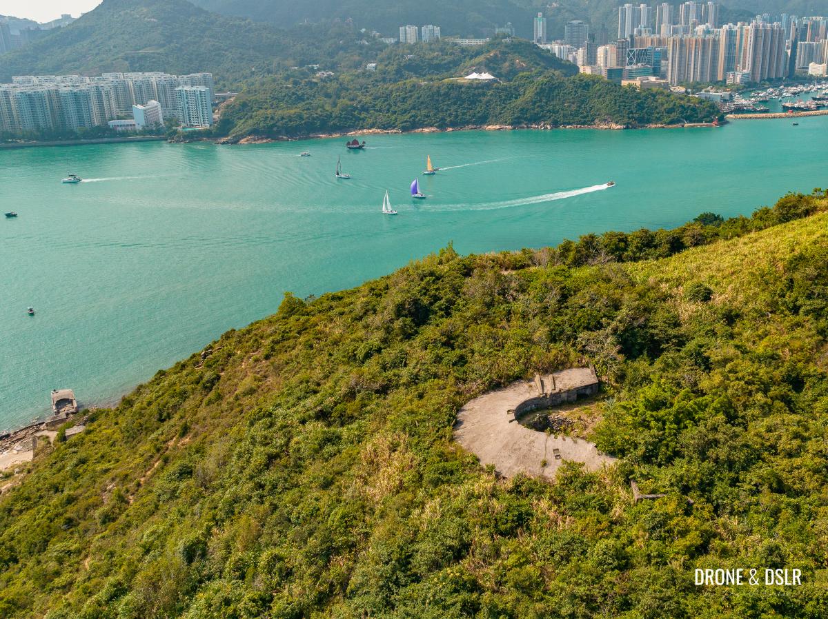
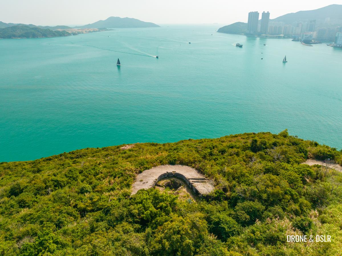
Situated at 81 metres above sea level, this is Pottinger Battery!

One of the gun pits at Pottinger Battery
About Pottinger Battery
The Pottinger Battery finished construction in 1902 and had two 9.2-inch B L (Beech-Loader) Mark X guns. The battery was relocated to Bokhara Battery, Cape D’Aguilar in 1939 or 1940.
-
- The gun pit at Pottinger Battery is overrun by nature
As this isn’t a frequently visited area on Devil’s Peak, it’s overrun by trees and bushes. The first gun pit is partially visible and reaching the second one requires a bit more bushwhacking.
-
- Aerial view of Pottinger Battery, Devil’s Peak
-
- Prime location to observe maritime traffic east of Victoria Harbour
Follow the ribbon along the path behind the gun pit to reach the second pit.
Top-down view of the gun pit at Pottinger Battery
Once you’re done exploring Pottinger Battery, trace your steps back uphill to the start of Wilson Trail Section 3.
Return to Wilson Trail after the Pottinger Battery detour
To Gough Battery
Once you return to the start of Wilson Trail Section 3, cross the road and climb the steps. After the steps, turn left and follow the signs for Devil’s Peak.
-
- Cross the road and climb the steps

-
- Tun left and follow the signs for Devil’s Peak

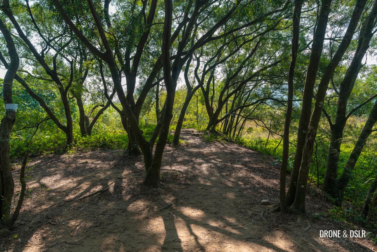
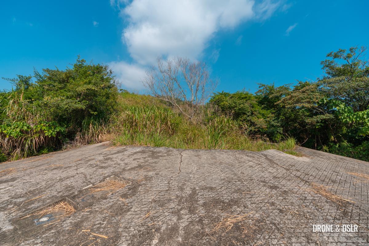
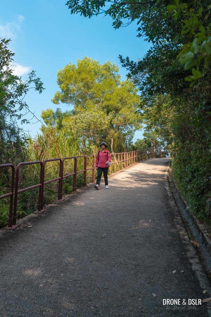
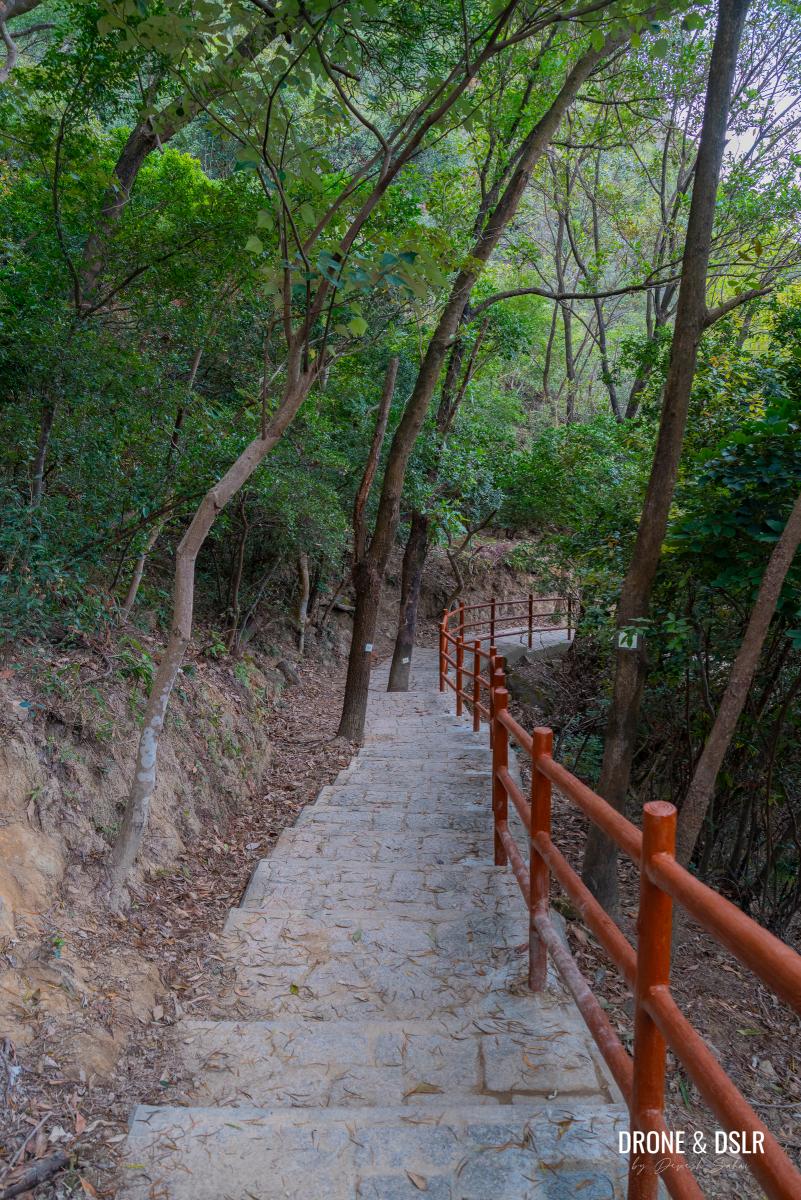
The paved slope on a gentle incline is extremely easy.

An easy uphill incline
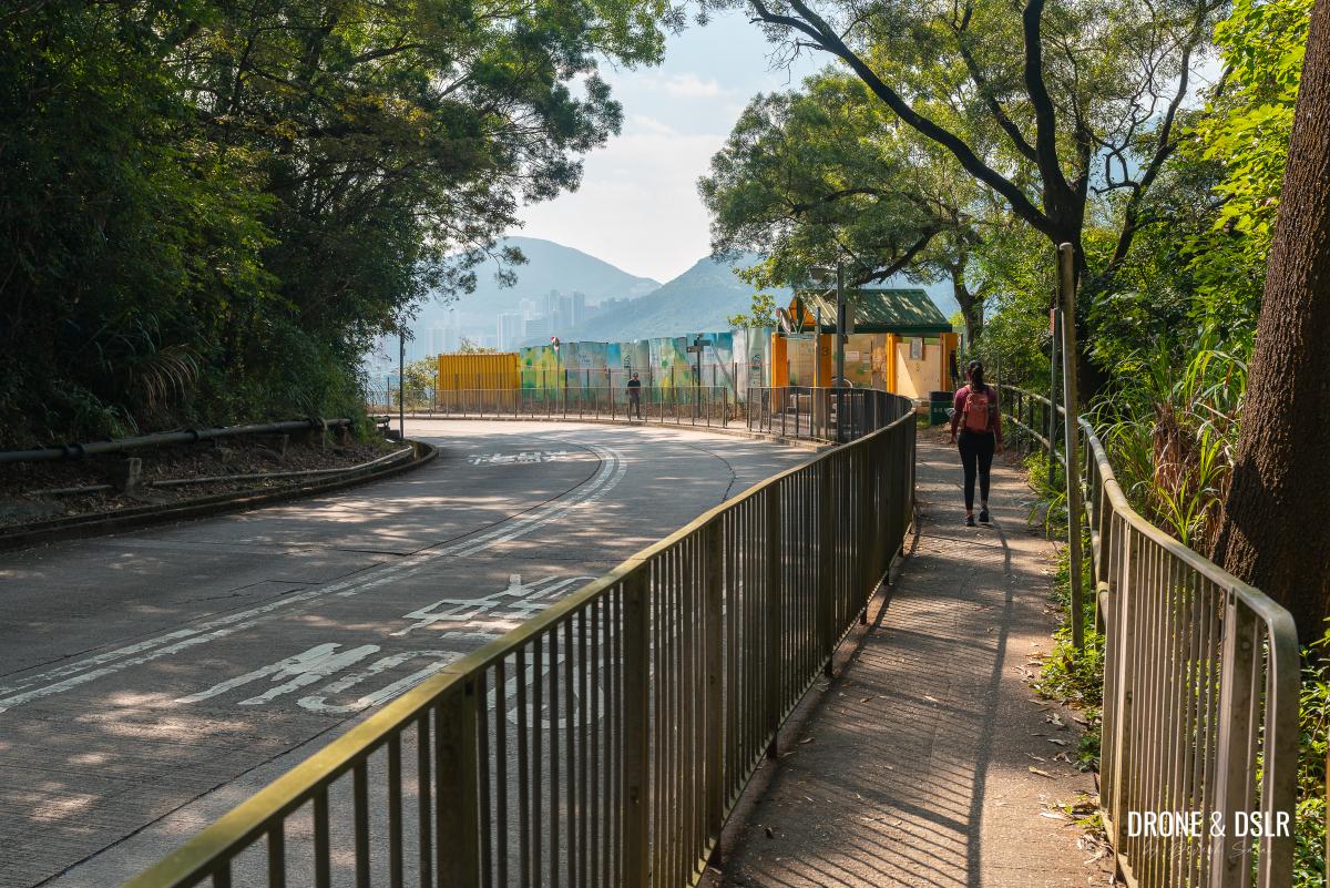
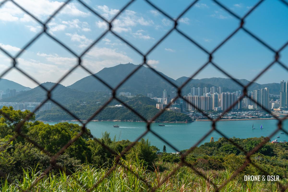
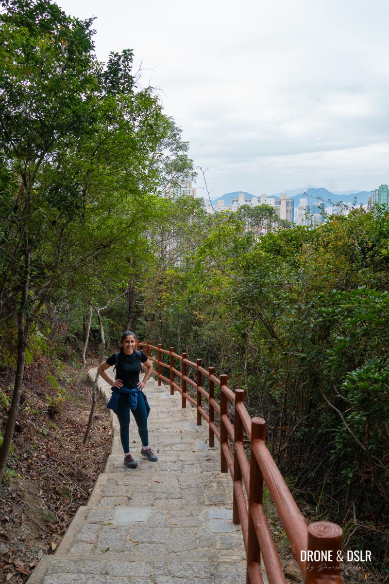
After a couple of hundred metres, the trees clear up, and you’re presented with beautiful views of the city below.
-
- Devil’s Peak is one of the easiest hikes
-
- Views of Yau Tong from the Devil’s Peak Hike
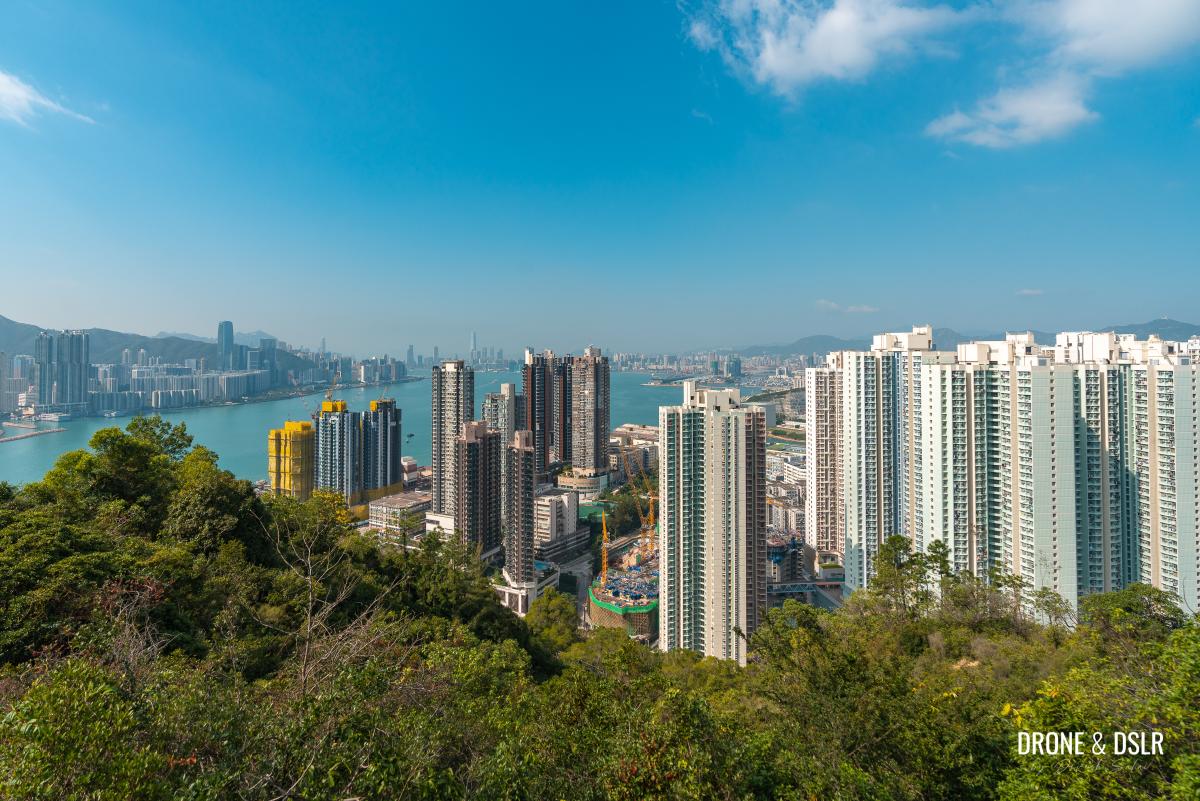
On a clear day, you can even see ICC and IFC. And if the day is slightly hazy, you can still admire the views of Black Hill and Kowloon Peak to the north.
View of Black Hill from the Devil’s Peak Hike
Continue walking uphill until the trail reaches a right turn. Although the sign points straight to Devil’s Peak, turn right and walk for a short distance till you reach Gough Battery.
-
- Turn right for a quick detour to Gough Battery
-
- Take this short detour to Gough Battery

-
- Welcome to Gough Battery

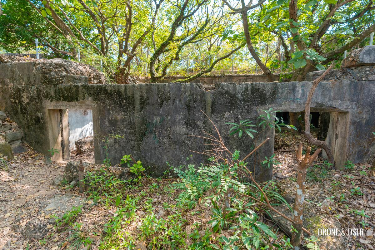
About Gough Battery
At a height of 160 metres, Gough Battery is the upper battery on Devil’s Peak. It was built in 1898 and consists of two gun pits (one big and one small), underground magazines, and a few buildings.
-
- Exploring Gough Battery
-
- The buildings at the back of Gough Battery

-
- Aerial view of the Gough Battery

The last gun was dismantled and taken to Stanley Fort in 1936.
-
- The second gun pit at Gough Battery is in a slightly worse condition

-
- The gun pit at Gough Battery
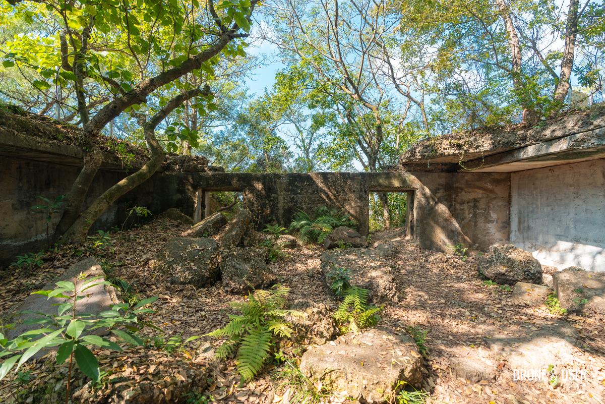
Today the gun pits, barracks, and buildings of Gough Battery lie in derelict conditions, overrun by nature. Part of the roof of the building has now collapsed, making way for trees to grow.
-
- Take your time exploring the battery and its buildings
-
- Walking around the structures of Gough Battery

-
- Top-down view of the gun pit at Gough Battery
-
- Nature at the Devil’s Peak fortifications

But despite that, I think the structures are still in good condition, and it’s quite enjoyable exploring the battery.
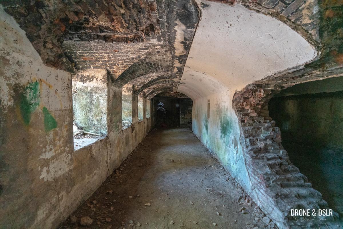
The entire structure occupies substantial space on the hill. So, make sure that you take your time to explore the gun pits and the underground magazine.
-
- The remains of Gough Battery at Devil’s Peak
-
- The underground structure at Gough Battery

-
- Exploring inside the underground magazines at Gough Battery
-
- Aerial view of Gough Battery
Once you’re done exploring the battery, head back down to connect with Wilson Trail.

Return to Wilson Trail after Gough Battery
To Devil’s Peak
Once you return to Wilson Trail from Gough Battery, Devil’s Peak is only 355 metres away.
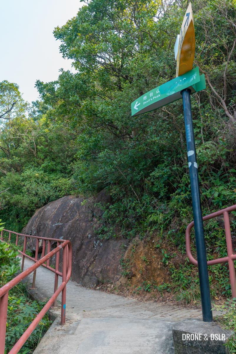
Getting to Devil’s Peak requires you to take a trail that runs parallel to Wilson Trail. So, remember to follow the signs to Devil’s Peak.
Turn left and get off Wilson Trail at this point
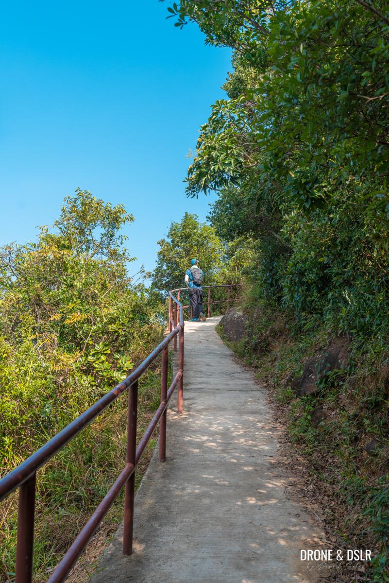
As you turn away from Wilson Trail, the incline picks up slightly. But it’s still paved and quite easy.

The easy uphill incline continues
Continue walking up the inclines as it scales the side of the Devil’s Peak.
-
- Keep climbing!
-
- Continue to follow the signs
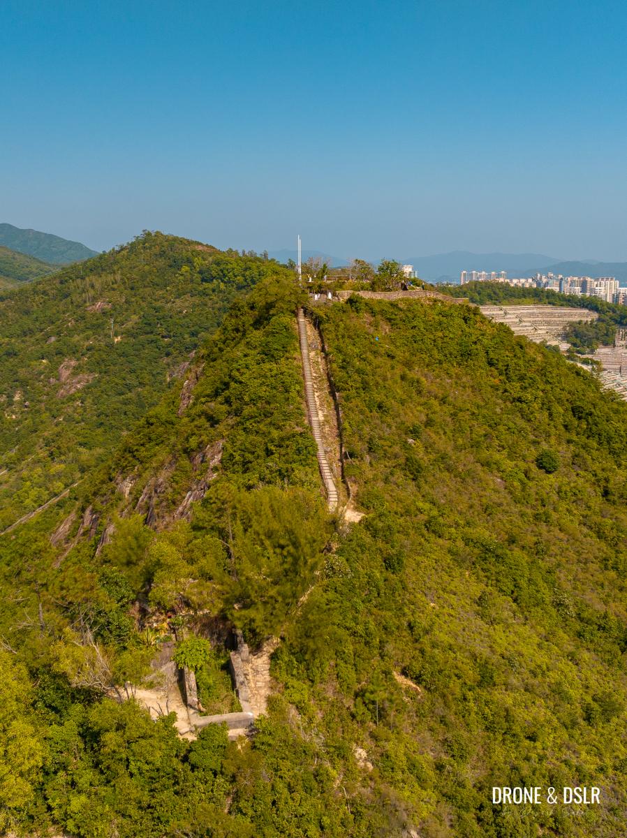
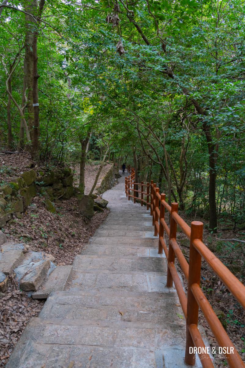
The final ascent is the only part of this hike where the incline gives way to steps.
-
- Steps mark the end of the hike

-
- The steps to the top of Devil’s Peak
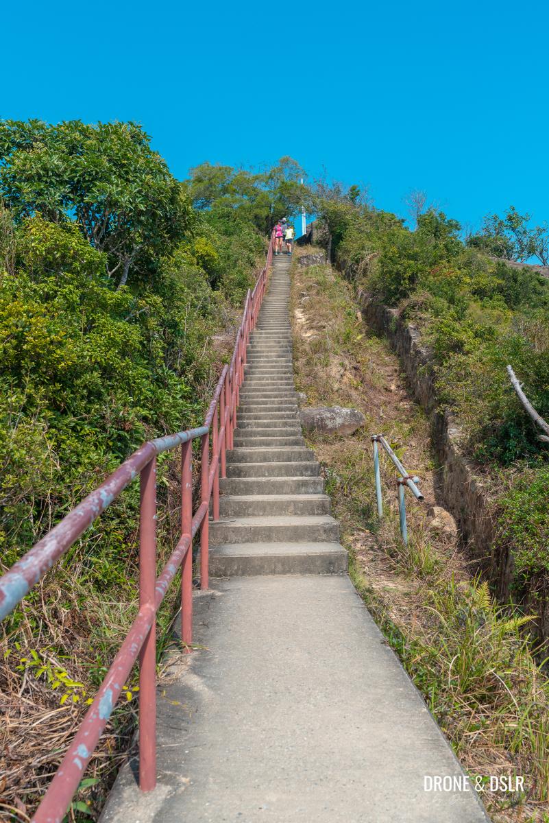
-
- The final steps leading up to Devil’s Peak
Follow the steps as they lead you directly to the Devil’s Peak Redoubt.
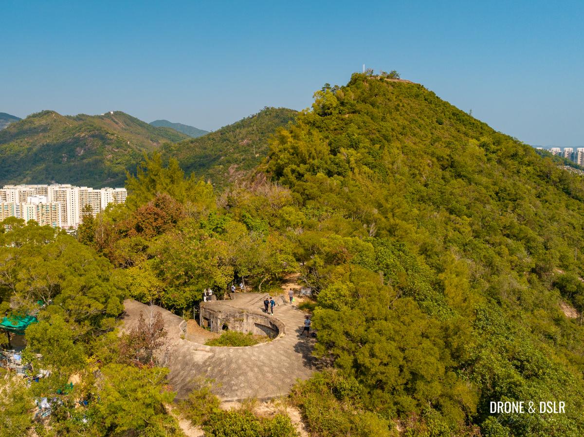
-
- Aerial view of the Devil’s Peak Redoubt
-
- The entrance to the Devil’s Peak Redoubt

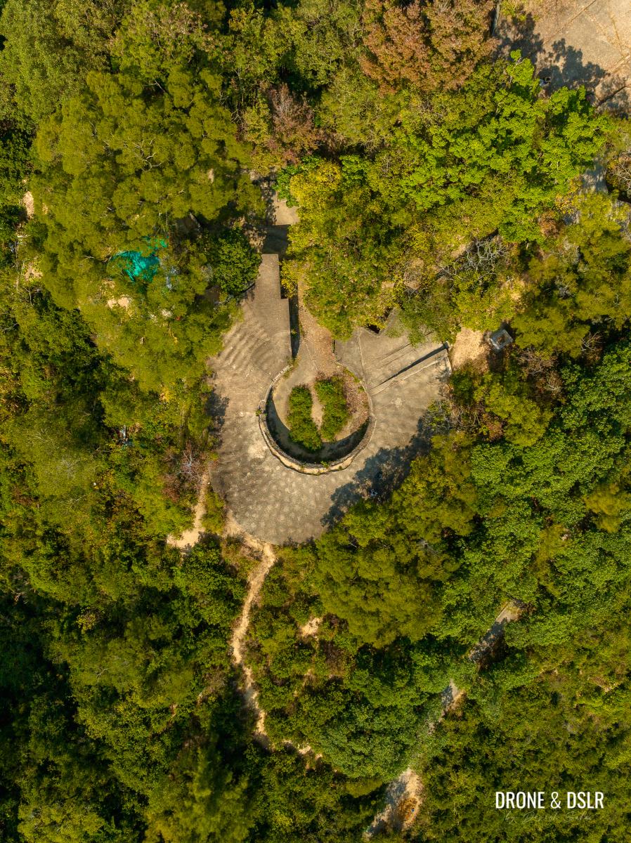
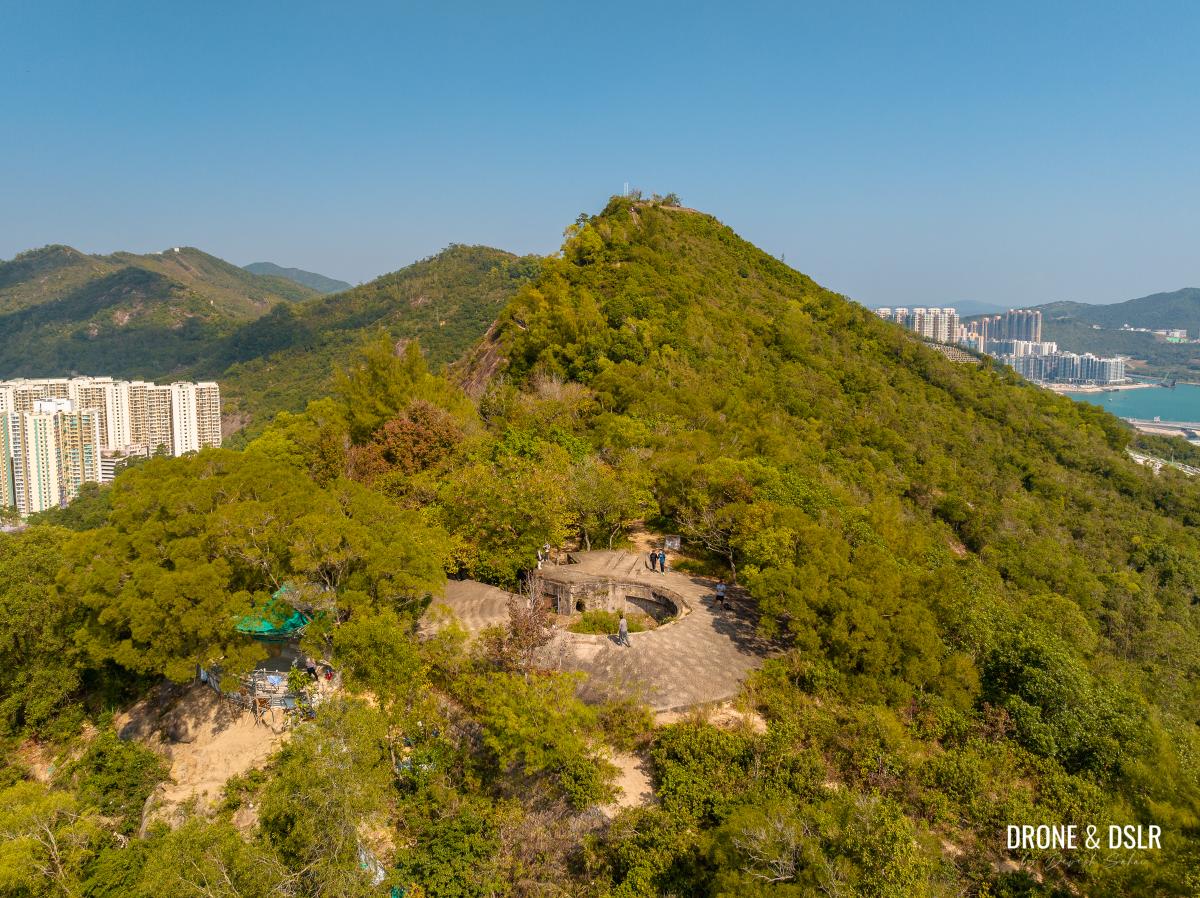
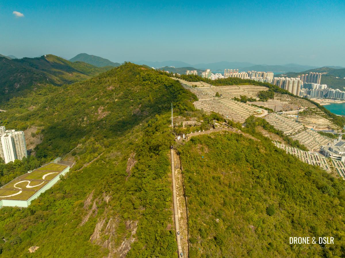
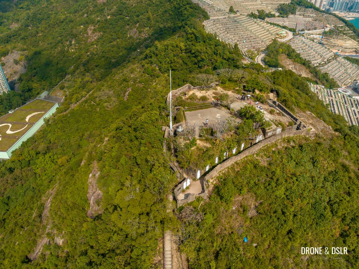
Devil’s Peak Redoubt
The summit of Devil’s Peak is occupied by the old redoubt (a temporary or supplementary fortification) that was built in 1914.
The external walls of the Devil’s Peak Redoubt
The Devil’s Peak Redoubt was the location of the Eastern Fire Command. Although it could accommodate at least 150 soldiers in action, the approved establishment of the Redoubt was only one officer and 10 soldiers.
-
- Walk around the redoubt

-
- Once the Eastern Fire Command of Hong Kong
-
- The outer walls of the Devil’s Peak fortification

-
- You may need to duck as you explore the redoubt on Devil’s Peak
-
- Exploring the redoubt on top of Devil’s Peak
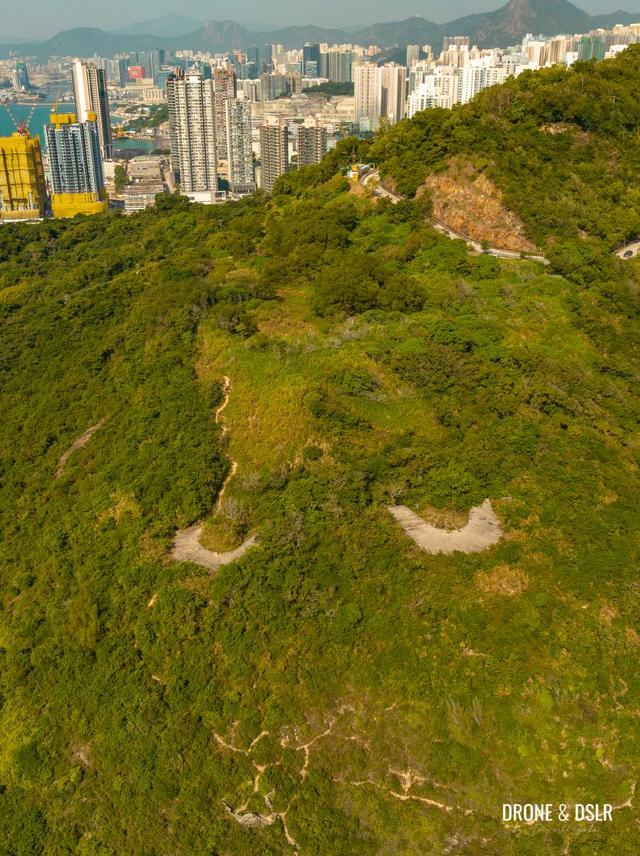
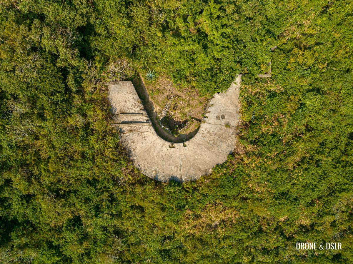
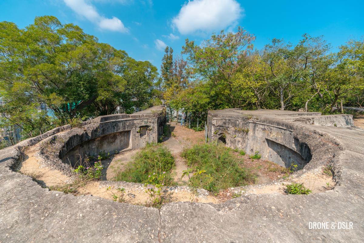
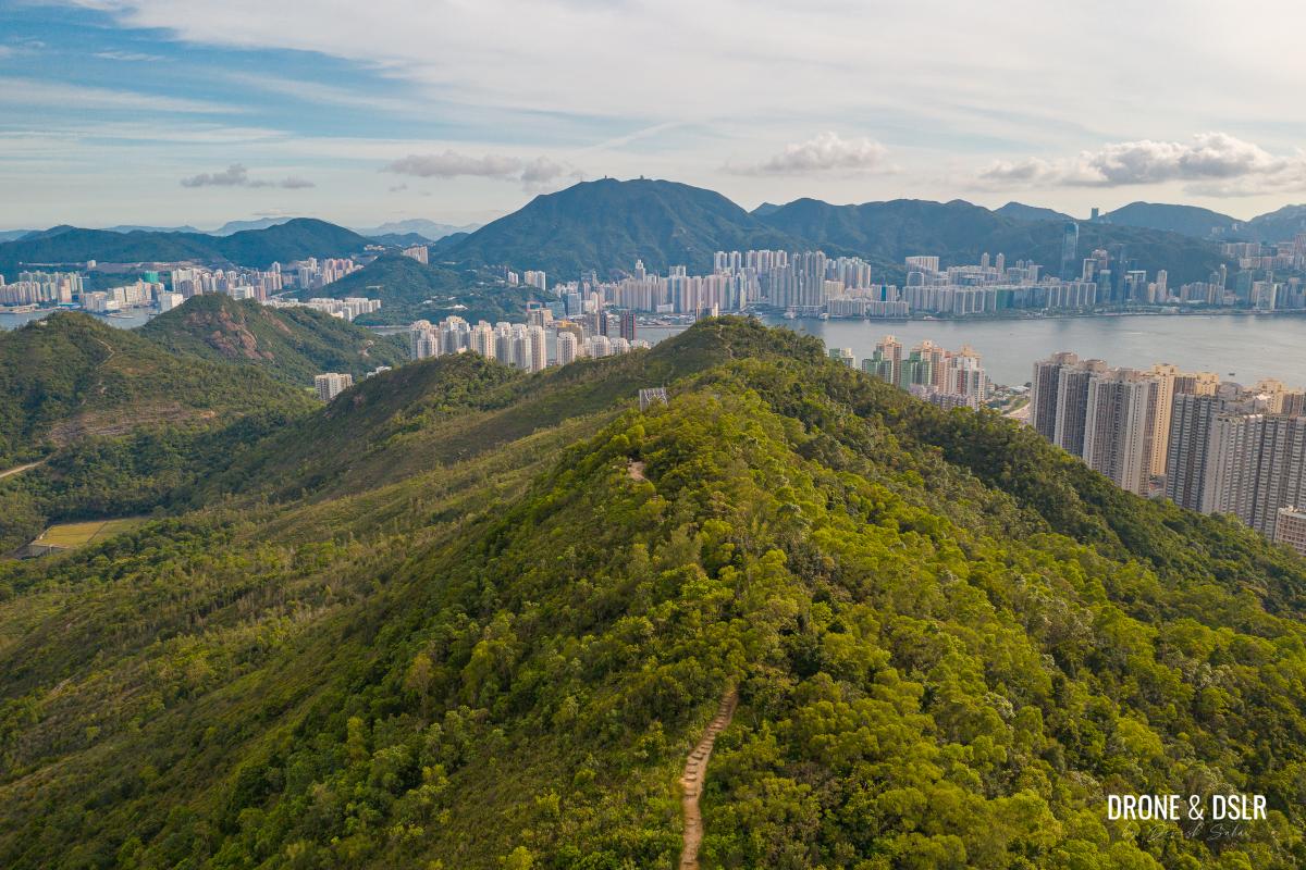
The redoubt has an area of about 1240 square metres and is rhomboid in shape. It looks like a crater from the air that was built to circumscribe the rock outcrop of Devil’s Peak.
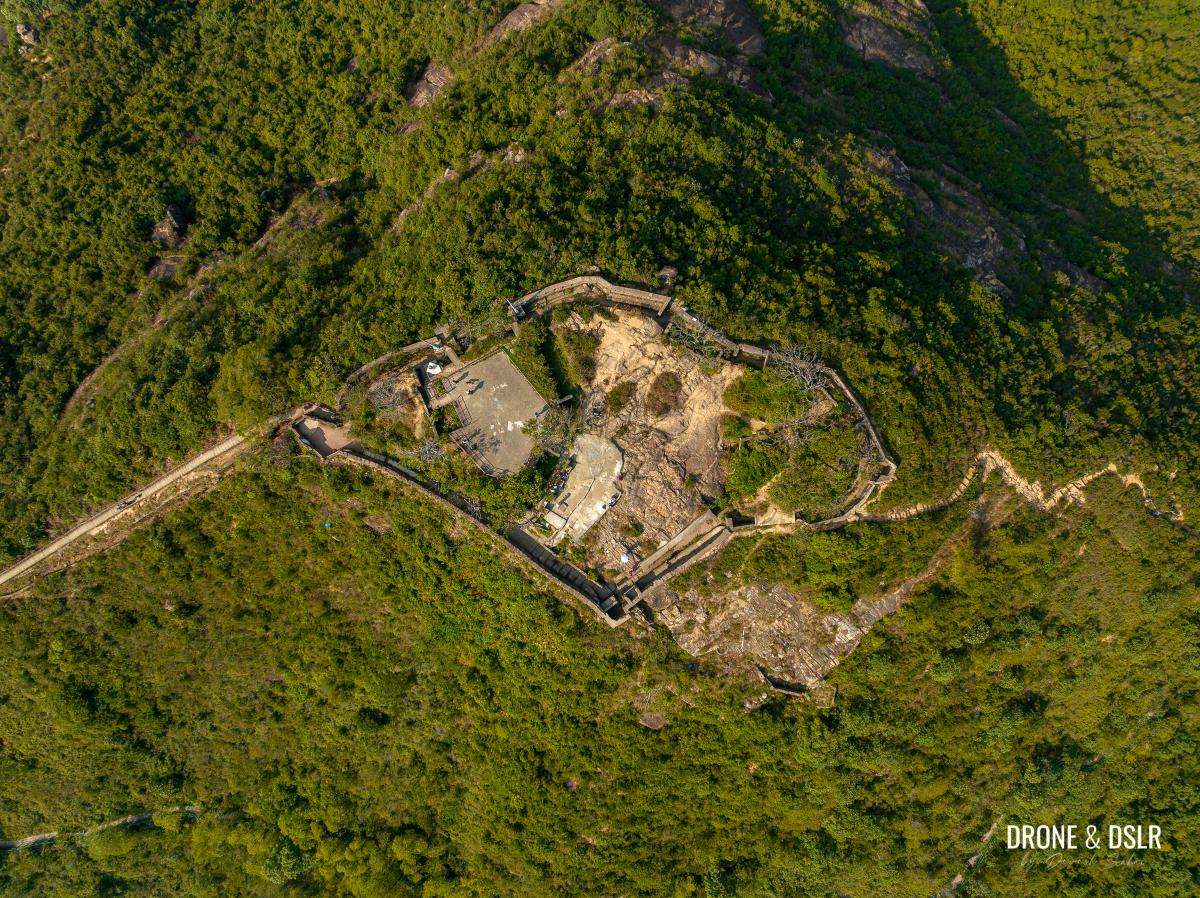
The rhomboid shape of the Devil’s Peak summit
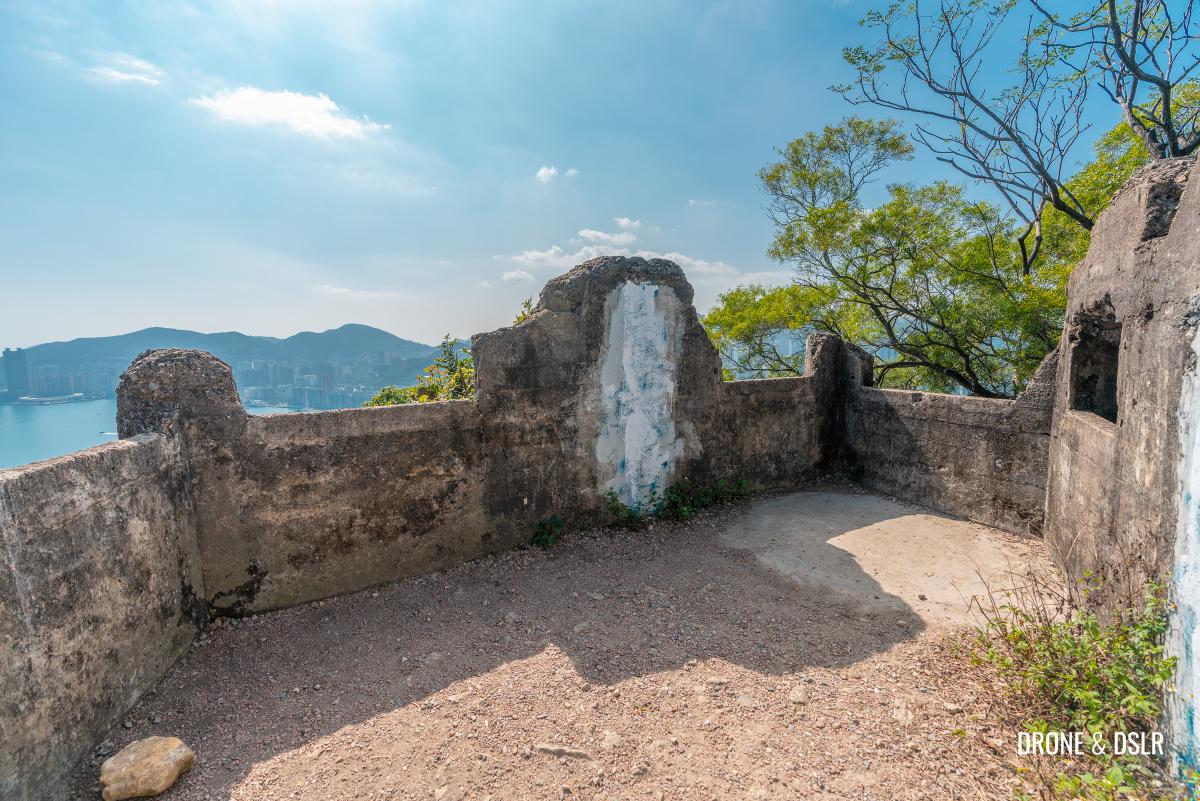
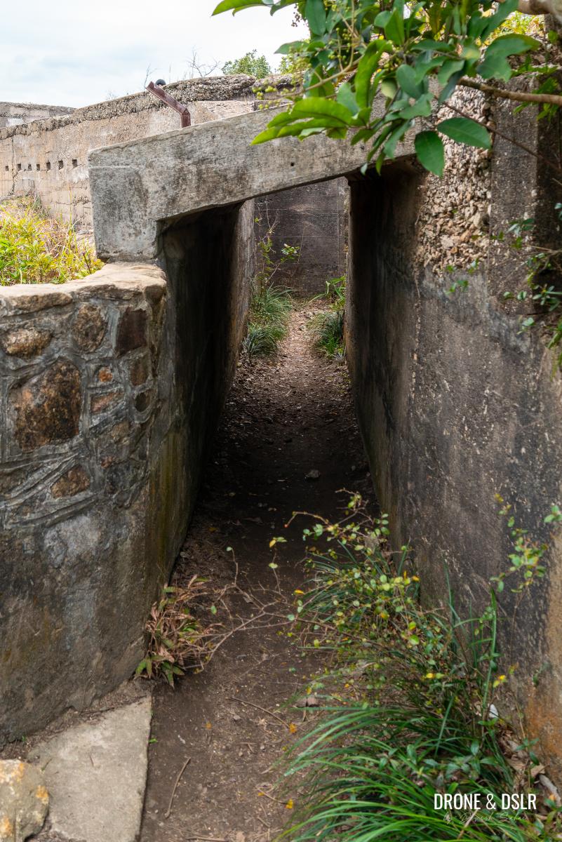
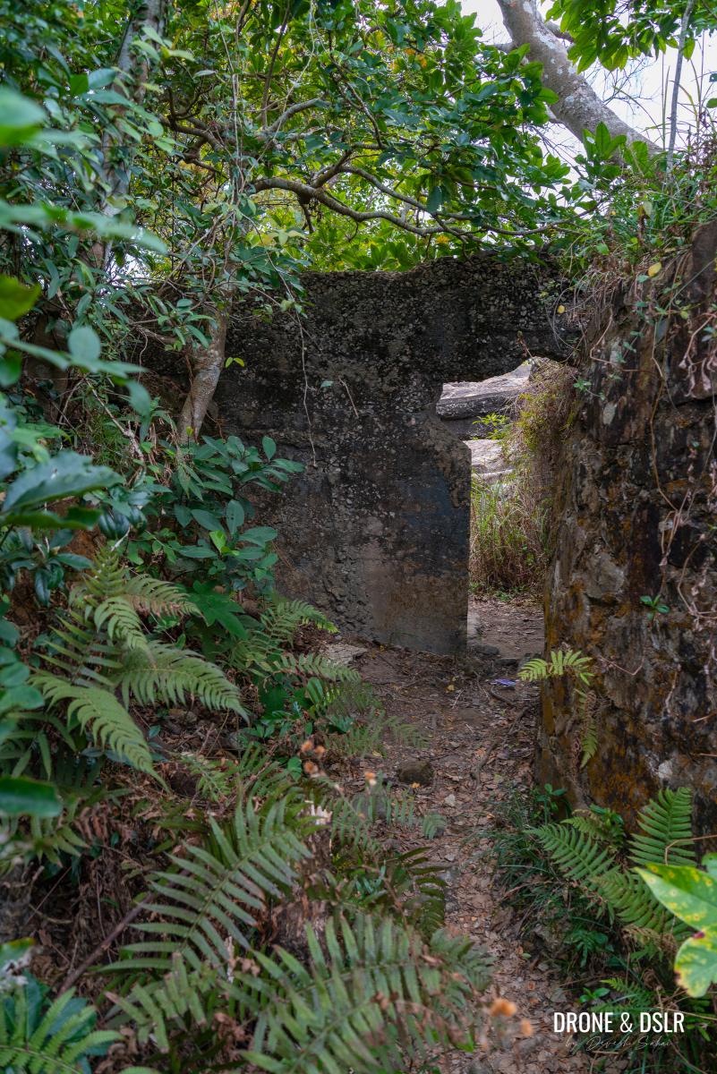
Today, a very small portion of its roofs survives, but the redoubt retains its external walls and internal dividing walls.

Explore the fortifications on top of Devil’s Peak
The northwest-facing external walls of the redoubt were generally built in stone while all the other structures were of concrete.
-
- Views Black Hill and Kowloon Peak from the Devil’s Peak Redoubt

-
- View of the eastern harbour from an opening along the outer wall of Devil’s Peak
-
- Make sure you explore the fortication

And in case you didn’t notice on our way up, there’s also a bunker under the redoubt accessible from a small opening next to the steps.
Aerial view of Devil’s Peak Redoubt
There are plenty of hidden areas of the redoubt that are now difficult to access.
The barracks of Devil’s Peak, Hong Kong
The views from Devil’s Peak
It’s best to take your time to explore the top of Devil’s Peak. The entire structure is fascinating and beautiful!

The views from the top of Devil’s Peak
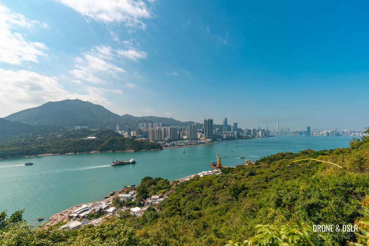
Given that the redoubt’s job was to protect Hong Kong from any invasion from the harbour, the panoramic views remain unobstructed even today.
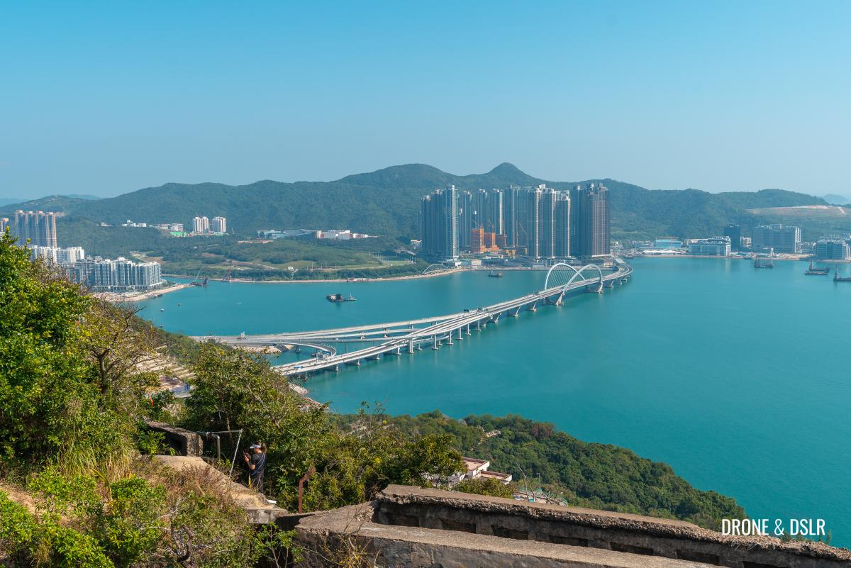
Views of LOHAS Park and Cross Bay Bridge from Devil’s Peak
From the western wall, next to the triangulation station, you can admire most of east Kowloon, from Yau Tong to ICC.
Views of Yau Tong from Devil’s Peak
To the north are incredible views of hills including Kowloon Peak and Black Hill.

Kowloon Peak from Devil’s Peak
To the east, you can admire Junk Bay and the new bridge, Tsuen Kwan O and LOHAS Park.
Views of LOHAS Park and Cross Bay Bridge from Devil’s Peak
Most hikers like to visit the top of Devil’s Peak during sunset. As the golden light illuminates the Hong Kong skyline, it makes for a lovely view!
-
- View of the sunset from Devil’s Peak

Options to end the hike
To keep things simple, you have three options to choose from to end your hike.
Option 1: Retrace your steps back to Yau Tong
The easiest option is to simply return via the path that you just hiked up on.
To end the hike, retrace your steps back to Yau Tong
Once you’re back in Yau Tong, you can decide to visit Lei Yue Mun, a squatter village filled with great seafood restaurants!
Option 2: Take the alternative route to Yau Tong via Lingnan Temple
You can also return to Yau Tong via the trail at the back of Devil’s Peak. This route is a bit more adventurous than the trail that you came up on.
To start your descent, locate the trail at the other end of redoubt. You may need to jump off a wall.
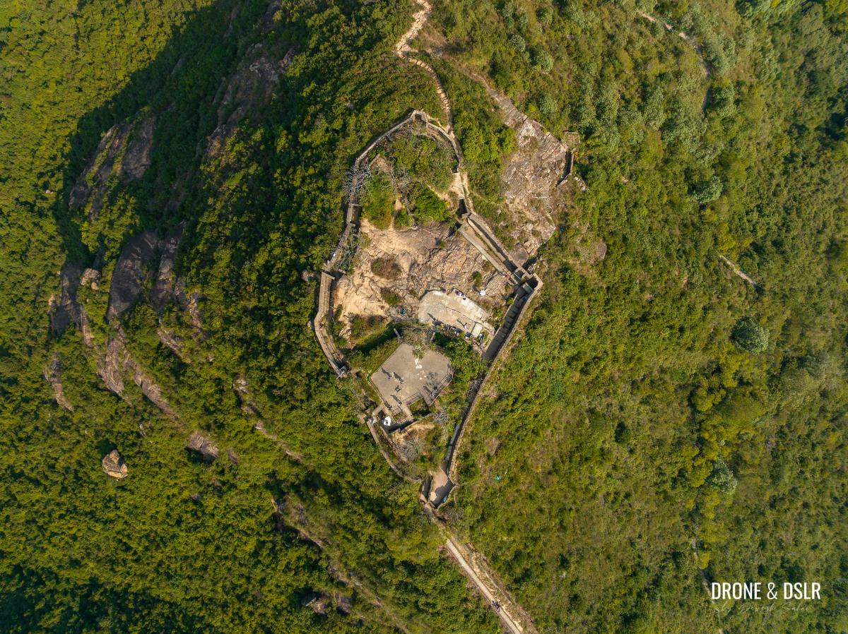
The redoubt was built to circumscribe the rock outcrop of the peak
Once on the trail, follow the path as it leads you down Devil’s Peak from the back.
The trail is definitely more challenging than what you experienced coming up. So, watch your step as you descend on the rocky terrain. Also, the views of Junk Bay from this side of Devil’s Peak are far more impressive.
-
- Grab the rope as you descend on the other side of Devil’s Peak

-
- The views of Junk Bay are amazing but remember to watch your step

-
- The initial descent is rocky and rough

The rough and rocky trail ends when it connects with Wilson Trail. At this point, turn left onto Wilson Trail, and walk down the steps.
-
- When the rough trail meets with Wilson Trail Section 3, turn left

-
- Stay on the steps as you descend on Wilson Trail
At the end of the steps, there is a short flat section with benches and a view of the cemetery.
Walk past the benches towards the cemetery
Just ahead of the benches, the trail splits in two. Section 3 of Wilson Trail continues on the right (which is Option 3 below). But to return to Yau Tong, turn left.
At this point, turn left to return to Yau Tong. Turn right to continue on Section 3 of Wilson Trail
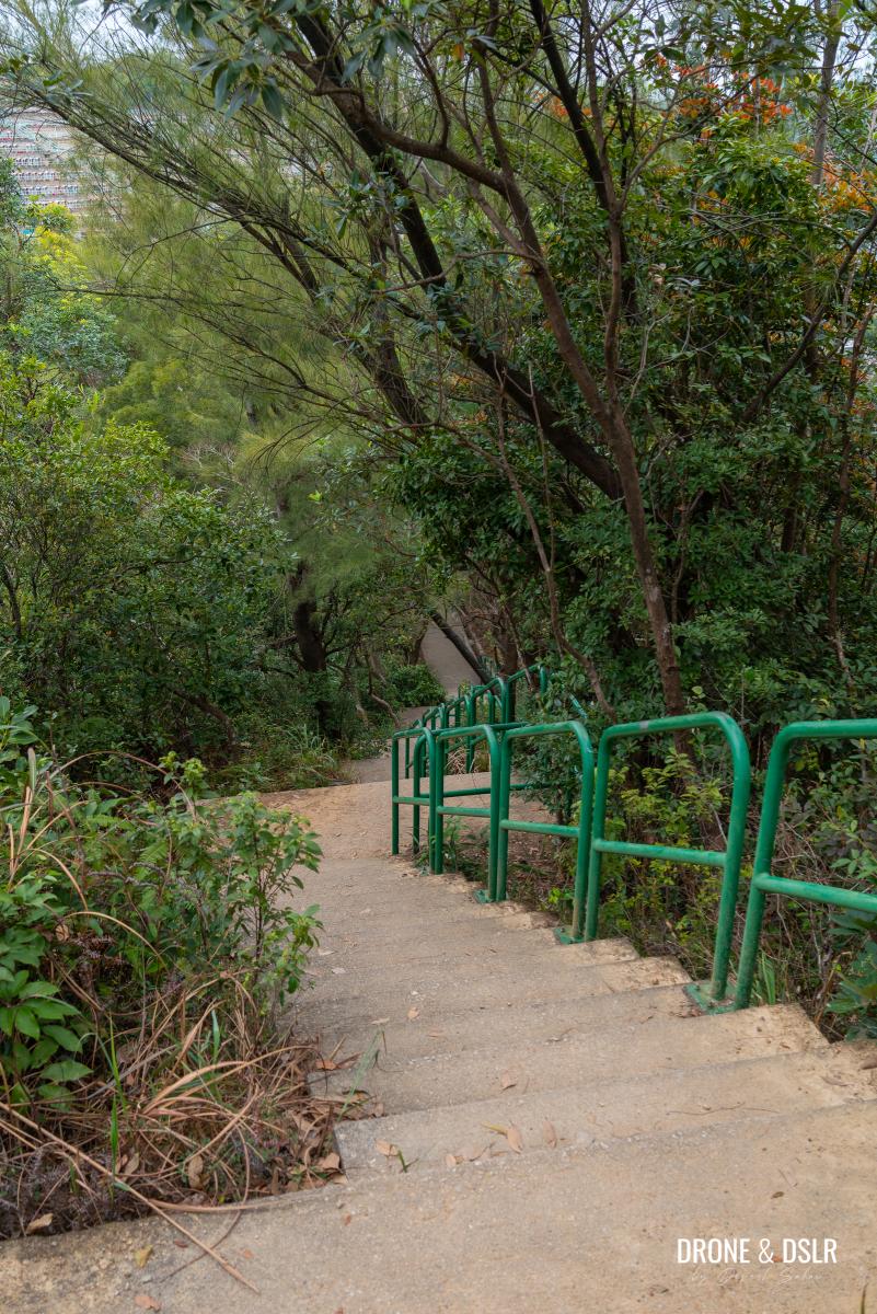
Continue walking down the next flight of steps as you turn left. The steps soon descend below the tree line, taking away any views.
-
- Start going down these steps
-
- Unlike the main route, these are the only views you’ll see on this back route
A short distance ahead, there is another abandoned structure with no name or signs.
-
- You’ll pass another abandoned structure on these steps

-
- Not much to see here
Keep walking down the steps till you reach the boundary of Lingnan Temple.
-
- Keep walking down the steps
-
- Peeking inside the Lingnan Temple
-
- A colourful furnace of sorts outside the Lingnan Temple

After the temple, simple follow the path as it twists and turns, and eventually exits at Junk Bay Chinese Permanent Cemetery Access Road, adjacent to where you started your climb.

And this route beings you out at exactly the same location where you started
Option 3: Continue on Wilson Trail Section 3 to Black Hill
Because Devil’s Peak is an easy hike, many hikers choose to continue hiking on Wilson Trail Section 3. Simply follow the same back trail in Option 2 above, and when the trail splits, turn right instead of left.
At this point, turn left to return to Yau Tong. Turn right to continue on Section 3 of Wilson Trail.
Follow Wilson Trail towards Black Hill and end at Mau Wu Shan. Black Hill is a 304-metre hill between Tiu Keng Leng and Lam Tin in the southeastern New Territories and played a role during the days when Kai Tak Airport was still used. Mau Wu Shan is the location of the historic Mau Wu Shan Observation Post.
Black Hill with Wilson Trail running on its ridge
Devil’s Peak — A Historically Significant Hike In Hong Kong
We hope you enjoyed our guide to Devil’s Peak in Hong Kong. There are many World War II relics that you can explore in Hong Kong. If you wish to read more about Devil’s Peak, here is a link to a survey from the Journal of the Royal Asiatic Society Hong Kong Branch, which contains many interesting facts about its past.

Aerial panorama of Devil’s Peak with the Hong Kong skyline in the background
We also recommend visiting Sai Wan Battery, which is situated directly opposite Devil’s Peak on Hong Kong Island. Or even better, Mount Davis which was the Western Fire Command for the British Army.
As always, drop us a comment below or share this post on the social media channel of your choice.
If you enjoy our work, come join us on Instagram and YouTube 🙂


You might also like


2 Comments
Just wanna say been following your site for years and love how informative your guides are! I come back to HK occasionally to visit family and any spare time I get to myslef, I go to your site to find some awesome hikes!
The photos u take are awesome, keep up the good work!
Thank you, Nathan! Your comment made my day 🙂