
The Mount Davis Hike is a relatively easy hike on the westernmost hill on Hong Kong Island. The hike explores the war relics of the former Mount Davis Battery, the headquarters of the Western Fire Command during World War II, that lie in ruins today.
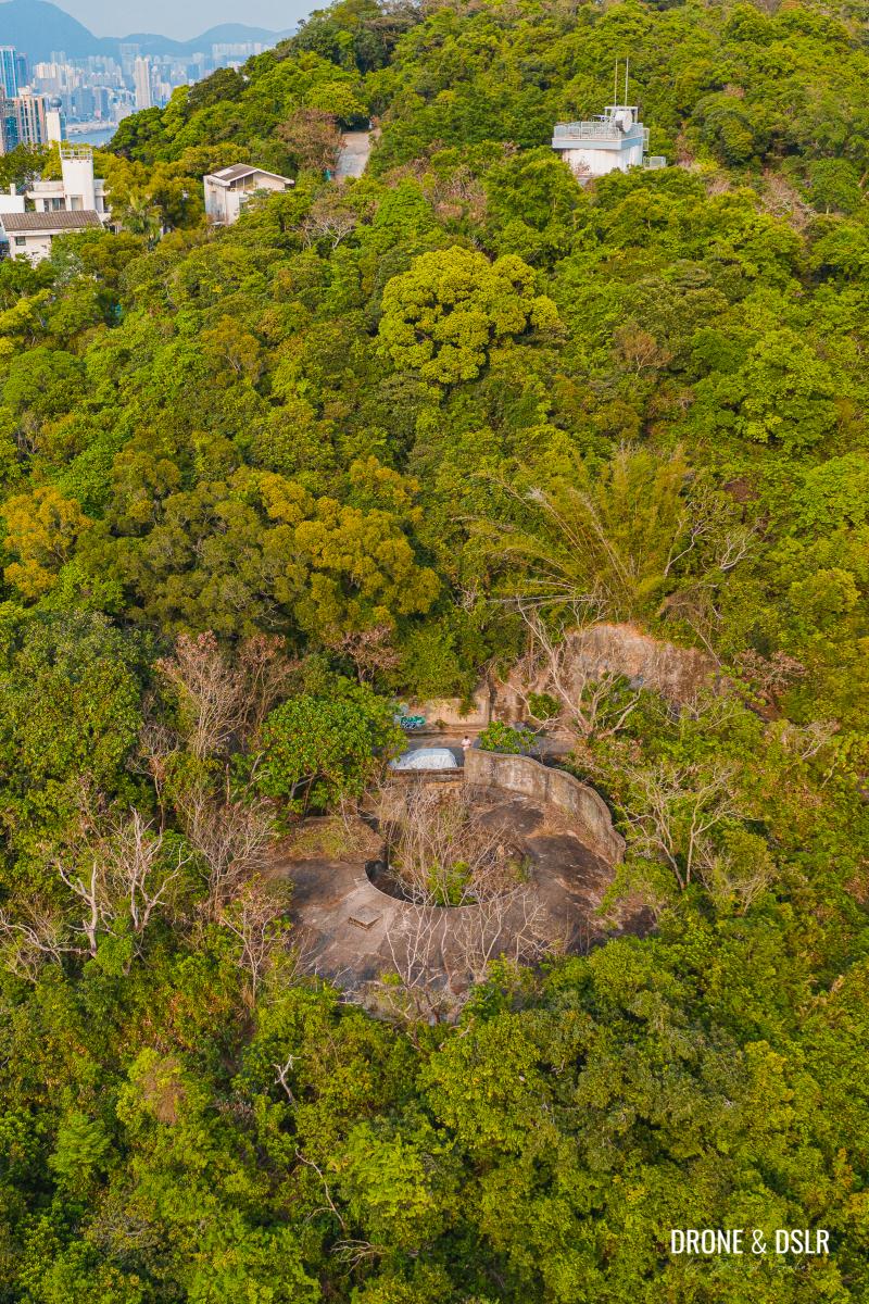
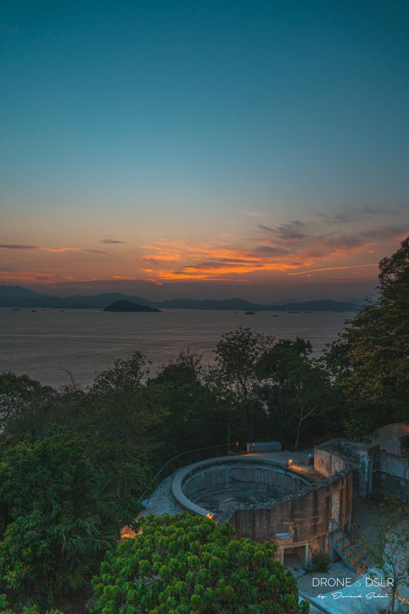
War relics overrun by nature on Mount Davis Battery
Mount Davis Hike
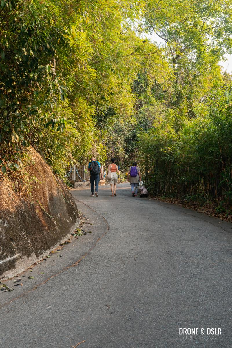
As mentioned, the hike to the top of Mount Davis is relatively quite easy. At 269 metres, Mount Davis isn’t all that difficult to climb. The trail to the top is essentially a paved road used by cars and is at a constant incline (see elevation below). So, in reality, think of it more as an exploratory walk.
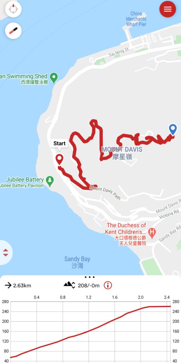
Mount Davis hike map and elevation profile
However, the Mount Davis Hike isn’t known for its challenging nature, but the countless war relics scattered all over the hill, that are a delight to uncover!
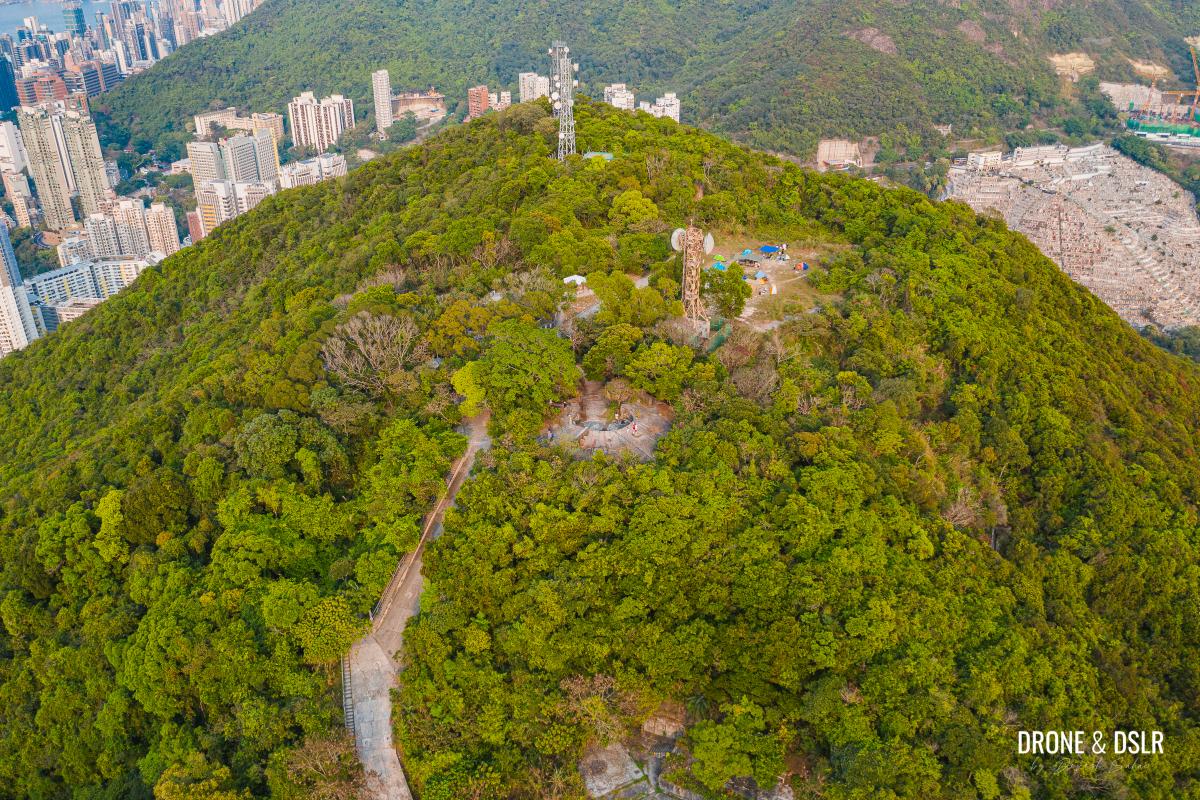
The top of Mount Davis
About Mount Davis Battery
The Mount Davis Battery was built in the early 20th century and served as the headquarters of the Western Fire Command. It was responsible for the defence of the western part of Hong Kong Island.
When the war arrived in Hong Kong in December 1941, the Japanese heavily bombarded the battery. Before surrendering to the enemy, the personnel destroyed the remaining armament and equipment.

Ruins of Mount Davis Battery
Today, the battery comprises five gun emplacements, the Western Fire Command Headquarters, ammunition stores, and accommodation buildings.
As you hike to the top of Mount Davis, you’ll come across numerous structures, lying in ruins and overrun by nature. The gun emplacements fall along the hike’s route.

Close up of a gun emplacement
Starting point
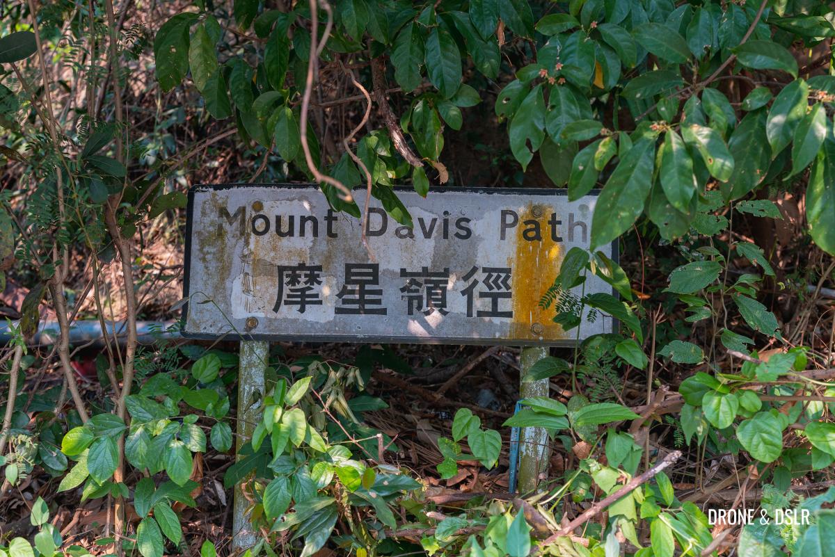
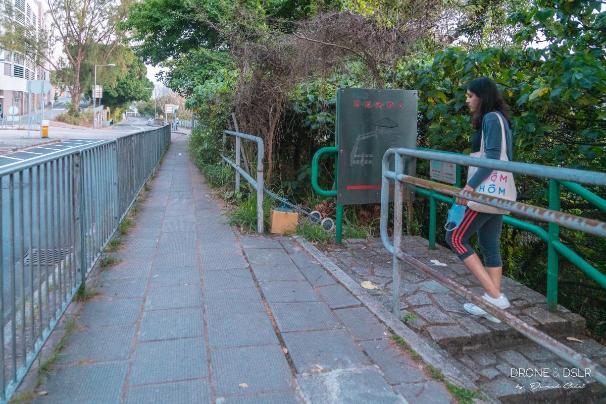
To start the Mount Davis Hike, make your way to Mount Davis Path. The road diverges from Victoria Road opposite The University of Chicago Francis and Rose Yuen Campus.

Mount Davis Path, opposite The University of Chicago Francis and Rose Yuen Campus
Depending on where you’re coming from, there are plenty of buses (1, 43M, 47P, 971) and minibuses (54, 54S, 58, 58A, 58M, 59) that stop next to this path.
Mount Davis Path
Jubilee Battery
Before you start the Mount Davis Hike, it might be worthwhile to check out Jubilee Battery, which is located at the foot of Mount Davis right below The University of Chicago Francis and Rose Yuen Campus.
If you want to just have a look at the battery and gun emplacement, enter the gate of the campus and look below to the right from the viewing area.
The view of the sunset and Jubilee Battery from the University of Chicago building
If you want to visit the battery, walk down the flight of steps down the road and then walk below the campus to reach it.
The entrance to the Jubilee Battery next to the University of Chicago Academic Complex
I believe this is the fifth gun emplacement on Mount Davis as I only spotted four others on the hill. I could be wrong.
After visiting or viewing Jubilee Battery, walk back to Mount Davis Path and start walking up the inclined road.
To the second gun emplacement
The hike up Mount Davis is fairly straightforward along the Mount Davis Path. Simply walk along the road as it navigates its way uphill.
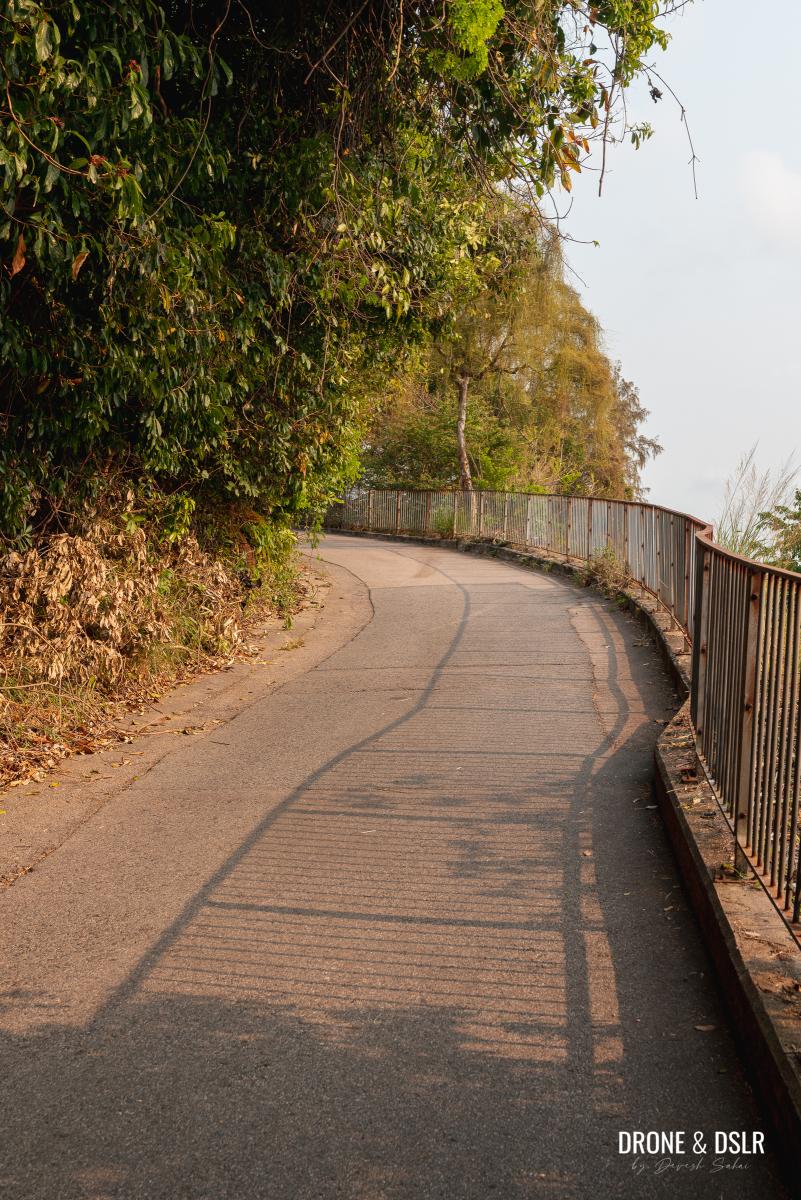
The initial section of Mount Davis Path
The initial part of the hike passes by the back of the buildings on Mount Davis. At the first turn, follow the red sign for Jockey Club Mt. Davis Youth Hostel to continue on the correct track.
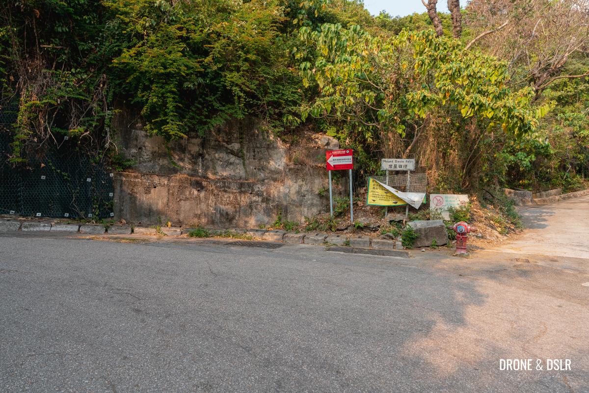
Follow the red sign for the Youth Hostel
Much before you reach the gun emplacement, you’ll notice a couple of dilapidated structures along the way. Some of them may be hidden or camouflaged.
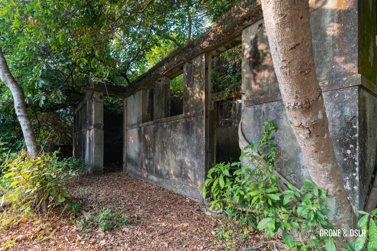
A structure in ruins near the start of the hike
With all these old structures and hidden steps, it’s no surprise that Mount Davis was a (maybe still is) popular location to play war games. Feel free to explore these hidden steps and trails, but my advice is to return to the main path as it’s the easiest to navigate.
Continue walking on Mount Davis Path till you cross the outdoor playground. One thing worth noting just after the playground is the sign for Victoria Road on the way. Make a note of it.
-

- Mount Davis Playground

-
- Just another structure in ruins on Mount Davis
Anyway, keep walking as you admire all the dilapidated structures along the way until you finally arrive at a pavilion.
-
- Views of the sea from Mount Davis Path

-
- Keep going up Mount Davis Path

-
- The path is a constant incline
Right next to the pavilion is the gun emplacement.
-
- A better view of the second gun emplacement
-
- The second gun emplacement

-
- Overrun by nature

-
- Above the second gun emplacement
To the third gun emplacement
To get to the next gun emplacement, there’s a nifty shortcut that you can take to avoid all the cars. Just as you continue walking uphill on Mount Davis Path after the second gun emplacement, you’ll notice a flight of steps on the left. Walk up these steps.
Take the steps for a shortcut
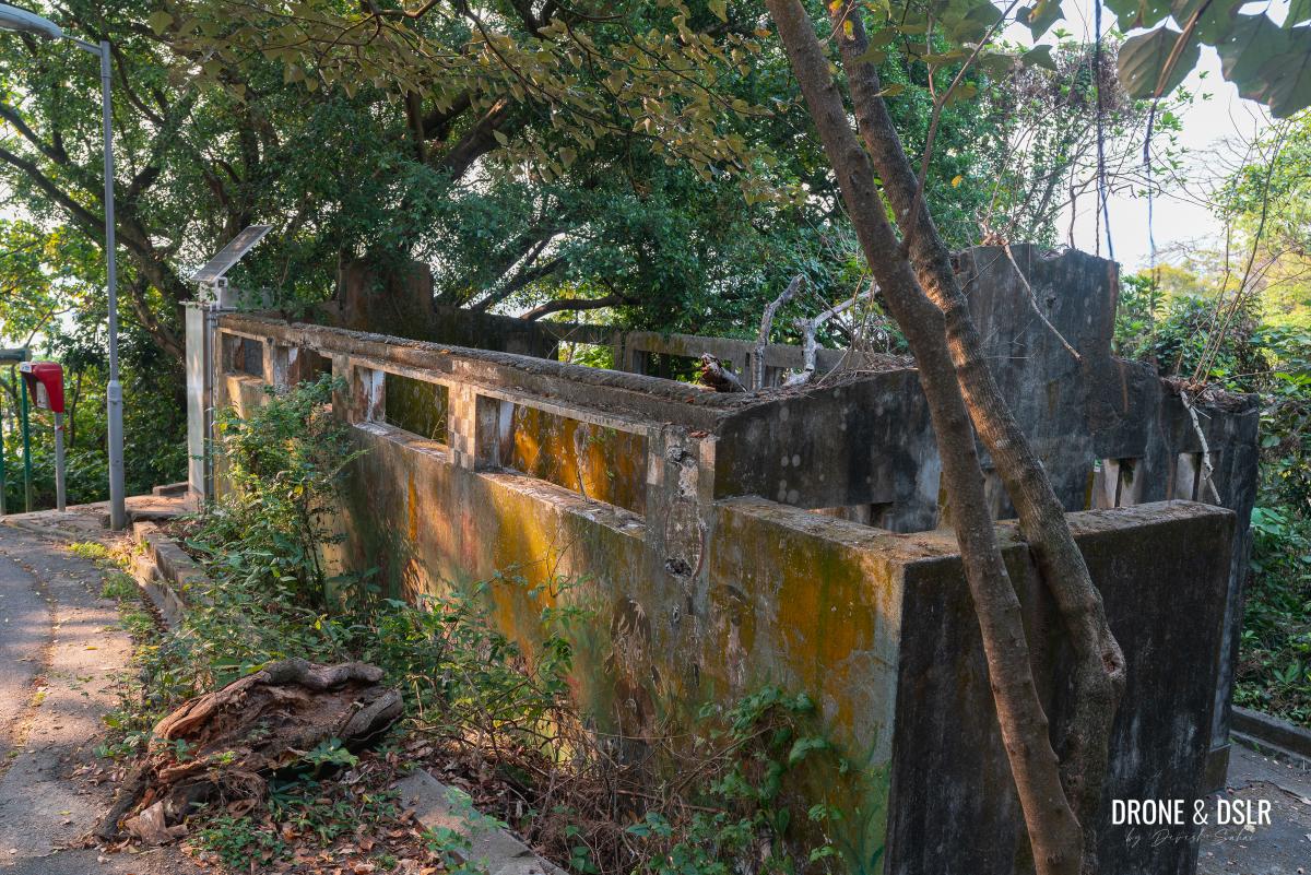
The steps essentially cut across to Mount Davis Path on the other side, but not before passing another hidden group of structures that, I believe, were part of the Mount Davis Battery.
-
- Walk up these steps on the right. The path on the left goes to another set of ruins
-
- More hidden structures on Mount Davis

Once you emerge on the road, turn left and walk for another 50 metres.

Turn left when the steps reach the road
And here, to the left is the third gun emplacement.
-
- The third gun emplacement

-
- Close up of a gun emplacement
To the Mount Davis Youth Hostel
Continue walking uphill after viewing the third gun emplacement. Up ahead, as the road turns you’ll notice another sign, next to a flight of steps going downhill, for Victoria Road. Make a mental note of this sign.
Soon after the sign to Victoria Road, you’ll arrive at the Jockey Club Mount Davis Youth Hostel.

Jockey Club Mount Davis Youth Hostel
For those wondering, the Youth Hostel is a fabulous, off-the-beaten-track option for a staycation, right in the heart of Hong Kong’s war relics!
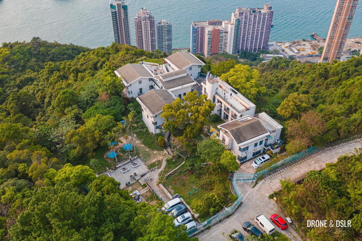
Aerial view of the Jockey Club Mount Davis Youth Hostel
Right opposite the Youth Hostel are two diverging paths. The more visible path is a cemented, 45-degree slope on the left (dubbed the ramp), and the other is a dirt path behind the car park.
-
- The infamous ramp on Mount Davis

-
- Take the path behind the car park opposite the Youth Hostel

To get to the next gun emplacement, take the dirt path and walk behind the car park.
Fourth gun emplacement
The area behind the car park resembles a fort. The stone wall that runs alongside the hill makes me think that this was the Mount Davis Fort. Again, this is just a guess looking at the structure.
If you’re facing the wall, walk towards the right. There is an ionospheric station housing an ionosonde. The ionosonde was set up in a refurbished bunkhouse by the University of Hong Kong Physics department in 1969.
Right next to the ionospheric station is the fourth gun emplacement. The top of the gun emplacement is covered, but I am fairly certain that is where one of the guns was placed.

A covered gun emplacement next to the ionospheric station
Feel free to explore the other old structures around this gun emplacement.

More ruins next to the Youth Hostel
To the fifth gun emplacement
To get to the last gun emplacement, I would recommend taking the narrow steps opposite the fourth gun emplacement.
Walk up this narrow flight of steps
The steps cut across a narrow corridor and make their way through the fort. Along the way, there are a couple of rooms or lookout points adjacent to the steps.

Rooms along the narrow steps
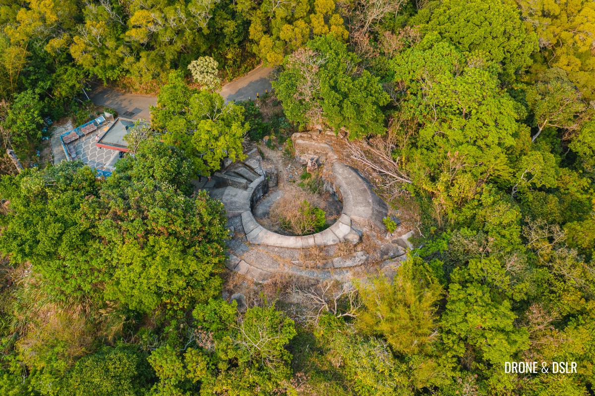
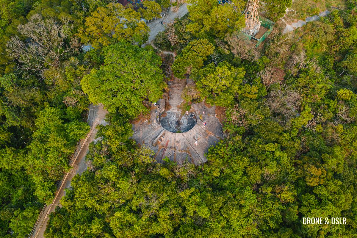
When you make it to the top of the steps, turn right and follow the dirt trail around the corner. The trail emerges next to the camp ground on top of Mount Davis.
-
- Follow the path towards the tower
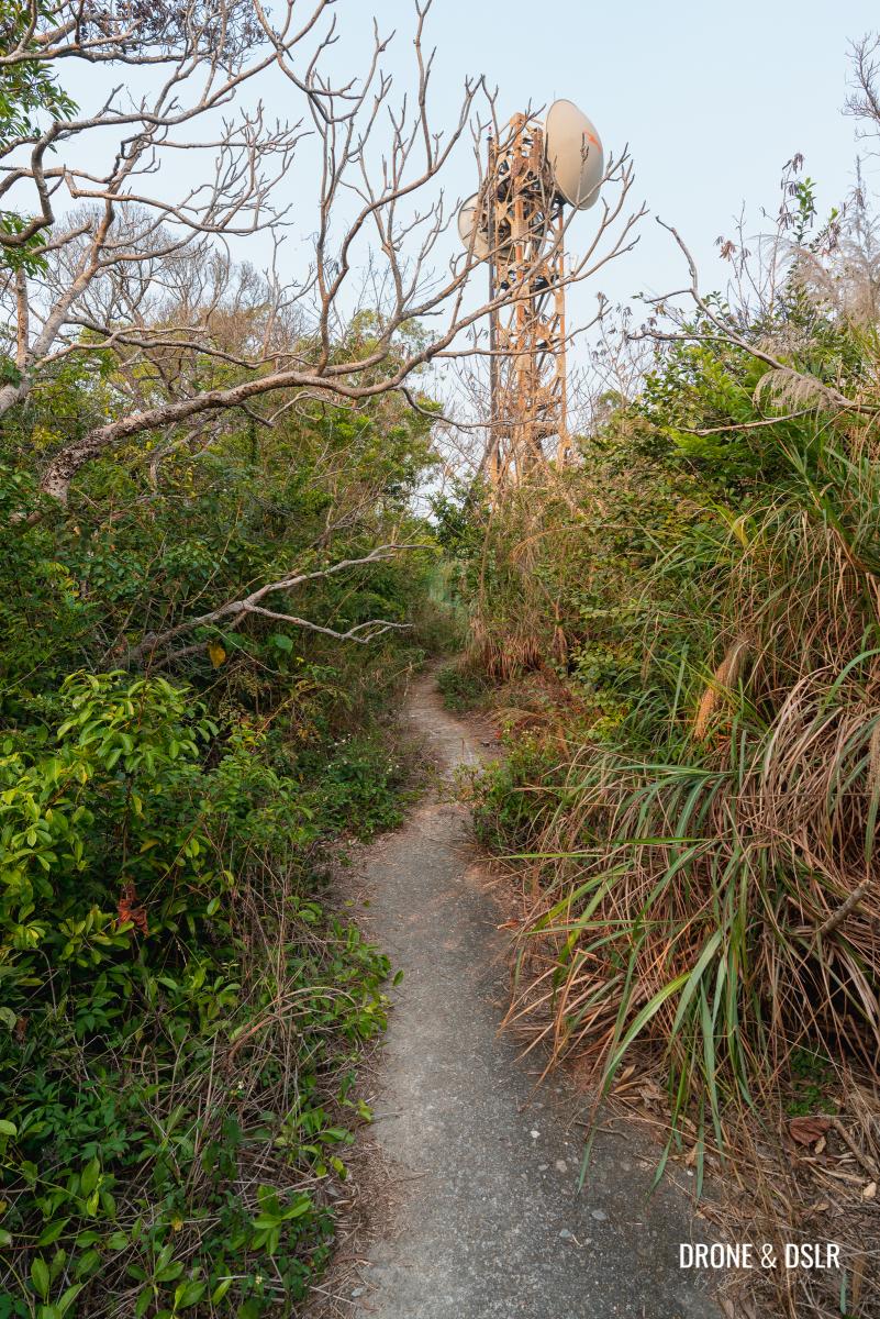
-
- Aerial view of the campground on top of Mount Davis

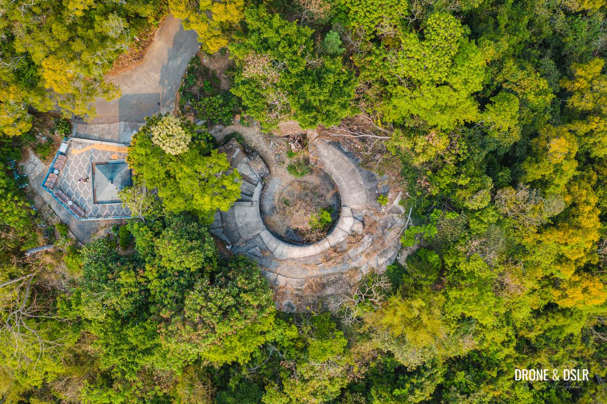
The final gun emplacement is to the left of this path, opposite the camp ground. This was my favourite gun emplacement as it is easy to explore and not overrun by nature.
-
- Perhaps the largest gun emplacement on Mount Davis Battery

-
- The final gun emplacement
To the headquarters and accommodation rooms
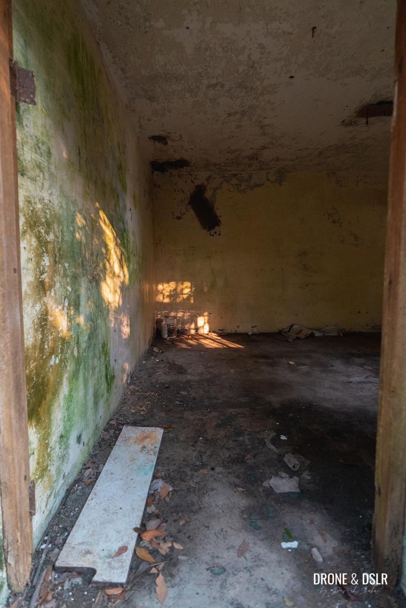
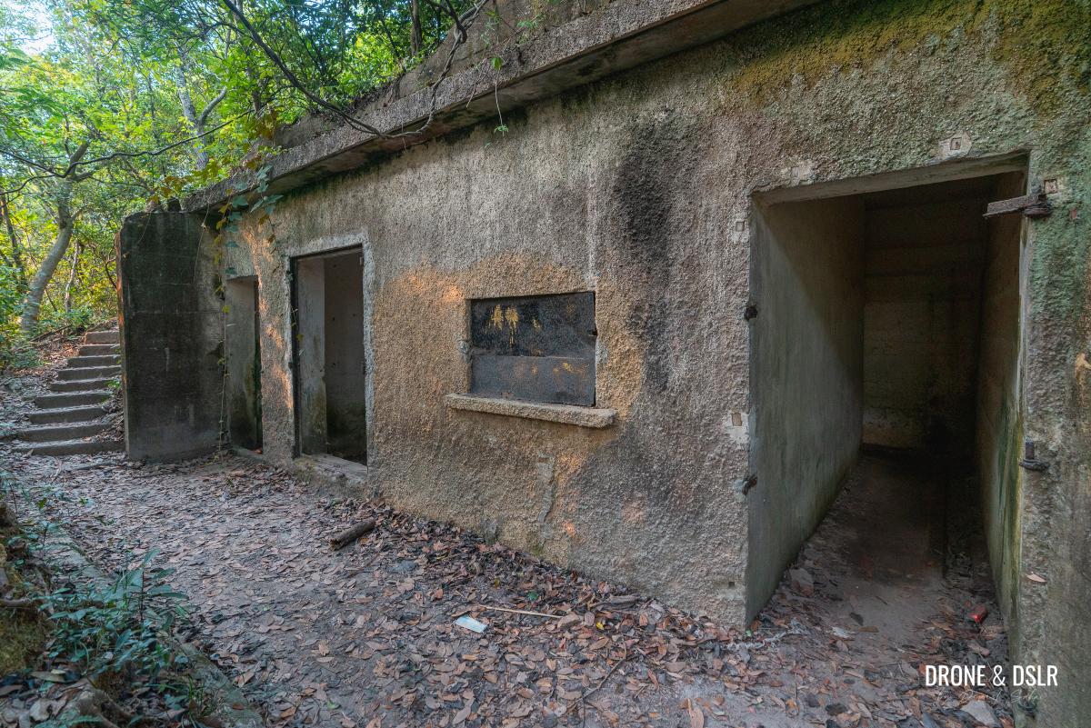
The final stop on the Mount Davis Hike is the largest structure located next to the peak of Mount Davis. I can only imagine that this building consisted of the headquarters and accommodation rooms.
To get this structure, turn right and walk on the dirt path next to the Mount Davis camp ground. As the path turns left at the end of the camp ground, there is a building with many rooms.
-
- Follow the road next to the campground

-
- The structure with the rooms opposite the campground

-
- Inside one of the rooms
-
- More rooms at Mount Davis Battery
-
- Ammunition stores and accommodation buildings at Mount Davis Battery

-
- Mount Davis Battery in ruins

You can walk down the path in front of the building to explore the ruins.
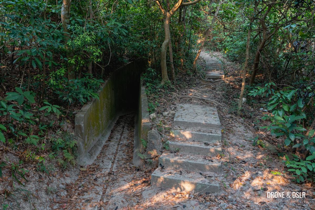
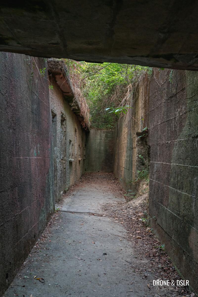
After that, return to the dirt path and continue walking up the incline. At the end of the incline, you’ll find another line of rooms on the left, and a tunnel on the right.
-
- Walk up this short incline to reach the end of the hike

-
- More remnants of the Mount Davis Battery

-
- Ruins of Hong Kong’s Western Fire Command

-
- More ammunition stores and accommodation buildings on Mount Davis

-
- Explore this tunnel-like passage

There are a few more rooms hidden inside the tunnel.
More hidden rooms – Mount Davis Battery
Continue down the path to see the final set of rooms in ruins. Again, since there are no signs here, I can only imagine that this structure was the headquarters of the Western Fire Command.
I spent a considerable amount of time here just exploring the ruins. There are plenty of hidden paths running all around the top. It’s truly fascinating!
Mount Davis Peak
No hike is complete without reaching the top of the hill! So, if you want to reach the Mount Davis summit, walk on the path in between the ruins on either side. These are the ruins right underneath the tower.

To reach the summit of Mount Davis, walk on the path between the structures
At the end of the ruins, the path goes up the small slope. Once you climb that slope, the Mount Davis triangulation station should be right in front.
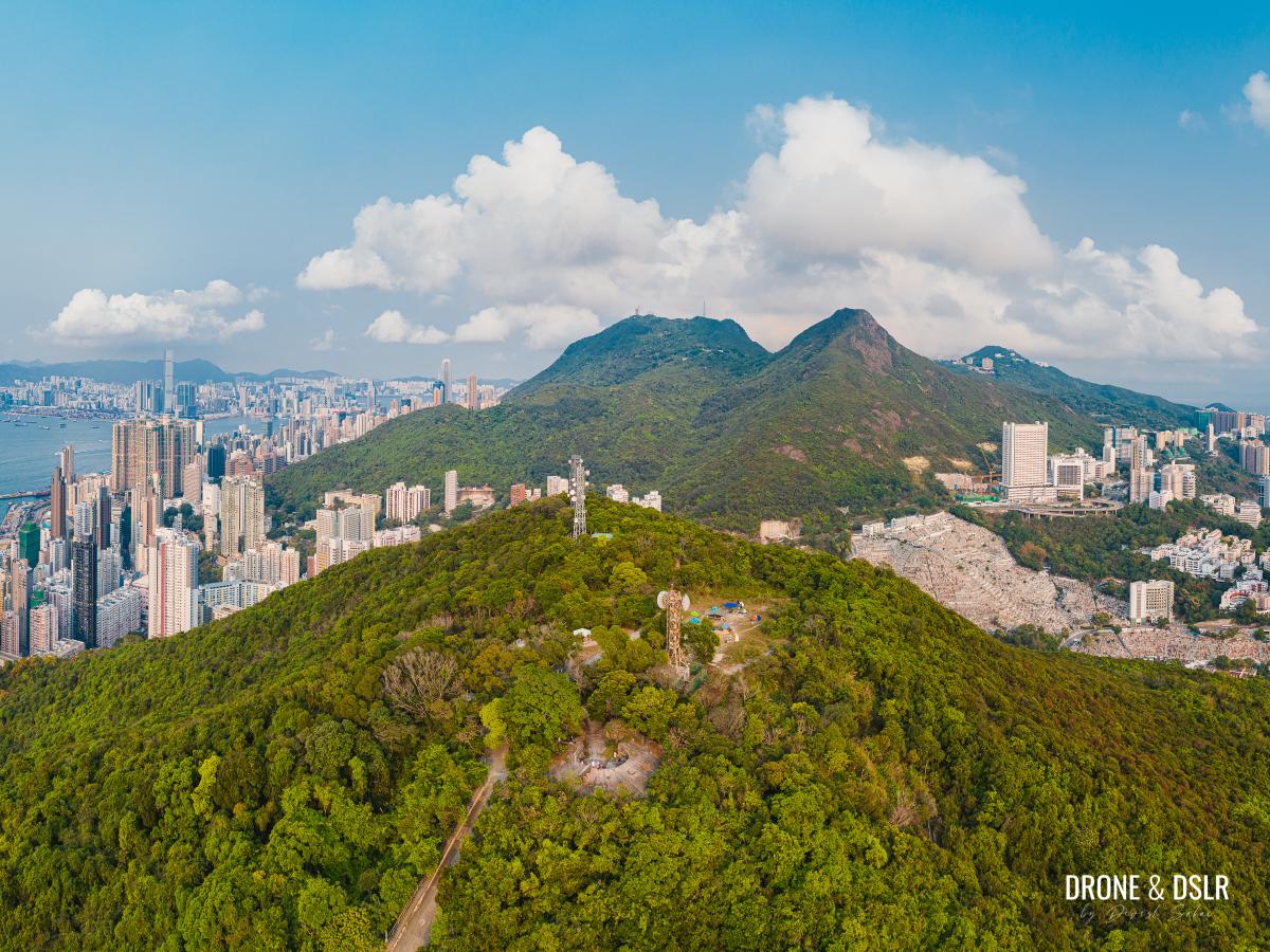
From here, you can see the mighty Mount High West and Victoria Peak straight ahead.

The view of Mount High West and Victoria Peak from the top of Mount Davis
End the hike
Once you’re completely satisfied that you’re done exploring the ruins of Mount Davis, you have two options to end the hike.
- The first option is to return the same way that you came up from.
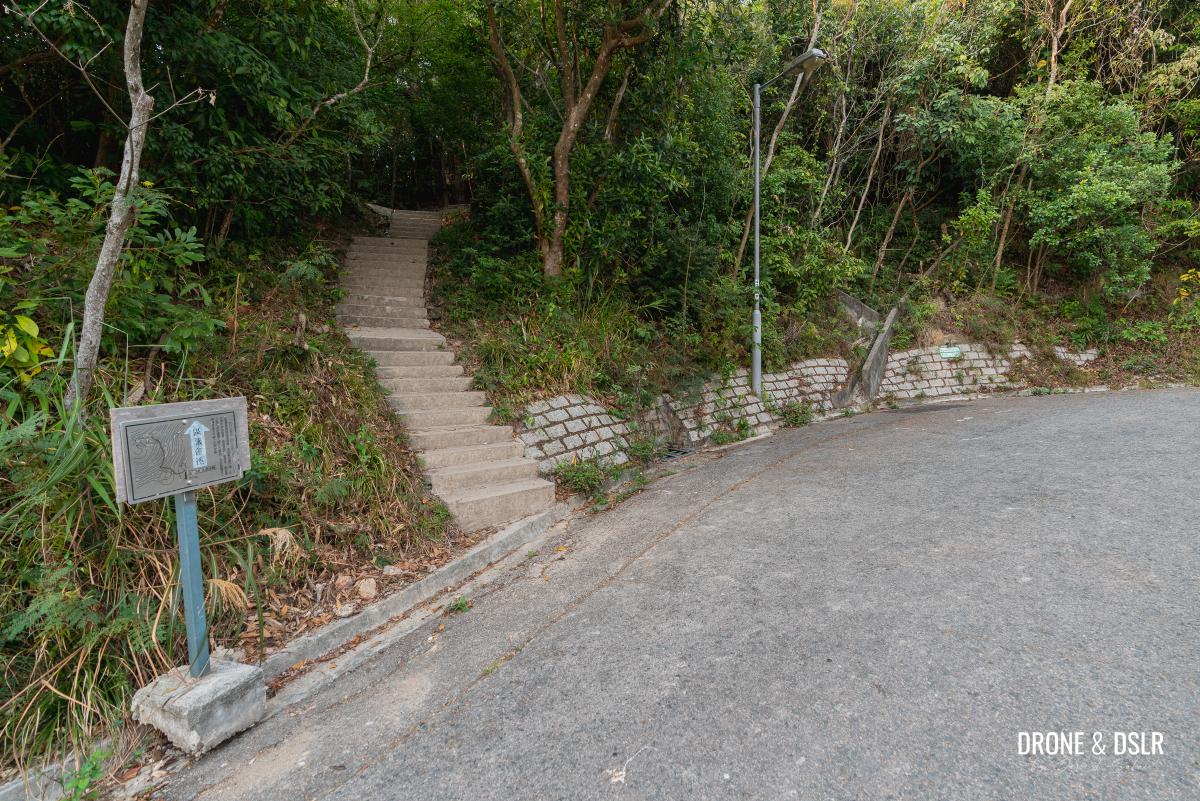
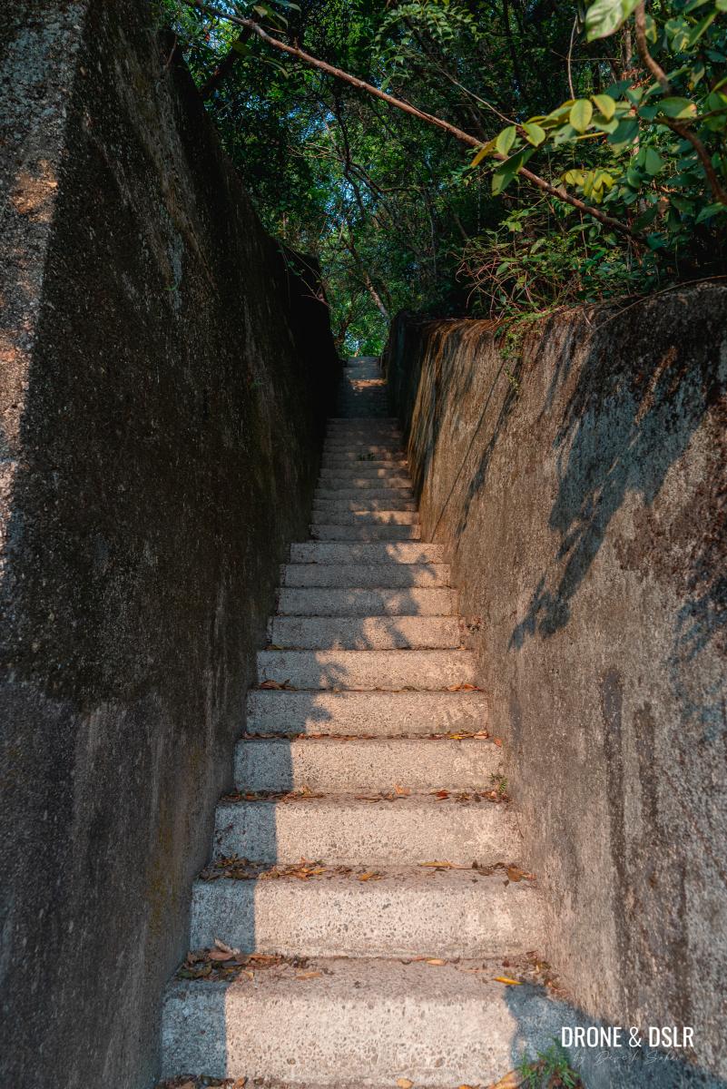
- Or there is a second option that involves taking a shortcut to Victoria Road. I’m referring to the steps with the signs to Victoria Road that you noticed on your way up. These steps cut straight across the north face of the hill, straight to Victoria Road below.
Shortcut to Victoria Road
From the Mount Davis peak, trace your steps back to the fifth gun emplacement, and take “the ramp” down to the Mount Davis Youth Hostel.
Right after the Youth Hostel are the first flight of steps with the sign to Victoria Road. Walk down these steps till you reach the Mount Davis Path next to the playground.
-
- The shortcut to Victoria Road just below the Youth Hostel

-
- The first part of the shortcut is well-maintained

-
- Shortcut steps

The next flight of steps should be visible right ahead. Unfortunately, this part of the shortcut isn’t as well maintained as the one above.
-
- The sign for the shortcut to Victoria Road

-
- Take the steps down for the shortcut

The steps almost immediately turn into an unmaintained and narrow trail, which then makes its way downhill through the lush vegetation of Mount Davis.
Be careful of spiders and uneven stones along this path. Also, keep a lookout for more relics lying in ruins on this path.
-
- Adding some colour to the shortcut

-
- The shortcut to Victoria Road

As you get close to Victoria Road, the steps become extremely narrow, and the path feels like a cage! If hikers are coming from the other direction, it might become slightly difficult to pass.
-
- Difficult for two people to pass

-
- A bit claustrophobic

Fortunately, the caged trail ends soon enough on Victoria Road. From here, you can catch the same set of buses or walk for 10 minutes to the Kennedy Town MTR Station.

The shortcut emerges at Victoria Road
Mount Davis – HK’s Western Fire Command
I hope you find this guide to exploring the war relics of Mount Davis helpful. As there wasn’t much information on the signs at the battery or online, I may have misidentified some structures. Please feel free to correct me if I am wrong.
Also, in case you haven’t been to Cape Collinson Battery, Hong Kong’s Eastern Fire Command, we highly recommend it! And also Pinewood Battery, which was Hong Kong’s aerial defence battery behind Mount Davis.
Mount Davis in front, behind it Mount High West, Victoria Peak, and Mt Kellet, with Hong Kong all around.
More information about Mount Davis, along with some interesting old photographs, can be viewed on Gwulo and this website. As always, do leave us your comments below and feel free to share this post on the social media channel of your choice.
If you enjoy our work, come join us on Instagram and YouTube 🙂


You might also like


Leave a reply