
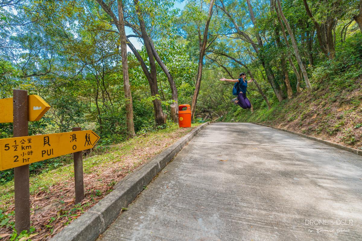
The hike from Mui Wo to Pui O Beach is one of my favourite hikes on Lantau Island. At over 8 km, Section 12 of the Lantau Trail connects Mui Wo to Pui O and with varying levels of difficulty, the hike can get challenging in parts but is relatively easy overall.
Early morning, empty beach at Pui O
I much prefer hiking from Mui Wo to Pui O rather than taking the bus. Not only do you get to enjoy the scenic views along the way, but you’ll also be adding some exercise to your day. And what better reward than a refreshing swim at the end of your hike? This combination of exercise and relaxation makes for an enticing option — don’t you agree?
About The Mui Wo to Pui O Beach Hike
For the record, there are two routes to hike between Mui Wo and Pui O. One via Lantau Trail Section 12 and the other on a coastal trail along Chi Ma Wan Bay. In this guide, we’ll focus on the route via Lantau Trail Section 12.
The official length of this hike is 9 km. However, it’s only 9 km if you finish at South Lantau Road at Pui O Village. From Mui Wo Ferry Pier to Pui O Beach is approximately 8 km.
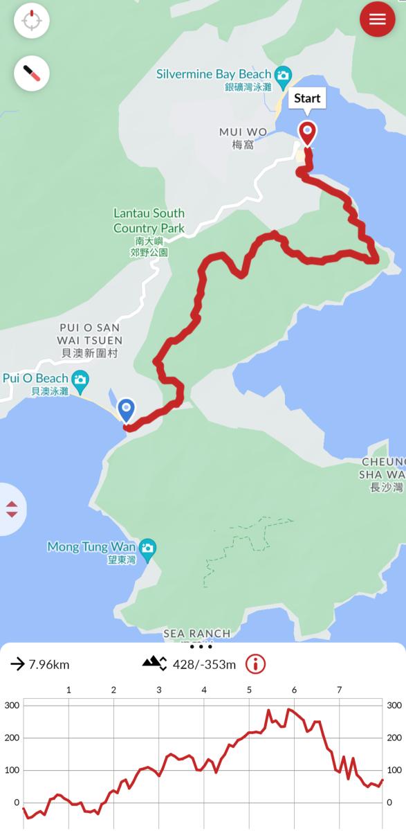
Mui Wo to Pui O Beach Hike Map
Click here to open the map of the hike in Google Maps.
Although the hike is easy for most parts, the climb to Tai Ngau Wu Peak is the only challenging section.
To give you a better idea of what the hike looks like, here is our video tour of the Mui Wo to Pui O hike, along with all the major highlights.
Subscribe to my YouTube channel
Starting Point
To get to the starting point for this hike, make your way to Mui Wo Ferry Pier. The easiest way to get here is by ferry from Central (Pier No. 6) to Mui Wo. The ferry timetable can be found on the operator’s website.
Alternatively, if you’re starting from Tung Chung, catch buses 3 or 3M to Mui Wo Ferry Pier.
Once you arrive at the ferry pier, walk towards McDonald’s, along the pier, till you see China Bear restaurant.
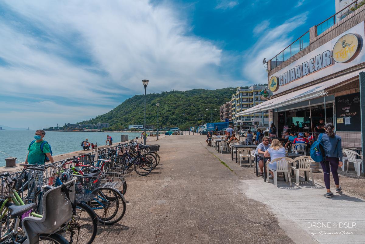
Your hike to Pui O from Mui Wo starts here
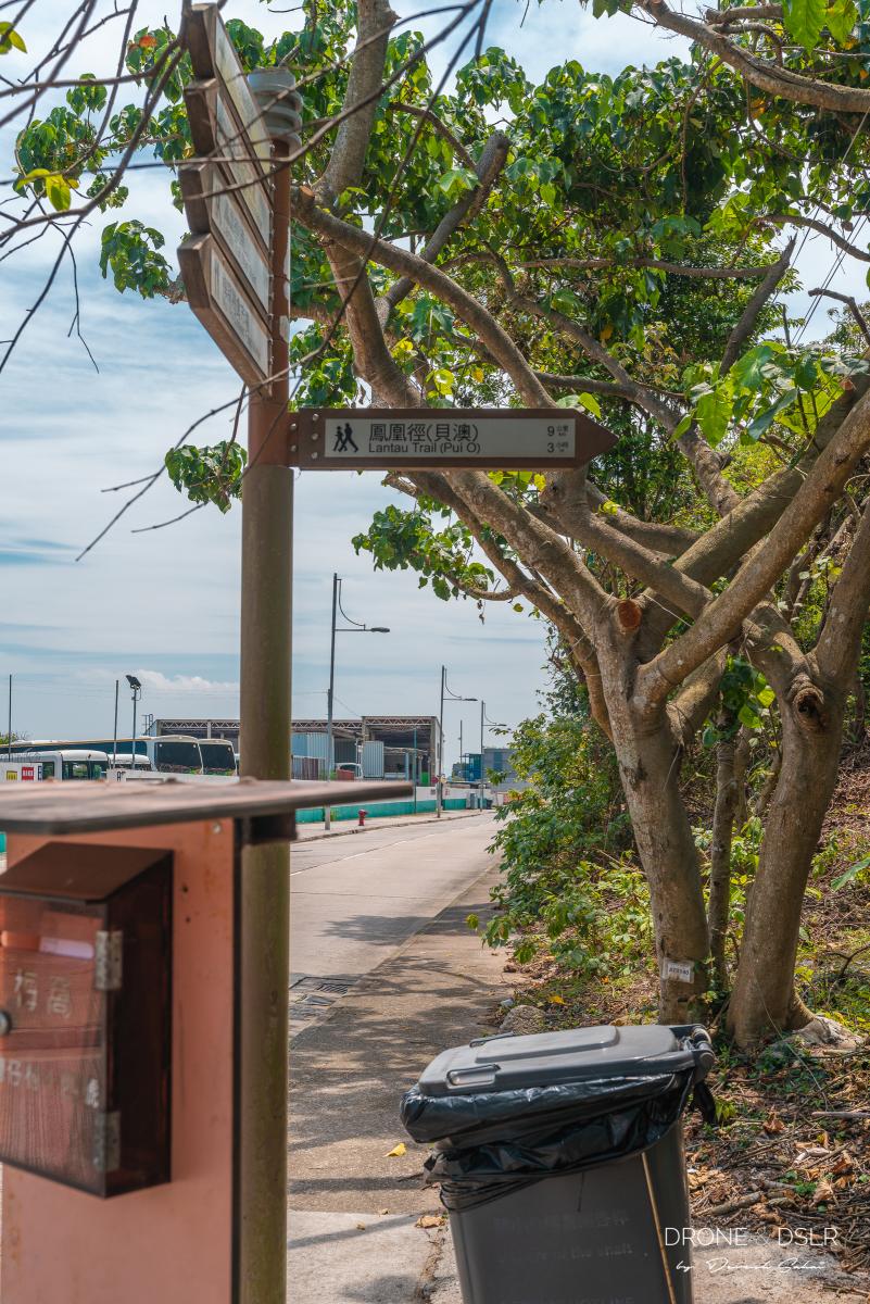
From China Bear, walk along the main road as it bends around the small bay with the kayaks. Just around the bend is the entrance to Section 12 of Lantau Trail — the start of this hike.
The Initial Scenic Coastal Walk
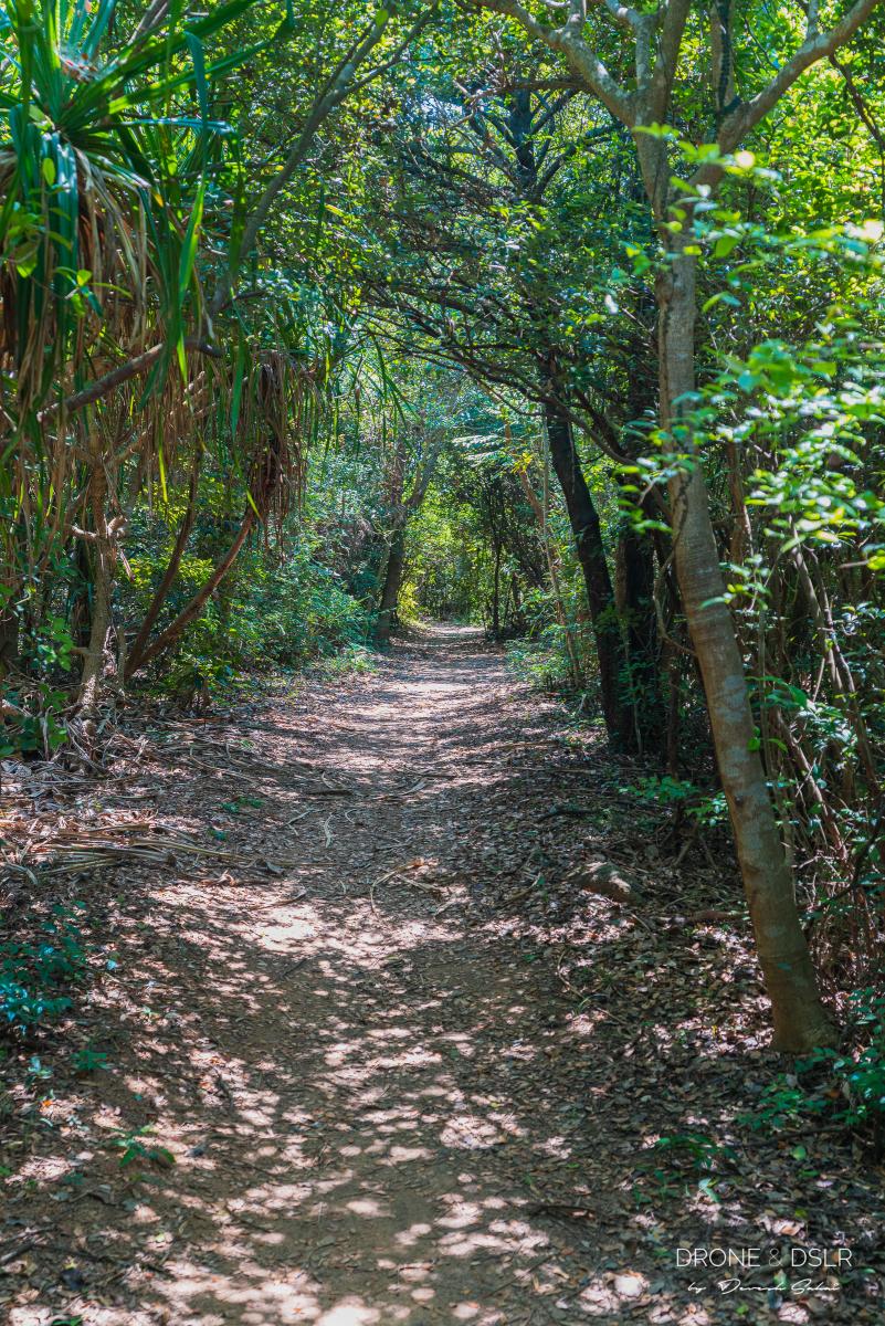
This initial part of the hike (the first 2 km) can best be described as an easy coastal walk.
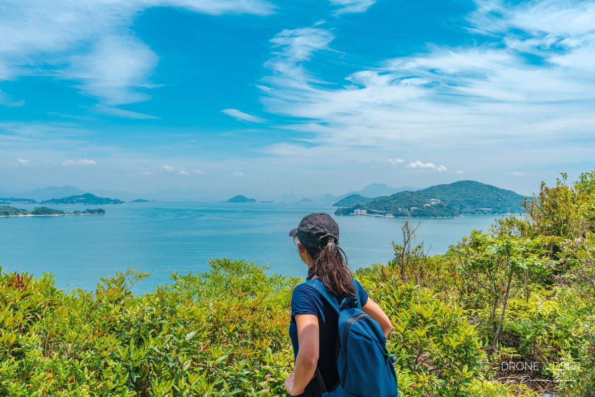
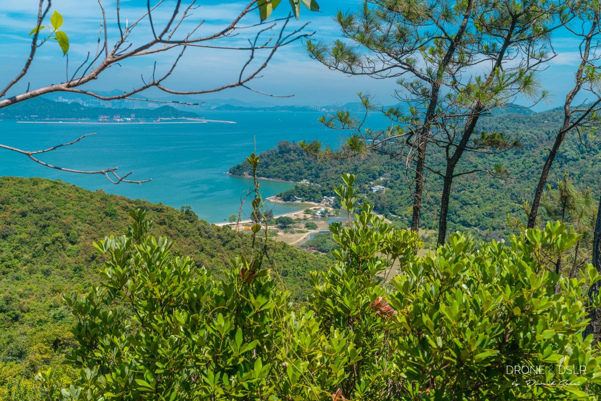
After the first couple of steps, the trail runs along the coastline of Lantau Island. And on a clear day, you can see the Hong Kong skyline and the ferries that come from the city alongside the trail.
-

- The sign to Lantau Trail Section 12 to Pui O
-
- A window to the sea
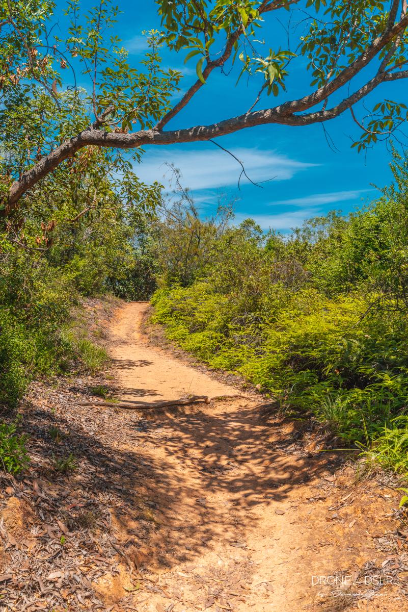
The paved cement way soon gives way to a natural, dirt trail. I would say that this initial part of the trail is equally shaded and open. It’s also perhaps the most scenic and easiest section of the hike.
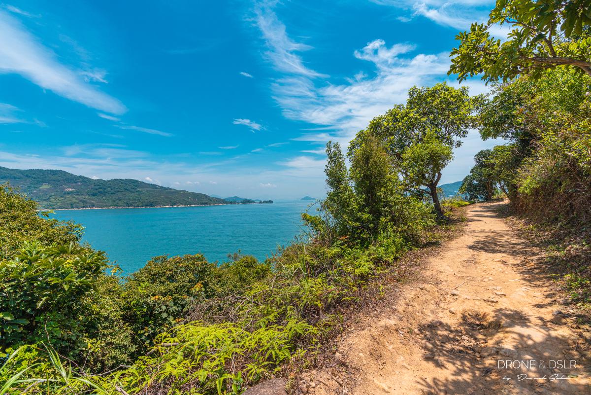
The initial part of the hike is an easy and breezy coastal walk
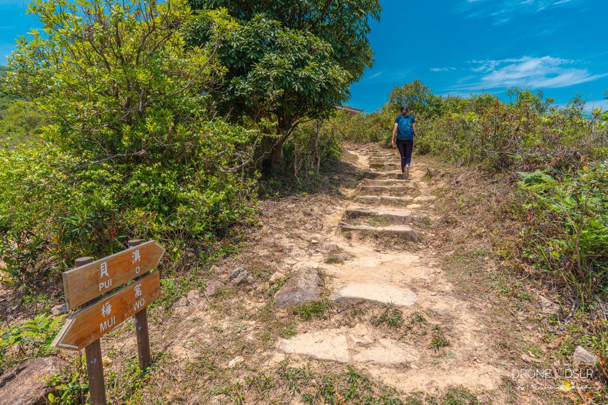
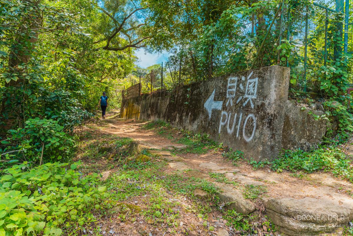
At the end of this coastal walk, you’ll arrive at an intersection of trails. The signs for Pui O point right. From here on out, Lantau Trail no longer runs along the coastline and moves inland.

At the end of the coastal walk
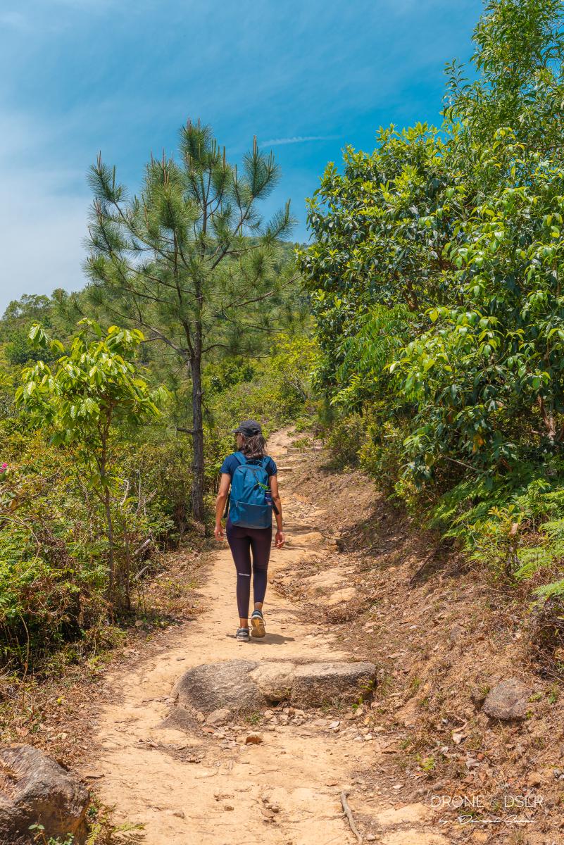
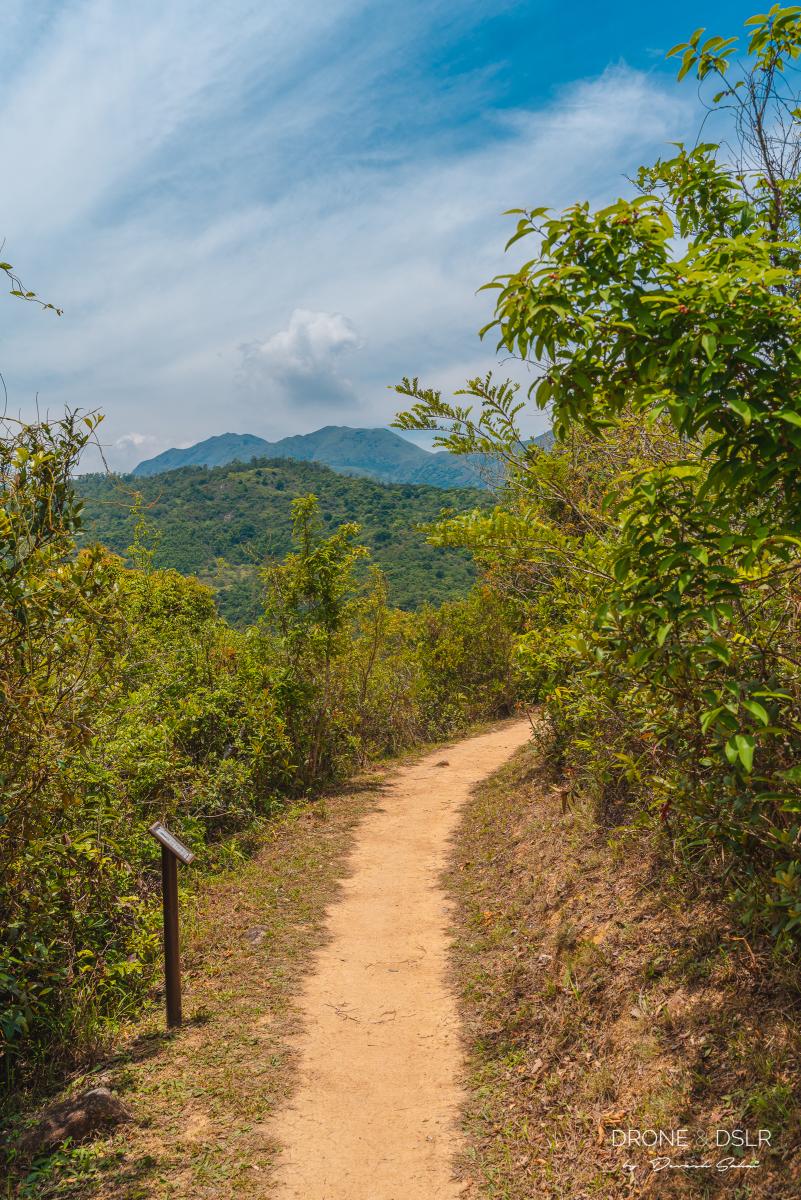
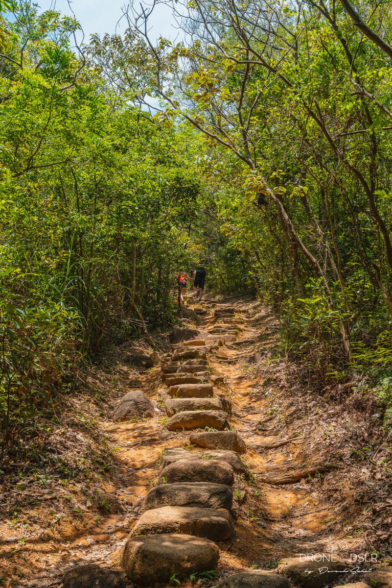
The Undulating Section
The next 1.2 km of the hike is slightly tougher. There’s some incline and climbing involved than what you’ve just encountered.
-
- As the trail moves inland, it gets a bit more challenging and loses the views of the sea
-
- Mui Wo to Pui O
-
- Admiring the Hong Kong skyline in the distance
After the first few steps there’s a pavilion, from where on a clear day, you get nice views of the Hong Kong skyline. We took a quick breather here before continuing ahead.
-
- The views of the Lantau hills from the hike
-
- The undulating part of the trail

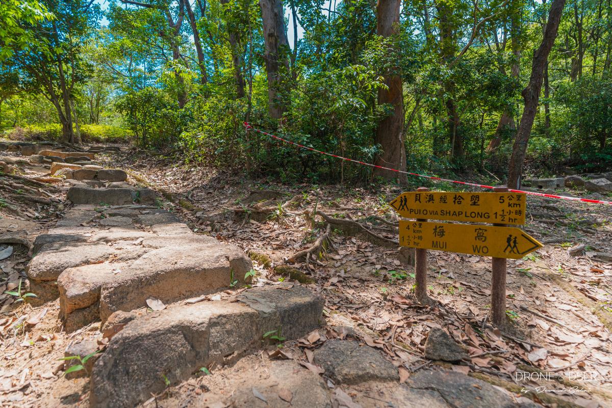
From here on, the next 20 minutes are fairly undulating till you arrive at the next junction – a cemented path.
The Short, Paved Path
Follow this short cemented path to where the natural trail restarts
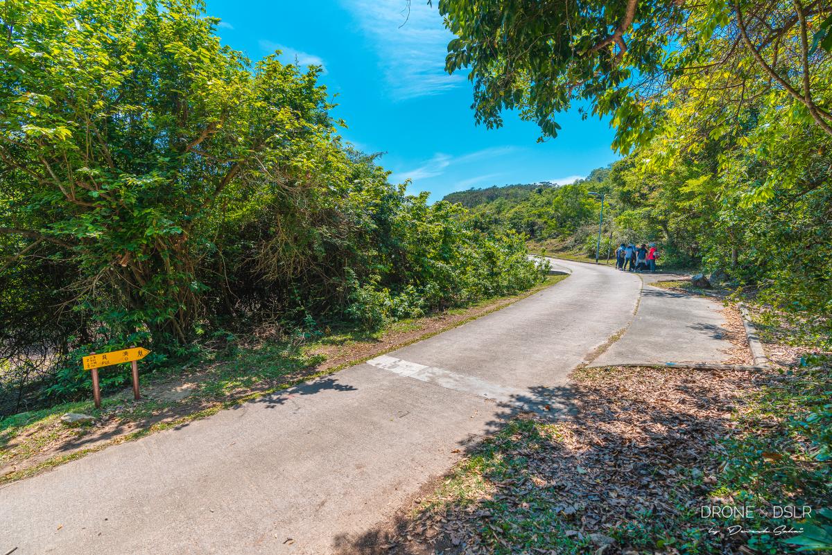
It’s only once you step onto this smooth, cemented path after a long undulating natural trail, do you truly appreciate its evenness. This short section of the hike connects a cemetery to the main South Lantau Road.
Turn right and walk along the cemented path for a couple of minutes till you see the dirt trail on your left. It’s a sharp left turn, so keep an eye out. Many hikers miss this turn and continue walking along the cemented path.
-
- The short cemented path that’s easy on your knees

-
- Remember to get off the cemented road and onto the dirt trail. Follow the yellow sign.

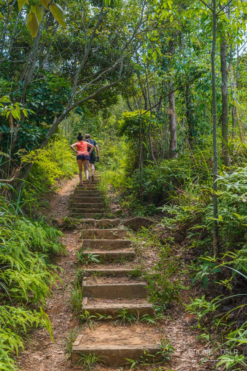
To the Barbecue Sitting Area
The next 5–10 minutes of the hike are quite easy. The trail remains more or less flat, and uneventful. Just remember to follow the signs to Pui O. Some of them are quite hard to miss.
-
- The best parts of the trail were the ones that were shaded and flat
-
- Can’t miss these signs to Pui O
-
- The sign at the barbecue area
Soon you’ll arrive at a barbecue sitting area for the Pak Fu Tin campsite. Fuel up because the next section of the hike gets quite steep.
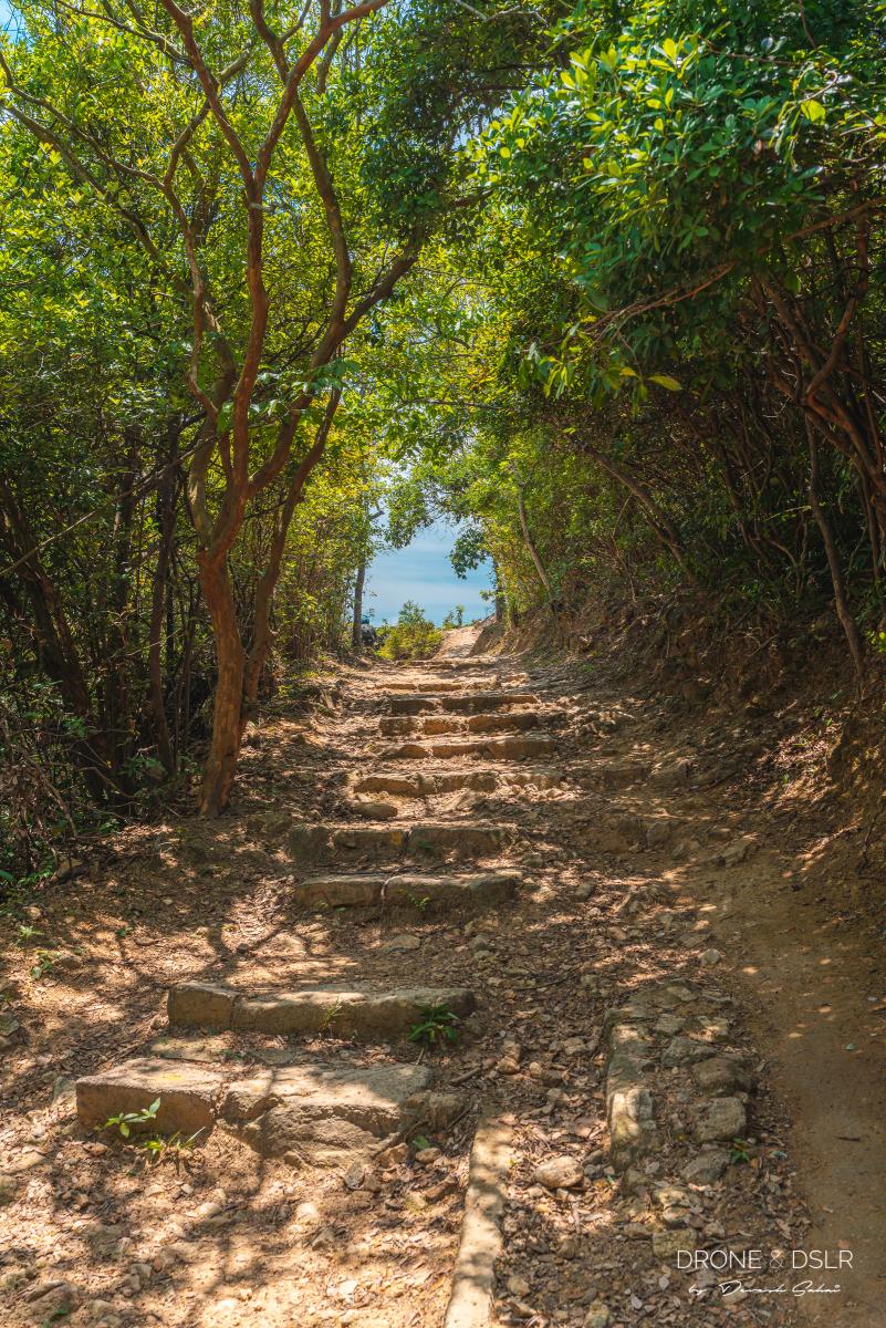
To Tai Ngau Wu Peak
At 275 metres, Tai Ngau Wu Peak is the highest point on the Mui Wo to Pui O hike.
From the Pak Fu Tin campsite area to Tai Ngau Wu Peak is a constant incline. Although it’s mostly a gentle slope, there are two long sections of steep steps.
-
- These are some pretty steep steps
-
- The excruciating steps to the highest point on this hike
This is the toughest part of the hike. Take it easy and go slow, ration your energy. Although this part of the hike is just over 1 km, it certainly feels like an eternity!
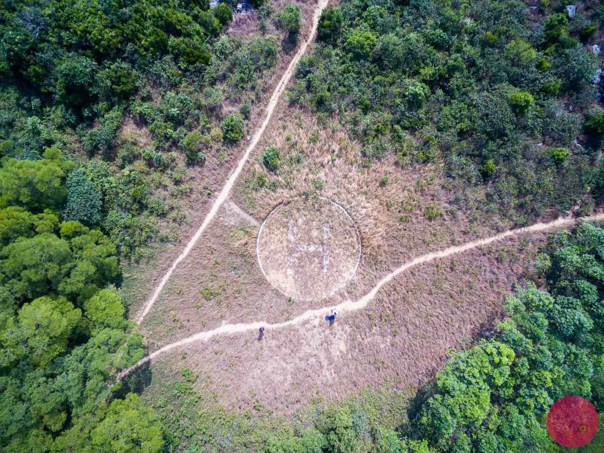
You’ll know you’ve arrived at Tai Ngau Wu Peak when you see a radio station next to a helipad.
-
- Tai Ngau Wu Peak with its helipad
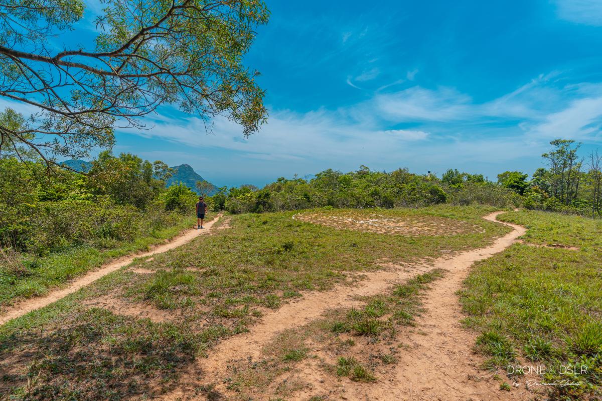
-
- The helipad at Tai Ngau Wu Peak
To continue along Lantau Trail Section 12 towards Pui O, take the trail on the left. The best news is that it’s all downhill from here!
Tai Ngau Wu Peak to Chi Ma Wan Road
As you begin your descent from Tai Ngau Wu Peak, you can catch beautiful glimpses of Pui O Beach on the right and Lamma Island on the left.
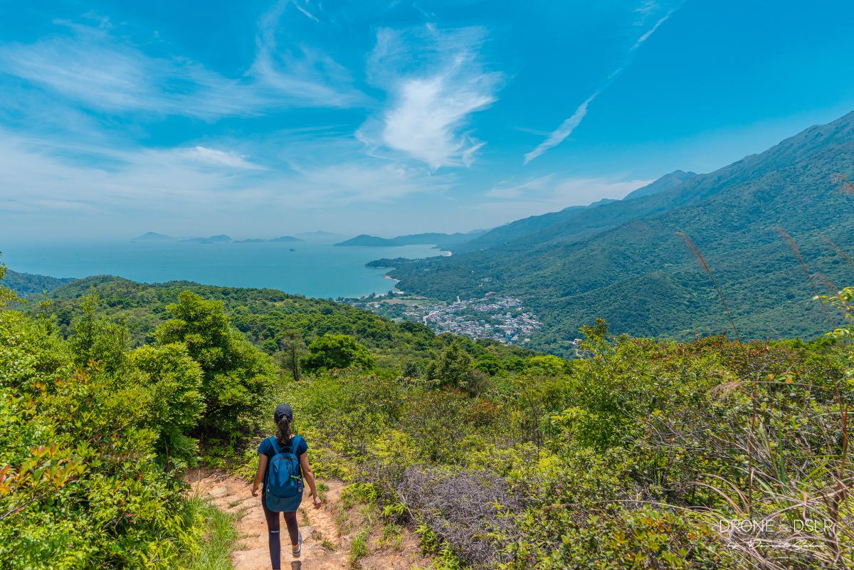
The end (Pui O Beach) is close
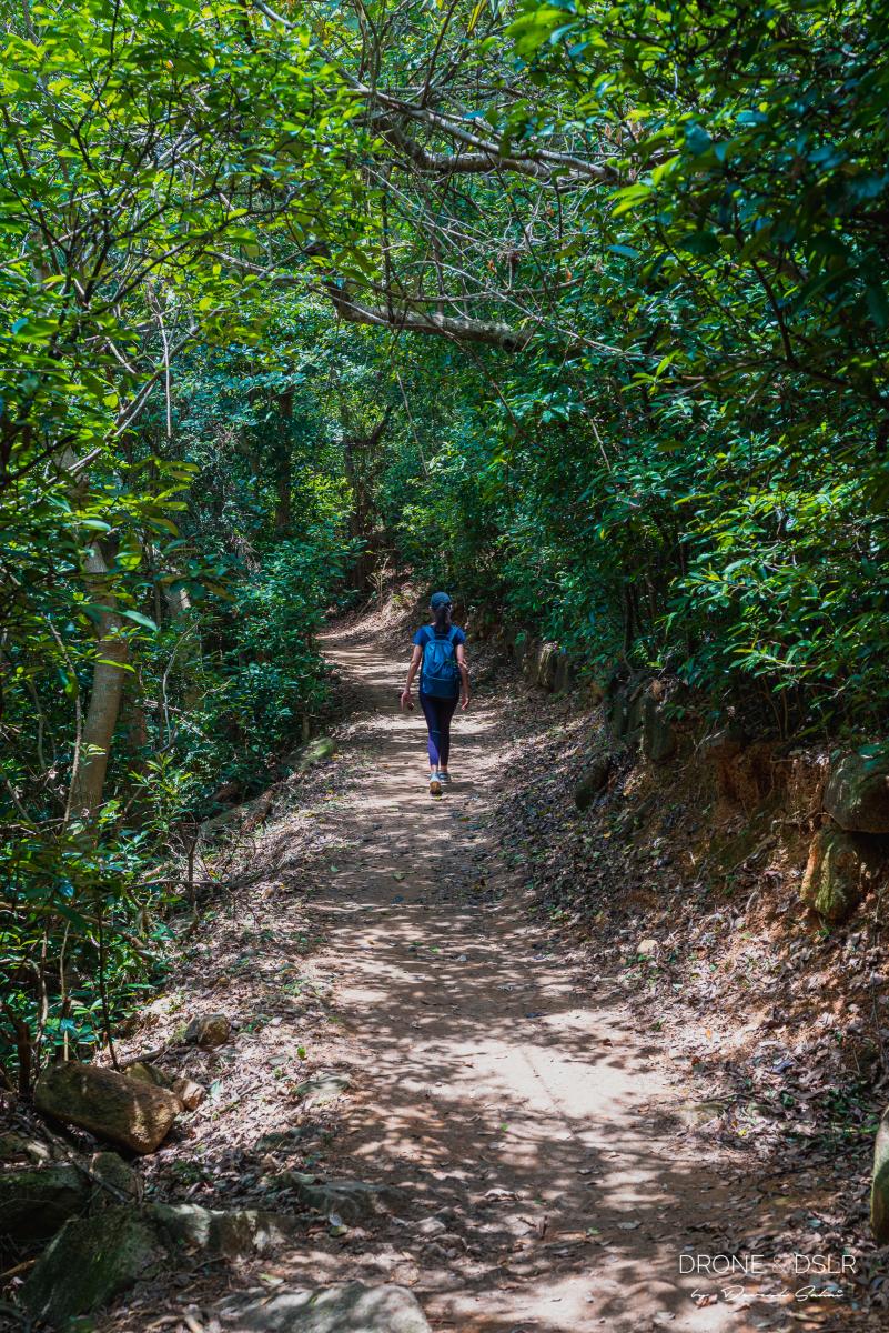
The initial part of the descent is quite easy — beautiful views and lots of shade. The shade was a life-saver by this time as the sun was beating down on us.
-
- Lot’s of shade on the way down to Pui O
-
- Getting close to the end
However, the second half of this decline does get a bit jarring on the knees as the gentle decline becomes a bit rough. You’ll know you’re close to the end when you see the beautiful, lonely village of Shap Long to your left.
The tiny village of Shap Long
And before you know it, the dirt trail ends on Chi Ma Wan Road, right in front of the entrance to Chi Ma Wan Country Trail.

The end of the natural trail
Chi Ma Wan Road to Pui O Beach
From here, turn right and stay on the main road. The road twists and turns, often times revealing the beautiful waters of Pui O, as it makes its way towards the end.
-
- Turn right, follow the yellow sign
-
- The final stretch – blue waters await!

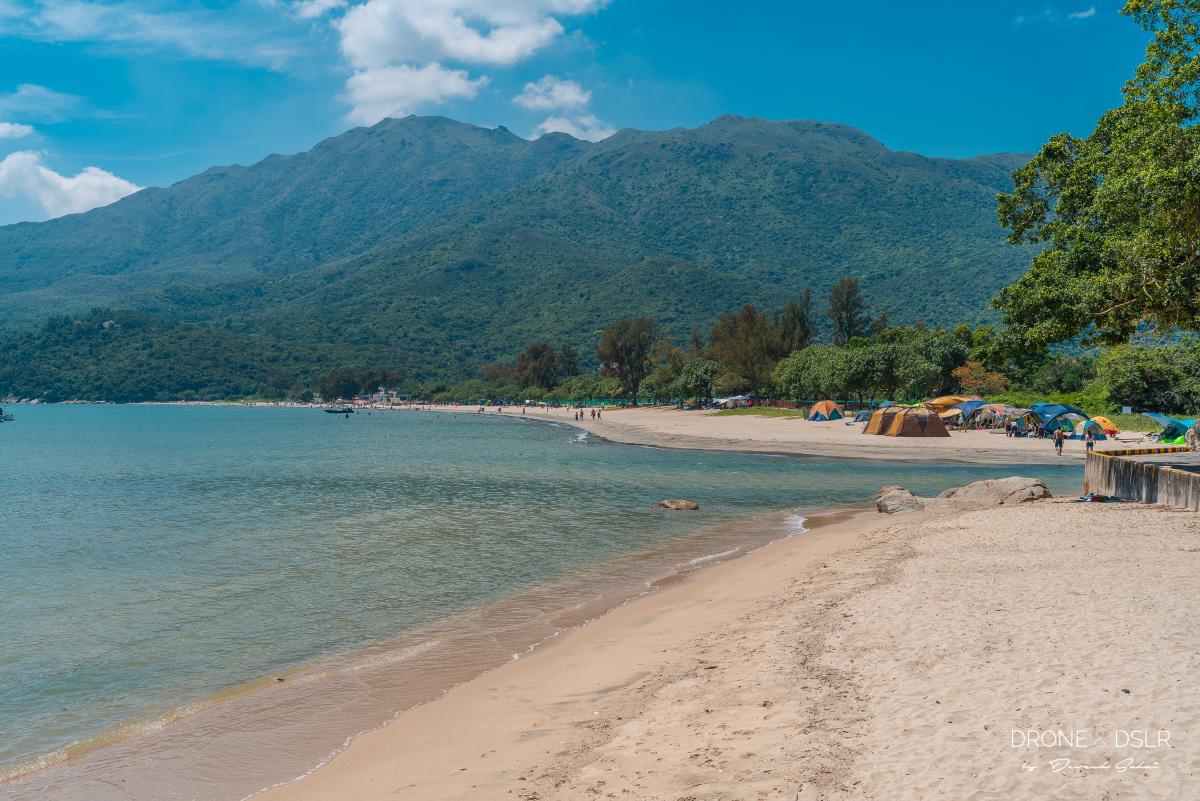
10 minutes later, you’ll arrive at the northern end of Pui O Beach, in front of the Tin Hau Temple.
The view of Pui O Beach from the Tin Hau Temple
The Tin Hau Temple on Pui O Beach is about 7.7 km from the start of the hike. If you continue along Chi Ma Wan Road to South Lantau Road, that’s another 1.5 km or another 1 km to the main Pui O town. But you don’t want to do that.
On the side of the Tin Hau Temple is a gap between two rocks from where you can step onto the sand. If the tide is low, you can walk right across to Pui O Beach. However, if the tide is high, don’t worry, the water isn’t that deep. Take off your shoes, and socks, roll up your pants/shorts (or not) and walk through the water.
Cut across to Pui O Beach from here and save walking another km to get to the beach
Trust me, this will save you an additional 10–15 minutes worth of walking! You don’t want to walk around the beach along the main road.
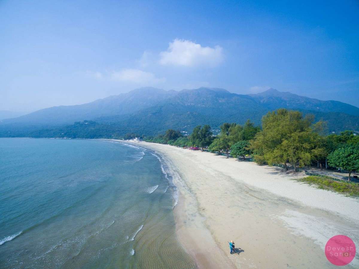
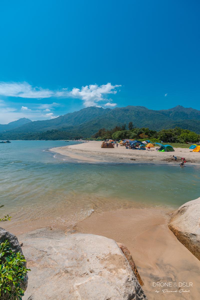
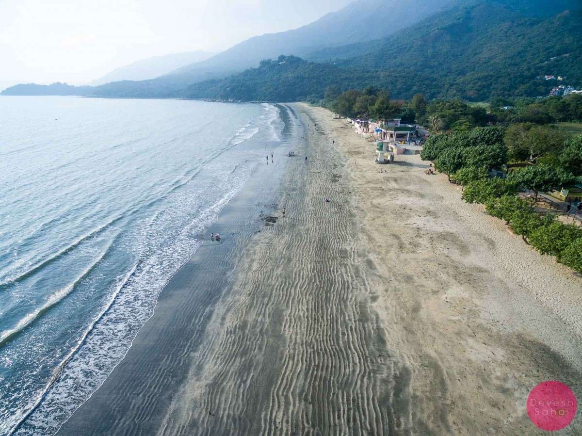
Pui O Beach

Pui O Beach
The beach is a popular destination for hikers, campers and beach-goers alike. The Pui O Beach Camping Site is located right on the beach and offers campers beautiful sunset views. And from here, you can always hike around the Chi Ma Wan Peninsula.
Fun fact about Pui O Beach — because of the surrounding rocks in the area, the sand on the beach is black and yellow. It may not look that impressive on the ground, but it does make for a spectacular aerial photo.
-
- Bird’s eye view of Pui O Beach
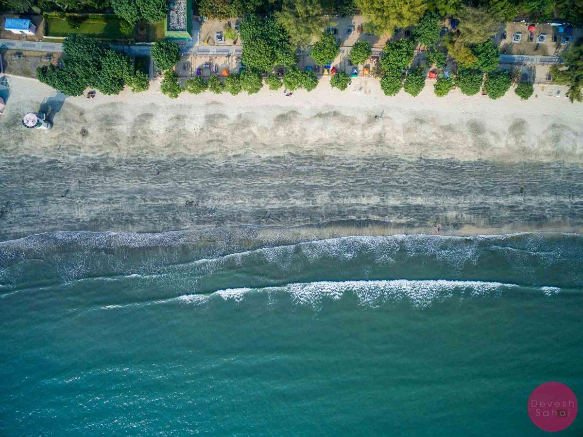
-
- Black and yellow sand sediment at Pui O Beach
If you’re looking for things to do post hike, we have a complete guide to Pui O that details all the things to do, and places to eat in the area. Or simply, unwind on the beach after completing your hike. You’ve earned it!
-
- Pui O Beach main entrance

-
- Treasure Island, Pui O Beach

Also, keep in mind that this part of Lantau Island has plenty of amazing restaurants. You can walk along the South Lantau Island at Pui O Village and step into any restaurant that catches your fancy. Or you could take a bus or taxi to Cheung Sha Beach, Tong Fuk, or back to Silvermine Beach near Mui Wo.
Hike from Mui Wo To Pui O
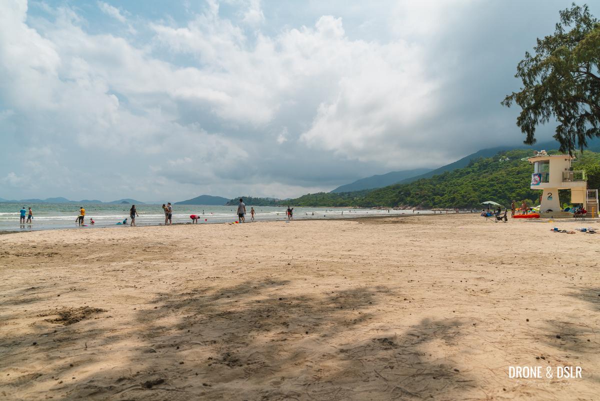
Enjoying the shade on Pui O Beach
We hope you enjoyed our guide to the Mui Wo to Pui O hike. Of course, you can also do this hike in reverse and finish at the Mui Wo Ferry Pier.
If you’re looking for more things to do in Mui Wo, check out our post on Mui Wo and Silvermine Bay. There’s also the hike from Mui Wo to Discovery Bay that you can explore. Alternatively, you can explore the Chi Ma Wan Peninsula next to Pui O Beach. The Chi Ma Wan Country Trail is the longest country trail in Hong Kong!
And finally, if you’re looking for an easy and scenic hike to another beach on Lantau Island, we recommend the hike from Pui O to Cheung Sha Beach on Lantau Trail Section 11.
If you find this post useful, feel free to share it on the social media channel of your choice or leave us a comment below.
If you enjoy our work, come join us on Instagram and YouTube 🙂


You might also like


4 Comments
Amazing! Thank you for sharing! 🙏❤️
Thank you, Virginia!
Thank you for the nice directions and pictures. Very easy to follow. Particularly nice suggestion about wading across the stream to the Pui O beach near Tin Hau temple.
Near the helipad on the top, it is worth taking a tiny detour by walking the right path, which leads to the triangulation point about 20 feet ahead and offers perhaps the best view of Pui O village.
Toilet info – At Mui Wo, then near the cemetery, then Pui O beach (which was closed due to Covid).
We caught a taxi back from Pui O to Mui Wo (HKD 40).
Thanks, and that’s a good tip about the detour from the helipad.