
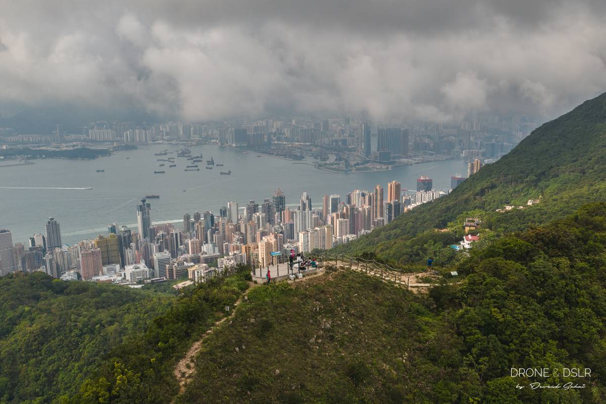
For breathtaking panoramic views of the western peninsula of Hong Kong Island, High West (Sai Ko Shan or 西高山 in Cantonese) is an excellent choice.
At 494 metres above sea level, High West offers sweeping 270-degree panoramic views of from the south, west, and north of Hong Kong Island. And conveniently, it’s located less than 2 km from Victoria Peak, accessible via a well-maintained path.

The top of High West, Hong Kong
Also, with its unobstructed views of the west, it’s also a fantastic spot to catch the sunset in Hong Kong.
Here’s a quick video to give you an idea of what to expect.
Subscribe to my YouTube channel
About the Mount High West Hike

High West Hike map
High West is located right besides Victoria Peak and is often overshadowed by its taller sibling. But if you dislike the crowds and commercial aspects of The Peak, and want a quieter, more natural setting, then High West is what you’re looking for.

Views of Mount High West from Victoria Peak Garden
There are two routes to reach Mount High West, one from the east and another from the west. However, only the western route follows a proper, maintained trail, beginning next to the High West Picnic Area on Harlech Road. The eastern approach can be a slightly treacherous, and I won’t cover it in this guide.
-

- The final steps going up the side of Mount High West

-
- Mount High West (Sai Ko Shan), Hong Kong

So, in this guide, I’ll highlight two routes to approach the western face of High West:
- Hike to High West from Victoria Peak
- Hike to High West from Kennedy Town / HKU
So, let’s dive into these two options in detail.
High West Hike from Victoria Peak
Hiking from Victoria Peak to High West is perfect for those who want a short, challenging, and scenic hike. I’d even advise it to anyone visiting Hong Kong for the first time and wants to experience a short, urban hike.

High West Hike from Victoria Peak Trail and Elevation Map
Click here to open the map in Google Maps.
Starting point
Victoria Peak is arguably one of the most popular tourist destinations in Hong Kong, and as such, easy to access via public transport. Once at The Peak, locate the Peak Morning Trail (Harlech Road Fitness Trail) next to The Peak Lookout Cafe.
To the High West Picnic Area
Walk on Harlech Road Fitness Trail for 1.2 km till you reach the High West Picnic Area.

Harlech Road Fitness Trail, Hong Kong
The Harlech Road Fitness Trail is a paved, flat road that is extremely popular with locals and tourists alike. Along the way, you’ll pass Lugard Falls, and beautiful flora that occupy this part of The Peak.
-
- Lugard Waterfall near Victoria Peak, Hong Kong
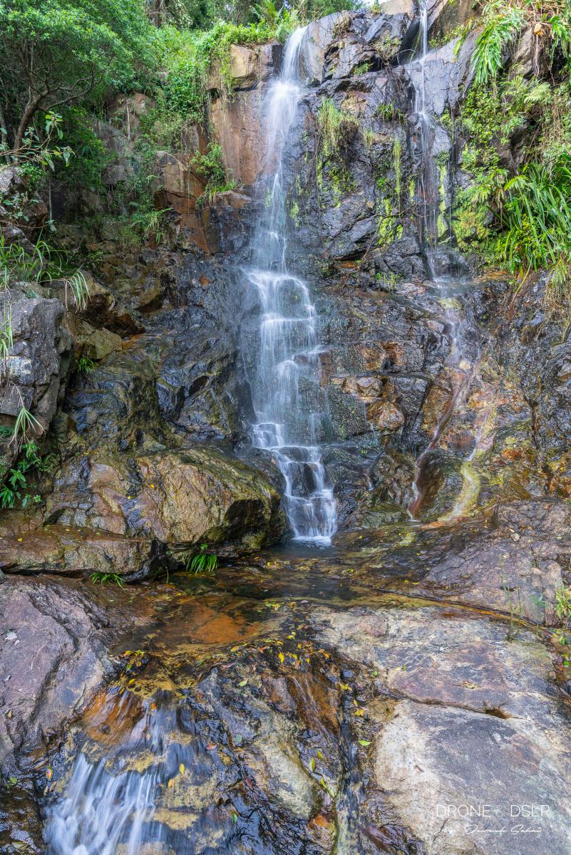
-
- Keep walking on Harlech Road (that’s High West in the background)

Once you reach the High West Picnic Area, follow the signs for High West that lead you down a few steps to a trail behind the park.
-
- Turn left for High West on Harlech Road
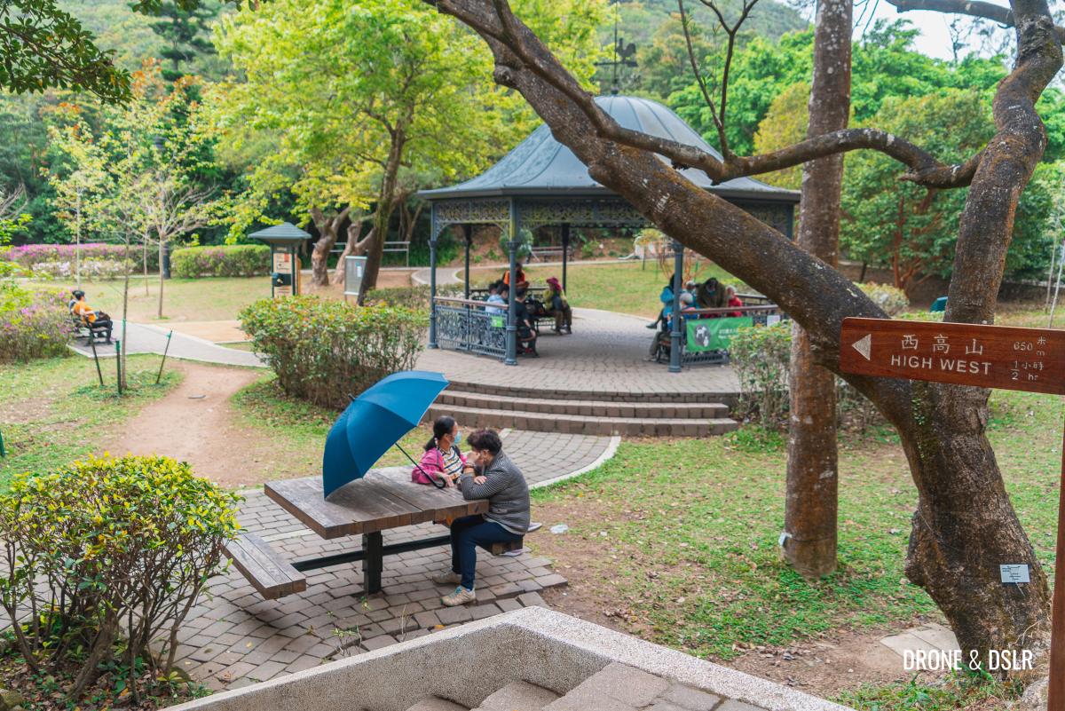
-
- Follow the signs to High West behind the High West Picnic Area

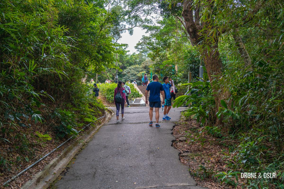
Follow the shaded trail for approximately 200 metres till you reach another open area with a few benches. This is the start of the climb to High West.
-
- Walk down this shaded trail

-
- An aerial view of the seating area at the start of the High West steps
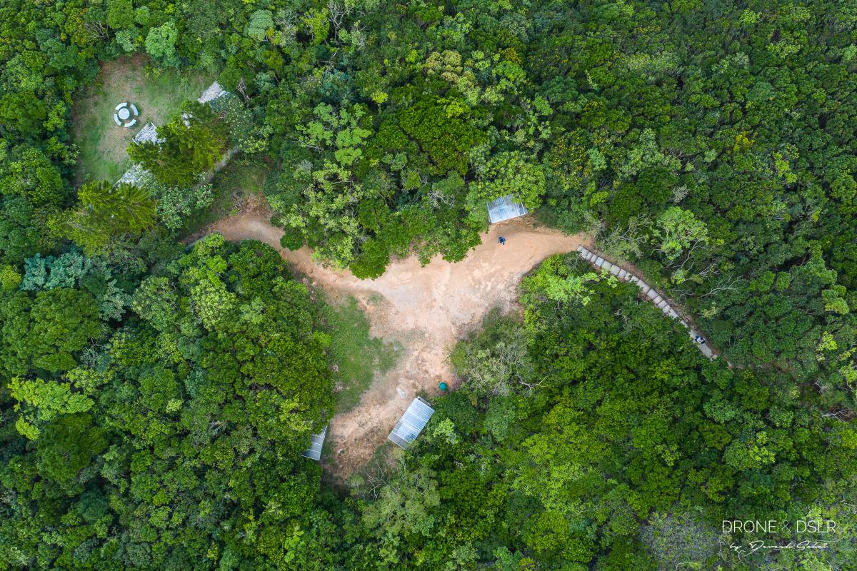
-
- The starting point to climbing High West

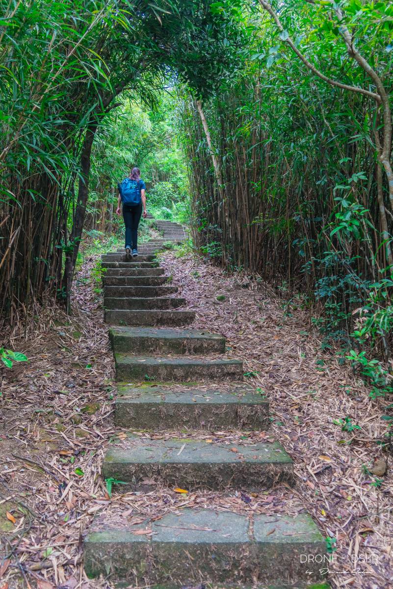
The Ascent To High West
The final ascent to Mount High West offers a moderately challenging 400-metre climb. To aid navigation, markers are placed along the route, providing hikers with an indication of their progress.
-
- The High West hike begins

-
- The incline picks up after the 1/4 marker

The ascent begins easily, but before long, you’ll reach the one-quarter mark. From there, the climb becomes increasingly more demanding until the three-quarters mark.
-
- The steps can be quite brutal

-
- Halfway to High West

On a sunny day, be sure to bring adequate sun protection and water, as the thinning shade can make this crucial on the steeper sections.
-
- Carry sun protection if you’re hiking up High West

-
- Three quarters of the way up to High West

By the time you reach the three-quarters mark, the incline levels off, gradually becoming less steep.
-
- Almost at the end of the climb to High West

-
- The final few metres to High West

The final 90 meters are relatively flat, allowing you to take in the stunning views before arriving at the summit which is the High West Viewing Point.
-
- The end of the trail — welcome to High West!

-
- High West, Hong Kong

-
- High West, 494 metres above sea level

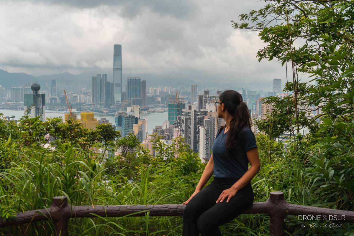
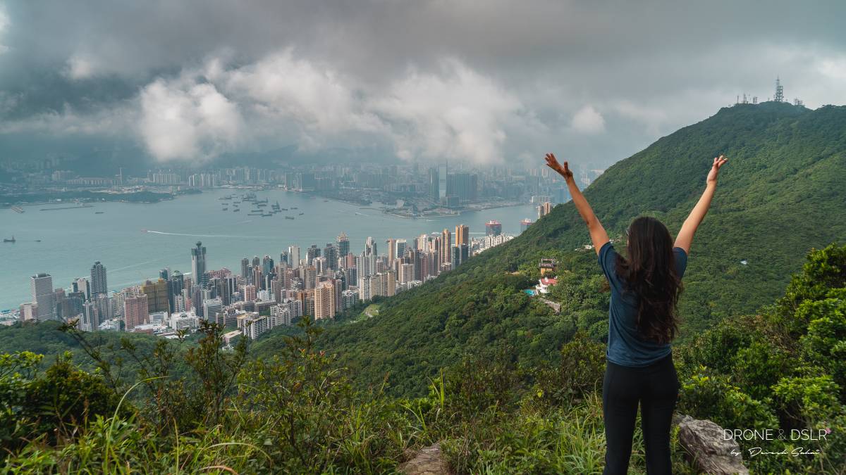
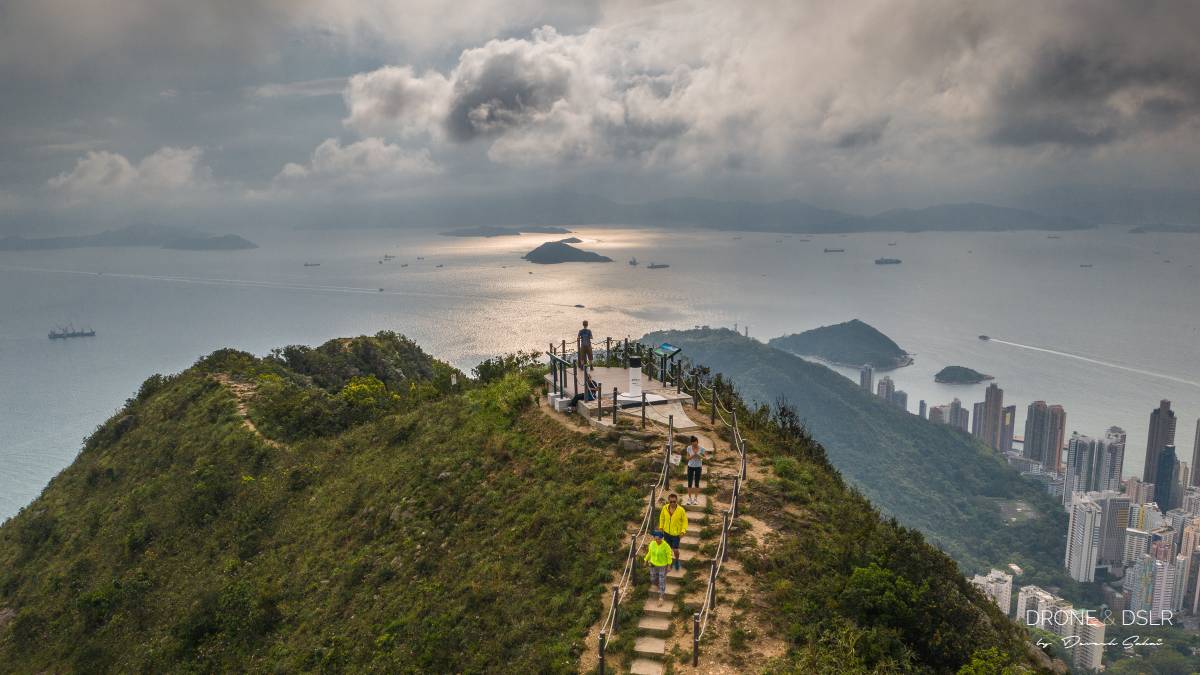
High West Viewing Point
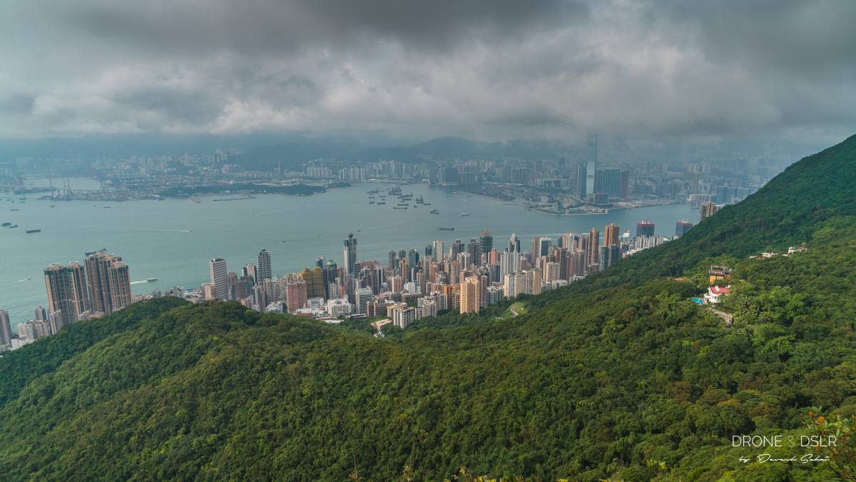
The High West Viewing Point provides hikers with breathtaking 270-degree panoramic views to the west of Hong Kong Island.

The platform at High West Viewing Point
From this vantage point, you can see the entire southern horizon stretching from Pok Fu Lam to Lamma Island in the south; Lantau Island to the west; and the iconic Hong Kong skyline in the north.
-
- The view of Cyberport and Lamma Island from Mount High West

-
- Looking down towards Kennedy town from High West

-
- Views of Hong Kong’s skyline from High West

The views are truly spectacular!

Views of Lantau Island to the west from Mount High West
And obviously, it goes without saying, a clear day makes all the difference to enjoying this hike and the views.
-
- Views of the ports and Tai Mo Shan from High West

-
- The gorgeous view of Hong Kong from Mount High West
-
- Enjoy the stunning panoramic views from on top of High West

-
- Mount High West Viewing Point
And now, let’s dive into how to hike up High West from Kennedy Town.
Mount High West Hike from Kennedy Town / HKU MTR
If you’re looking for a more challenging option to hike up High West, then why not start the hike from Kennedy Town? The trail through Lung Fu Shan Country Park is not only more gruelling but also offers hikers a glimpse of the remains of a WWII relic.

High West Hike from Pok Fu Lam Road Trail and Elevation Map (incomplete)
Click here to open the map in Google Maps.
Starting point
You can start your hike to High West from Kennedy Town or HKU MTR Station. If you begin at Kennedy Town, take the steps on Pokfield Road to Pok Fu Lam Road. Note that this initial section is quite steep, so be prepared.
If you’re coming from anywhere east of Kennedy Town, we recommend starting from HKU MTR Station instead. From Exit C, follow the signs and walk out onto Pok Fu Lam Road.
Whether you start from Kennedy Town or HKU, you need to reach the Sinopec Sandy Bay Gap Station on Pok Fu Lam Road, which serves as the starting point. Once you arrive at this location, look for a flight of stairs adjacent to the petrol station – this will mark your exit from the city.
-
- This is your starting point for the High West hike
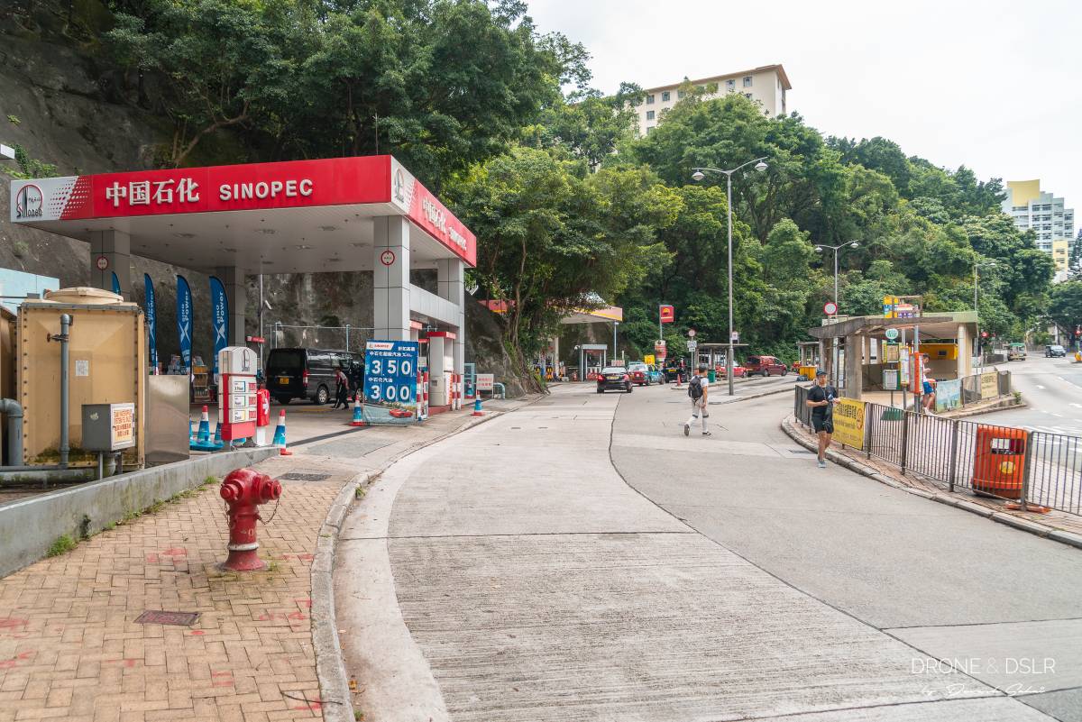
-
- The steps that go up from right next to the petrol station
-
- The initial steps are steep!
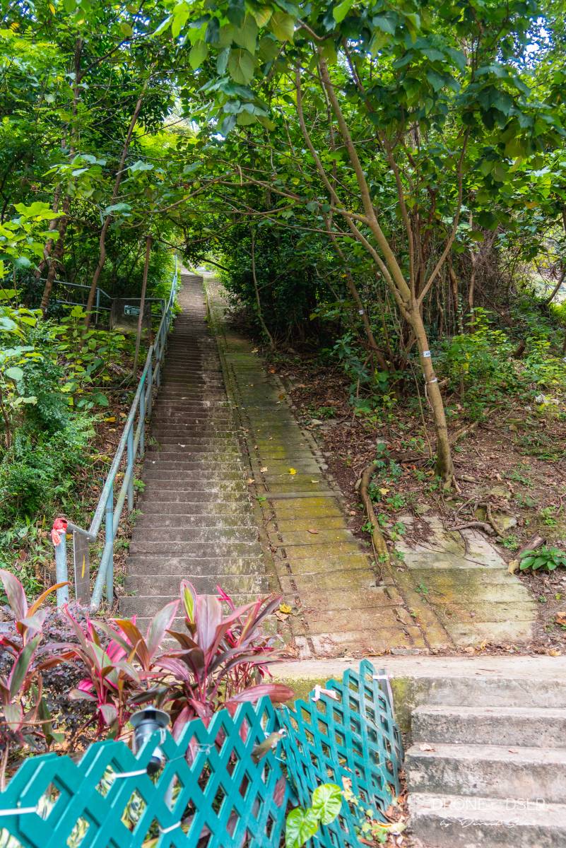
Pok Fu Lam Road to Pinewood Battery
The steps leading up the hill look intimidating from the start. All you see are steps that never seem to end. But don’t worry, it gets less steep once you reach the shaded seating area.
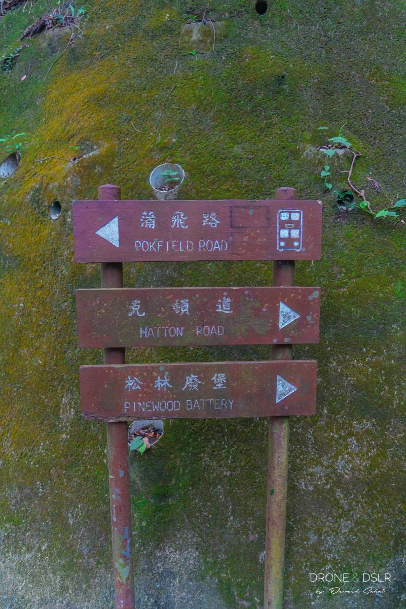
Keep climbing till you arrive at Pik Shan Path at the end of the steps. Turn right and follow the path that immediately slips to the left (signs for Hatton Road and Pinewood Battery).
-
- Follow the signs to Pinewood Battery
-
- Take the steps going uphill
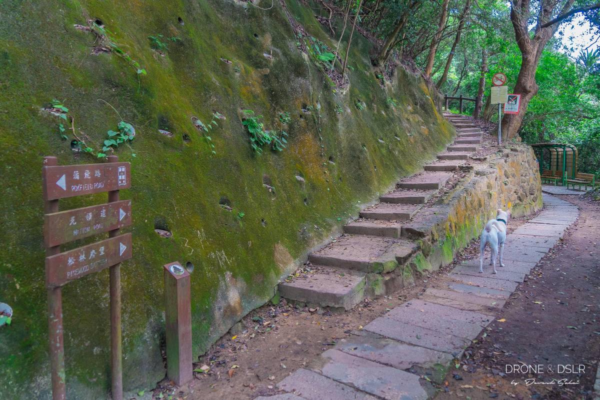
After a short incline, you’ll reach the first lookout point, Lung Fu Shan Country Park Pavilion No. 1. Take a moment to rest and enjoy the views from here before continuing on your journey.
-
- The view of the skyline from the first resting point
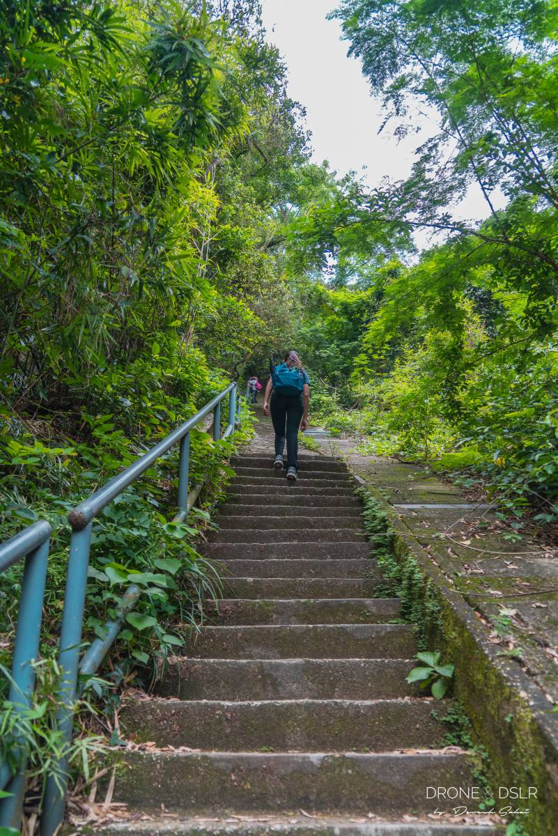
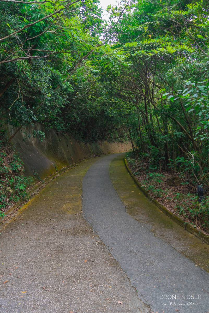
From here on out, the paved road continues to climb uphill as it twists and turns, making its way to Hatton Road.
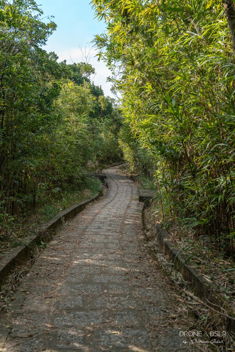
When you arrive at Hatton Road, turn right. You’ll immediately notice another right turn onto Lung Fu Shan Fitness Trail. Step onto the trail and begin walking up the flight of steps, surrounded by bamboo.
-
- The steps soon turn into an easier slope
-
- Lung Fu Shan Country Trail is quite pretty with all these bamboos
Keep climbing the steps till you finally arrive at Pinewood Battery.
Pinewood Battery to Hatton Road
Pinewood Battery is a historical landmark in Hong Kong and was once the city’s highest coastal defence post. You can learn more about Pinewood Battery in this post.
Feel free to explore the remains of the battery or come back another time.
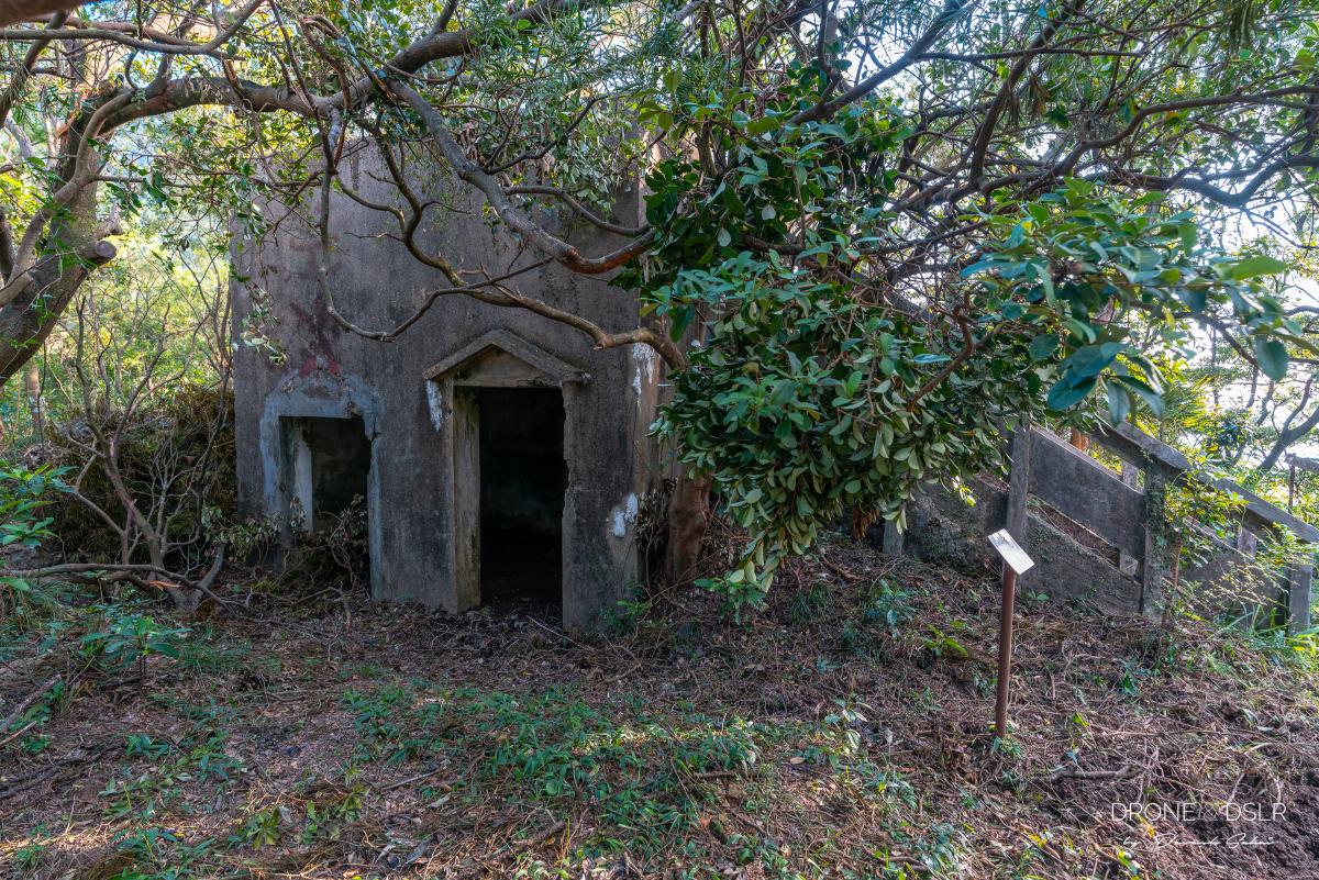
The former observation post at Pinewood Battery
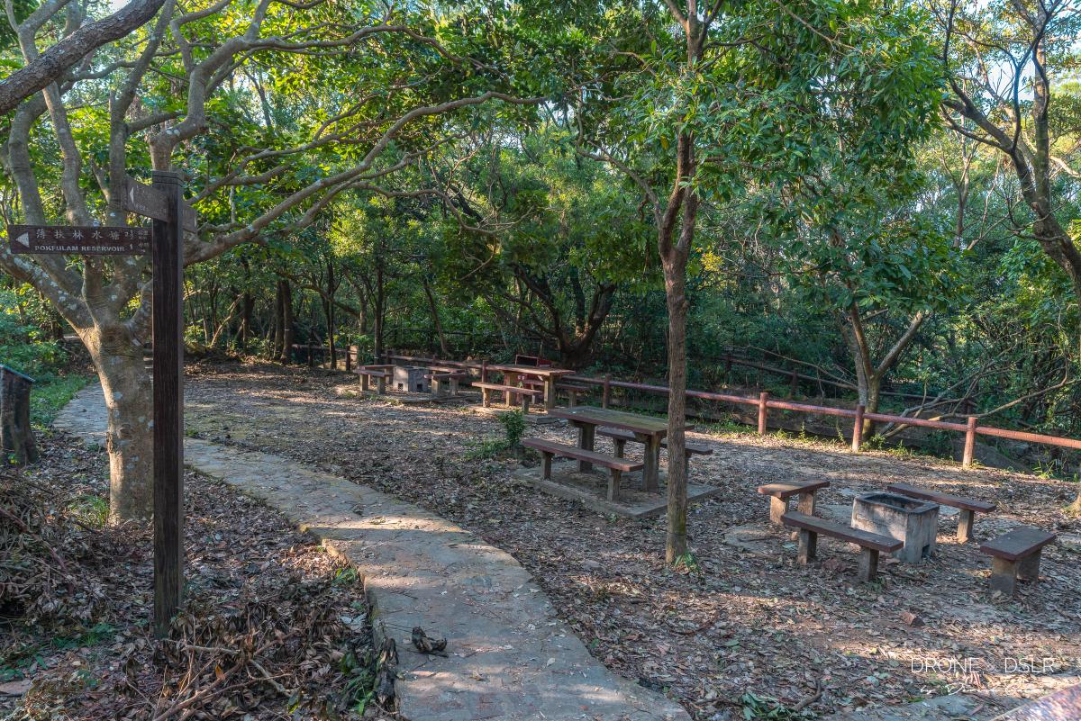
From Pinewood Battery, continue walking uphill on Lung Fu Shan Fitness Trail. Walk past the Lung Fu Shan Country Park Picnic areas, a fitness area, more bamboos, until the trail finally reunites with Hatton Road.
-
- The Lung Fu Shan BBQ and picnic spot
-
- Lung Fu Shan Fitness Trail, Hong Kong
Once on Hatton Road, walk for another 250 metres till the road merges with Harlech Road, next to the High West Picnic Area.
Hatton Road meets Harlech Road
From here, follow the signs for High West and follow the trail at the end of the High West Picnic Area. What follows is the final ascent up High West, which has been detailed in the section above.
The High West Hike in Hong Kong
We hope that you found our guide to the hiking up Mount High West helpful. Personally, I love this hike and have completed it on numerous occasions.
We made it to Mount High West
If you’re visiting Victoria Peak anytime soon, make the effort to hike up High West. And it’s also good to know that it’s a great place to catch those beautiful sunset views.
Mount High West has an incredible view of the west
As always, feel free to share this post on the social media channel of your choice and drop us a comment below.
If you enjoy our work, come join us on Instagram and YouTube 🙂


You might also like


8 Comments
Really thanks for your post abt Mt High West. I took the 1st option and the experience was absolutely worth the effort. But since the impression I got from getting to the top was so huge, the view from The Peak (I went back with option 2) was underwhelmed to me =)))))
Hey Jane,
Thank you so much. Really happy that you found the guide helpful 🙂
Love your site!! Thank you so much for posting all these amazing hiking trails!!
Thank you very much! We’ll keep adding more hikes for you to visit us again 🙂
A simple practical guide for hiking in Hong Kong with very useful advice and information.
Thank you!
There are other ways to get to Mount High West. You can avoid that plight of stairs too. Those stairs could be very discouraging for people who don’t like stairs. 1) You can start hiking from the back of HKU, again from HKU you could start from different ways: from the back of Alfafa Cafe in Centennial Campus or follow the usual road from HKU up to the Victoria Peak. There is also another way from Pokfulam side.
Hi Jnan,
You’re absolutely right! We have mentioned the way from Pokfulam in the post. I imagine that route will also apply to hiking from HKU because it’s between the HKU and Pokfulam Reservoir hike.