
The Shek Pik Country Trail on Lantau Island is a relatively easy hike that runs between Ngong Ping and Shek Pik Reservoir. Depending on your mood, or level of fitness you can either hike down to Shek Pik Reservoir or hike up to Ngong Ping village. The trail is 5.5 km, and the elevation distance between the end-points is 400 metres. In other words, the hike is moderately sloped and not too steep.
We decided to hike from Ngong Ping to Shek Pik, and for good reason. We wanted to finish the hike by the evening and then head to one of our favourite restaurants, on Lantau Island, for dinner. However, if you want to hike up, just reverse the instructions that follow.
Here’s a quick video to give you a glimpse into this beautiful hike.
Subscribe to my YouTube channel
Starting point
To start the Shek Pik Country Trail, make your way up to Ngong Ping village.
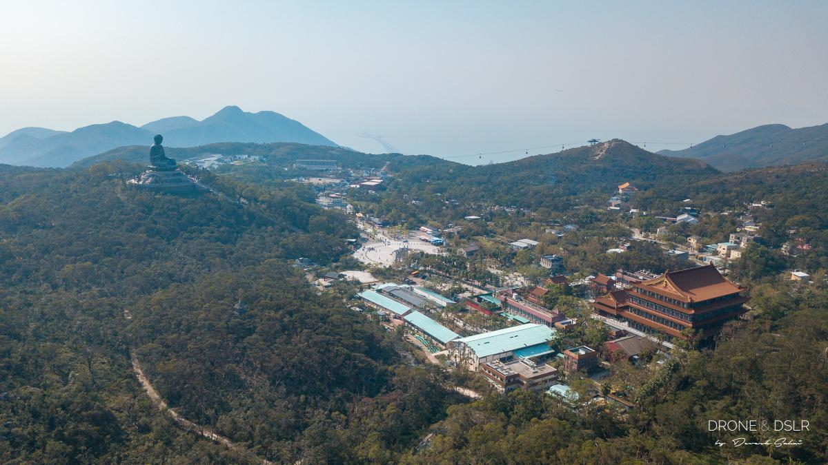
Aerial view of Ngong Ping village, Hong Kong
Here are a few options to get there:
From Central
- Take the ferry from Central Ferry Pier to Mui Wo.
- From Mui Wo Ferry Pier, take bus number 2 to Ngong Ping.
From Tung Chung
- Take bus number 23 from Tung Chung Town Centre to Ngong Ping.
From Hung Hom
- Take bus number 1R from Hung Hom Ferry Pier. The bus only runs on Sundays and public holidays.
You can also take a taxi from Mui Wo Ferry Pier or Tung Chung Town Centre. Alternatively, if you’re feeling touristy, you can take the Ngong Ping 360 (cable car) up to the village.
Ngong Ping to Wisdom Path
Once you reach Ngong Ping, feel free to explore the touristy village and piazza. It’s home to some of the biggest attractions in Hong Kong – the Tian Tan Buddha (Giant Buddha) and the Po Lin Monastery.
-

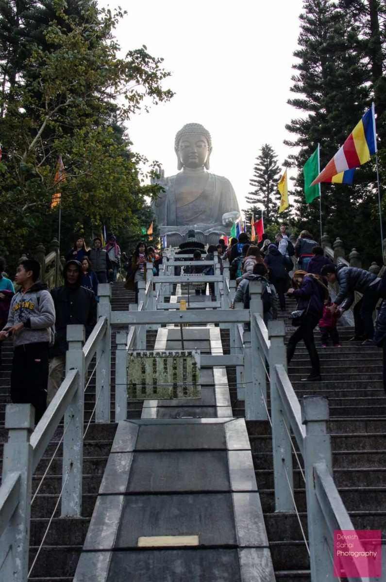
- The stairway to the Giant Buddha
-
- Entrance to the Po Lin Monastery at Ngong Ping

From the base of the Giant Buddha, follow the signs to the Wisdom Path. After a 10-minute walk, you’ll arrive at the Wisdom Path – a monument consisting of 38 wooden beams, each inscribed with a Heart Sutra prayer.
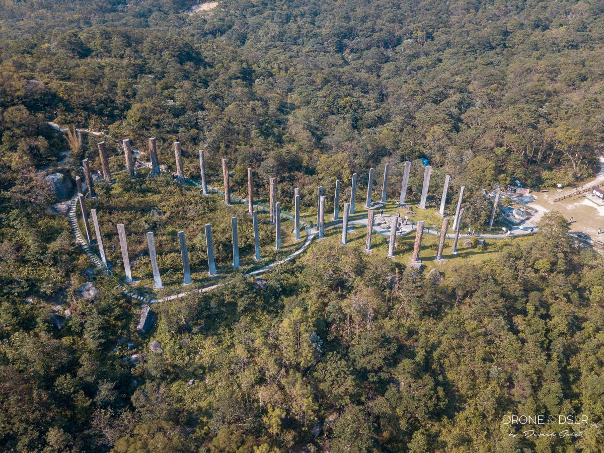
The Wisdom Path, Hong Kong
The Wisdom Path, in my opinion, is a hidden gem at Ngong Ping that often gets overlooked by tourists. Again, if you haven’t been here, I would recommend that you spend some time exploring it. Make sure you climb up to admire the wooden beams under the shadow of Lantau Peak.

Neha standing at the Wisdom Path
Once you’re done with the tourist attractions, let’s start with the hike.
The Shek Pik Country Trail
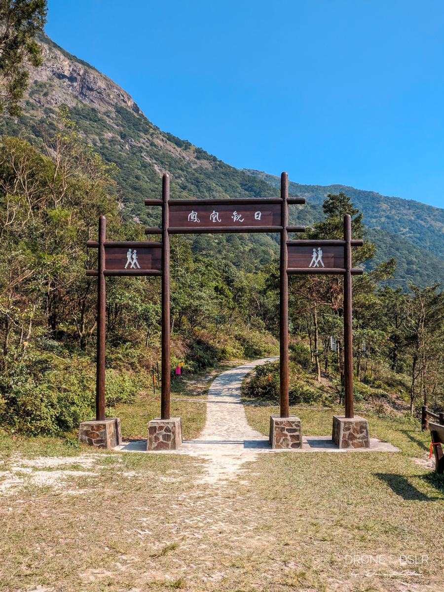
The trail starts from next to the entrance of the Wisdom Path. Don’t go through the large entrance. That’s part of the Lantau Trail and takes you to Lantau Peak. The section of the Lantau Trail also has a path to Kau Nga Ling (literally, fangs of a wild dog, West Dog’s Teeth). Although this path could also lead you downhill, I wouldn’t recommend it unless you are a serious hiker. I would advise that you enter the Shek Pik Country Trail, which runs parallel to the large entrance gates.
-
- Follow the sign to the Shek Pik Country Trail

-
- The entrance to Lantau Peak Trail. Don’t take this for the Shek Pik Country Trail.
From here on out, the hike is a gradual and easy 5.5 km walk downhill. Along the first few kilometres, the Wisdom Path and the back of the Giant Buddha remain visible. But around the halfway mark, the trail twists away from Ngong Ping to give you incredible views of the reservoir.
-
- Inclines are few and far in between on the Shek Pik Country Trail

-
- Most of Shek Pik Country Trail is shaded

Shek Pik Reservoir
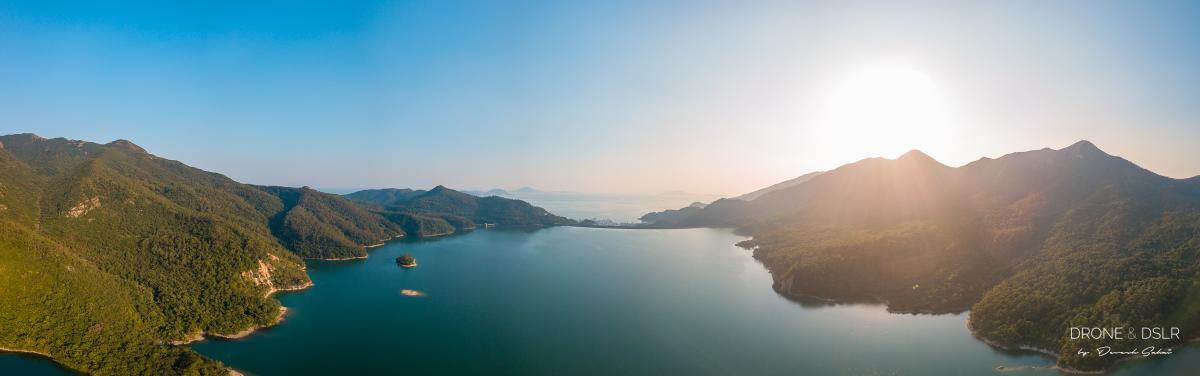
Aerial panorama of Shek Pik Reservoir, Hong Kong
The Shek Pik Reservoir was completed in 1963 and has a storage capacity of 24 million cubic metres. It’s the third-largest reservoir in Hong Kong after the High Island Reservoir and Plover Cove Reservoir. The country trail zigs and zags as it runs along this massive reservoir.
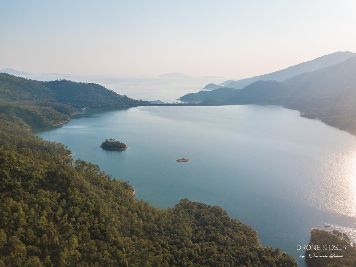
View of the reservoir from Shek Pik Country Trail
There is one lookout point that offers amazing views entire catchment area. And 5 minutes ahead of that is a tiny creek that flows into Shek Pik Reservoir. We thought the creek looked gorgeous illuminated by the sun’s settings rays.
-
- The Shek Pik catchment area

-
- Admiring this little creek we found on Shek Pik Country Trail

Ending The Hike
From here on out, the hike slowly winds down to a close. The last few hundred metres are a series of steps that bring you to a picturesque picnic park.
-
- The Shek Pik Country Trail glowing against the setting sun

-
- The steps at the base of the Shek Pik Country Trail

Exit the park to your right, and walk for a couple of minutes till you approach the Shek Pik Police Post bus stop. From here you can catch:
- Bus number 1 or 2 to Mui Wo Ferry Pier, or
- Bus number 11 or 23 to Tung Chung Town Centre.
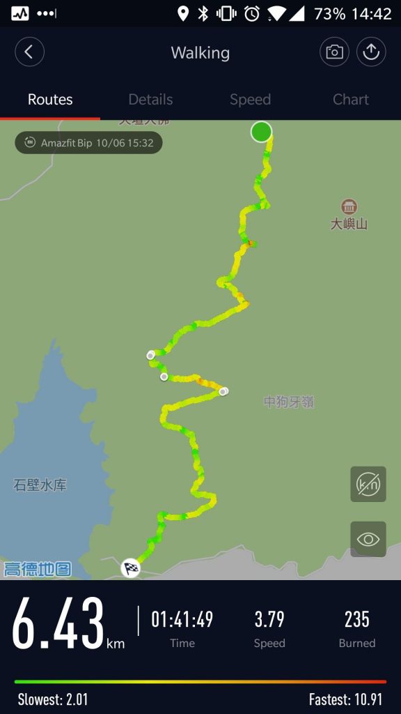
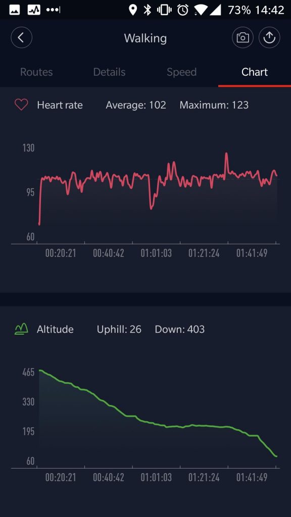
Map of the hike with elevation profile
Here’s a glance at the map of the hike, along with the elevation profile.
The length of the hike varies according to who you ask (my GPS watch, Google, or the signposts).
-
- Shek Pik Country Trail Map
-
- Shek Pik Country Trail Elevation Profile
To open the hiking map in Google on your phone, click here.
Final Words
One of the reasons we chose to end the hike at the reservoir was because after the hike we wanted to head to one of our favourite restaurants on Lantau Island. We had to choose between “The Gallery” on Tong Fuk Beach, or “Lantana” on Cheung Sha Beach. Eventually, we ended up going to Cheung Sha Beach. The beach and the restaurants along the beach were full of life and light in the evening!

Aerial panorama of Ngong Ping, Tian Tan Buddha, and Lantau Peak from Shek Pik Country Trail
Of course, you can also hike up from Shek Pik Reservoir to Ngong Ping. The hike is moderately easy as it’s a steady incline all the way to the top. Just remember that Ngong Ping shuts at 5 PM. The last bus leaves at 7 PM, and the last cable car at 6 PM.
And if you’re looking for a more relaxing outing, check out our list of top beaches on Lantau Island.
If you enjoy our work, come join us on Instagram and YouTube 🙂


You might also like


2 Comments
This is, by far, the most helpful hiking site I have read. Thank you for the great write-up!
Thank you very much! Your feedback really means a lot to us 🙂