
Cape Collinson, or Hak Kok Tau (黑角頭), is the east-most point of Hong Kong Island, located close to Siu Sai Wan. It’s known for its lighthouse, which unfortunately is inaccessible, and its ancient rock carving, which is also quite difficult to reach. And the famous Cape Collinson Battery is located much further south, and is accessible via a separate hiking route.
But if you’re looking for a mini excursion to a secluded Insta-worthy spot, with lovely views of the sea, then Cape Collinson might be of interest to you.
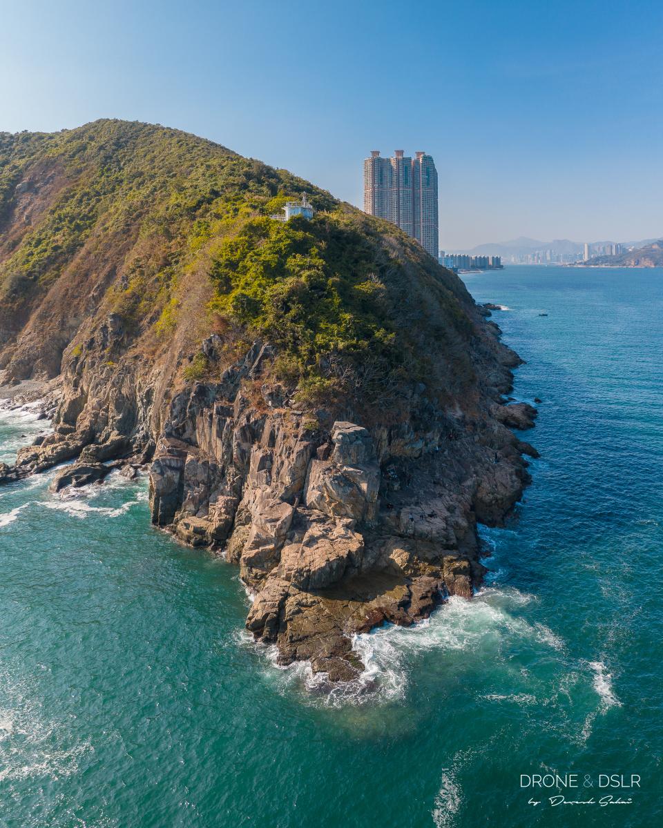
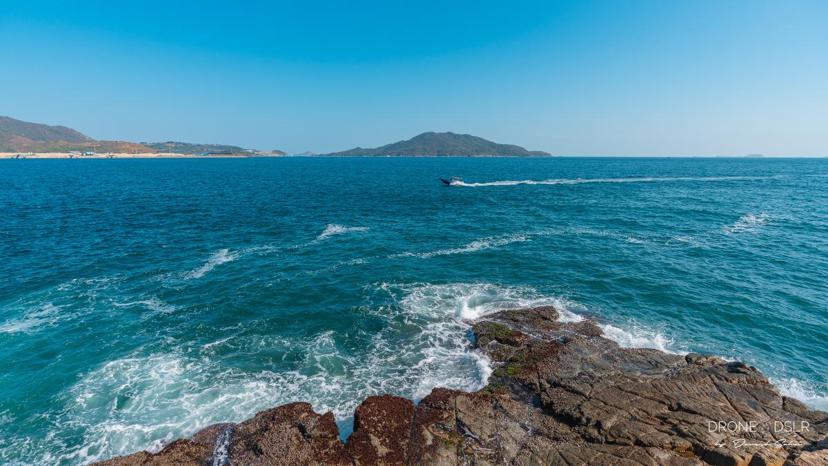
The north-east edge of Hong Kong Island
The Walk to Cape Collison
I wouldn’t technically classify this as a hike because it’s an easy walk 98% of the way. However, the last 2% is as treacherous as treacherous can be! Which is why I like to refer to it as a mini excursion.

Cape Collinson walk map
The distance from Siu Sai Wan Promenade to Cape Collinson is about 1 km, and it should take 15-20 minutes to complete the journey. And with that out of the way, let’s find out how to start this excursion.
Siu Sai Wan Promenade
To start the Cape Collinson excursion, make your way to the Siu Sai Wan Promenade, next to Island Resort. You can use Google Maps to guide you here via bus, as the MTR terminates at Chai Wan.
Some of the buses that stop close by are 8H, 8P, 8X, 19, 82, 82M, 82S, 82X, 85P, 88X, 682, 788, and 789.
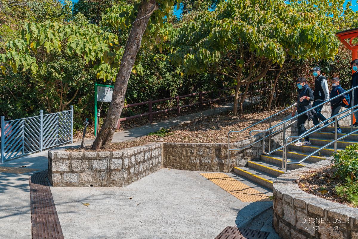
Once you arrive at the promenade, find the playground next to the public toilets. Next to the public toilets, you’ll find the steps that go up to the Leaping Dragon Walk.

The start of the Leaping Dragon Walk
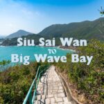
And in case you were wondering, this is also the starting point for the Cape Collinson Battery Hike, and the Siu Sai Wan to Big Wave Bay Hike.
Sitting-out Area No. 2
As you climb up the steps and the slopes, remember to stay on the right. You will pass by two outdoor sitting areas in quick succession.
-

- Stay to the right as you go up the Leaping Dragon Walk

-
- Almost at the sitting out area number 2

Once you reach the Siu Sai Wan Sitting-out Area No. 2, turn left and walk towards the back. Here you should see the start of the Cape Collinson Path that runs parallel to the Leaping Dragon Walk.
-
- Turn left and walk towards the back of the sitting area no. 2

-
- Behind the orange benches you can see Cape Collinson Path
-
- The start of the Cape Collinson Path

All in all, it should take you only a few minutes to reach here from the bottom of the steps.
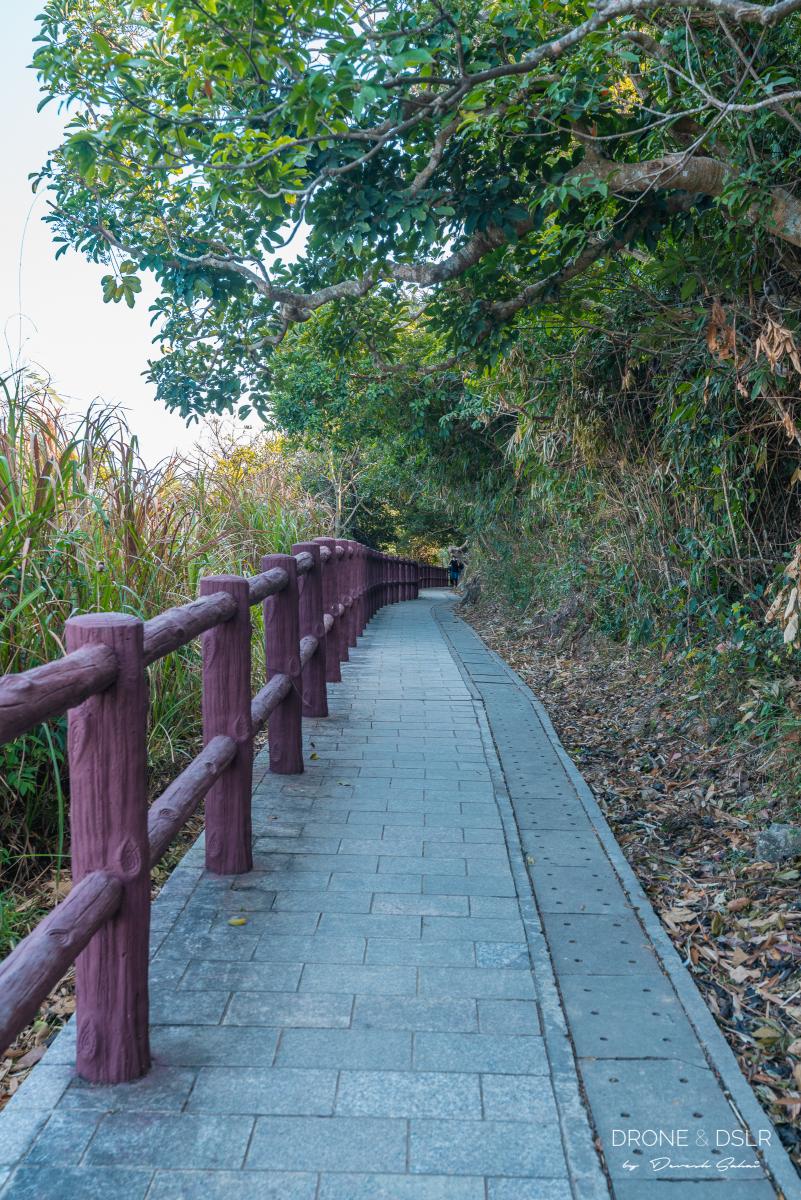
Cape Collinson Path
The Cape Collinson Path is a 500 metre long picturesque coastal walk with views of the Tathong Channel and Tsuen Kwan O.
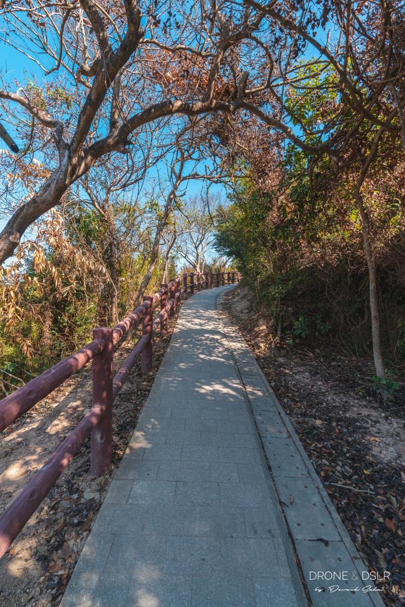
Cape Collinson Path
If you wish to sit and enjoy the views, there are a couple of spots along the path with amazing views. Take your time and enjoy this short walk!
-
- Views of Tsueng Kwan O from Cape Collinson Path

-
- Take a break along the path, enjoy the views
The path finally ends at the fence around the Cape Collinson Lighthouse.
-
- Quite a scenic coastal route!

-
- Continue walking along the Cape Collinson Path
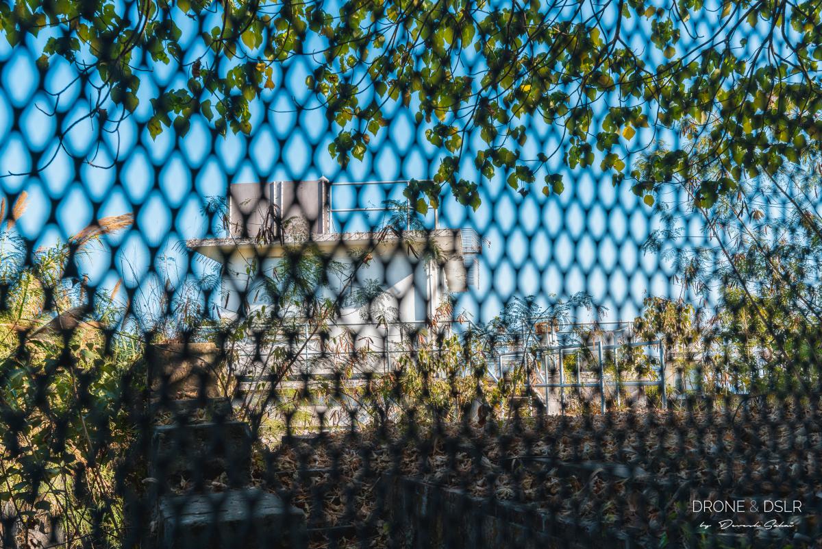
Cape Collinson Lighthouse
The Cape Collinson Lighthouse was completed in 1877 and modernized in 1964. During the modernisation the lantern was moved to Tang Lung Chau (near Ma Wan), and replaced by an electric light. The lighthouse was also briefly used as a weather station by the Royal Observatory.
-
- Cape Collinson Lighthouse from behind the fence
-
- Cape Collinson Lighthouse with the rocky beach behind

Today the Cape Collinson Lighthouse is still active, and I guess that’s why it is protected by a fence from the public.
Next to the lighthouse is a gap along the wall, from where a trail is seen heading down. Next to this gap is the sign for the rock carving and also warning people not to proceed further. I guess that means proceed with caution!
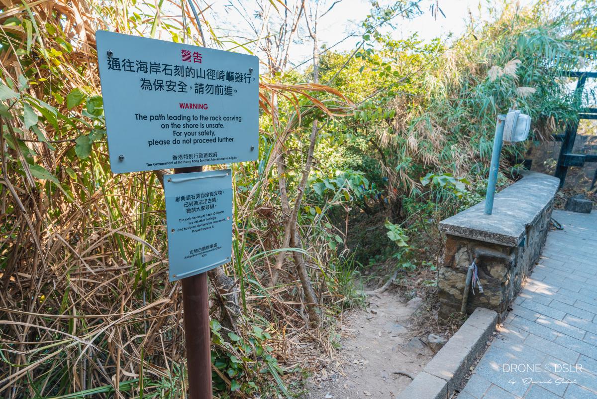
The gap in the wall that provides access to the shore below
Short, Steep Decline To The Shore
Until now, the trail is literally a walk in the park. But the next 50 odd metres is a treacherous downhill slope to the rocky shoreline of Cape Collinson.
The start of the trail is lined with Tibetan prayer flags that add a bit of colour to the surroundings. The slope gets rockier and steeper as it descends. Make sure you hold onto a tree branch or the ropes along the way.
-
- The colourful Tibetan prayer flags guide you downhill

-
- The short trail is steep and rocky

-
- From here you can tell the trail is almost vertical (spot the prayer flags)

Fortunately, it’s a short distance till you reach the rocky shores below.
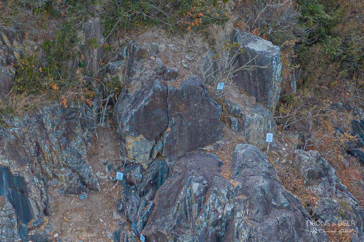
Rock Carving at Cape Collinson
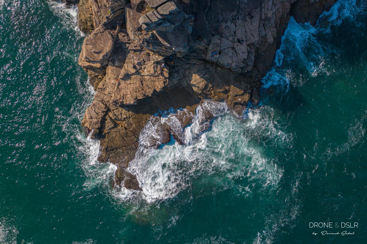
Once I reached the shore, I kept wondering where the ancient rock carving is located. As it turns out, the rock carving is relatively inaccessible from the trail. It’s located on a cliff towards the left, 11 metres above sea level.

I circled the cliff where the rock carving at Cape Collinson. Difficult to spot otherwise
The rock carving at Cape Collinson was only discovered in October 2018, and declared a monument in 2019. The design is a combination of geometric and curvy lines, measuring about 160 by 260 cm.
The Rock Carving at Cape Collinson
The designs include elements closely resembling those on Bronze Age stamped geometric pottery and the other eight rock carvings in Hong Kong, namely the ones Big Wave Bay and Tung Lung Chau.

One way to approach the cliff is from the other side
You can learn more about the rock carving at Cape Collinson here.
Fortunately, I was able to send my trusty drone to hunt for the rock carving and take a few pictures.
Cape Collinson
From the trail, continue walking along the rocky shoreline towards the end of Cape Collinson. Be mindful of your steps as the rocks are very uneven and may even require a bit of clambering.
-
- Almost reached Cape Collinson

-
- First glimpse of Cape Collinson

-
- You can walk around the bend to get a view of the other side

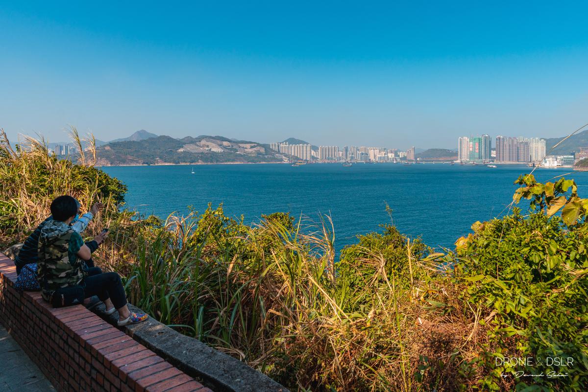
Once you reach the edge (of Hong Kong Island), take a moment to enjoy the views of the Tathong Channel, the eastern channel leading into Victoria Harbour through Lei Yue Mun, with Junk Island (Fat Tong Chau) and Tung Lung Chau in the east, and Hong Kong Island in the west. You are within touching distance of passing cruise ships at this location!
-
- Standing at the north-east tip of Hong Kong Island
-
- Watching sailboats pass by at Cape Collinson

-
- The waves at Cape Collinson are quite spectacular

Given that this north-east end of the island, the shoreline is totally exposed and the waves crashing into the rocks do make a rather big splash!

Tung Lung Chau in the distance
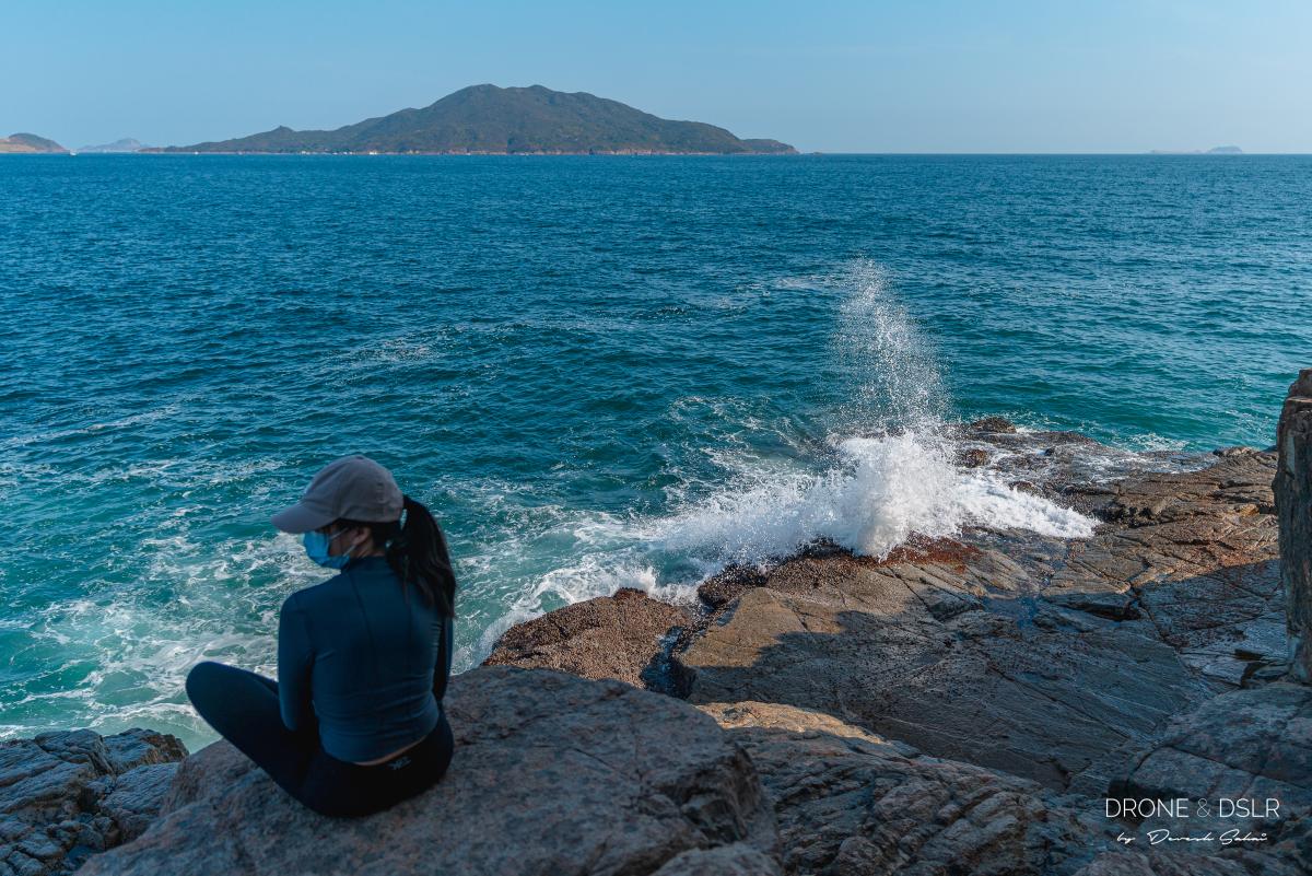
The views, the waves, and rocks in my opinion make for some great photo opportunities.
-
- Cape Collinson can be quite a photogenic spot
-
- The views of the sea from Cape Collinson

The East-most Point of Hong Kong Island
I visited Cape Collinson on a day when I was too tired to set out on a hike, and this mini excursion turned out to be a perfect way to spend my afternoon!
The end of Hong Kong Island
I honestly enjoyed just sitting on the rocks, watching the waves crash against them, and the boats pass by. It’s clearly no Cape D’Aguilar, but it has its own charm, which means it was quite secluded. But of course, if you’re looking for a more adventurous and photogenic location, head to Hong Kong Island’s south-east tip, Cape D’Aguilar!
Also, I highly recommend a visit to the Cape Collinson Battery, a World War 2 relic. And if you’re looking for another fun hike in the vicinity, go for the hike from Siu Sai Wan to Big Wave Beach.

Aerial panorama of Cape Collinson, the north-east tip of Hong Kong Island
You might also like


2 Comments
Hi always enjoy reading your articles and follow the guide :-). I am wondering whether I can wear a normal running shoes e.g Nike Pegasus for this route or Ap Lei Lay course. It looks a bit rocky and slippery – I am quite fit and careful but wanna make sure it’s safe . Thanks for the all great posting !
Hi Gemma,
Thank you very much 🙂
Yes, it should be fine. As long as you’re careful while descending, and the rocks aren’t wet, you’ll be fine.