
Red Incense Burner Summit (紅香爐峰 or Hung Heung Lo Fung in Cantonese), sometimes also referred to as Red Incense Burner Hill, is a hidden peak in the Braemar Hill neighbourhood. It has been my favourite go-to spot for the best views of Hong Kong for years and is also my top recommendation for the best sunset spot in Hong Kong.
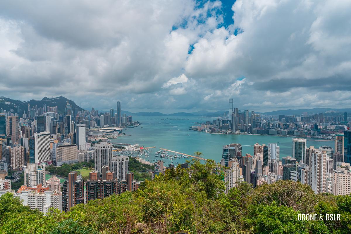
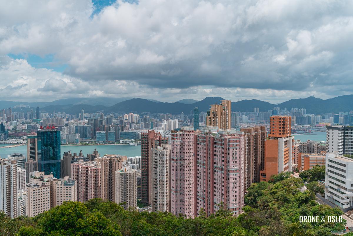
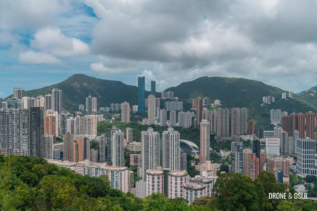
The views of Hong Kong’s skyline from on top of Red Incense Burner Summit are incredibly stunning! You get to see a 360-degree view of Hong Kong Island and Kowloon, separated by the harbour.
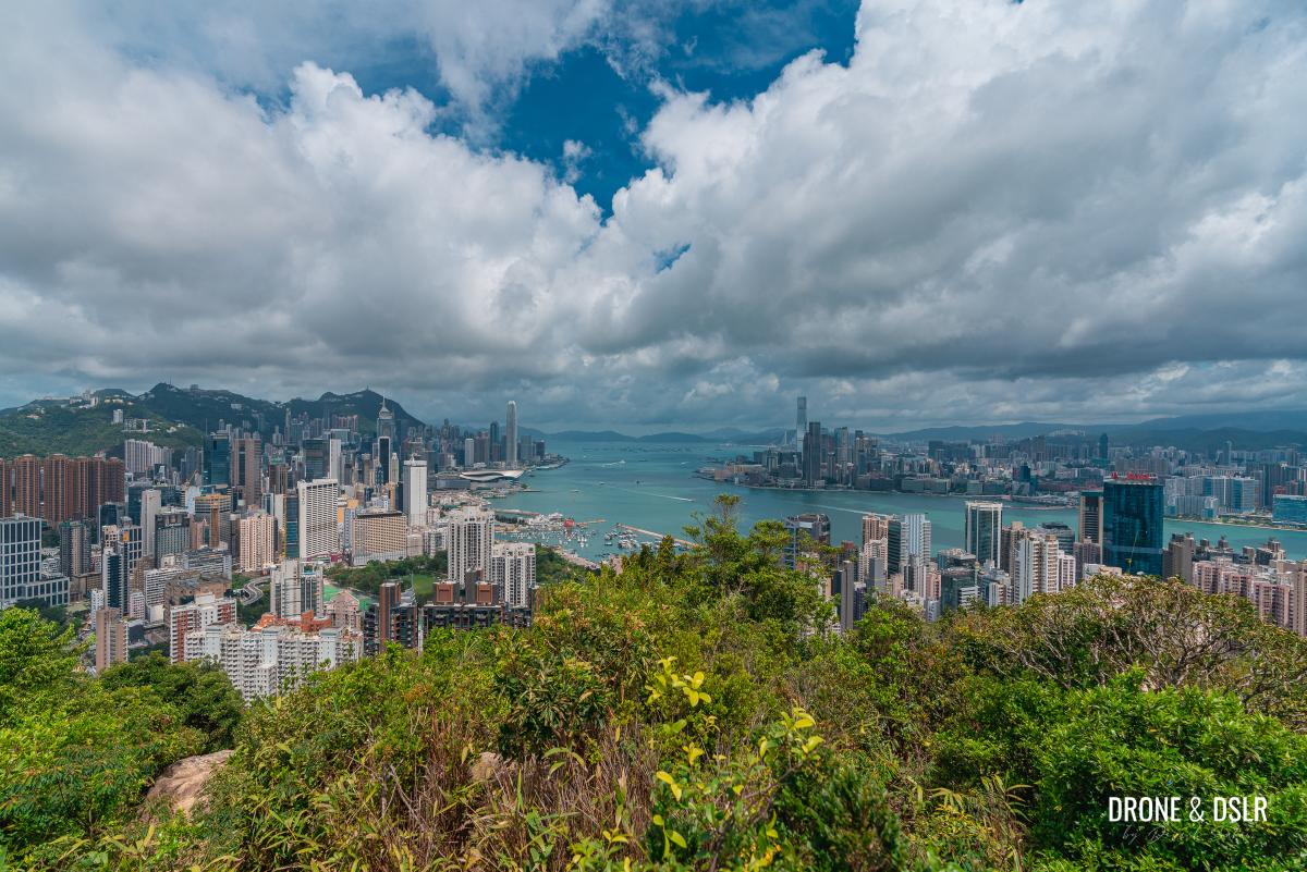
Views of Hong Kong from Red Incense Burner Hill
There are a few ways to get to Red Incense Burner Summit, the easiest of course is via a 10-minute hike from the Braemar Hill bus terminus.
However, I decided to hike to the summit from Tai Hang. The hike is short but unnecessarily challenging thanks to the lack of clear path. But it’s doable.
Name confusion
Although “Braemar Hill” and “Red Incense Burner Summit” are often used interchangeably, it might be helpful to clear things up.
Braemar Hill Peak (the actual hill) is a 200-metre tall hill located south of North Point and right next to Braemar Hill Mansions. However, Braemar Hill is mostly used to refer to the residential neighbourhood surrounding this hill. There’s also Braemar Hill Lookout, a hill adjacent to Braemar Hill Peak, which offers better views and makes for another easy hike.
Red Incense Burner Summit (or Hung Heung Lo Fung) is a 228-metre hill located to the west of Braemar Hill, behind Tai Hang and Tin Hau. When you hear the term “Braemar Hill Hike”, it’s almost always referring to a hike to Red Incense Burner Summit (Hung Heung Lo Fung).
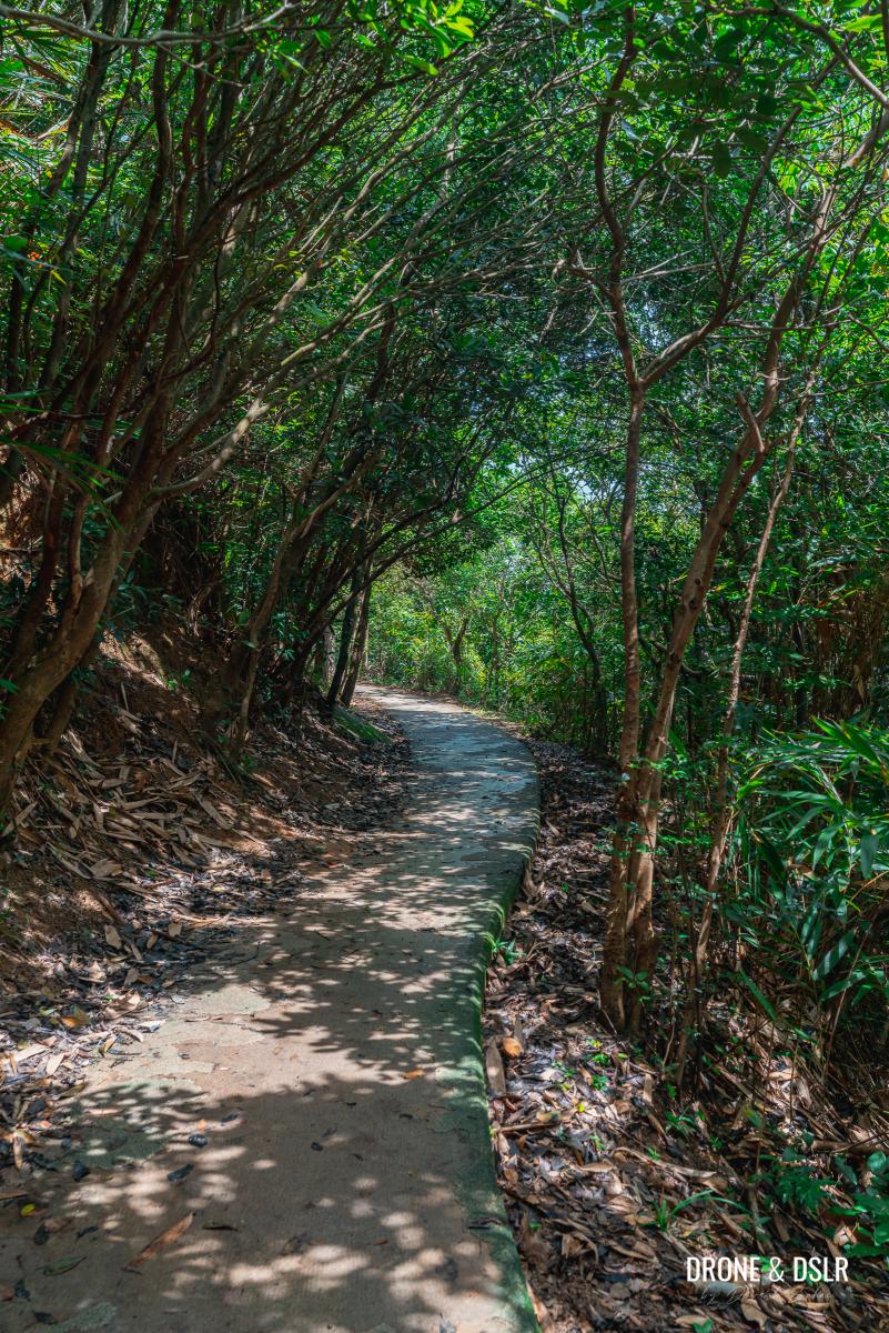
Tai Hang to Red Incense Burner Summit Hike
I’ve always known there is a hiking trail from Tai Hang to Red Incense Burner Summit but not much else about it. After having completed it, I can say that this hike isn’t for everyone.
Although the distance between Tai Hang and Red Incense Burner Hill (Hung Heung Lo Fung) is less than 1 km, the trail is a deserted mess. But if you love a challenge, or are curious to explore this route to Braemar Hill, then by all means give it a go. However, be prepared to get lost a couple of times.
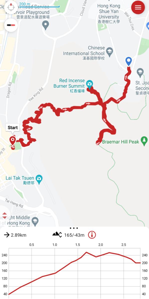
Tai Hang to Red Incense Burner Hill Hike map and elevation profile
If you much rather prefer the easy 10-minute hike to Red Incense Burner Hill, then skip to the “End the hike” section below and follow the directions in reverse.
Starting point
To start this hike, make your way to the end of Lin Fa Kung Street West in Tai Hang.
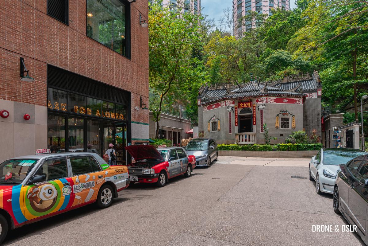
Lin Fa Kung Temple on Lin Fa Kung Street West
The easiest option to arrive here is via the Tin Hau MTR Station. From the MTR station, take Exit B onto King’s Road. Cross the road and walk towards the right till you reach Tung Lo Wan Road. Walk down Tung Lo Wan Road for about 250 metres till you arrive at Lin Fa Kung Street West on your left. Walk down to the end of the street towards Lin Fa Kung Temple.
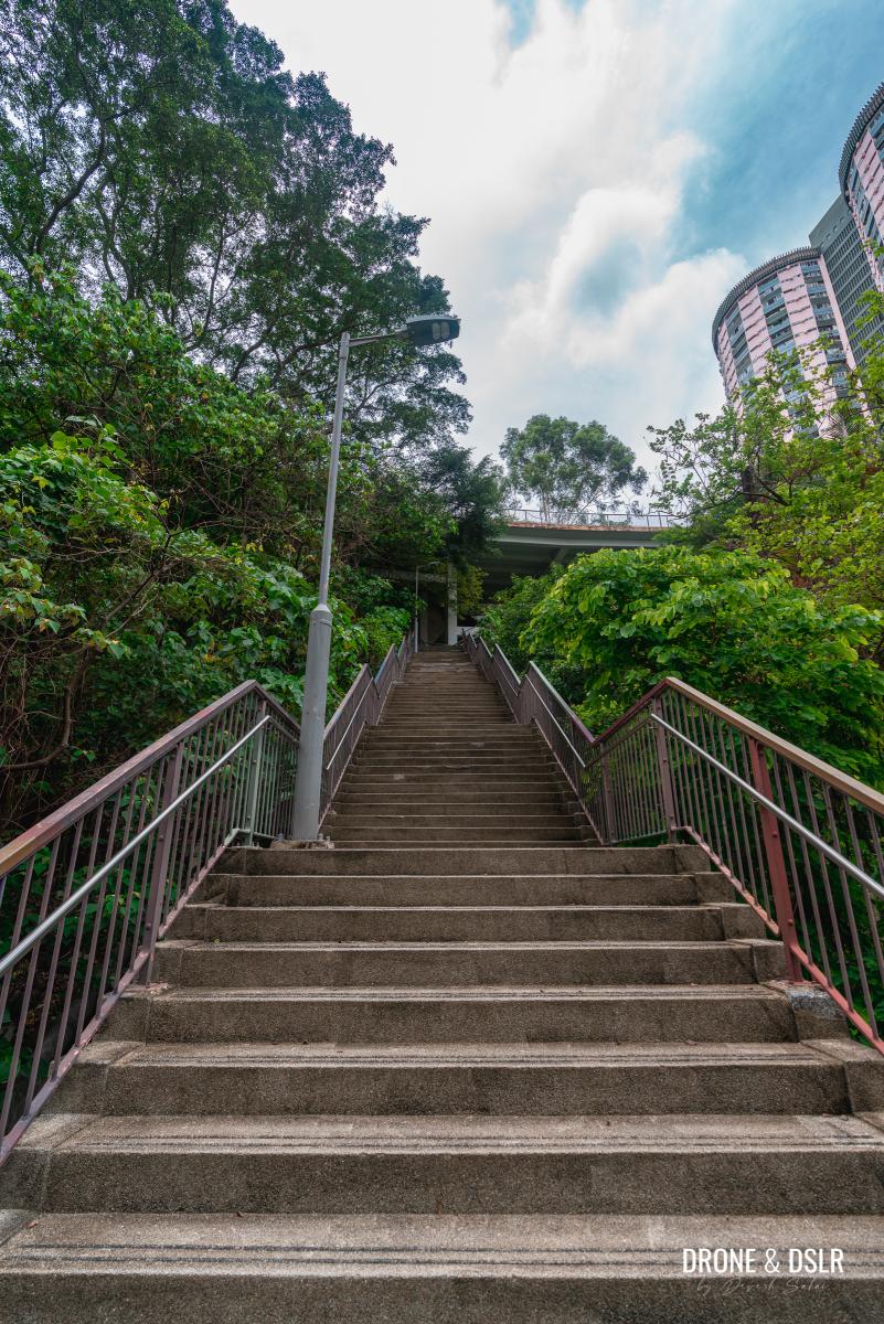
Next to the temple is the Lin Fa Kung Garden, and at the end of the garden are the steps. The steps mark the starting point.

The steps inside Lin Fa Kung Garden
To Yee King Road
Walk up the steps till you emerge in the middle of the Lai Tak Tsuen bus terminus, a relatively small bus terminus.
Climb up the steps to Lai Tak Tsuen
Turn around and walk towards Yee King Road and the Lai Tak Tsuen housing estate, a public housing estate known for its unique circular design.
Walk towards Yee King Road and Lai Tak Tsuen housing estate
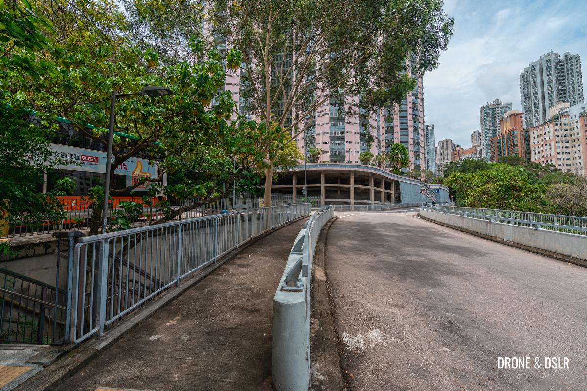
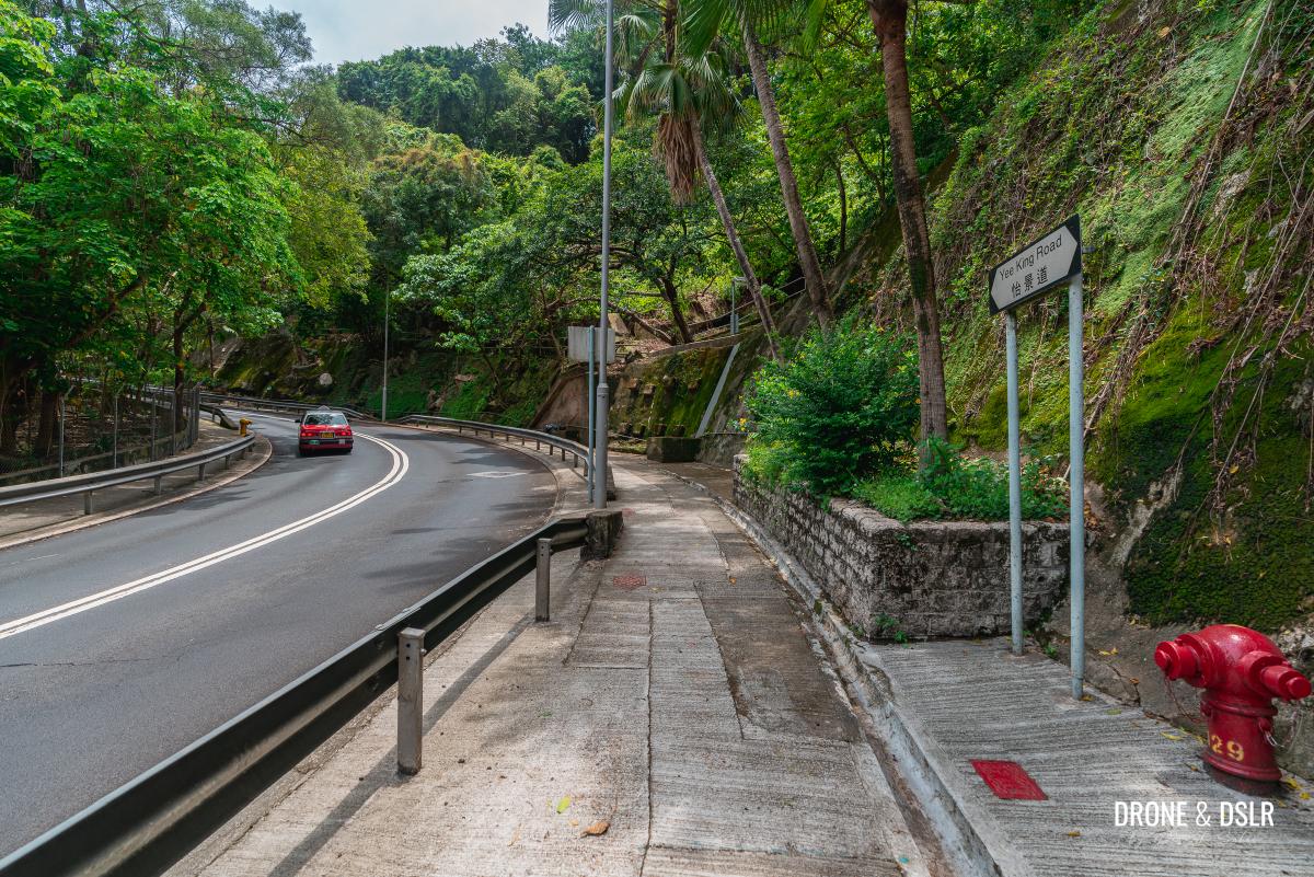
Cross Yee King Road and turn left. Walk ahead a couple of metres till you arrive at the steps on the side of the hill. Walk up the first flight of steps and then immediately turn left to walk parallel to Yee King Road. Do not walk on the steps going uphill at this point.
-

- Walk up Yee King Road
-
- Walk up these steps on the side of the hill of Yee King Road

-
- Turn left and walk parallel to Yee King Road

Walk along the catchwater path as it turns right to reveal the next flight of steps going uphill.
-
- Walk along the catchwater drain

-
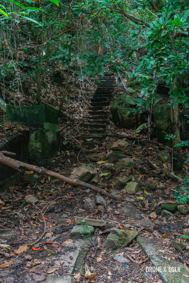
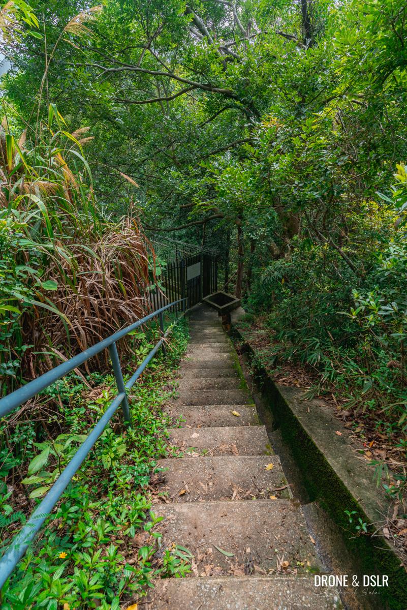
- Deplapidated steps to start the hike
To Sir Cecil’s Ride
The next section of the hike is, in my opinion, a challenge to navigate. It’s a deserted mess where the trail is often difficult to follow. It’s also full of mosquitoes in the summer.
As you begin climbing up the steps, the first creepy sight is a moss-covered, stuffed bear hanging from the tree. Not something you want to see on a hike!
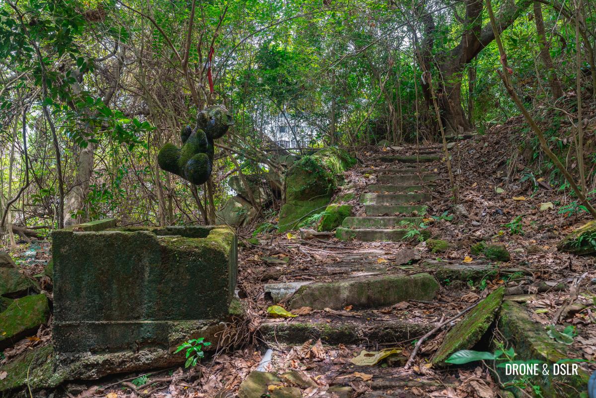
Walk past the creepy stuffed bear
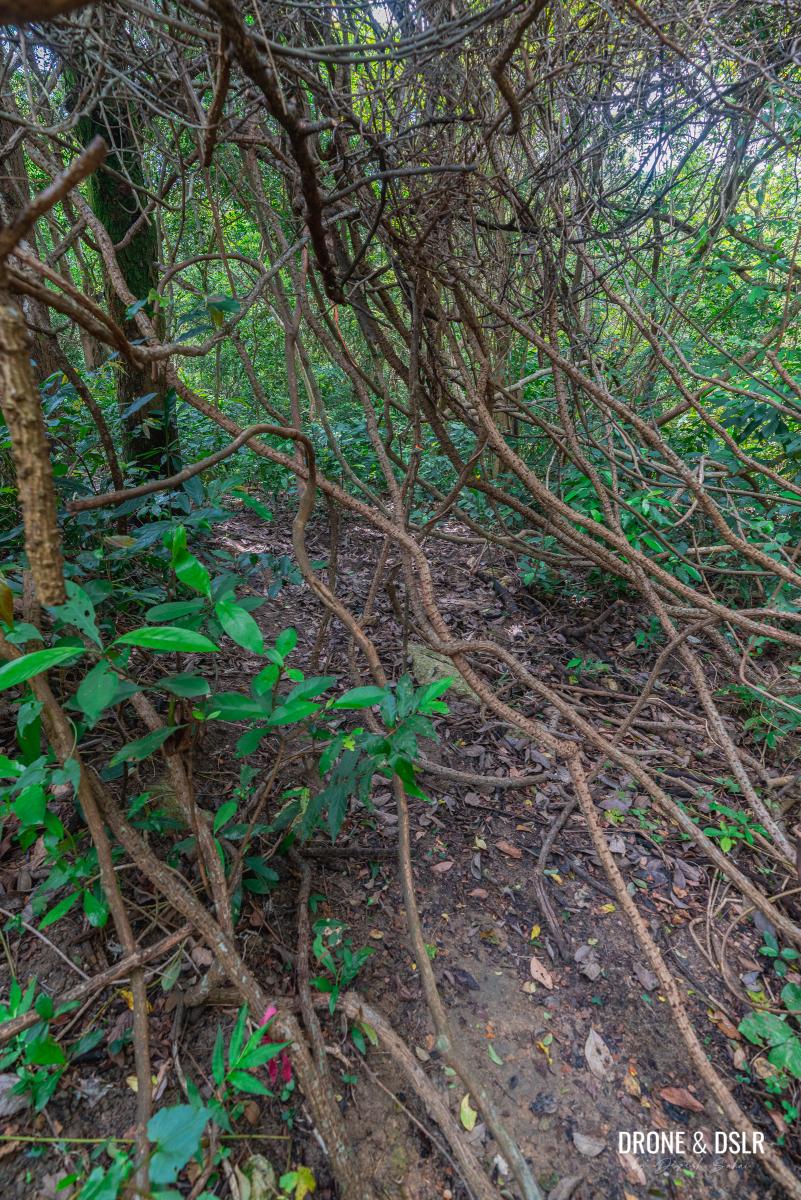
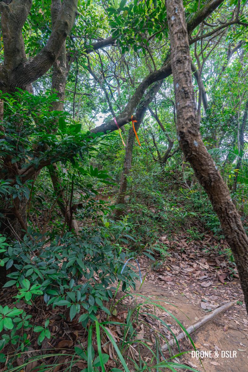
As you continue to climb the steps, one thing becomes very apparent. Fallen trees and moss have hidden many parts of the trail, making it difficult to follow. Fortunately, there are colourful ribbons left as trail markers. But in many sections, even they become difficult to spot. There is a very high chance of getting lost. I did, multiple times!
-
- It’s easy to get lost when the trail isn’t visible
-
- Keep a look out for the ribbons. They can be hard to spot
-
- At times the steps are clearly visible
-
- Walk through this mess

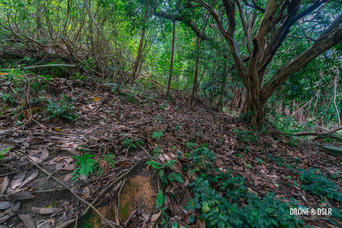
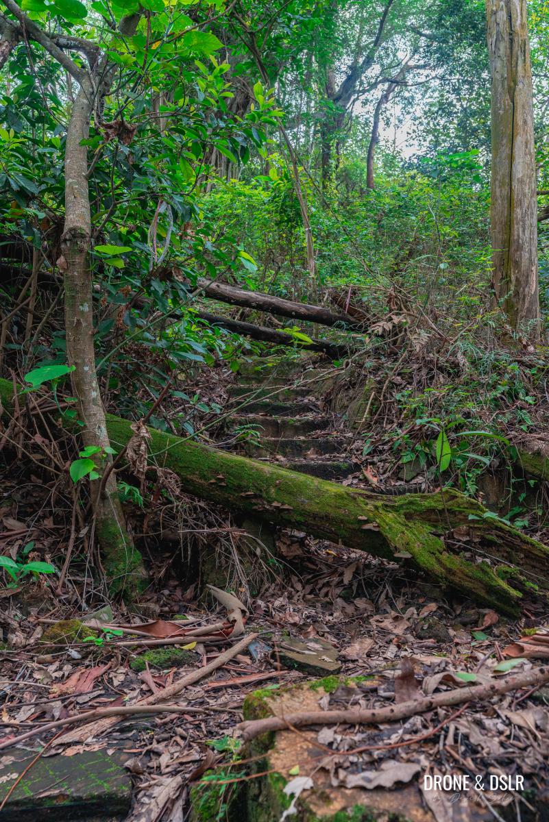
Try your best to keep track of the steps and the ribbons. If you cannot spot them, keep climbing uphill towards the left. The initial section of the trail also has a few abandoned structures, which I think were part of the old village on the hill.

Old abandoned structures on the hike, perhaps the remains of the old village
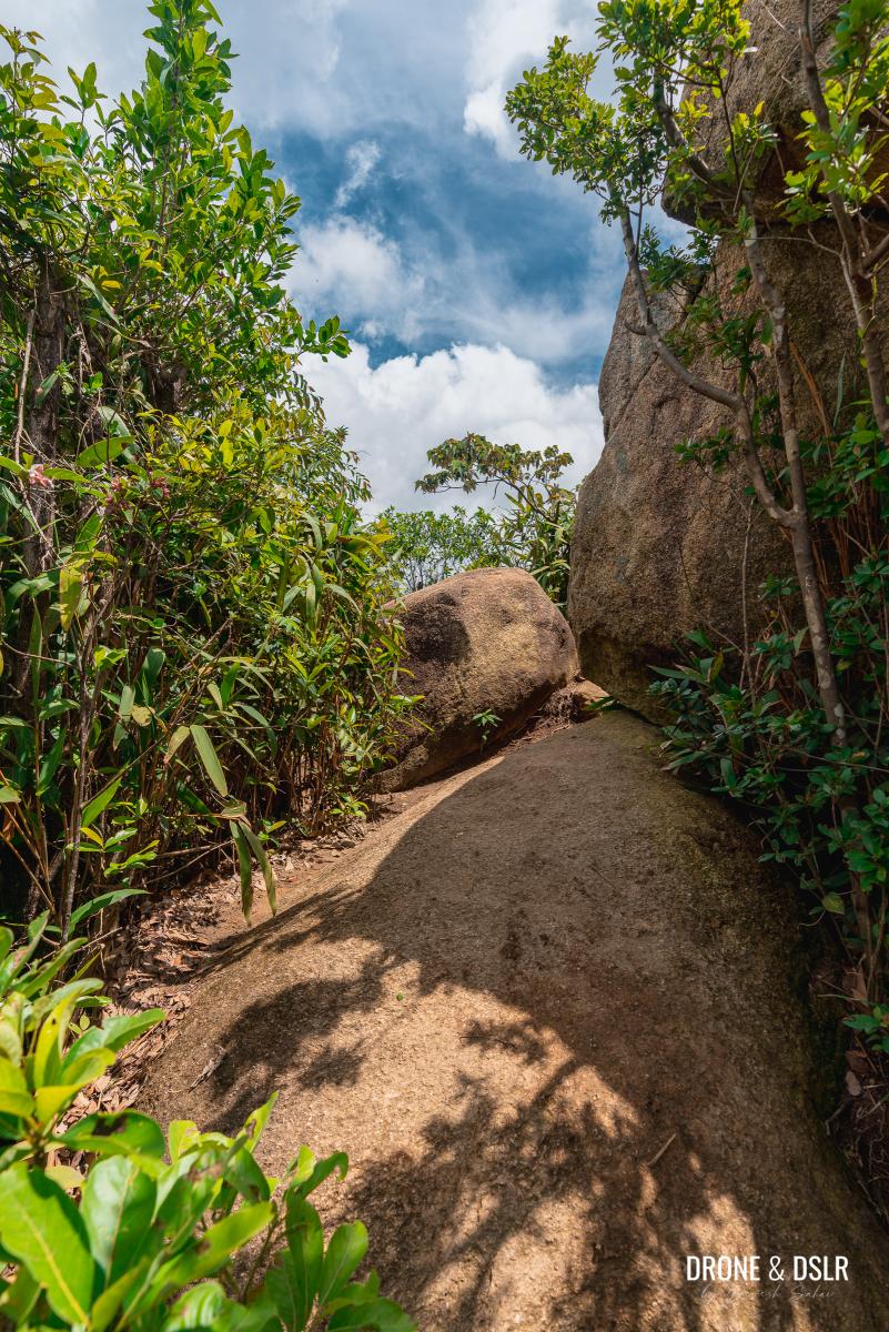
At one point, the trail cuts through the hanging roots of a massive tree. It’s hauntingly beautiful!
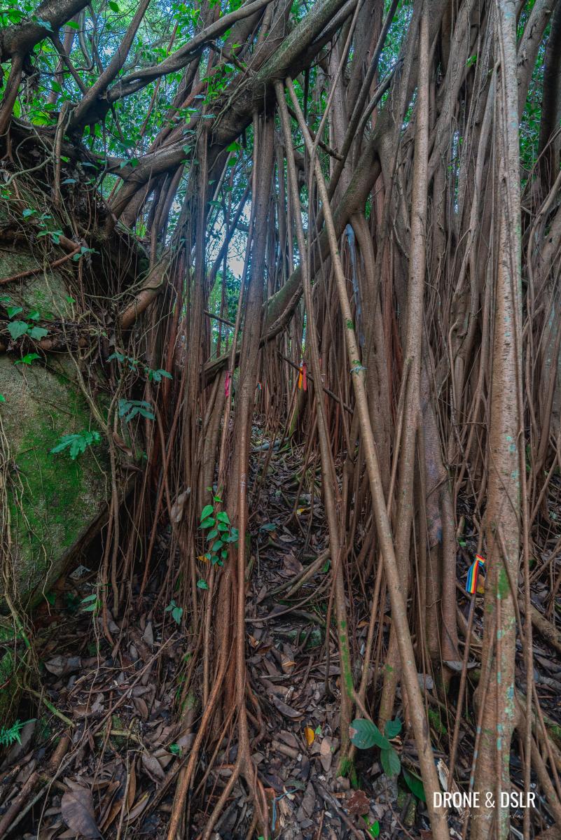
Walk between the hanging roots
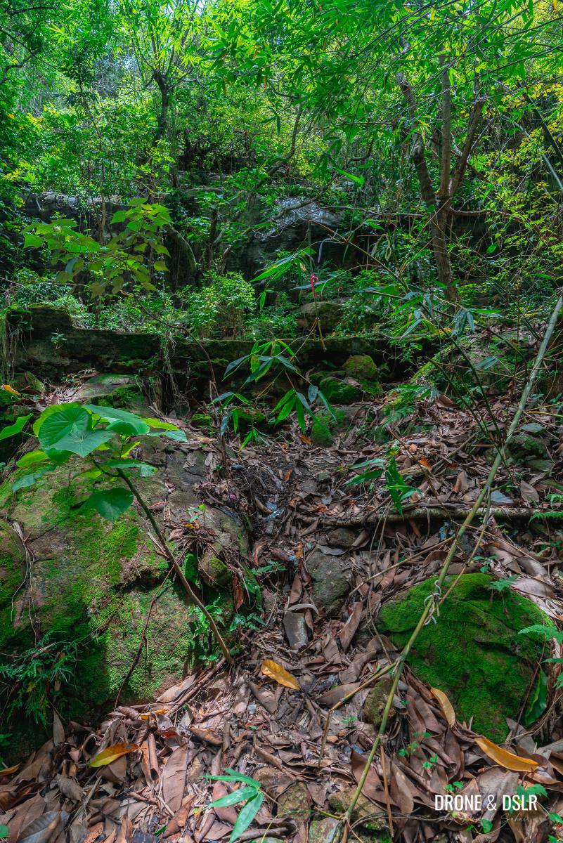
After the hanging roots, the steps reappear. But I found this part of the trail filled with discarded trash.
-
- The trail is quite a mess, you’ve been warned
-
- Can you spot the steps?

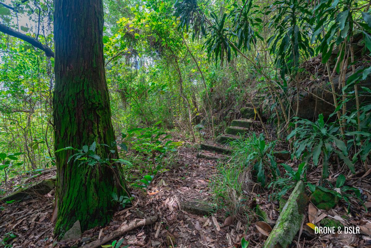
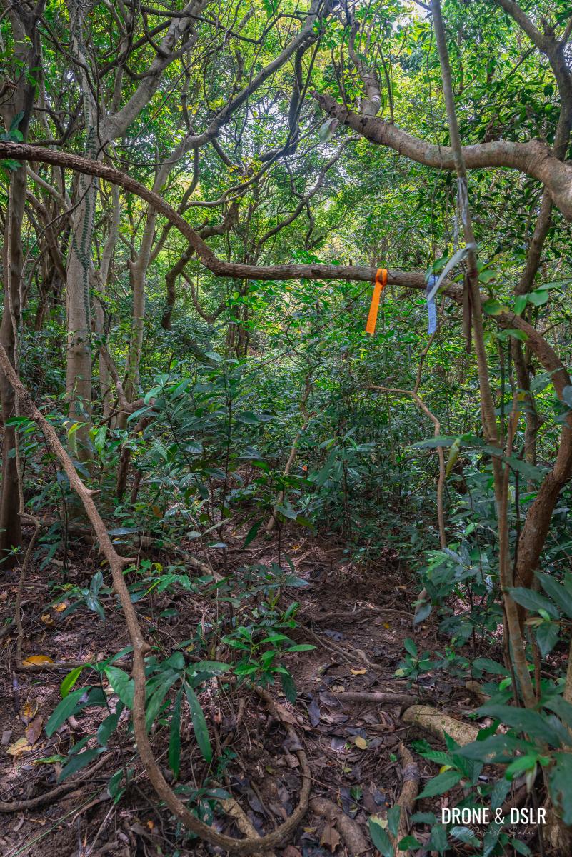
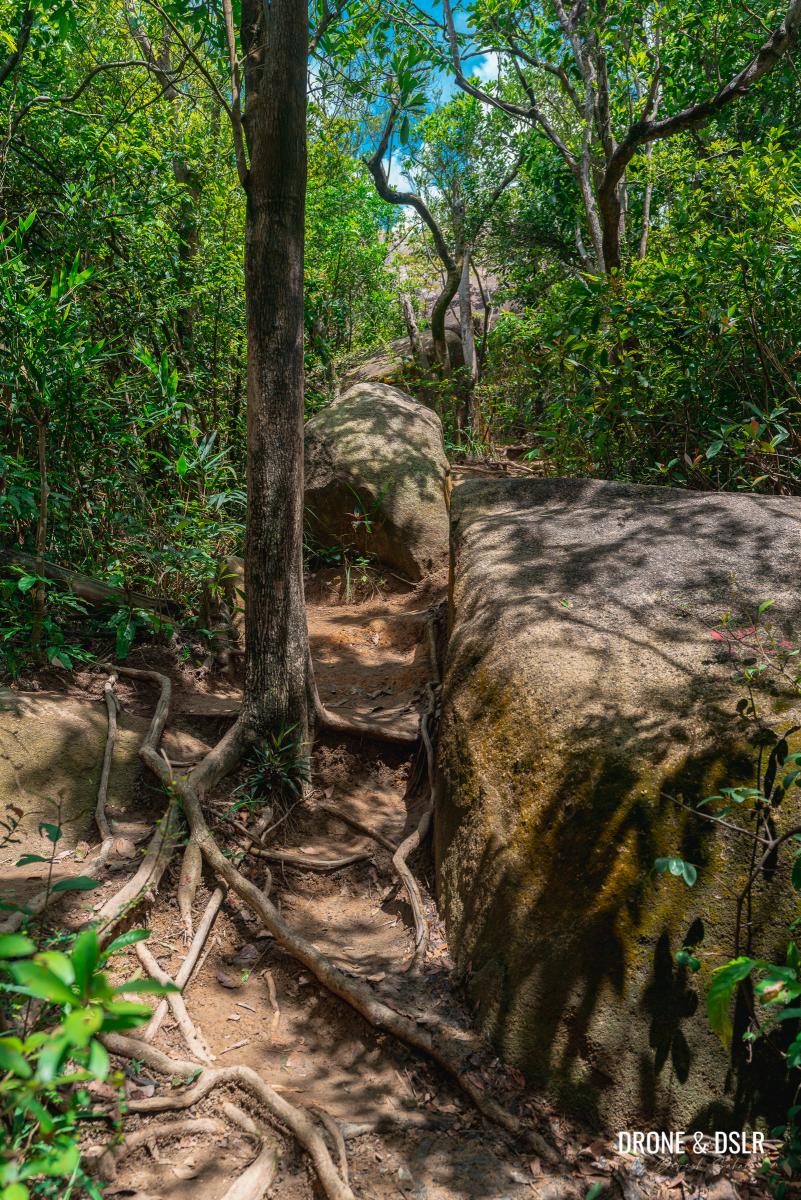
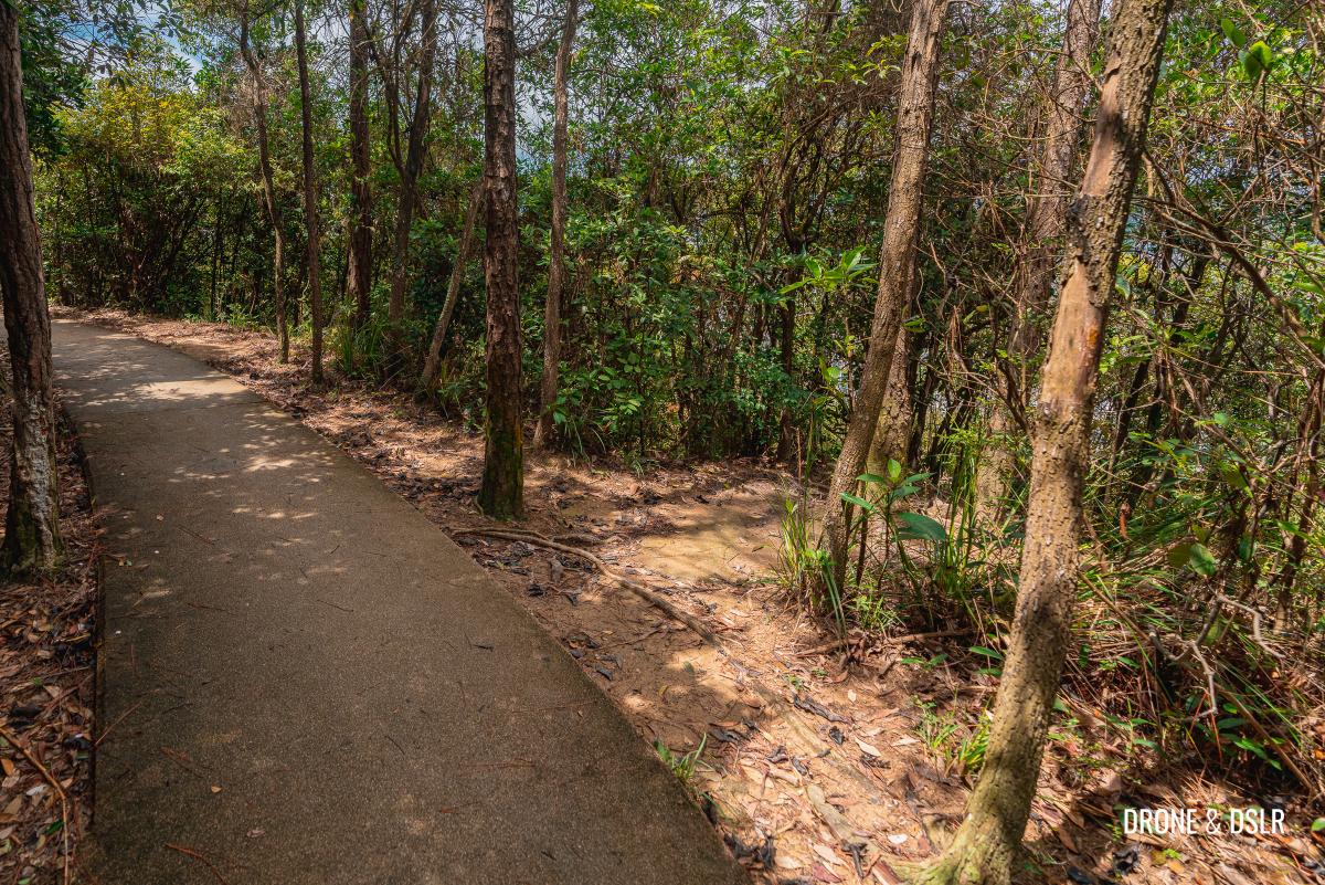
Remember to stay on the steps, as much as possible, and follow the ribbons. After about 350 metres, the steps end and there’s a slightly more visible trail.
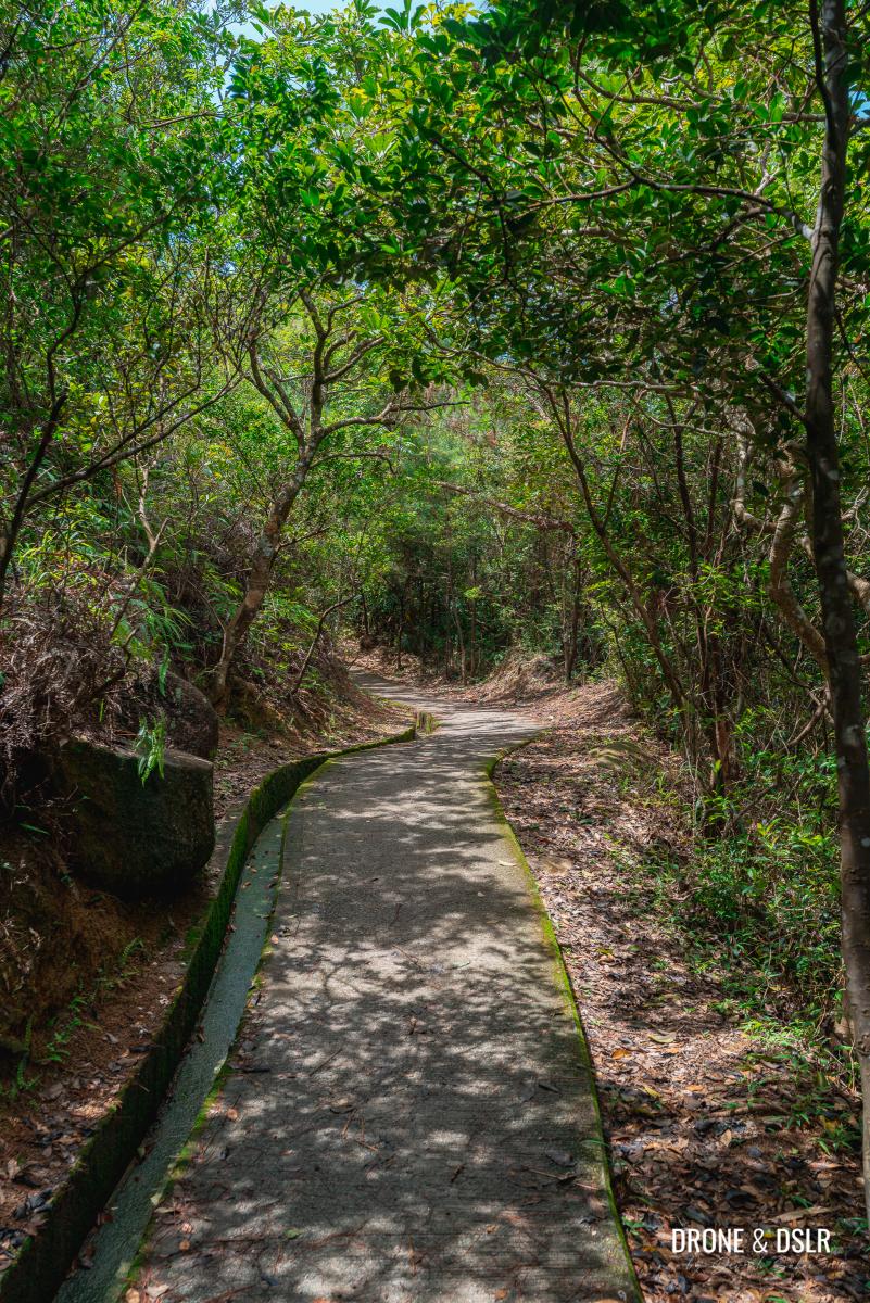
-
- The trail after the steps is easier to follow

-
- Fight your way through all these branches
-
- Thank you for these marker ribbons
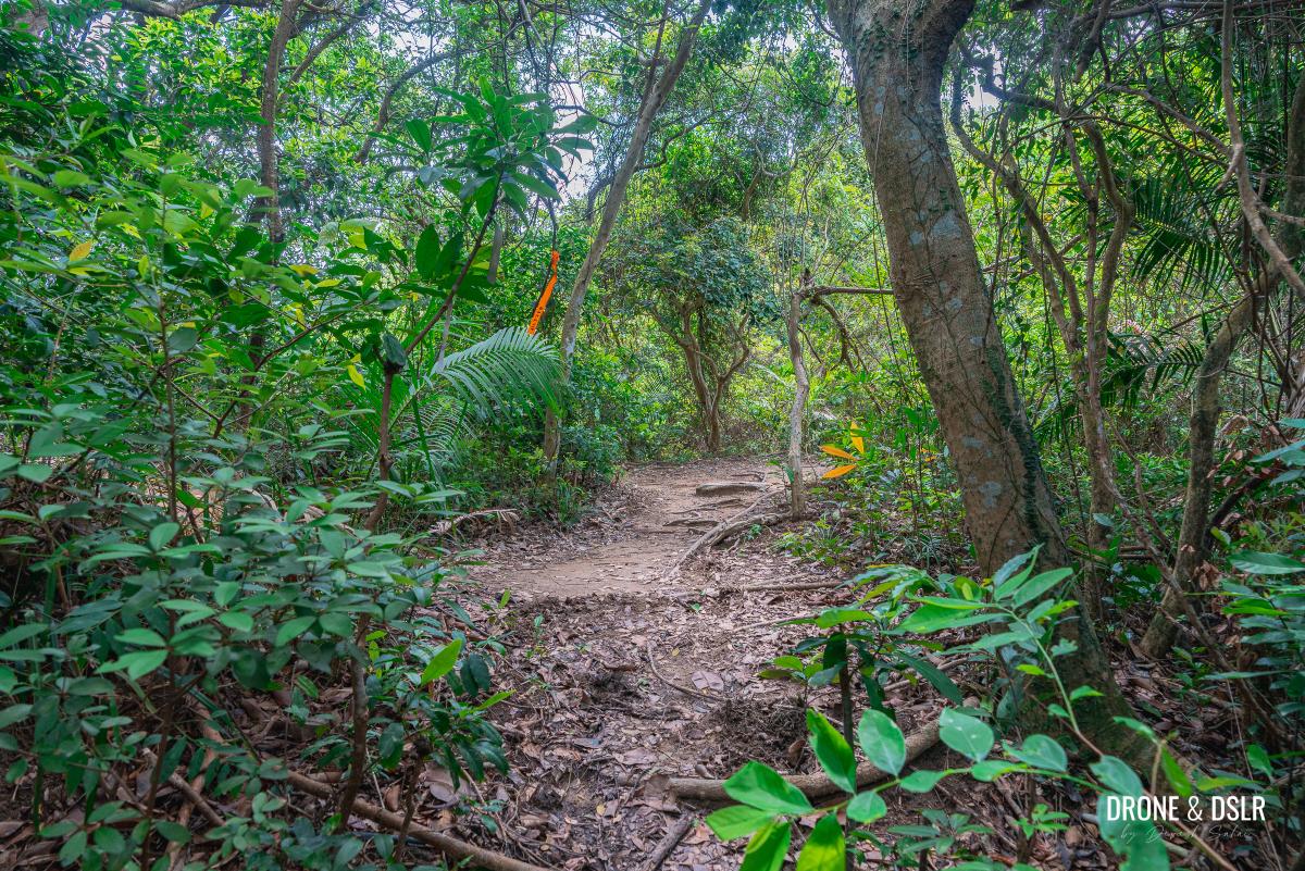
Although the trail is easier to navigate, it still requires a lot of crouching under branches and some bushwhacking. Stay on the trail till you emerge at a clearing marked by plenty of ribbons. You can finally breathe a sigh of relief that you made it to Sir Cecil’s Ride!
-
- The trail looks quite normal closer to the end

-
- Remember to watch your head, lot’s of low branches

-
- You’ve made it to Sir Cecil’s Ride!
To Red Incense Burner Summit (Hung Heung Lo Fung)
The moment you emerge from the trail onto Sir Cecil’s Ride, turn left. There is a trail, marked again by colourful ribbons, leading you to the top of Red Incense Burner Summit (Hung Heung Lo Fung).
Turn left for Red Incense Burner Summit
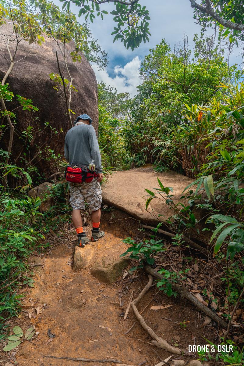
Fortunately, this last section of the trail is short but slightly steep.
-
- Walk up this path to reach the Red Incense Burner Hill Summit
-
- Be careful of slippery rocks
-
- The trail to Red Incense Burner Hill

Just as you’re getting close to the top, the route becomes confusing again. My advice is to stay to the left and look for a narrow opening between two large rocks.
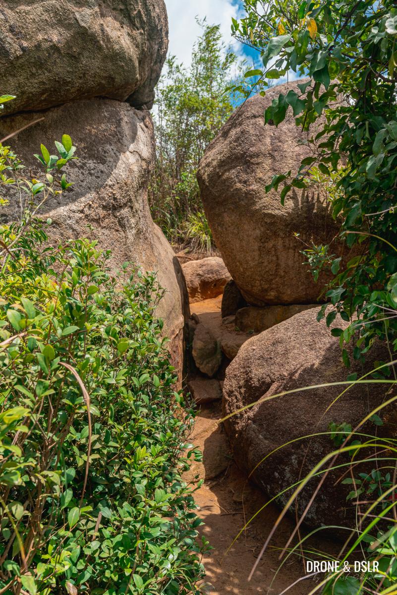
Squeeze between the rocks
Once you squeeze through the rocks, you’ll notice that you can climb up the rock on the left to enjoy the views.
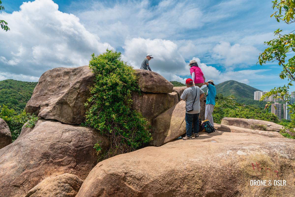
This rock also offers some nice views
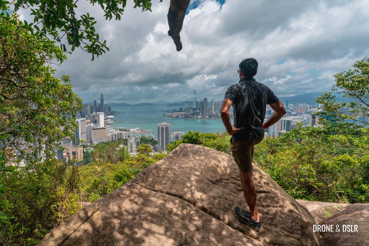
However, keep walking on the trail, through the bushes and trees. At numerous spots on this hill, the trees give way to reveal the most stunning and close-up view of the Hong Kong skyline. But to get the clearest views, look for the triangulation station on the Red Incense Burner Hill Summit.
-
- The area close to the summit is rocky and wild
-
- Scramble your way to the triangulation station

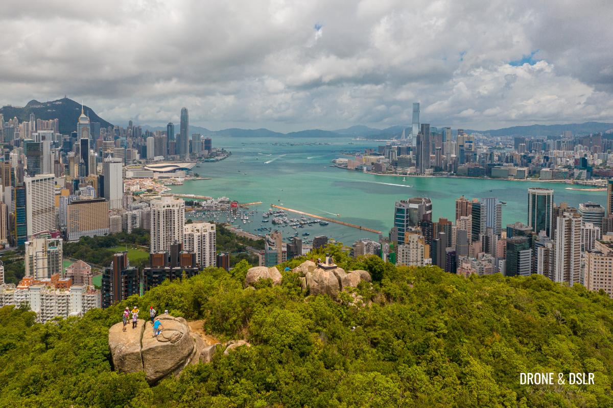
Getting to the triangulation station is slightly tricky and requires a bit of clambering on the rocks and identifying your approach path. But once you reach the top, the 360-degree views are some of the best in the city!
-
- The view of the city from Red Incense Burner Hill Summit

-
- Gorgeous views of Hong Kong from Red Incense Burner Hill
-
- Views of Kowloon and Lion Rock
-
- Views of Tai Hang and Causeway Bay
-
- Aerial view of Red Incense Burner Hill and the two lookout points on the summit
Head back down
Given the incredible views, it’s no surprise that Red Incense Burner Summit (Hung Heung Lo Fung) can get very crowded. It’s also a very popular spot to observe any fireworks display in the harbour.
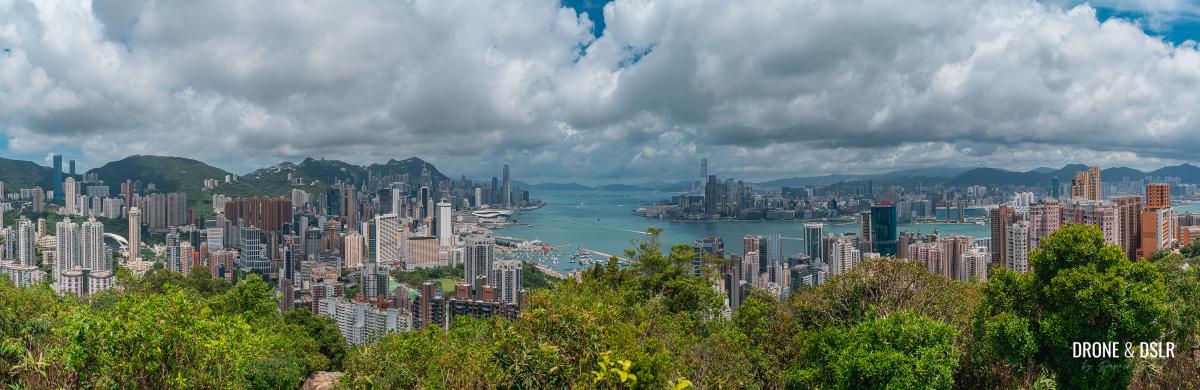
Panoramic view from Red Incense Burner Hill Summit
Once you’re done admiring the views from the hill, trace your steps back down the hill back to Sir Cecil’s Ride. Be careful as you descend, as some sections can get slippery.
Once you emerge on Sir Cecil’s Ride again, you have two options.
- End the hike, or
- Take a quick detour to another lookout point
Detour to the lookout point on Sir Cecil’s Ride (Optional)
A short detour (600 metres back and forth) takes you to another lookout point along Sir Cecil’s Ride.
As you arrive at Sir Cecil’s Ride from Red Incense Burner Hill, go straight on the cemented pathway.
-
- The path is at a slight incline, but you won’t feel it
-
- Walk on Sir Cecil’s Ride for about 300 metres
The path is at a slight incline but feels relatively flat as you walk on it. Keep walking on this pathway for about 300 metres till you see another path between trees going off-trail towards a clearing.
-
- Take the off-track path between the trees
-
- The lookout point on Sir Cecil’s Ride

I love this lookout point, which usually remains less crowded than Red Incense Burner Summit.
-
- Can’t get enough of these views!
-
- The views from the lookout are quite similar to those from Red Incense Burner Hill

Once you’re done admiring the views from this lookout point, trace your steps back to the foot of Red Incense Burner Summit.
End the hike
To end the hike, turn left on Sir Cecil’s Ride as you descend from Red Incense Burner Summit. If you’re returning from the detour, that means continue walking on Sir Cecil’s Ride.

Turn left to end the hike or go straight to reach the optional lookout point
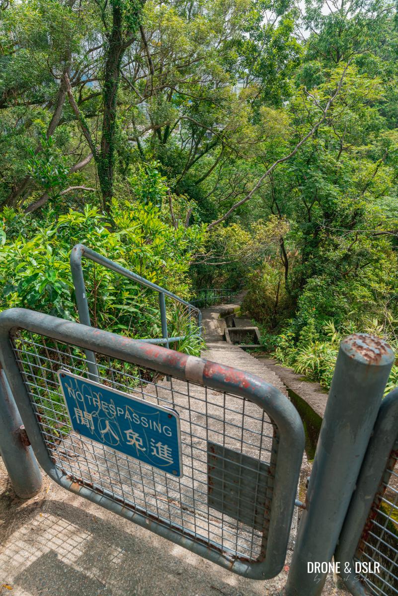
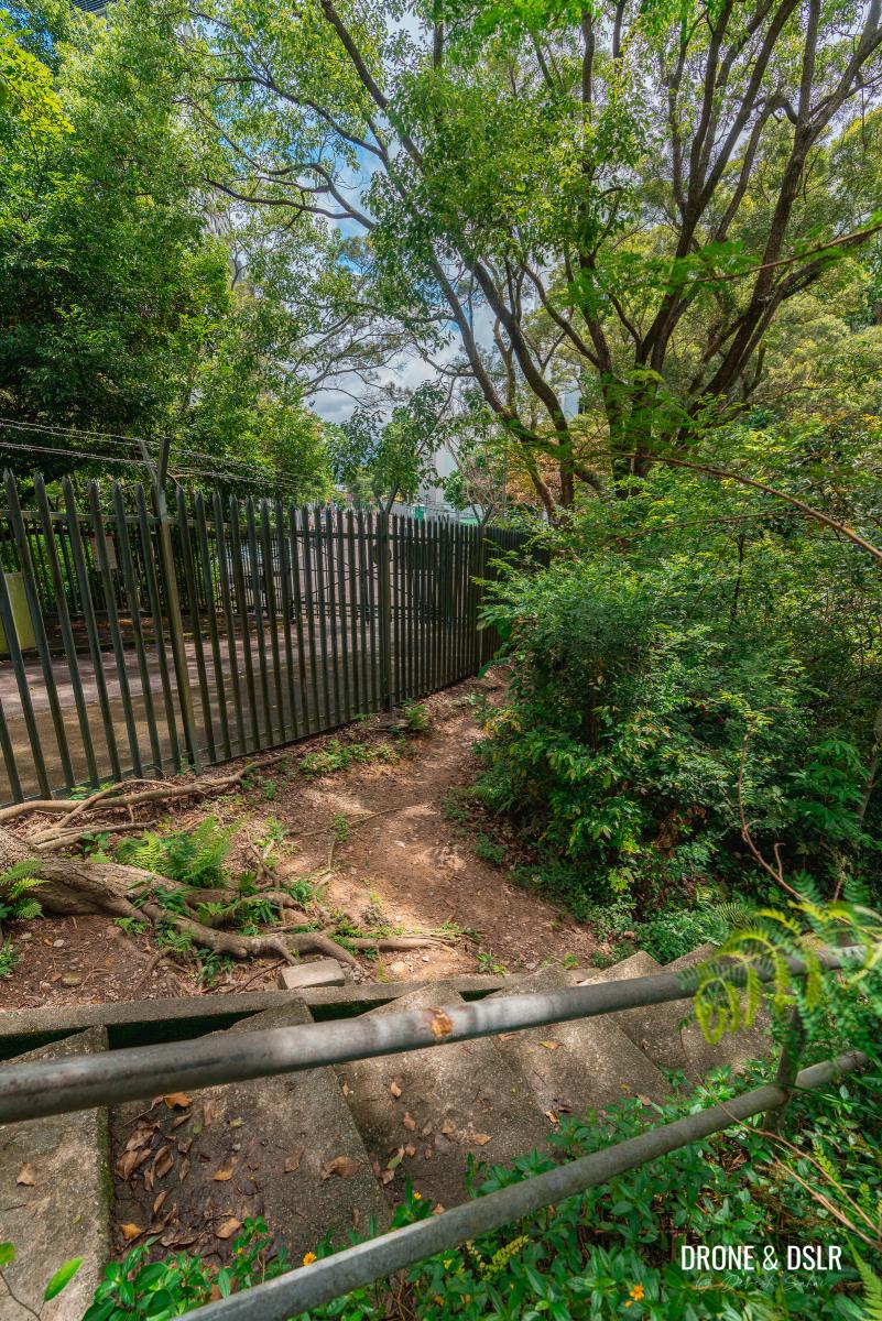
The trail quickly bends around the hill to reveal views of the Braemar Hill neighbourhood. Walk a few metres ahead on the cemented pathway till you notice a small gate with a “no trespassing” sign.
-
- Walk down this path and around the hill

-
- Stay on Sir Cecil’s Ride

-
- For the shortcut, jump over or open the no trespassing gate

To take a shortcut, hop over the gate and walk down the steps till you reach the fence.
-
- Walk down these steps
-
- When you reach the fence, walk around it
-
- Hop across the steps and continue walking along the fence
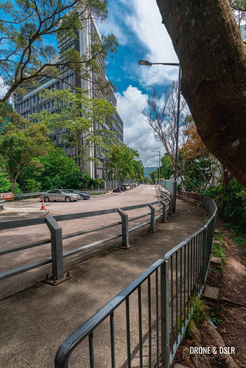
Walk around the fence and hop across the steps to reach the guardrails along Braemar Hill Road. Jump over the guardrails and walk past the Chinese International School. Right after the school building is the Braemar Hill bus terminus.
-
- Hop over these guardrails
-
- Walk past the Chinese International School on Braemar Hill Road

From here you can catch the green minibus 25 to Causeway Bay MTR station, 49M to Tin Hau MTR Station, or any other bus that gets you to your destination.
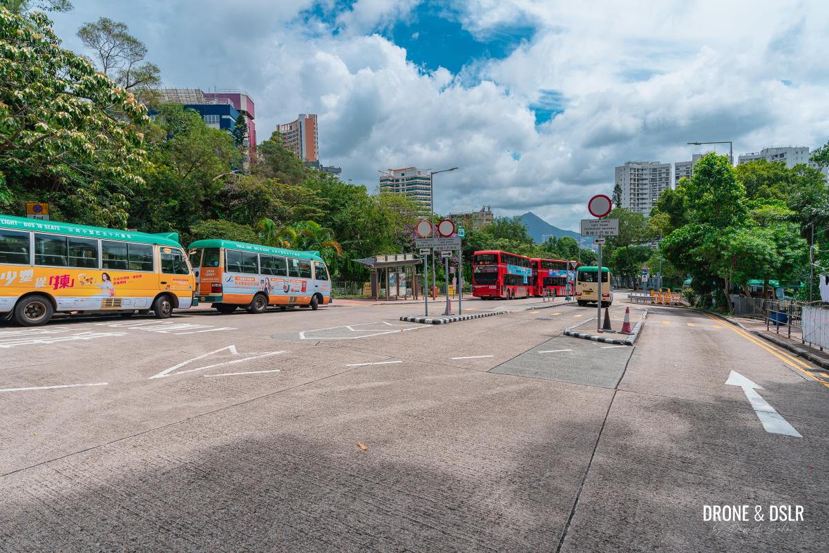
The Braemar Hill bus terminus
The Easy Hike to Red Incense Burner Summit
I would imagine that most people wouldn’t want to venture up Braemar Hill from Tai Hang. However, as you’ve probably noticed, the easiest option to reach Red Incense Burner Summit (Hung Heung Lo Fung) is via the short hike from the Braemar Hill bus terminus.

The views make this hike worth it!
Simply take minibus 25 from Causeway Bay MTR station (opposite H&M) or minibus 49 from the Tin Hau MTR to the Braemar Hill bus terminus. Then to reach Red Incense Burner Hill, follow the directions above in reverse.
Best time for the Braemar Hill Hike
Given its ease of access (via the easy hike) and stunning views, Red Incense Burner Hill on Braemar Hill is always busy.
However, it’s the busiest during sunsets. Needless to say, the views of the sunset from here are spectacular. Braemar Hill is a must-do sunset hike!

An epic sunset from Braemar Hill’s vantage point
Having said that, it’s also popular during sunrises and other times of the day when it’s not too hot.
Red Incense Burner Summit Hike from Tai Hang
I’m glad that I hiked up from Tai Hang to Braemar Hill but honestly wouldn’t advise this trail to everyone. Only undertake it if you’re adventurous or don’t mind getting lost.
For most, the short 10-minute hike from the Braemar Hill bus terminus is perhaps the most convenient way to reach Red Incense Burner Summit for its views.
And finally, there’s another relatively popular route from Mount Butler to Braemar Hill. But whichever route you take to this hill, you won’t be disappointed by the views!
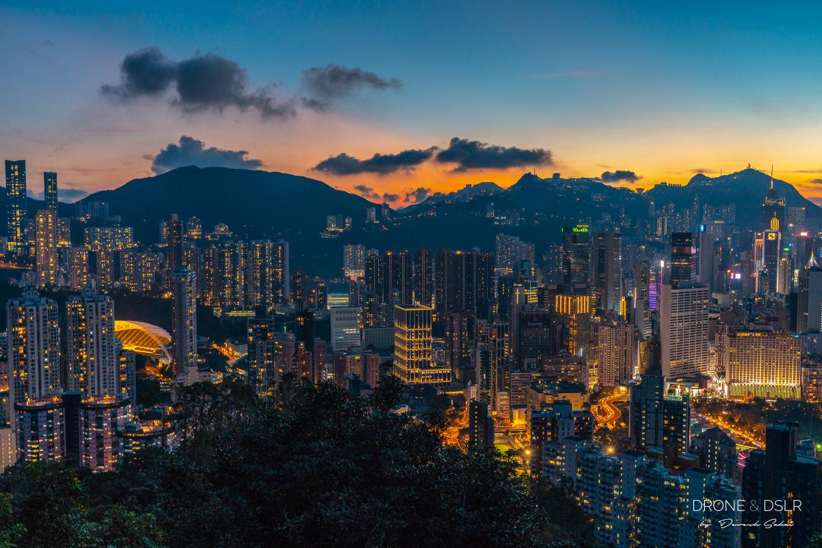
Hong Kong bathe in city lights and twilight
If you enjoy our work, come join us on Instagram and YouTube 🙂


You might also like


4 Comments
We approached the Red Incense Burner Summit from Mount Butler, and used your directions towards the end to locate the summit and the triangulation point. There are several view points along this path as well.
After finishing, we walked to another observation point with incredible views as well (76P4+4V Quarry Bay). Easy walk.
Thank you.
Thanks for the feedback and for sharing your experience! Yes, there are many viewing points from Red Incense Burner Hill towards Mount Butler. It’s actually quite a pleasant walk 🙂
Swear to God that the path from Tai Hang is cursed. I completed it today and had weird feelings for the whole thing — felt like I was in a horror film.
Is the bear still there? That thing was so spooky!