
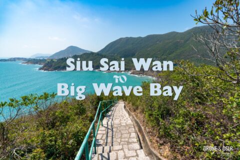
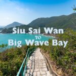
The Twin Peaks and Violet Hill Hike is probably the most challenging hike on Hong Kong Island. Often collectively referred to as the “The Twins” or “Terrible Twins”, this 4.8 km hike from Wong Nai Chung Reservoir (near Parkview) to Stanley will truly test your limits.
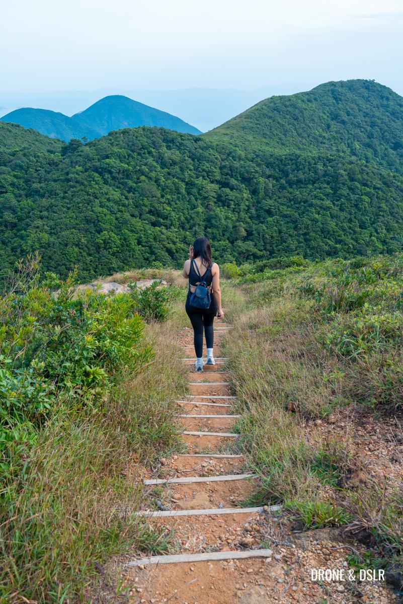
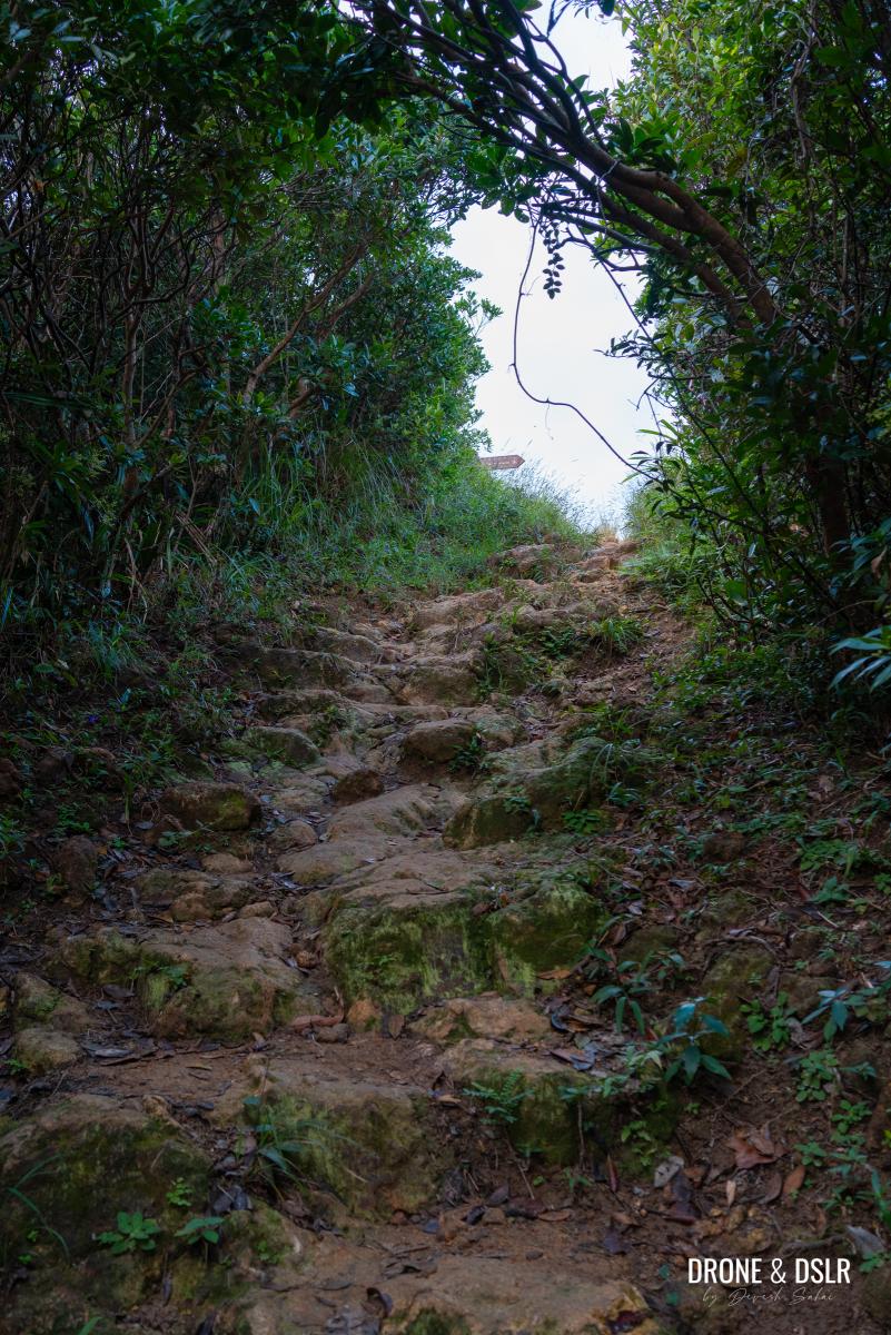
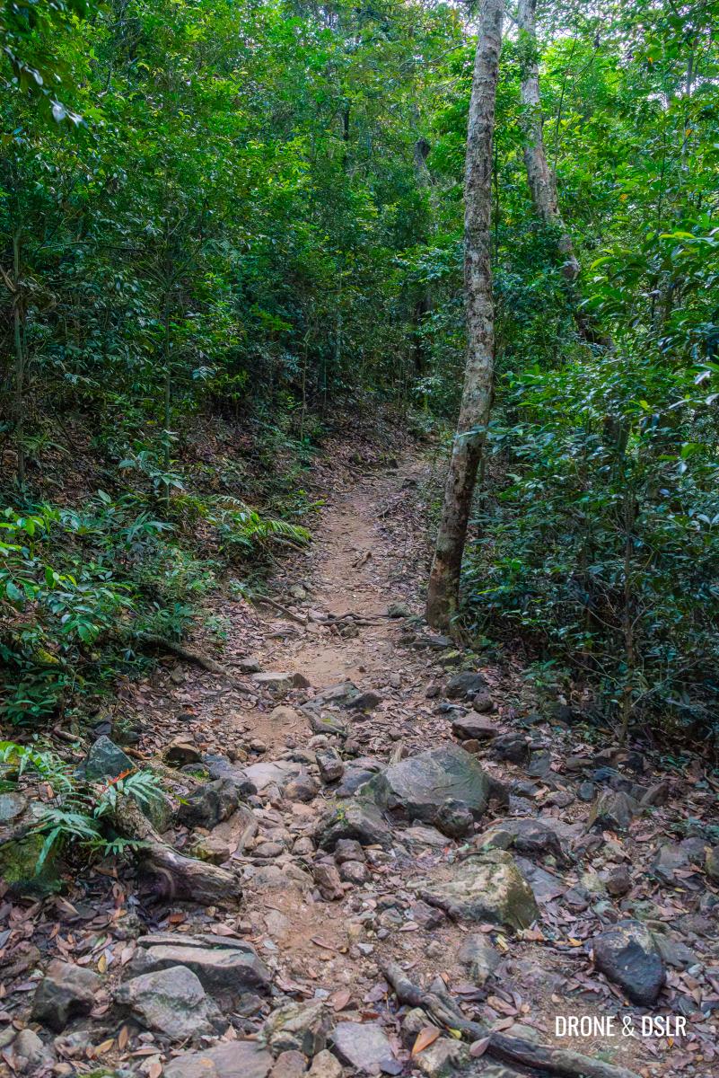
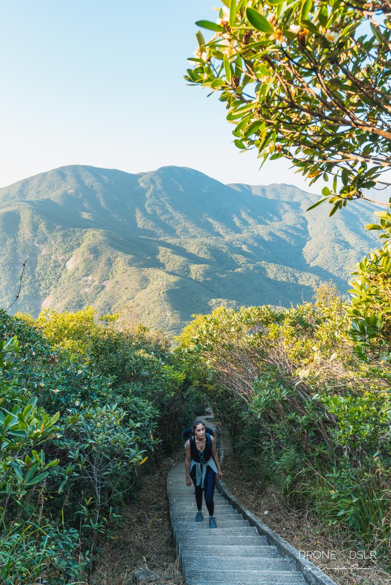
What makes the Twin Peaks Hike difficult is the ascending and descending of two hills, Violet Hill and The Twins, in quick succession. The most difficult and unforgettable part of the hike is the 1,200 steps to the top of The Twins. No matter what your fitness level, these steps will give your glutes and legs the best workout ever!
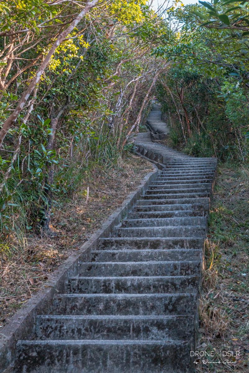
The never-ending steps to the top of The Twins
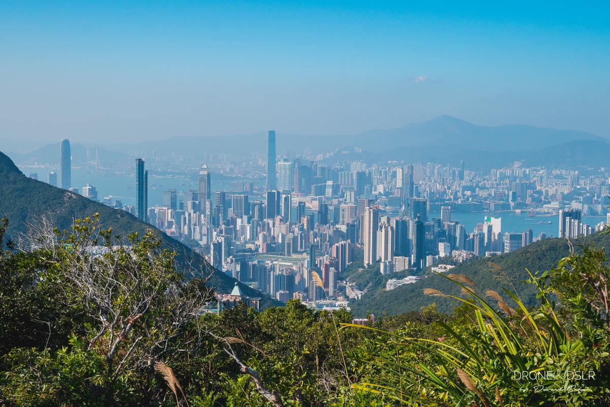
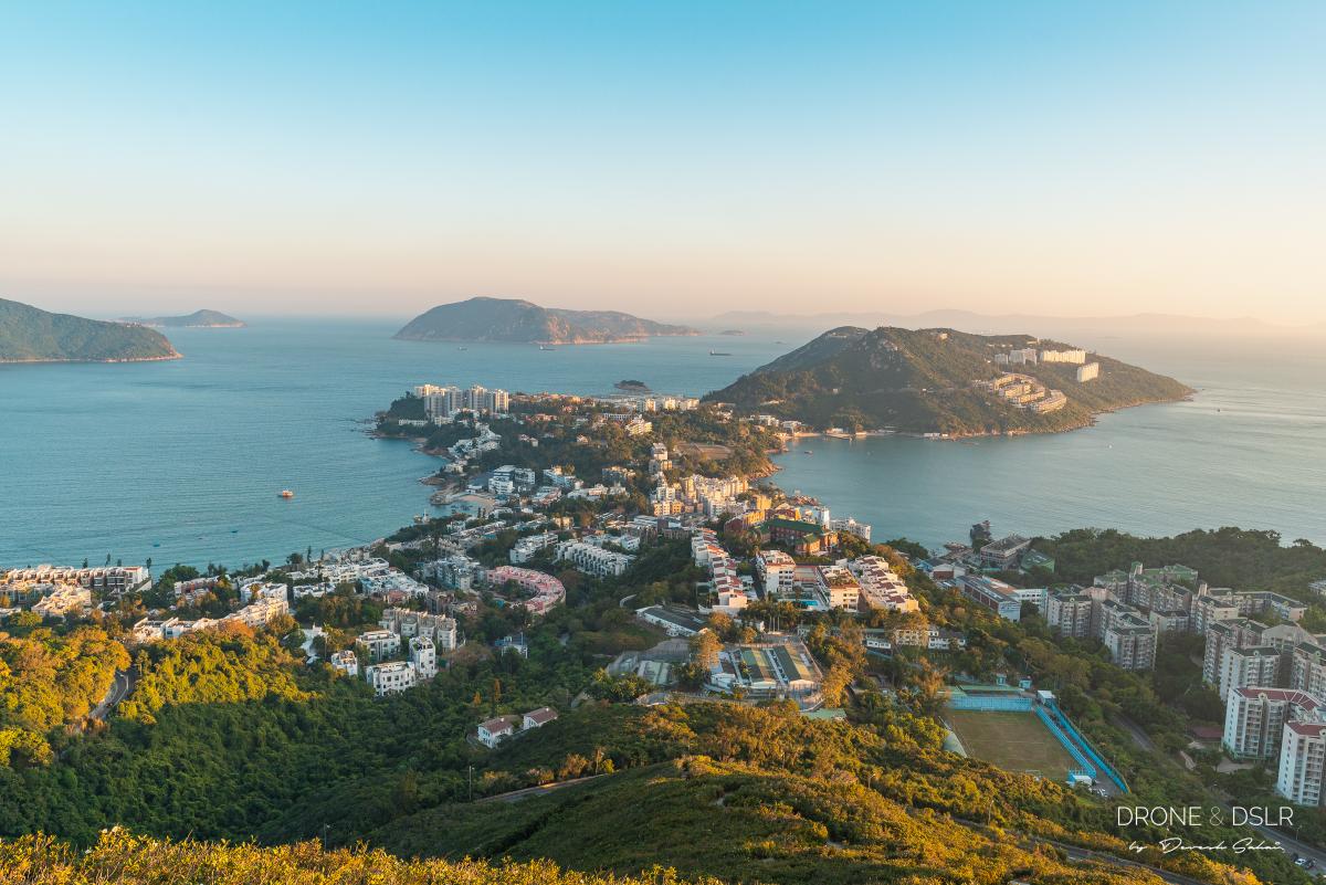
Fortunately, The Twin Peaks and Violet Hill Hike is as scenic as it is challenging. The hike passes through Tai Tam Country Park on Wilson Trail alongside Deep Water Bay, Repulse Bay, and finally ends at Stanley. As a result, the hike offers some of the most incredible views of Hong Kong’s diversity – skyscrapers, mountains, beaches, lush green country parks, reservoirs, and a seaside township!
-

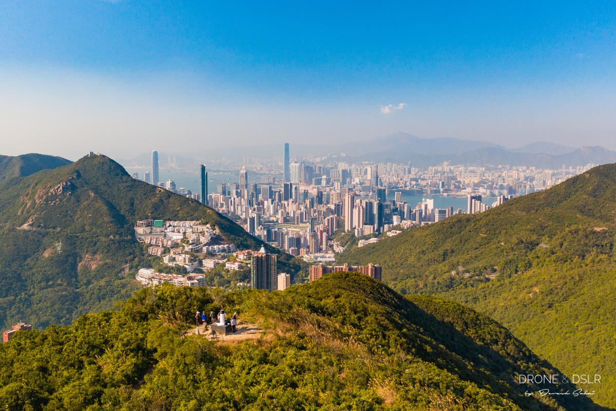
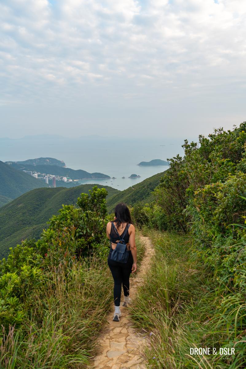
- View of Hong Kong skyline from Violet Hill
-
- The view of Stanley as you finally complete the Twin Peak Hike
Now, let’s learn about The Twin Peaks Hike in greater detail.
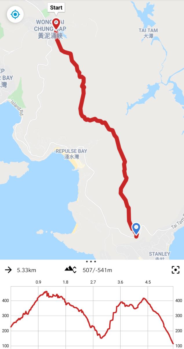
Twin Peaks & Violet Hill Hike — Map and Elevation
To illustrate the difficulty level, the elevation profile should give you a really clear picture of what to expect on The Twins Hike. Just to be clear, this hike consists of scaling and descending two subsequent hills — Violet Hill and The Twin Peaks.
It can be confusing to some, but the Twin Peaks is a single hill, with two nearly identical summits, hence the name. You can see the two peaks in the elevation map below.
You can choose to start your hike in the morning and end at Stanley for lunch. Or you could plan to end your hike at Stanley just before sunset. The views of the sun’s golden light illuminating Stanley are simply amazing!
Here’s a quick video of The Twins Hike, so that you can see what to expect.
Subscribe to my YouTube channelTwins Hike Starting Point
You can start the hike from either end, but I prefer to start from Wong Nai Chung Gap Road and finish in Stanley.
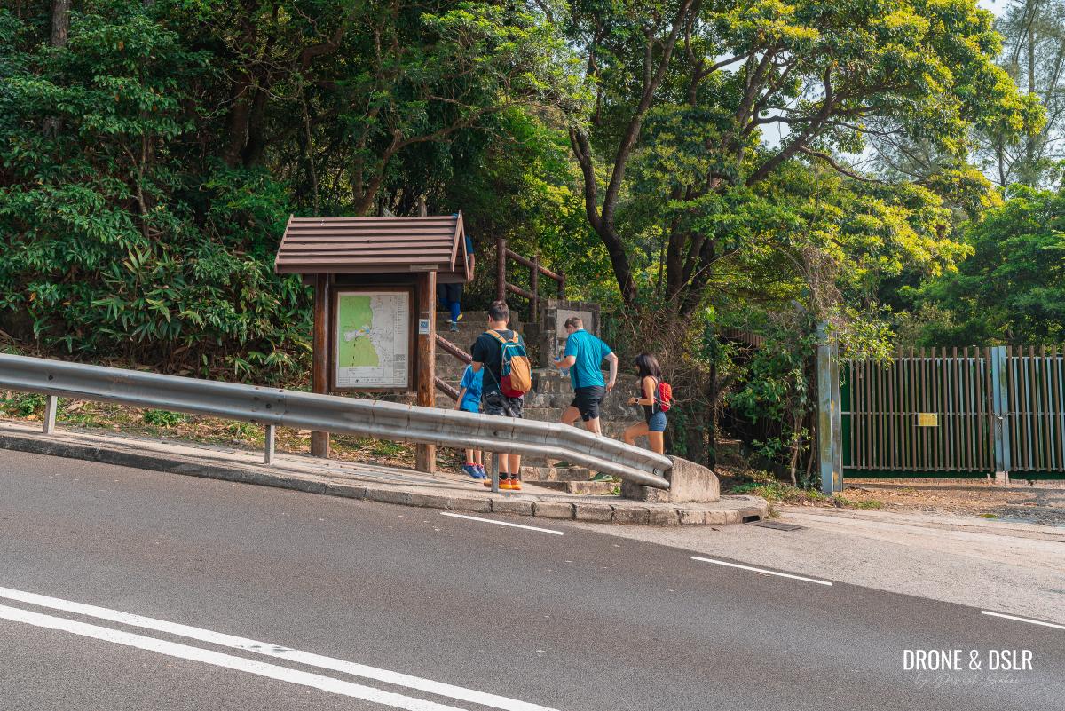
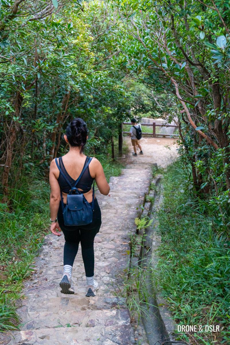
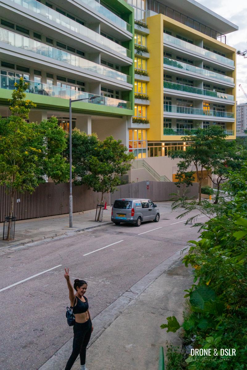
To make your way to the starting point, take bus number 6, 41A, 76, 63, or 66 to Wong Nai Chung Reservoir Park. Once you alight at the Sinopec gas station, walk up the short flight of steps that go up to Tai Tam Reservoir Road.

Walk up the steps at the end of the petrol station
This is where the Twin Peaks Hike begins.
Wong Nai Chung Gap Road to Violet Hill
Once you make your way to Tai Tam Reservoir Road, you have two options to get to Violet Hill, the easy option or the slightly more difficult option. Both options are shown in the map below.
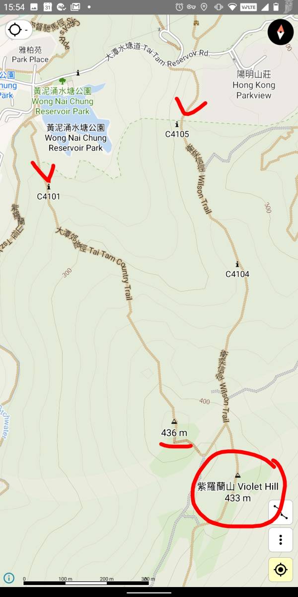
You can hike to Violet Hill via these two options
Easy Option to Violet Hill – via Wilson Trail
To take the easier option, walk up Tai Tam Reservoir Road to Parkview. Alternatively, you can also take a taxi straight up to Parkview if you’re not taking the bus.
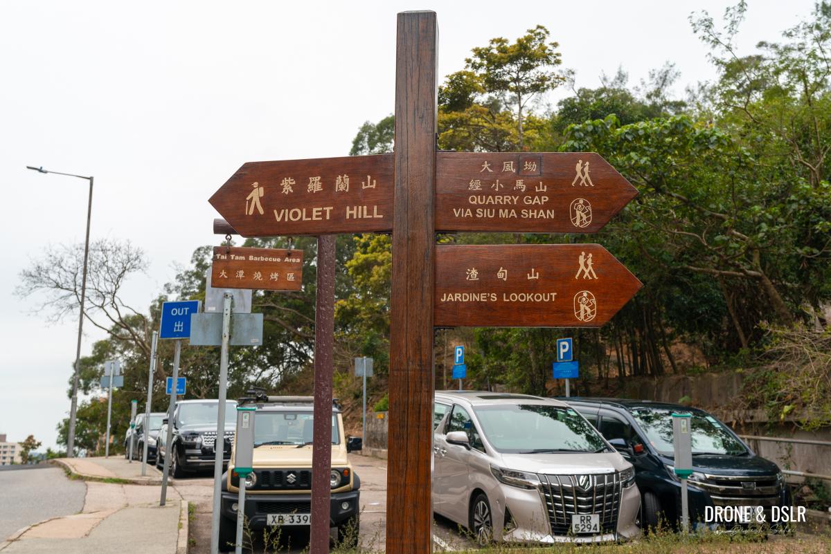
There are trails on either side of the road. Follow the signs for Violet Hill
Just besides Parkview is the entrance to the Wilson Trail. Take the entrance that goes towards Violet Hill (the other side heads to Jardine’s Lookout) and stay on the trail till you reach the highest point on this section of the hike.
-
- Entry for Violet Hill next to Parkview
-
- Violet Hill, Hong Kong
Difficult Option to Violet Hill – via Tai Tam Country Trail
If you’re up for a challenge, you could further increase the intensity of this hike.
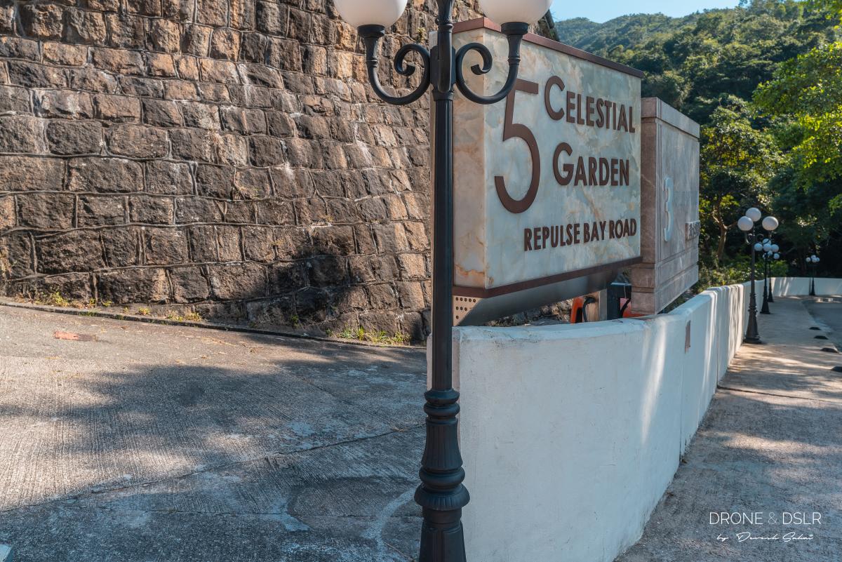
At the start of Tai Tam Reservoir Road, there is a concealed entrance to Tai Tam Reservoir Country Trail beside the entrance to Celestial Garden. Walk down the path for about 70–80 metres till it curves right and then turn left. You’ll see a sign for Violet Hill. If you continue straight, you’ll end up on the Tsz Lo Lan Shan Path.
-
- The path behind the entrance to Celestial Garden goes up to Violet Hill via Tai Tam Country Trail
-
- Follow the signs to Violet Hill

-
- Get your hiking shoes on, it’s time to climb up Violet Hill

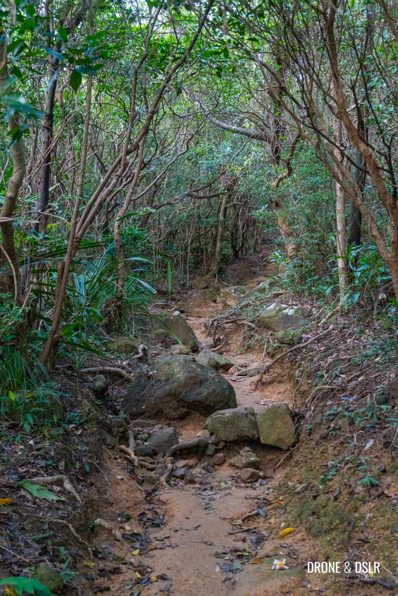
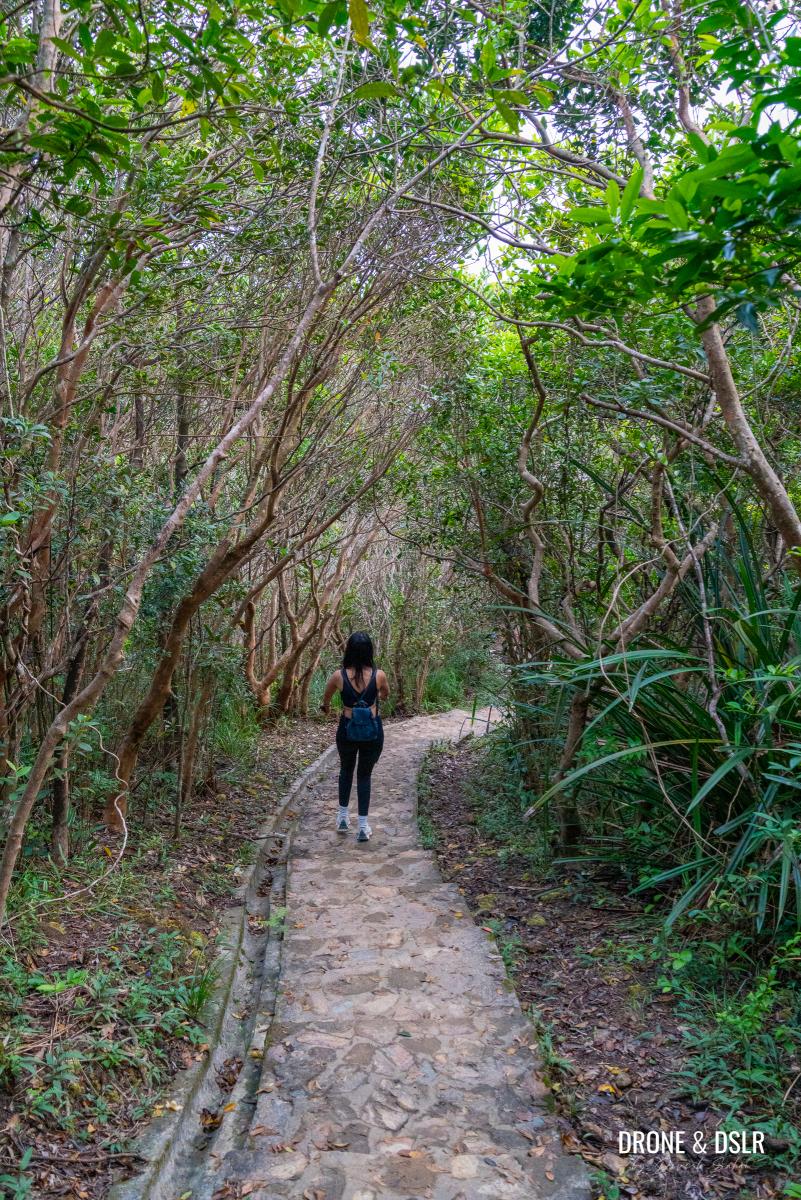
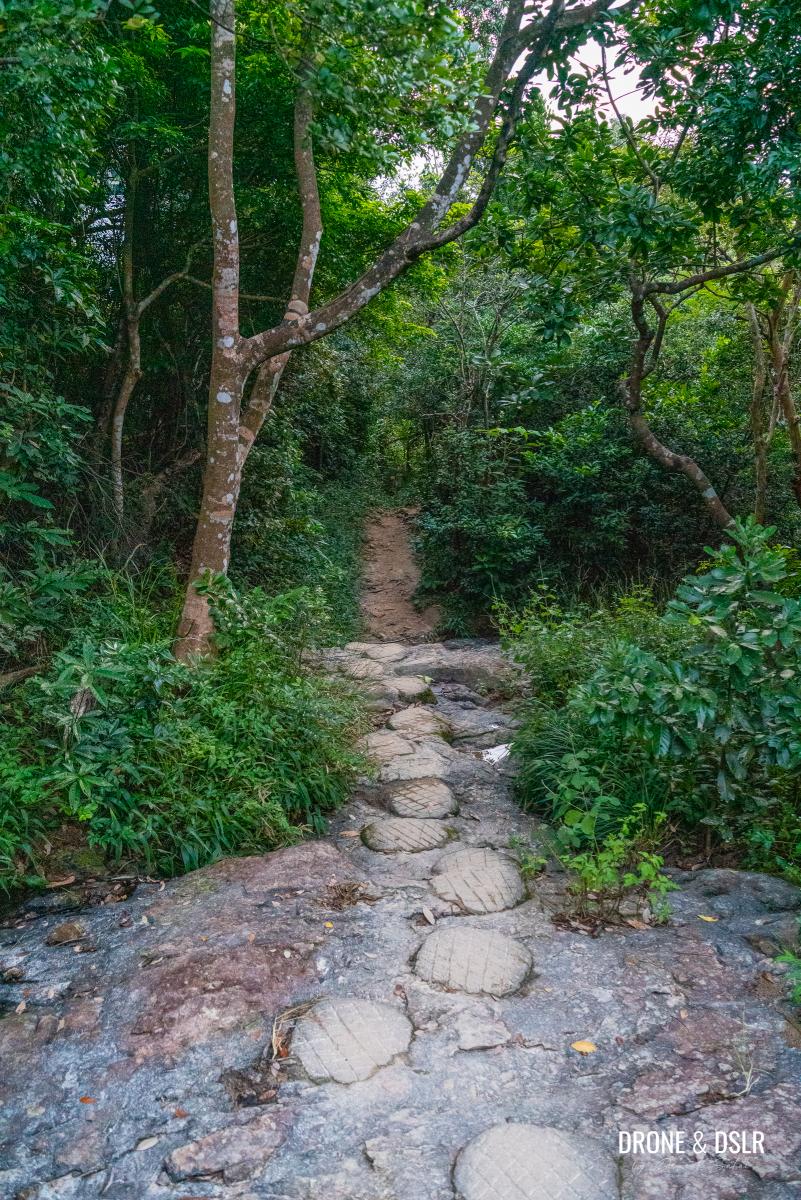
Take your time as you ascend the Tai Tam Country Trail. It starts off with a relatively easy climb before levelling out. After that, the trail becomes a much steeper climb all the way to the top.

Turn around to admire the view of the city as you’re climbing up Violet Hill
Be sure to keep looking back as the Hong Kong skyline slowly reveals itself.
This trail will bring you out to another hill that is adjacent to Violet Hill and is slightly taller (marked as 436 m on the map above).
Perhaps the only reason you’d want to climb up via the Tai Tam Country Trail is to appreciate the views of the city from this hill. On a clear day, you can appreciate the Hong Kong skyline, nestled between Mount Nicholson and Jardine’s Lookout.
The view of Hong Kong from the peak next to Violet Hill is beautiful
Continue to Violet Hill
After you’re done admiring the views from this vantage point, continue along the trail, which dips between the two hills, before connecting with Wilson Trail.
-
- Continue hiking from the unnamed hill
-
- To reach Violet Hill (right opposite), you must first cross the gap between the two hills

-
- Walk up the trail towards Violet Hill
-
- Walk onto Wilson Trail from the gap
Once you emerge on Wilson Trail, turn right and walk uphill till you reach Violet Hill.
-
- Turn right once you reach Wilson Trail
-
- The final climb to Violet Hill
-
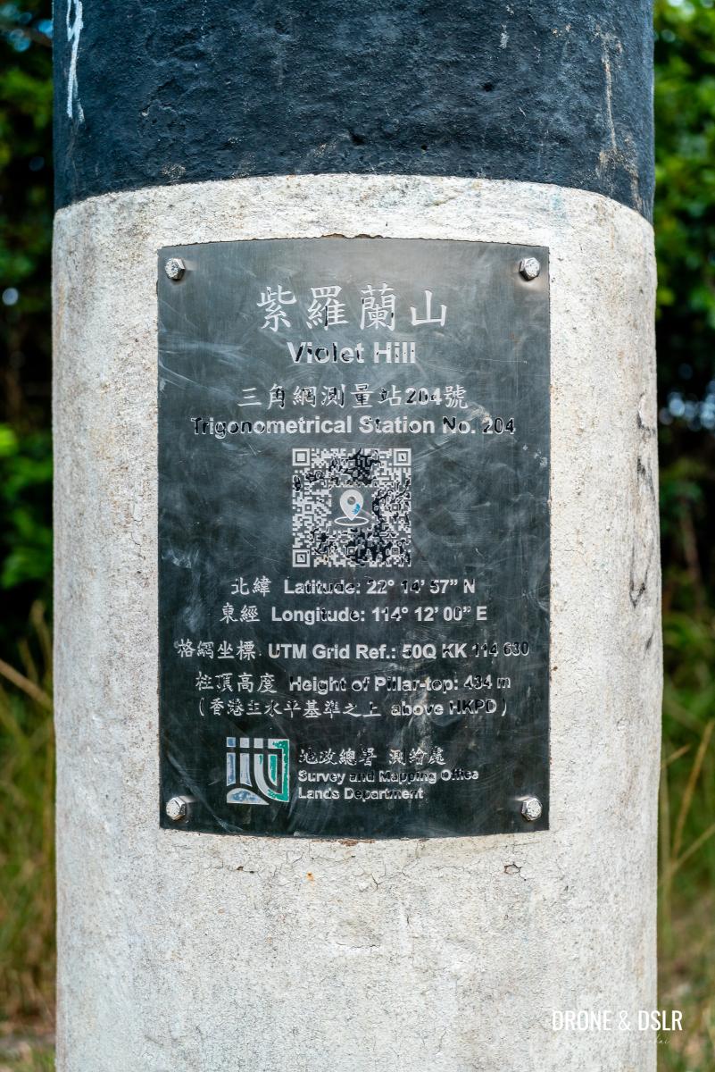
- Standing on top of Violet Hill
Sadly, there are no views from Violet Hill. But that changes going ahead.
Violet Hill to Tze Kong Bridge (Repulse Bay Gap)
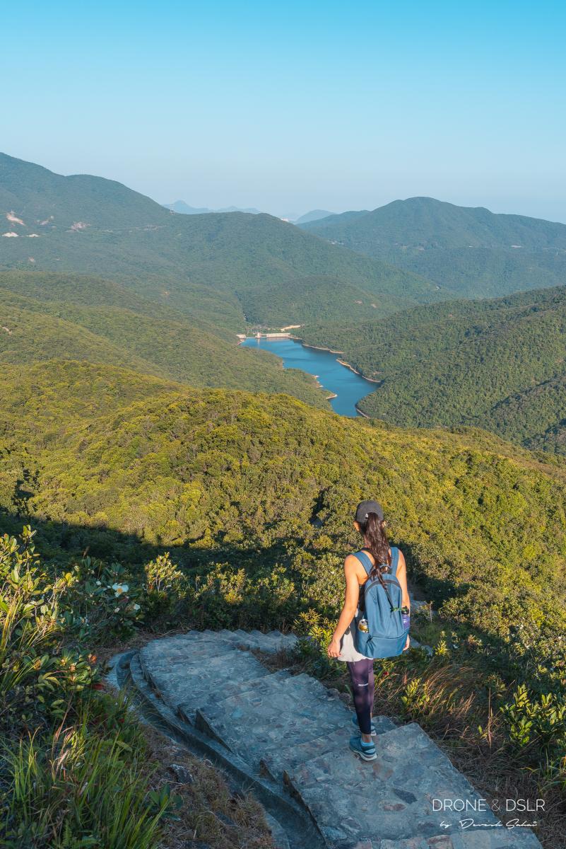
The hike from Violet Hill down to Tze Kong Bridge, on Wilson Trail Section 1, starts gradually. The trail runs along the side of the hill, with views of Tai Tam Reservoir to the left, and Repulse Bay straight ahead.
-
- Continue hiking from Violet Hill

-
- A short distance from Violet Hill, the views open up
-
- The trail veers right and descends

The trail then veers right, before continuing down another very scenic section with stunning views of Tai Tam Country Park. Further ahead as the trail begins to dip, views of Repulse Bay reappear on the horizon.
-
- Gorgeous Views of Tai Tam Country Park

-
- Coming down Violet Hill
-
- The views of Repulse Bay while descending Violet Hill

-
- View of Tai Tam Country Park as you come down from Violet Hill
-
- The shade comes and goes while descending Violet Hill
-
- A lovely day to take on the Twin Peaks hike
The trail moves through open spaces and covered sections before finally approaching the steep descent.
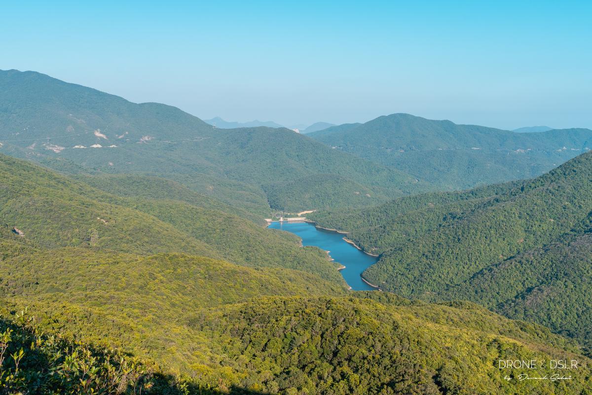
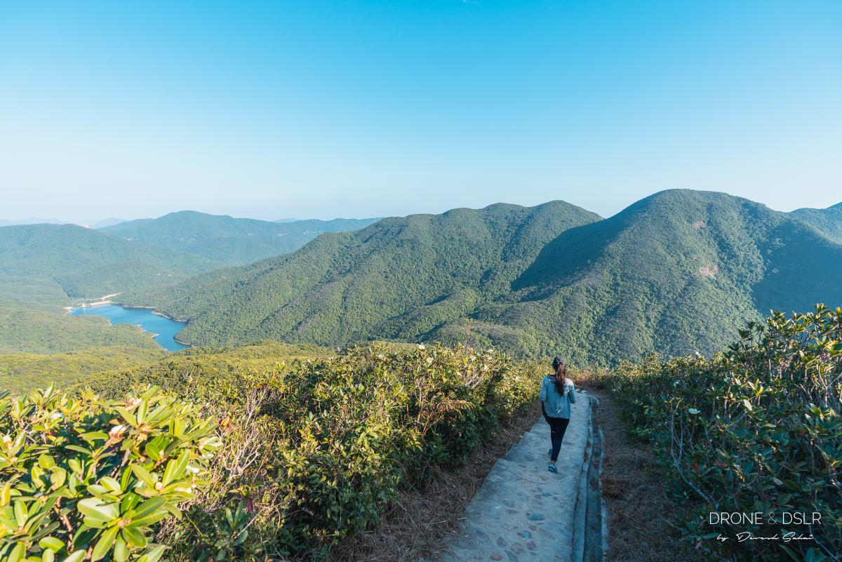
As you begin the steep descent, Tai Tam Reservoir appears right in front of you and believe me it looks stunning from this height and angle. Moreover, from these steps, you can also see the incredibly steep trail that runs up the hill in front of you. That’s the trail up to the Twin Peaks!
-
- What a beautiful view of Tai Tam Reservoir as you descend down Violet Hill
-
- From here you can see the thin trail running up to The Twins
-
- Walk past the point where Tsz Lo Lan Shan Path meets Wilson Trail
Keep following the steps downhill at a comfortable pace. Appreciate the views and prevent any knee injury — that’s my advice.
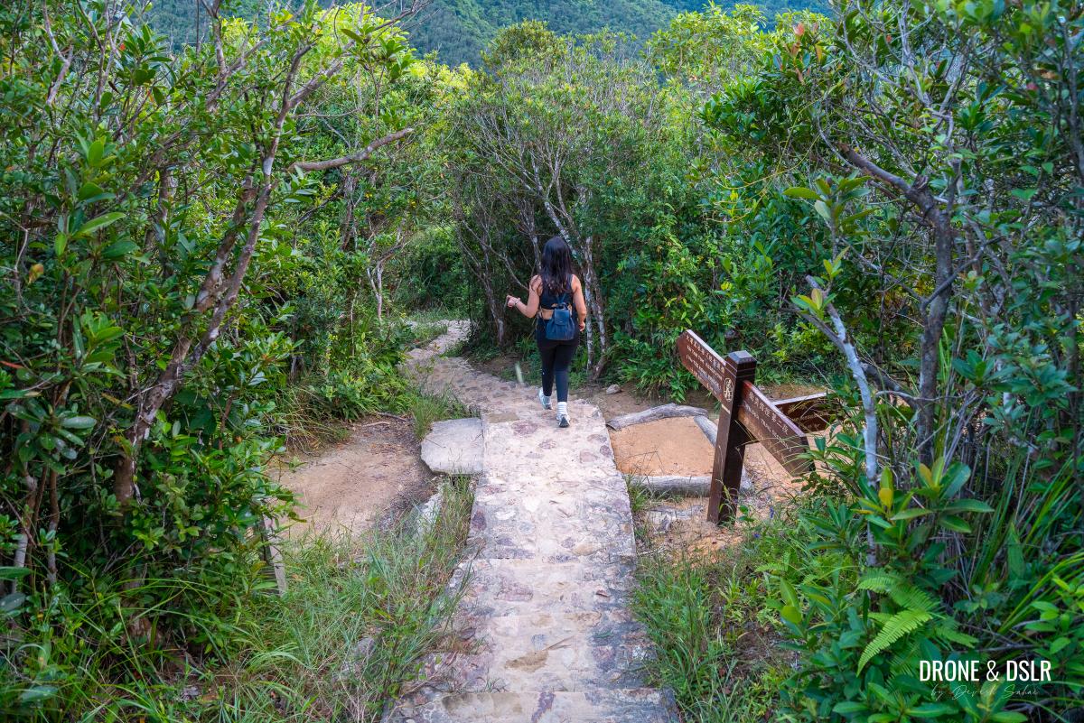
Shortly before the Wilson Trail reaches Tze Kong Bridge, it passes the intersection with the Tsz Lo Shan Path. Keep following the steps till you reach the resting area next to a small bridge.
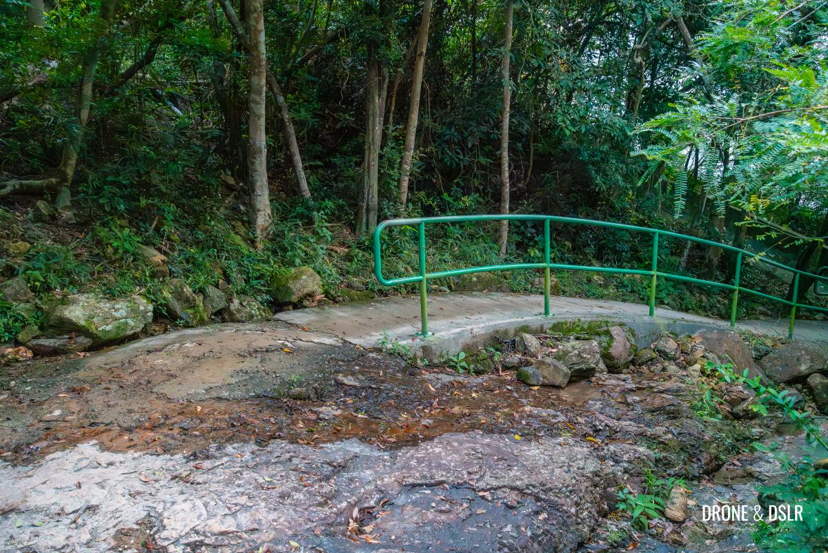
Arriving at Tze Kong Bridge (Tsin Shui Wan Au)
Tze Kong Bridge is a short pedestrian bridge over a stream of water that runs into Tai Tam Reservoir. It serves as the midway point between Violet Hill and The Twins.
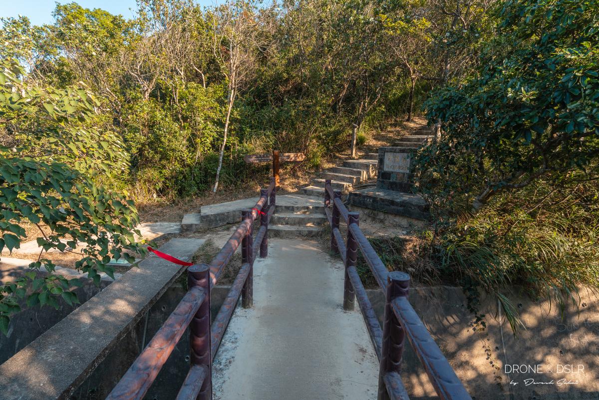
The Tze Kong Bridge sits between Violet Hill and The Twins
When you finally make it to the bridge, take a moment to relax. Take more if needed, because the next section of the hike is going to make you wish that you were back home, sitting on your couch!
Repulse Bay Exit from Tze Kong Bridge (Optional)
If you’re continuing to The Twins and Stanley, ignore this and skip to the section below.
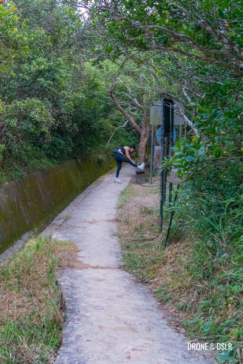
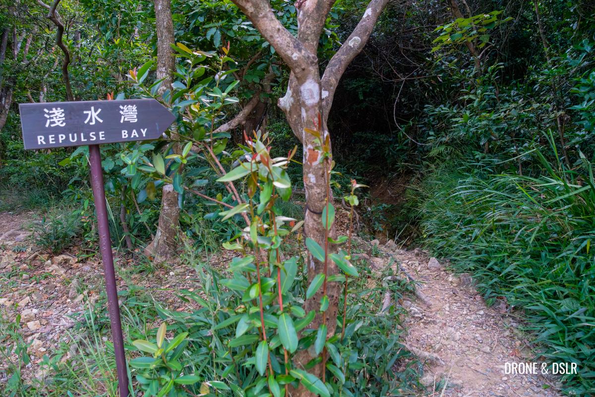
If for any reason, you wish to exit the hike at this stage, there is a fairly rugged path to Repulse Bay. Instead of crossing the Tze Kong Bridge, turn right and walk a few steps along the canal till you see a sign for Repulse Bay.
-
- Turn right before Tze Kong Bridge if you want to exit to Repulse Bay
-
- Follow the sign and descend onto the narrow path
Take the narrow path and walk downhill. Depending on the season, the trail can be slightly slippery. So, walk with caution.
-
- It doesn’t help that the exit to Repulse Bay is a bit tricky

-
- This exit is a bit rough
Also, as the trail runs along an old streambed, I imagine it could become treacherous during the rainy season.
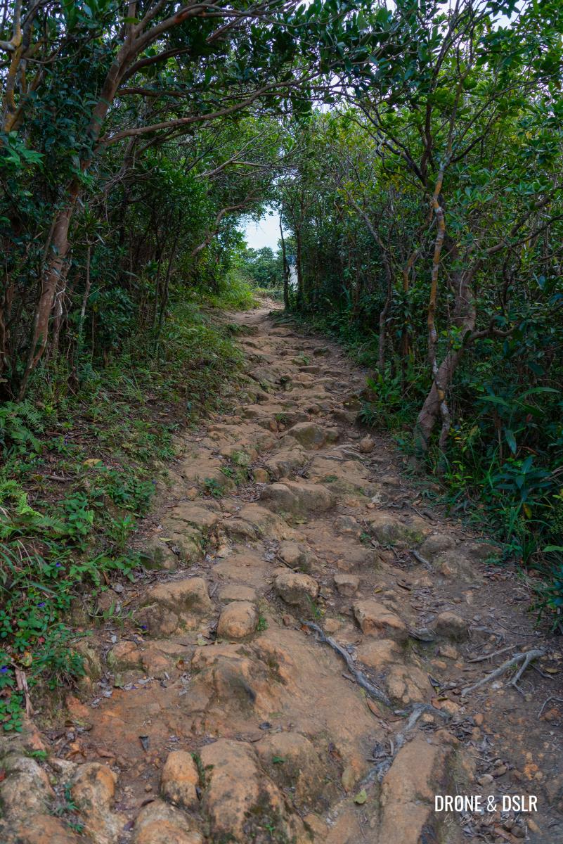
From the stone path to the dirt path
Keep following the trail till it veers left and reaches a paved path with a side railing.
-
- Hop across to the paved path
-
- Almost at Repulse Bay
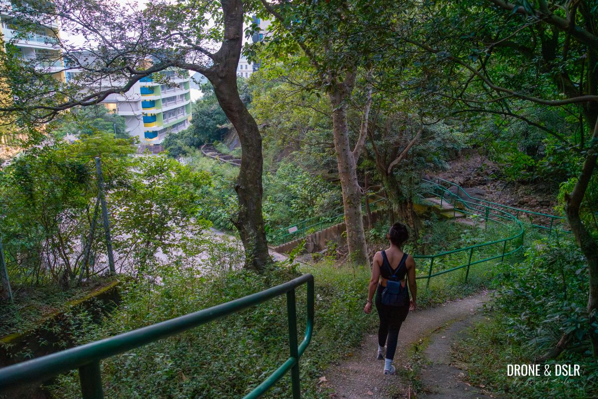
Take that path and walk down the steps onto South Bay Road, next to Hong Kong International School.
Exiting next to the Hong Kong International School
From here, Repulse Bay Beach is a 10-15 minute walk.
Tze Kong Bridge to The Twins
After you cross the Tze Kong Bridge, follow the signs to Stanley Gap Road to the right.
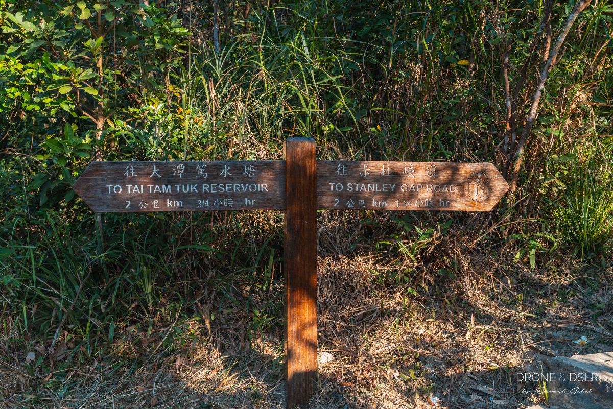
Follow the sign to Stanley Gap Road
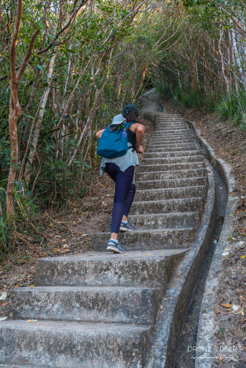
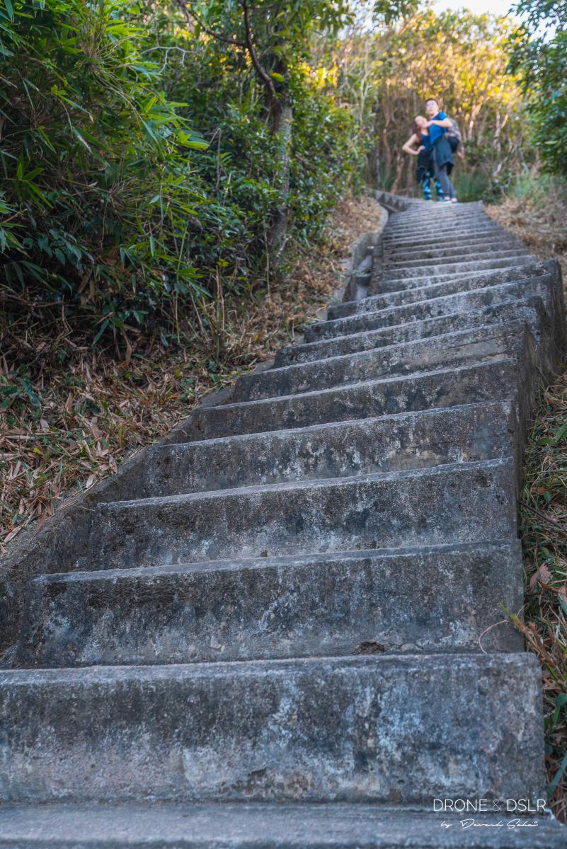
The steep hike up to The Twins consists of 1,200 daunting, steep steps. The steps feel endless and relentless. You’ll find yourself running out of breath quite often and your glutes hurting like crazy. Don’t worry, sit down on the steps. You’ll find plenty of other hikers doing the same thing.
-
- The journey begins up the 1,200 steps flight to The Twins
-
- The steep, relentless steps of the Twin Peaks Hike
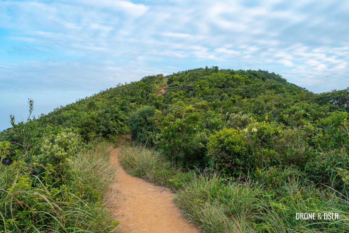
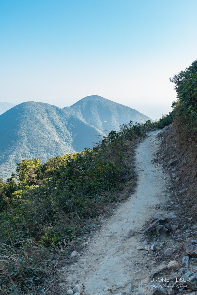
Fortunately, the steps are shaded to the top. Once you emerge from the steps, the trail quickly flattens out. This is the first peak of The Twins.
The Twins are two (almost) equal peaks on the top of this hill. They are separated by a short ridge between them. This means that after you cross the first Twin, expect the trail to dip before climbing again. As I said, this section of the hike feels endless and relentless!
-
- The Terrible Twins hike – the hill at the back is Violet Hill and here we’re almost at the top of the Twins
-
- The final flight of steps to the second of The Twins

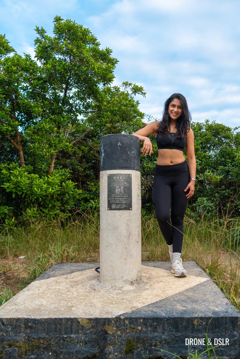
After you finally reach the second peak of The Twins, you can breathe a sigh of relief because it’s all downhill from here!
If you’re expecting scenic views from on top of either of The Twins, you’ll be disappointed. If it wasn’t for the markers, you wouldn’t even know that you had conquered The Twins.

The final of the Twin Peaks was very uneventful.
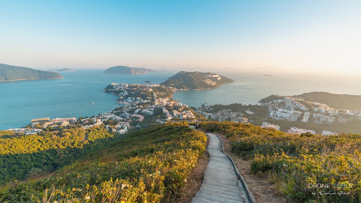
Nonetheless, the most scenic views lie just ahead after The Twins at the ridge that opens up to Stanley.
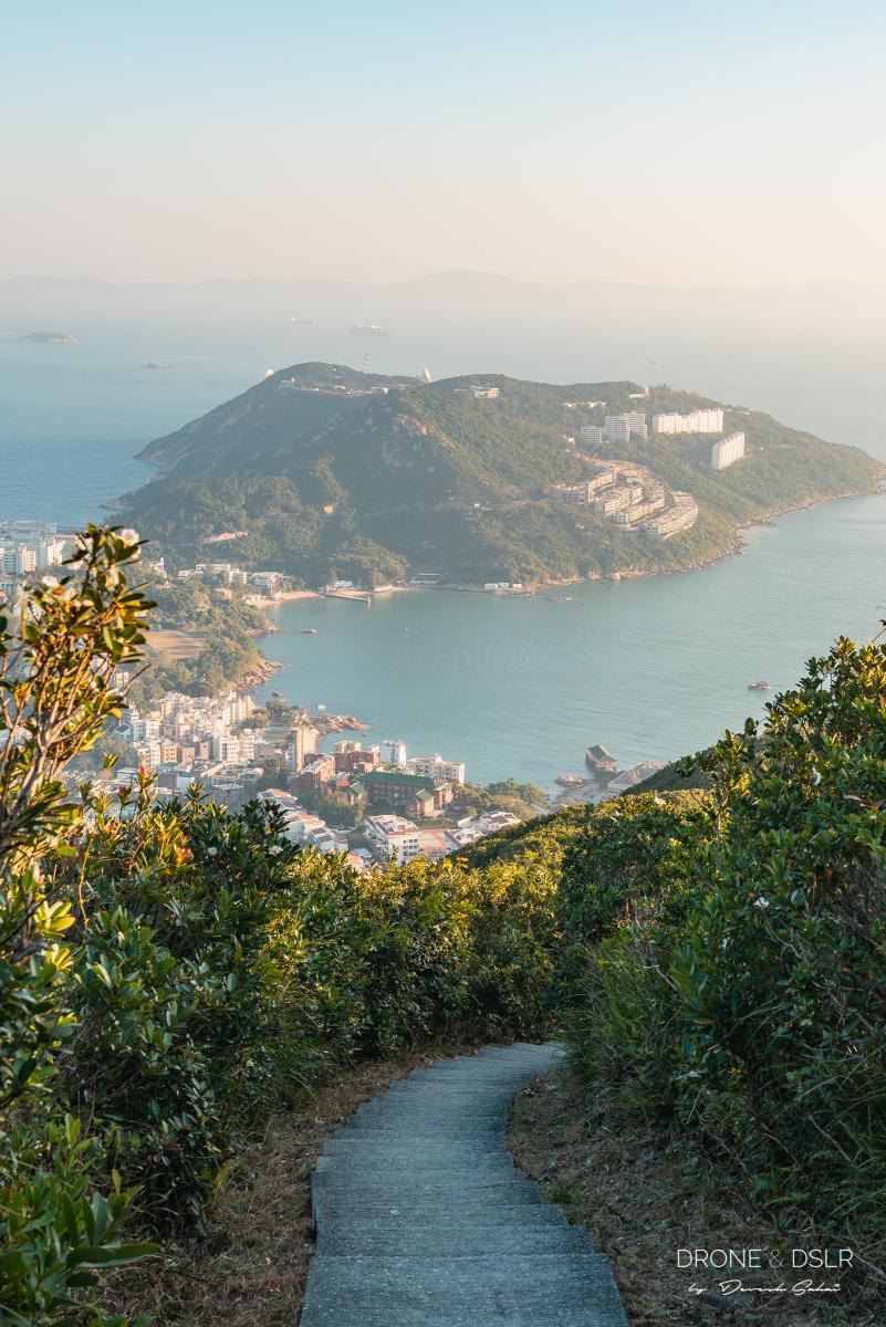
After the second Twin Peak, this is the view that reveals itself
The Twins to Stanley Gap Road
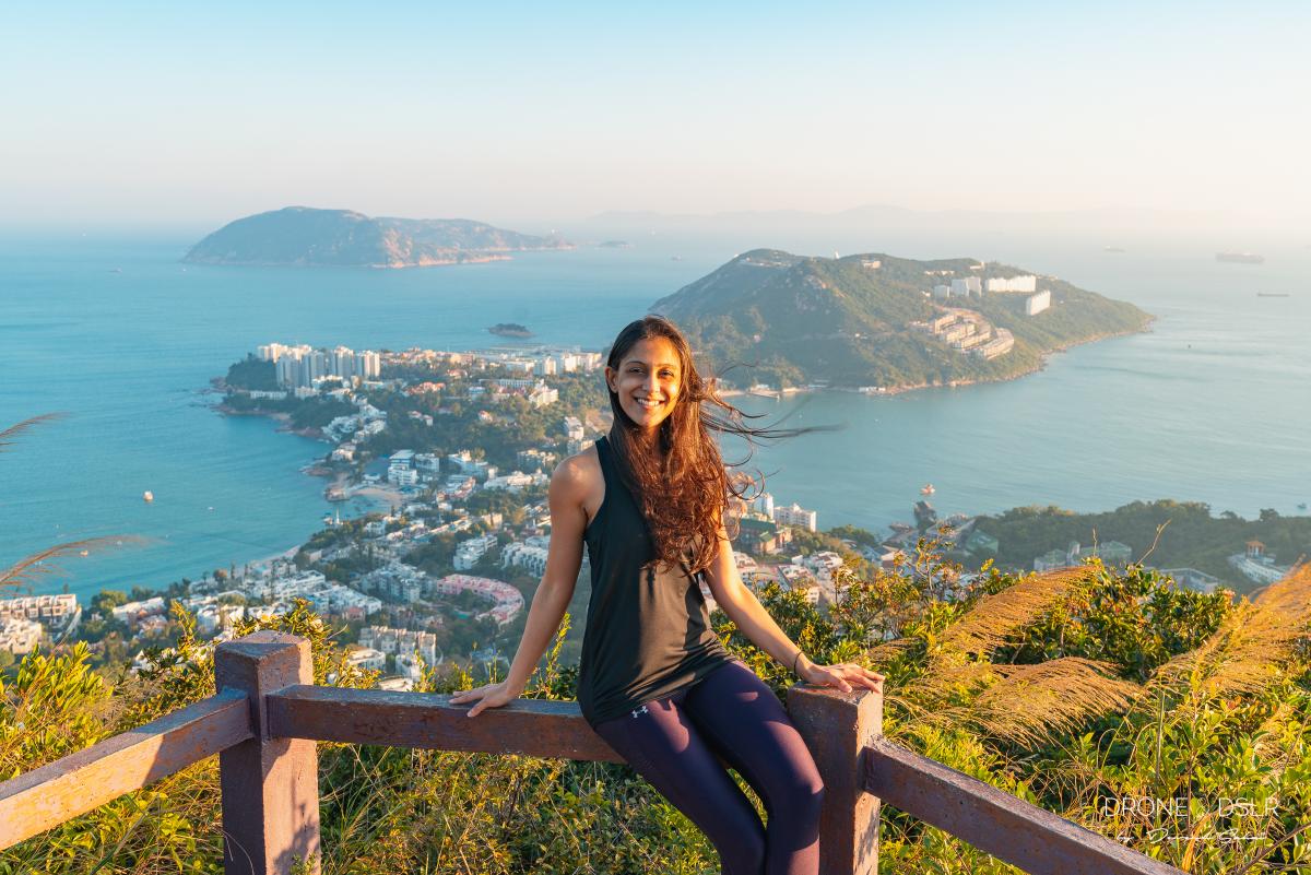
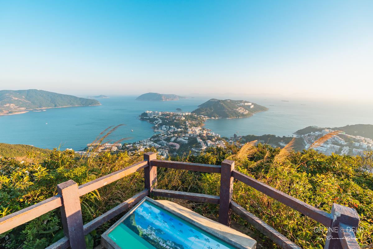
Just as you begin the descent towards Stanley, the spinal ridge that runs along the hill opens up with some of the most beautiful views. In front of you Stanley, on the left is Tai Tam Bay, and on the right Stanley Bay. On a clear day, the views from here are simply gorgeous!
Admittedly, these views are best enjoyed from the Ma Kong Shan View Compass where you can soak it all and get those amazing Instagram shots.
-
- Ma Kong Shan View Compass at The Twins

-
- Bathing in the glow of the sunlight at Ma Kong Shan View Compass
-
- View of Stanley from Ma Kong Shan View Compass
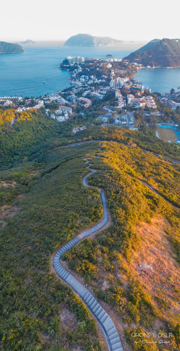
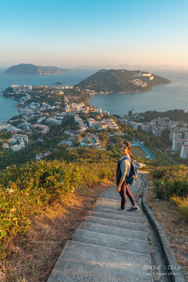
Undoubtedly, my favourite part of the Twin Peaks Hike is towards its end. More specifically, the short section between the Ma Kong Shan View Compass and Stanley Gap Road. This twisting, steep stairway that is open on all sides and has a direct view of Stanley below feels almost surreal! You can also see this trail from the Stanley Promenade.
-
- Aerial view of the final descent onto Stanley Gap Road. The slithering steps, and Stanley Village on the horizon
-
- The final set of steps to Stanley from The Twin Peaks
-
- Happy to be completing The Twins Hike
How to End the Twins Hike?

The end of the Twin Peaks and Violet Hill Hike
The trail finally ends on Stanley Gap Road. From here, you have two options:
- Head to Stanley and grab a drink or meal along the promenade, or
- Head back towards the city
In case you want to head to Stanley, stand at the bus stop on the same side of the road, and catch any bus headed to Stanley Village. These would include numbers 6, 6A, 73, and 260.
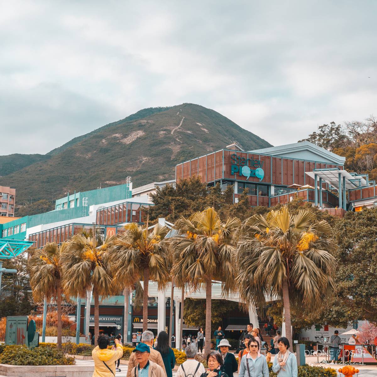
Stanley Plaza with the end of the Twin Peaks trail behind
On the other hand, if you want to head back to the city, cross the road carefully and wait for one of the buses or a taxi.
The Twins and Violet Hill Hike
I’m fairly positive that at the end of this hike, you probably wouldn’t be able to feel your legs. But you’d also be proud of what you’ve accomplished. The Twin Peaks hike is one of those hikes that manages to balance effort and reward.
If you happen to be hiking this trail between November and February, keep an eye out for the beautiful flowers that bloom along this hike. Such as the violet-coloured enkianthus and the fried-egg-looking polyspora axillaris.
-
- The fried egg looking polyspora axillaris flower

-
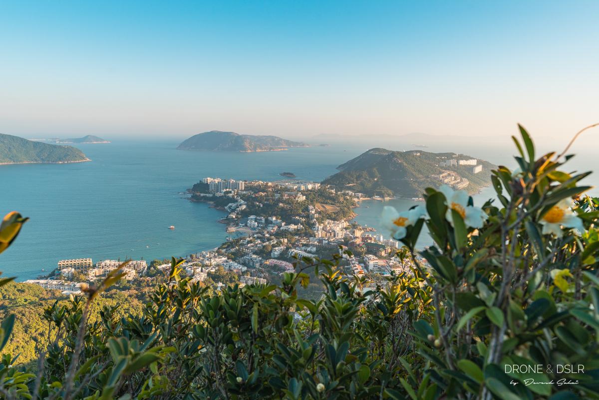
- The Stanley peninsula with the fried egg flowers in the foreground
If you’re looking for another scenic yet slightly less challenging hike, we highly recommend the Jardine’s Lookout and Mount Butler Hike, which also starts from Parkview.
Finally, we hope you enjoyed our guide to the Twin Peaks and Violet Hill Hike. As always, feel free to share this post or leave a comment below.
If you enjoy our work, come join us on Instagram and YouTube 🙂


You might also like


4 Comments
This was an excellent guide to get me to and through this beautiful hike! Thank you for sharing this! The beauty was well worth the challenging climb 🙂 Highly recommend!
Thank you, Kristen! We really appreciate your feedback and congrats on conquering the Twin Peaks!
Just finished this hike. The climb and descents were challenging. But the view at the end was well worth the effort. From Stanley Gap Road, crossing the road led me to a sign for a trail to Stanley Plaza. It was a short hike down to the Plaza.
That’s true, the views coming down into Stanley are beautiful (especially on a clear day)!