
The Ngong Ping 360 Rescue Trail Hike is a 5.7 km gruelling climb from Tung Chung to Ngong Ping, where the Tian Tan Buddha (Big Buddha) is located.
If you’ve ever taken a ride on the Ngong Ping 360 cable car, it’s hard to miss this trail and the steady stream of hikers below. Although the cable car offers a comfortable ride to the Big Buddha, the same can’t be said for hiking up the Ngong Ping 360 Rescue Trail. The challenging hike isn’t an easy alternative to a cable car ride and requires a high degree of fitness to complete it.

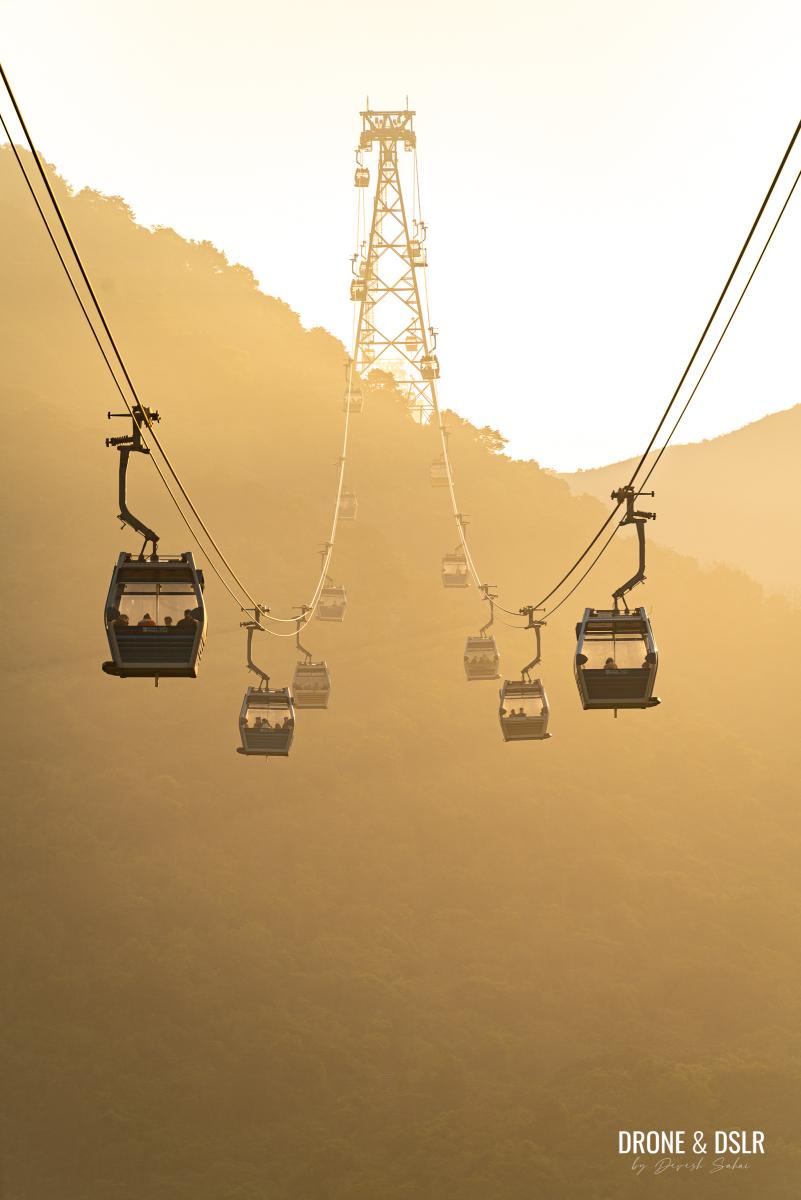
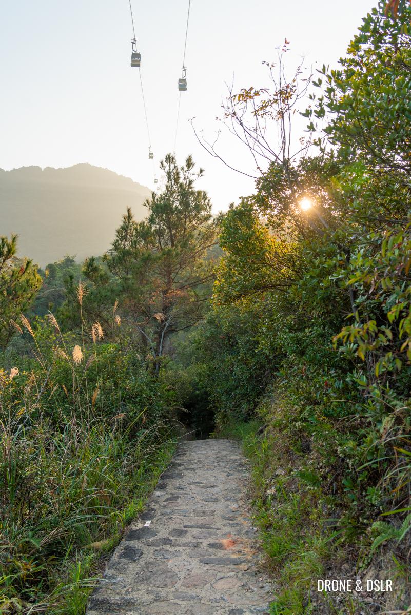
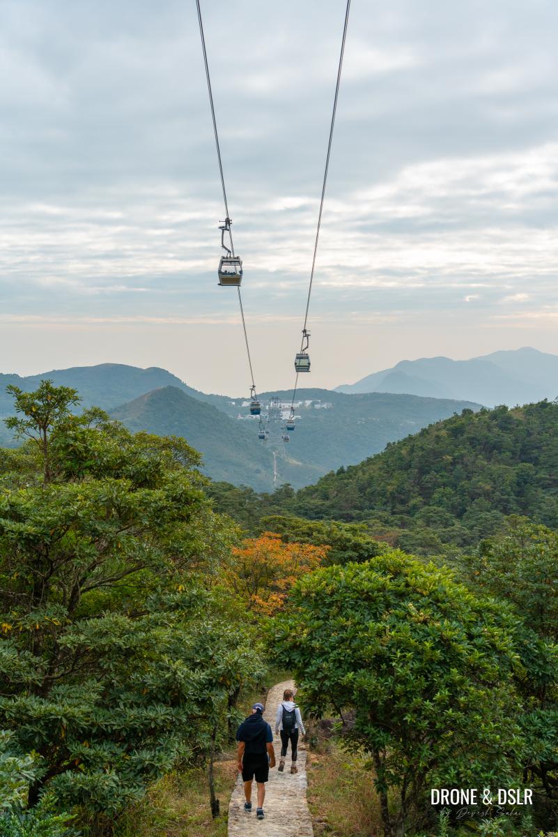
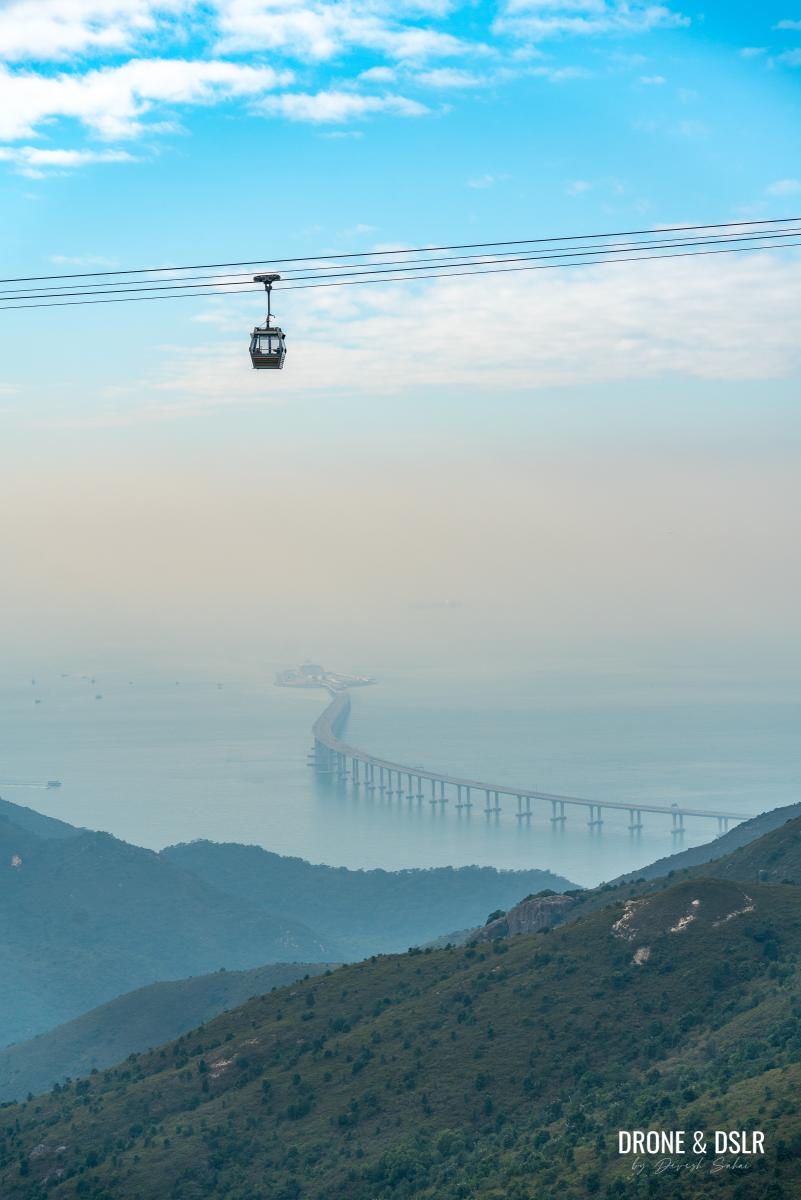
The only hike in Hong Kong with a cable car running overhead
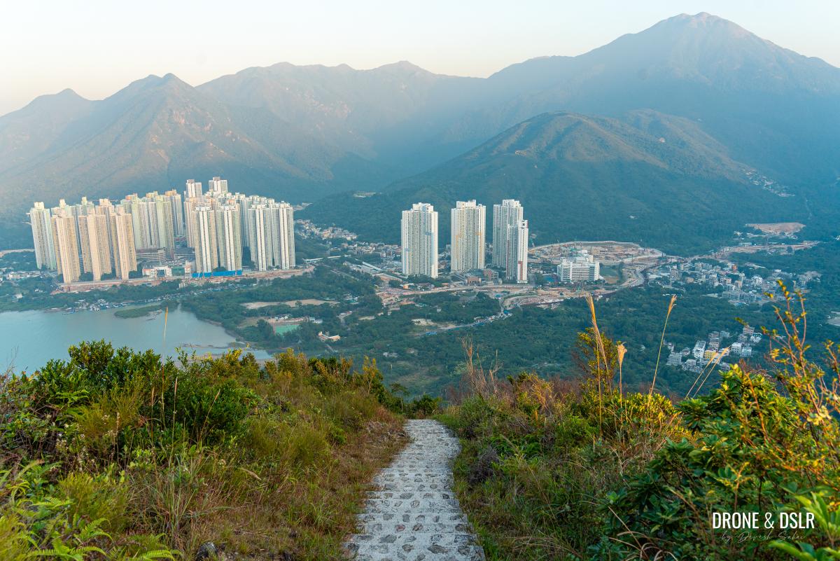
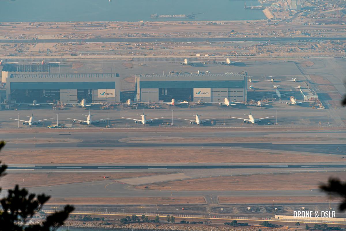
But once on the trail, the scenic views will more than make up for its challenging nature. The highlights include fabulous views of the Hong Kong International Airport while hiking under the cable cars. Not only that, but one can also appreciate the natural beauty found in the mountains of Lantau Island, which the trail has managed to preserve for the most part.
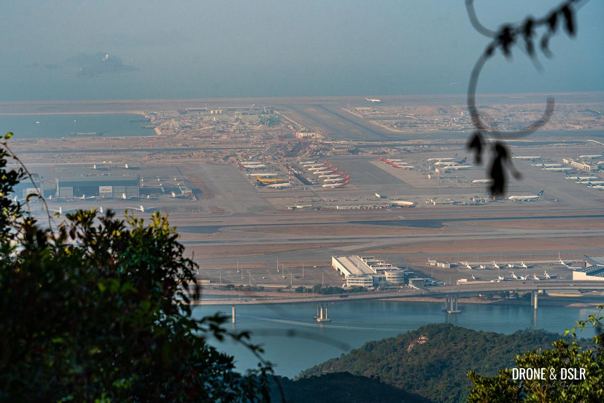
Views of the Hong Kong International Airport from the Ngong Ping 360 Rescue Trail
About The Ngong Ping 360 Rescue Trail

Ngong Ping 360 Rescue Trail map, directions, and elevation profile
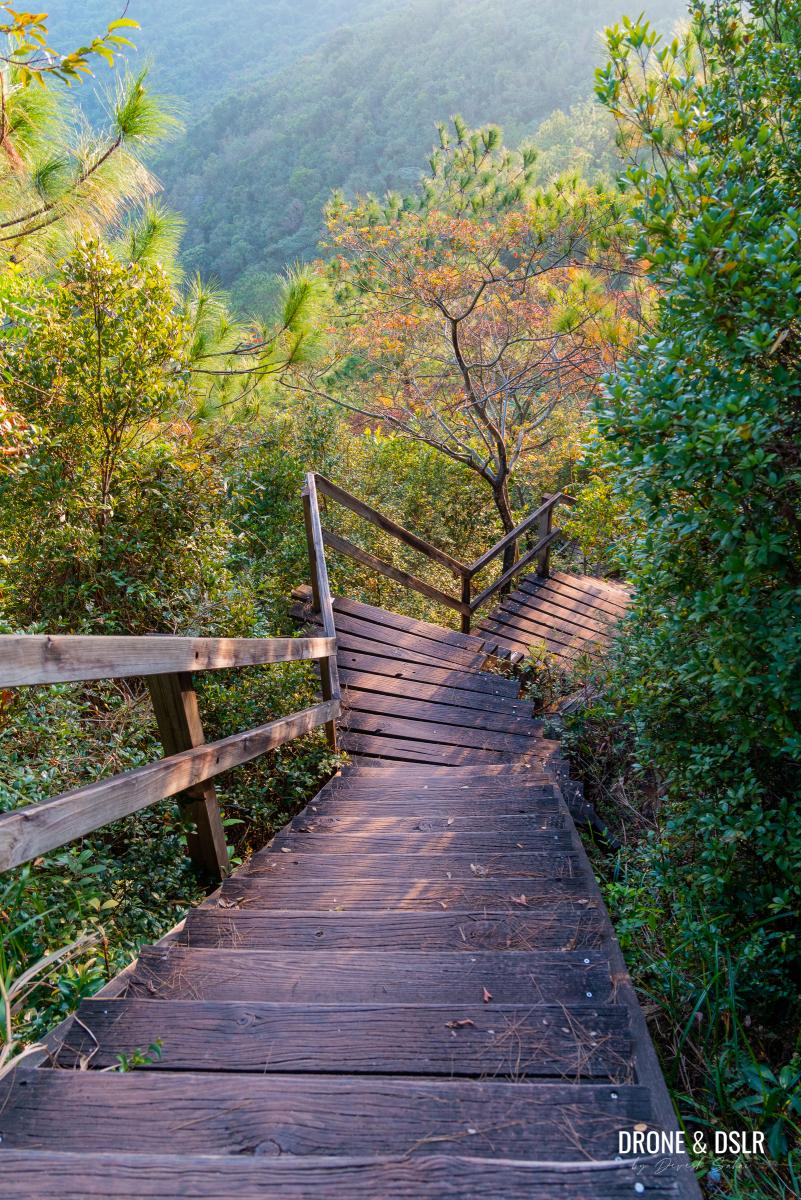
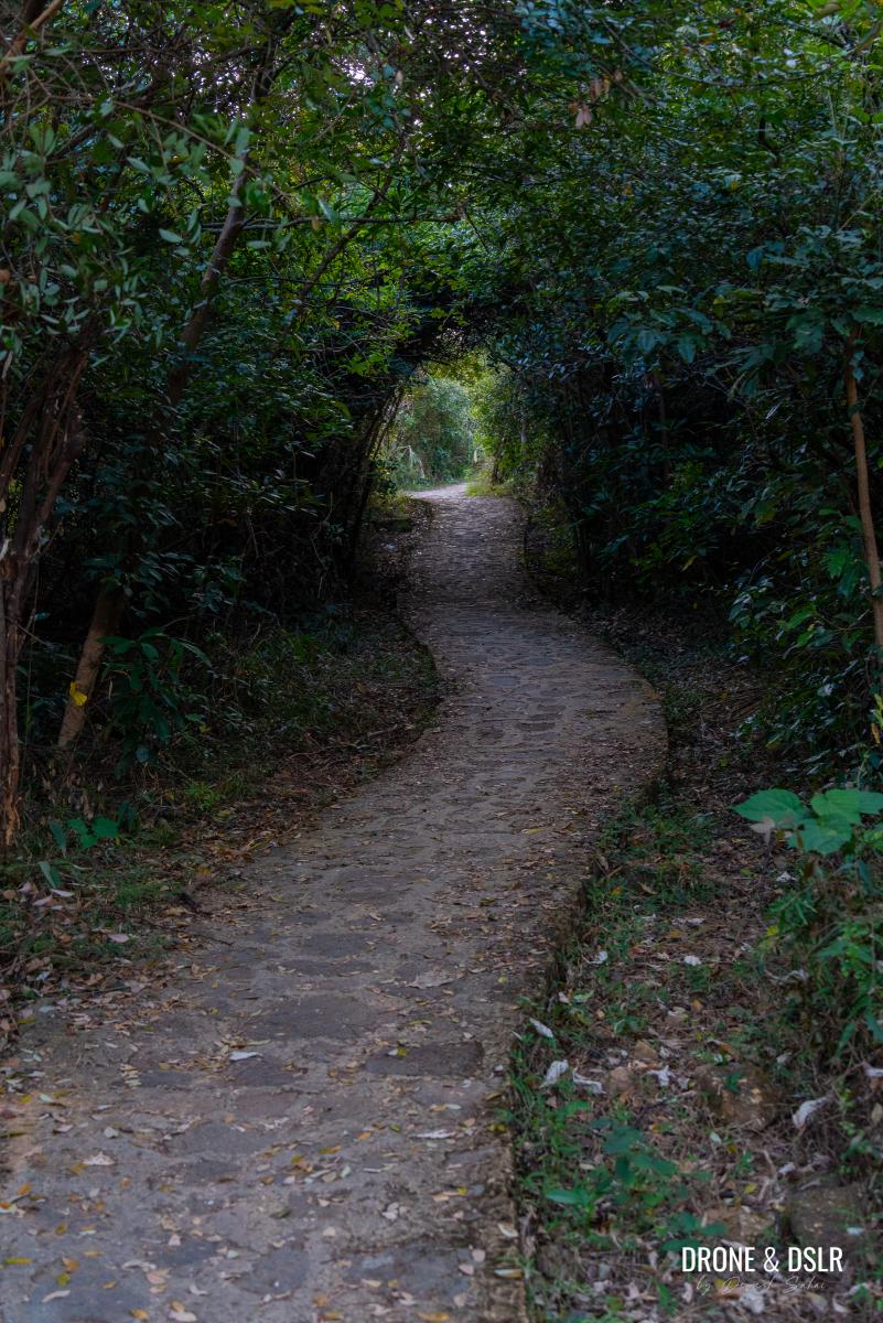
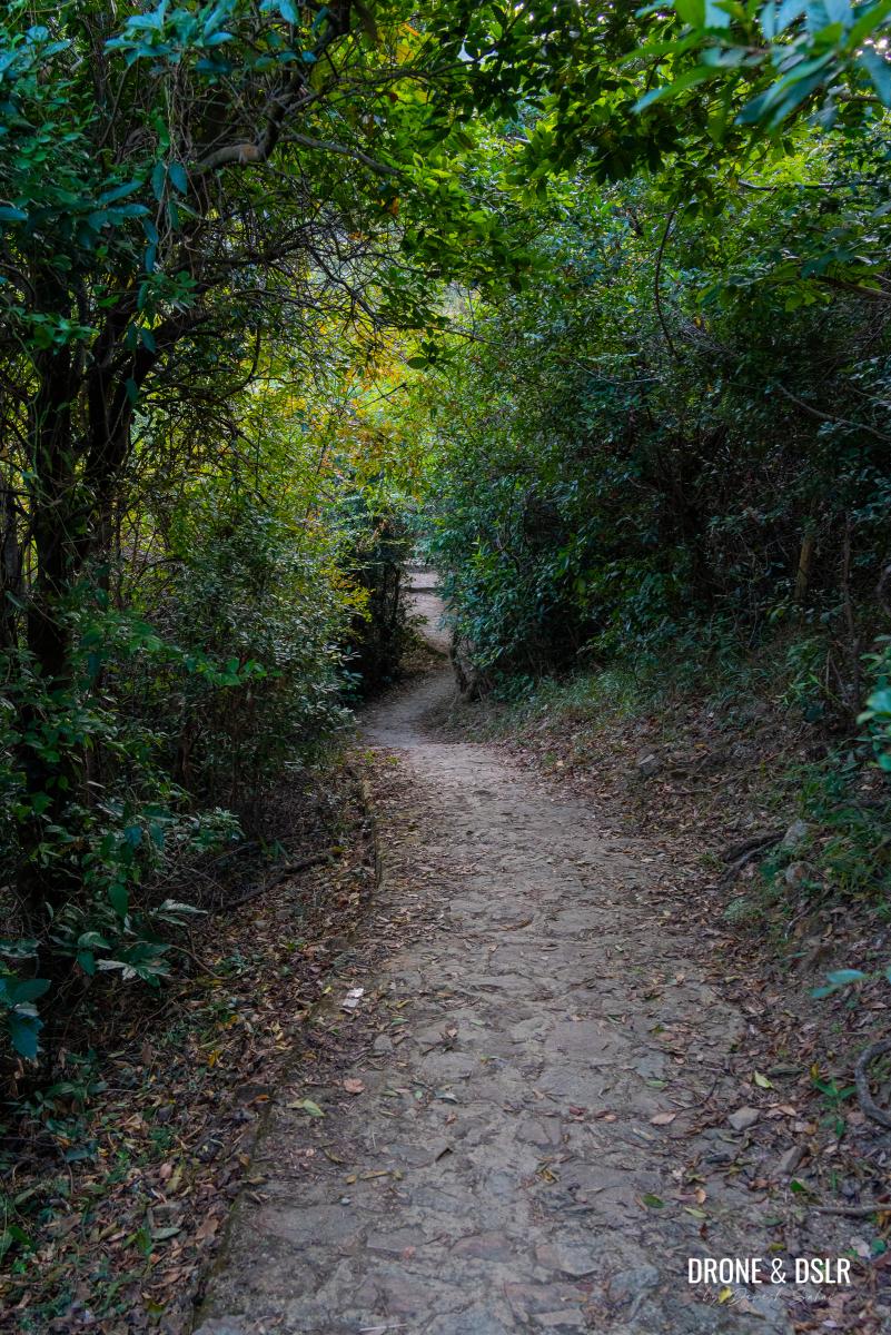
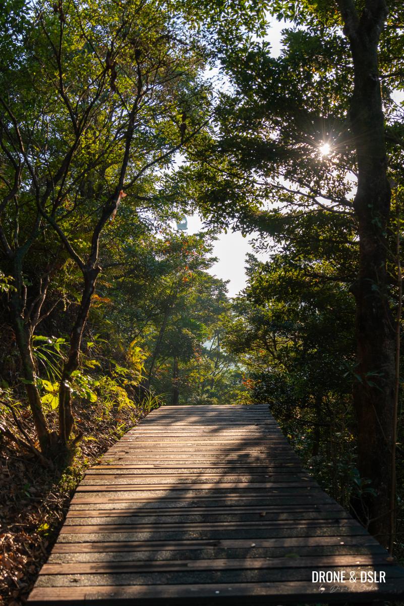
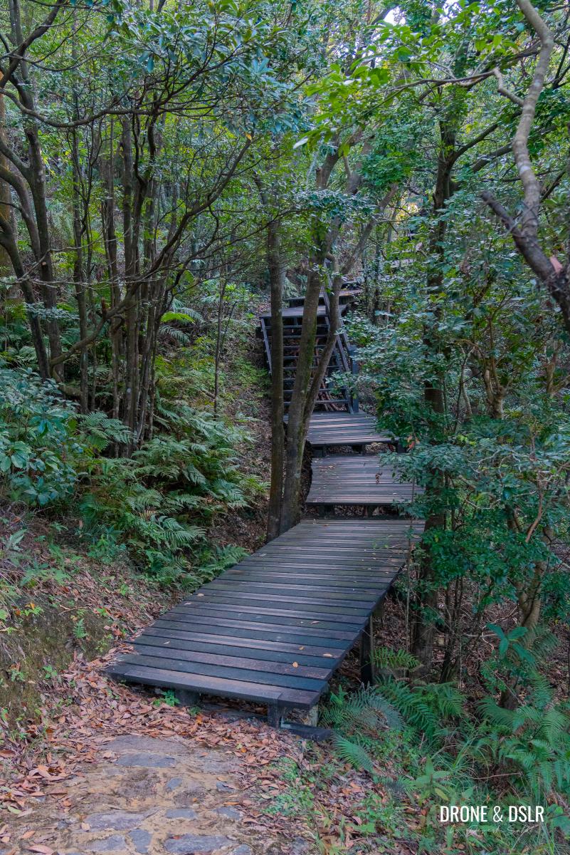
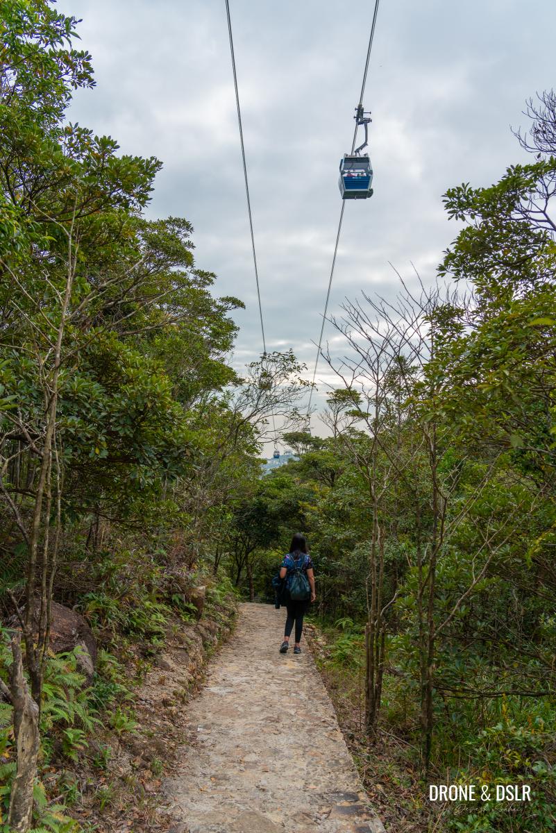
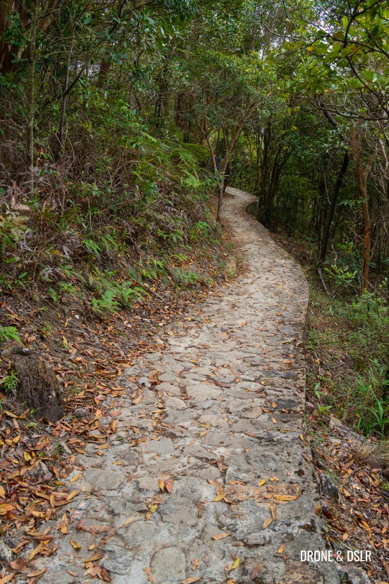
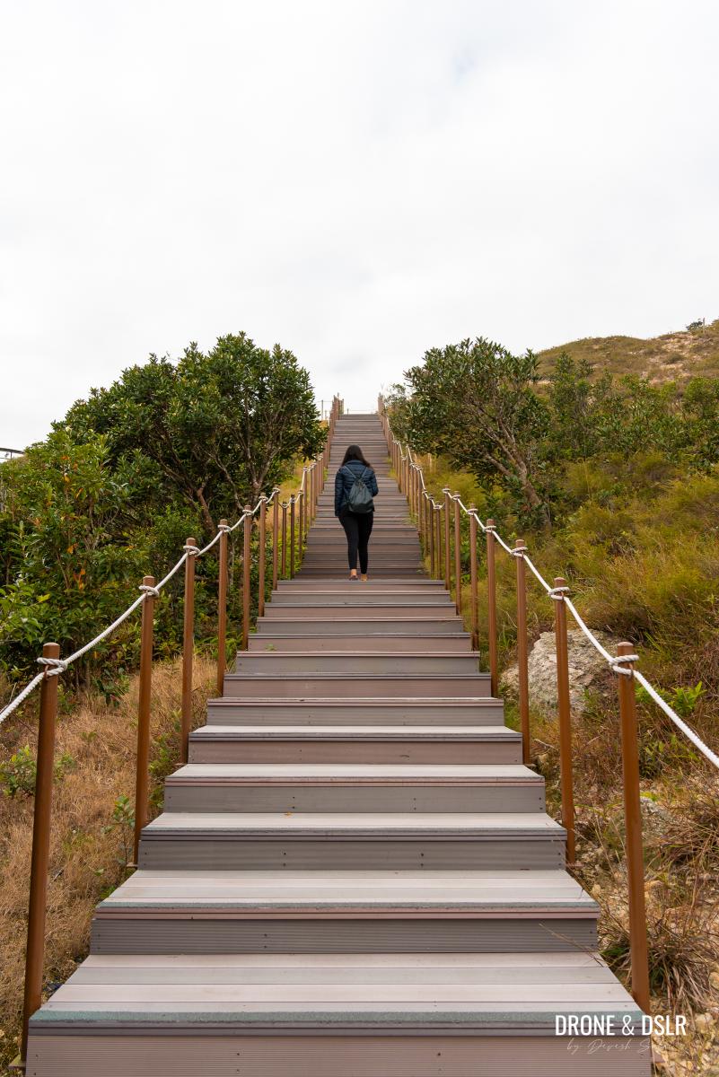
The Ngong Ping 360 Rescue Trail is a 5.7 km well-maintained trail below the Ngong Ping 360 cable car. The trail is paved, from end to end, either with stones and cement or wooden planks. The wooden planks are used in sections to preserve the natural environment.
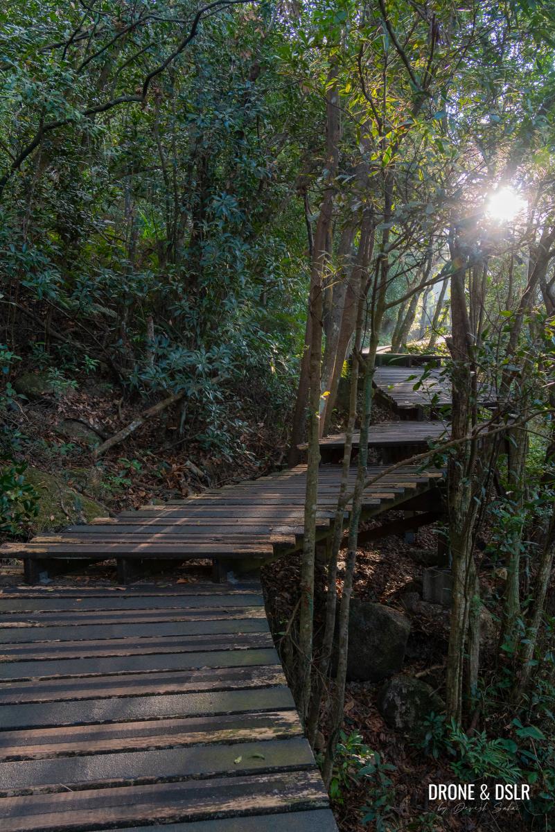
The wooden boardwalks add a nice touch to the trail
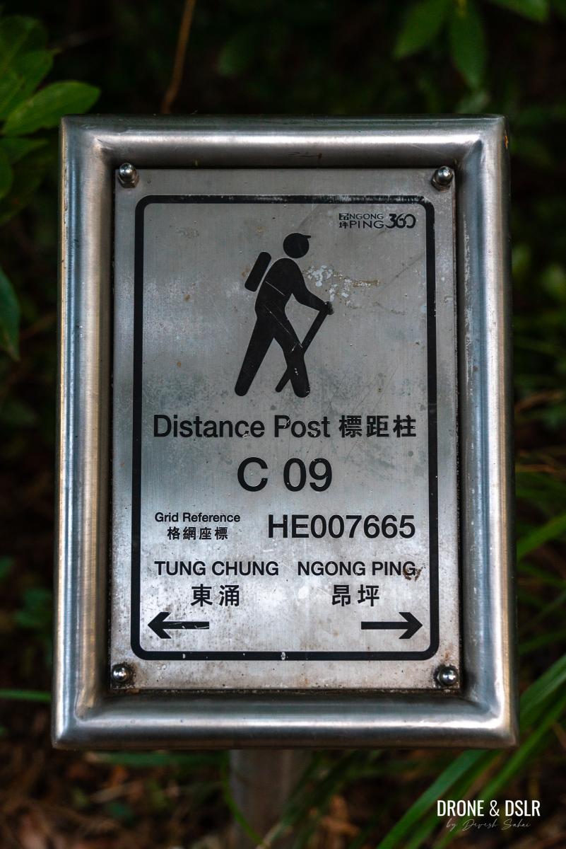
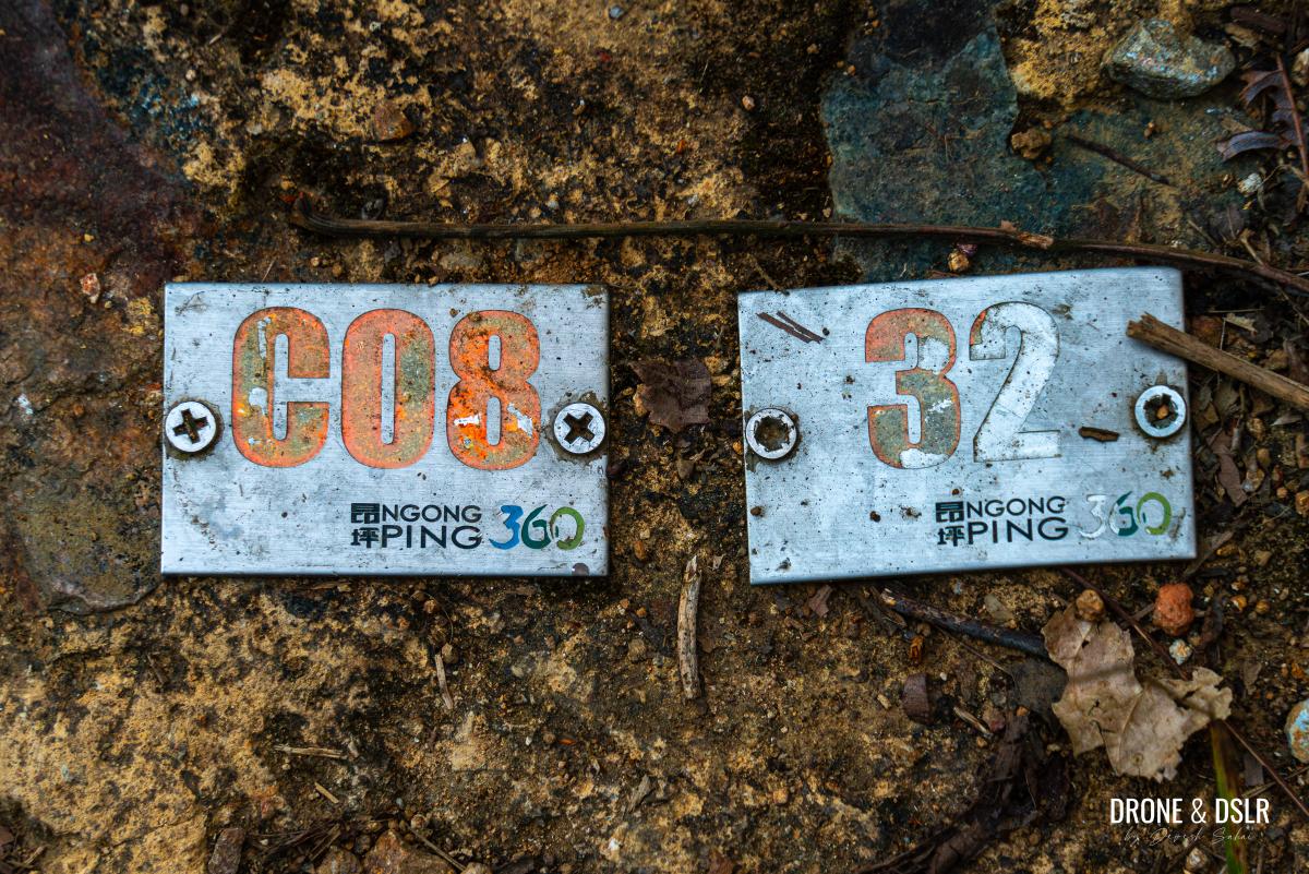
The trail’s main purpose is to serve as the rescue and maintenance route for the cable car, but that doesn’t stop anyone from hiking on it. It is also well-marked with “C” markers along the way. The markers are numbered from C00 to C30, from start to finish, which I’ll use to describe the different sections of the hike.
-

- I will use these “C” markers to describe the hike
-
- Ground markers are visible throughout the trail
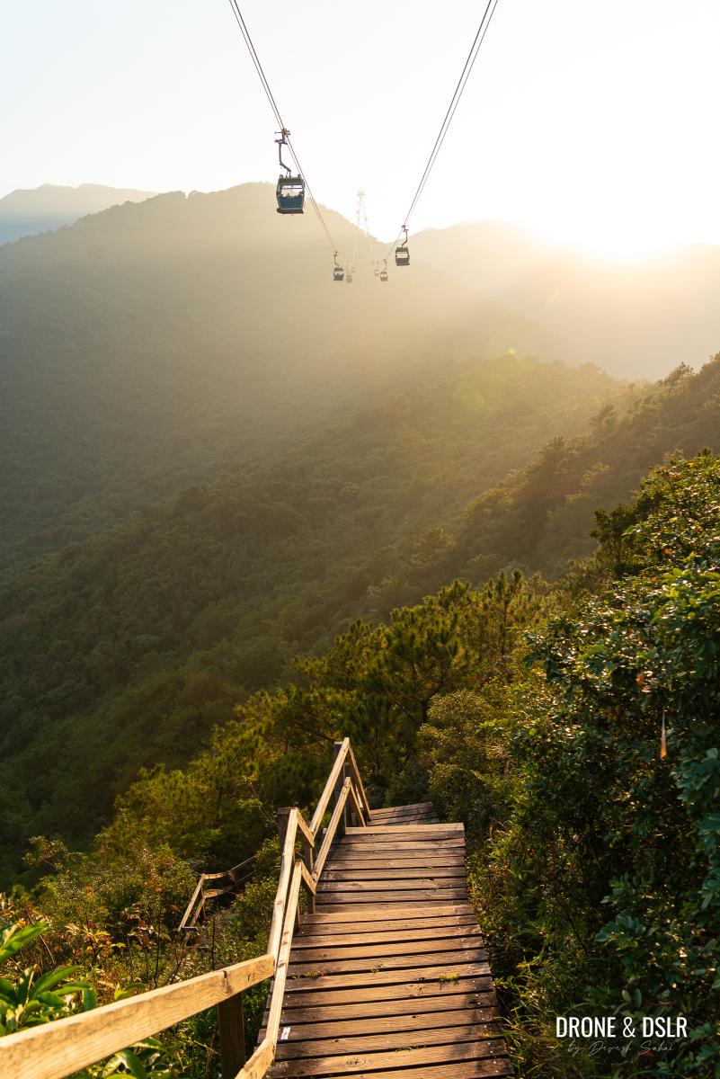
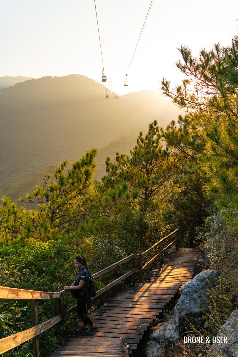
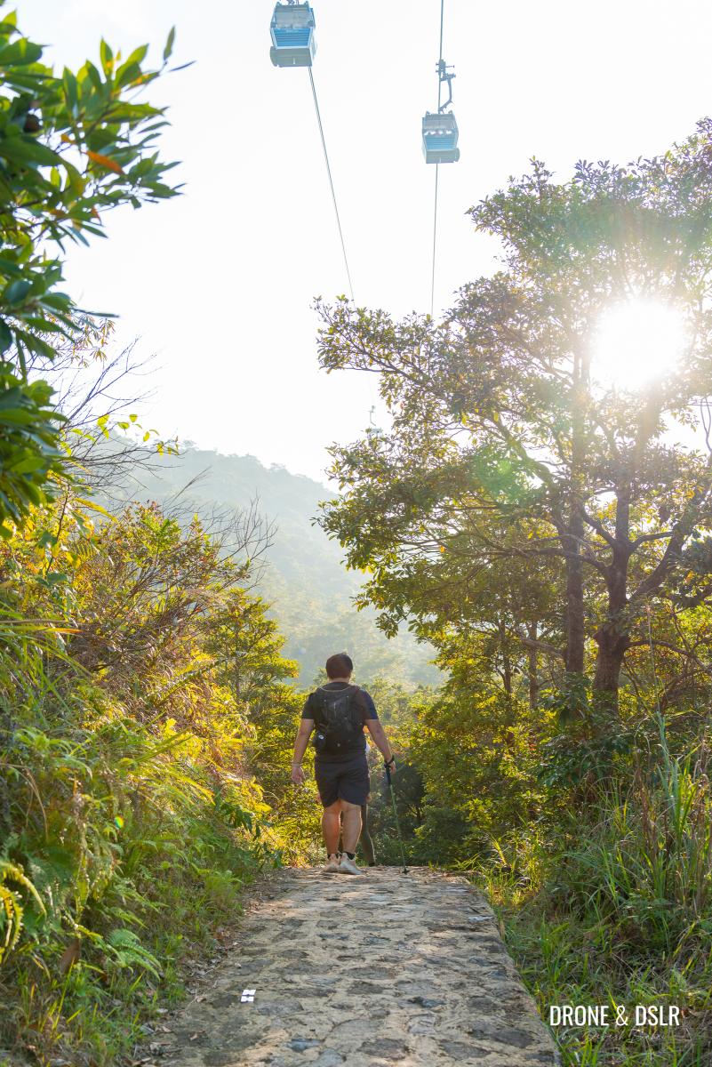
For the most part, the Ngong Ping 360 Rescue Trail runs directly below the cable cars (except from sections C00 to C06 and C22 to C29), making it a unique hike in Hong Kong.
More one pointer, we do recommend taking the Ngong Ping 360 cable car for one way of your journey. After all, it’s a beautiful cable car ride!
With that out of the way, let’s discuss how to hike the Ngong Ping 360 Rescue Trail.
Starting point
You can complete the Ngong Ping 360 Rescue Trail Hike in either direction, but if you’re looking for a very challenging hike, we recommend starting from Tung Chung.
The Ngong Ping 360 Rescue Trail starts along the Tung O Ancient Trail, which connects Tung Chung with Tai O. To reach the starting point, first make your way to Yat Tung Estate by bus or taxi.
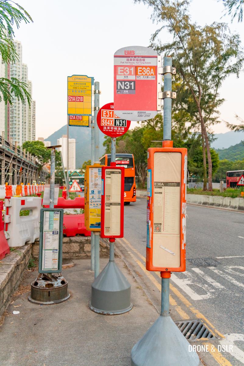
The bus stop at Yat Tung Estate
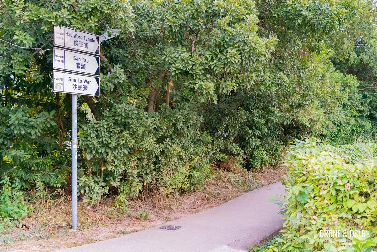
Alight at the Fuk Yat House Yat Tung Estate bus stop and take the pedestrian path and walk back towards the steps with the sign for “Hau Wong Temple” and “Tung O Ancient Trail“.
-
- Walk back on the pedestrian path

-
- Follow the signs for Hau Wong Temple and Tung O Ancient Trail
Walk down the steps and at the end of the path, turn left. Walk to the next intersection and take a right, follow the signs for “Hau Wong Temple”.
-
- Walk down the steps
-
- Turn left at the end of the path
-
- Once you turn left, the path joins Tung O Ancient Trail

-
- Follow the signs for Hau Wong Temple
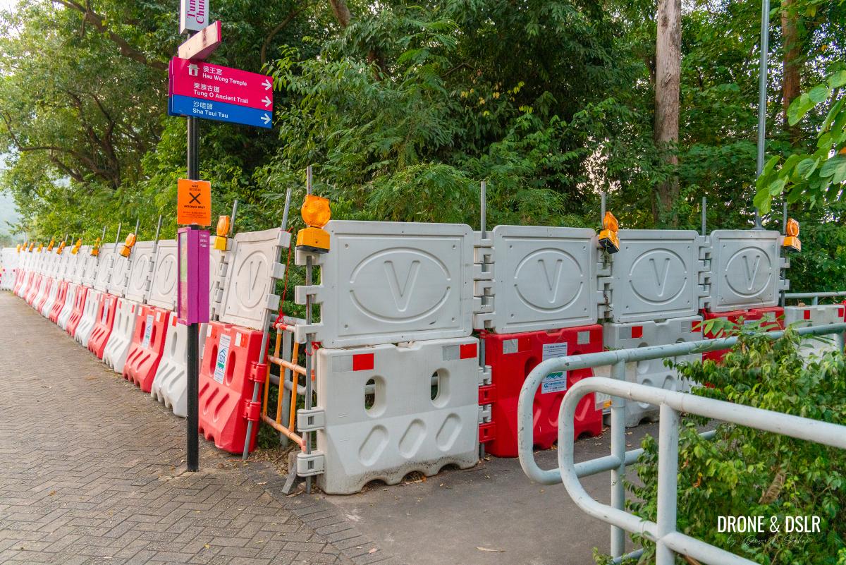
Once you cross the public toilet, turn left and follow the signs for “Tung O Ancient Trail” and walk alongside the Tung Chung Playground.
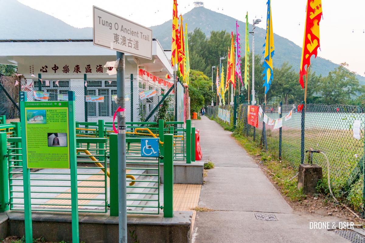
Turn left at the playground and follow the signs for Tung O Ancient Trail
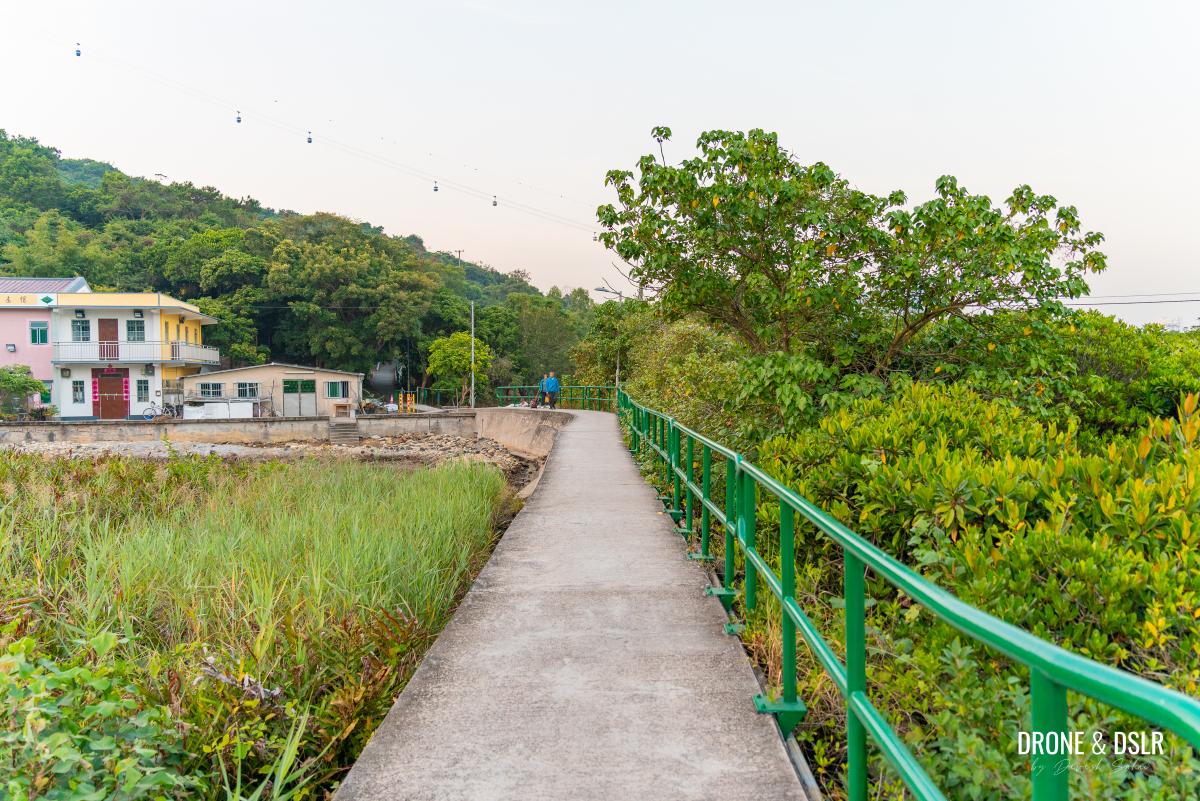
After the playground, cross the picturesque Hau Wong Bridge to stay on the Tung O Ancient Trail.
The trail turns more rustic after the bridge, as it crosses farm land on one side and a marsh on the other. The trail, now elevated above the marsh, turns the corner a couple of times before approaching a few houses.
-
- Cross the pretty Hau Wong Bridge
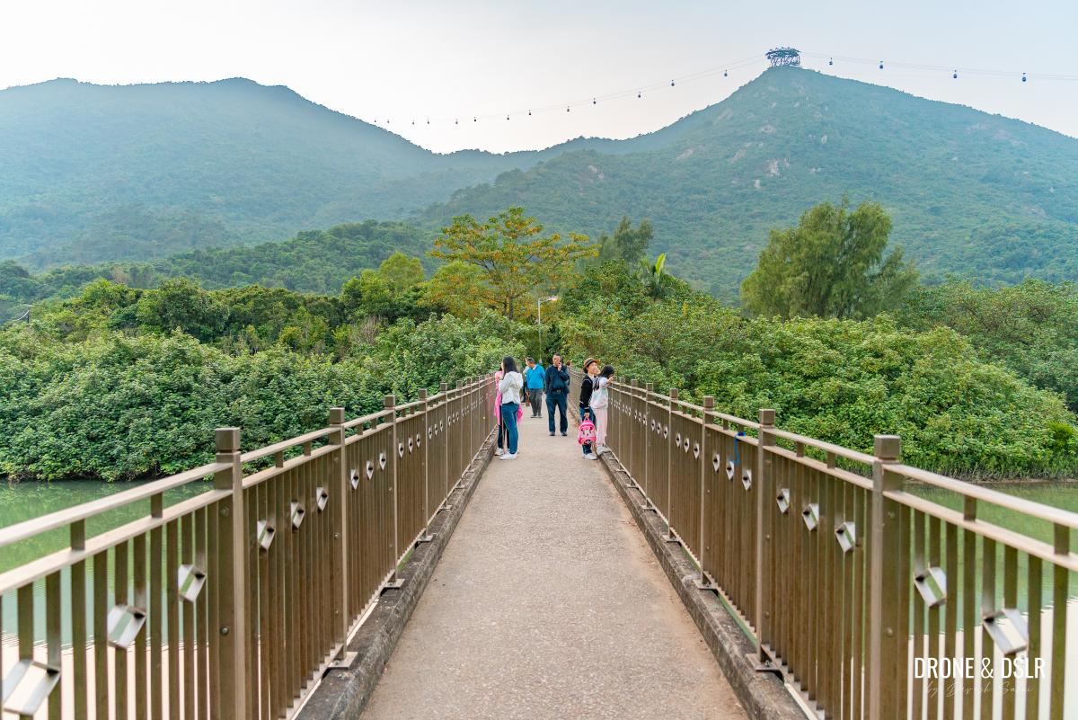
-
- The Tung O Ancient Trail enters the march area after the bridge
-
- Walk towards the houses
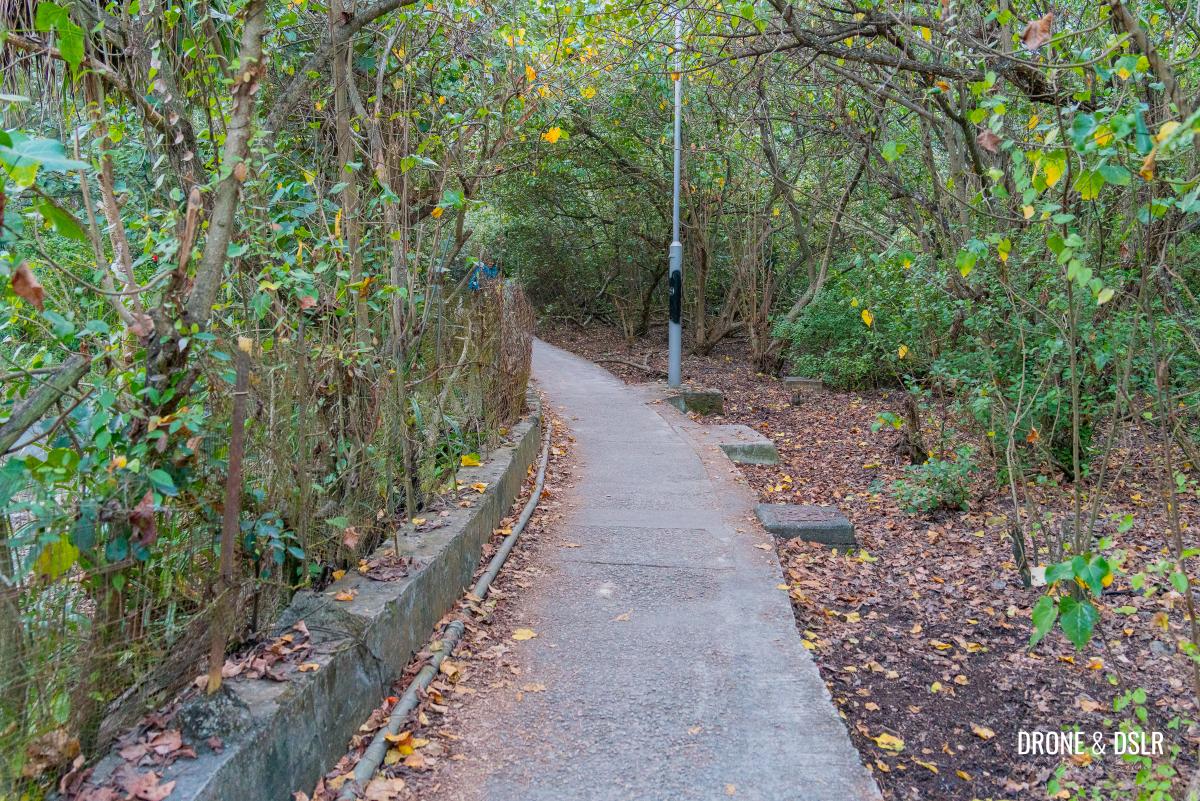
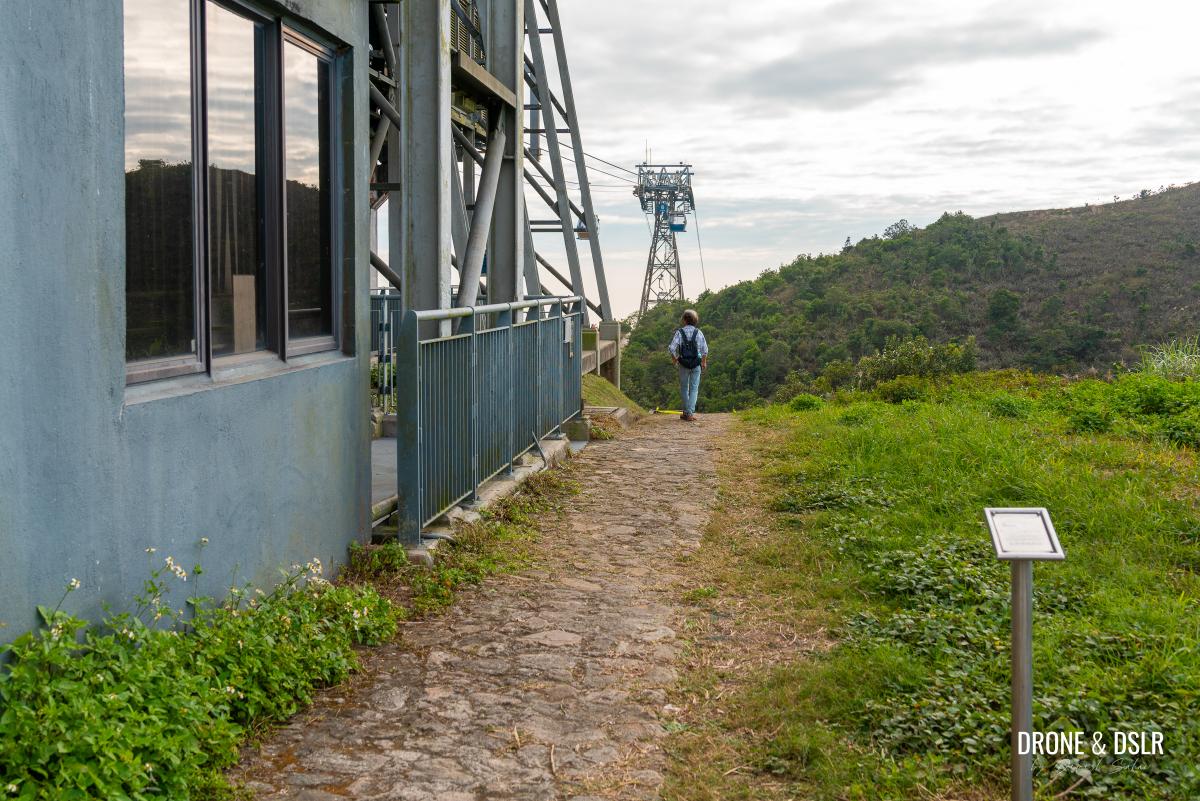
Just beyond the houses, is a shaded area. And 15 metres into the shaded area is the start of the Ngong Ping 360 Rescue Trail on the left.
-
- The shaded section of the trail after the houses
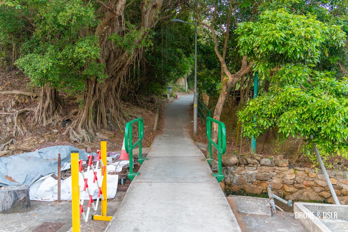
-
- The start of the Ngong Ping 360 Rescue Trail

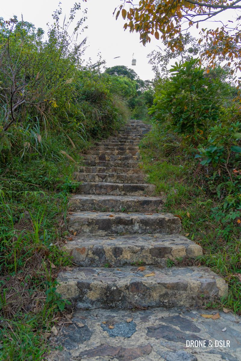
To Tower 3 – C00 to C06
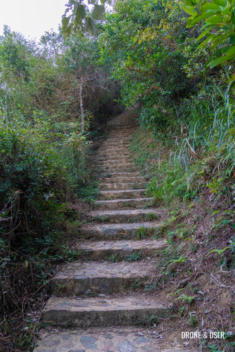
The first kilometre of the Ngong Ping 360 Rescue Trail is a very challenging uphill climb that takes you to Tower 3, which is 270 metre above sea level.
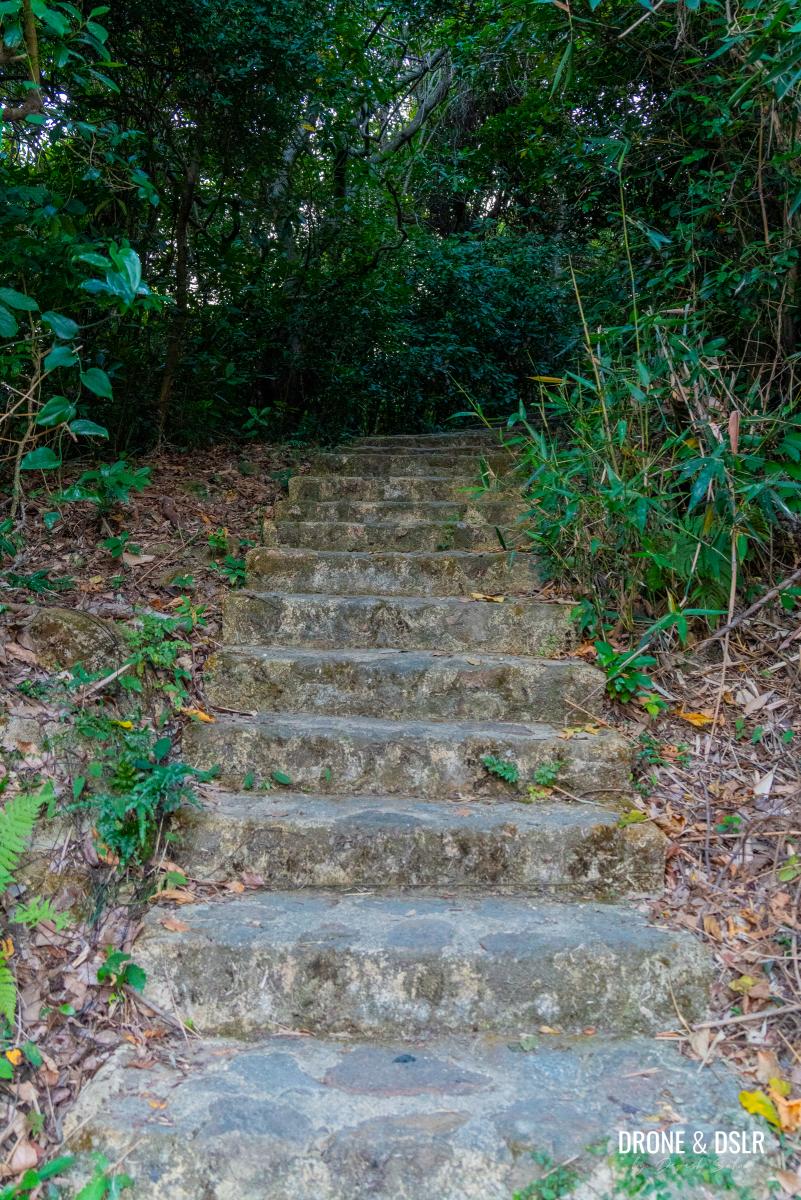
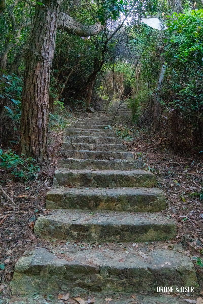
The steps start immediately
The initial section of the steps is relatively easy and also offers shade. So, if you’re hiking on a sunny day, the shade will provide much needed protection.
-
- The initial section of the Ngong Ping 360 Rescue Trail is shaded
-
- More steps as you progress
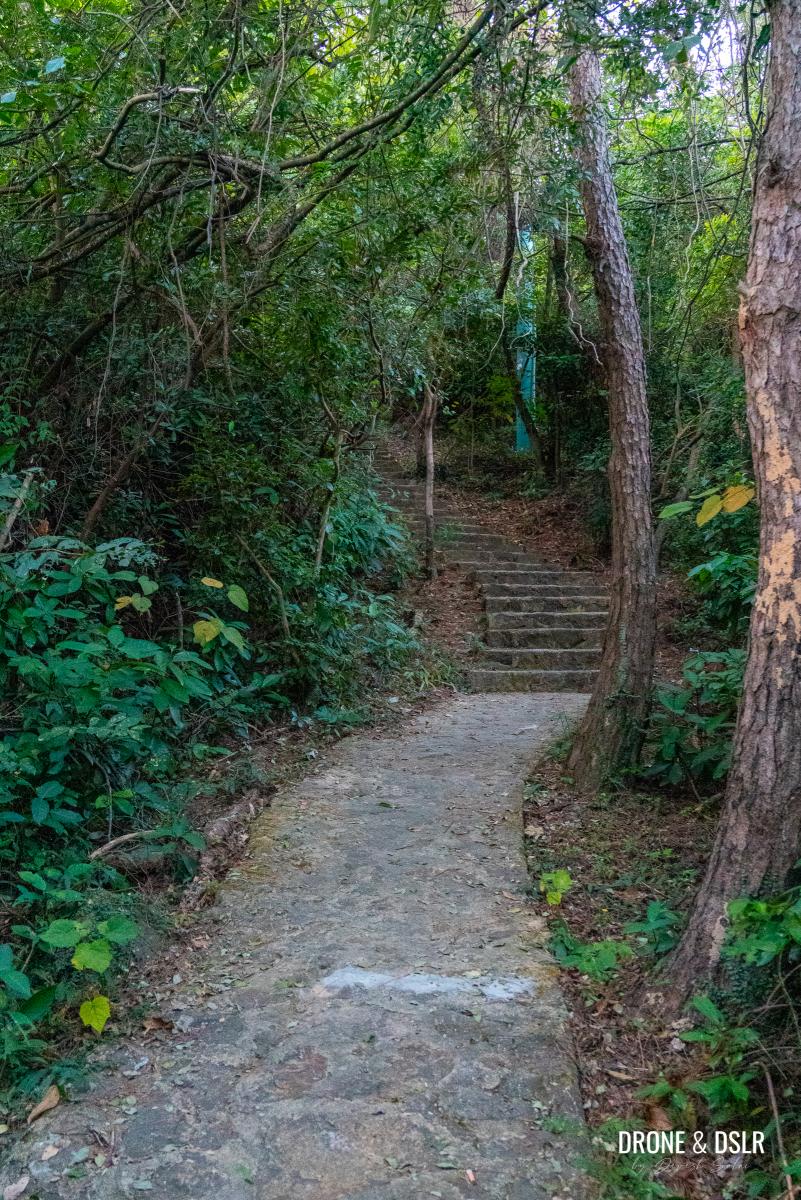
The steps gradually become challenging as they progress and remain shaded till the C02 marker.
-
- The incline gets more challenging
-
- A short flat section between the steps

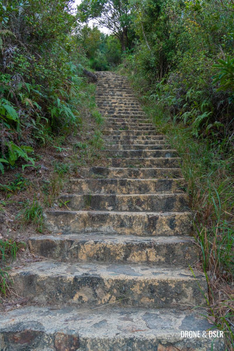
Once the shade lift, the steps gain momentum and become slightly more challenging between C02 and C03. Fortunately, the views also start opening up around this section of the trail, and you can see the cable cars approaching the top of the same hill that you’re climbing. In case you forgot, this section of the hike is devoid of cable cars above your head.
-
- The steps can be very challenging
-
- Take a break, enjoy the views
Remember to take it slow as you’re climbing this section of the Ngong Ping 360 Rescue Trail. Take multiple breaks, if required, and pace yourself out.
-
- Lots more steps that follow to Tower 3
-
- Just before you approach the tower, have a look at the views below
The steps between C04 and C05 remain steep but fortunately, if you take a break here, be sure to look behind and appreciate the amazing views of Tung Chung.
Stunning views of Tung Chung and the mountains of Lantau Island
It’s only when you approach the telecom station (at least that’s what I think it is) at C05, does the trail offer some respite. The distance between the C05 and C06 markers is quite short.

The telecom station – almost at Tower 3
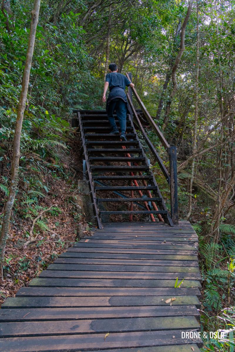
The start of C06 is also where the first tower (Tower 3) is located. During the course of this hike, you’ll cross 4 towers in total. So, once you reach Tower 3, take a well deserved break and enjoy the views of Tung Chung and airport.
Made it to Tower 3. Time to take a break
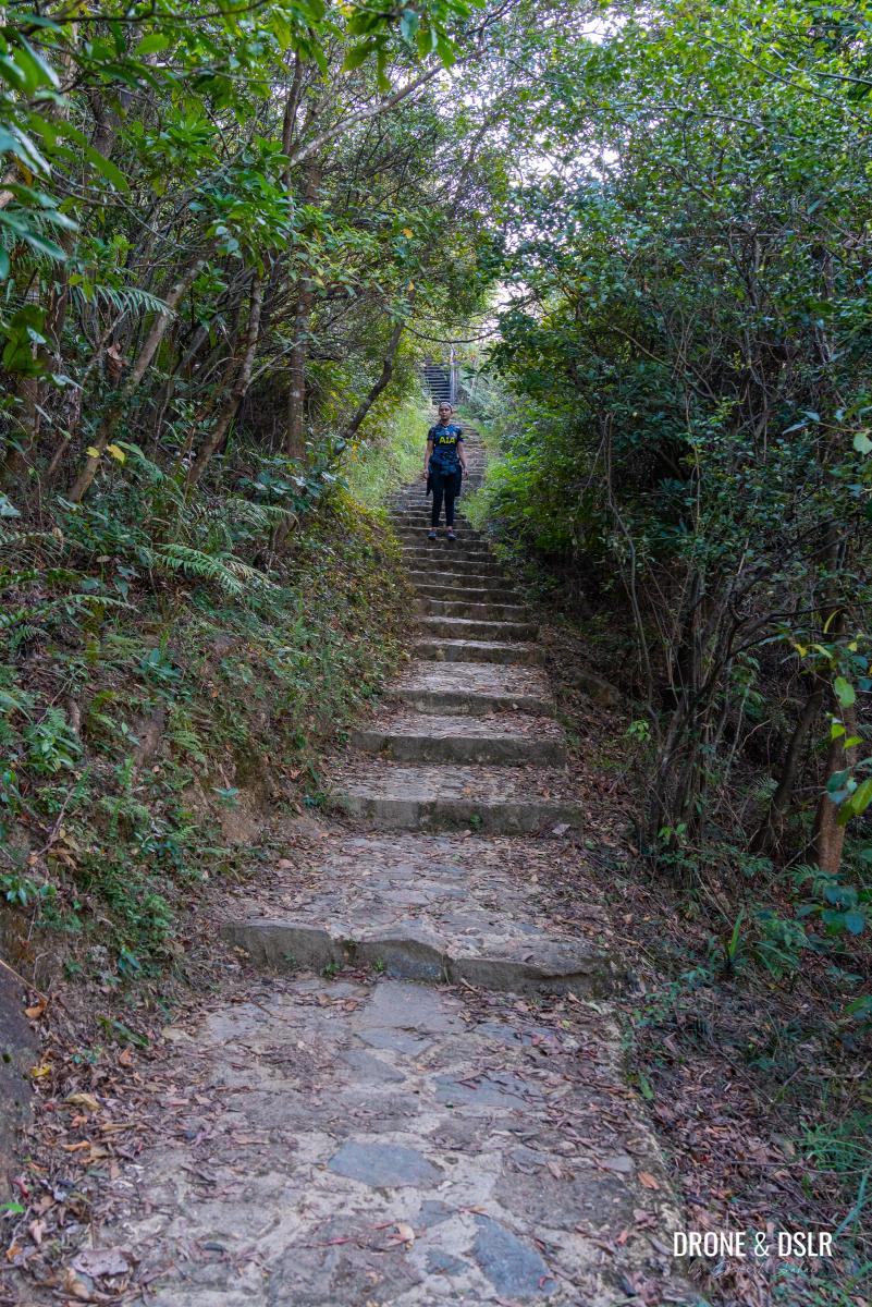
C06 to C10
The next section of the Ngong Ping 360 Rescue Trail is a mixed bag in my opinion. For starters, the section between C06 and C07 is quite scenic.
-
- Continue on the Ngong Ping 360 Rescue Trail around Tower 3

-
- The Ngong Ping 360 Rescue Trail is a well-maintained trail because it’s used for rescue and maintenance work
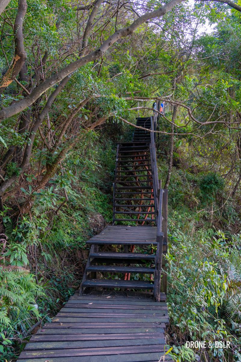
As the trail progresses from Tower 3, it descends on a beautiful wooden stairway. This location offers a stunning vantage point to admire the cable cars running above to the top of the next hill and tower.
-
- Gorgeous views of the cable cars and the trail
-
- The cable cars run above the trail after Tower 3
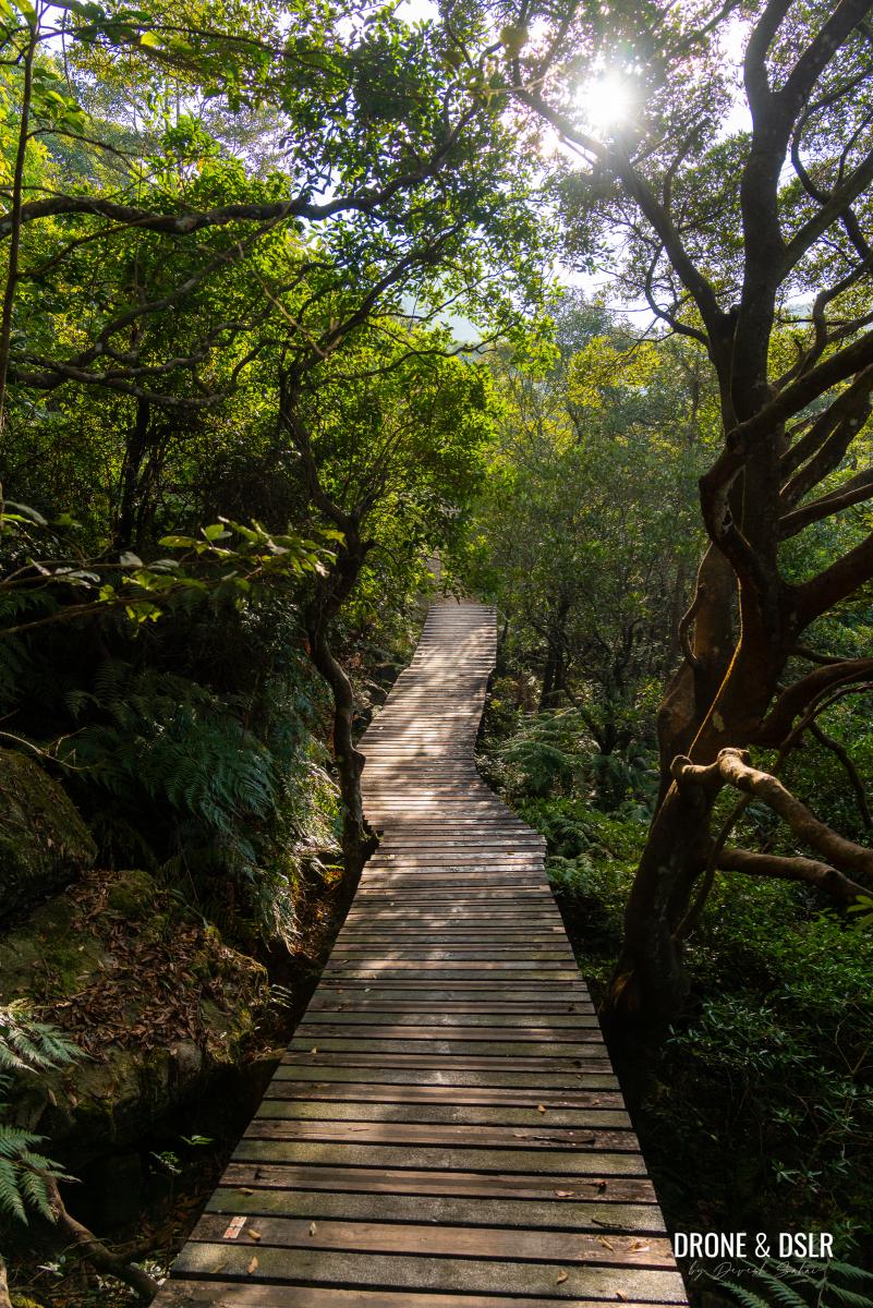
Enjoy these views and then continue down the steps onto the trail made of wooden planks. Unfortunately, the planks give way to a cemented trail and that the cue to prepare yourself for another challenging ascent.
-
- Taking it easy on the boardwalk
-
- The Ngong Ping 360

-
- When the wooden planks give way to the stone path, get ready for the climb
If it helps, the ascent isn’t as gruelling as what you just covered. Nonetheless, it starts gradually at C07 and gets steeper as it approaches C08.
-
- Slow incline to start with
-
- Here come more uphill steps
We were really glad that this section of the trail is shaded too and has a few flat sections in-between the steps. And although the cable cars are running above us, we hardly noticed them.
-
- Here come more uphill steps
-
- A short flat section between flights of steps
-
- Almost done with the steps at C09
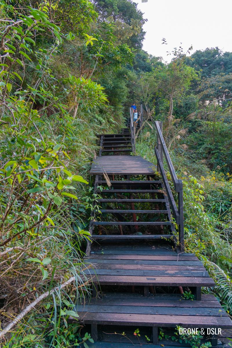
By the time we reached the C09 marker, we almost wished that the steps would end. Summon whatever strength you can and climb past the final steep stairway till you reach the trail reaches the next set of wooden steps.
-
- Taking a quick break to catch up and enjoy nature
-
- The final steep ascent for a while

-
- The wooden planks make a picturesque return

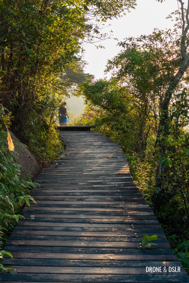
To Tower 4 – C10 to C12
The section between C10 to C12 becomes even more scenic and relatively easier. The trail also consists of only wooden boardwalks and steps.
-
- Section C10 is relatively easy and quite scenic
-
- Enjoying the views of the airport with cable cars running above us
Be sure to turn back and admire the Hong Kong International Airport and the cable cars as you climb the steps.
-
- The wooden steps don’t require the mountain side to be cleared or destroyed
-
- These steps aren’t too bad
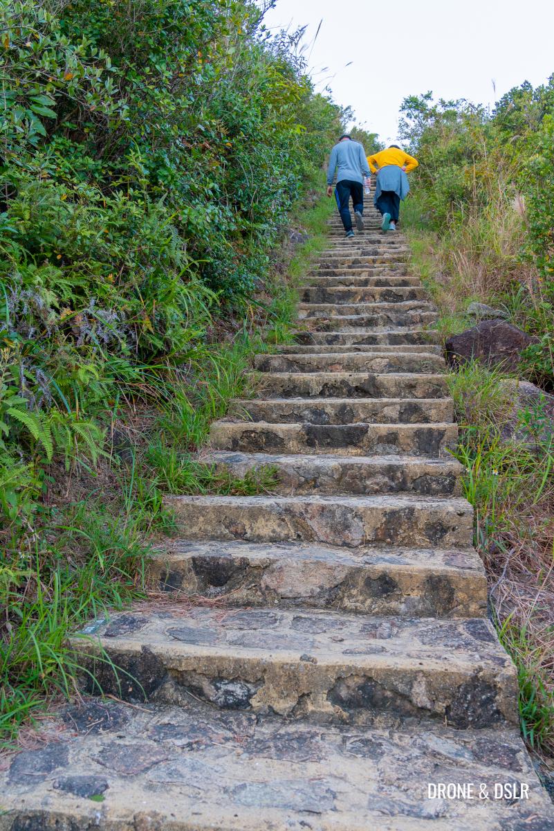
The steps come in short flights as the Ngong Ping 360 Rescue Trail gently ascends to the top of the next hill.
More wooden steps as you make your way to Tower 4
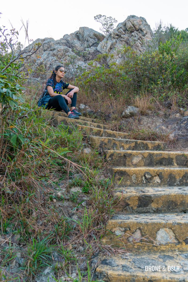
As the trail gets closer to Tower 4, the steps pick up in intensity. We took many breaks along this section just to watch aeroplanes taxi and take-off.

I took some long breaks here to enjoy these views
Eventually, we hardly noticed when we reached Tower 4 because it’s not as prominent as the other towers along the trail.
Now approaching Tower 4
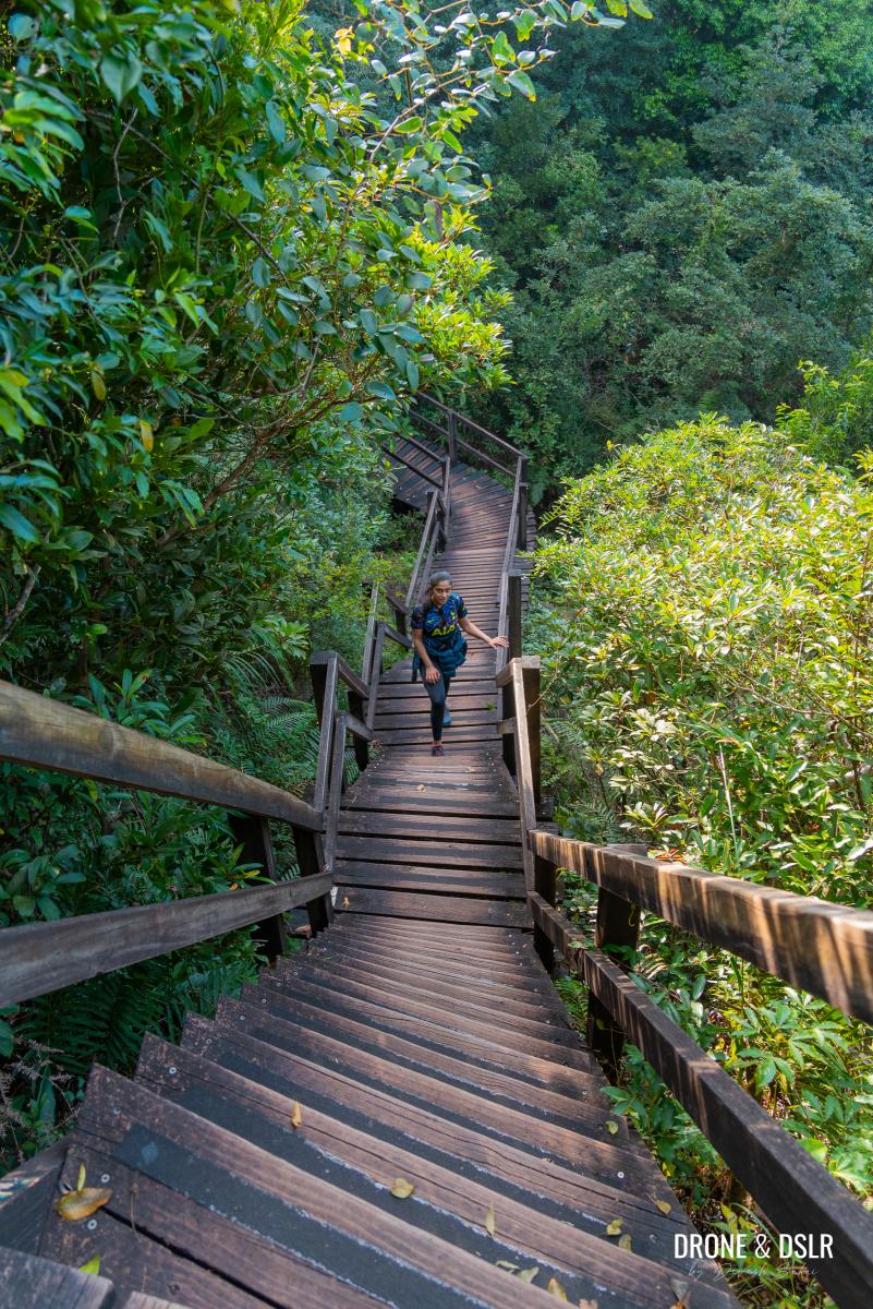
To Tower 5 – C13 to C17 (Stairway to Heaven)
The section just beyond Tower 4 is referred to as the “stairway to heaven” (please correct me if I am wrong). I imagine the trail’s natural surrounding, scenic views of the airport, and mix of wood and stone paths lend it this name.

The following section is dubbed as the “stairway to heaven”
But for us hikers, this section of the trail remains relatively easy and undulating, with a few challenging sections.
-
- The Ngong Ping 360 Rescue Trail can be a stunner
-
- Slowing making our way down this undulating section
The views of the airport stay for the initial part and I personally took many breaks to watch more planes take-off. The cable cars above the trail also add a nice touch.
-
- This section of the hike offers the best views of the airport
-
- Some more steps to add to mix
-
- Be careful on the boardwalk as some sections don’t have a railing on the side
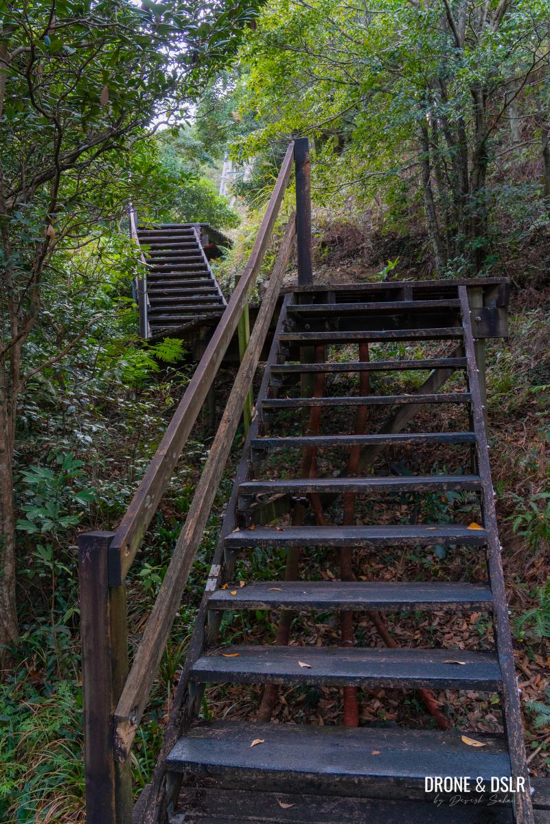
I don’t recall exactly where, but somewhere between markers C15 and C16, is a sign warning hikers of a “very steep trail ahead”. This very steep trail consists of a wooden stairway, steeply descending on one side of the hill and then ascending on the other side.
-
- The dip in the trail that follows can be tricky
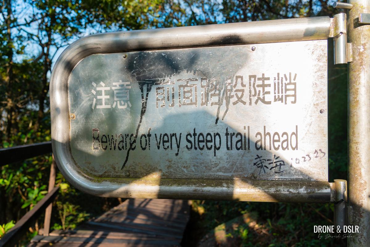
-
- The steep decline
To be honest, I did find this dip to be quite challenging and tricky thanks to the steepness and the large gap between each step. Just try not to look down.
Followed by a steep incline (be careful of the gap between the steps)
After climbing out of the steep stairway, the trail continues on a gentle incline with a few more undulating sections to C17.
-
- The boardwalk continues after the steep section
-
- Beautiful afternoon sun lighting up the trail
-
- The stairway to heaven coming to an end soon

-
- Almost at the final ascent to Tower 5
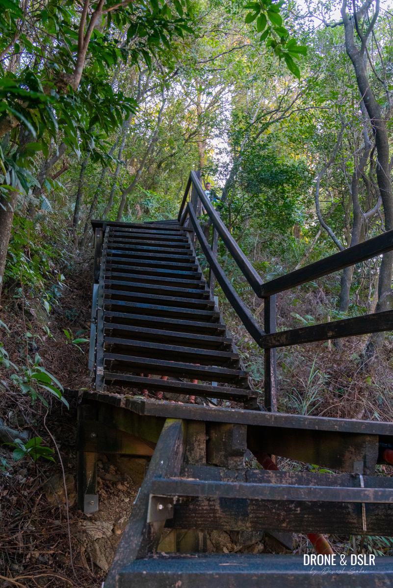
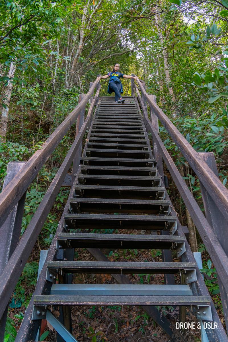
If what you just covered is the “stairway to heaven”, what follows after C17 is a “hellish stairway”!

This is the hellish stairway to Tower 5
The ascent to Tower 5 is a brutal climb to the highest point on the Ngong Ping 360 Rescue Trail. Take your time as you climb up the steps and remember – it only gets easier after this!
Finally, made it to Tower 5!
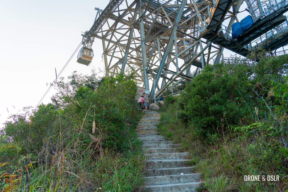
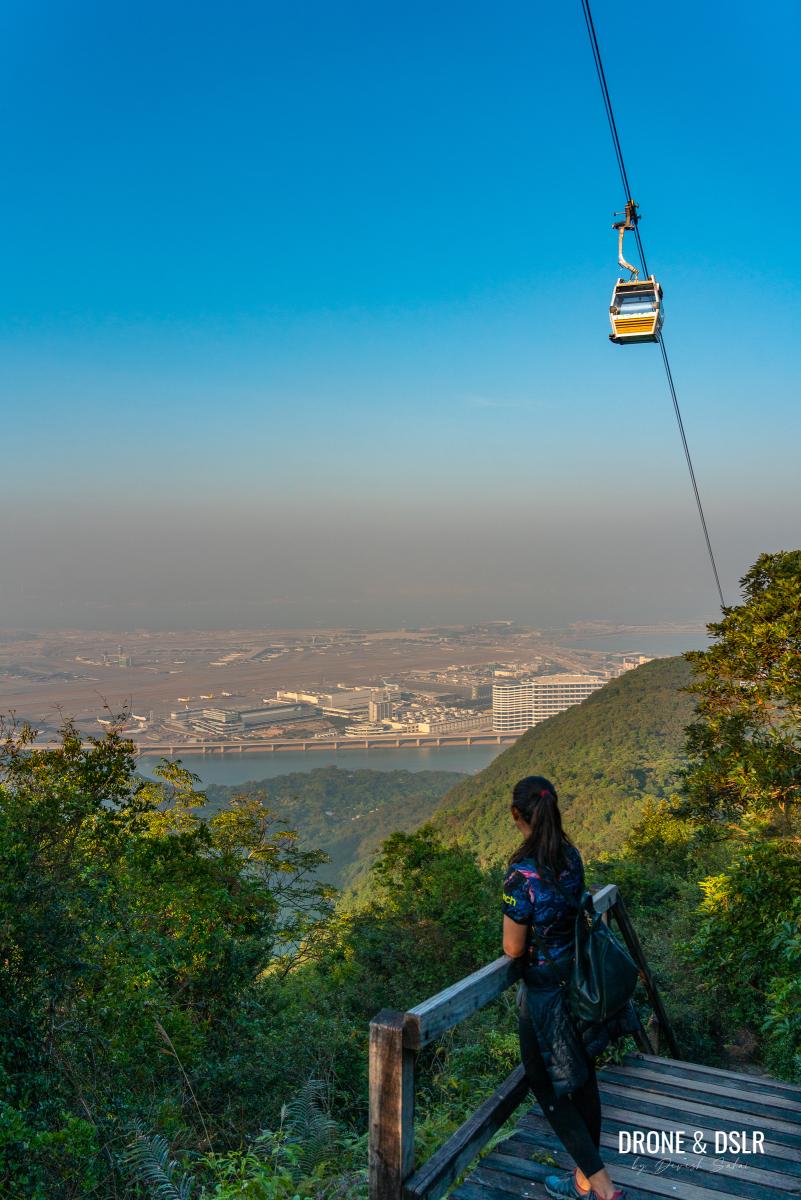
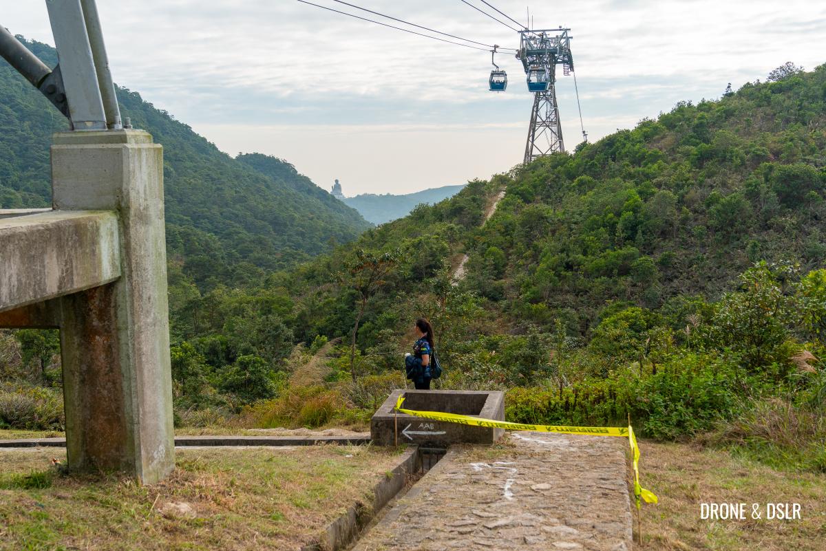
Towers 5 and 6 – The Nei Lak Shan Angled Station
At approximately 550 metres above sea level, the Nei Lak Shan Angled Station is the highest point on the Ngong Ping 360 Rescue Trail.
Walk around Tower 5 and wave to the passengers in the cable car
The Nei Lak Shan Angled Station (that consists of towers 5 and 6) gets its name from how the two towers allow the cable cars to turn and change direction. The station is situated at the base of Nei Lak Shan, where the Nei Lak Shan Country Trail intersects the Ngong Ping 360 Rescue Trail.
At Tower 5, you’re at same level as the cable cars. So, make sure you wave to the nice passengers on their way to the Big Buddha! From here, you can also take a moment to admire the airport one last time.
To the right of Tower 5 is the entrance to the picturesque Tingsi Trail, which connects with the Tung O Ancient Trail at the base of this mountain.

The picturesque Tingsi Trail that also connects Ngong Ping 360 Rescue Trail to Tung O Ancient Trail
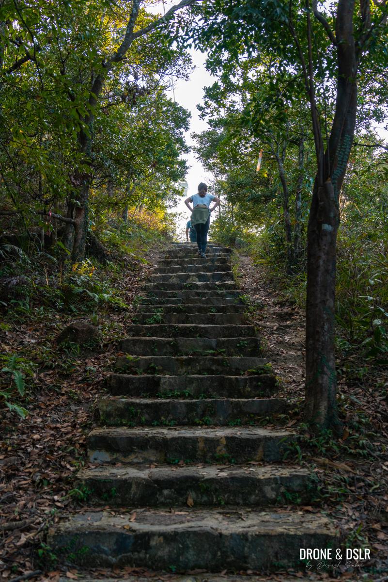
Continue walking on the trail, past Tower 6. At this point, the trail reaches another picturesque stairway.
Continue walking towards the next tower
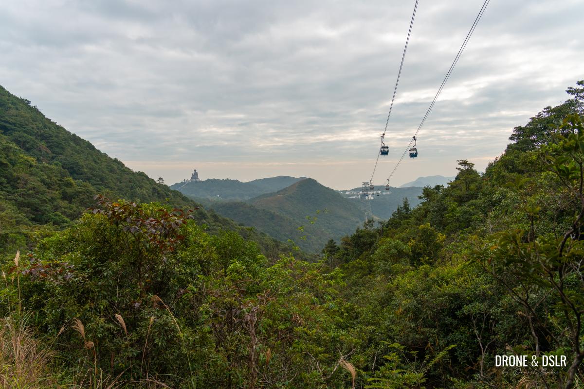
From here, you can admire the cable cars running directly above Ngong Ping 360 Rescue Trail, and the Big Buddha and Ngong Ping Village (which is just less than 2 km away).
-
- First views of the Big Buddha and Ngong Ping Village from Tower 6
-
- Another scenic view of the cable cars, the trail, and the Big Buddha from Tower 6 descent
-
- Cable cars coming to and from Ngong Ping Village

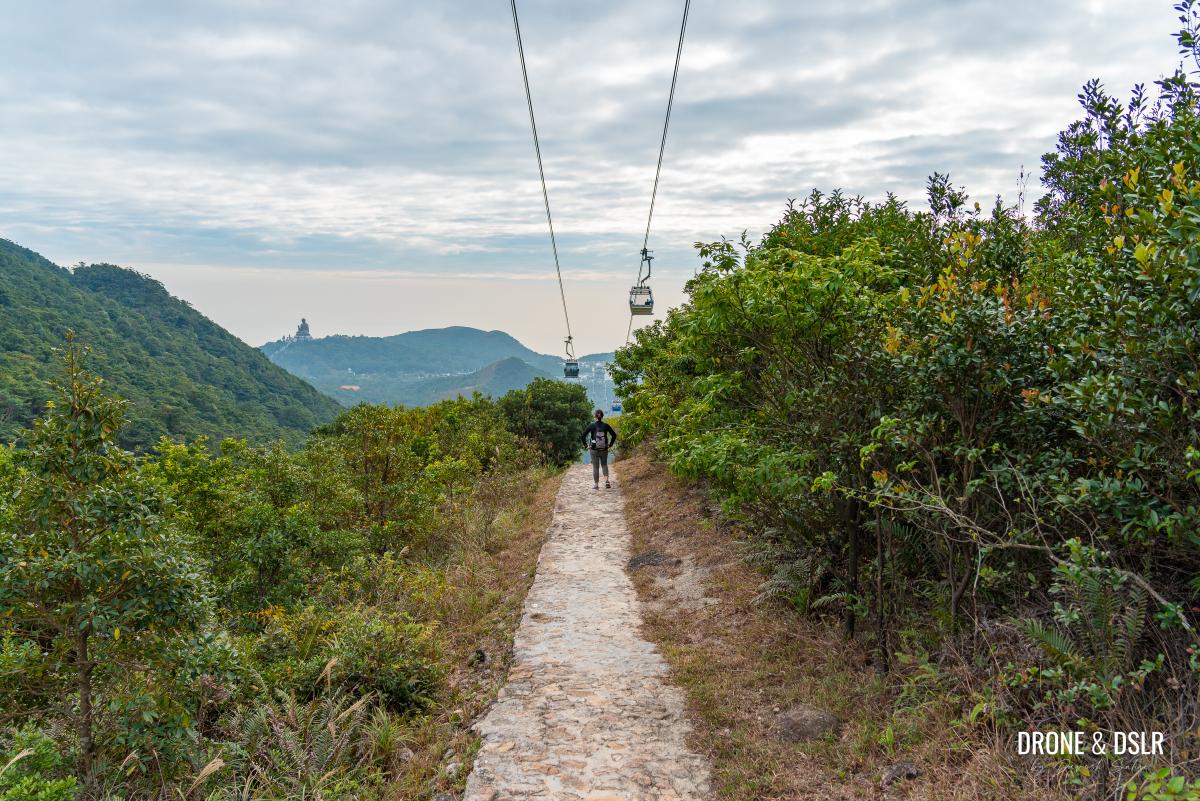
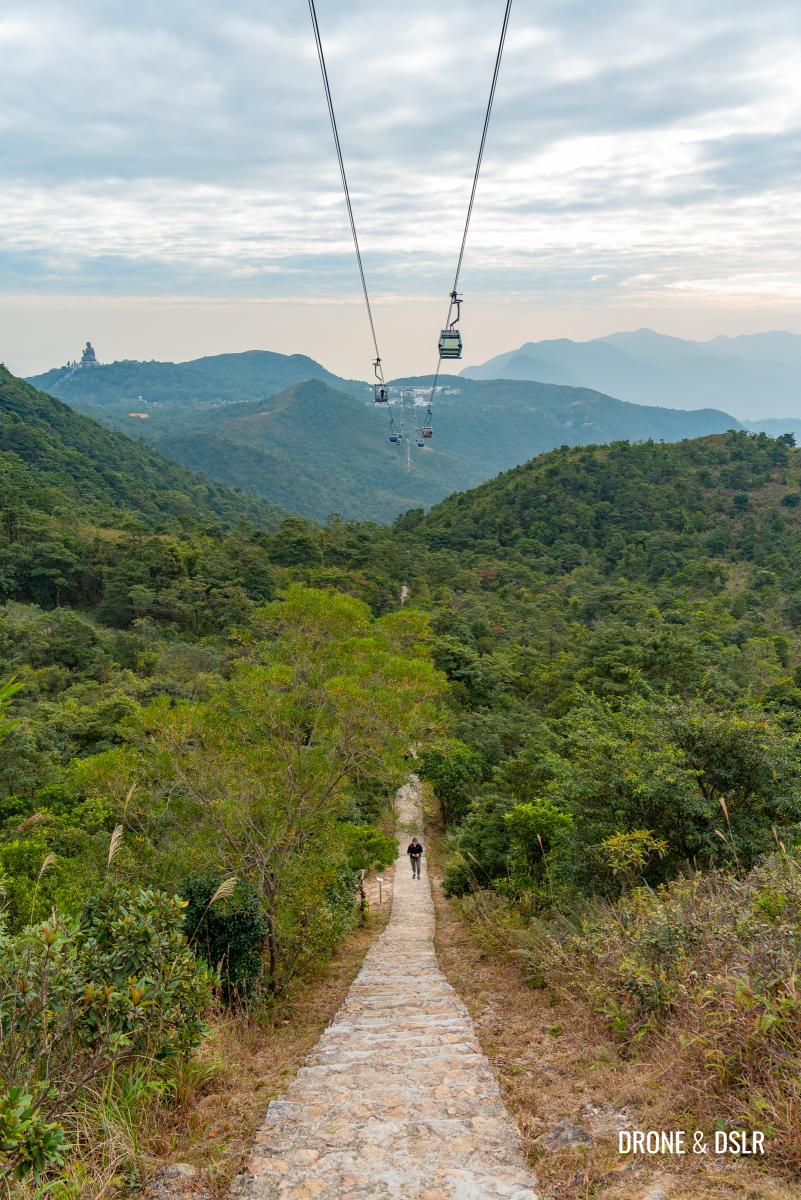
To the Ngong Ping Viewing Deck (C19 to C27)
The descent from Tower 6 is quite picturesque. The trail continues to run directly below the cable cars for 300 metres, giving hikers an opportunity to snap some of the best pictures of the cable cars above the trail.
It’s much easier from this point onwards
At around the C21 marker, the Nei Lak Shan Country Trail and the Ngong Ping 360 Rescue Trail begin their overlap. The two trails run at the base of Nei Lak Shan, passing many of the streams flowing down the mountain.
Hiking under the cable cars
At the C22 marker, the Ngong Ping 360 Rescue Trail (Nei Lak Shan Country Trail) move from under the cable cars, not before giving you one last view of the pods above heading to their destination.
The Ngong Ping 360 Rescue Trail moves away from under the cable cars after C22
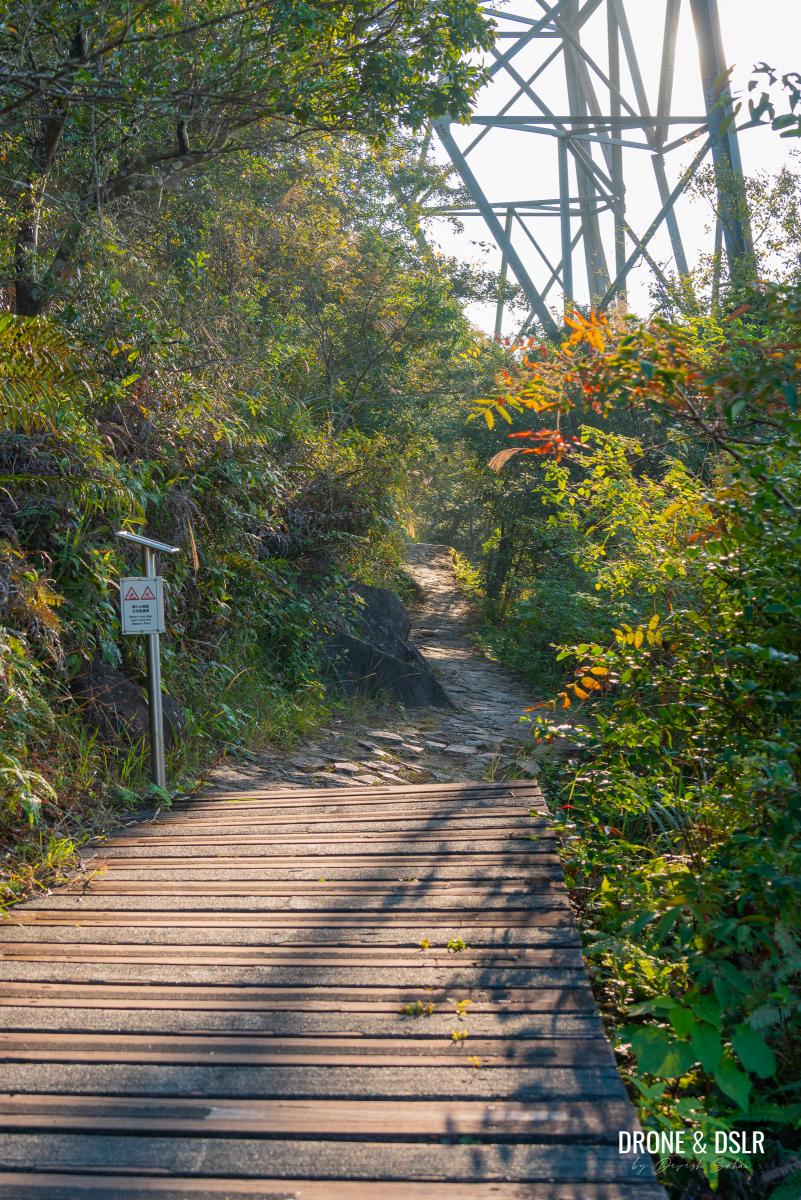
From here on out, the trail continues to meander below Nei Lak Shan, gently descending towards Ngong Ping Village.
The overlapping sections of the Ngong Ping 360 Rescue Trail and Nei Lak Shan Country Trail
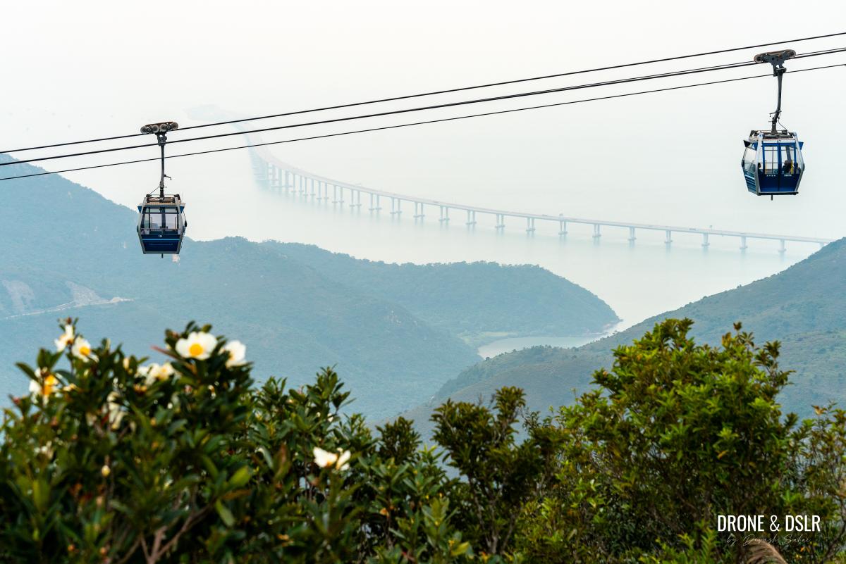
The views for the most part are obstructed by the trees, but every time there’s a clearing, you can admire the views of the Hong Kong-Zhuhai-Macau Bridge along with the cable cars. Sadly, we picked a hazy day to hike which obscured the views of the bridge.
-
- The undulating section of the trail at the base of Nei Lak Shan

-
- Views of the Hong Kong-Zhuhai-Macau Bridge from the Ngong Ping 360 Rescue Trail
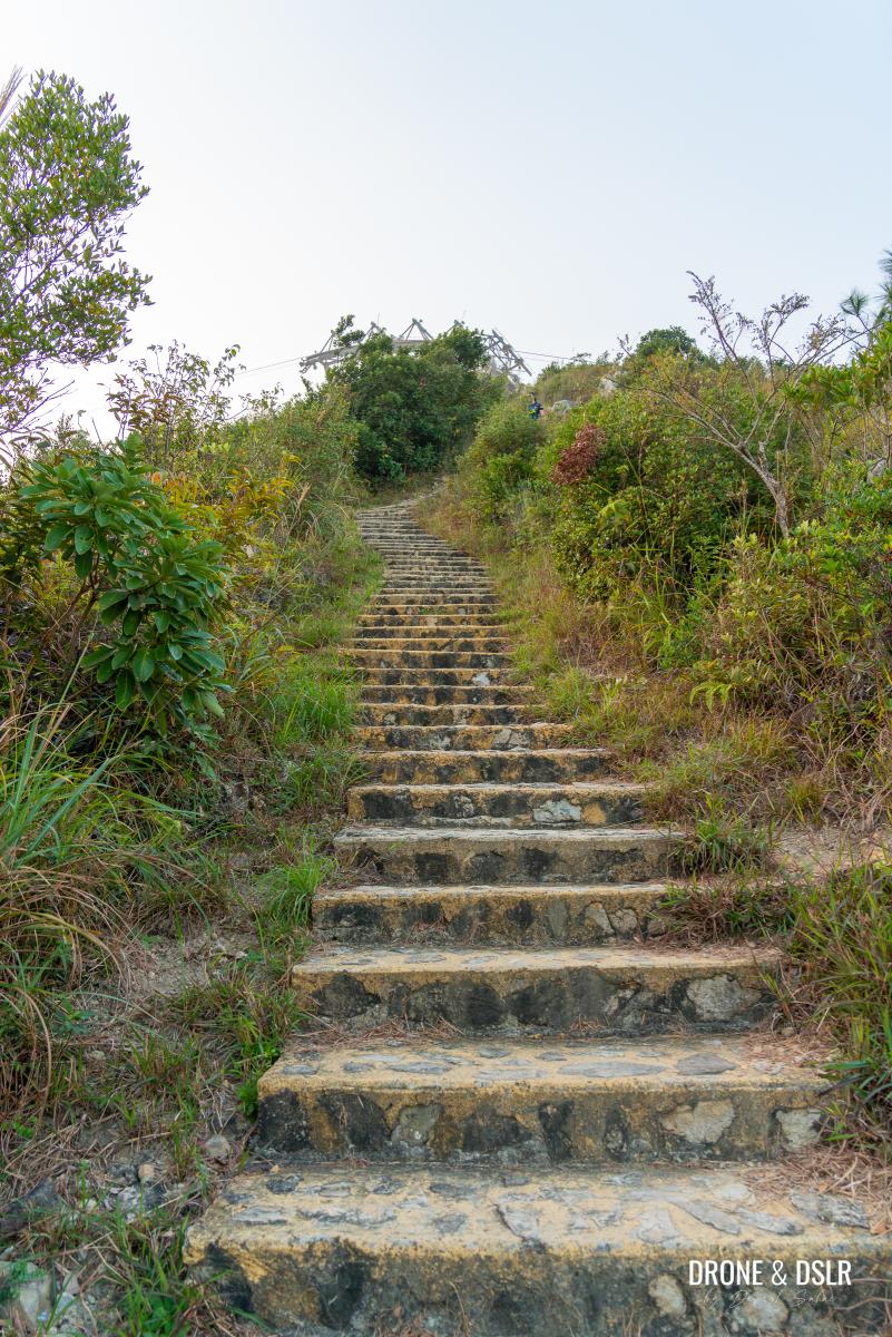
After approximately 500 metres from C22, is the C25 marker. At this point, the Nei Lak Shan Country Trail diverges from the Ngong Ping 360 Rescue Trail and continues to go around the base of Nei Lak Shan. Stay on the Ngong Ping 360 Rescue Trail and follow the signs for the Ngong Ping Village and Lantau Trail.
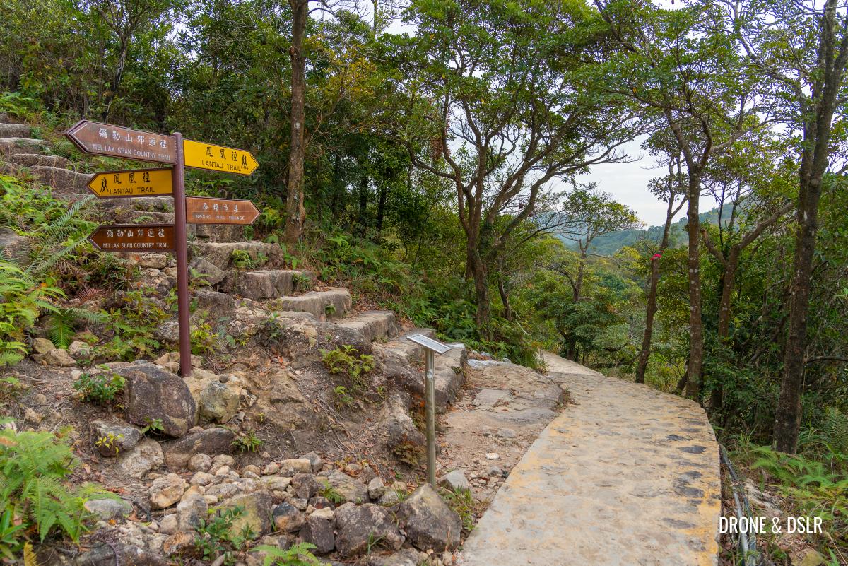
The point where the Ngong Ping 360 Rescue Trail breaks away from the Nei Lak Shan Country Trail
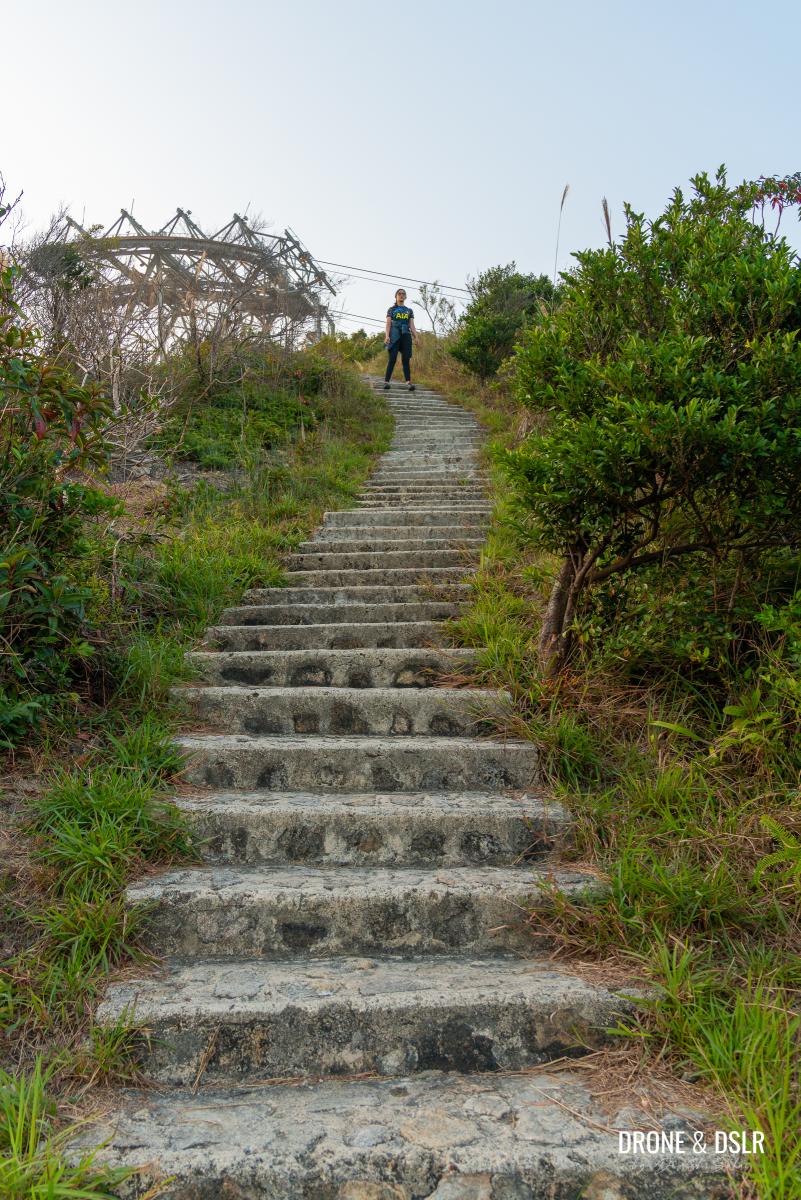
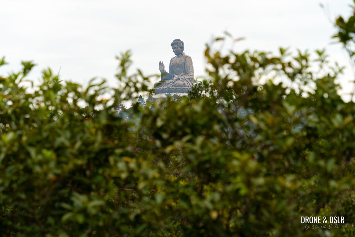
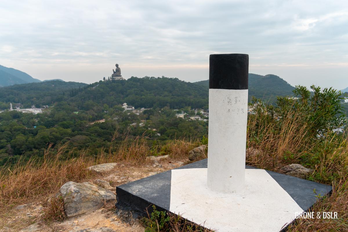
As the trails split, the Big Buddha reappears. Stay on the trail for another 500 metres till you reach a flight of steps to the right.
-
- Views of the Big Buddha reappear

-
- Slowly making our way to the Ngong Ping Village

-
- Views of the Big Buddha within 500 metres of the end of the Ngong Ping 360 Rescue Trail
-
- Go straight if you want to reach Ngong Ping Village or climb up the steps to the viewing deck
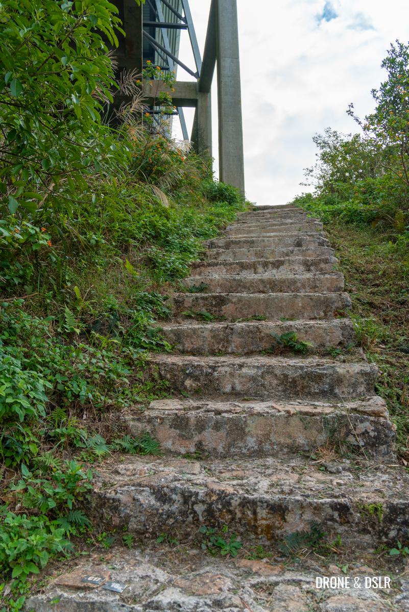
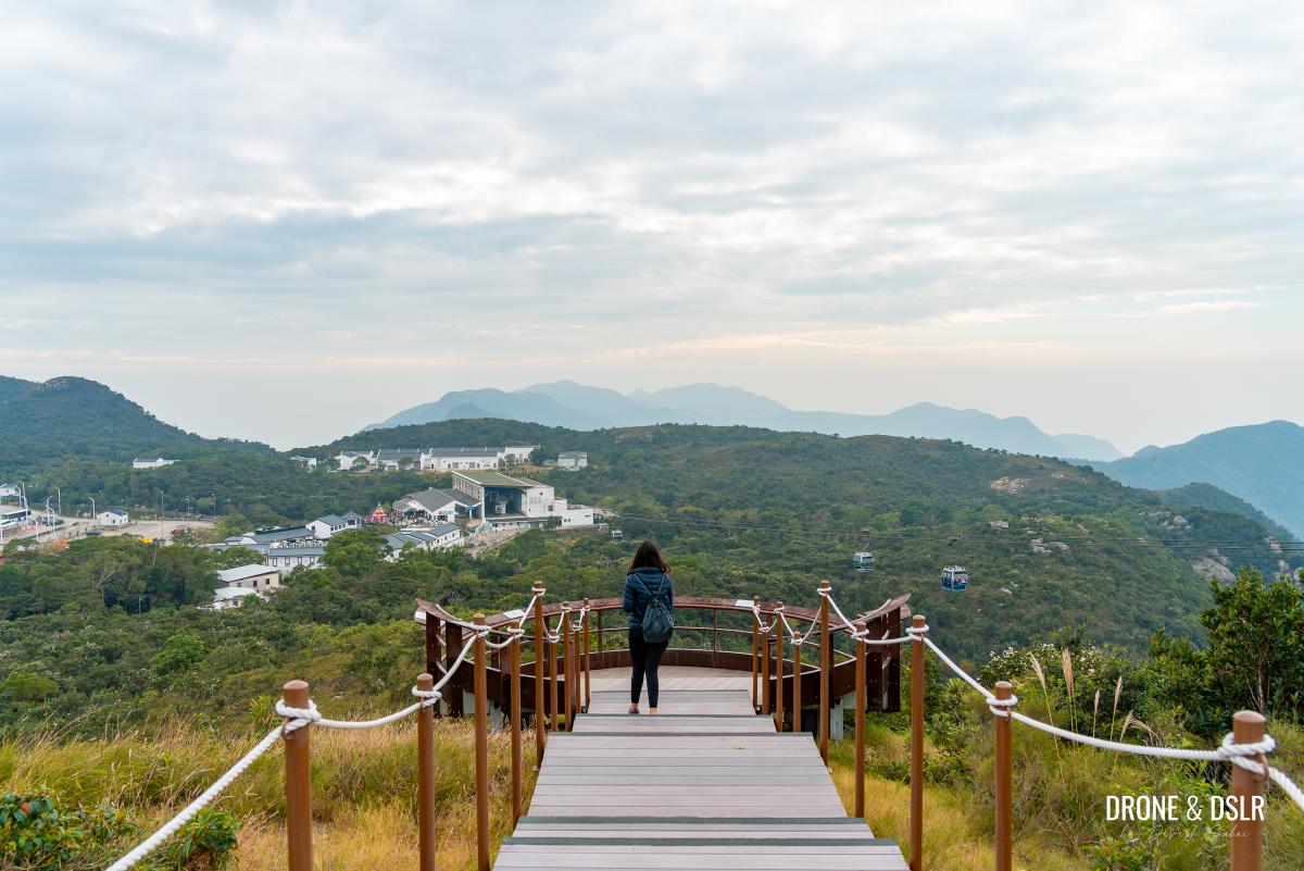
Ngong Ping Viewing Deck (Optional)
If you’re too exhausted to climb these steps, skip this section. But if you can summon some energy, you’ll be rewarded with the most amazing and panoramic views of Ngong Ping Village, the Big Buddha, Po Lin Monastery, Lantau Peak, and Hong Kong-Zhuhai-Macau Bridge.
-
- We recommend climbing up the steps to the viewing deck
-
- The Viewing Deck – worth the short climb up the steps
-
- Views of the cable cars and the Hong Kong-Zhuhai-Macau Bridge from the viewing deck
-
- Views of Po Lin Monastery and Lantau Peak from the viewing deck

-
- The viewing deck offers a unique vantage point

Given that you’re almost at the end of the Ngong Ping 360 Rescue Trail Hike, I think the views are definitely worth the climb. And if you’re feeling a bit more energetic, you can scramble to the trigonometrical station behind the viewing deck for even better views.
Scramble up to the trigonometrical station for unobstructed 360 degree views
After you’ve admired the views from up here, return to the trail.
Finish the Ngong Ping 360 Rescue Trail
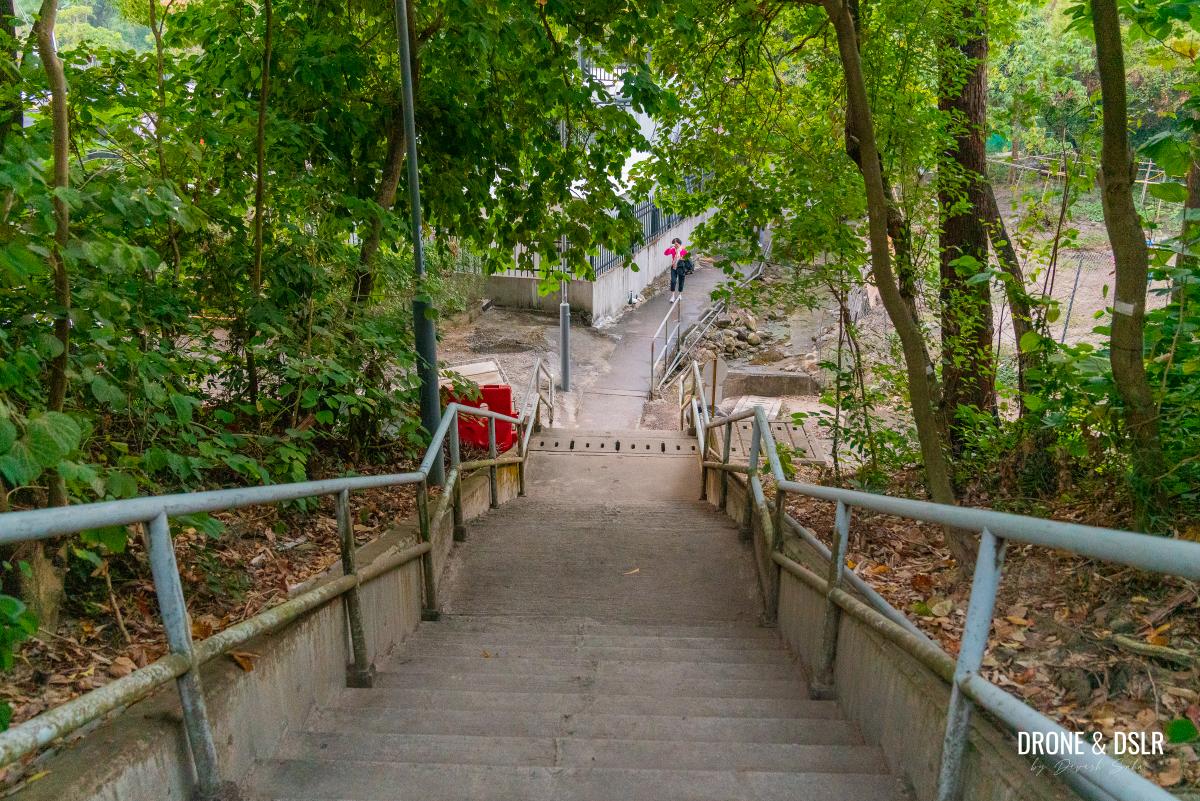
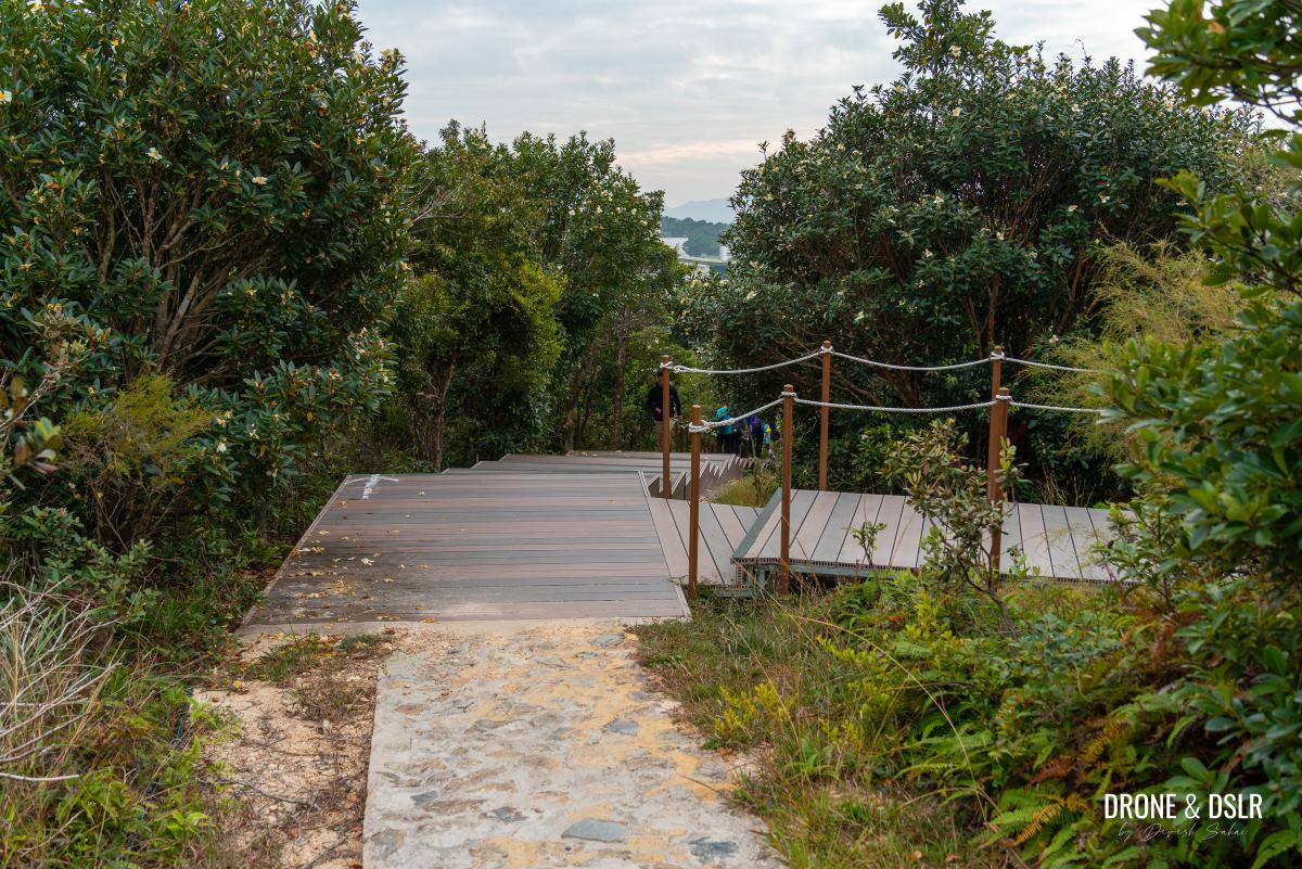
From the steps leading up to the viewing deck, the end of the Ngong Ping 360 Rescue Trail is a mere 350 metres away. And what’s even better is that it’s all downhill or flat.
Continue walking downhill after you’re done admiring the views from the viewing deck
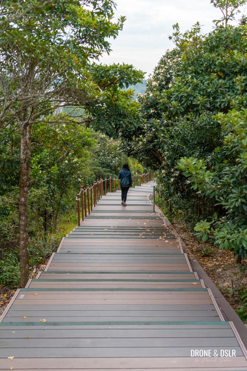
The final approach, on the wooden planks, brings the Ngong Ping 360 Rescue Trail to glorious end!
-
- The final stretch of the Ngong Ping 360 Rescue Trail

-
- And that’s a wrap on the Ngong Ping 360 Rescue Trail!
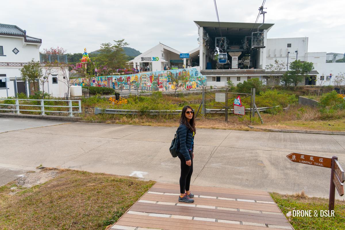
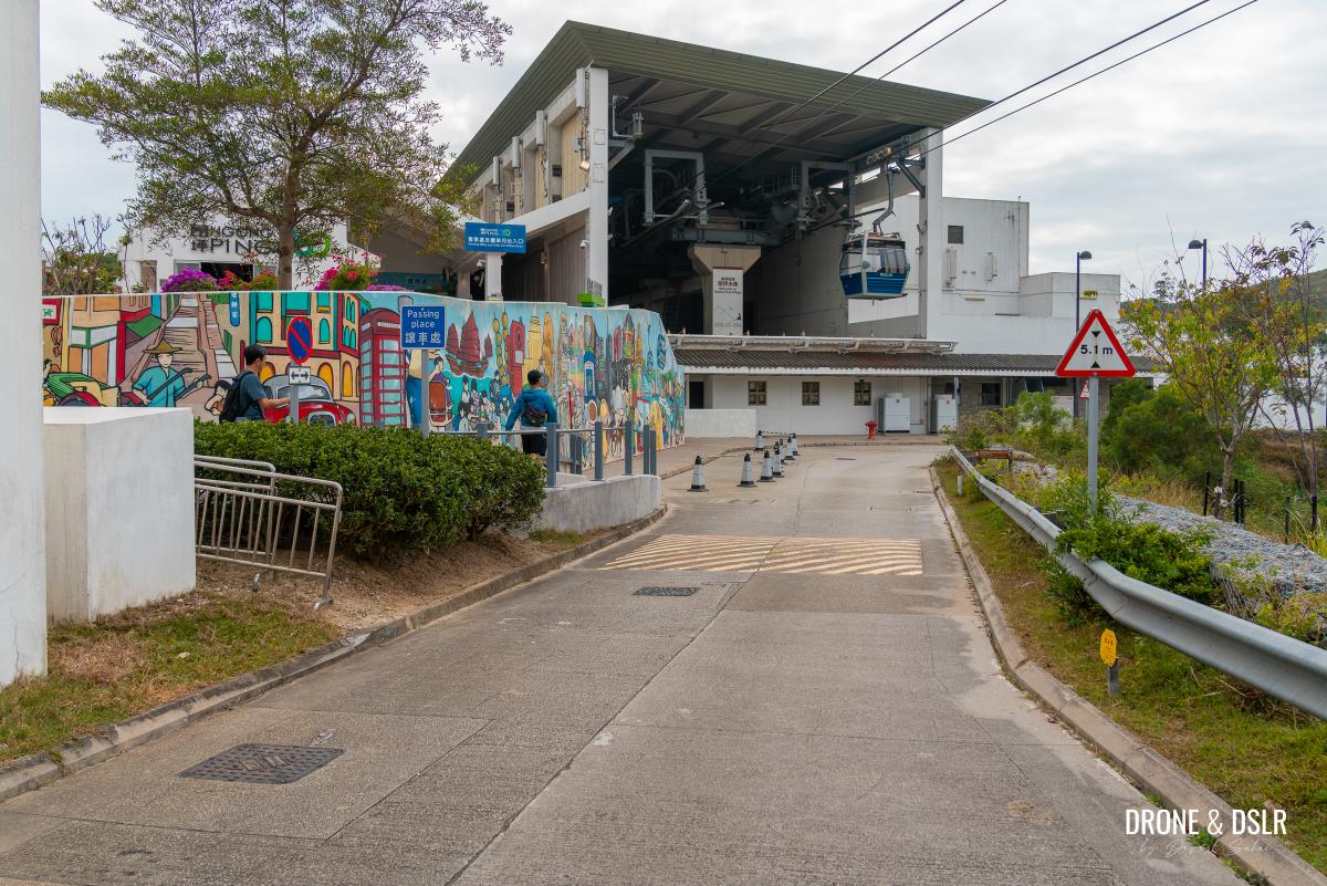
After that, simply follow the road to the colourful ramp entrance to Ngong Ping Village.
-
- Walk along the road to the colourful wall
-
- Walk up the ramp to enter the Ngong Ping Village
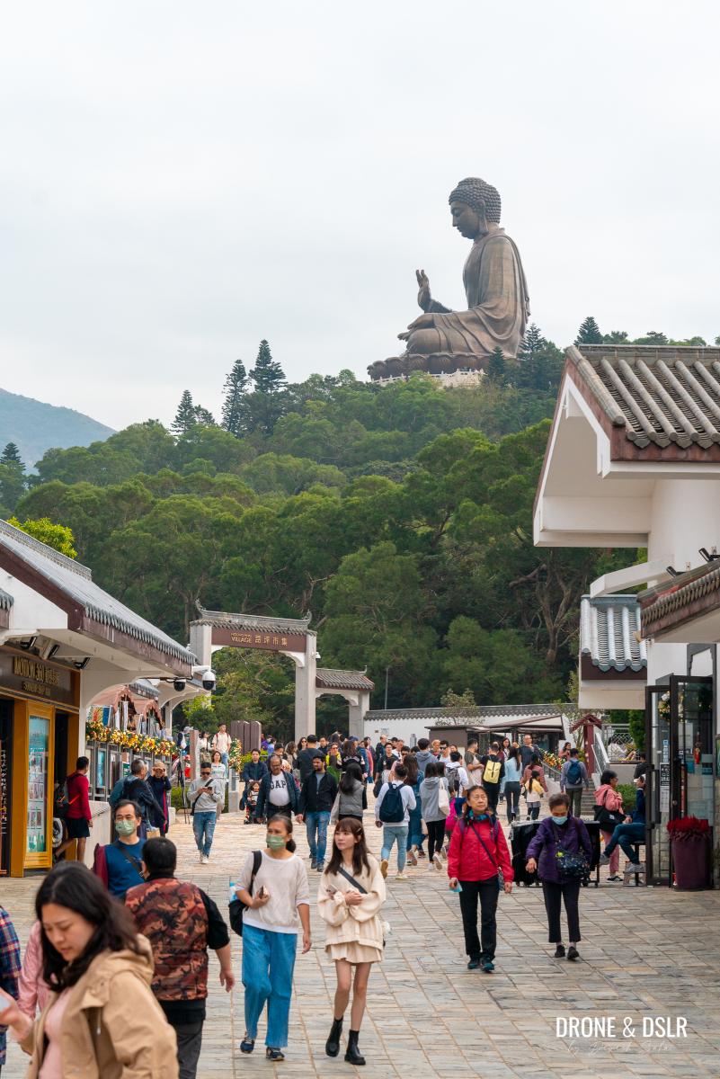
-
- Welcome to the very touristy Ngong Ping Village

Tung Chung to the (Tian Tan) Big Buddha Hike
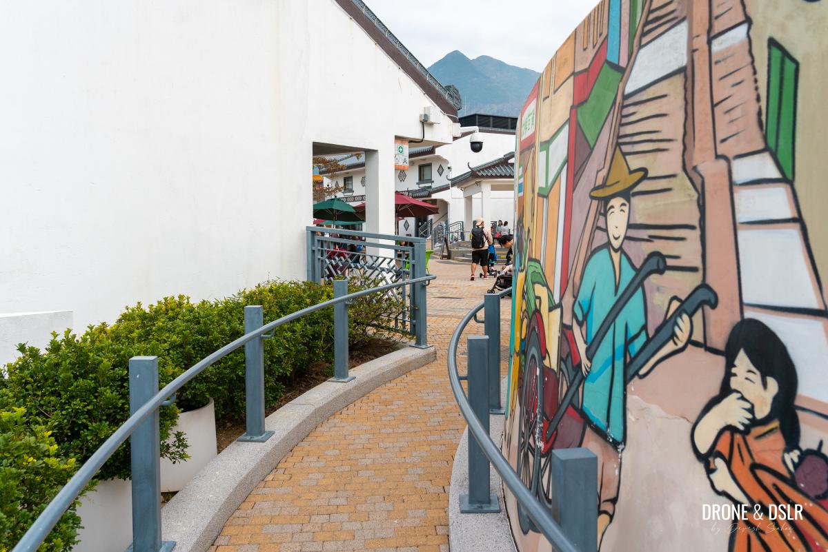
Once you reach the Ngong Ping Village, relax and enjoy as there are plenty of shops, cafés, and even toilets at this tourist hub. Feel free to pay your respects at Po Lin Monastery and the Big Buddha. Or if you have the energy, why not visit the Wisdom Path, which is a short walk from the Big Buddha.
-
- Walk around as there are many shops and cafés, or visit the Big Buddha
-
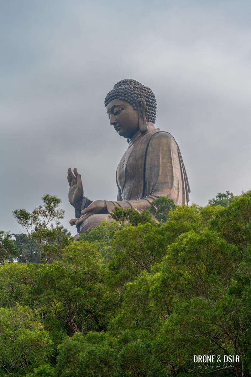
- Tian Tan Buddha (Big Buddha), Hong Kong
If you hiked your way up, we highly recommend taking the cable car back down. After all, it is a beautiful journey. Just remember to book your ticket online to avail any discounts.
The Ngong Ping 360 Rescue Trail is a challenging hike and I wouldn’t classify it as an alternative to the cable car or bus to Ngong Ping Village. It’s not as easy as the Victoria Peak Hike, which I do prefer hiking to than taking the Peak Tram.
We hope you found our detailed guide of the Ngong Ping 360 Rescue Trail resourceful. Be sure to check out more of our hikes on Lantau Island, including the ever challenging Sunset Peak and Lantau Peak.
Feel free to share this post on the social media channel of your choice and drop us a message below.
If you enjoy our work, come join us on Instagram and YouTube 🙂


You might also like


Leave a reply