
Kai Kung Leng (雞公嶺 in Chinese, quite literally “Mountain of Chicken” or more elegantly “Rooster Ridge”) is a picturesque mountain ridge in Lam Tsuen Country Park, between Yuen Long and Sheng Shui in the New Territories of Hong Kong.
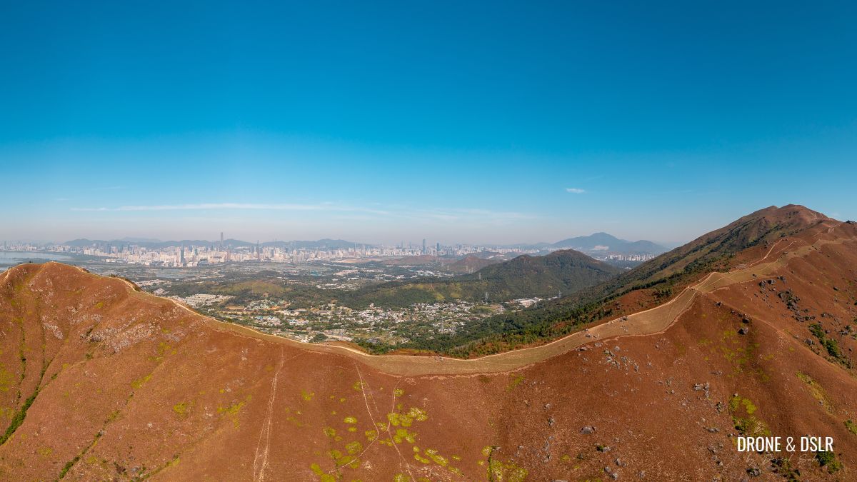
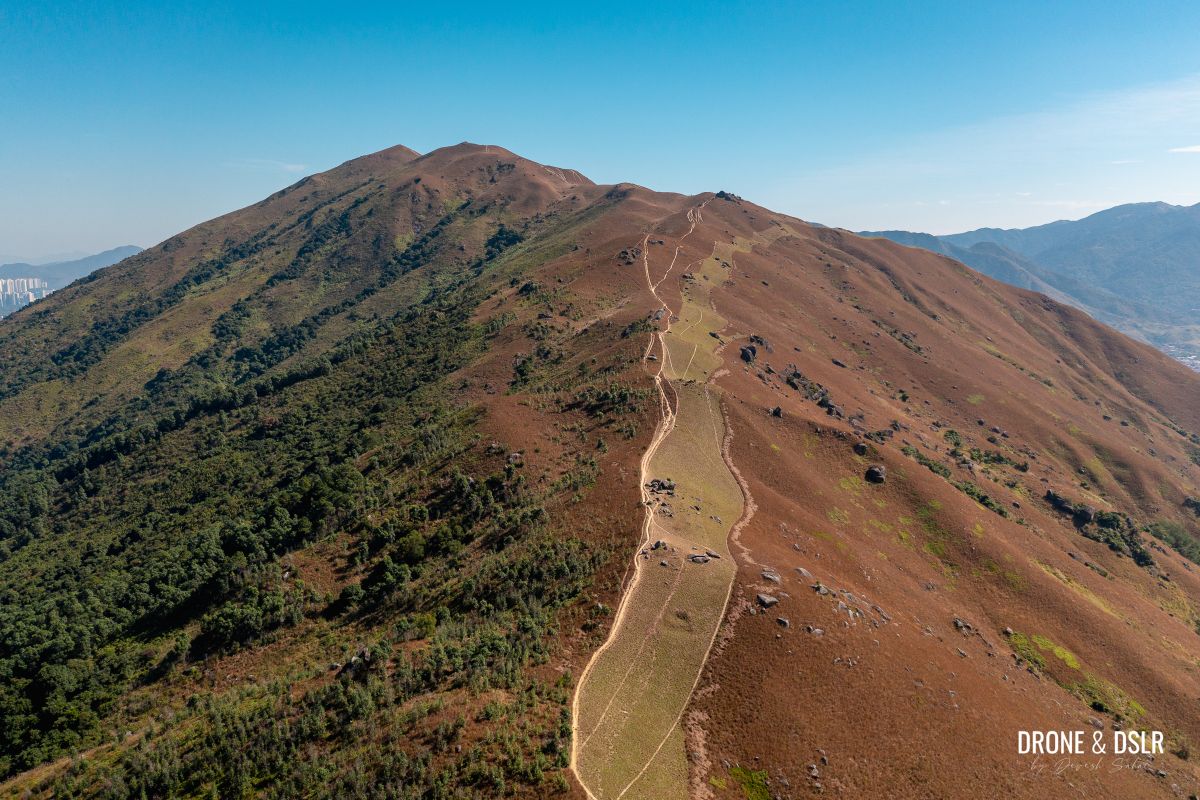
Aerial panorama of Kai Kung Leng (Rooster Ridge)
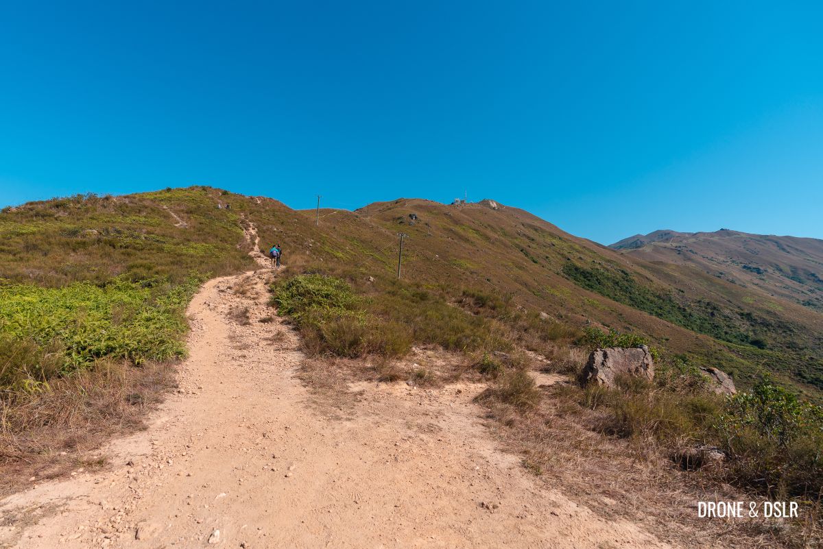
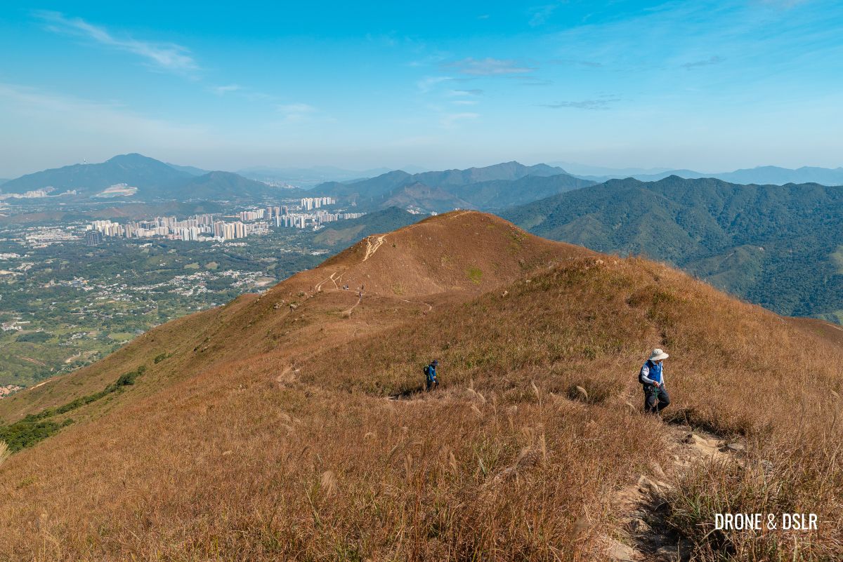
A volcanic crest with a velvety texture, Kai Kung Leng has a towering presence equalled by the magnificent views from its ridge! On a clear day, not only can one admire views of Shenzhen, but also of Tai Mo Shan, Tai To Yan, Sheung Shui, Pat Sing Leng, and even as far as Castle Peak!

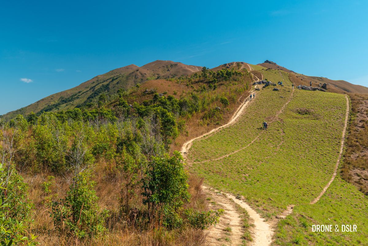
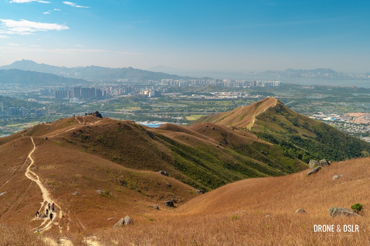
The glorious ridge of Kai Kung Leng
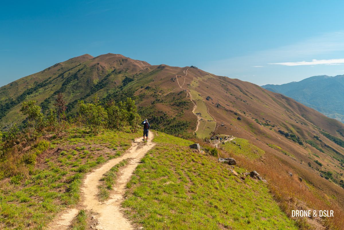
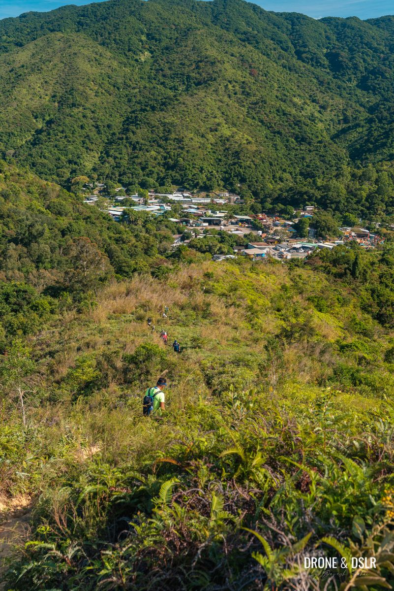
The ridge is extremely popular with hikers, mountain bikers and cyclists which is apparent by the number of trails traversing its velvet surface.
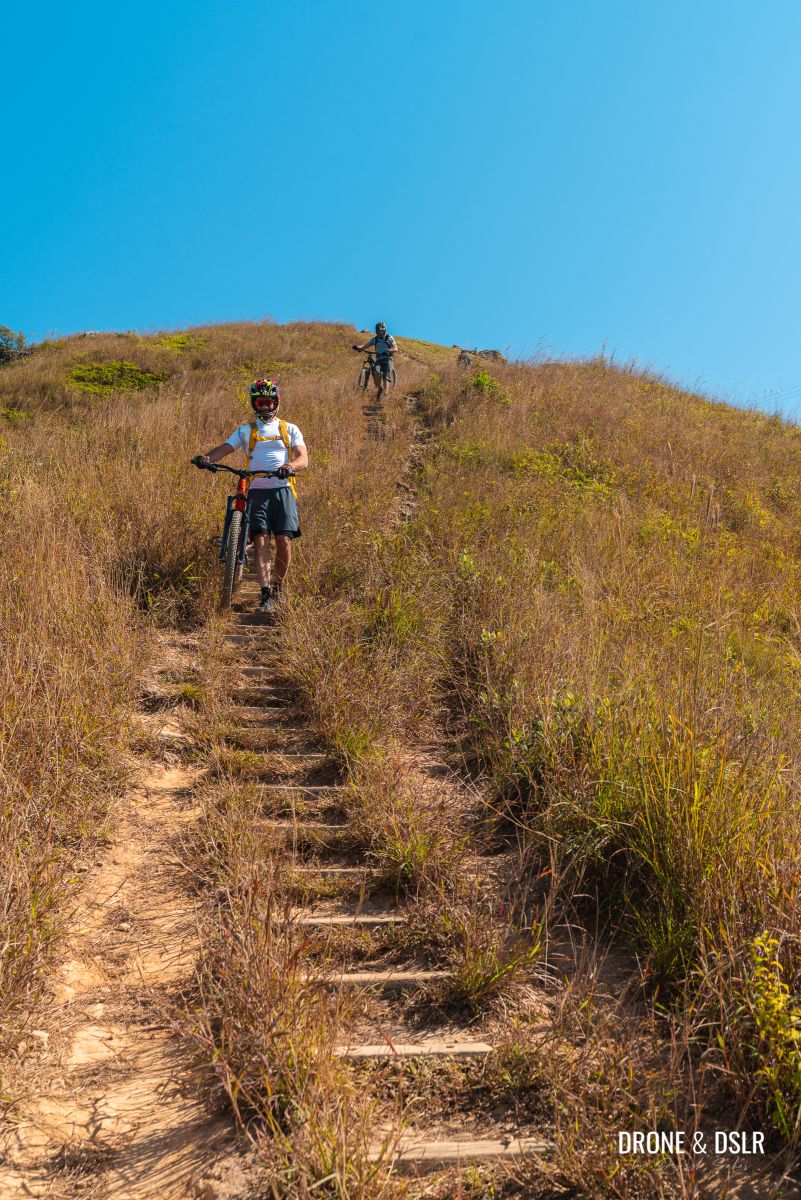
Mountain cycling is quite popular on Kai Kung Leng
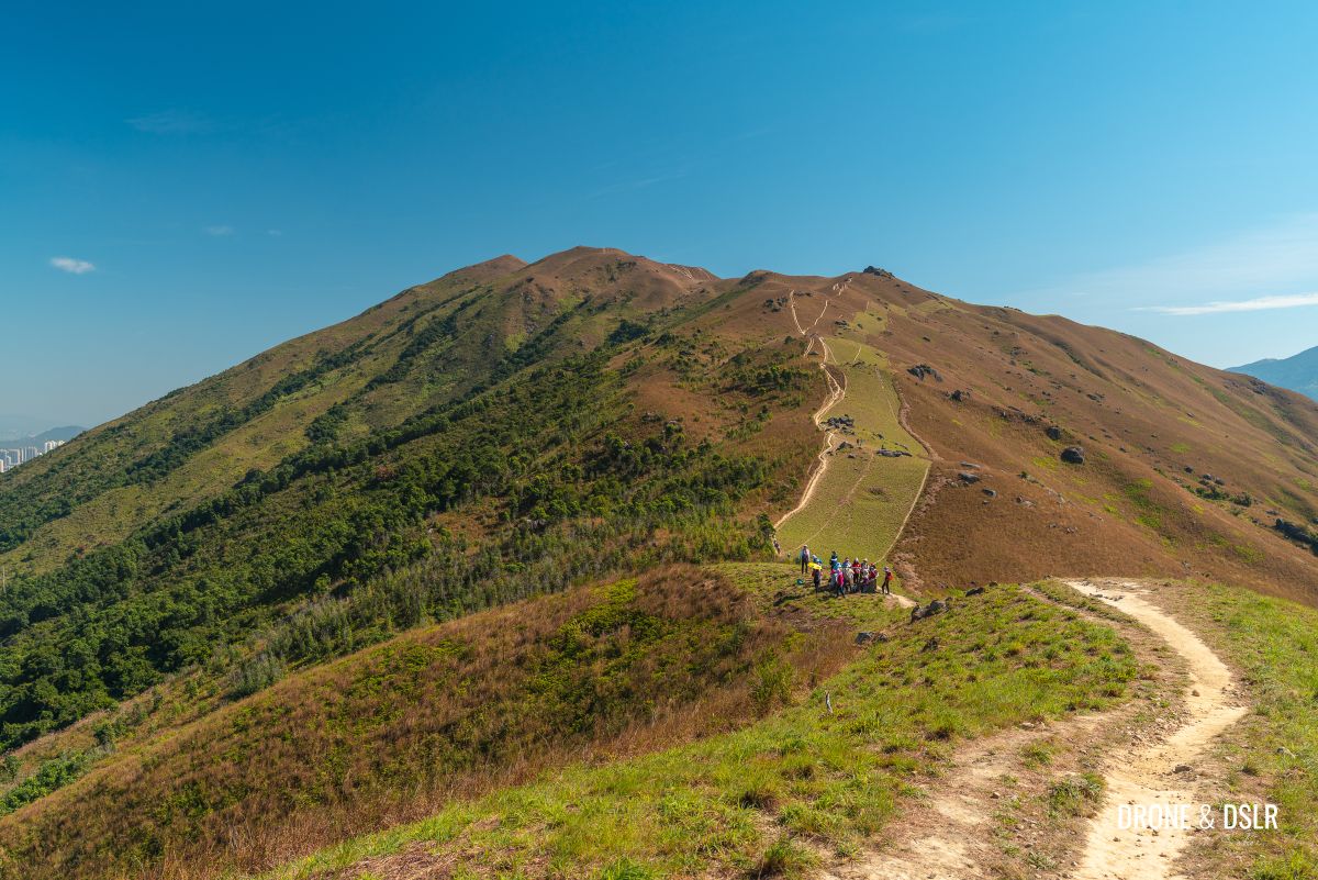
Kai Kung Leng Hike, Lam Tsuen Country Park
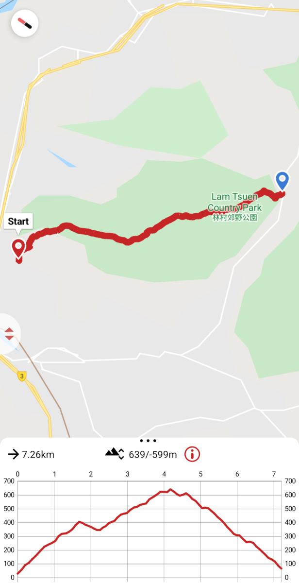
Kai Kung Leng Hike map and elevation profile
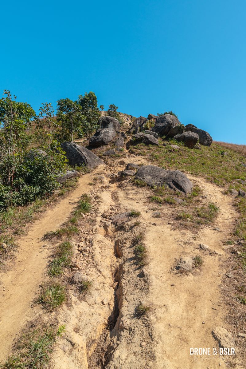
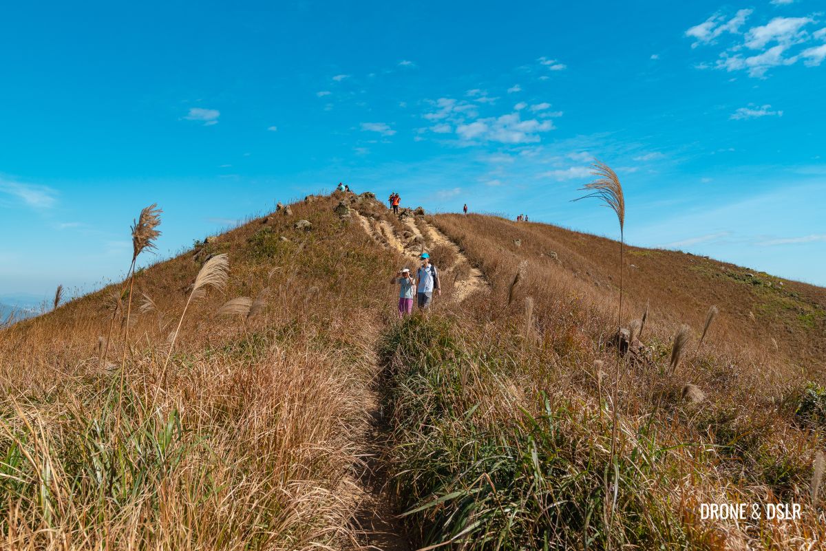
The Kai Kung Leng Hike is a challenging hike. From start to end, it crosses three peaks along the ridge, each with a steep and rugged approach. Even the trail downhill is covered in loose gravel, making it difficult to descend.
There are signs at the bottom of the ridge that warn hikers of the steep inclines and the treacherous climb ahead.
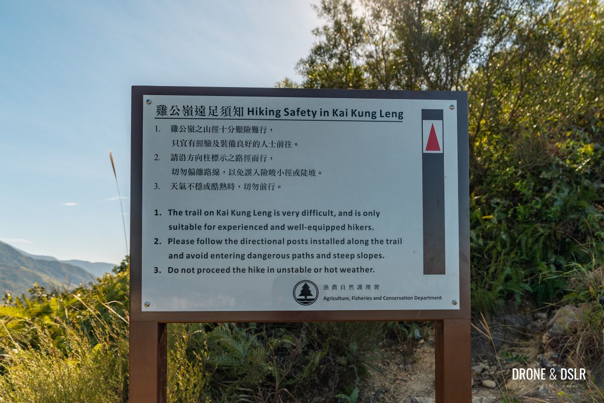
Kai Kung Leng is a challenging hike and there are sufficient warnings along the way
This isn’t a deterrent but in fact, a reminder that this is not an easy hike. So, be mentally prepared.
But most importantly, do not attempt to hike Kai Kung Leng on a sunny and hot day. There is no shade on the trail and the sun can be brutal.

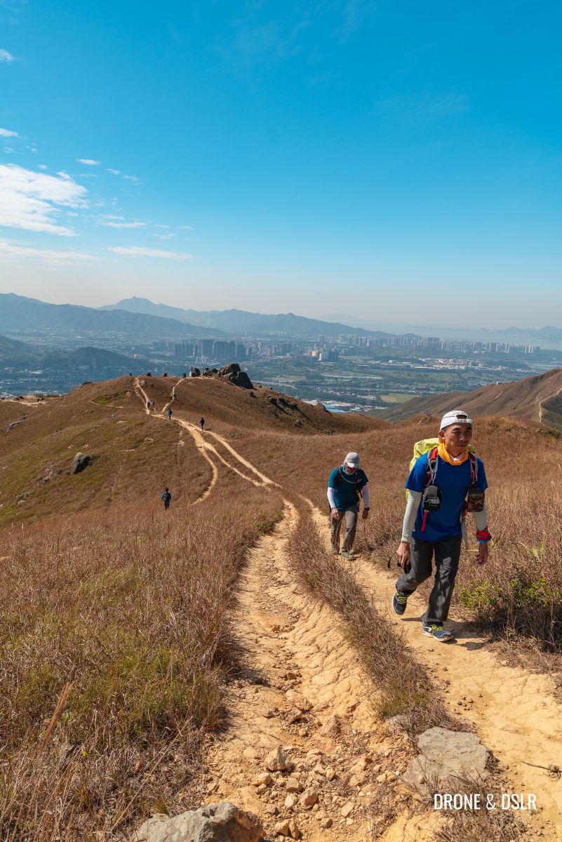
On the Kai Kung Leng Hike
An ideal day for this hike is one with no haze, which is crisp cool or cloudy so that you can enjoy the views and not worry about the heat.
And finally, please remember to carry sufficient water and sun protection, and wear proper hiking shoes and attire.
With that, here’s a quick video highlight of the hike.
Get to the starting point
It is possible to start the Kai Kung Leng Hike from either end of the ridge. But I highly recommend starting from the Yuen Long side.
To reach the starting point, make your way to Yuen Long MTR station. At the MTR station take Exit E to the bus stops below and locate the stop for the green minibus 603.
Ride the minibus to Fung Kat Heung Road and alight at the turn after the recycling point. There is no visible sign or bus stop, so use this marker on your Google Maps to alight.
Also, 603 is pretty infrequent, once every 30 minutes. So, if you don’t have the patience, take a green taxi to the starting point. It should cost approximately HK$ 50.
The starting point of Kai Kung Leng Hike is quite nondescript, except for the painted signs on poles next to the steps.

The starting point for the Kai Kung Leng Hike
To The Transmitting Station (元朗374山發射站)
If you’re not a fan of steps, you’re not going to enjoy the first part of this hike. From Fung Kat Heung Road to the TV Transmitting Station (the white building with the antennas) is a mountain of steps to climb.
-

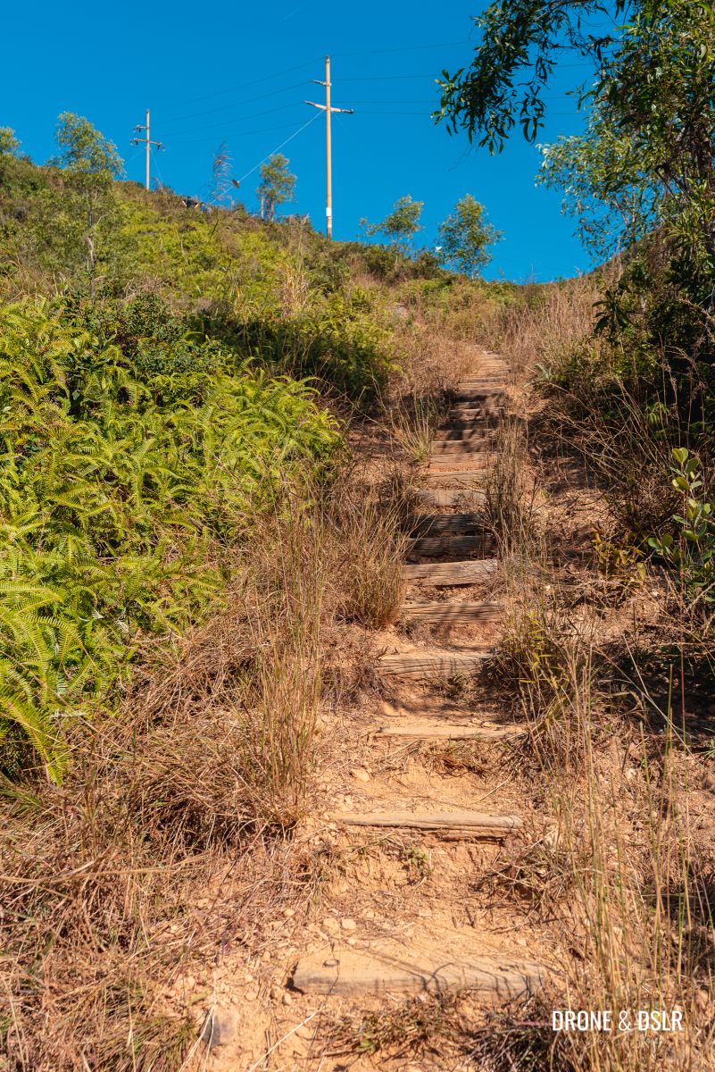
- And the steps begin
-
- The initial steps on the Kai Kung Leng hike
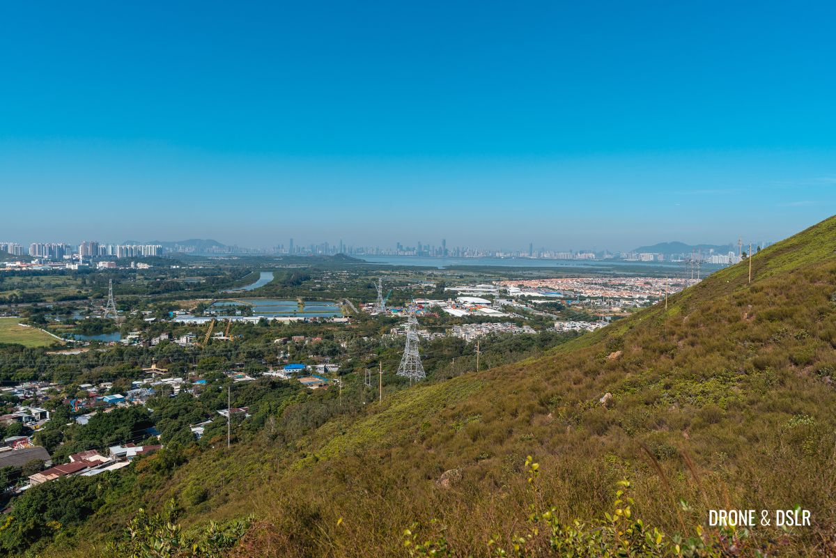
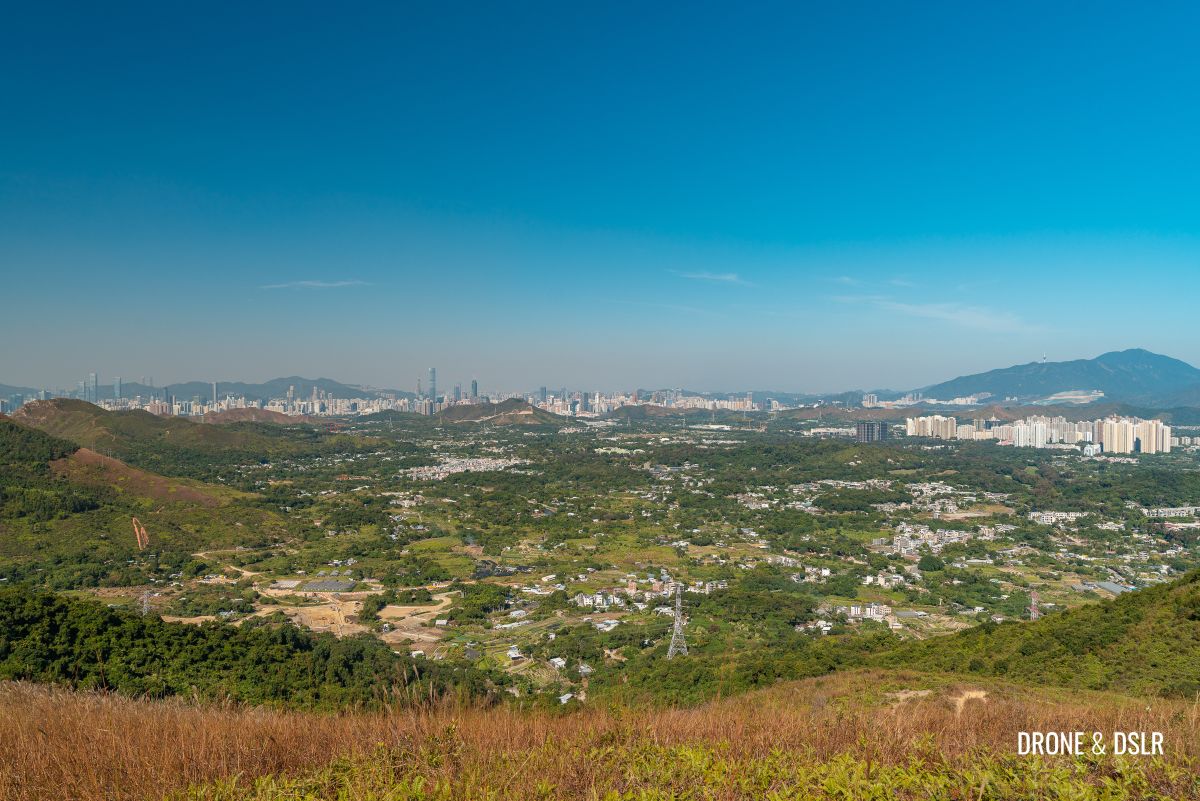
The initial section of the steps starts moderately till it approaches the landing. The landing at the end of the steps offers the first views of the Shenzhen skyline, Kai Shan, and the suburban walled garden of Fairview Park.
-
- The trail after the steps

-
- The first views for Shenzhen and Fairview Park
Continue hiking on the trail as it slowly inclines, with the Transmitting Station in line of sight.
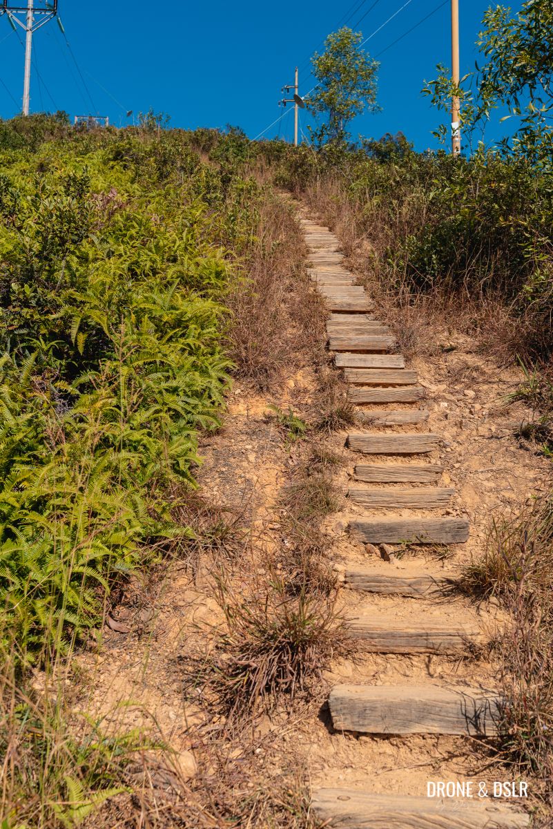
The next flight of steps is slightly more challenging with steeper steps up a winding trail. At the end of the steps, there’s another landing that offers the same views but from a higher vantage point.
-
- A mountain of steps
-
- The steps get quite steep

-
- The trail flattens after the steep steps
-
- The views keep getting better!

At this stage, the trail stays relatively flat before it approaches the final flight of steps.

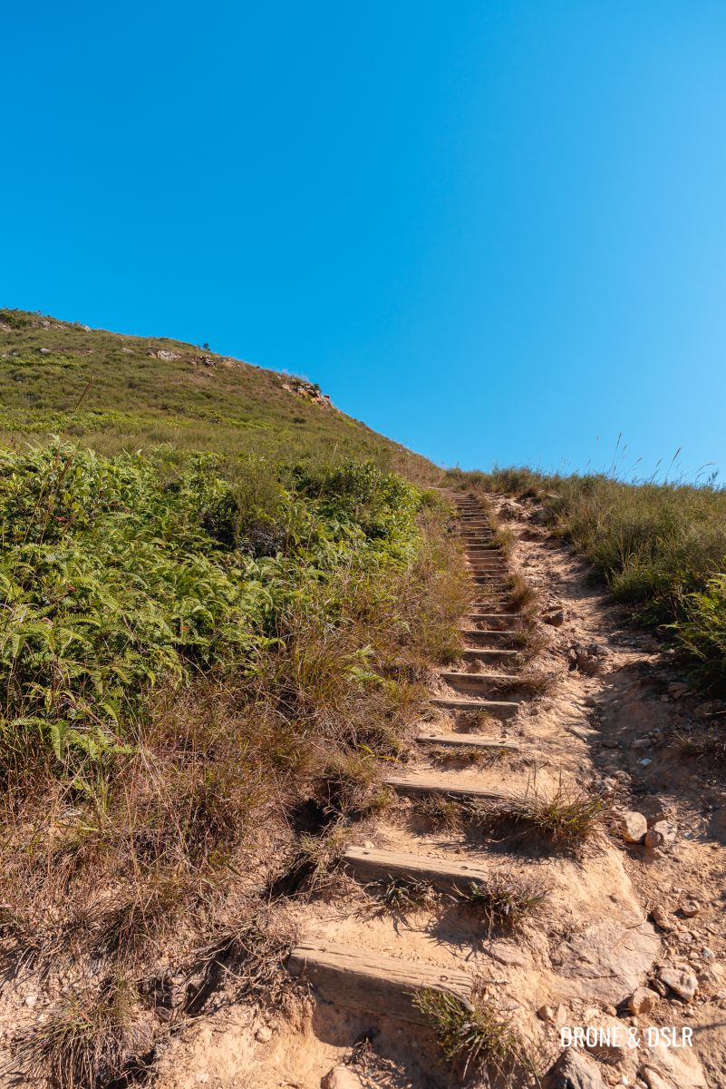
The next flight of steps is a long climb uphill, so go slow, take your time and enjoy the views.
-
- Getting ready to climb the final flight of steps to the transmitting station

-
- Climbing slowly to the transmitting station

-
- Beautiful views of Fairview Park from the hike

At the end of the steps is a short climb to the Transmitting Station (元朗374山發射站).

Almost at the Transmitting Station (元朗374山發射站)
We recommend taking a break under the shadow of the station and enjoying the views of Shenzhen while you catch your breath after the climb.
-
- Hikers taking a break in the shade of the Transmitting Station (元朗374山發射站)

-
- The views of Shenzhen from the transmitting station

To Kai Kung Shan
From the Transmitting Station, Kai Kung Shan (not to be confused with a hill in Sai Kung with the same name), the first peak on Kai Kung Leng Hike, is visible right ahead.

The final trail to Kai Kung Shan, the first peak
Although it’s a short 400-metre hike to its summit, the last 100 metres is on a steep and treacherous slope! I recall the feeling of being so close yet so far, as we began climbing the incline.
-
- The steep incline to Kai Kung Shan
-
- The steep and challenging climb to the first peak on the Kai Kung Leng Hike

-
- A feeling of accomplishment when you look back from Kai Kung Shan

Be careful as you scale the final incline to Kai Kung Shan.
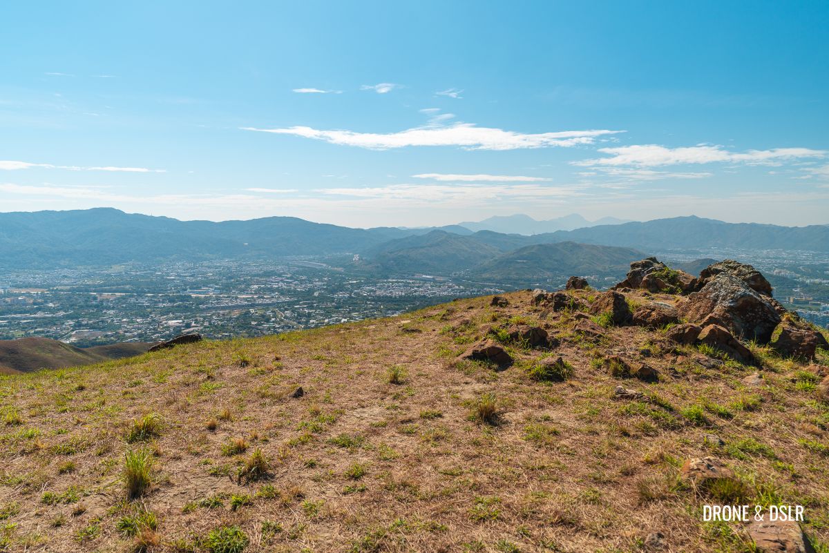
At 374 metres, Kai Kung Shan is the first peak on the Rooster Ridge Hike. Although the views of Shenzhen, Fairview Park, and the valley below are amazing, they’re no match for the views of the ridge up ahead.
-
- And finally at Kai Kung Shan!
-
- Aerial view of Kai Kung Shan, the first peak on the Rooster Ridge
-
- Literally on top of Kai Kung Shan

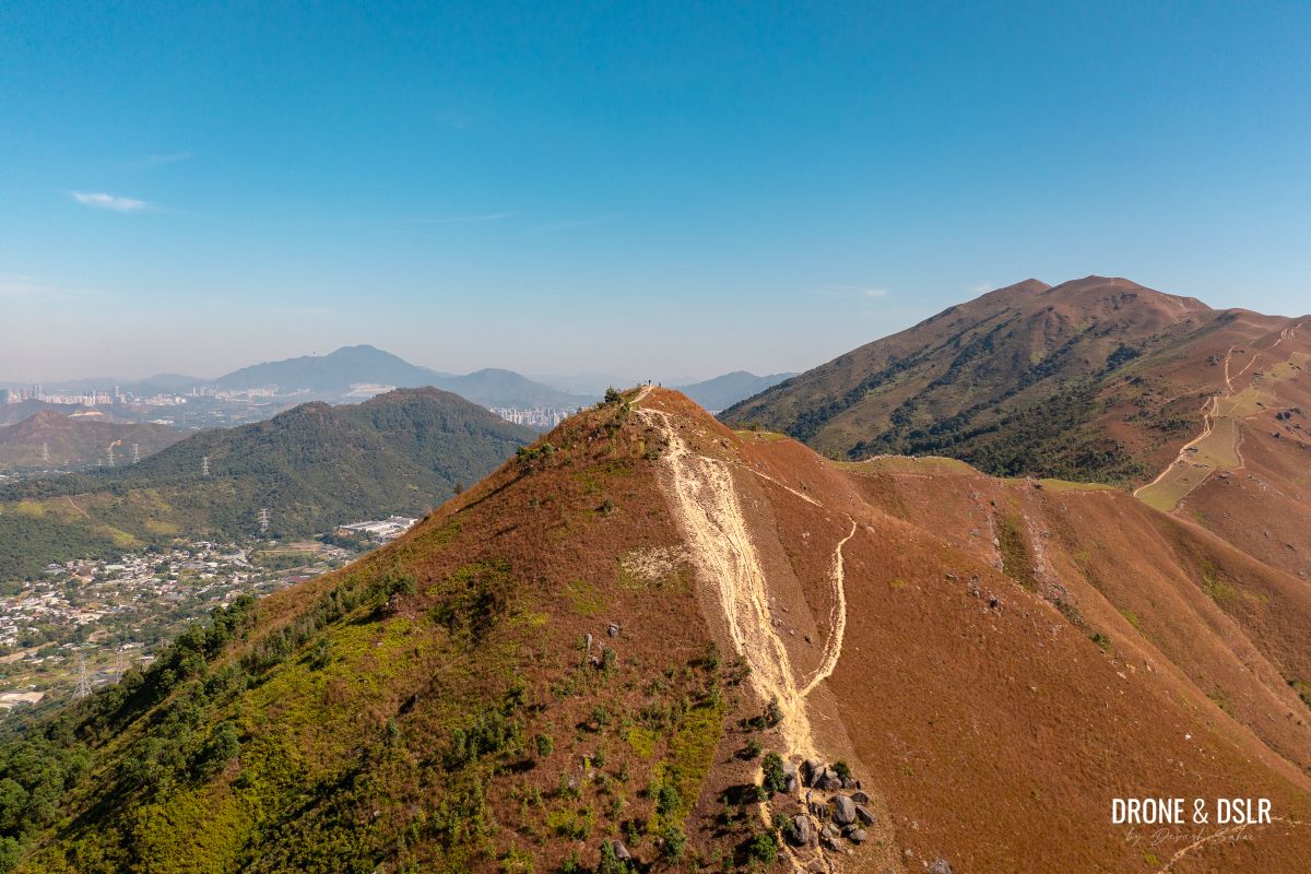
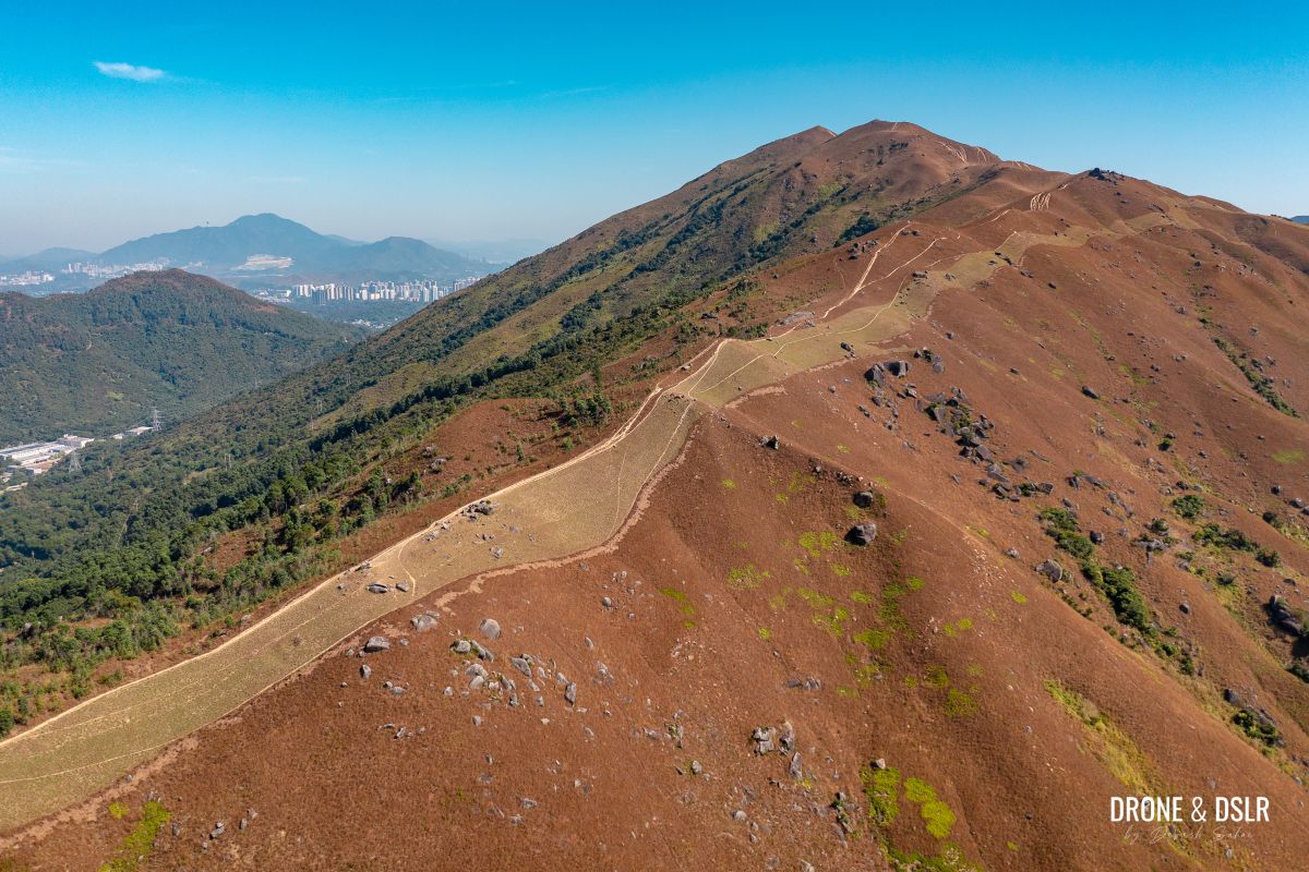
Summer or winter, the velvety texture of the ridge provides this hike with an idyllic characteristic. The local authorities have also made several efforts to plant more grass and trees along the ridge, which makes it one of the most beautiful ridges in Hong Kong in my opinion.
Rooster Ridge
I could be completely wrong but the ridge following Kai Kung Shan sort of looks like a rooster’s neck. Perhaps that’s where it gets its name from? Maybe someone can help me understand the name origins of this ridge.
The trail on the ridge, with two notably different sides
Whether that’s true or not, this section is the most scenic and easy part of the entire hike!
The most scenic section of the hike begins after Kai Kung Shan
As you proceed from Kai Kung Shan, the trail dips below to an area that’s unusually lush with laurel trees, and grassy.
-
- The trail descends into Rooster Ridge

-
- The velvety surface of Kai Kung Leng

-
- Cherish this section of the hike
The north-facing slope is clearly more fertile and lush than the south-facing slope. But what’s more, the open ridge provides unobstructed views of Shenzhen on one side, and Kam Tin on the other. I found walking on this ridge absolutely gorgeous!
The open ridge of Kai Kung Leng with views of Shenzhen
Although the lushness of the ridge feels oddly relaxing, it’s difficult not to be slightly intimidated by the view of the trail up ahead!
The incline returns
At the end of this verdant and easy section, the trail begins its incline again.
And the incline begins again
As the trail gradually progresses, it approaches a cluster of rocks and rock formations. One of the rocks in this section of the hike is known as the Earthworm Rock. Unfortunately, I couldn’t find it. But it’s from this rocky area that the hike once again becomes an uphill challenge.

The incline is accompanied by an area of rock formations
Because there is no shade on this hike, Kai Kung Leng and the trail to its summit are always visible and serve as a visual reminder of what still needs to be conquered.
The beautiful texture of Kai Kung Leng
Always having the summit and trail in your line of sight can be slightly anxiety-inducing. So, my advice is to put your head down and keep climbing.

A fellow hiker enjoying the rocks on this incline
The trail also gradually swaps its verdant texture for more rugged terrain. As that rugged terrain continues to climb uphill, it approaches another large rock formation labelled on maps as 桂角石嶺.
-
- A platform for viewing the valley below
-
- The trail gets rawer after the rocks
-
- On the ridge of Kai Kung Leng

-
- Approaching the Guijiao Stone Ridge (rock formation)

Guijiao Stone Ridge (桂角石嶺)
This large cluster of rocks provided shade for another much-needed break! On this shadeless hike, we valued whatever respite we could get from the sun.

Guijiao Stone Ridge (桂角石嶺)
From my research, I think that there is a fair amount of interest in this rock formation (桂角石嶺), with many stories and tales.
One of the rocks in the formations is known as the “Fairy Dressing Rock”. Again, I could be wrong because my research is limited.

The most popular rock formation on the hike
But we were glad to take a break under its shade before mustering the strength to conquer the final stretch!
To Kai Kung Leng
From the Guijiao Stone Ridge, the Kai Kung Leng summit is another 700 metres ahead.

The hike continues to Kai Kung Leng
The trail continues uphill at a moderate incline till it reaches a rock with multiple cairns (piles of stones) on top of it.
-
- So fascinating to turn around and admire the views
-
- Approaching another steep incline

-
- The steep incline next to the cairn

The rock with the cairns marks what I found to be one of the most challenging inclines on the Kai Kung Leng Hike.

The incline is steep and can be very slippery
But at the top of this incline, is a flat rock platform perfect for admiring the views of Rooster Ridge and the trail behind! Because the trail is always visible on this hike, it’s worth looking back and feeling proud of what you’ve conquered so far! Not to mention, the ridge looks very photogenic from here.
-
- The views of Kai Kung Leng from the platform after the steep incline
-
- On the Kai Kung Leng Hike
From the flat area, continue on the trail as it finally closes in on Kai Kung Leng.

The home stretch to Kai Kung Leng peak
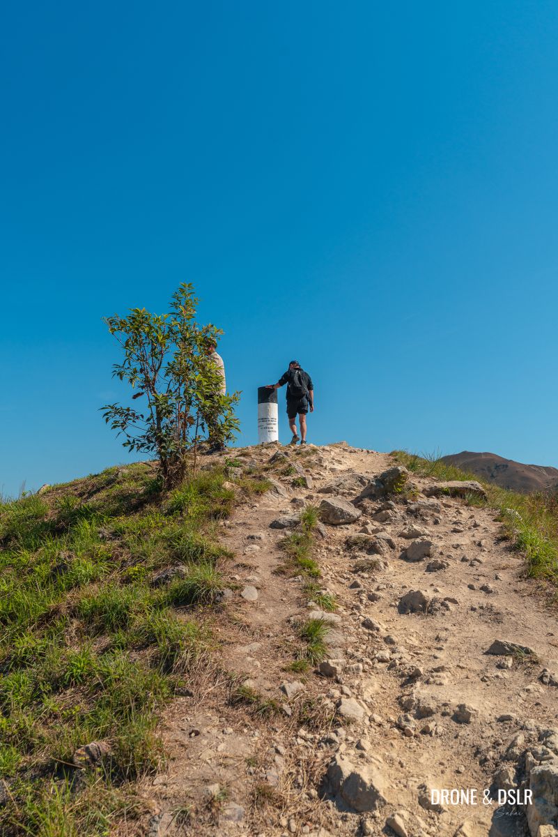
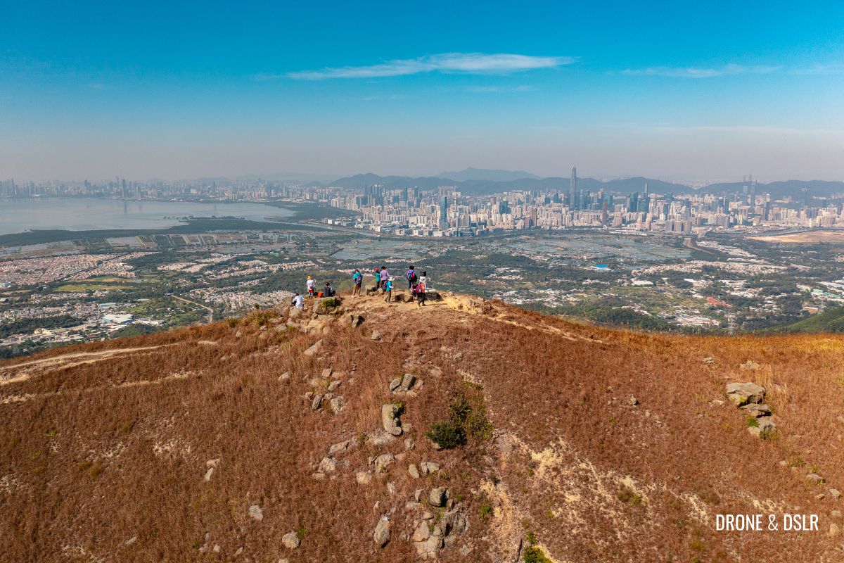
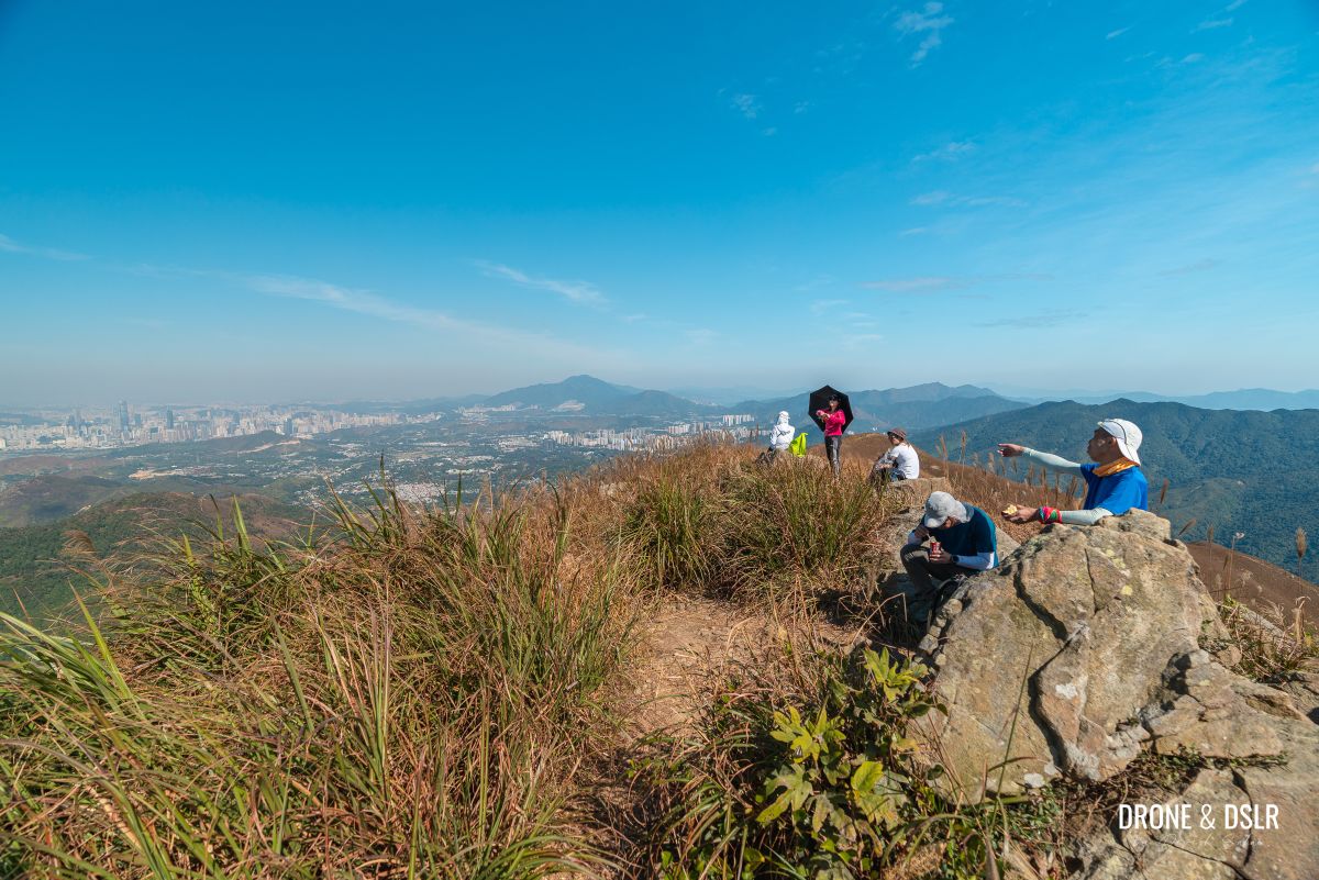
Kai Kung Leng
At 572 metres, Kai Kung Leng (also known as Tai Lo Tin (大羅天) or formerly Kwai Kok Shan) is the second peak on the Kai Kung Leng Hike. And it may come as a surprise but it’s not the tallest peak on the range.

Made it to Kai Kung Leng
But it’s the peak the hike is now named after and has some of the most spectacular views of Shenzhen, Kam Tin, the wetlands, Tai Mo Shan, Kam Tin and beyond.
-
- The views from on top of Kai Kung Leng
-
- Views of the valley, the airstrip, and Tai Mo Shan to the south

-
- Views of Shenzhen from on top of Kai Kung Leng

Now you know why we recommend hiking to Kai Kung Leng on a day with no haze. During our hike, we could see as far as Castle Peak!

Kai Kung Leng panoramic view
Lo Tin Teng
At 585 metres, Lo Tin Teng is the tallest peak on the Kai Kung Leng Hike. It’s situated adjacent to Kai Kung Keng, separated only by a small gap.

Views of Lo Tin Teng from Kai Kung Leng
The trail between Kai Kung Leng and Lo Tin Teng first descends before sharply ascending again. But there is an alternate trail that goes around the Lo Tin Teng Peak, in case you’re not interested in scaling it.
-
- Another steep climb up to Lo Tin Teng

-
- The top of Lo Tin Teng
The views from on top of Lo Tin Teng are no different than those from the top of Kai Kung Leng. Except that, I found more vegetation on top of Lo Tin Teng.
-
- The views from on top of Lo Tin Teng

-
- Views of Shenzhen from the top of Lo Tin Teng

So, that’s the highest point on the Kai Kung Leng Hike. And from here on out, it’s all downhill!
Down to the hill with trees on top
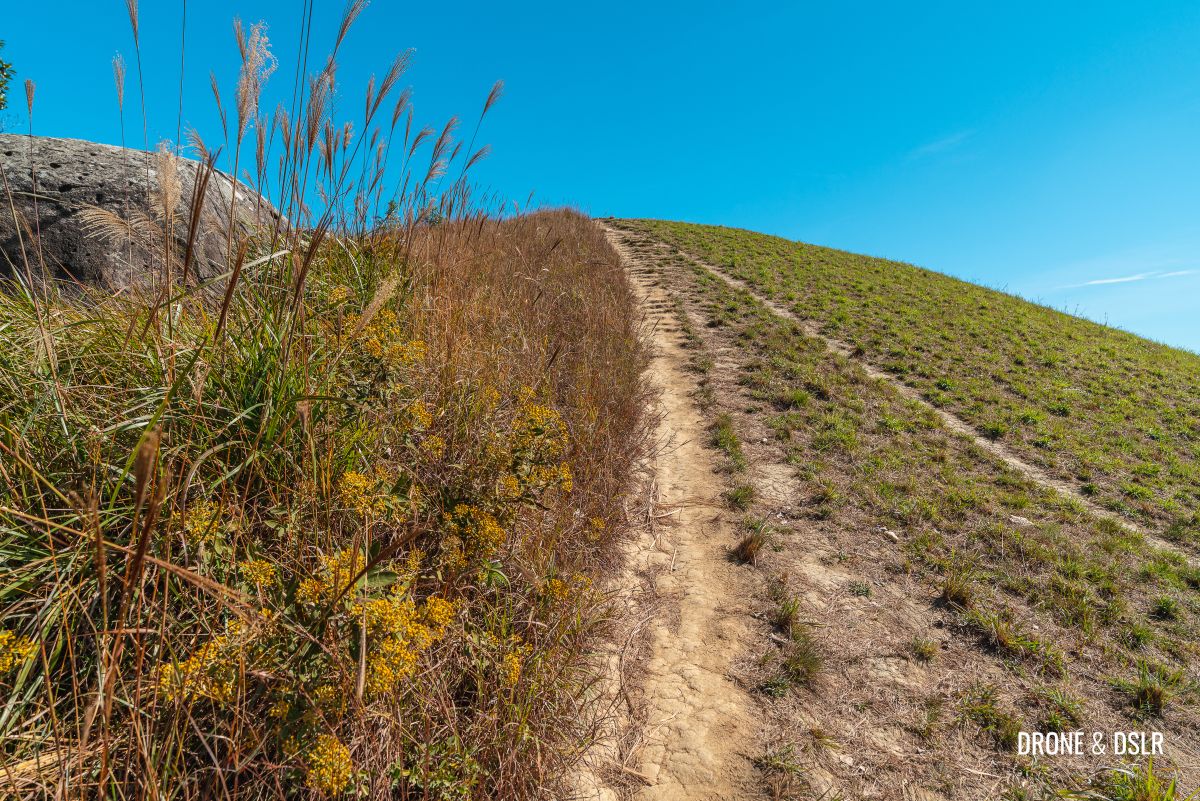
As I mentioned earlier, Kai Kung Leng Hike is challenging, even while going downhill. The trail downhill remains steep and treacherous with loose gravel for an added level of slipperyness.
Let the descent begin!
As you begin your descent from Lo Tin Teng, the trail sharply descends and reaches a small mound.
The small mound after the initial descent
After the mound, remember to stay on the trail to the right, the one that faces the neighbouring ridge of Tai To Yan. I honestly found this section of the descent to be as challenging as it is beautiful!
-
- Finally, clear views ahead

-
- Some sections of the descent are steep and slippery

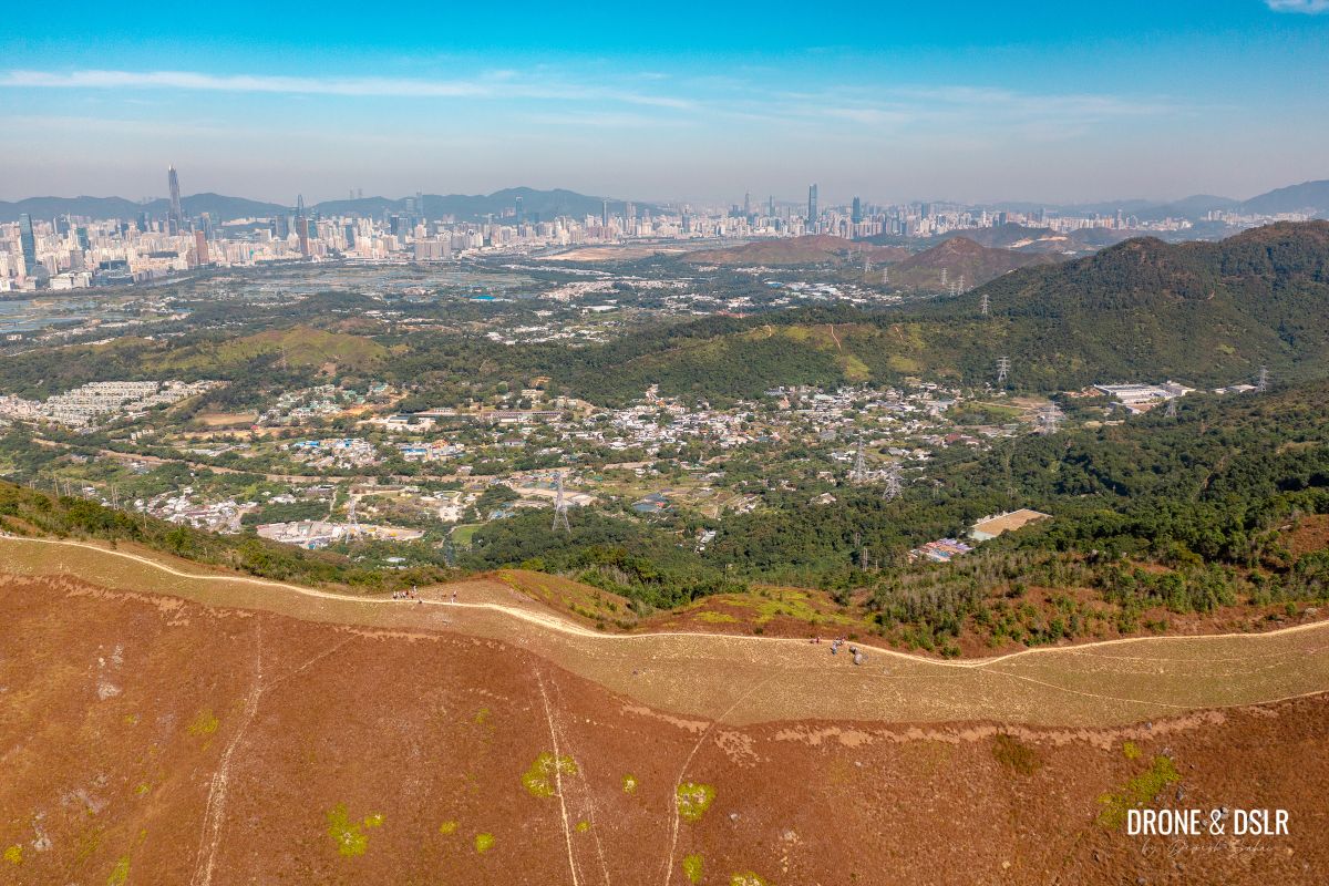
The panoramic views are simply breathtaking. On the left are Sheung Shui, Fanling, and Shenzhen, in front is Tai To Yan, and on the right is the valley with the Shek Kong Airfield.
-
- View of Shek Kong Airfield from the velvety hills of Kai Kung Leng

-
- This section, in front of Tai To Yan is very tricky to navigate

-
- Gorgeous views of Tai To Yan from Kai Kung Leng

Honestly, I didn’t know what to focus on, the challenging descent or the beautiful views!
-
- The trail downhill is steeper than it looks

-
- Finally, a flat trail with beautiful views up ahead

-
- Encountering more mountain cyclists on our way downhill

-
- The descent is long and unforgiving

Other than the views, we also found many scattered marble rocks along the trail.
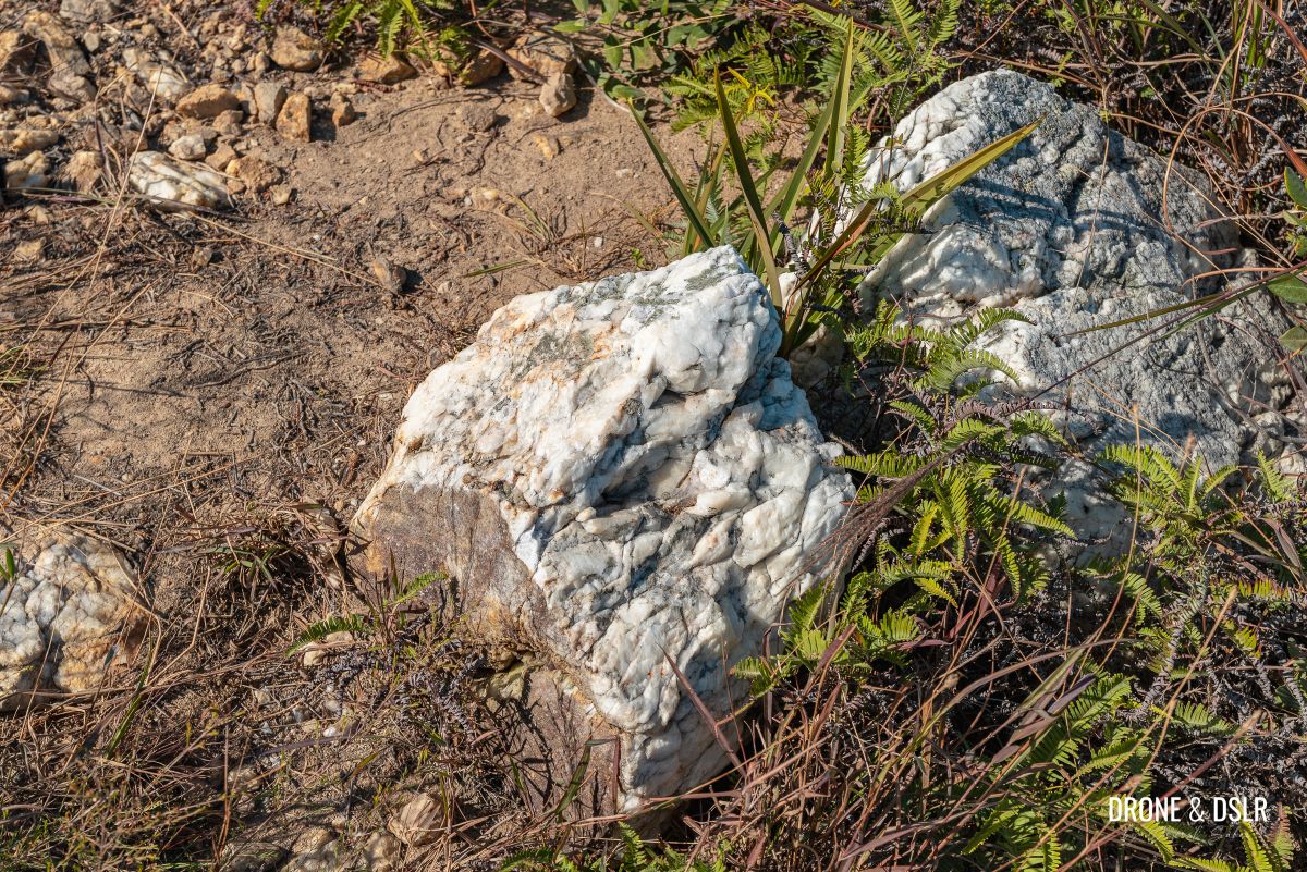
We noticed many marble rocks along our hike
There are a couple of stretches where the trail runs flat, but sadly for not too long. As the trail gets closer to the end, a small hill covered with trees on its top appears. Trees are a rare sight on this hike.
-
- Almost at the hill with the trees

-
- More views of Shenzhen and Sheung Shui
-
- And finally, the hill with the tree top

Once we entered the shaded area of the tree-top hill, we decided to take another quick break.
The final descent to Fan Kam Road
After crossing the hill with the trees, the trail continues to descend sharply. I think my legs were so tired at this point, I slipped a couple of times. The loose gravel didn’t help either.
-
- After crossing the hill we realised there was more downhill hiking


As the trail ends its downhill slope, it splits in two. At this point, turn right.

Turn right at this point
The trail then faces Tai To Yan again and cuts through wild vegetation. For the first time during this hike, the route becomes hidden.
-
- The trail heads downhill through the vegetation with Tai To Yan ahead
-
- The only part of the hike that cuts through vegetation

Once the trail with the vegetation ends, turn left onto the cemented path and walk down the steps.

Walk down these steps
At the end of this path, turn right and continue walking down the steps to arrive at a village near Kiu Tau.

And walk down these steps to the village
At the village, cross the bridge over the Sheung Yue River and walk under the large overhead pipe to end the hike at Fan Kam Road.
-
- Cross the bridge over the Sheung Yue River

-
- Walk under the overhead pipe to reach Fan Kam Road

To head to Yuen Long, cross the road and walk right to the bus stop for 77K. To head to Sheung Shui, turn right and walk to the bus stop for 77K on the same side of the road.
The Rooster Ridge Hike
The Rooster Ridge Hike is as challenging as it is picturesque!

Aerial view of the twin tops of Lo Tin Leng and Kai Kung Leng
The initial part of the hike reminded me of the Lantau Peak Hike because of the multiple hills. The unsettling downhill trail reminded me of the Lo Fu Tau Hike (Tiger’s Head) in Discovery Bay.
But of course, the best part about the hike is the views! Kai Kung Leng, with its unobstructed views, offers incredible views of both Hong Kong and Shenzhen throughout the hike! If you want a hike with a similar landscape, but much easier, then we also recommend Cheung Ngau Shan, a neighbouring hill.

An aerial panorama of Kai Kung Leng
We hope you find our guide to the Kai Kung Leng Hike helpful. We’d love to hear your comments below, and please feel free to share this post on the social media channel of your choice.
If you enjoy our work, come join us on Instagram and YouTube 🙂


You might also like


4 Comments
Hi I’m very pleased to see your guide on rooster ridge as it’s on my to hike list. A question. May I know why you recommend to start the hike from Yuen Long side? You mentioned it’s challenging going downhill due to loose gravel. Personally I prefer ascending rather than descending if the ground has lots of loose gravel. So bearing this in mind what would your advice be. Start from Yuen Long or from Sheung Shui?
Hi Lulu,
Great question! I think I am one of those who doesn’t mind descending down the loose gravel. But having said that, the steep inclines while going up from Yuen Long side, become the steep descents with the loose gravel when coming down from the Sheung Shui side.
But the main reason why I recommend the Yuen Long side is that the climb is more gradual. If you look at the elevation profile on the map, it is a non-stop climb up to Lo Ti Teng from the Sheung Shui side. But if you start from the Yuen Long side, the hike is more gradual and spaced out before reaching Kai Kung Leng and Lo Tin Teng.
Hope that makes sense 🙂
I did this hike based on your post! Really thankful for it cos I was slow and by the time I started my descent after Lo Tin Teng, the sky quickly turned dark and I had to rely on my phone light AND your post helped a lot especially when going through the vegetation in the dark. Thanks! Which other similar trail would you recommend next? Thanks a million!
Hi there,
You’re very welcome! I know what you mean, navigating through the vegetation is bad enough in broad daylight, can’t imagine it after sundown.
In terms of a similar trail, the descent for Rooster Ridge reminded me a lot of the descent for Tiger’s Head. Perhaps you could try the Lo Fu Tau Country Trail next.