
Ha Fa Shan (下花山) is a 316-metre-tall hill located northwest of Tsuen Wan along the Yuen Tsuen Ancient Trail.
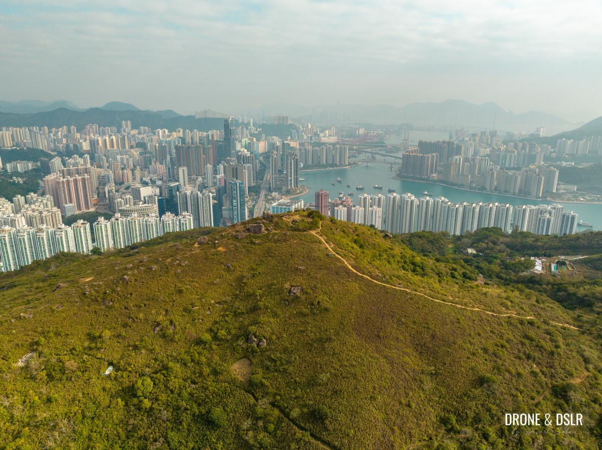
Ha Fa Shan with Tsuen Wan and Tsing Yi in the background
Ha Fa Shan, which also shares its name with the village situated on it, is perhaps the best location to enjoy panoramic views of Tsuen Wan and Tsing Yi! The hill is also covered with many large boulders that make it popular for rock climbers.

Tsuen Wan views from Ha Fa Shan
The Ha Fa Shan Hike
The hike to Ha Fa Shan is relatively easy and comes with stunning views of Tsuen Wan, Tsing Yi, and the Rambler Channel that separates the two.
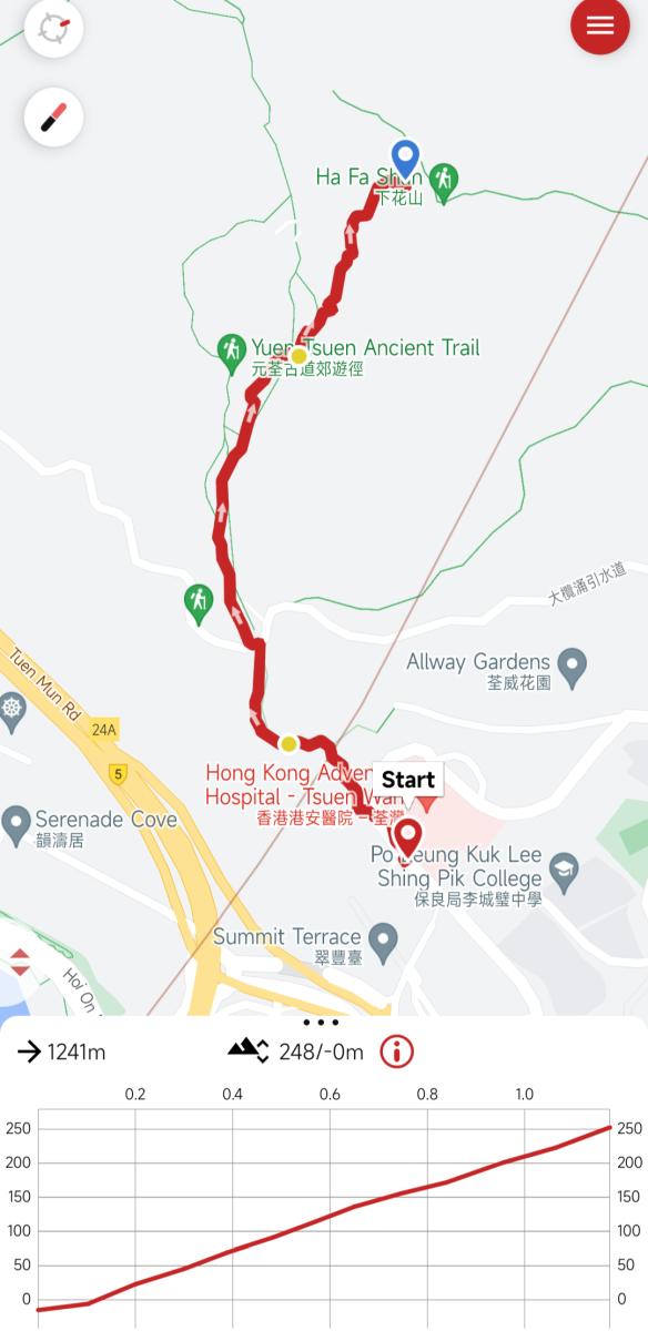
Ha Fa Shan hike trail map
Given its short distance, many hikers choose to combine it with Lin Fa Shan and Shek Lung Kung or do it as part of the Yuen Tsuen Ancient Trail.
But of course, it’s possible to just hike up Ha Fa Shan, if you want nothing else but incredible views of Tsuen Wan.

Aerial panoramic views of Tsuen Wan, Rambler Channel, and Tsing Yi from Ha Fa Shan
And here’s a quick video of Ha Fa Shan to give you an idea of the views from the top.
Subscribe to my YouTube channelUnfortunately, there is no maintained trail to Ha Fa Shan which involves going off-trail from the Yuen Tsuen Ancient Trail. There are numerous unmarked approaches to Ha Fa Shan. However, this guide will focus on two approaches from Adventist Hospital, one easy (longer) and the other slightly more challenging (shorter). And although I picked the latter, I’ll highlight the easier route in this guide too.
Starting point
The Ha Fa Shan Hike starts from the Hong Kong Adventist Hospital in Tsuen Wan. This also happens to be the starting point of the Yuen Tsuen Ancient Trail.

Tsuen Wan Adventist Hospital bus stop
There are a few buses that ply the Tsuen King Circuit Road in front of the hospital. And the most convenient option I found was bus 39A from outside the Tsuen Wan MTR Station.
At the Tsuen Wan MTR Station, take the steps down from exit A4 to the bus stop. The stop for 39A is close to the steps.
Alight at the stop for the Adventist Hospital and walk 50 metres ahead to the steps for Yuen Tsuen Ancient Trail.
-

- Walk ahead after alighting at the bus stop

-
- Turn left onto the steps
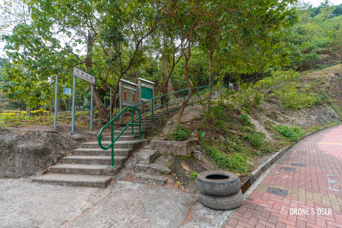
This is the starting point.
To the Tai Lam Chung Catchment
The Ha Fa Shan Hike overlaps with the Yuen Tsuen Ancient Trail for the initial section.
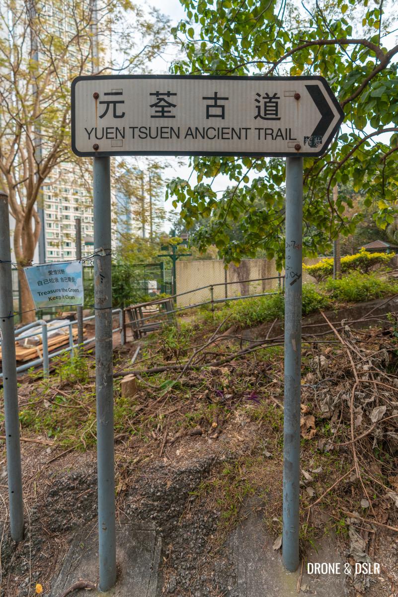
Follow the signs for the Yuen Tsuen Ancient Trail
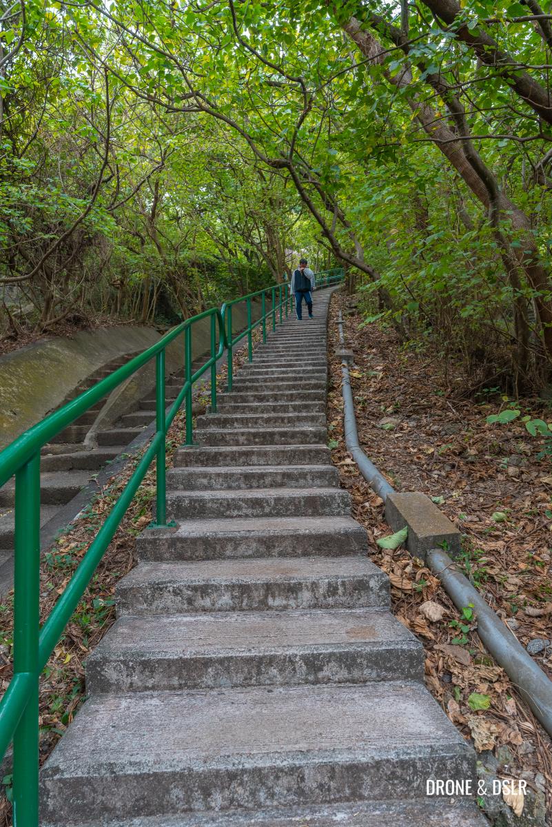
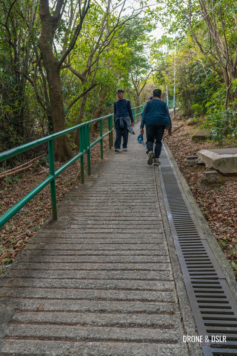
On you’re off the road, the trail immediately starts with a flight of steps.
The steps are relatively easy and shaded and run alongside a water drainage system. At the end of the first flight, cross the drainage to the other side and continue climbing them.
-
- The hike begins
-
- Cross and continue climbing the steps

-
- The steps aren’t too difficult

Halfway up the second flight of steps is a beautiful old tree with an ancient structure beside it. I imagine it’s part of the Yuen Tsuen Ancient Trail.
-
- An old, abandoned house on the Yuen Tsuen Ancient Trail

-
- Beautiful tree on the Yuen Tsuen Ancient Trail

At the end of this flight of steps is another bridge. After the bridge, take the steps immediately to the right.
-
- Cross the second bridge and turn right immediately

-
- The steps continue

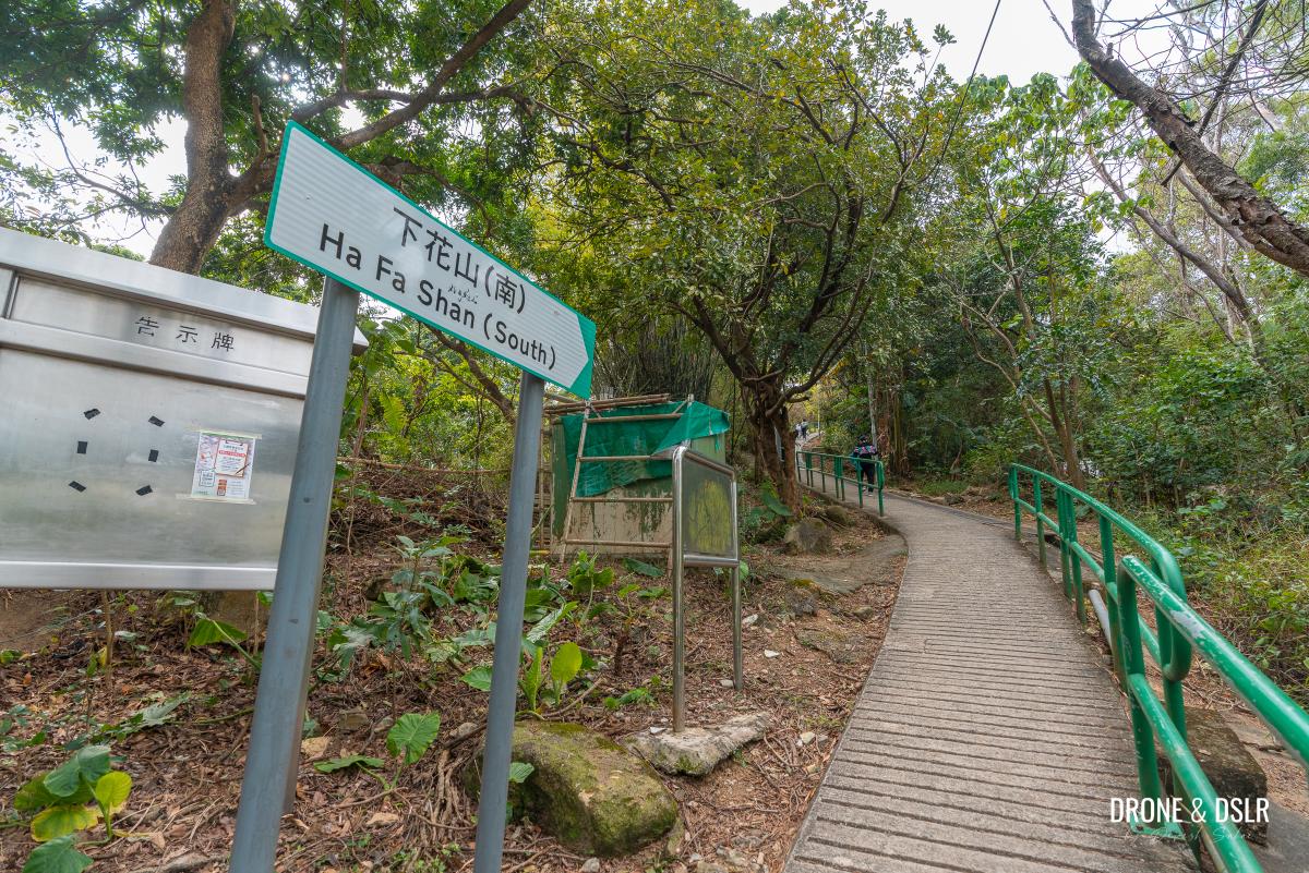
Continue climbing the next flight of steps alongside one of the settlements of Ha Fa Shan village, from where you can see Tsuen Wan.
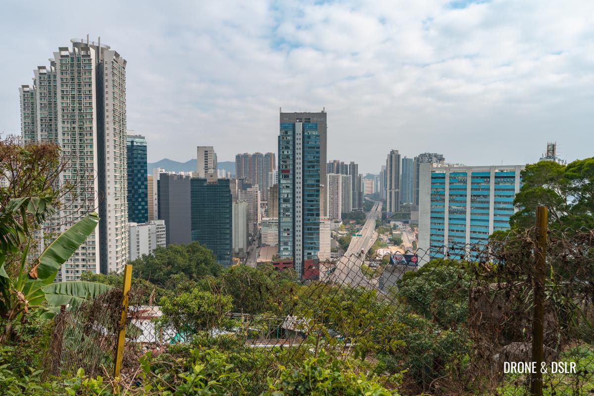
First views of Tsuen Wan from the steps
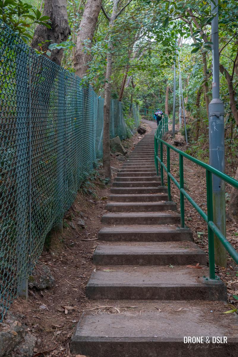
Slightly ahead, the steps approach a fenced area. From here, continue climbing the steps as they run alongside the fence.
-
- Stay on the steps, don’t enter the fenced area

-
- Lots of steps but fortunately easy to climb
The steps finally end after this flight and land on an unnamed road along the Tai Lam Chung Catchment.
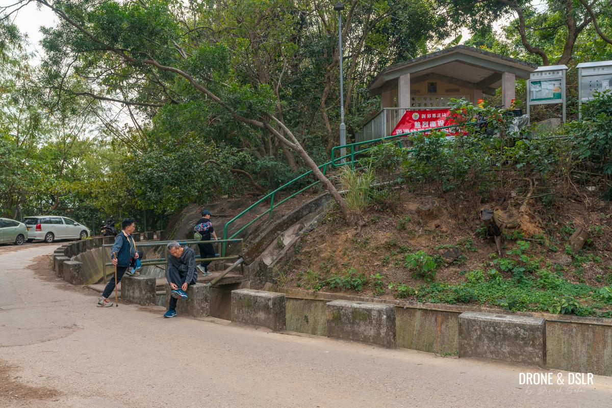
At the Tai Lam Chung Catchment, cross the road and continue on the Yuen Tsuen Ancient Trail
Take a break here, if needed, and then cross the road to continue on Yuen Tsuen Ancient Trail.
The Detour
The Yuen Tsuen Ancient Trail continues on a slope and not steps on the other side of the Tai Lam Chung Catchment. I imagine this would be a relief for some.
-
- No more steps after the catchwater
-
- Gently walk up the incline
After less than 100 metres on the incline, the trail splits into two. At this point, take the trail on the right, with the steps.

Turn right to continue towards Ha Fa Shan
This detour to Ha Fa Shan breaks away from Yuen Tsuen Ancient Trail and runs parallel to it.
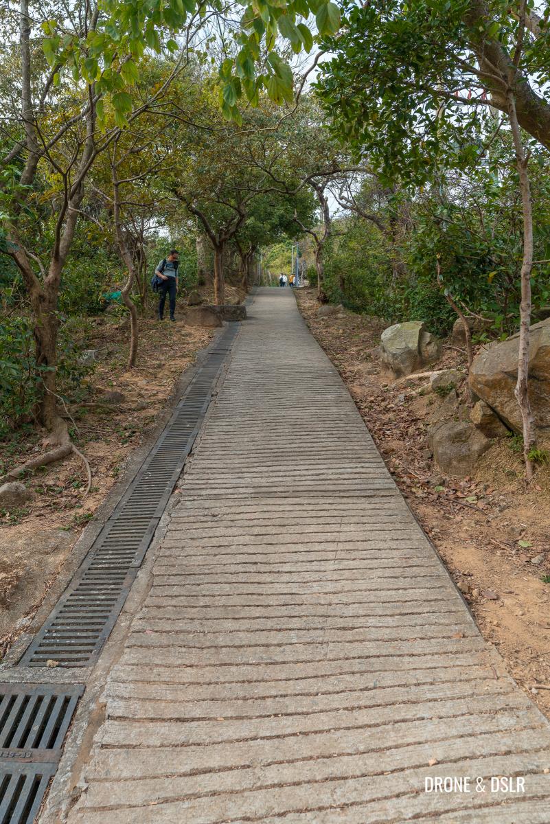
This section of the hike is a combination of steps and incline. However, I must admit that the incline is a lot steeper than it looks!

The trail is a mix of inclines and steps
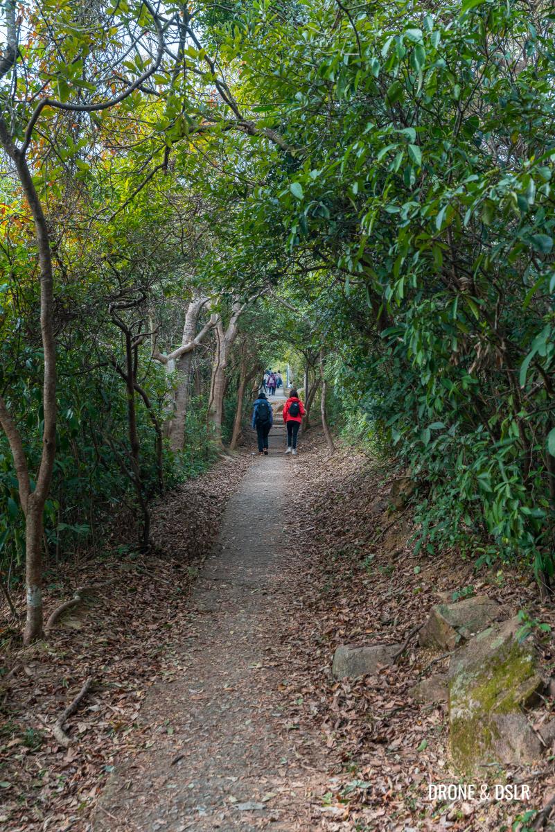
Keeping walking on this path till it emerges from the canopy of trees onto a smoother incline.
-
- The incline becomes gentler and the trail looks more picturesque
-
- Continue straight on the incline
Go straight and up ahead is a lone village house, which at the time I hiked, had blossoms growing in its garden outside.
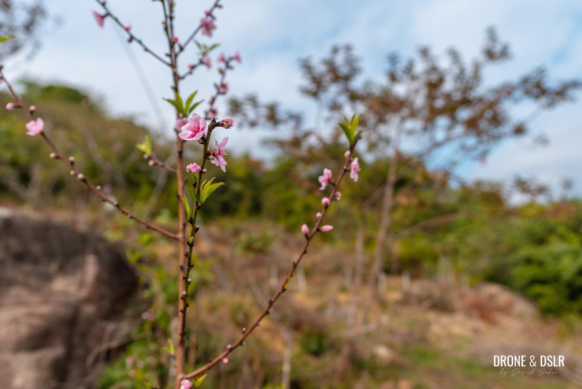
Spotted blossoms on the hike
It’s also from this house that you get your first glimpse of Tsuen Wan if you turn around.

Views get better next to this house at Ha Fa Shan (South)
Just after the house is a pavilion. And opposite the pavilion is an unmarked trail heading into the woods.

After the pavilion, turn right onto this unmarked trail
The Ha Fa Shan Hike continues on this unmarked trail.
The Final Ascent (Shortcut)
The final ascent to Ha Fa Shan via this unmarked trail is a shortcut that cuts the distance down to 350 metres. It’s fairly easy to get lost on the shortcut. So, if you’re not an experienced hiker, I would advise you to follow the longer route. Also, if you’re not wearing proper hiking shoes, I recommend taking the longer route.
However, if you’re confident that you can follow a rough uphill shortcut, then turn right onto the unmarked trail. Fortunately, there are colourful ribbons tied onto branches to keep you on track.
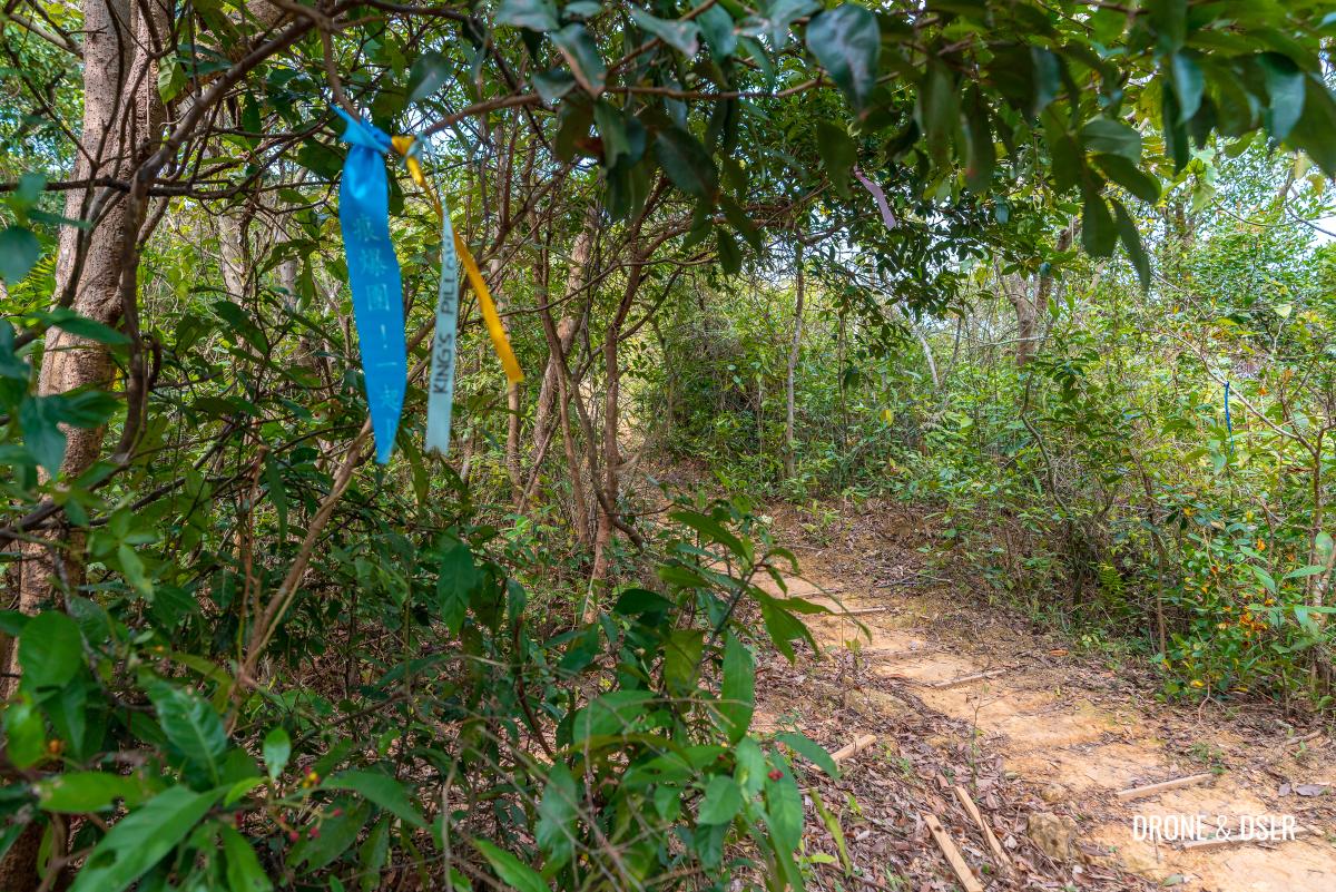
Follow the colourful ribbons
As you turn onto the trail, follow ribbons and the path heading uphill. Again, the trail is relatively easy to follow at the start as there’s only one visible path.
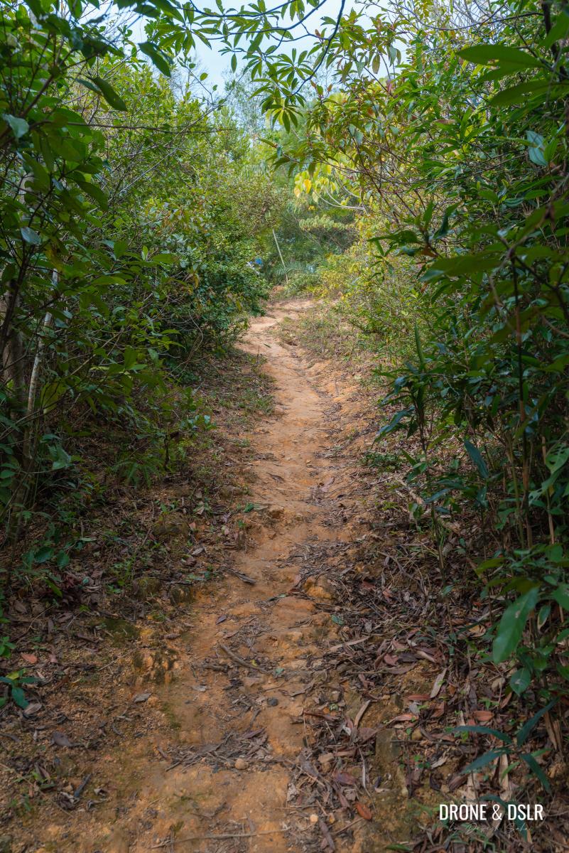
Follow the trail
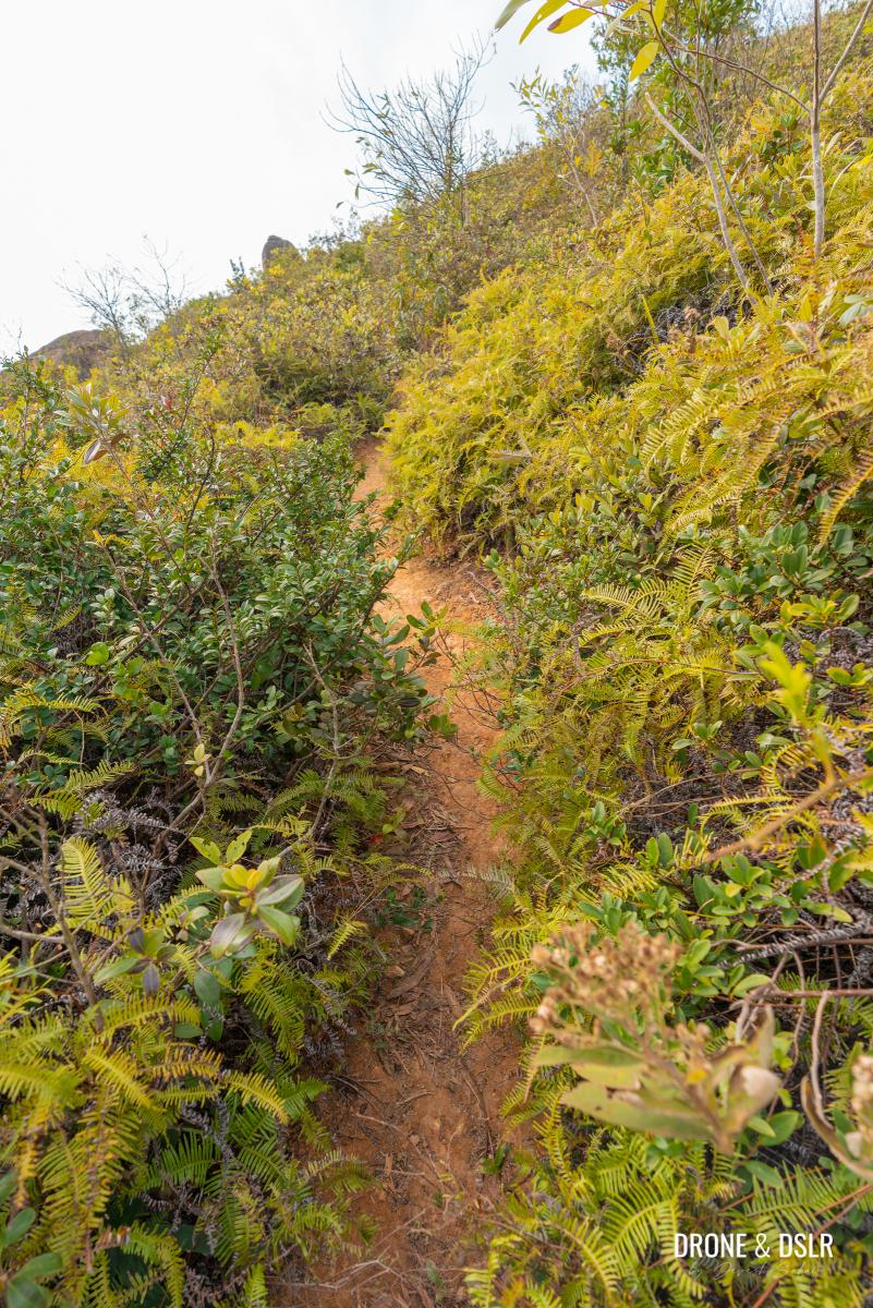
Once you walk past the trees, the trail begins to increase in intensity. That means not just incline but also there are many loose rocks and gravel that make it challenging.
-
- Keep following the ribbons

-
- This is where the hike becomes challenging thanks to the incline and loose gravel

-
- Hiking up Ha Fa Shan via the shortcut

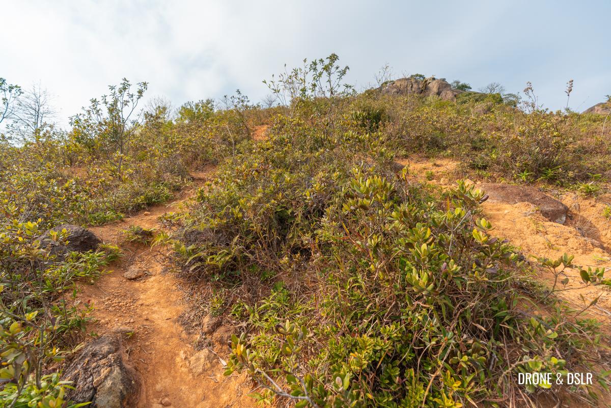
Be careful as you hike uphill on this section as it’s a bit slippery. But whenever you need to take a break, just turn around and admire the views of Tsuen Wan below and Tai Mo Shan to the right.

And the views clear up from this section of the hike
You should also be able to see the outcrop of rocks on the top of Ha Fa Shan.

First view of the rock outcrop on top of Ha Fa Shan
Climb at a gentle pace keeping an eye out for the ribbons.

Stay on the trail but if you get lost, look for the ribbons
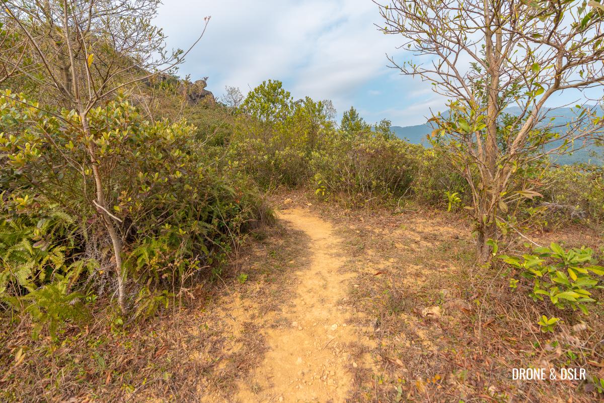
At about the halfway point, the single trail becomes multiple trails.
-
- There are some easy sections too
-
- The incline continues up Ha Fa Shan
-
- All trails lead uphill but I took the one on the left as it seemed more manageable
Although all trails on the south face of the hill lead to the top, I found the trails on the left-hand side were easier to navigate.
-
- Challenging in parts

-
- A bird’s eye view of the shortcut trail up Ha Fa Shan

The final section of the ascent becomes much steeper and more challenging before emerging onto a relatively flat terrain.
-
- Almost at the top (follow the arrows)
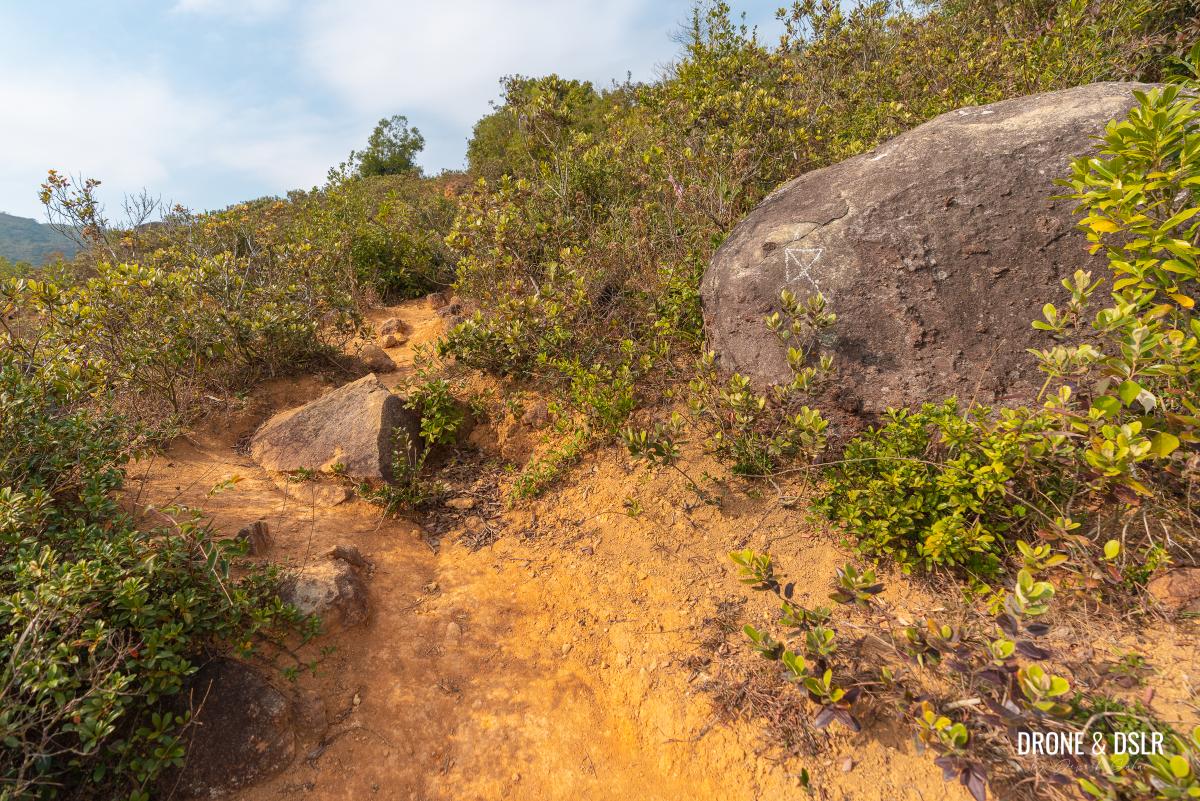
-
- When there’s no more incline, you know that you’re close to the top

At this point, stay on the trail towards the left and spot the white arrows on the rocks telling you which direction to head in.
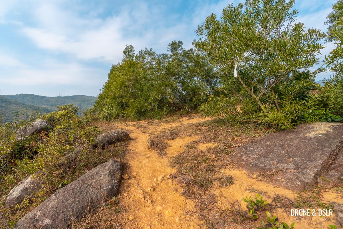
Keep an eye out for the white cloth and arrow
Look for a white ribbon and arrow pointing to the right. Because behind those trees is the summit of Ha Fa Shan.

The flat-top summit of Ha Fa Shan
Ha Fa Shan
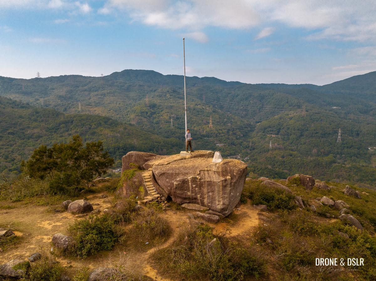
The top of Ha Fa Shan is easily distinguishable thanks to the two large boulders with a pole between them.

The boulder that is Ha Fa Shan
It may not be immediately obvious, but the large boulder is two boulders, split down the middle.

The boulder is two boulders
The top of the hill is a plateau, littered with many rocks.
-
- The plateaued top of Ha Fa Shan

-
- Aerial view of the rock outcrop on the summit of Ha Fa Shan

Make sure to walk around the summit to admire the viewing points in all directions.
-
- Tai Mo Shan views from Ha Fa Shan

-
- The rock outcrop on the opposite side

-
- Gorgeous views of Tsuen Wan and beyond from on top of Ha Fa Shan

-
- Ha Fa Shan with Shek Lung Kung in the background

However, the most noticeable viewing point is the large boulder, which can be climbed thanks to the steps carved onto its side.
-
- The steps to climb the rock on top of Ha Fa Shan
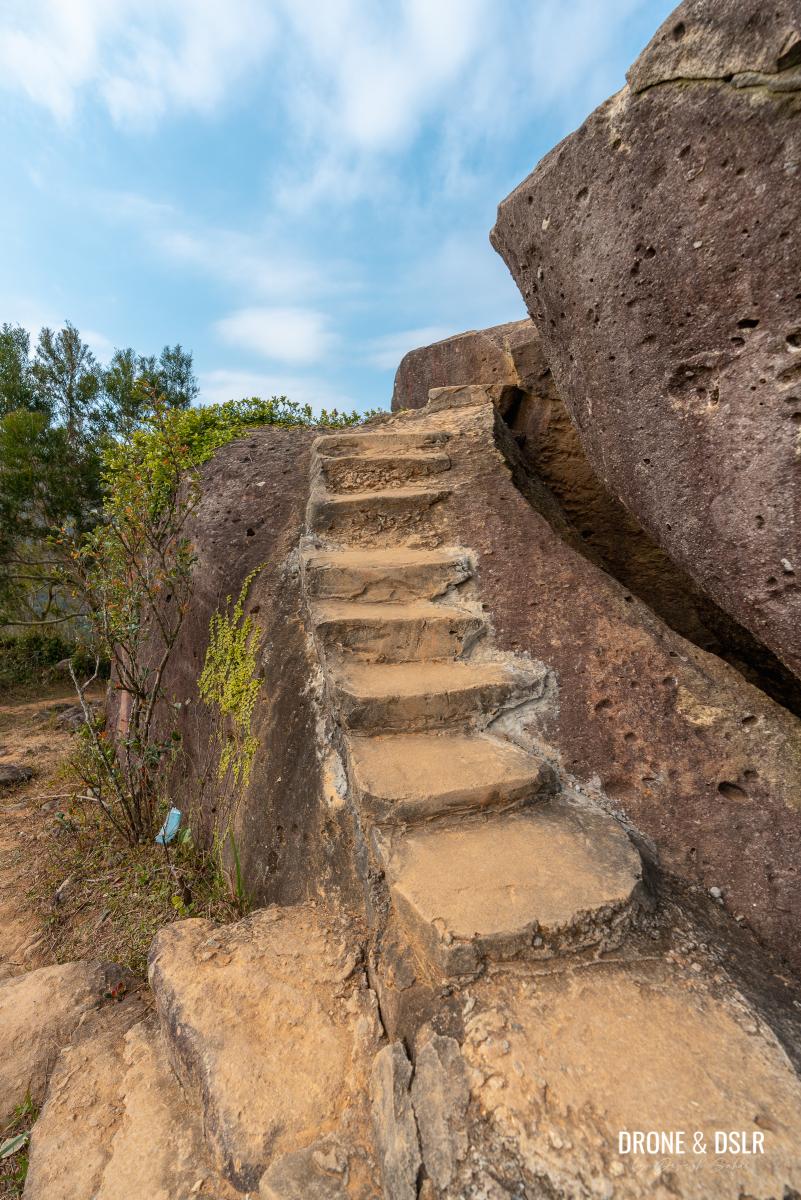
-
- The boulder on top of Ha Fa Shan features steps, a triangulation station, and a pole
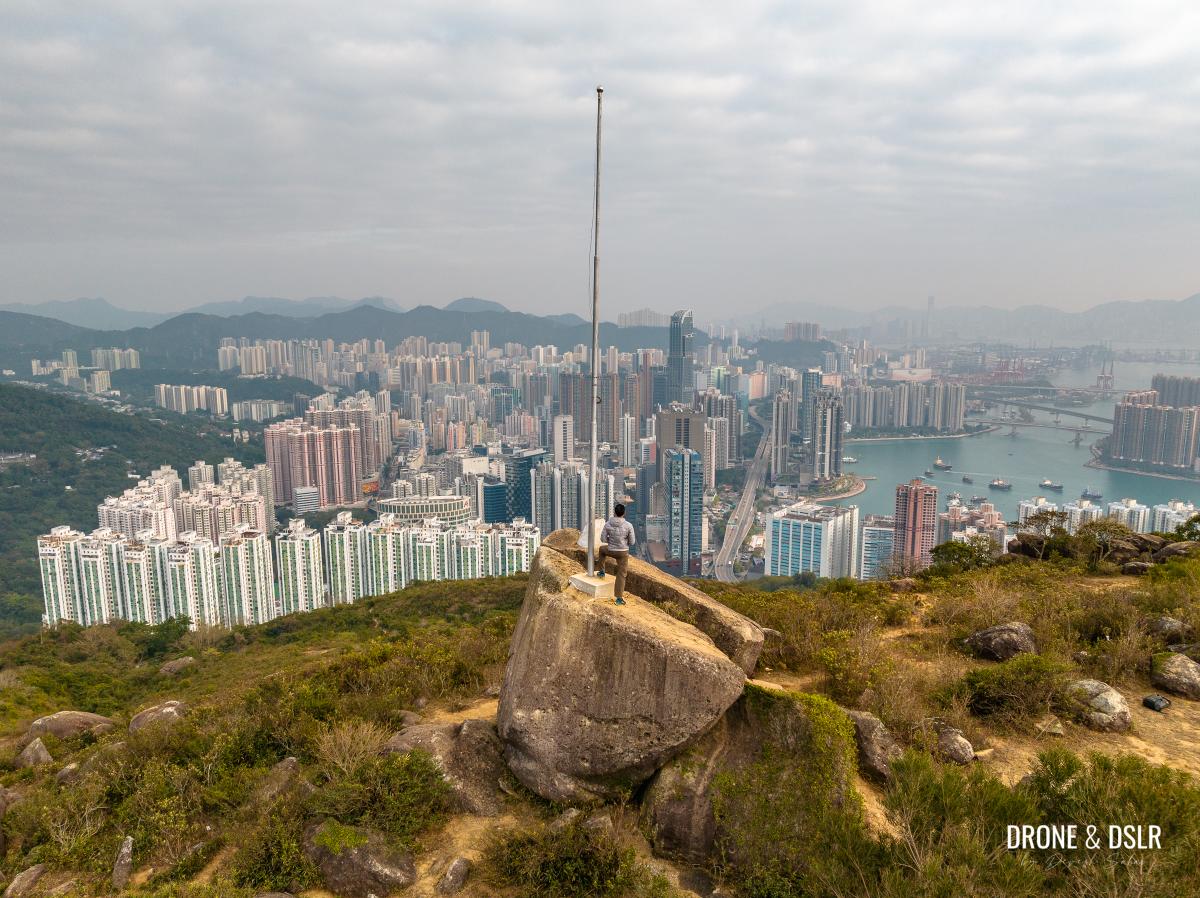
From on top of the boulder, you can enjoy panoramic views of Tsuen Wan, Tsing Yi, Tai Mo Shan, and Shek Lung Kung.

Ha Fa Shan aerial panorama
I waited for all the other hikers to leave so that I could have the Ha Fa Shan boulder to myself.
Me on top of Ha Fa Shan admiring the views
Just standing on top of it, enjoying the views, was extremely enjoyable!
Options to end the hike
If you’re not wearing proper hiking shoes, I wouldn’t recommend hiking down the shortcut. I wore proper hiking shoes and still fell numerous times thanks to the loose gravel.
You can also return to Tsuen Wan via the longer route. The path for which is on the opposite face of the hill.

Take the trail from behind the hill that connects with Yuen Tsuen Ancient Trail
Follow the path for approximately 360 metres to the pavilion. And at the pavilion, take the first left which will bring you back to the house with the blossoms.
Alternatively, if you’re feeling up to it, you can hike to Shek Lung Kung, which is another 1.8 km.
Once you return to Tsuen King Circuit next to Adventist Hospital, turn left and walk for another 150 metres to the bus terminus. From here you can take any bus towards Tsuen Wan MTR or Tsuen Wan West MTR. Hailing a taxi should also be easy from here.
Ha Fa Shan, Tusen Wan
We hope you enjoyed our simple guide to the Ha Fa Shan Hike in Tsuen Wan. Honestly, this is a short and slightly challenging hike with incredible views.

Panoramic views of Tsuen Wan, Tsing Yi, and the Tambler Channel that separates them
And as mentioned earlier, you can do this as a standalone hike or combine it with the Yuen Tsuen Ancient Trail or Shek Lung Kung.

The best views of Tsuen Wan are from Ha Fa Shan
But if you’re looking for the best views, why not hike to Tai Mo Shan?
As always, please feel free to share this post on the social media channel of your choice and drop us a comment below.
If you enjoy our work, come join us on Instagram and YouTube 🙂


You might also like


Leave a reply